West Barns

Settlement in East Lothian

Scotland

West Barns

Winterfield GC Golf course in Dunbar. View of the Bass Rock and Fife.
Winterfield GC Credit: Richard Webb

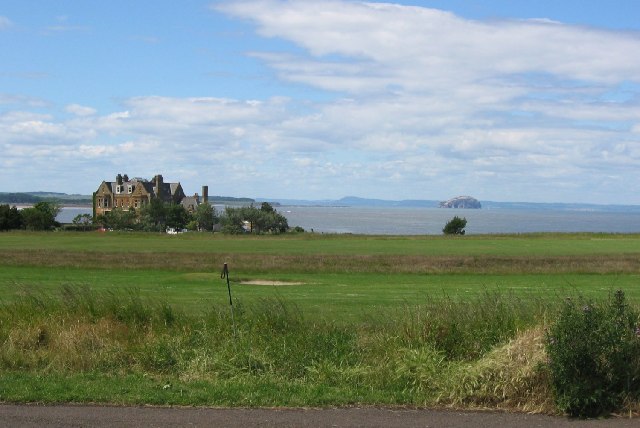
West Barns is a small village located in the county of East Lothian, in the southeast of Scotland. Situated approximately 2 miles west of Dunbar, it is nestled between the North Sea coastline and the rolling hills of the East Lothian countryside.

The village is primarily residential, with a population of around 700 people according to the latest census. It features a mix of traditional stone-built cottages, more modern housing developments, and a few local amenities. There is a small convenience store, a post office, and a village hall that serves as a community gathering place.

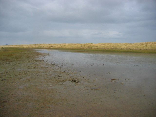
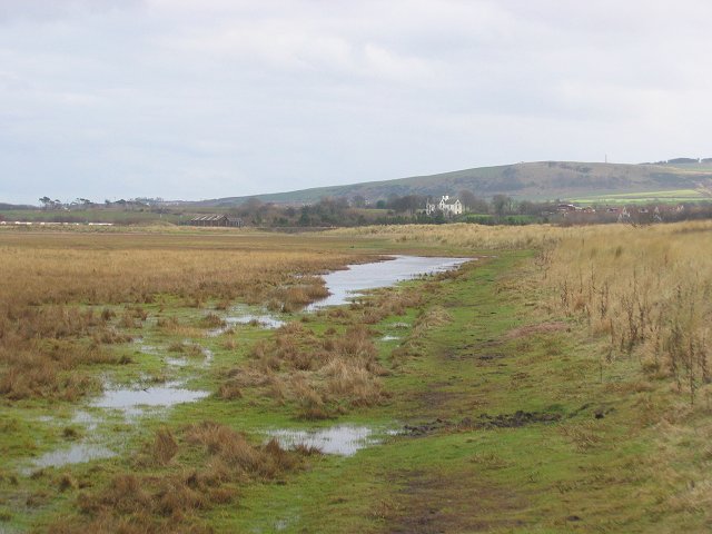
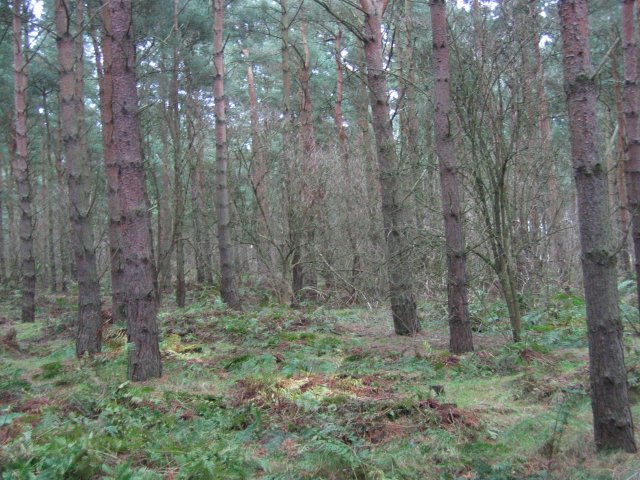
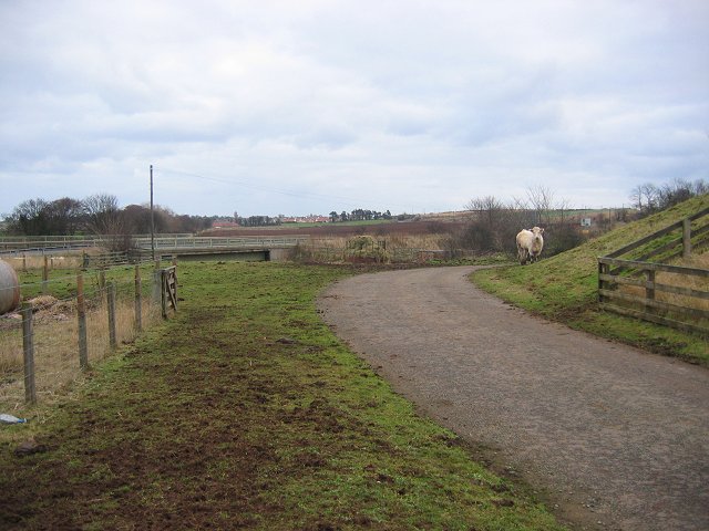
West Barns benefits from its proximity to the coast, with stunning sandy beaches just a short walk away. The area is known for its picturesque dunes and is a popular spot for nature lovers and outdoor enthusiasts. The John Muir Country Park is also nearby, offering further opportunities for walking, cycling, and wildlife spotting.

The village has a strong sense of community, with various social groups and clubs catering to different interests. There is a local football team, a bowling club, and a community garden where residents can come together to tend to the plants and enjoy the outdoors.

Although relatively small, West Barns is well-connected. It is conveniently located near the A1 road, providing easy access to nearby towns such as Dunbar and Haddington, as well as the city of Edinburgh, which is approximately 30 miles away.

If you have any feedback on the listing, please let us know in the comments section below.
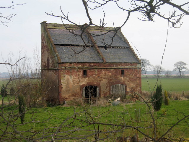
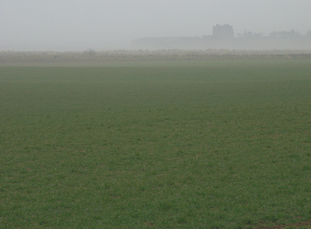
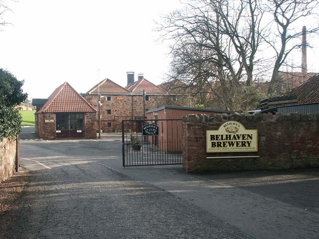
West Barns Images

Images are sourced within 2km of 55.994841/-2.5510387 or Grid Reference NT6578. Thanks to Geograph Open Source API. All images are credited.

Winterfield GC Golf course in Dunbar. View of the Bass Rock and Fife.
Winterfield GC
Golf course in Dunbar. View of the Bass Rock and Fife.
Belhaven Brewery Great beer since 1719
Belhaven Brewery
Great beer since 1719
Belhaven Bay I don't see the point of this bridge but it has been there for years.
Belhaven Bay
I don't see the point of this bridge but it has been there for years.
Lobster pots, Belhaven Bay Pots on the edge of the beach. A northerly wind meant some big waves.
Lobster pots, Belhaven Bay
Pots on the edge of the beach. A northerly wind meant some big waves.
Dune slacks, John Muir Country Park. This square was once all tidal according to the old maps.  Now a new line of dunes has formed, leaving the old beach as a flat low lying area of flooded grassland and salt marsh.  Looking north across this new land to the current frontline dunes.

Sandy shorelines can change in an instant.
Dune slacks, John Muir Country Park.
This square was once all tidal according to the old maps. Now a new line of dunes has formed, leaving the old beach as a flat low lying area of flooded grassland and salt marsh. Looking north across this new land to the current frontline dunes. Sandy shorelines can change in an instant.
The old shoreline, Belhaven Bay This was once the highwater mark, but changes in the dunes meant new land forming offshore turning a once tidal beach into wetland. Looking east towards Dunbar.
The old shoreline, Belhaven Bay
This was once the highwater mark, but changes in the dunes meant new land forming offshore turning a once tidal beach into wetland. Looking east towards Dunbar.
New dunes, West Barns Links The Tyne estuary is a dynamic shoreline. Different age maps show different shorelines, this was sea on the old 1" maps.  The dunes have formed on a tidal beach, turning what was once flooded by the sea into "dry" land. It is actually a salt marsh here near the shoreline.
New dunes, West Barns Links
The Tyne estuary is a dynamic shoreline. Different age maps show different shorelines, this was sea on the old 1" maps. The dunes have formed on a tidal beach, turning what was once flooded by the sea into "dry" land. It is actually a salt marsh here near the shoreline.
Hedderwick Hill Plantation. Trees planted on West Barns Links.  There are low sand dunes, now far inland due to natural reclamation here, but no hills. Possibly the flattest area used for orienteering in Scotland.
Hedderwick Hill Plantation.
Trees planted on West Barns Links. There are low sand dunes, now far inland due to natural reclamation here, but no hills. Possibly the flattest area used for orienteering in Scotland.
Beltonford Charolais waiting for some silage by the link road connecting the old and new A1. Bridge over the Biel Water, looking SE.
Beltonford
Charolais waiting for some silage by the link road connecting the old and new A1. Bridge over the Biel Water, looking SE.
Storm water trap, A1 The A1 has just been upgraded to a dual carriageway here. The pool is to catch excessive run-off from the road and lessen the chances of flooding. View East to newly opened section.
Storm water trap, A1
The A1 has just been upgraded to a dual carriageway here. The pool is to catch excessive run-off from the road and lessen the chances of flooding. View East to newly opened section.
Highland cow Taken at East Links Family Farm Park at Hedderwick, near Dunbar. Farm buildings in background.
Highland cow
Taken at East Links Family Farm Park at Hedderwick, near Dunbar. Farm buildings in background.
Deep furrows at Eweford, near Dunbar Recently a Neolithic mortuary structure was excavated at Eweford. Subsequently, the site was also used for burials during the Bronze Age.
Deep furrows at Eweford, near Dunbar
Recently a Neolithic mortuary structure was excavated at Eweford. Subsequently, the site was also used for burials during the Bronze Age.
Horsey, horsey South Bolton Farm, near Dunbar, East Lothian.
Horsey, horsey
South Bolton Farm, near Dunbar, East Lothian.
Doocot at Bowerhouse, near Dunbar, East Lothian This doocot is of the rectangular lectern type that superseded the beehive design <a href="https://www.geograph.org.uk/photo/137466">NT5977 : Phantassie 'Doocot'</a> and <a href="https://www.geograph.org.uk/photo/137838">NT5680 : Early morning at Waughton doocot</a> in the late 16th century. As typical of this type, the doocot has a sloping roof with stepped gables to provide perches for the pigeons. The roofs usually face south to give the birds a sunny surface to rest on, while sheltering them from northerly winds. 

This one appears to be two-storey, the ground floor would have been used for other purposes and the pigeon quarters on the upper floor.
Doocot at Bowerhouse, near Dunbar, East Lothian
This doocot is of the rectangular lectern type that superseded the beehive design NT5977 : Phantassie 'Doocot' and NT5680 : Early morning at Waughton doocot in the late 16th century. As typical of this type, the doocot has a sloping roof with stepped gables to provide perches for the pigeons. The roofs usually face south to give the birds a sunny surface to rest on, while sheltering them from northerly winds. This one appears to be two-storey, the ground floor would have been used for other purposes and the pigeon quarters on the upper floor.
Mist by Miles West Barns plains near East Links Family Park and John Muir Country Park.  Looking over Belhaven Bay toward the clubhouse of Winterfield Golf Club near St Margaret's.
Mist by Miles
West Barns plains near East Links Family Park and John Muir Country Park. Looking over Belhaven Bay toward the clubhouse of Winterfield Golf Club near St Margaret's.
Belhaven Brewery The entrance to one of the great Scottish breweries. Belhaven was demerged from a larger group back in early 1990's, as I remember under the brand-master hand of Raymond Miguel, and which went on to become City Centre Restaurants plc (now called The Restaurant Group) which used to include well known names such as Est Est Est, Garfunkels, The Filling Station, Cafe Uno, Wok Wok, Chiquitos, Frankie and Benny's even the little chrome caravan niche called "OK Diner".  It would seem that some of these are no longer part of their portfolio.  (<span class="nowrap"><a title="http://www.ccruk.com/html/our_restaurants.asp)" rel="nofollow ugc noopener" href="http://www.ccruk.com/html/our_restaurants.asp)">Link</a><img style="margin-left:2px;" alt="External link" title="External link - shift click to open in new window" src="https://s1.geograph.org.uk/img/external.png" width="10" height="10"/></span> Nevertheless it would seem that 15ish years down the line that both companies are doing very well.  Over the years I had a little flutter in the equity of both businesses.  More on the history of Belhaven Brewery here: (and what colourful history) <span class="nowrap"><a title="http://www.beerhunter.com/documents/19133-000784.html" rel="nofollow ugc noopener" href="http://www.beerhunter.com/documents/19133-000784.html">Link</a><img style="margin-left:2px;" alt="External link" title="External link - shift click to open in new window" src="https://s1.geograph.org.uk/img/external.png" width="10" height="10"/></span>
Belhaven Brewery
The entrance to one of the great Scottish breweries. Belhaven was demerged from a larger group back in early 1990's, as I remember under the brand-master hand of Raymond Miguel, and which went on to become City Centre Restaurants plc (now called The Restaurant Group) which used to include well known names such as Est Est Est, Garfunkels, The Filling Station, Cafe Uno, Wok Wok, Chiquitos, Frankie and Benny's even the little chrome caravan niche called "OK Diner". It would seem that some of these are no longer part of their portfolio. (LinkExternal link Nevertheless it would seem that 15ish years down the line that both companies are doing very well. Over the years I had a little flutter in the equity of both businesses. More on the history of Belhaven Brewery here: (and what colourful history) LinkExternal link
Peacock East Links Family Park is an ever expanding farm park where children can feed the animals and birds. These days many farmers are needing to diversify to make a living.
Peacock
East Links Family Park is an ever expanding farm park where children can feed the animals and birds. These days many farmers are needing to diversify to make a living.
Lamb East Links Family Park is an ever expanding farm park where children can feed the animals and birds. These days many farmers are needing to diversify to make a living.
Lamb
East Links Family Park is an ever expanding farm park where children can feed the animals and birds. These days many farmers are needing to diversify to make a living.
Show me another place!

West Barns is located at Grid Ref: NT6578 (Lat: 55.994841, Lng: -2.5510387)

Unitary Authority: East Lothian

Police Authority: The Lothians and Scottish Borders

What 3 Words

///hiring.feasts.imprints. Near Dunbar, East Lothian

Related Wikis

West Barns

West Barns is a small village in East Lothian, Scotland. It lies 2 miles west of Dunbar and approximately 28 miles east of Edinburgh. It is close to John...

Belhaven Hospital

Belhaven Hospital is a community hospital in Beveridge Row, Dunbar, East Lothian. The hospital is managed by NHS Lothian. == History == The hospital was...

Belhaven, Scotland

Belhaven is a village in East Lothian, Scotland, and was originally the ancient port of Dunbar of which town the village has always been a part. Belhaven...

Belhaven Hill School

Belhaven Hill School is an independent, co-educational preparatory school for boarding and day pupils aged 5 to 13 in Dunbar, East Lothian, Scotland...

John Muir Country Park

The John Muir Country Park is a country park near the village of West Barns, which is part of the town of Dunbar in East Lothian, Scotland. It is named...

Dunbar United F.C.

Dunbar United Football Club is a Scottish football club from the town of Dunbar, East Lothian. The club operates on a semi-professional basis, playing...

Dunbar

Dunbar ( ) is a town on the North Sea coast in East Lothian in the south-east of Scotland, approximately 30 miles (50 kilometres) east of Edinburgh and...

John Muir's Birthplace

John Muir's Birthplace, in Dunbar, East Lothian, Scotland, is a museum run by East Lothian Council Museums Service as a centre for study and interpretation...

Nearby Amenities

Located within 500m of 55.994841,-2.5510387
Bus Stop
Inn
Bus: yes
Naptan AtcoCode: 627010010010
Naptan Bearing: E
Naptan CommonName: Inn
Naptan Indicator: at West Barns Inn
Naptan NaptanCode: 58234342
Naptan Street: Edinburgh Road
Naptan Verified: no
Public Transport: platform
Source: naptan_import
Lat/Long: 55.9948745/-2.5544308
Bus Stop
School Brae
Bus: yes
Naptan AtcoCode: 627010010020
Naptan Bearing: E
Naptan CommonName: School Brae
Naptan Indicator: opposite School Brae
Naptan NaptanCode: 58234563
Naptan Street: Edinburgh Road
Naptan Verified: no
Public Transport: platform
Source: naptan_import
Lat/Long: 55.9950129/-2.5505139
Bus Stop
Caravan Park
Bus: yes
Naptan AtcoCode: 627010010025
Naptan Bearing: E
Naptan CommonName: Caravan Park
Naptan Indicator: at Caravan Park Entrance
Naptan NaptanCode: 58234828
Naptan Street: Edinburgh Road
Naptan Verified: no
Public Transport: platform
Source: naptan_import
Lat/Long: 55.9960238/-2.5446986
Bus Stop
Inn
Bus: yes
Naptan AtcoCode: 627010020010
Naptan Bearing: W
Naptan CommonName: Inn
Naptan Indicator: opposite West Barns Inn
Naptan NaptanCode: 58234343
Naptan Street: Edinburgh Road
Naptan Verified: no
Public Transport: platform
Source: naptan_import
Lat/Long: 55.9948185/-2.5550544
Bus Stop
School Brae
Bus: yes
Naptan AtcoCode: 627010020020
Naptan Bearing: W
Naptan CommonName: School Brae
Naptan Indicator: at School Brae
Naptan NaptanCode: 58234635
Naptan Street: Edinburgh Road
Naptan Verified: no
Public Transport: platform
Source: naptan_import
Lat/Long: 55.9949759/-2.550184
Bus Stop
Caravan Park
Bus: yes
Naptan AtcoCode: 627010020025
Naptan Bearing: W
Naptan CommonName: Caravan Park
Naptan Indicator: opposite Caravan Park Entrance
Naptan NaptanCode: 58234829
Naptan Street: Edinburgh Road
Naptan Verified: no
Public Transport: platform
Source: naptan_import
Lat/Long: 55.9957271/-2.5447265
Bus Stop
Springfield
Bus: yes
Naptan AtcoCode: 627010050010
Naptan Bearing: N
Naptan CommonName: Springfield
Naptan Indicator: at 34 Springfield
Naptan NaptanCode: 58234562
Naptan Street: Springfield
Naptan Verified: no
Public Transport: platform
Source: naptan_import
Lat/Long: 55.9929876/-2.5525914
West Barns
Place: village
Source: OS OpenData StreetView
Wikidata: Q1011233
Wikipedia: en:West Barns
Lat/Long: 55.9943611/-2.5519075
Traffic Calming: cushion
Lat/Long: 55.9946763/-2.5496629
Traffic Calming: cushion
Lat/Long: 55.9943286/-2.5492376
Traffic Calming: cushion
Lat/Long: 55.9949754/-2.5494261
Traffic Calming: table
Lat/Long: 55.9949323/-2.5535079
Traffic Calming: cushion
Lat/Long: 55.9940274/-2.5485716
Post Box
Ref: EH42 252
Lat/Long: 55.99469/-2.5539852
Crossing
Crossing: traffic_signals
Crossing Ref: pelican
Source: Bing
Lat/Long: 55.9949058/-2.5508291
Traffic Calming: cushion
Lat/Long: 55.994435/-2.5477319
Traffic Calming: cushion
Lat/Long: 55.9941491/-2.5479285
Traffic Calming: cushion
Lat/Long: 55.9949782/-2.5487135
Crossing Island: yes
Crossing Markings: surface
Traffic Calming: island
Lat/Long: 55.995146/-2.5488228
Barrier: cycle_barrier
Foot: yes
Lat/Long: 55.9936841/-2.5513835
Ford: yes
Source: OS Opendata Streetview
Lat/Long: 55.9964625/-2.5555814
Barrier: bollard
Lat/Long: 55.9923135/-2.5517391
Bus Stop
Bus: yes
Naptan AtcoCode: 627010010005
Naptan NaptanCode: 58235295
Public Transport: platform
Shelter: yes
Lat/Long: 55.9946837/-2.5586662
Townhall
Lat/Long: 55.994827/-2.5555554
Pub
Lat/Long: 55.995019/-2.5549706
Gardens lodge
Tourism: chalet
Lat/Long: 55.9951657/-2.5540835
Addr City: West Barns
Addr Housenumber: 11
Addr Street: Stenton Road
Lat/Long: 55.9930711/-2.5511788
Addr City: West Barns
Addr Housenumber: 12
Addr Street: Stenton Road
Lat/Long: 55.9929946/-2.55127
Material: wood
Power: pole
Lat/Long: 55.9931668/-2.5436676
Material: wood
Power: pole
Lat/Long: 55.9928758/-2.5449818
Material: wood
Power: pole
Lat/Long: 55.9925968/-2.546339
Material: wood
Power: pole
Lat/Long: 55.9922877/-2.5478411
Material: wood
Power: pole
Lat/Long: 55.9933288/-2.544204
Material: wood
Power: pole
Lat/Long: 55.9930603/-2.5455263
Material: wood
Power: pole
Lat/Long: 55.9928263/-2.546728
Material: wood
Power: pole
Lat/Long: 55.9925503/-2.5480878
Material: wood
Power: pole
Lat/Long: 55.9922922/-2.5493136
Material: wood
Power: pole
Lat/Long: 55.9920522/-2.5505152
Material: wood
Power: pole
Lat/Long: 55.9918407/-2.5514621
Material: wood
Power: pole
Lat/Long: 55.9913471/-2.5539029
Material: wood
Power: pole
Lat/Long: 55.9910996/-2.5551662
Material: wood
Power: pole
Lat/Long: 55.9912856/-2.5527066
Material: wood
Power: pole
Lat/Long: 55.9915316/-2.5515264
Material: wood
Power: pole
Lat/Long: 55.9918077/-2.5502765
Material: wood
Power: pole
Lat/Long: 55.9920657/-2.5489998
Tourism: picnic_site
Lat/Long: 55.9946791/-2.554705
Material: wood
Power: pole
Lat/Long: 55.9952891/-2.5568076
Material: wood
Power: pole
Lat/Long: 55.9955082/-2.5582561
Bicycle Parking
Lat/Long: 55.994847/-2.5553623
Bicycle Parking
Lat/Long: 55.9947735/-2.5551772
Bicycle Parking
Bicycle Parking: stands
Lat/Long: 55.9941773/-2.5474296
Bicycle Parking
Bicycle Parking: front_wheel
Lat/Long: 55.9942005/-2.5473747
Crossing Island: yes
Crossing Markings: surface
Traffic Calming: island
Lat/Long: 55.9954537/-2.5457667
Crossing Island: yes
Crossing Markings: no
Surface: tactile_paving
Traffic Calming: island
Lat/Long: 55.9947268/-2.5522932
Crossing Island: yes
Crossing Markings: no
Surface: tactile_paving
Traffic Calming: island
Lat/Long: 55.9947562/-2.5540692
Crossing Island: yes
Crossing Markings: no
Surface: tactile_paving
Traffic Calming: island
Lat/Long: 55.9949291/-2.5556006
Traffic Calming: island
Lat/Long: 55.9947769/-2.5578113
Waste Basket
Waste: dog_excrement
Lat/Long: 55.9984935/-2.5472034
Bench
Access: yes
Backrest: yes
Colour: brown
Direction: 9
Level: 0
Lit: no
Material: wood
Seats: 3
Lat/Long: 55.9984308/-2.5479877
Waste Basket
Colour: black
Covered: no
Indoor: no
Waste: trash
Lat/Long: 55.9960114/-2.5516437
The data included in this document is from www.openstreetmap.org. The data is made available under ODbL.

Have you been to West Barns?

Leave your review of West Barns below (or comments, questions and feedback).