West Acton

Settlement in Middlesex

England

West Acton

Signs and qr code on car for tattooing and piercing The Smart Car for Ink'D London has signs for tattooing, piercing, and tattoo numbing cream. It displays a qr code panel for scanning on a smart phone.
Signs and qr code on car for tattooing and piercing Credit: David Hawgood

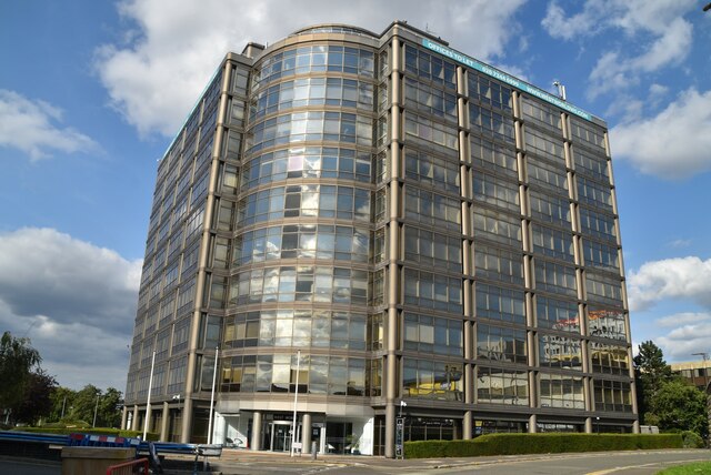
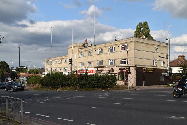
West Acton is a suburban area located in the London Borough of Ealing, Middlesex, in the western part of Greater London. It is situated approximately eight miles west of Charing Cross, making it a convenient location for commuters working in central London. West Acton is bordered by North Acton to the north, Acton Town to the east, Ealing Common to the south, and Park Royal to the west.

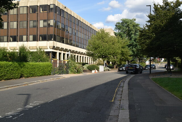
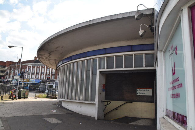
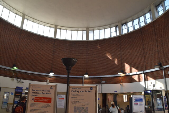
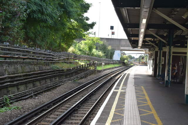
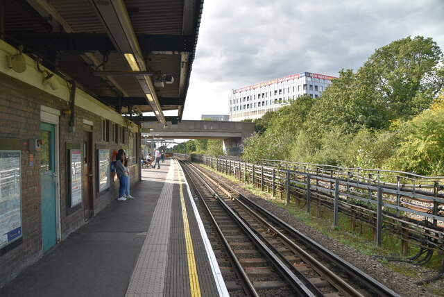
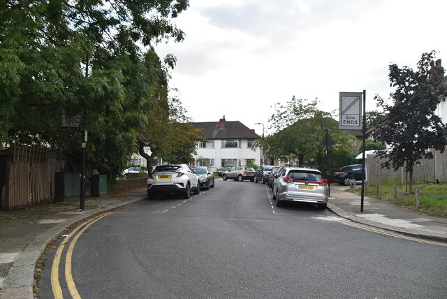
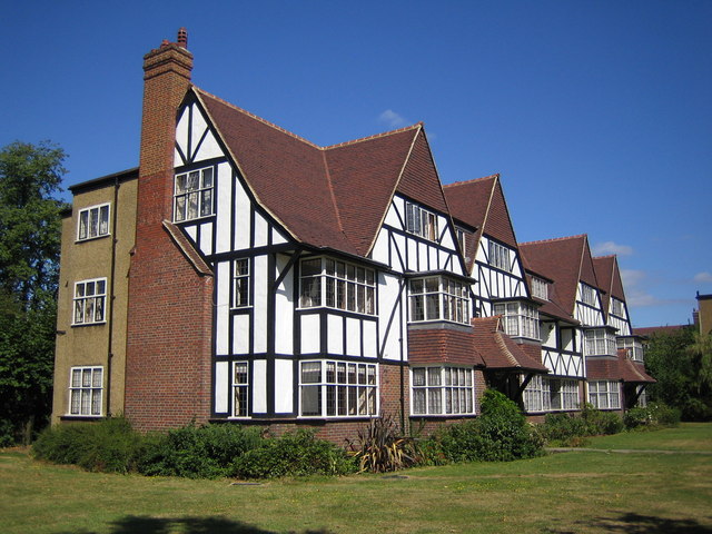
The area predominantly consists of residential properties, ranging from Victorian and Edwardian terraced houses to modern apartment buildings. The residential streets are lined with trees, giving the area a pleasant and green ambiance. West Acton benefits from excellent transport links, with West Acton Underground station on the Central Line providing easy access to central London and other parts of the city.

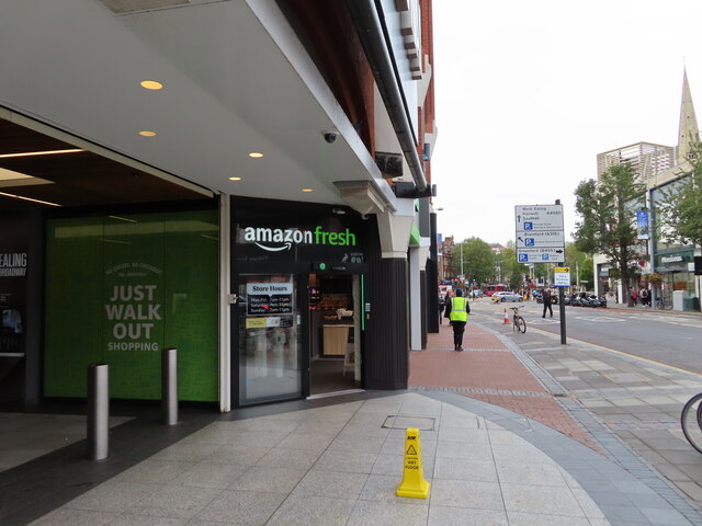
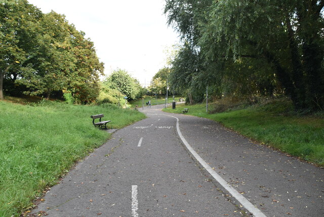
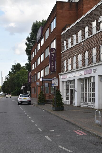
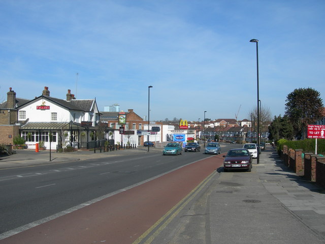
In terms of amenities, West Acton offers a variety of local shops, cafes, and restaurants, catering to the needs of its residents. There are also several schools in the area, including West Acton Primary School and Twyford Church of England High School. For recreational activities, residents can enjoy the nearby green spaces of Acton Park and Ealing Common, which offer opportunities for jogging, picnicking, and sports.

Overall, West Acton provides a suburban lifestyle with easy access to the bustling city center. It is a well-connected area with a range of amenities, making it an attractive place to live for families and professionals alike.

If you have any feedback on the listing, please let us know in the comments section below.
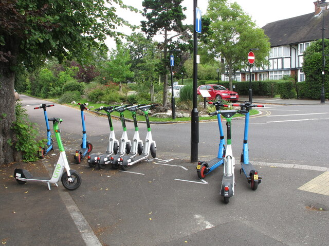
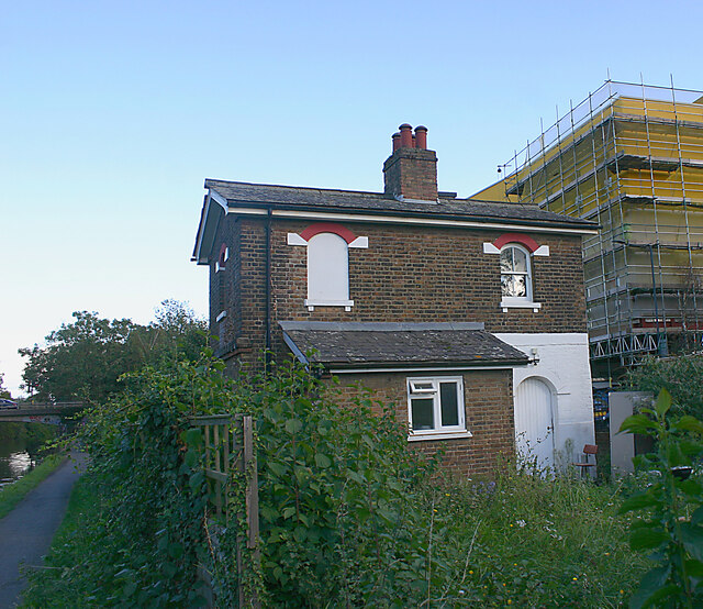
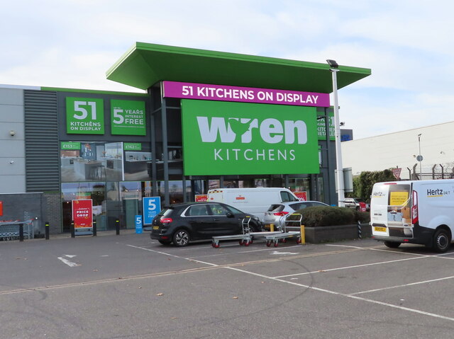
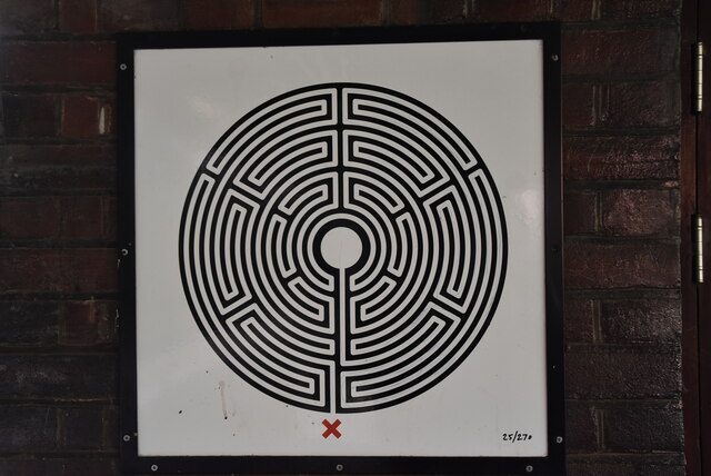
West Acton Images

Images are sourced within 2km of 51.51784/-0.28301828 or Grid Reference TQ1981. Thanks to Geograph Open Source API. All images are credited.

Signs and qr code on car for tattooing and piercing The Smart Car for Ink'D London has signs for tattooing, piercing, and tattoo numbing cream. It displays a qr code panel for scanning on a smart phone.
Signs and qr code on car for tattooing and piercing
The Smart Car for Ink'D London has signs for tattooing, piercing, and tattoo numbing cream. It displays a qr code panel for scanning on a smart phone.
E-scooters for hire, West Acton From 7 June 2021 there is a trial of legal hire of electric scooters. Ealing Borough is participating. The scooters shown in this designated area are from Lime and Dott. The location in Princes Gardens is near West Acton tube station.
E-scooters for hire, West Acton
From 7 June 2021 there is a trial of legal hire of electric scooters. Ealing Borough is participating. The scooters shown in this designated area are from Lime and Dott. The location in Princes Gardens is near West Acton tube station.
Unoccupied cottage, Grand Union Canal (Paddington Branch) This cottage is situated on land between the canal towpath and Twyford Abbey Road. Although the garden was overgrown, it looked as though the building was the subject of refurbishment.
Unoccupied cottage, Grand Union Canal (Paddington Branch)
This cottage is situated on land between the canal towpath and Twyford Abbey Road. Although the garden was overgrown, it looked as though the building was the subject of refurbishment.
Wren Kitchens, Acton This warehouse store sold office supplies for many years under different names, Staples, Office World, etc.
Wren Kitchens, Acton
This warehouse store sold office supplies for many years under different names, Staples, Office World, etc.
Amazon "Just walk out" shop, Ealing Broadway In this shop you sign in, take goods, cameras track what you take, you can just leave without going to a checkout, you get charged automatically.
Amazon "Just walk out" shop, Ealing Broadway
In this shop you sign in, take goods, cameras track what you take, you can just leave without going to a checkout, you get charged automatically.
Railway bridge, West Gate
Westgate House
Westgate House
West Gate
West Gate
Subway, Hanger Lane
Subway, Hanger Lane
Cycle track, Hanger Lane London Cycle Network route 85 from Kew Bridge to Neasden passes through Hanger Lane Gyratory. There is a new crossing on Hanger Lane, just north of the gyratory. This set of photos shows the route from the A40 west, under the Central Line, across Hanger Lane, under the North Circular, and into Twyford Abbey Road for Park Royal.
Cycle track, Hanger Lane
London Cycle Network route 85 from Kew Bridge to Neasden passes through Hanger Lane Gyratory. There is a new crossing on Hanger Lane, just north of the gyratory. This set of photos shows the route from the A40 west, under the Central Line, across Hanger Lane, under the North Circular, and into Twyford Abbey Road for Park Royal.
Fernlea House
Fernlea House
Hanger Lane Station Hanger Lane Underground station is located on the West Ruislip branch of the Central line, between Perivale and North Acton stations, and is in Travelcard Zone 3. The station is located in Hanger Hill.
It is within walking distance of Park Royal station on the Piccadilly line. The two lines cross a little east of Hanger Lane station. The station opened in 1947.
Hanger Lane Station
Hanger Lane Underground station is located on the West Ruislip branch of the Central line, between Perivale and North Acton stations, and is in Travelcard Zone 3. The station is located in Hanger Hill. It is within walking distance of Park Royal station on the Piccadilly line. The two lines cross a little east of Hanger Lane station. The station opened in 1947.
Central Line, Hanger Lane Station Hanger Lane Underground station is located on the West Ruislip branch of the Central line, between Perivale and North Acton stations, and is in Travelcard Zone 3. The station is located in Hanger Hill.
It is within walking distance of Park Royal station on the Piccadilly line. The two lines cross a little east of Hanger Lane station. The station opened in 1947.
Central Line, Hanger Lane Station
Hanger Lane Underground station is located on the West Ruislip branch of the Central line, between Perivale and North Acton stations, and is in Travelcard Zone 3. The station is located in Hanger Hill. It is within walking distance of Park Royal station on the Piccadilly line. The two lines cross a little east of Hanger Lane station. The station opened in 1947.
Labyrinth #25, Hanger Lane Hanger Lane Underground station is located on the West Ruislip branch of the Central line, between Perivale and North Acton stations, and is in Travelcard Zone 3. The station is located in Hanger Hill.
It is within walking distance of Park Royal station on the Piccadilly line. The two lines cross a little east of Hanger Lane station. The station opened in 1947.
Labyrinth #25, Hanger Lane
Hanger Lane Underground station is located on the West Ruislip branch of the Central line, between Perivale and North Acton stations, and is in Travelcard Zone 3. The station is located in Hanger Hill. It is within walking distance of Park Royal station on the Piccadilly line. The two lines cross a little east of Hanger Lane station. The station opened in 1947.
Hanger Lane Station Hanger Lane Underground station is located on the West Ruislip branch of the Central line, between Perivale and North Acton stations, and is in Travelcard Zone 3. The station is located in Hanger Hill.
It is within walking distance of Park Royal station on the Piccadilly line. The two lines cross a little east of Hanger Lane station. The station opened in 1947.
Hanger Lane Station
Hanger Lane Underground station is located on the West Ruislip branch of the Central line, between Perivale and North Acton stations, and is in Travelcard Zone 3. The station is located in Hanger Hill. It is within walking distance of Park Royal station on the Piccadilly line. The two lines cross a little east of Hanger Lane station. The station opened in 1947.
Premier Inn, Hanger Lane Premier Inn is the largest Hotel chain in the UK, with over 600 budget hotels.
Website: <span class="nowrap"><a title="http://www.premierinn.com/en/" rel="nofollow ugc noopener" href="http://www.premierinn.com/en/">Link</a><img style="margin-left:2px;" alt="External link" title="External link - shift click to open in new window" src="https://s1.geograph.org.uk/img/external.png" width="10" height="10"/></span>
Premier Inn, Hanger Lane
Premier Inn is the largest Hotel chain in the UK, with over 600 budget hotels. Website: LinkExternal link
Connell Crescent
Connell Crescent
Show me another place!

West Acton is located at Grid Ref: TQ1981 (Lat: 51.51784, Lng: -0.28301828)

Unitary Authority: Ealing

Police Authority: Metropolitan

What 3 Words

///proud.stack.shower. Near Acton, London

Nearby Locations

Acton, West West Acton

Related Wikis

West Acton tube station

West Acton is a London Underground station between Ealing Broadway and North Acton on the Ealing Broadway branch of the Central line, and is its only intermediate...

Hanger Hill

Hanger Hill or Haymills Estate is a local area and ward of the London Borough of Ealing around Hanger Lane (A406 road). It was developed in the interwar...

The Ellen Wilkinson School for Girls

The Ellen Wilkinson School for Girls is a comprehensive, foundation secondary school for 1400 girls aged 11–19 years, located in the London borough of...

North Ealing tube station

North Ealing is a London Underground station on the Uxbridge branch of the Piccadilly line between Ealing Common and Park Royal. The station is located...

Japanese School in London

The Japanese School in London (ロンドン日本人学校, Rondon Nihonjin Gakkō) is a Japanese international school in Acton, London Borough of Ealing. The school is incorporated...

Hanger Lane

Hanger Lane is a major road in Ealing, London, England. The majority of the road forms the westernmost part of the A406 North Circular Road, running north...

Muslim College

The Muslim College is a postgraduate Islamic seminary situated in Ealing, West London, that trains imams and religious leaders and provides Islamic education...

LH2 Studios

LH2 Studios is a purpose-built rehearsal and production space located in Park Royal, West London, United Kingdom, close to Park Royal tube station. The...

Nearby Amenities

Located within 500m of 51.51784,-0.28301828
Ref GB Tflcid: RWG271319
Traffic Calming: table
Lat/Long: 51.5211583/-0.2818385
North Ealing
Fare Zone: 3
Line: Piccadilly
Naptan AtcoCode: 940GZZLUNEN
Network: London Underground
Public Transport: station
Railway: station
Source: NPE
Station: subway
Subway: yes
Wheelchair: no
Wikidata: Q1272075
Wikipedia: en:North Ealing tube station
Lat/Long: 51.5174885/-0.2887523
Mini Roundabout
Direction: clockwise
Lat/Long: 51.5212269/-0.2852692
Ref GB Tflcid: RWG271298
Traffic Calming: hump
Lat/Long: 51.5216563/-0.2848462
West Acton
Line: Central
Network: London Underground
Operator: Transport for London
Public Transport: stop_position
Railway: stop
Subway: yes
Lat/Long: 51.5186534/-0.2800132
Railway: switch
Lat/Long: 51.5151313/-0.2886253
Railway: switch
Lat/Long: 51.5151218/-0.2886751
Ref GB Tflcid: RWG271431
Traffic Calming: hump
Lat/Long: 51.5188189/-0.2771067
Bus Stop
Lynton Road
Bus: yes
Local Ref: ED
Naptan AtcoCode: 490009481N
Naptan Bearing: N
Naptan CommonName: Lynton Road Twyford Avenue
Naptan Indicator: Stop ED
Naptan Street: TWYFORD AVENUE
Naptan Verified: no
Public Transport: platform
Ref: 54747
Lat/Long: 51.514318/-0.2824538
Pub
The Greystoke
Brand: Greene King
Brand Wikidata: Q5564162
Website: https://www.greeneking.co.uk/pubs/greater-london/greystoke
Lat/Long: 51.5169424/-0.2899892
Mini Roundabout
Direction: clockwise
Lat/Long: 51.5175027/-0.2804997
Ref GB Tflcid: RWG271437
Traffic Calming: hump
Lat/Long: 51.5180548/-0.277666
Ref GB Tflcid: RWG230280
Traffic Calming: hump
Lat/Long: 51.5143074/-0.2864306
Bicycle Parking
Bicycle Parking: stands
Capacity: 10
Covered: no
Fee: no
Lat/Long: 51.5176491/-0.2806261
Crossing
Button Operated: yes
Crossing: traffic_signals
Crossing Island: no
Kerb: lowered
Tactile Paving: yes
Traffic Signals Sound: yes
Lat/Long: 51.5178444/-0.2811483
Atm
Booth: KXPlus
Colour: white
Note: atm is converted phone box with phone on outside
Lat/Long: 51.5174603/-0.2807496
Telephone
Colour: black
Note: not BT
Lat/Long: 51.5176215/-0.2804865
Crossing
Crossing: traffic_signals
Crossing Island: no
Tactile Paving: yes
Lat/Long: 51.5172882/-0.2871876
Bicycle Parking
Capacity: 8
Lat/Long: 51.5178332/-0.2891641
Bicycle Parking
Capacity: 10
Lat/Long: 51.517613/-0.2897984
Post Box
Collection Times: Mo-Fr 18:00; Sa 12:00
Operator: Royal Mail
Operator Wikidata: Q638098
Post Box Type: pillar
Ref: W5 71
Royal Cypher: GR
Royal Cypher Wikidata: Q33102273
Lat/Long: 51.5175861/-0.2897953
Post Box
Operator: Royal Mail
Operator Wikidata: Q638098
Ref: W5 70
Lat/Long: 51.5219044/-0.2858484
Post Box
Collection Times: Mo-Fr 09:00; Sa 07:00
Operator: Royal Mail
Operator Wikidata: Q638098
Post Box Type: pillar
Ref: W5 63D
Royal Cypher: GR
Royal Cypher Wikidata: Q33102273
Lat/Long: 51.5192105/-0.2876898
Bus Stop
West Acton Station
Local Ref: EA
Naptan AtcoCode: 490000258A
Naptan Bearing: E
Naptan CommonName: West Acton
Naptan Indicator: EA
Naptan Street: NOEL ROAD
Naptan Verified: no
Public Transport: platform
Ref: 72822
Lat/Long: 51.5176775/-0.2798933
Bus Stop
West Acton Station
Local Ref: EB
Naptan AtcoCode: 490000258B
Naptan Bearing: S
Naptan CommonName: West Acton
Naptan Indicator: EB
Naptan Street: NOEL ROAD
Naptan Verified: no
Public Transport: platform
Ref: 54144
Lat/Long: 51.5172367/-0.2807391
Bus Stop
Lynton Road
Local Ref: EC
Naptan AtcoCode: 490009481S
Naptan Bearing: S
Naptan CommonName: Lynton Road Twyford Avenue
Naptan Indicator: Stop EC
Naptan Street: TWYFORD AVENUE
Naptan Verified: no
Public Transport: platform
Ref: 75019
Lat/Long: 51.5141892/-0.2822456
Restaurant
Villa Toscana
Addr Housenumber: 5
Addr Street: Boileau Road
Cuisine: italian
Lat/Long: 51.5174028/-0.289626
Access: yes
Barrier: bollard
Bicycle: yes
Bollard: fixed
Cyclestreets Id: 27821
Foot: yes
Motor Vehicle: no
Vehicle: no
Wheelchair: yes
Lat/Long: 51.5208863/-0.283169
Railway: switch
Lat/Long: 51.5149692/-0.2868649
Ref GB Tflcid: RWG271354
Traffic Calming: hump
Lat/Long: 51.5181612/-0.2818433
Check Date: 2021-05-30
Maxwidth: 2.1
Traffic Calming: choker
Lat/Long: 51.5174703/-0.2857413
Post Box
Collection Times: Mo-Fr 09:00, Sa 07:00
Operator: Royal Mail
Operator Wikidata: Q638098
Post Box Type: pillar
Ref: W3 61D
Royal Cypher: GR
Royal Cypher Wikidata: Q33102273
Lat/Long: 51.5176281/-0.284962
Addr City: London
Addr Country: GB
Addr Housenumber: 11
Addr Postcode: W3 0HF
Addr Street: Queen's Drive
Lat/Long: 51.5180432/-0.2832993
Addr City: London
Addr Country: GB
Addr Housenumber: 13
Addr Postcode: W3 0HF
Addr Street: Queen's Drive
Lat/Long: 51.5179901/-0.2833602
Addr City: London
Addr Country: GB
Addr Housenumber: 15
Addr Postcode: W3 0HF
Addr Street: Queen's Drive
Lat/Long: 51.5179262/-0.2834274
Addr City: London
Addr Country: GB
Addr Housenumber: 17
Addr Postcode: W3 0HF
Addr Street: Queen's Drive
Lat/Long: 51.5178798/-0.283599
Addr City: London
Addr Country: GB
Addr Housenumber: 19
Addr Postcode: W3 0HF
Addr Street: Queen's Drive
Lat/Long: 51.5178691/-0.2836756
Addr City: London
Addr Country: GB
Addr Housenumber: 21
Addr Postcode: W3 0HF
Addr Street: Queen's Drive
Lat/Long: 51.5178578/-0.2837574
Addr City: London
Addr Country: GB
Addr Housenumber: 23
Addr Postcode: W3 0HF
Addr Street: Queen's Drive
Lat/Long: 51.5178431/-0.2838501
Addr City: London
Addr Country: GB
Addr Housenumber: 25
Addr Postcode: W3 0HF
Addr Street: Queen's Drive
Lat/Long: 51.5178329/-0.2839373
Addr City: London
Addr Country: GB
Addr Housenumber: 27
Addr Postcode: W3 0HF
Addr Street: Queen's Drive
Lat/Long: 51.5178205/-0.2840155
Addr City: London
Addr Country: GB
Addr Housenumber: 9
Addr Postcode: W3 0HF
Addr Street: Queen's Drive
Lat/Long: 51.5181005/-0.2832281
Maxheight: 2.08
Lat/Long: 51.517778/-0.2890923
Addr City: London
Addr Country: GB
Addr Housenumber: 22
Addr Postcode: W3 0HA
Addr Street: Queen's Drive
Lat/Long: 51.5176339/-0.2828665
Addr City: London
Addr Country: GB
Addr Housenumber: 24
Addr Postcode: W3 0HA
Addr Street: Queen's Drive
Lat/Long: 51.5176227/-0.2829423
Addr City: London
Addr Country: GB
Addr Housenumber: 26
Addr Postcode: W3 0HA
Addr Street: Queen's Drive
Lat/Long: 51.51761/-0.2830385
Addr City: London
Addr Country: GB
Addr Housenumber: 28
Addr Postcode: W3 0HA
Addr Street: Queen's Drive
Lat/Long: 51.5175995/-0.283118
Addr City: London
Addr Country: GB
Addr Housenumber: 30
Addr Postcode: W3 0HA
Addr Street: Queen's Drive
Lat/Long: 51.5175823/-0.2832383
Addr City: London
Addr Country: GB
Addr Housenumber: 32
Addr Postcode: W3 0HA
Addr Street: Queen's Drive
Lat/Long: 51.5175733/-0.2833129
Addr City: London
Addr Country: GB
Addr Housenumber: 34
Addr Postcode: W3 0HA
Addr Street: Queen's Drive
Lat/Long: 51.5175598/-0.2834079
Addr City: London
Addr Country: GB
Addr Housenumber: 36
Addr Postcode: W3 0HA
Addr Street: Queen's Drive
Lat/Long: 51.5175501/-0.283485
Addr City: London
Addr Country: GB
Addr Housenumber: 1
Addr Postcode: W3 0HD
Addr Street: Queen's Drive
Source Addr Postcode: code-point_open
Lat/Long: 51.5180443/-0.2823381
Addr City: London
Addr Country: GB
Addr Housenumber: 3
Addr Postcode: W3 0HD
Addr Street: Queen's Drive
Source Addr Postcode: code-point_open
Lat/Long: 51.518038/-0.2823928
Addr City: London
Addr Country: GB
Addr Housenumber: 5
Addr Postcode: W3 0HD
Addr Street: Queen's Drive
Source Addr Postcode: code-point_open
Lat/Long: 51.5180235/-0.2825022
Addr City: London
Addr Country: GB
Addr Housenumber: 7
Addr Postcode: W3 0HD
Addr Street: Queen's Drive
Source Addr Postcode: code-point_open
Lat/Long: 51.5180172/-0.282558
West Acton
Line: Central
Network: London Underground
Operator: Transport for London
Public Transport: stop_position
Railway: stop
Subway: yes
Lat/Long: 51.5180135/-0.2808512
Addr City: London
Addr Country: GB
Addr Housenumber: 1
Addr Postcode: W3 0LY
Addr Street: Princes Gardens
Source Addr Postcode: code-point_open
Lat/Long: 51.5182178/-0.281428
Addr City: London
Addr Country: GB
Addr Housenumber: 10
Addr Postcode: W3 0LG
Addr Street: Princes Gardens
Source Addr Postcode: code-point_open
Lat/Long: 51.5185202/-0.2820823
Addr City: London
Addr Country: GB
Addr Housenumber: 100
Addr Postcode: W3 0LJ
Addr Street: Princes Gardens
Source Addr Postcode: code-point_open
Lat/Long: 51.5219843/-0.2814338
Addr City: London
Addr Country: GB
Addr Housenumber: 102
Addr Postcode: W3 0LJ
Addr Street: Princes Gardens
Source Addr Postcode: code-point_open
Lat/Long: 51.5220704/-0.281432
Addr City: London
Addr Country: GB
Addr Housenumber: 104
Addr Postcode: W3 0LJ
Addr Street: Princes Gardens
Source Addr Postcode: code-point_open
Lat/Long: 51.5221147/-0.2814372
Addr City: London
Addr Country: GB
Addr Housenumber: 106
Addr Postcode: W3 0LJ
Addr Street: Princes Gardens
Source Addr Postcode: code-point_open
Lat/Long: 51.5221707/-0.2814388
Addr City: London
Addr Country: GB
Addr Housenumber: 108
Addr Postcode: W3 0LJ
Addr Street: Princes Gardens
Source Addr Postcode: code-point_open
Lat/Long: 51.5222116/-0.2814517
Addr City: London
Addr Country: GB
Addr Housenumber: 11
Addr Postcode: W3 0LX
Addr Street: Princes Gardens
Source Addr Postcode: code-point_open
Lat/Long: 51.5189361/-0.2813393
Addr City: London
Addr Country: GB
Addr Housenumber: 12
Addr Postcode: W3 0LG
Addr Street: Princes Gardens
Source Addr Postcode: code-point_open
Lat/Long: 51.5185692/-0.2820854
Addr City: London
Addr Country: GB
Addr Housenumber: 13
Addr Postcode: W3 0LX
Addr Street: Princes Gardens
Source Addr Postcode: code-point_open
Lat/Long: 51.5189567/-0.2814143
Addr City: London
Addr Country: GB
Addr Housenumber: 14
Addr Postcode: W3 0LG
Addr Street: Princes Gardens
Source Addr Postcode: code-point_open
Lat/Long: 51.5186239/-0.282089
Addr City: London
Addr Country: GB
Addr Housenumber: 15
Addr Postcode: W3 0LX
Addr Street: Princes Gardens
Source Addr Postcode: code-point_open
Lat/Long: 51.5189713/-0.2814839
Addr City: London
Addr Country: GB
Addr Housenumber: 152
Addr Postcode: W3 0LN
Addr Street: Princes Gardens
Source Addr Postcode: code-point_open
Lat/Long: 51.5222822/-0.2822
Addr City: London
Addr Country: GB
Addr Housenumber: 154
Addr Postcode: W3 0LN
Addr Street: Princes Gardens
Source Addr Postcode: code-point_open
Lat/Long: 51.5221969/-0.2822287
Addr City: London
Addr Country: GB
Addr Housenumber: 156
Addr Postcode: W3 0LN
Addr Street: Princes Gardens
Source Addr Postcode: code-point_open
Lat/Long: 51.5221589/-0.2822191
Addr City: London
Addr Country: GB
Addr Housenumber: 158
Addr Postcode: W3 0LN
Addr Street: Princes Gardens
Source Addr Postcode: code-point_open
Lat/Long: 51.5220977/-0.2822129
Addr City: London
Addr Country: GB
Addr Housenumber: 16
Addr Postcode: W3 0LG
Addr Street: Princes Gardens
Source Addr Postcode: code-point_open
Lat/Long: 51.5186689/-0.2820955
Addr City: London
Addr Country: GB
Addr Housenumber: 160
Addr Postcode: W3 0LN
Addr Street: Princes Gardens
Source Addr Postcode: code-point_open
Lat/Long: 51.5220439/-0.2822116
Addr City: London
Addr Country: GB
Addr Housenumber: 162
Addr Postcode: W3 0LN
Addr Street: Princes Gardens
Source Addr Postcode: code-point_open
Lat/Long: 51.5219541/-0.2822097
Addr City: London
Addr Country: GB
Addr Housenumber: 164
Addr Postcode: W3 0LN
Addr Street: Princes Gardens
Source Addr Postcode: code-point_open
Lat/Long: 51.5219151/-0.2821969
Addr City: London
Addr Country: GB
Addr Housenumber: 166
Addr Postcode: W3 0LN
Addr Street: Princes Gardens
Source Addr Postcode: code-point_open
Lat/Long: 51.5218647/-0.2822085
Addr City: London
Addr Country: GB
Addr Housenumber: 168
Addr Postcode: W3 0LN
Addr Street: Princes Gardens
Source Addr Postcode: code-point_open
Lat/Long: 51.5218157/-0.2822024
Addr City: London
Addr Country: GB
Addr Housenumber: 17
Addr Postcode: W3 0LX
Addr Street: Princes Gardens
Source Addr Postcode: code-point_open
Lat/Long: 51.5192257/-0.2815045
Addr City: London
Addr Country: GB
Addr Housenumber: 170
Addr Postcode: W3 0LW
Addr Street: Princes Gardens
Source Addr Postcode: code-point_open
Lat/Long: 51.5216636/-0.2821761
Addr City: London
Addr Country: GB
Addr Housenumber: 172
Addr Postcode: W3 0LW
Addr Street: Princes Gardens
Source Addr Postcode: code-point_open
Lat/Long: 51.5216298/-0.2821377
Addr City: London
Addr Country: GB
Addr Housenumber: 174
Addr Postcode: W3 0LW
Addr Street: Princes Gardens
Source Addr Postcode: code-point_open
Lat/Long: 51.5215792/-0.2821066
Addr City: London
Addr Country: GB
Addr Housenumber: 176
Addr Postcode: W3 0LW
Addr Street: Princes Gardens
Source Addr Postcode: code-point_open
Lat/Long: 51.5215317/-0.2820735
Addr City: London
Addr Country: GB
Addr Housenumber: 18
Addr Postcode: W3 0LG
Addr Street: Princes Gardens
Source Addr Postcode: code-point_open
Lat/Long: 51.5187457/-0.2820879
Addr City: London
Addr Country: GB
Addr Housenumber: 19
Addr Postcode: W3 0LX
Addr Street: Princes Gardens
Source Addr Postcode: code-point_open
Lat/Long: 51.5192747/-0.2815039
Addr City: London
Addr Country: GB
Addr Housenumber: 197
Addr Postcode: W3 0LT
Addr Street: Princes Gardens
Source Addr Postcode: code-point_open
Lat/Long: 51.522322/-0.2827603
Addr City: London
Addr Country: GB
Addr Housenumber: 199
Addr Postcode: W3 0LT
Addr Street: Princes Gardens
Source Addr Postcode: code-point_open
Lat/Long: 51.5222702/-0.282762
Addr City: London
Addr Country: GB
Addr Housenumber: 2
Addr Postcode: W3 0LG
Addr Street: Princes Gardens
Source Addr Postcode: code-point_open
Lat/Long: 51.5182366/-0.2820917
Addr City: London
Addr Country: GB
Addr Housenumber: 20
Addr Postcode: W3 0LG
Addr Street: Princes Gardens
Source Addr Postcode: code-point_open
Lat/Long: 51.5187892/-0.2820864
Addr City: London
Addr Country: GB
Addr Housenumber: 201
Addr Postcode: W3 0LT
Addr Street: Princes Gardens
Source Addr Postcode: code-point_open
Lat/Long: 51.5221826/-0.282726
Addr City: London
Addr Country: GB
Addr Housenumber: 203
Addr Postcode: W3 0LT
Addr Street: Princes Gardens
Source Addr Postcode: code-point_open
Lat/Long: 51.5221413/-0.2827236
Addr City: London
Addr Country: GB
Addr Housenumber: 205
Addr Postcode: W3 0LT
Addr Street: Princes Gardens
Source Addr Postcode: code-point_open
Lat/Long: 51.5220983/-0.282722
Addr City: London
Addr Country: GB
Addr Housenumber: 207
Addr Postcode: W3 0LT
Addr Street: Princes Gardens
Source Addr Postcode: code-point_open
Lat/Long: 51.522048/-0.2827207
Addr City: London
Addr Country: GB
Addr Housenumber: 209
Addr Postcode: W3 0LT
Addr Street: Princes Gardens
Source Addr Postcode: code-point_open
Lat/Long: 51.5219576/-0.2827164
Addr City: London
Addr Country: GB
Addr Housenumber: 21
Addr Postcode: W3 0LX
Addr Street: Princes Gardens
Source Addr Postcode: code-point_open
Lat/Long: 51.5193321/-0.2815021
Addr City: London
Addr Country: GB
Addr Housenumber: 211
Addr Postcode: W3 0LT
Addr Street: Princes Gardens
Source Addr Postcode: code-point_open
Lat/Long: 51.521916/-0.2827202
Addr City: London
Addr Country: GB
Addr Housenumber: 213
Addr Postcode: W3 0LT
Addr Street: Princes Gardens
Source Addr Postcode: code-point_open
Lat/Long: 51.5218627/-0.2827153
Addr City: London
Addr Country: GB
Addr Housenumber: 215
Addr Postcode: W3 0LT
Addr Street: Princes Gardens
Source Addr Postcode: code-point_open
Lat/Long: 51.5218116/-0.2827148
Addr City: London
Addr Country: GB
Addr Housenumber: 217
Addr Postcode: W3 0LT
Addr Street: Princes Gardens
Source Addr Postcode: code-point_open
Lat/Long: 51.5217134/-0.2827068
Addr City: London
Addr Country: GB
Addr Housenumber: 219
Addr Postcode: W3 0LT
Addr Street: Princes Gardens
Source Addr Postcode: code-point_open
Lat/Long: 51.5216759/-0.2827115
Addr City: London
Addr Country: GB
Addr Housenumber: 22
Addr Postcode: W3 0LG
Addr Street: Princes Gardens
Source Addr Postcode: code-point_open
Lat/Long: 51.5188382/-0.2820843
Addr City: London
Addr Country: GB
Addr Housenumber: 221
Addr Postcode: W3 0LU
Addr Street: Princes Gardens
Source Addr Postcode: code-point_open
Lat/Long: 51.5215214/-0.2826767
Addr City: London
Addr Country: GB
Addr Housenumber: 223
Addr Postcode: W3 0LU
Addr Street: Princes Gardens
Source Addr Postcode: code-point_open
Lat/Long: 51.5214786/-0.2826262
Addr City: London
Addr Country: GB
Addr Housenumber: 225
Addr Postcode: W3 0LU
Addr Street: Princes Gardens
Source Addr Postcode: code-point_open
Lat/Long: 51.5214169/-0.2825537
Addr City: London
Addr Country: GB
Addr Housenumber: 227
Addr Postcode: W3 0LU
Addr Street: Princes Gardens
Source Addr Postcode: code-point_open
Lat/Long: 51.5213903/-0.2825169
Addr City: London
Addr Country: GB
Addr Housenumber: 229
Addr Postcode: W3 0LU
Addr Street: Princes Gardens
Source Addr Postcode: code-point_open
Lat/Long: 51.5213554/-0.2824606
Addr City: London
Addr Country: GB
Addr Housenumber: 23
Addr Postcode: W3 0LX
Addr Street: Princes Gardens
Source Addr Postcode: code-point_open
Lat/Long: 51.5193792/-0.281508
Addr City: London
Addr Country: GB
Addr Housenumber: 231
Addr Postcode: W3 0LU
Addr Street: Princes Gardens
Source Addr Postcode: code-point_open
Lat/Long: 51.5213255/-0.2824187
Addr City: London
Addr Country: GB
Addr Housenumber: 233
Addr Postcode: W3 0LU
Addr Street: Princes Gardens
Source Addr Postcode: code-point_open
Lat/Long: 51.52129/-0.2823675
Addr City: London
Addr Country: GB
Addr Housenumber: 235
Addr Postcode: W3 0LU
Addr Street: Princes Gardens
Source Addr Postcode: code-point_open
Lat/Long: 51.5211498/-0.2822216
Addr City: London
Addr Country: GB
Addr Housenumber: 237
Addr Postcode: W3 0LU
Addr Street: Princes Gardens
Source Addr Postcode: code-point_open
Lat/Long: 51.5211035/-0.2822245
Addr City: London
Addr Country: GB
Addr Housenumber: 24
Addr Postcode: W3 0LG
Addr Street: Princes Gardens
Source Addr Postcode: code-point_open
Lat/Long: 51.5188932/-0.2820923
Addr City: London
Addr Country: GB
Addr Housenumber: 25
Addr Postcode: W3 0LX
Addr Street: Princes Gardens
Source Addr Postcode: code-point_open
Lat/Long: 51.5195134/-0.2815034
Addr City: London
Addr Country: GB
Addr Housenumber: 26
Addr Postcode: W3 0LG
Addr Street: Princes Gardens
Source Addr Postcode: code-point_open
Lat/Long: 51.5189711/-0.2820982
Addr City: London
Addr Country: GB
Addr Housenumber: 27
Addr Postcode: W3 0LX
Addr Street: Princes Gardens
Source Addr Postcode: code-point_open
Lat/Long: 51.5195574/-0.281514
Addr City: London
Addr Country: GB
Addr Housenumber: 28
Addr Postcode: W3 0LG
Addr Street: Princes Gardens
Source Addr Postcode: code-point_open
Lat/Long: 51.519015/-0.2820937
Addr City: London
Addr Country: GB
Addr Housenumber: 29
Addr Postcode: W3 0LX
Addr Street: Princes Gardens
Source Addr Postcode: code-point_open
Lat/Long: 51.5196139/-0.281514
Addr City: London
Addr Country: GB
Addr Housenumber: 3
Addr Postcode: W3 0LY
Addr Street: Princes Gardens
Source Addr Postcode: code-point_open
Lat/Long: 51.5182597/-0.2814312
Addr City: London
Addr Country: GB
Addr Housenumber: 30
Addr Postcode: W3 0LG
Addr Street: Princes Gardens
Source Addr Postcode: code-point_open
Lat/Long: 51.5190787/-0.2820948
Addr City: London
Addr Country: GB
Addr Housenumber: 31
Addr Postcode: W3 0LX
Addr Street: Princes Gardens
Source Addr Postcode: code-point_open
Lat/Long: 51.5196554/-0.2815167
Addr City: London
Addr Country: GB
Addr Housenumber: 32
Addr Postcode: W3 0LG
Addr Street: Princes Gardens
Source Addr Postcode: code-point_open
Lat/Long: 51.5191252/-0.2821003
Addr City: London
Addr Country: GB
Addr Housenumber: 33
Addr Postcode: W3 0LX
Addr Street: Princes Gardens
Source Addr Postcode: code-point_open
Lat/Long: 51.5198842/-0.281514
Addr City: London
Addr Country: GB
Addr Housenumber: 34
Addr Postcode: W3 0LG
Addr Street: Princes Gardens
Source Addr Postcode: code-point_open
Lat/Long: 51.5192087/-0.2820926
Addr City: London
Addr Country: GB
Addr Housenumber: 35
Addr Postcode: W3 0LX
Addr Street: Princes Gardens
Source Addr Postcode: code-point_open
Lat/Long: 51.5199021/-0.2814403
Addr City: London
Addr Country: GB
Addr Housenumber: 36
Addr Postcode: W3 0LG
Addr Street: Princes Gardens
Source Addr Postcode: code-point_open
Lat/Long: 51.5192567/-0.2820942
Addr City: London
Addr Country: GB
Addr Housenumber: 37
Addr Postcode: W3 0LX
Addr Street: Princes Gardens
Source Addr Postcode: code-point_open
Lat/Long: 51.5199277/-0.2813494
Addr City: London
Addr Country: GB
Addr Housenumber: 38
Addr Postcode: W3 0LG
Addr Street: Princes Gardens
Source Addr Postcode: code-point_open
Lat/Long: 51.5193066/-0.2820908
Addr City: London
Addr Country: GB
Addr Housenumber: 39
Addr Postcode: W3 0LX
Addr Street: Princes Gardens
Source Addr Postcode: code-point_open
Lat/Long: 51.5199481/-0.2812845
Addr City: London
Addr Country: GB
Addr Housenumber: 4
Addr Postcode: W3 0LG
Addr Street: Princes Gardens
Source Addr Postcode: code-point_open
Lat/Long: 51.5182851/-0.2820906
Addr City: London
Addr Country: GB
Addr Housenumber: 40
Addr Postcode: W3 0LG
Addr Street: Princes Gardens
Source Addr Postcode: code-point_open
Lat/Long: 51.5193515/-0.2820908
Addr City: London
Addr Country: GB
Addr Housenumber: 41
Addr Postcode: W3 0LP
Addr Street: Princes Gardens
Source Addr Postcode: code-point_open
Lat/Long: 51.5203799/-0.281391
Addr City: London
Addr Country: GB
Addr Housenumber: 42
Addr Postcode: W3 0LQ
Addr Street: Princes Gardens
Source Addr Postcode: code-opint_open
Lat/Long: 51.5194388/-0.2821032
Addr City: London
Addr Country: GB
Addr Housenumber: 43
Addr Postcode: W3 0LP
Addr Street: Princes Gardens
Source Addr Postcode: code-point_open
Lat/Long: 51.5204267/-0.2814208
Addr City: London
Addr Country: GB
Addr Housenumber: 44
Addr Postcode: W3 0LQ
Addr Street: Princes Gardens
Source Addr Postcode: code-opint_open
Lat/Long: 51.5194878/-0.2821048
Addr City: London
Addr Country: GB
Addr Housenumber: 45
Addr Postcode: W3 0LP
Addr Street: Princes Gardens
Source Addr Postcode: code-point_open
Lat/Long: 51.5204688/-0.281467
Addr City: London
Addr Country: GB
Addr Housenumber: 46
Addr Postcode: W3 0LQ
Addr Street: Princes Gardens
Source Addr Postcode: code-opint_open
Lat/Long: 51.5195476/-0.2821029
Addr City: London
Addr Country: GB
Addr Housenumber: 47
Addr Postcode: W3 0LP
Addr Street: Princes Gardens
Source Addr Postcode: code-point_open
Lat/Long: 51.5205107/-0.2814863
Addr City: London
Addr Country: GB
Addr Housenumber: 48
Addr Postcode: W3 0LQ
Addr Street: Princes Gardens
Source Addr Postcode: code-opint_open
Lat/Long: 51.5195926/-0.2821013
Addr City: London
Addr Country: GB
Addr Housenumber: 49
Addr Postcode: W3 0LP
Addr Street: Princes Gardens
Source Addr Postcode: code-point_open
Lat/Long: 51.5206311/-0.2815025
Addr City: London
Addr Country: GB
Addr Housenumber: 5
Addr Postcode: W3 0LY
Addr Street: Princes Gardens
Source Addr Postcode: code-point_open
Lat/Long: 51.5183067/-0.281436
Addr City: London
Addr Country: GB
Addr Housenumber: 50
Addr Postcode: W3 0LQ
Addr Street: Princes Gardens
Source Addr Postcode: code-opint_open
Lat/Long: 51.5196792/-0.2821054
Addr City: London
Addr Country: GB
Addr Housenumber: 51
Addr Postcode: W3 0LP
Addr Street: Princes Gardens
Source Addr Postcode: code-point_open
Lat/Long: 51.5206854/-0.2815142
Addr City: London
Addr Country: GB
Addr Housenumber: 52
Addr Postcode: W3 0LQ
Addr Street: Princes Gardens
Source Addr Postcode: code-opint_open
Lat/Long: 51.5197225/-0.2821033
Addr City: London
Addr Country: GB
Addr Housenumber: 53
Addr Postcode: W3 0LP
Addr Street: Princes Gardens
Source Addr Postcode: code-point_open
Lat/Long: 51.5207366/-0.2815058
Addr City: London
Addr Country: GB
Addr Housenumber: 54
Addr Postcode: W3 0LQ
Addr Street: Princes Gardens
Source Addr Postcode: code-opint_open
Lat/Long: 51.5197724/-0.2821049
Addr City: London
Addr Country: GB
Addr Housenumber: 55
Addr Postcode: W3 0LP
Addr Street: Princes Gardens
Source Addr Postcode: code-point_open
Lat/Long: 51.5207767/-0.2815102
Addr City: London
Addr Country: GB
Addr Housenumber: 56
Addr Postcode: W3 0LQ
Addr Street: Princes Gardens
Source Addr Postcode: code-opint_open
Lat/Long: 51.5198129/-0.282107
Addr City: London
Addr Country: GB
Addr Housenumber: 57
Addr Postcode: W3 0LP
Addr Street: Princes Gardens
Source Addr Postcode: code-point_open
Lat/Long: 51.5208674/-0.281513
Addr City: London
Addr Country: GB
Addr Housenumber: 58
Addr Postcode: W3 0LQ
Addr Street: Princes Gardens
Source Addr Postcode: code-opint_open
Lat/Long: 51.5199014/-0.2821087
Addr City: London
Addr Country: GB
Addr Housenumber: 59
Addr Postcode: W3 0LP
Addr Street: Princes Gardens
Source Addr Postcode: code-point_open
Lat/Long: 51.5209109/-0.2815116
Addr City: London
Addr Country: GB
Addr Housenumber: 6
Addr Postcode: W3 0LG
Addr Street: Princes Gardens
Source Addr Postcode: code-point_open
Lat/Long: 51.5183337/-0.2820881
Addr City: London
Addr Country: GB
Addr Housenumber: 60
Addr Postcode: W3 0LQ
Addr Street: Princes Gardens
Source Addr Postcode: code-opint_open
Lat/Long: 51.5199437/-0.2821097
Addr City: London
Addr Country: GB
Addr Housenumber: 61
Addr Postcode: W3 0LP
Addr Street: Princes Gardens
Source Addr Postcode: code-point_open
Lat/Long: 51.5209641/-0.2815075
Addr City: London
Addr Country: GB
Addr Housenumber: 62
Addr Postcode: W3 0LQ
Addr Street: Princes Gardens
Source Addr Postcode: code-opint_open
Lat/Long: 51.5199959/-0.282105
Addr City: London
Addr Country: GB
Addr Housenumber: 63
Addr Postcode: W3 0LP
Addr Street: Princes Gardens
Source Addr Postcode: code-point_open
Lat/Long: 51.5210145/-0.2815153
Addr City: London
Addr Country: GB
Addr Housenumber: 64
Addr Postcode: W3 0LQ
Addr Street: Princes Gardens
Source Addr Postcode: code-opint_open
Lat/Long: 51.5200351/-0.282105
Addr City: London
Addr Country: GB
Addr Housenumber: 65
Addr Postcode: W3 0LR
Addr Street: Princes Gardens
Source Addr Postcode: code-point_open
Lat/Long: 51.5211884/-0.2814362
Addr City: London
Addr Country: GB
Addr Housenumber: 66
Addr Postcode: W3 0LQ
Addr Street: Princes Gardens
Source Addr Postcode: code-opint_open
Lat/Long: 51.5201296/-0.2821072
Addr City: London
Addr Country: GB
Addr Housenumber: 67
Addr Postcode: W3 0LR
Addr Street: Princes Gardens
Source Addr Postcode: code-point_open
Lat/Long: 51.5212313/-0.2813693
Addr City: London
Addr Country: GB
Addr Housenumber: 68
Addr Postcode: W3 0LQ
Addr Street: Princes Gardens
Source Addr Postcode: code-opint_open
Lat/Long: 51.5201791/-0.282099
Addr City: London
Addr Country: GB
Addr Housenumber: 69
Addr Postcode: W3 0LR
Addr Street: Princes Gardens
Source Addr Postcode: code-point_open
Lat/Long: 51.5212758/-0.2812955
Addr City: London
Addr Country: GB
Addr Housenumber: 7
Addr Postcode: W3 0LY
Addr Street: Princes Gardens
Source Addr Postcode: code-point_open
Lat/Long: 51.5183471/-0.281445
Addr City: London
Addr Country: GB
Addr Housenumber: 70
Addr Postcode: W3 0LQ
Addr Street: Princes Gardens
Source Addr Postcode: code-opint_open
Lat/Long: 51.5202245/-0.2821084
Addr City: London
Addr Country: GB
Addr Housenumber: 71
Addr Postcode: W3 0LR
Addr Street: Princes Gardens
Source Addr Postcode: code-point_open
Lat/Long: 51.5213204/-0.2812221
Addr City: London
Addr Country: GB
Addr Housenumber: 72
Addr Postcode: W3 0LQ
Addr Street: Princes Gardens
Source Addr Postcode: code-opint_open
Lat/Long: 51.5202728/-0.2821047
Addr City: London
Addr Country: GB
Addr Housenumber: 73
Addr Postcode: W3 0LR
Addr Street: Princes Gardens
Source Addr Postcode: code-point_open
Lat/Long: 51.521398/-0.2811146
Addr City: London
Addr Country: GB
Addr Housenumber: 74
Addr Postcode: W3 0LQ
Addr Street: Princes Gardens
Source Addr Postcode: code-opint_open
Lat/Long: 51.5203268/-0.2821079
Addr City: London
Addr Country: GB
Addr Housenumber: 75
Addr Postcode: W3 0LR
Addr Street: Princes Gardens
Source Addr Postcode: code-point_open
Lat/Long: 51.5214459/-0.281064
Addr City: London
Addr Country: GB
Addr Housenumber: 76
Addr Postcode: W3 0LQ
Addr Street: Princes Gardens
Source Addr Postcode: code-opint_open
Lat/Long: 51.520387/-0.2821165
Addr City: London
Addr Country: GB
Addr Housenumber: 78
Addr Postcode: W3 0LQ
Addr Street: Princes Gardens
Source Addr Postcode: code-opint_open
Lat/Long: 51.5204738/-0.282128
Addr City: London
Addr Country: GB
Addr Housenumber: 79
Addr Postcode: W3 0LR
Addr Street: Princes Gardens
Source Addr Postcode: code-point_open
Lat/Long: 51.5214917/-0.2809939
Addr City: London
Addr Country: GB
Addr Housenumber: 8
Addr Postcode: W3 0LG
Addr Street: Princes Gardens
Source Addr Postcode: code-point_open
Lat/Long: 51.518386/-0.2820878
Addr City: London
Addr Country: GB
Addr Housenumber: 80
Addr Postcode: W3 0LQ
Addr Street: Princes Gardens
Source Addr Postcode: code-opint_open
Lat/Long: 51.5205214/-0.2821445
Addr City: London
Addr Country: GB
Addr Housenumber: 81
Addr Postcode: W3 0LR
Addr Street: Princes Gardens
Source Addr Postcode: code-point_open
Lat/Long: 51.5216036/-0.2808991
Addr City: London
Addr Country: GB
Addr Housenumber: 82
Addr Postcode: W3 0LQ
Addr Street: Princes Gardens
Source Addr Postcode: code-opint_open
Lat/Long: 51.5205794/-0.2821719
Addr City: London
Addr Country: GB
Addr Housenumber: 83
Addr Postcode: W3 0LR
Addr Street: Princes Gardens
Source Addr Postcode: code-point_open
Lat/Long: 51.5216439/-0.2809001
Addr City: London
Addr Country: GB
Addr Housenumber: 84
Addr Postcode: W3 0LH
Addr Street: Princes Gardens
Source Addr Postcode: code-point_open
Lat/Long: 51.5214068/-0.2818317
Addr City: London
Addr Country: GB
Addr Housenumber: 85
Addr Postcode: W3 0LR
Addr Street: Princes Gardens
Source Addr Postcode: code-point_open
Lat/Long: 51.5217/-0.2809085
Addr City: London
Addr Country: GB
Addr Housenumber: 86
Addr Postcode: W3 0LH
Addr Street: Princes Gardens
Source Addr Postcode: code-point_open
Lat/Long: 51.5215182/-0.2816014
Addr City: London
Addr Country: GB
Addr Housenumber: 87
Addr Postcode: W3 0LR
Addr Street: Princes Gardens
Source Addr Postcode: code-point_open
Lat/Long: 51.521742/-0.2809084
Addr City: London
Addr Country: GB
Addr Housenumber: 88
Addr Postcode: W3 0LH
Addr Street: Princes Gardens
Source Addr Postcode: code-point_open
Lat/Long: 51.5215703/-0.2815198
Addr City: London
Addr Country: GB
Addr Housenumber: 89
Addr Postcode: W3 0LR
Addr Street: Princes Gardens
Source Addr Postcode: code-point_open
Lat/Long: 51.521833/-0.2809117
Addr City: London
Addr Country: GB
Addr Housenumber: 9
Addr Postcode: W3 0LX
Addr Street: Princes Gardens
Source Addr Postcode: code-point_open
Lat/Long: 51.5189259/-0.2812576
Addr City: London
Addr Country: GB
Addr Housenumber: 90
Addr Postcode: W3 0LH
Addr Street: Princes Gardens
Source Addr Postcode: code-point_open
Lat/Long: 51.5216089/-0.2814654
Addr City: London
Addr Country: GB
Addr Housenumber: 91
Addr Postcode: W3 0LR
Addr Street: Princes Gardens
Source Addr Postcode: code-point_open
Lat/Long: 51.5218817/-0.2809161
Addr City: London
Addr Country: GB
Addr Housenumber: 92
Addr Postcode: W3 0LH
Addr Street: Princes Gardens
Source Addr Postcode: code-point_open
Lat/Long: 51.5216388/-0.2814306
Addr City: London
Addr Country: GB
Addr Housenumber: 93
Addr Postcode: W3 0LR
Addr Street: Princes Gardens
Source Addr Postcode: code-point_open
Lat/Long: 51.5219387/-0.2809193
Addr City: London
Addr Country: GB
Addr Housenumber: 94
Addr Postcode: W3 0LJ
Addr Street: Princes Gardens
Source Addr Postcode: code-point_open
Lat/Long: 51.5218246/-0.2814296
Addr City: London
Addr Country: GB
Addr Housenumber: 95
Addr Postcode: W3 0LR
Addr Street: Princes Gardens
Source Addr Postcode: code-point_open
Lat/Long: 51.5219833/-0.2809148
Addr City: London
Addr Country: GB
Addr Housenumber: 96
Addr Postcode: W3 0LJ
Addr Street: Princes Gardens
Source Addr Postcode: code-point_open
Lat/Long: 51.5218744/-0.2814288
Addr City: London
Addr Country: GB
Addr Housenumber: 97
Addr Postcode: W3 0LR
Addr Street: Princes Gardens
Source Addr Postcode: code-point_open
Lat/Long: 51.5220743/-0.280926
Addr City: London
Addr Country: GB
Addr Housenumber: 98
Addr Postcode: W3 0LJ
Addr Street: Princes Gardens
Source Addr Postcode: code-point_open
Lat/Long: 51.5219295/-0.2814315
Addr City: London
Addr Country: GB
Addr Housenumber: 99
Addr Postcode: W3 0LR
Addr Street: Princes Gardens
Source Addr Postcode: code-point_open
Lat/Long: 51.5221232/-0.2809226
Railway: switch
Lat/Long: 51.5149384/-0.2868288
Railway: buffer_stop
Lat/Long: 51.5150762/-0.2866018
Railway: switch
Lat/Long: 51.5153352/-0.2819618
Barrier: bollard
Lat/Long: 51.5202246/-0.2866286
Maxwidth: 2.1
Traffic Calming: choker
Lat/Long: 51.5204415/-0.285447
Ref GB Tflcid: RWG271319
Traffic Calming: table
Lat/Long: 51.521084/-0.2817662
Ref GB Tflcid: RWG271321
Traffic Calming: hump
Lat/Long: 51.5217566/-0.2811779
Ref GB Tflcid: RWG271449
Traffic Calming: cushion
Lat/Long: 51.516443/-0.2820281
Ref GB Tflcid: RWG229414
Traffic Calming: cushion
Lat/Long: 51.5137311/-0.2822797
Traffic Calming: hump
Lat/Long: 51.5185058/-0.2892934
Bicycle Parking
Access: yes
Bicycle Parking: stands
Capacity: 2
Covered: no
Fee: no
Operator: Ealing Council
Operator Type: government
Lat/Long: 51.5175024/-0.2806645
Ref GB Tflcid: RWG271302
Traffic Calming: hump
Lat/Long: 51.5202911/-0.2888697
Ref GB Tflcid: RWG271308
Traffic Calming: hump
Lat/Long: 51.5204324/-0.2867202
Addr Housenumber: 4
Addr Street: Vale Lane
Lat/Long: 51.5206404/-0.2826882
Addr Housenumber: 6
Addr Street: Vale Lane
Lat/Long: 51.5206955/-0.2824629
Addr Housenumber: 3
Addr Street: Vale Lane
Lat/Long: 51.5209976/-0.2826104
Addr Housenumber: 11
Addr Street: Vale Lane
Lat/Long: 51.5209509/-0.2830503
Addr Housenumber: 5
Addr Street: Vale Lane
Lat/Long: 51.5209859/-0.2827445
Addr Housenumber: 2
Addr Street: Vale Lane
Lat/Long: 51.5205653/-0.2827633
Addr Housenumber: 9
Addr Street: Vale Lane
Lat/Long: 51.5209626/-0.2829538
Addr Housenumber: 7
Addr Street: Vale Lane
Lat/Long: 51.5209776/-0.2828331
Addr Housenumber: 8
Addr Street: Vale Lane
Lat/Long: 51.5206772/-0.2823181
Addr Housenumber: 1
Addr Street: Vale Lane
Lat/Long: 51.5210043/-0.2825246
Crossing
Crossing: uncontrolled
Crossing Ref: zebra
Ref GB Tflcid: RWG271438
Traffic Calming: hump
Lat/Long: 51.518078/-0.2775429
Ref GB Tflcid: RWG271453
Traffic Calming: hump
Lat/Long: 51.5144298/-0.281971
West Acton
Fare Zone: 3
Line: Central
Naptan AtcoCode: 940GZZLUWTA
Network: London Underground
Public Transport: station
Railway: station
Station: subway
Subway: yes
Wheelchair: no
Wikidata: Q1363805
Wikipedia: en:West Acton tube station
Lat/Long: 51.5183524/-0.280413
Railway: switch
Lat/Long: 51.5155525/-0.2799825
Railway: switch
Lat/Long: 51.5154975/-0.2804779
Railway: switch
Lat/Long: 51.5155331/-0.28015
Railway: switch
Lat/Long: 51.5158435/-0.2773995
Railway: switch
Lat/Long: 51.51578/-0.2785594
Railway: switch
Lat/Long: 51.5157501/-0.2790128
Railway: switch
Lat/Long: 51.5150002/-0.2847383
Railway: switch
Lat/Long: 51.5150165/-0.2842746
Railway: switch
Lat/Long: 51.515579/-0.2788626
Railway: switch
Lat/Long: 51.5156591/-0.2796565
Railway: switch
Lat/Long: 51.5156616/-0.2797571
Railway: switch
Lat/Long: 51.5155597/-0.2801554
Railway: switch
Lat/Long: 51.5154584/-0.2803706
Railway: switch
Lat/Long: 51.5153336/-0.2813027
Railway: switch
Lat/Long: 51.5150732/-0.2827699
Railway: switch
Lat/Long: 51.5150903/-0.2830226
Crossing
Crossing: uncontrolled
Crossing Island: no
Crossing Ref: zebra
Kerb: lowered
Lat/Long: 51.5207891/-0.2833448
Hanger Lane Junction
Railway: junction
Lat/Long: 51.5150953/-0.2886052
Bicycle Parking
Access: yes
Bicycle Parking: stands
Capacity: 8
Covered: no
Fee: no
Lat/Long: 51.5177699/-0.2809224
Bicycle Parking
Access: yes
Bicycle Parking: stands
Capacity: 12
Covered: no
Fee: no
Lat/Long: 51.5178385/-0.2809285
Bicycle Parking
Access: yes
Bicycle Parking: stands
Capacity: 12
Covered: no
Fee: no
Operator: Ealing Council
Operator Type: government
Lat/Long: 51.5180867/-0.2815262
Bicycle Parking
Access: yes
Bicycle Parking: stands
Capacity: 6
Covered: no
Fee: no
Operator: Ealing Council
Operator Type: government
Lat/Long: 51.5182363/-0.2813127
Direction: SSE
Generator Method: photovoltaic
Generator Output Electricity: yes
Generator Solar Modules: 8
Generator Source: solar
Generator Type: solar_photovoltaic_panel
Location: roof
Power: generator
Lat/Long: 51.5172348/-0.2788322
Direction: SSE
Generator Method: photovoltaic
Generator Output Electricity: yes
Generator Solar Modules: 28
Generator Source: solar
Generator Type: solar_photovoltaic_panel
Location: roof
Power: generator
Lat/Long: 51.5172603/-0.2786849
Direction: 170
Generator Method: photovoltaic
Generator Output Electricity: yes
Generator Solar Modules: 20
Generator Source: solar
Generator Type: solar_photovoltaic_panel
Location: roof
Power: generator
Lat/Long: 51.5169734/-0.2796806
Mini Roundabout
Lat/Long: 51.514433/-0.2823614
Post Box
Collection Times: Mo-Fr 16:15; Sa 12:00
Operator: Royal Mail
Operator Wikidata: Q638098
Post Box Type: pillar
Ref: W3 41
Royal Cypher: GR
Royal Cypher Wikidata: Q33102273
Lat/Long: 51.5176679/-0.2807086
Post Box
Collection Times: Mo-Fr 09:00; Sa 07:00
Operator: Royal Mail
Operator Wikidata: Q638098
Post Box Type: pillar
Ref: W3 36D
Royal Cypher: GR
Royal Cypher Wikidata: Q33102273
Lat/Long: 51.5188669/-0.2811381
Escooter Rental
Lat/Long: 51.5181035/-0.2819301
Post Box
Collection Times: Mo-Fr 09:00; Sa 07:00
Operator: Royal Mail
Operator Wikidata: Q638098
Post Box Type: pillar
Ref: W3 54D
Royal Cypher: GR
Royal Cypher Wikidata: Q33102273
Lat/Long: 51.521458/-0.2813002
Dentist
North Ealing Dental Care
Healthcare: dentist
Lat/Long: 51.5176186/-0.2896658
Traffic Calming: hump
Lat/Long: 51.5173995/-0.289864
Traffic Calming: hump
Lat/Long: 51.5176745/-0.2898663
Traffic Calming: hump
Lat/Long: 51.5189866/-0.2882258
Traffic Calming: hump
Lat/Long: 51.5195339/-0.2870078
Bicycle Parking
Access: yes
Bicycle Parking: stands
Capacity: 2
Covered: no
Fee: no
Lat/Long: 51.5201972/-0.2863607
Traffic Calming: hump
Lat/Long: 51.5206333/-0.2842887
Traffic Calming: hump
Lat/Long: 51.5207453/-0.2836195
Traffic Calming: hump
Lat/Long: 51.5208314/-0.2817601
Traffic Calming: hump
Lat/Long: 51.5198342/-0.2817419
Traffic Calming: hump
Lat/Long: 51.5189363/-0.2817302
Traffic Calming: hump
Lat/Long: 51.518202/-0.2817098
Traffic Calming: hump
Lat/Long: 51.5198338/-0.2819
Traffic Calming: hump
Lat/Long: 51.5189409/-0.2818849
Traffic Calming: hump
Lat/Long: 51.5183889/-0.2818754
Poplar Junction
Railway: junction
Lat/Long: 51.5150793/-0.2829894
Entrance: main
Lat/Long: 51.5175566/-0.2890993
Charging Station
Operator: Source London
Lat/Long: 51.5177856/-0.2799887
Ref GB Tflcid: RWG271445
Traffic Calming: cushion
Lat/Long: 51.5171094/-0.281049
Ref GB Tflcid: RWG230302
Traffic Calming: hump
Lat/Long: 51.5133514/-0.2834745
Ref GB Tflcid: RWG230286
Traffic Calming: hump
Lat/Long: 51.5144126/-0.282889
Ref GB Tflcid: RWG230279
Traffic Calming: hump
Lat/Long: 51.5139025/-0.2857375
Ref GB Tflcid: RWG271366
Traffic Calming: hump
Lat/Long: 51.5171899/-0.288739
Ref GB Tflcid: RWG271455
Traffic Calming: hump
Lat/Long: 51.5147215/-0.2780218
Ref GB Tflcid: RWG230304
Traffic Calming: hump
Lat/Long: 51.5140375/-0.2836818
Ref GB Tflcid: RWG271454
Traffic Calming: hump
Lat/Long: 51.5145703/-0.2799754
Ref GB Tflcid: RWG230283
Traffic Calming: hump
Lat/Long: 51.5143756/-0.2842369
Ref GB Tflcid: RWG230281
Traffic Calming: hump
Lat/Long: 51.5143553/-0.2851617
Ref GB Tflcid: RWG271320
Traffic Calming: hump
Lat/Long: 51.5219396/-0.282457
Ref GB Tflcid: RWG271433
Traffic Calming: hump
Lat/Long: 51.5181955/-0.2794904
Ref GB Tflcid: RWG271417
Traffic Calming: hump
Lat/Long: 51.5195508/-0.2774985
Ref GB Tflcid: RWG271338
Traffic Calming: hump
Lat/Long: 51.5176235/-0.2846348
Ref GB Tflcid: RWG271340
Traffic Calming: hump
Lat/Long: 51.5182705/-0.2830072
Ref GB Tflcid: RWG271326
Traffic Calming: hump
Lat/Long: 51.5202456/-0.2830393
Ref GB Tflcid: RWG271306
Traffic Calming: hump
Lat/Long: 51.5208453/-0.2863086
Ref GB Tflcid: RWG271416
Traffic Calming: hump
Lat/Long: 51.518998/-0.2783092
Ref GB Tflcid: RWG271432
Traffic Calming: hump
Lat/Long: 51.5190731/-0.2775797
Ref GB Tflcid: RWG271332
Traffic Calming: hump
Lat/Long: 51.5179458/-0.2848102
Ref GB Tflcid: RWG271434
Traffic Calming: cushion
Lat/Long: 51.5176833/-0.2795542
Ref GB Tflcid: RWG271342
Traffic Calming: hump
Lat/Long: 51.5188233/-0.2830041
Ref GB Tflcid: RWG271435
Traffic Calming: cushion
Lat/Long: 51.5177001/-0.2794692
Ref GB Tflcid: RWG271429
Traffic Calming: cushion
Lat/Long: 51.5183956/-0.2759375
Bicycle Parking
Bicycle Parking: stands
Capacity: 2
Covered: no
Ref GB Tflcid: RWG260776
Lat/Long: 51.5170314/-0.2901123
Restaurant
Yo Yo Kitchen
Cuisine: sushi
Website: https://www.yoyokitchen.co.uk/
Lat/Long: 51.5175454/-0.2809819
West Acton Superstores
Shop: convenience
Lat/Long: 51.5174745/-0.2808937
London Tokyo property services
Office: property_management
Website: london-tokyo.co.uk
Lat/Long: 51.5174234/-0.2809084
West Acton Launderers and Dry Cleaners
Self Service: no
Shop: laundry
Lat/Long: 51.5173899/-0.2809648
Southfields News Convenience Store
Shop: convenience
Lat/Long: 51.5177141/-0.2806017
Check Date: 2023-08-02
Disused Shop: yes
Old Name: Noel Road Post Office
Lat/Long: 51.5177547/-0.2806851
Conway Chemist
Shop: chemist
Lat/Long: 51.5177661/-0.2803642
Atari-Ya
Shop: japanese_food_shop
Lat/Long: 51.5177341/-0.2804188
Waste Basket
Colour: black
Material: metal
Operator: bigbelly
Waste: trash
Lat/Long: 51.5180091/-0.2813617
Telephone
Atm: yes
Colour: grey
Lat/Long: 51.5174565/-0.280745
The data included in this document is from www.openstreetmap.org. The data is made available under ODbL.

Have you been to West Acton?

Leave your review of West Acton below (or comments, questions and feedback).