Aberllechau

Settlement in Glamorgan

Wales

Aberllechau

Lane leading to Wattstown
Lane leading to Wattstown Credit: Alan Hughes

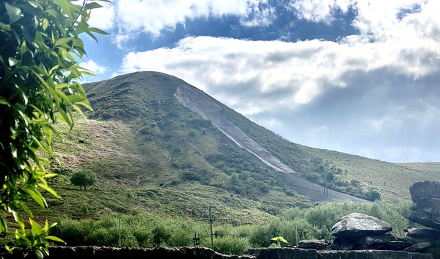
Aberllechau is a small village located in the county of Glamorgan, Wales. Situated in the Rhondda Valley, it lies approximately 13 miles northwest of Cardiff, the capital city of Wales. The village is nestled amidst picturesque green hills and surrounded by the natural beauty of the South Wales Valleys.

Historically, Aberllechau was an important coal mining community during the industrial revolution, with several collieries operating in the area. The village grew rapidly during this period, attracting many workers and their families. However, with the decline of the coal industry in the late 20th century, Aberllechau, like many other mining communities, faced economic challenges and a loss of population.

Today, Aberllechau retains its village charm and offers a peaceful and serene environment for its residents. The village is characterized by rows of terraced houses, a testament to its coal mining past. The local community is tight-knit, with a strong sense of camaraderie and pride in their heritage.

Despite its small size, Aberllechau boasts a range of amenities, including a primary school, a community center, and several local shops. The village is also well-connected to nearby towns and cities through a reliable bus service.

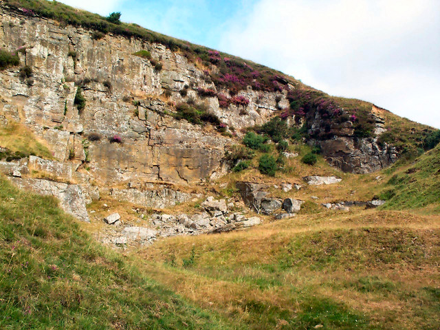
Surrounded by stunning natural landscapes, Aberllechau offers plenty of opportunities for outdoor activities such as hiking, cycling, and exploring the nearby Rhondda Heritage Park. The village is also within easy reach of larger urban centers, allowing residents to enjoy both the tranquility of rural living and the conveniences of city life.

If you have any feedback on the listing, please let us know in the comments section below.

Aberllechau Images

Images are sourced within 2km of 51.634311/-3.42467 or Grid Reference ST0193. Thanks to Geograph Open Source API. All images are credited.

Lane leading to Wattstown
Walking the dog Near Wattstown.
Walking the dog
Near Wattstown.
Landslide on Tylorstown tip Landslide caused by Storm Dennis on 16 February 2020.

<span class="nowrap"><a title="https://www.bbc.co.uk/news/uk-wales-53185569" rel="nofollow ugc noopener" href="https://www.bbc.co.uk/news/uk-wales-53185569">Link</a><img style="margin-left:2px;" alt="External link" title="External link - shift click to open in new window" src="https://s1.geograph.org.uk/img/external.png" width="10" height="10"/></span>
Landslide on Tylorstown tip
Landslide caused by Storm Dennis on 16 February 2020. LinkExternal link
Track junction in St Gwynno Forest
Mycena fungus I think this is one of the Mycena genus of fungi, but I’m not sure which species.
Mycena fungus
I think this is one of the Mycena genus of fungi, but I’m not sure which species.
Lost in the woods OS maps show a footpath through the forest but there is no sign of it on the ground.
Lost in the woods
OS maps show a footpath through the forest but there is no sign of it on the ground.
Public footpath? Marked on OS maps but no sign on the ground - except perhaps this stone?  The walking is rough trying to follow this path through the woodland.
Public footpath?
Marked on OS maps but no sign on the ground - except perhaps this stone? The walking is rough trying to follow this path through the woodland.
Ystrad Rhondda: B4512 The road towards Tylorstown ascends steeply.
Ystrad Rhondda: B4512
The road towards Tylorstown ascends steeply.
Mynydd Brith-weunydd from steps, Tonypandy
Ponies on Troed-y-rhiw mountain Above Ynyshir looking westward
Ponies on Troed-y-rhiw mountain
Above Ynyshir looking westward
Troed-y-rhiw mountain Above Ynyshir looking northwards along the footpath looking towards a distant minor road climbing the mountainside
Troed-y-rhiw mountain
Above Ynyshir looking northwards along the footpath looking towards a distant minor road climbing the mountainside
Ynyshir and Porth from Troed-y-rhiw mountain Looking south-southeast
Ynyshir and Porth from Troed-y-rhiw mountain
Looking south-southeast
Disused quarry Disused quarry on Troed-y-rhiw mountain
Disused quarry
Disused quarry on Troed-y-rhiw mountain
Tip above Tylorstown This tip is one of the few mountain top tips left and can be seen from as far away as Exmoor, the Brecon Beacons and the Blorenge.
(Following the disaster at Aberfan in 1966 virtually all of the mountain top tips were removed.)
The Banana tip was situated alongside the railway line between the villages of Tylorstown and Ferndale and shaped like a banana - hence its name, it was moved very many years ago and is no longer to be seen.
Tip above Tylorstown
This tip is one of the few mountain top tips left and can be seen from as far away as Exmoor, the Brecon Beacons and the Blorenge. (Following the disaster at Aberfan in 1966 virtually all of the mountain top tips were removed.) The Banana tip was situated alongside the railway line between the villages of Tylorstown and Ferndale and shaped like a banana - hence its name, it was moved very many years ago and is no longer to be seen.
Rhondda Golf Course trig
From the top of Penrhys
Llanwonno: southern approach The minor road which arrives at Llanwonno from Pontypridd.
Llanwonno: southern approach
The minor road which arrives at Llanwonno from Pontypridd.
Tylorstown: view from above A splendid view down the Rhondda valley above Tylorstown.
Tylorstown: view from above
A splendid view down the Rhondda valley above Tylorstown.
Show me another place!

Aberllechau is located at Grid Ref: ST0193 (Lat: 51.634311, Lng: -3.42467)

Unitary Authority: Rhondda Cynon Taf

Police Authority: South Wales

Also known as: Wattstown

What 3 Words

///flag.polite.orbit. Near Llwynypia, Rhondda Cynon Taf

Nearby Locations

Aberllechau Wattstown

Related Wikis

Wattstown

Wattstown (Welsh: Aberllechau) is a village located in the Rhondda Valley in the county borough of Rhondda Cynon Taf, Wales. Located in the Rhondda Fach...

Pontygwaith, Rhondda

Pontygwaith (Welsh language: "Bridge of work" or "Bridge of the Ironworks") is a small village located in the Rhondda Fach valley in the county borough...

Wattstown Platform railway station

Wattstown Platform railway station was a short-lived railway station on the now-disused Maerdy Branch in South Wales. == History and description == The...

Tylorstown railway station

Tylorstown railway station served the mining community of Tylorstown in Rhondda Cynon Taf, South Wales, between 1877 and 1964. == History & Description... ==

Pontygwaith Halt railway station

Pontygwaith Halt railway station served the village of Pontygwaith in South Wales. It was only open for nine years. == History and description == Located...

Stanleytown, Rhondda Cynon Taf

Stanleytown is a village located in the Rhondda, Rhondda Cynon Taf, Wales. == History == Stanleytown is located in the ancient parish of Llanwonno. The...

Rhondda (Senedd constituency)

Rhondda is a constituency of the Senedd. It elects one Member of the Senedd by the first past the post method of election. Also, however, it is one of...

Ynyshir railway station

Ynyshir railway station served the village of Ynyshir, in the Rhondda Fach valley in south Wales, from 1876 to 1964. == History == The station was opened...

Nearby Amenities

Located within 500m of 51.634311,-3.42467
Wattstown
Place: village
Wikidata: Q7975052
Lat/Long: 51.6351228/-3.4195847
Turning Circle
Lat/Long: 51.6359832/-3.4302221
Power: pole
Lat/Long: 51.6318122/-3.4266454
Power: pole
Lat/Long: 51.6317389/-3.4291855
Power: pole
Lat/Long: 51.6325947/-3.4304193
Power: pole
Lat/Long: 51.6332639/-3.4314439
Power: pole
Lat/Long: 51.6320586/-3.4197253
Power: pole
Lat/Long: 51.631997/-3.4215304
Power: pole
Lat/Long: 51.6319537/-3.4233919
Direction: 145
Generator Method: photovoltaic
Generator Output Electricity: yes
Generator Solar Modules: 36
Generator Source: solar
Generator Type: solar_photovoltaic_panel
Location: roof
Power: generator
Lat/Long: 51.638013/-3.4208964
Direction: SSE
Generator Method: photovoltaic
Generator Output Electricity: yes
Generator Solar Modules: 18
Generator Source: solar
Generator Type: solar_photovoltaic_panel
Location: roof
Power: generator
Lat/Long: 51.6375234/-3.4208595
Direction: SSE
Generator Method: photovoltaic
Generator Output Electricity: yes
Generator Solar Modules: 17
Generator Source: solar
Generator Type: solar_photovoltaic_panel
Location: roof
Power: generator
Lat/Long: 51.6375958/-3.4197873
Direction: SSE
Generator Method: photovoltaic
Generator Output Electricity: yes
Generator Solar Modules: 12
Generator Source: solar
Generator Type: solar_photovoltaic_panel
Location: roof
Power: generator
Lat/Long: 51.6362599/-3.4213239
Direction: SSE
Generator Method: photovoltaic
Generator Output Electricity: yes
Generator Solar Modules: 11
Generator Source: solar
Generator Type: solar_photovoltaic_panel
Location: roof
Power: generator
Lat/Long: 51.6362535/-3.4198748
Direction: SSE
Generator Method: photovoltaic
Generator Output Electricity: yes
Generator Solar Modules: 11
Generator Source: solar
Generator Type: solar_photovoltaic_panel
Location: roof
Power: generator
Lat/Long: 51.635568/-3.4216002
Direction: 165
Generator Method: photovoltaic
Generator Output Electricity: yes
Generator Solar Modules: 10
Generator Source: solar
Generator Type: solar_photovoltaic_panel
Location: roof
Power: generator
Lat/Long: 51.6354948/-3.421922
Direction: SSE
Generator Method: photovoltaic
Generator Output Electricity: yes
Generator Solar Modules: 15
Generator Source: solar
Generator Type: solar_photovoltaic_panel
Location: roof
Power: generator
Lat/Long: 51.6354862/-3.420654
Direction: 165
Generator Method: photovoltaic
Generator Output Electricity: yes
Generator Solar Modules: 10
Generator Source: solar
Generator Type: solar_photovoltaic_panel
Location: roof
Power: generator
Lat/Long: 51.634798/-3.4190745
Direction: 165
Generator Method: photovoltaic
Generator Output Electricity: yes
Generator Solar Modules: 7
Generator Source: solar
Generator Type: solar_photovoltaic_panel
Location: roof
Power: generator
Lat/Long: 51.6339919/-3.4213018
Direction: SW
Generator Method: photovoltaic
Generator Output Electricity: yes
Generator Solar Modules: 8
Generator Source: solar
Generator Type: solar_photovoltaic_panel
Location: roof
Power: generator
Lat/Long: 51.6338882/-3.429508
Direction: 75
Generator Method: photovoltaic
Generator Output Electricity: yes
Generator Solar Modules: 4
Generator Source: solar
Generator Type: solar_photovoltaic_panel
Location: roof
Power: generator
Lat/Long: 51.6349895/-3.4305919
Direction: 255
Generator Method: photovoltaic
Generator Output Electricity: yes
Generator Solar Modules: 12
Generator Source: solar
Generator Type: solar_photovoltaic_panel
Location: roof
Power: generator
Lat/Long: 51.6349774/-3.4306627
Direction: SE
Generator Method: photovoltaic
Generator Output Electricity: yes
Generator Solar Modules: 16
Generator Source: solar
Generator Type: solar_photovoltaic_panel
Location: roof
Power: generator
Lat/Long: 51.6332267/-3.4271386
The data included in this document is from www.openstreetmap.org. The data is made available under ODbL.

Have you been to Aberllechau?

Leave your review of Aberllechau below (or comments, questions and feedback).