Achadh a' Chùirn

Settlement in Inverness-shire

Scotland

Achadh a' Chùirn

Pond in a private garden at Breakish
Pond in a private garden at Breakish Credit: Rod Allday

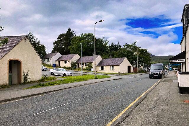
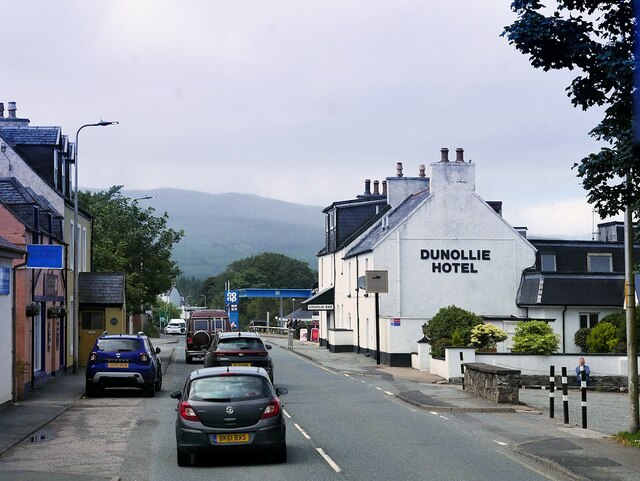
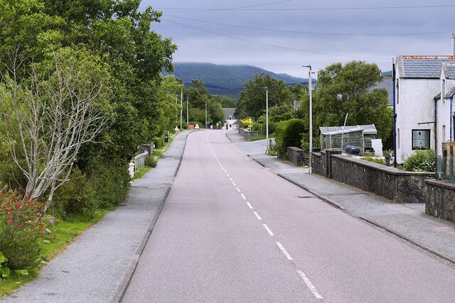
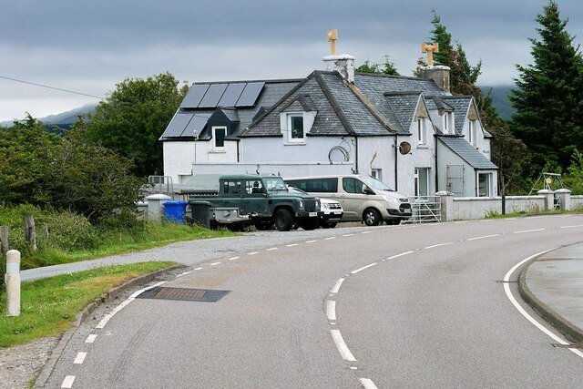
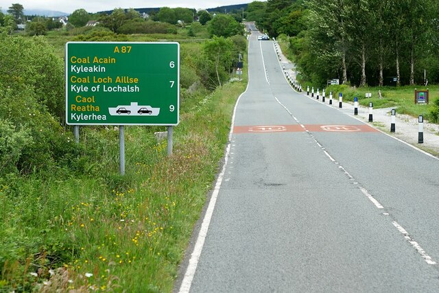
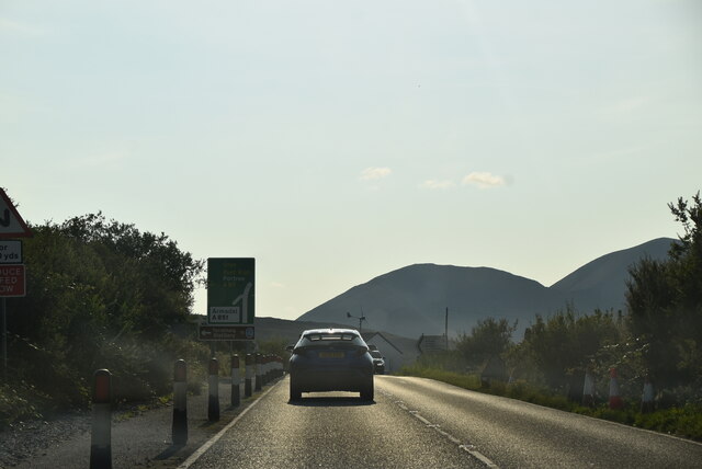
Achadh a' Chùirn is a small rural settlement located in Inverness-shire, Scotland. It is situated in the Scottish Highlands, surrounded by picturesque landscapes of rolling hills and lush greenery. The village is known for its tranquil and peaceful atmosphere, making it a popular destination for those seeking a quiet retreat away from the hustle and bustle of city life.

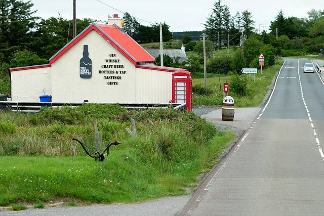
Achadh a' Chùirn is home to a small community of residents who primarily work in agriculture and tourism-related industries. The village has a few local amenities such as a general store, a pub, and a community hall where residents gather for social events and celebrations.

Visitors to Achadh a' Chùirn can enjoy outdoor activities such as hiking, fishing, and bird-watching in the surrounding countryside. The village is also close to several historical sites and attractions, including ancient ruins and castles that offer a glimpse into Scotland's rich history.

Overall, Achadh a' Chùirn is a charming and quaint village that offers a peaceful escape for both residents and visitors alike.

If you have any feedback on the listing, please let us know in the comments section below.

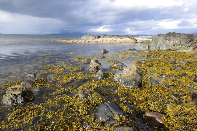
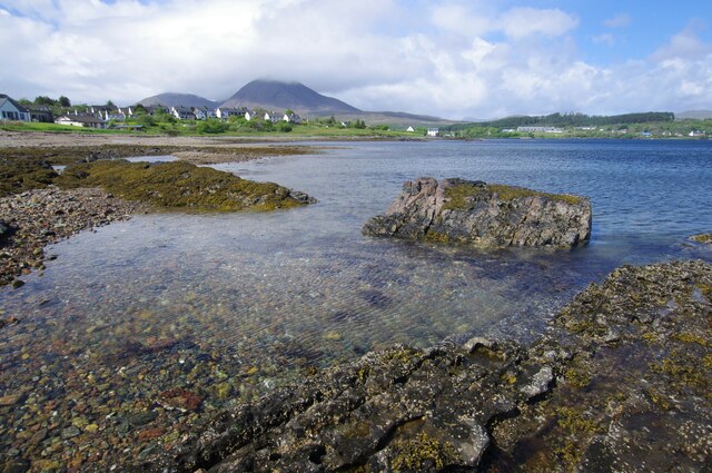
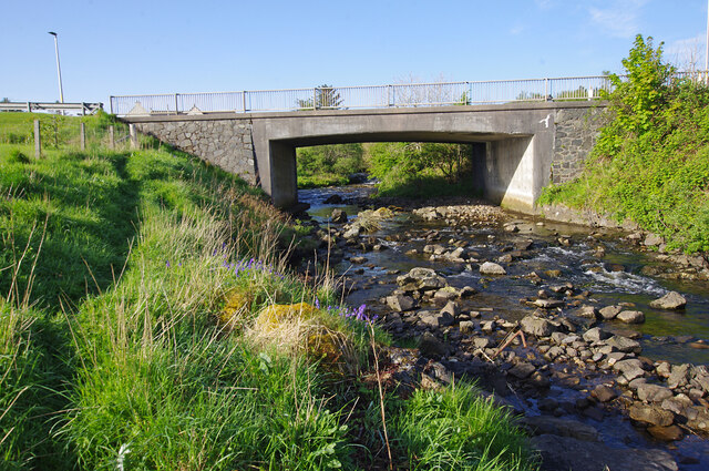
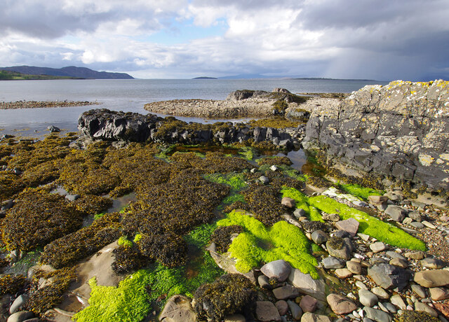
Achadh a' Chùirn Images

Images are sourced within 2km of 57.243401/-5.8738871 or Grid Reference NG6623. Thanks to Geograph Open Source API. All images are credited.

Pond in a private garden at Breakish
View across Lower Breakish
The A87 westbound between Breakish and Broadford
Foreshore, Broadford Bay
Foreshore, Broadford Bay Beinn na Caillich (centre) and Beinn Dearg Bheag (left) are in the background.
Foreshore, Broadford Bay
Beinn na Caillich (centre) and Beinn Dearg Bheag (left) are in the background.
Road bridge, Broadford Carries the A87 over the Allt a' Mhuilinn. Looking upstream. <a href="https://www.geograph.org.uk/photo/1113446">NG6423 : Allt a' Mhuillin</a> shows a downstream view.
Road bridge, Broadford
Carries the A87 over the Allt a' Mhuilinn. Looking upstream. NG6423 : Allt a' Mhuillin shows a downstream view.
Foreshore, Broadford Bay
Broadford, Isle of Skye Broadford, together with nearby Harrapool, is the second-largest settlement on the Isle of Skye.
Broadford, Isle of Skye
Broadford, together with nearby Harrapool, is the second-largest settlement on the Isle of Skye.
A87, Lower Breakish The A87 is a primary route  in the Highland region of Scotland. It runs west for 99 miles from its junction with the A82 at Invergarry, along the north shores of Loch Garry and Loch Cluanie, then through Glen Shiel and along Loch Duich to Kyle of Lochalsh before crossing the Skye Bridge to Kyleakin, Broadford, and Portree, before terminating at Uig in the north of the Isle of Skye.
A87, Lower Breakish
The A87 is a primary route in the Highland region of Scotland. It runs west for 99 miles from its junction with the A82 at Invergarry, along the north shores of Loch Garry and Loch Cluanie, then through Glen Shiel and along Loch Duich to Kyle of Lochalsh before crossing the Skye Bridge to Kyleakin, Broadford, and Portree, before terminating at Uig in the north of the Isle of Skye.
Isle of Skye, Broadford Broadford, together with nearby Harrapool, is the second-largest settlement on the Isle of Skye.
Isle of Skye, Broadford
Broadford, together with nearby Harrapool, is the second-largest settlement on the Isle of Skye.
A87, Harrapool The A87 is a primary route  in the Highland region of Scotland. It runs west for 99 miles from its junction with the A82 at Invergarry, along the north shores of Loch Garry and Loch Cluanie, then through Glen Shiel and along Loch Duich to Kyle of Lochalsh before crossing the Skye Bridge to Kyleakin, Broadford, and Portree, before terminating at Uig in the north of the Isle of Skye.
A87, Harrapool
The A87 is a primary route in the Highland region of Scotland. It runs west for 99 miles from its junction with the A82 at Invergarry, along the north shores of Loch Garry and Loch Cluanie, then through Glen Shiel and along Loch Duich to Kyle of Lochalsh before crossing the Skye Bridge to Kyleakin, Broadford, and Portree, before terminating at Uig in the north of the Isle of Skye.
Large House on a Bend in the A87 The A87 is a primary route  in the Highland region of Scotland. It runs west for 99 miles from its junction with the A82 at Invergarry, along the north shores of Loch Garry and Loch Cluanie, then through Glen Shiel and along Loch Duich to Kyle of Lochalsh before crossing the Skye Bridge to Kyleakin, Broadford, and Portree, before terminating at Uig in the north of the Isle of Skye.
Large House on a Bend in the A87
The A87 is a primary route in the Highland region of Scotland. It runs west for 99 miles from its junction with the A82 at Invergarry, along the north shores of Loch Garry and Loch Cluanie, then through Glen Shiel and along Loch Duich to Kyle of Lochalsh before crossing the Skye Bridge to Kyleakin, Broadford, and Portree, before terminating at Uig in the north of the Isle of Skye.
A87 Broadford to Kyleakin Road The A87 is a primary route  in the Highland region of Scotland. It runs west for 99 miles from its junction with the A82 at Invergarry, along the north shores of Loch Garry and Loch Cluanie, then through Glen Shiel and along Loch Duich to Kyle of Lochalsh before crossing the Skye Bridge to Kyleakin, Broadford, and Portree, before terminating at Uig in the north of the Isle of Skye.
A87 Broadford to Kyleakin Road
The A87 is a primary route in the Highland region of Scotland. It runs west for 99 miles from its junction with the A82 at Invergarry, along the north shores of Loch Garry and Loch Cluanie, then through Glen Shiel and along Loch Duich to Kyle of Lochalsh before crossing the Skye Bridge to Kyleakin, Broadford, and Portree, before terminating at Uig in the north of the Isle of Skye.
Bridge over Allt Achaidh na Caillich at Breakish The A87 is a primary route  in the Highland region of Scotland. It runs west for 99 miles from its junction with the A82 at Invergarry, along the north shores of Loch Garry and Loch Cluanie, then through Glen Shiel and along Loch Duich to Kyle of Lochalsh before crossing the Skye Bridge to Kyleakin, Broadford, and Portree, before terminating at Uig in the north of the Isle of Skye.
Bridge over Allt Achaidh na Caillich at Breakish
The A87 is a primary route in the Highland region of Scotland. It runs west for 99 miles from its junction with the A82 at Invergarry, along the north shores of Loch Garry and Loch Cluanie, then through Glen Shiel and along Loch Duich to Kyle of Lochalsh before crossing the Skye Bridge to Kyleakin, Broadford, and Portree, before terminating at Uig in the north of the Isle of Skye.
The Misty Bottle, Lower Breakish An independent off-licence specialising in Whisky, gin and quality craft beets <span class="nowrap"><a title="https://themistybottle.co.uk/" rel="nofollow ugc noopener" href="https://themistybottle.co.uk/">Link</a><img style="margin-left:2px;" alt="External link" title="External link - shift click to open in new window" src="https://s1.geograph.org.uk/img/external.png" width="10" height="10"/></span> . Located in the former post office at Breakish.
The Misty Bottle, Lower Breakish
An independent off-licence specialising in Whisky, gin and quality craft beets LinkExternal link . Located in the former post office at Breakish.
Broadford Pier
Broadford Pier
A87 approaching junction with A851 The A87 runs 99 miles from Invergarry to Uig on the Isle of Skye <a href="https://www.geograph.org.uk/photo/7374675">NG3863 : End of the A87, Uig</a>.
<span class="nowrap"><a title="https://www.sabre-roads.org.uk/wiki/index.php?title=A87" rel="nofollow ugc noopener" href="https://www.sabre-roads.org.uk/wiki/index.php?title=A87">Link</a><img style="margin-left:2px;" alt="External link" title="External link - shift click to open in new window" src="https://s1.geograph.org.uk/img/external.png" width="10" height="10"/></span>
A87 approaching junction with A851
The A87 runs 99 miles from Invergarry to Uig on the Isle of Skye NG3863 : End of the A87, Uig. LinkExternal link
A87, Broadford The A87 runs 99 miles from Invergarry to Uig on the Isle of Skye <a href="https://www.geograph.org.uk/photo/7374675">NG3863 : End of the A87, Uig</a>.
<span class="nowrap"><a title="https://www.sabre-roads.org.uk/wiki/index.php?title=A87" rel="nofollow ugc noopener" href="https://www.sabre-roads.org.uk/wiki/index.php?title=A87">Link</a><img style="margin-left:2px;" alt="External link" title="External link - shift click to open in new window" src="https://s1.geograph.org.uk/img/external.png" width="10" height="10"/></span>
A87, Broadford
The A87 runs 99 miles from Invergarry to Uig on the Isle of Skye NG3863 : End of the A87, Uig. LinkExternal link
Show me another place!

Achadh a' Chùirn is located at Grid Ref: NG6623 (Lat: 57.243401, Lng: -5.8738871)

Unitary Authority: Highland

Police Authority: Highlands and Islands

Also known as: Waterloo

What 3 Words

///organ.bystander.proved. Near Broadford, Highland

Related Wikis

Harrapool

Harrapool (Scottish Gaelic: Harrapul) is a village, that lies on the right hand side of Broadford Bay, in Isle of Skye, Scottish Highlands and is in the...

Broadford, Skye

Broadford (Scottish Gaelic: An t-Àth Leathann [ən̪ˠ t̪aːh ˈʎɛhən̪ˠ]), together with nearby Harrapool, is the second-largest settlement on the Isle of Skye...

Broadford Parish Church

Broadford Parish Church, Skye is a parish church in the Church of Scotland in Broadford, Skye. == History == The church was built between 1839 and 1841...

Lower Breakish

Lower Breakish (Scottish Gaelic: Breacais Ìosal) is a village on the Isle of Skye in Scotland. == Gallery... ==

Nearby Amenities

Located within 500m of 57.243401,-5.8738871
Source: PGS
Lat/Long: 57.2463239/-5.8711186
Achadh a' Chùirn
Name En: Waterloo
Name Gd: Achadh a' Chùirn
Place: hamlet
Source: survey
Lat/Long: 57.2448537/-5.8714383
Leisure: slipway
Source: survey
Lat/Long: 57.2410605/-5.875973
Power: pole
Lat/Long: 57.2451301/-5.8715961
Power: pole
Lat/Long: 57.2447152/-5.8721578
Power: pole
Lat/Long: 57.2440116/-5.8725362
Power: pole
Lat/Long: 57.243455/-5.8728462
Material: wood
Power: pole
Lat/Long: 57.2429366/-5.8732307
Material: wood
Power: pole
Lat/Long: 57.2424508/-5.873591
Material: wood
Power: pole
Lat/Long: 57.24166/-5.8741426
Material: wood
Power: pole
Lat/Long: 57.2403165/-5.8750796
Material: wood
Power: pole
Lat/Long: 57.2395349/-5.875613
The data included in this document is from www.openstreetmap.org. The data is made available under ODbL.

Have you been to Achadh a' Chùirn?

Leave your review of Achadh a' Chùirn below (or comments, questions and feedback).