Wasperton

Settlement in Warwickshire Warwick

England

Wasperton

Junction on A429 Turning is part of one of the bus routes between Warwick and Stratford-upon-Avon
Junction on A429 Credit: Clint Mann

Wasperton is a small village located in the county of Warwickshire, England. Situated approximately 5 miles west of Warwick, it lies on the banks of the River Avon. The village is part of the district of Stratford-on-Avon and falls within the civil parish of Barford.

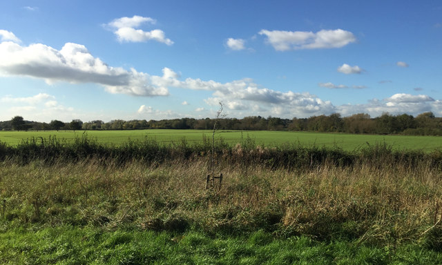
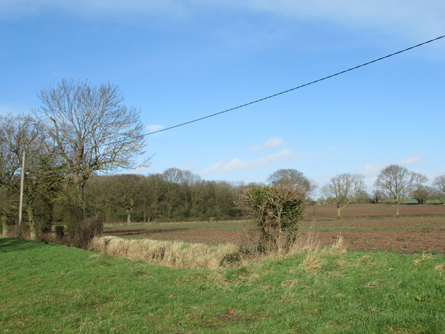
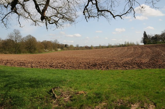
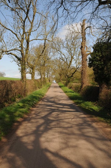
Wasperton is known for its picturesque countryside and rural charm. The village is surrounded by rolling hills and farmland, offering residents and visitors a tranquil and idyllic setting. The River Avon flows through the village, adding to its scenic beauty.

Historically, Wasperton has a rich heritage. The area has evidence of human occupation dating back to the Neolithic period, with archaeological finds such as pottery and tools. Additionally, a Roman settlement was discovered near the village, indicating its significance in ancient times.

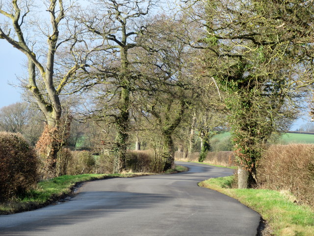
In terms of amenities, Wasperton has limited facilities. However, the nearby town of Warwick provides a wider range of services, including schools, healthcare centers, shops, and leisure activities. The village is well-connected by road, with easy access to major routes such as the A46 and M40, which link it to nearby towns and cities.

Overall, Wasperton offers a peaceful and scenic retreat for those seeking a rural lifestyle. Its rich history, beautiful surroundings, and proximity to larger towns make it an attractive place to live or visit in Warwickshire.

If you have any feedback on the listing, please let us know in the comments section below.

Wasperton Images

Images are sourced within 2km of 52.227769/-1.6112192 or Grid Reference SP2658. Thanks to Geograph Open Source API. All images are credited.

Junction on A429 Turning is part of one of the bus routes between Warwick and Stratford-upon-Avon
Junction on A429
Turning is part of one of the bus routes between Warwick and Stratford-upon-Avon
Oil seed rape field ripening View across an oil seed rape field ripening in the June sunshine.
See the same view five years earlier <a href="https://www.geograph.org.uk/photo/2836687">SP2557 : Wheatfield with poppies</a>.
Oil seed rape field ripening
View across an oil seed rape field ripening in the June sunshine. See the same view five years earlier SP2557 : Wheatfield with poppies.
A429 road junction near Charlecote Park A429 heading north; the road off to the left takes traffic to NT Charlecote Park and the nearby village of Hampton Lucy.
A429 road junction near Charlecote Park
A429 heading north; the road off to the left takes traffic to NT Charlecote Park and the nearby village of Hampton Lucy.
Historic bridge over River Avon at Hampton Lucy Autumn clouds abound. Same bridge as in <a href="https://www.geograph.org.uk/photo/2300429">SP2557 : Hampton Lucy Bridge</a> five years on. Nothing much changes. Well, it has been here since 1829 so what's another 5 years. The bridge is a listed structure on the Historic England website. See <span class="nowrap"><a title="https://historicengland.org.uk/listing/the-list/list-entry/1382105" rel="nofollow ugc noopener" href="https://historicengland.org.uk/listing/the-list/list-entry/1382105">Link</a><img style="margin-left:2px;" alt="External link" title="External link - shift click to open in new window" src="https://s1.geograph.org.uk/img/external.png" width="10" height="10"/></span>
Historic bridge over River Avon at Hampton Lucy
Autumn clouds abound. Same bridge as in SP2557 : Hampton Lucy Bridge five years on. Nothing much changes. Well, it has been here since 1829 so what's another 5 years. The bridge is a listed structure on the Historic England website. See LinkExternal link
Wasperton Church St John the Baptist.
Wasperton Church
St John the Baptist.
Autumn-sown crop emerging, field north of Wellesbourne A field belonging to the Wellesbourne Campus of the University of Warwick, formerly the Wellesbourne Horticultural Research Institute. These level lands in the Avon Valley are in marked contrast to the Cotswolds to the south and the Arden plateau to the north. The view is from a Stratford-Warwick X17 bus.
Autumn-sown crop emerging, field north of Wellesbourne
A field belonging to the Wellesbourne Campus of the University of Warwick, formerly the Wellesbourne Horticultural Research Institute. These level lands in the Avon Valley are in marked contrast to the Cotswolds to the south and the Arden plateau to the north. The view is from a Stratford-Warwick X17 bus.
Line of a brook, a footpath and a field boundary north of Wellesbourne Flat land in the Avon Valley, part of the University of Warwick's Wellesbourne Campus, still shown on the 1:25 000 map as Horticulture Research International. The view is from an X17 Stratford-Warwick bus on the A429.
Line of a brook, a footpath and a field boundary north of Wellesbourne
Flat land in the Avon Valley, part of the University of Warwick's Wellesbourne Campus, still shown on the 1:25 000 map as Horticulture Research International. The view is from an X17 Stratford-Warwick bus on the A429.
River Avon From Hampton Lucy Bridge
Charlecotte Mill Hampton Lucy
Charlecotte Mill Hampton Lucy & Mill Stream
Field Off Snitterfield Street Hampton Lucy
Field Off Snitterfield Street Hampton Lucy (2)
Gorse Cottage Near Hampton Lucy
Snitterfield Street North of Hampton Lucy
An old drinking trough An old drinking trough used to obstruct a field entrance beside a country road to the north of Hampton Lucy.
An old drinking trough
An old drinking trough used to obstruct a field entrance beside a country road to the north of Hampton Lucy.
Farmland beside Hampton Wood Farmland beside Hampton Wood to the north of Hampton Lucy.
Farmland beside Hampton Wood
Farmland beside Hampton Wood to the north of Hampton Lucy.
Country road passing Hampton Wood Country road between Hampton Lucy and Sherbourne passing Hampton Wood.
Country road passing Hampton Wood
Country road between Hampton Lucy and Sherbourne passing Hampton Wood.
St John the Baptist, Wasperton
Show me another place!

Wasperton is located at Grid Ref: SP2658 (Lat: 52.227769, Lng: -1.6112192)

Administrative County: Warwickshire

District: Warwick

Police Authority: Warwickshire

What 3 Words

///opposing.mills.paddock. Near Wellesbourne, Warwickshire

Nearby Locations

Wasperton

Related Wikis

Wasperton

Wasperton is a village and civil parish in the English county of Warwickshire. The population of the civil parish at the 2011 census was 153. It is on...

Thelsford Priory

Thelsford Priory is a site listed by the Historic Buildings and Monuments Commission for England.Thelsford Priory was a small house, originally of the...

Charlecote Mill

Charlecote Mill is a watermill in Hampton Lucy, Warwickshire, England, near to Charlecote Park and about 4 miles (6 km) east of Stratford-upon-Avon. It...
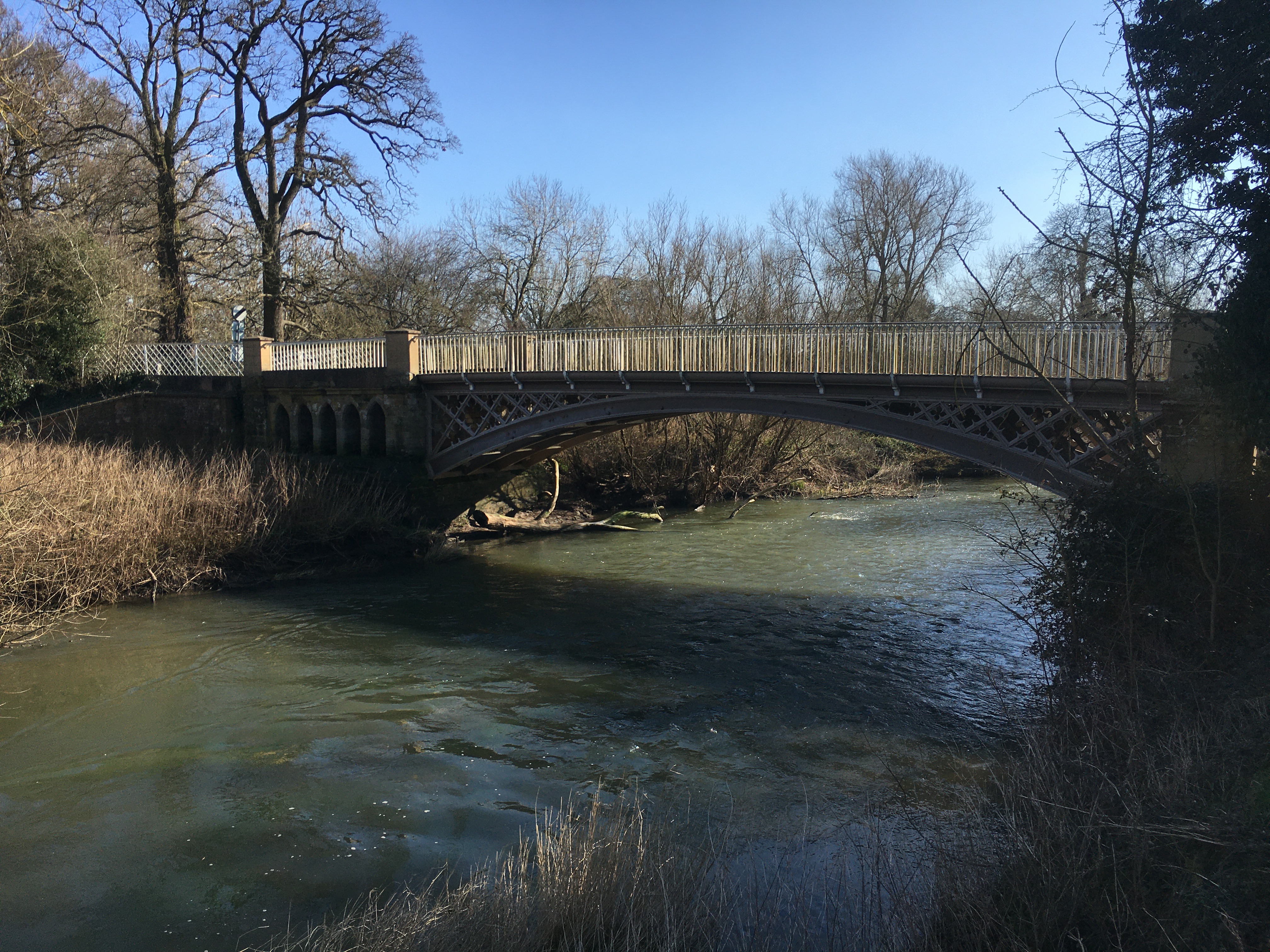
Hampton Lucy Bridge

Hampton Lucy Bridge is a cast iron bridge over the River Avon at the east end of the village of Hampton Lucy in Warwickshire, England. It was originally...

Nearby Amenities

Located within 500m of 52.227769,-1.6112192
Wasperton
Place: village
Source: NPE
Wikidata: Q3432387
Lat/Long: 52.2270156/-1.6129792
Bus Stop
Turn
Bus: yes
Naptan AtcoCode: 4200F164701
Naptan Bearing: N
Naptan CommonName: Turn
Naptan Indicator: Adj
Naptan Landmark: Bus Shelter
Naptan NaptanCode: waramtjt
Naptan Street: Wellesbourne Road
Naptan Verified: no
Public Transport: platform
Shelter: yes
Source: naptan_import
Lat/Long: 52.2296124/-1.6049559
Bus Stop
Turn
Bench: no
Bin: no
Bus: yes
Lit: no
Naptan AtcoCode: 4200F164702
Naptan Bearing: S
Naptan CommonName: Turn
Naptan Indicator: Opp
Naptan Landmark: Turn
Naptan NaptanCode: waramtjw
Naptan Street: Wellesbourne Road
Naptan Verified: no
Public Transport: platform
Shelter: no
Source: naptan_import
Tactile Paving: no
Lat/Long: 52.22962/-1.6045459
Post Box
Collection Times: Mo-Fr 17:00; Sa 08:30
Operator: Royal Mail
Operator Wikidata: Q638098
Post Box Mounting: brick_pillar
Post Box Type: wall
Ref: CV35 160
Royal Cypher: GVIR
Royal Cypher Wikidata: Q33102169
Source: survey
Lat/Long: 52.2277752/-1.6117817
Bench
Backrest: yes
Source: survey
Lat/Long: 52.2277099/-1.6123524
Barrier: kissing_gate
Lat/Long: 52.2255887/-1.6105415
Barrier: kissing_gate
Lat/Long: 52.2294863/-1.6078222
Barrier: kissing_gate
Lat/Long: 52.2255329/-1.6105407
Generator Method: photovoltaic
Generator Output Electricity: yes
Generator Source: solar
Generator Type: solar_photovoltaic_panel
Power: generator
Lat/Long: 52.2266651/-1.6139376
Generator Method: photovoltaic
Generator Output Electricity: yes
Generator Source: solar
Generator Type: solar_photovoltaic_panel
Power: generator
Lat/Long: 52.2266787/-1.6138243
Generator Method: photovoltaic
Generator Output Electricity: yes
Generator Source: solar
Generator Type: solar_photovoltaic_panel
Power: generator
Lat/Long: 52.2267695/-1.6133912
Generator Method: photovoltaic
Generator Output Electricity: yes
Generator Source: solar
Generator Type: solar_photovoltaic_panel
Power: generator
Lat/Long: 52.2279517/-1.6115396
Generator Method: photovoltaic
Generator Output Electricity: yes
Generator Source: solar
Generator Type: solar_photovoltaic_panel
Power: generator
Lat/Long: 52.2278013/-1.6088435
Barrier: kissing_gate
Foot: designated
Lat/Long: 52.2266602/-1.6105481
Barrier: kissing_gate
Lat/Long: 52.2269157/-1.6104206
Material: wood
Operator: National Grid Electricity Distribution
Operator Wikidata: Q7988183
Power: pole
Lat/Long: 52.2291157/-1.6045903
Material: wood
Operator: National Grid Electricity Distribution
Operator Wikidata: Q7988183
Power: pole
Lat/Long: 52.2296613/-1.6080929
Material: wood
Operator: National Grid Electricity Distribution
Operator Wikidata: Q7988183
Power: pole
Lat/Long: 52.2300908/-1.6088369
Material: wood
Operator: National Grid Electricity Distribution
Operator Wikidata: Q7988183
Power: pole
Lat/Long: 52.2305949/-1.6096678
Material: wood
Operator: National Grid Electricity Distribution
Operator Wikidata: Q7988183
Power: pole
Lat/Long: 52.2295078/-1.6100273
Material: wood
Operator: National Grid Electricity Distribution
Operator Wikidata: Q7988183
Power: pole
Lat/Long: 52.2290421/-1.6109847
Material: wood
Operator: National Grid Electricity Distribution
Operator Wikidata: Q7988183
Power: pole
Lat/Long: 52.2285715/-1.6119787
Frequency: 50
Material: wood
Operator: National Grid Electricity Distribution
Operator Wikidata: Q7988183
Power: pole
Ref: 931853
Source: wpd_opendata
Transformer: distribution
Lat/Long: 52.2280657/-1.6130103
Material: wood
Operator: National Grid Electricity Distribution
Operator Wikidata: Q7988183
Power: pole
Lat/Long: 52.2315886/-1.6113283
Material: wood
Operator: National Grid Electricity Distribution
Operator Wikidata: Q7988183
Power: pole
Lat/Long: 52.2321478/-1.6122833
The data included in this document is from www.openstreetmap.org. The data is made available under ODbL.

Have you been to Wasperton?

Leave your review of Wasperton below (or comments, questions and feedback).