Wasdale Head

Settlement in Cumberland Copeland

England

Wasdale Head

Kirk Fell and the Scafells The southern slopes of Kirk Fell with Scafell Pike and Scafell viewed from the path ascending Pillar.
Kirk Fell and the Scafells Credit: Philip Halling

Wasdale Head is a small village nestled in the remote valley of Wasdale, located in the county of Cumberland, in northwest England. Situated within the Lake District National Park, it is renowned for its breathtaking natural beauty and is often regarded as one of the most picturesque areas in the region.

The village itself consists of a handful of traditional stone cottages, a charming inn, and a small church. With a population of less than 100 residents, Wasdale Head offers a tranquil and secluded escape from the bustling city life.

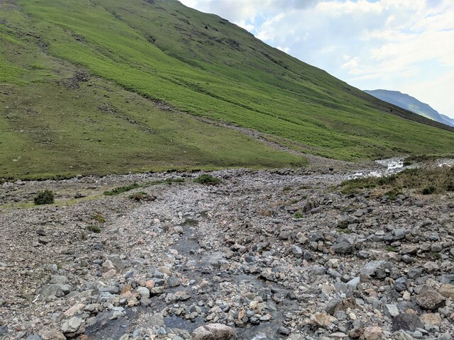
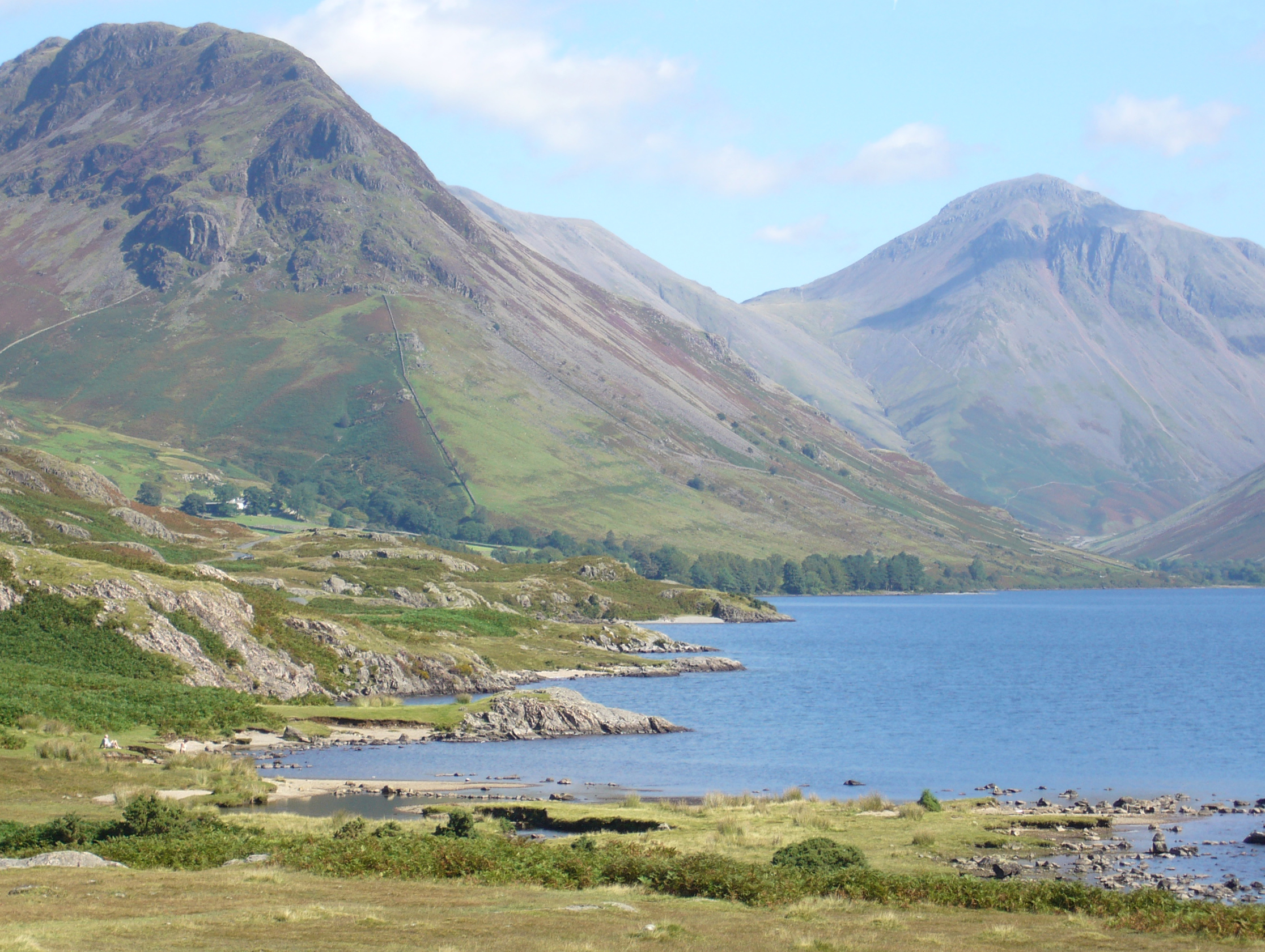
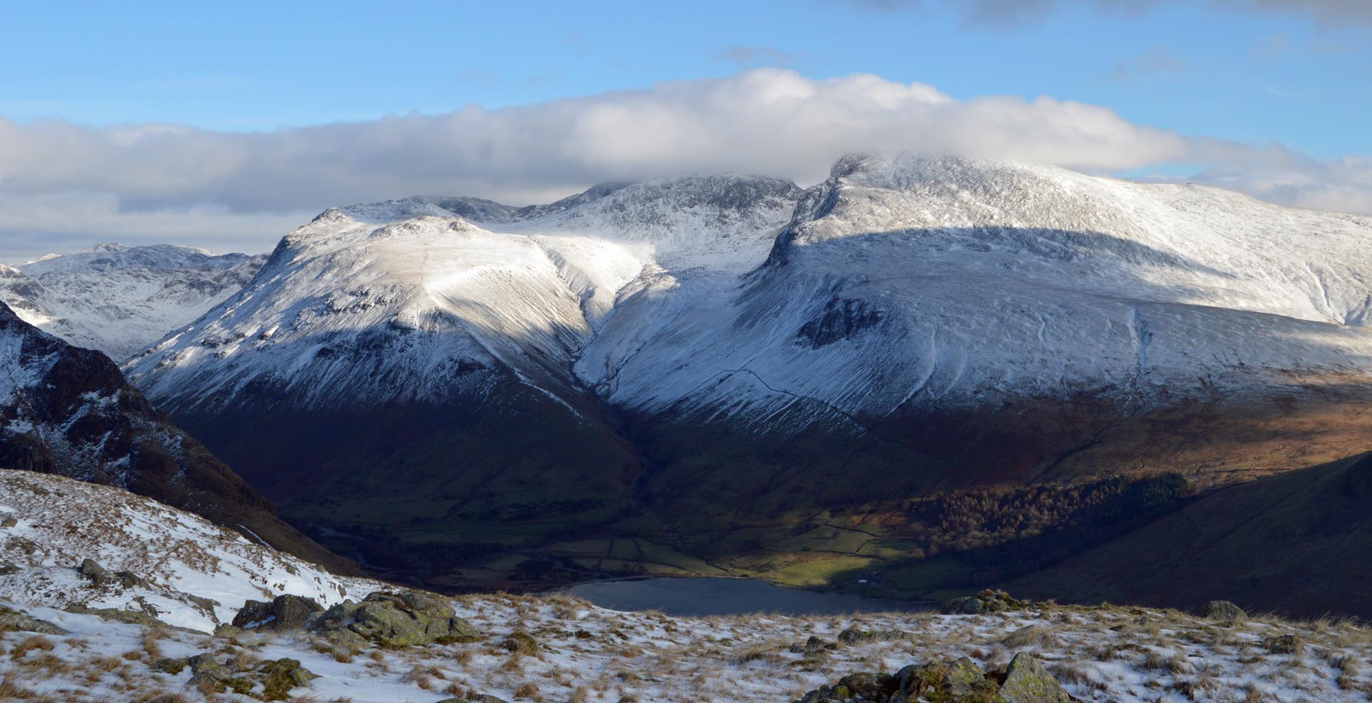
The area is dominated by the surrounding fells, including England's highest peak, Scafell Pike, which stands at an impressive 978 meters (3,209 feet) above sea level. This makes Wasdale Head a popular destination for hikers and outdoor enthusiasts, who flock to the village to take on the challenge of climbing the mighty mountains.

One of the main attractions in Wasdale Head is Wastwater, England's deepest and most dramatic lake. Surrounded by steep screes and towering mountains, it offers a striking backdrop for visitors. The lake is also renowned for its tranquility and is a haven for wildlife, attracting birdwatchers and nature lovers alike.

Despite its remote location, Wasdale Head has a rich history and is steeped in folklore and legend. It is said to be the birthplace of British rock climbing, with early pioneers scaling the rugged cliffs and crags in the area.

Overall, Wasdale Head is a hidden gem in the Lake District, offering unparalleled natural beauty, challenging hikes, and a sense of tranquility for those seeking an escape into the heart of nature.

If you have any feedback on the listing, please let us know in the comments section below.

Wasdale Head Images

Images are sourced within 2km of 54.464998/-3.256487 or Grid Reference NY1808. Thanks to Geograph Open Source API. All images are credited.

Kirk Fell and the Scafells The southern slopes of Kirk Fell with Scafell Pike and Scafell viewed from the path ascending Pillar.
Kirk Fell and the Scafells
The southern slopes of Kirk Fell with Scafell Pike and Scafell viewed from the path ascending Pillar.
Yewbarrow from Lingmell Gill
Brackenclose Hut The Fell & Rock Climbing Club hut was badly damaged in a fire in 2019. It is being (slowly) rebuilt.  See: <a title="https://www.geograph.org.uk/photo/4526670" href="https://www.geograph.org.uk/photo/4526670">Link</a> taken before the fire.
Brackenclose Hut
The Fell & Rock Climbing Club hut was badly damaged in a fire in 2019. It is being (slowly) rebuilt. See: Link taken before the fire.
The junction of the paths Mosedale to the left, the Sty Head path to the right. With Kirk Fell looking down.
The junction of the paths
Mosedale to the left, the Sty Head path to the right. With Kirk Fell looking down.
The path beside Lingmell Gill
Footbridge across Fogmire Beck
Barn at Burnthwaite
Barn at Burnthwaite
Looking down Lingmell Gill
Crossing Lingmell Gill at the foot of Brown Tongue
Looking towards the valley of Gable Beck From Moses' Trod.
Looking towards the valley of Gable Beck
From Moses' Trod.
Gable Beck joins Lingmell Beck The widespread rocks and boulders indicate the spread of the streams when in spate.
Gable Beck joins Lingmell Beck
The widespread rocks and boulders indicate the spread of the streams when in spate.
Wasdale Head These former farm buildings are now used to serve tourists with a shop and holiday apartments.
The steep fell in the background is the northern shoulder of Yewbarrow.
There is an Ordnance Survey cut benchmark on the pillar between the doors beyond the yellow defibrillator box (photograph <a href="https://www.geograph.org.uk/photo/7123697">NY1808 : Benchmark, Wasdale Head</a>).
Wasdale Head
These former farm buildings are now used to serve tourists with a shop and holiday apartments. The steep fell in the background is the northern shoulder of Yewbarrow. There is an Ordnance Survey cut benchmark on the pillar between the doors beyond the yellow defibrillator box (photograph NY1808 : Benchmark, Wasdale Head).
Benchmark, Wasdale Head Detail of the Ordnance Survey cut benchmark on a former barn (now a shop and holiday accommodation) at Wasdale Head. In spite of the many years since the benchmark was cut, the darkness of the cut stone still contrasts with the weathered surface of the natural block used in the construction of the barn.
The benchmark marks a height of 80.3483m above sea level (Ordnance Datum Newlyn) last verified in 1956 (location photograph <a href="https://www.geograph.org.uk/photo/7123690">NY1808 : Wasdale Head</a>).
Benchmark, Wasdale Head
Detail of the Ordnance Survey cut benchmark on a former barn (now a shop and holiday accommodation) at Wasdale Head. In spite of the many years since the benchmark was cut, the darkness of the cut stone still contrasts with the weathered surface of the natural block used in the construction of the barn. The benchmark marks a height of 80.3483m above sea level (Ordnance Datum Newlyn) last verified in 1956 (location photograph NY1808 : Wasdale Head).
Moody day at Wasdale Head The morning’s low cloud and rain had cleared and as a foretaste of better weather to come a brief glimpse of sun catches Great Gable between Great Napes and Tom Blue.
Moody day at Wasdale Head
The morning’s low cloud and rain had cleared and as a foretaste of better weather to come a brief glimpse of sun catches Great Gable between Great Napes and Tom Blue.
Wastwater and Wasdale Head Some of the most remote Lakeland country - taken from the path that follows Wastwater through some really brutal scree slopes.
Wastwater and Wasdale Head
Some of the most remote Lakeland country - taken from the path that follows Wastwater through some really brutal scree slopes.
Queen Victoria (VR) Post Box (1837-1901), Wasdale Head
Packhorse Bridge Over Mosdale Beck, Wasdale Head
Ritson Force Waterfall (Upper Section), Wasdale Head The waterfall is said to be named after Will Ritson, landlord and tall tale teller at the nearby Wasdale Head Inn.
Ritson Force Waterfall (Upper Section), Wasdale Head
The waterfall is said to be named after Will Ritson, landlord and tall tale teller at the nearby Wasdale Head Inn.
Show me another place!

Wasdale Head is located at Grid Ref: NY1808 (Lat: 54.464998, Lng: -3.256487)

Administrative County: Cumbria

District: Copeland

Police Authority: Cumbria

What 3 Words

///played.access.risking. Near Seascale, Cumbria

Nearby Locations

Wasdale Head

Related Wikis

St Olaf's Church, Wasdale

St Olaf's Church in Wasdale Head, Cumbria, is England's smallest parish church. The earliest record of a church on this site is from 1550, though it is...

Wasdale Head

Wasdale Head (; traditionally ) is a scattered agricultural hamlet in the Lake District National Park in Cumbria, England. Wasdale Head claims to be home...

Mosedale Beck (Wast Water)

Mosedale Beck is a stream in Cumbria which runs into Wast Water, which is the deepest lake in England. Mosedale Beck rises in Little Scoat Fell, it then...

Yewbarrow

Yewbarrow is a fell, in the English Lake District, which lies immediately north of the head of Wast Water. It is 628 metres (2,060 feet) high and in shape...

Kirk Fell

Kirk Fell is a fell in the Western part of the English Lake District. It is situated between Great Gable and Pillar on the long ring of fells surrounding...

Lingmell

Lingmell is a fell in the English Lake District, standing above the village of Wasdale Head. It is an outlier on the north-west flank of Scafell Pike,...

Scafell

Scafell ( or ; also spelled Sca Fell, previously Scawfell) is a mountain in the English Lake District, part of the Southern Fells. Its height of 964 metres...

Mickledore

Mickledore (the name means great door or pass) is a narrow ridge, 840 metres (2755 ft) high, connecting the mountains of Scafell and Scafell Pike in the...

Nearby Amenities

Located within 500m of 54.464998,-3.256487
Barrier: stile
Material: wood
Source: survey;bing;gps
Stile: stepover
Lat/Long: 54.4639082/-3.2567913
Barrier: stile
Material: wood
Source: survey;bing;gps
Stile: stepover
Lat/Long: 54.4639365/-3.2567292
Post Box
Collection Times: Mo-Fr 11:00; Sa 10:00; Su off
Post Box Type: wall
Ref: CA20 49
Royal Cypher: VR
Royal Cypher Wikidata: Q33102356
Lat/Long: 54.4673441/-3.2561698
Defibrillator
Emergency: defibrillator
Lat/Long: 54.4677468/-3.2565285
Barrier: stile
Lat/Long: 54.4664473/-3.2590431
Wasdale Head
Place: hamlet
Wikidata: Q7971373
Wikipedia: en:Wasdale Head
Lat/Long: 54.4676926/-3.2562113
Down In The Dale
Place: locality
Lat/Long: 54.461865/-3.2600019
Camera Mount: building
Camera Type: fixed
Contact Webcam: http://www.s213669645.websitehome.co.uk/17.html
Man Made: surveillance
Surveillance Type: camera
Lat/Long: 54.4659822/-3.2551037
Lingmell House
Addr Housename: Lingmell House
Addr Postcode: CA20 1EX
Addr Village: Wasdale Head
Tourism: guest_house
Website: http://www.s213669645.websitehome.co.uk/11.html
Lat/Long: 54.4658902/-3.2551184
Information: guidepost
Tourism: information
Lat/Long: 54.4657953/-3.2557999
Information: board
Tourism: information
Lat/Long: 54.465769/-3.2557626
Barn Door Shop
Addr City: Seascale
Addr Postcode: CA20 1EX
Addr Street: Wasdale Head
Contact Facebook: https://www.facebook.com/barndoorshop/
Phone: +44 19467 26384
Shop: outdoor
Lat/Long: 54.4677499/-3.2563662
Row Head
Place: locality
Lat/Long: 54.4687759/-3.2551901
Entrance: main
Lat/Long: 54.4675337/-3.2567195
Shower
Campsite shower
Access: customers
Fee: yes
Opening Hours: 24/7
Operator: Wasdale Head Hotel
Unisex: yes
Lat/Long: 54.4677267/-3.256999
Entrance: yes
Lat/Long: 54.4677448/-3.2569888
Toilets
Campsite toilet
Access: customers
Fee: no
Female: yes
Operator: Wasdale Head Hotel
Toilets Disposal: flush
Toilets Position: seated
Lat/Long: 54.4677373/-3.2570309
Toilets
Campsite toilet
Access: customers
Fee: no
Male: yes
Operator: Wasdale Head Hotel
Toilets Disposal: flush
Toilets Position: seated
Lat/Long: 54.4677012/-3.2570487
Entrance: yes
Lat/Long: 54.4677406/-3.2570621
Entrance: yes
Lat/Long: 54.4677187/-3.2570715
Drinking Water
Lat/Long: 54.4677326/-3.2568736
Barrier: stile
Lat/Long: 54.4673189/-3.2562656
Historic: memorial
Inscription: Shakespeare Was not born here and never visited here
Memorial: plaque
Lat/Long: 54.4658965/-3.2552954
Fell And Rock Climbing Club
Historic: memorial
Memorial: plaque
Lat/Long: 54.4670025/-3.2537507
Bus Stop
Wasdale Head Green
Public Transport: platform
Lat/Long: 54.4656481/-3.255904
The data included in this document is from www.openstreetmap.org. The data is made available under ODbL.

Have you been to Wasdale Head?

Leave your review of Wasdale Head below (or comments, questions and feedback).