Wargate

Settlement in Lincolnshire South Holland

England

Wargate

Cressy Hall and Moated site near Gosberton: aerial 2021 See: <span class="nowrap"><a title="https://www.heritagegateway.org.uk/Gateway/Results_Single.aspx?uid=MLI86313&resourceID=1006" rel="nofollow ugc noopener" href="https://www.heritagegateway.org.uk/Gateway/Results_Single.aspx?uid=MLI86313&resourceID=1006">Link</a><img style="margin-left:2px;" alt="External link" title="External link - shift click to open in new window" src="https://s1.geograph.org.uk/img/external.png" width="10" height="10"/></span>
Cressy Hall and Moated site near Gosberton: aerial 2021 Credit: Simon Tomson

Wargate is a small village located in the East Lindsey district of Lincolnshire, England. Situated approximately 20 miles east of the city of Lincoln, Wargate is nestled amidst the picturesque Lincolnshire Wolds, an Area of Outstanding Natural Beauty.

With a population of around 200 residents, Wargate retains its rural charm and tranquility. The village is known for its beautiful countryside views, rolling hills, and lush green fields. It offers a peaceful escape from the hustle and bustle of city life, making it an ideal destination for those seeking a serene getaway.

Wargate is home to a modest range of amenities, including a village hall, a local pub, and a church. The village hall serves as a focal point for community events and activities, hosting regular gatherings, social functions, and meetings. The local pub offers a warm and friendly environment, serving traditional British cuisine and a selection of beverages.

Surrounding Wargate are several nature reserves and walking trails, providing ample opportunities for outdoor enthusiasts to explore and appreciate the region's natural beauty. The area is also popular among birdwatchers, as it attracts a diverse range of bird species throughout the year.

While Wargate may be small in size, its location in the heart of the Lincolnshire Wolds makes it a desirable destination for nature lovers and those seeking a peaceful retreat in the English countryside.

If you have any feedback on the listing, please let us know in the comments section below.
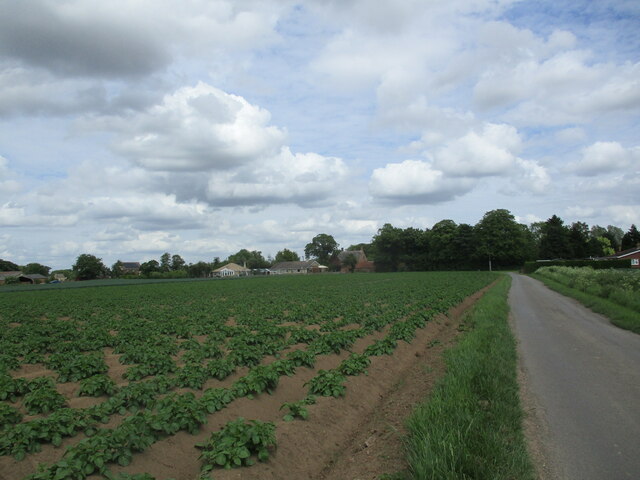
Wargate Images

Images are sourced within 2km of 52.858119/-0.16534126 or Grid Reference TF2330. Thanks to Geograph Open Source API. All images are credited.

Cressy Hall and Moated site near Gosberton: aerial 2021 See: <span class="nowrap"><a title="https://www.heritagegateway.org.uk/Gateway/Results_Single.aspx?uid=MLI86313&resourceID=1006" rel="nofollow ugc noopener" href="https://www.heritagegateway.org.uk/Gateway/Results_Single.aspx?uid=MLI86313&resourceID=1006">Link</a><img style="margin-left:2px;" alt="External link" title="External link - shift click to open in new window" src="https://s1.geograph.org.uk/img/external.png" width="10" height="10"/></span>
Cressy Hall and Moated site near Gosberton: aerial 2021
See: LinkExternal link
Road junction
Road junction
Quadring Road, Gosberton Looking towards Quadring.
Quadring Road, Gosberton
Looking towards Quadring.
Wargate Way, Gosberton The house on the corner dates from the eighteenth century <span class="nowrap"><a title="https://historicengland.org.uk/listing/the-list/list-entry/1064423?section=official-list-entry" rel="nofollow ugc noopener" href="https://historicengland.org.uk/listing/the-list/list-entry/1064423?section=official-list-entry">Link</a><img style="margin-left:2px;" alt="External link" title="External link - shift click to open in new window" src="https://s1.geograph.org.uk/img/external.png" width="10" height="10"/></span> as does that adjacent to it <span class="nowrap"><a title="https://historicengland.org.uk/listing/the-list/list-entry/1064424?section=official-list-entry" rel="nofollow ugc noopener" href="https://historicengland.org.uk/listing/the-list/list-entry/1064424?section=official-list-entry">Link</a><img style="margin-left:2px;" alt="External link" title="External link - shift click to open in new window" src="https://s1.geograph.org.uk/img/external.png" width="10" height="10"/></span>
Wargate Way, Gosberton
The house on the corner dates from the eighteenth century LinkExternal link as does that adjacent to it LinkExternal link
Gosberton Community Hall
Potato field off Cawood Lane
Risegate Eau at Cressy Bridge Risegate Eau is completely blocked with vegetation.
Risegate Eau at Cressy Bridge
Risegate Eau is completely blocked with vegetation.
Potato field and Spalding Road
Gosberton Methodist Church
Co-op Food Store, Gosberton A former chapel.
Co-op Food Store, Gosberton
A former chapel.
The Bell Inn, Gosberton Dates from the early nineteenth century <span class="nowrap"><a title="https://historicengland.org.uk/listing/the-list/list-entry/1146579?section=official-list-entry" rel="nofollow ugc noopener" href="https://historicengland.org.uk/listing/the-list/list-entry/1146579?section=official-list-entry">Link</a><img style="margin-left:2px;" alt="External link" title="External link - shift click to open in new window" src="https://s1.geograph.org.uk/img/external.png" width="10" height="10"/></span>
The Bell Inn, Gosberton
Dates from the early nineteenth century LinkExternal link
Former shop, Gosberton
Church of St. Peter and St. Paul, Gosberton The spire dates from the fourteenth century <span class="nowrap"><a title="https://historicengland.org.uk/listing/the-list/list-entry/1064425?section=official-list-entry" rel="nofollow ugc noopener" href="https://historicengland.org.uk/listing/the-list/list-entry/1064425?section=official-list-entry">Link</a><img style="margin-left:2px;" alt="External link" title="External link - shift click to open in new window" src="https://s1.geograph.org.uk/img/external.png" width="10" height="10"/></span>
Church of St. Peter and St. Paul, Gosberton
The spire dates from the fourteenth century LinkExternal link
The Manor House, Gosberton
Houses on Bow Gate, Gosberton
Potato field, North Gate, Gosberton
Potato field, Cawood Lane, Gosberton
Wheat field, Wargate
Show me another place!

Wargate is located at Grid Ref: TF2330 (Lat: 52.858119, Lng: -0.16534126)

Division: Parts of Holland

Administrative County: Lincolnshire

District: South Holland

Police Authority: Lincolnshire

What 3 Words

///prefect.ombudsman.language. Near Gosberton, Lincolnshire

Nearby Locations

Wargate

Related Wikis

Gosberton

Gosberton is a village and civil parish in the South Holland district of Lincolnshire, England. It is situated 9 miles (14.5 km) south-west of Boston,...

Gosberton railway station

Gosberton railway station was a station in Gosberton, Lincolnshire. It was opened in 1882 and closed for passengers on 11 September 1961 and freight on...

Westhorpe, Lincolnshire

Westhorpe is a hamlet in the civil parish of Gosberton and the South Holland district of Lincolnshire, England. It is 30 miles (50 km) south-east from...

Risegate

Risegate is a village in the civil parish of Gosberton and the South Holland district of Lincolnshire, England. It is 30 miles (50 km) south-east from...

Nearby Amenities

Located within 500m of 52.858119,-0.16534126
Wargate Way Farm
Place: farm
Source: Bing
Lat/Long: 52.8624134/-0.1637097
Wargate
Place: hamlet
Source: Bing
Lat/Long: 52.8587686/-0.1654534
Wargate Bridge
Place: locality
Source: Bing
Lat/Long: 52.8585877/-0.1644817
The data included in this document is from www.openstreetmap.org. The data is made available under ODbL.

Have you been to Wargate?

Leave your review of Wargate below (or comments, questions and feedback).