Valtos

Settlement in Inverness-shire

Scotland

Valtos

View south by Mealt Waterfall
View south by Mealt Waterfall Credit: Chris Morgan

The requested URL returned error: 429 Too Many Requests

If you have any feedback on the listing, please let us know in the comments section below.
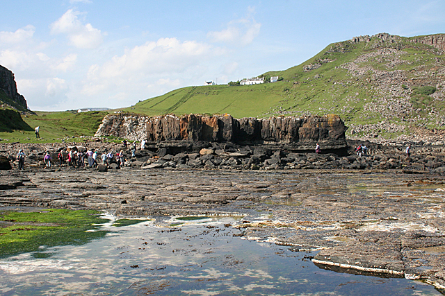
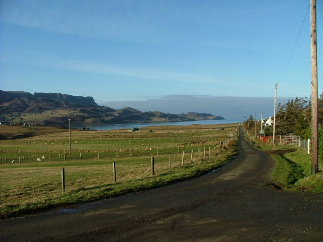
Valtos Images

Images are sourced within 2km of 57.593085/-6.1601229 or Grid Reference NG5163. Thanks to Geograph Open Source API. All images are credited.

View south by Mealt Waterfall
Coastline south of Mealt The basalt sea-cliffs illuminated by the rising sun.
Coastline south of Mealt
The basalt sea-cliffs illuminated by the rising sun.
Milkwort (Polygala sp) Milkwort is generally a deep blue colour, but occasionally you come across a plant with pink flowers.
Milkwort (Polygala sp)
Milkwort is generally a deep blue colour, but occasionally you come across a plant with pink flowers.
Cul nan Cnoc The foreground is in this square, but the more interesting linear feature is in the next square. It is a fault line separating the low-lying Lealt Shale from a Palaeogene lava plateau.
Cul nan Cnoc
The foreground is in this square, but the more interesting linear feature is in the next square. It is a fault line separating the low-lying Lealt Shale from a Palaeogene lava plateau.
Unnamed Burn at Cul nan Cnoc The burn has carved a gorge in the soft Lealt Shale.
Unnamed Burn at Cul nan Cnoc
The burn has carved a gorge in the soft Lealt Shale.
The Descent to Rubha nam Brathairean The view from the path as one descends to the shore. Rubha nam Brathairean ('headland of the brothers') is the furthest point of land.
The Descent to Rubha nam Brathairean
The view from the path as one descends to the shore. Rubha nam Brathairean ('headland of the brothers') is the furthest point of land.
Port Earlish Although named as a port, the cobble beach here is not at all sheltered from the north and east.
Port Earlish
Although named as a port, the cobble beach here is not at all sheltered from the north and east.
Memorial Stone The other side of the stone in the foreground bears a Caithness flagstone plaque with a Gaelic inscription referring to the brothers after whom the 'Brothers' Headland' is presumably named.
Memorial Stone
The other side of the stone in the foreground bears a Caithness flagstone plaque with a Gaelic inscription referring to the brothers after whom the 'Brothers' Headland' is presumably named.
Rock at Port Earlish The flat part is Jurassic limestone and the dark rock nearest the camera is a basaltic dyke. At low tide it must give some shelter to the beach at Port Earlish.
Rock at Port Earlish
The flat part is Jurassic limestone and the dark rock nearest the camera is a basaltic dyke. At low tide it must give some shelter to the beach at Port Earlish.
Stone Parcels We found several of these along the shore, each one embroidered with the name of a MacLeod girl. I wonder who created them and why?
Stone Parcels
We found several of these along the shore, each one embroidered with the name of a MacLeod girl. I wonder who created them and why?
Lagoon and Dyke The flat rock in the foreground is Jurassic, and the Palaeogene dyke beyond it, sculpted by erosion into a shape like a stack of leaning cards, almost encloses a small lagoon.
Lagoon and Dyke
The flat rock in the foreground is Jurassic, and the Palaeogene dyke beyond it, sculpted by erosion into a shape like a stack of leaning cards, almost encloses a small lagoon.
A Gap with a View Through the gap in the lava flow there is a glimpse of the distant Kilt Rock. This is formed of a thick lava flow on top of a shale unit, with a sill at sea level.
A Gap with a View
Through the gap in the lava flow there is a glimpse of the distant Kilt Rock. This is formed of a thick lava flow on top of a shale unit, with a sill at sea level.
Lava and a Lagoon The lagoon has formed where overlying lava has been eroded out, leaving the flat Jurassic limestone. Cul nan Cnoc is at the top of the slope in the distance.
Lava and a Lagoon
The lagoon has formed where overlying lava has been eroded out, leaving the flat Jurassic limestone. Cul nan Cnoc is at the top of the slope in the distance.
Lava on Limestone At this point a thick lava flow overlies thinly bedded limestones of the Lealt Shale Formation.
Lava on Limestone
At this point a thick lava flow overlies thinly bedded limestones of the Lealt Shale Formation.
Lealt Shale and Lava At this point a thick lava flow overlies thinly bedded limestones of the Lealt Shale Formation.
Lealt Shale and Lava
At this point a thick lava flow overlies thinly bedded limestones of the Lealt Shale Formation.
Jurassic Limestone This flat platform is limestone of the Lealt Shale Formation. It contains little pods of fossil debris such as bone fragments.
Jurassic Limestone
This flat platform is limestone of the Lealt Shale Formation. It contains little pods of fossil debris such as bone fragments.
Lava on Lealt Limestone From a bit further away the difference between the overlying lava and underlying sediment is even more marked.
Lava on Lealt Limestone
From a bit further away the difference between the overlying lava and underlying sediment is even more marked.
Lava Flow In the middle of the rock you can see where the lava has filled in a hollow in the underlying rock, and the cracks formed as it colled radiate out from the lowest point of the hollow, almost like a fan.
Lava Flow
In the middle of the rock you can see where the lava has filled in a hollow in the underlying rock, and the cracks formed as it colled radiate out from the lowest point of the hollow, almost like a fan.
Show me another place!

Valtos is located at Grid Ref: NG5163 (Lat: 57.593085, Lng: -6.1601229)

Unitary Authority: Highland

Police Authority: Highlands and Islands

Also known as: Bhaltos

What 3 Words

///thatched.thrillers.stutter. Near Uig, Highland

Nearby Locations

Valtos Bhaltos

Related Wikis

Loch Mealt

Loch Mealt is an inland fresh-water loch on the Isle of Skye in Scotland. It lies close to Ellishadder and south of Staffin, on the eastern side of the...

Ellishadder

Ellishadder (Scottish Gaelic: Ealaiseadar) is a crofting township, situated close to the north shore of the freshwater Loch Mealt, on the Trotternish peninsula...

Lealt, Skye

Lealt (Scottish Gaelic: An Leathallt) is a crofting township, on the western coastline of the Sound of Raasay on the Trotternish peninsula of Skye, in...

Garafad

Garafad or Garafad, (Scottish Gaelic: An Garradh Fada) is a linear crofting settlement on the east coast of the Trotternish Peninsula of Skye in the...

Nearby Amenities

Located within 500m of 57.593085,-6.1601229
Created By: dmgroom_coastlines
Source: PGS
Lat/Long: 57.59066/-6.15359
Created By: dmgroom_coastlines
Source: PGS
Lat/Long: 57.5908/-6.15406
Created By: dmgroom_coastlines
Source: PGS
Lat/Long: 57.59105/-6.1538
Created By: dmgroom_coastlines
Source: PGS
Lat/Long: 57.5913/-6.15379
Created By: dmgroom_coastlines
Source: PGS
Lat/Long: 57.59157/-6.15424
Created By: dmgroom_coastlines
Source: PGS
Lat/Long: 57.59184/-6.15469
Created By: dmgroom_coastlines
Source: PGS
Lat/Long: 57.59209/-6.15467
Created By: dmgroom_coastlines
Source: PGS
Lat/Long: 57.59234/-6.15466
Created By: dmgroom_coastlines
Source: PGS
Lat/Long: 57.59312/-6.15459
Created By: dmgroom_coastlines
Source: PGS
Lat/Long: 57.59336/-6.15457
Created By: dmgroom_coastlines
Source: PGS
Lat/Long: 57.59389/-6.15501
Created By: dmgroom_coastlines
Source: PGS
Lat/Long: 57.59441/-6.15497
Created By: dmgroom_coastlines
Source: PGS
Lat/Long: 57.59466/-6.15494
Created By: dmgroom_coastlines
Source: PGS
Lat/Long: 57.59518/-6.15539
Created By: dmgroom_coastlines
Source: PGS
Lat/Long: 57.59596/-6.1558
Created By: dmgroom_coastlines
Source: PGS
Lat/Long: 57.59647/-6.15576
Created By: dmgroom_coastlines
Source: PGS
Lat/Long: 57.59673/-6.15574
Valtos
Name Gd: Bhaltos
Place: hamlet
Lat/Long: 57.596257/-6.161028
Telephone
Booth: K6
Covered: booth
Source: survey
Lat/Long: 57.5905443/-6.1588481
Historic: memorial
Source: survey
Lat/Long: 57.5893366/-6.1582201
Valtos4
Addr City: Valtos
Addr Housenumber: 4
Addr Postcode: IV51 9JD
Addr Street: Valtos
Internet Access: yes
Internet Access Fee: no
Phone: +44 1470 562426
Rooms: 2
Tourism: guest_house
Website: https://valtos4.wixsite.com/skyebedandbreakfast
Lat/Long: 57.5956933/-6.1606787
Power: pole
Lat/Long: 57.5886505/-6.1600269
Power: pole
Lat/Long: 57.5891554/-6.1600994
Power: pole
Lat/Long: 57.589738/-6.1607335
Power: pole
Lat/Long: 57.590257/-6.1612971
Power: pole
Lat/Long: 57.590846/-6.1619594
Power: pole
Lat/Long: 57.5913337/-6.1624888
Power: pole
Lat/Long: 57.5910456/-6.1614823
Power: pole
Lat/Long: 57.5934494/-6.1616751
Power: pole
Lat/Long: 57.5903196/-6.15927
Power: pole
Lat/Long: 57.590736/-6.1597813
Power: pole
Lat/Long: 57.5911071/-6.1602322
Power: pole
Lat/Long: 57.5914891/-6.1606912
Power: pole
Lat/Long: 57.5918462/-6.1633262
Power: pole
Lat/Long: 57.5923446/-6.1641636
Power: pole
Lat/Long: 57.5927955/-6.1649124
Power: pole
Lat/Long: 57.5931591/-6.1651197
Power: pole
Lat/Long: 57.5936294/-6.1653714
Power: pole
Lat/Long: 57.59424/-6.1657095
Power: pole
Lat/Long: 57.5947492/-6.1662732
Power: pole
Lat/Long: 57.5952347/-6.1668086
Barrier: cattle_grid
Lat/Long: 57.5924472/-6.159975
The data included in this document is from www.openstreetmap.org. The data is made available under ODbL.

Have you been to Valtos?

Leave your review of Valtos below (or comments, questions and feedback).