Vale Park

Settlement in Cheshire

England

Vale Park

King's Parade, New Brighton
King's Parade, New Brighton Credit: Richard Webb

Vale Park is a charming village located in Cheshire, England. Situated in the northwestern part of the county, Vale Park is known for its picturesque scenery, quaint atmosphere, and close-knit community. The village is nestled within the tranquil countryside, surrounded by rolling green hills, sprawling meadows, and idyllic farmland.

Vale Park is home to a small population, creating a tight-knit community where neighbors are familiar faces and a strong sense of community prevails. The village is characterized by its well-maintained houses, each with its own unique character and charm. Many of these properties boast beautifully manicured gardens, adding to the overall appeal of the village.

The village of Vale Park offers a range of amenities to its residents. A local primary school provides education for the younger generation, while a community center acts as a hub for various social activities and events. Additionally, the village is served by a small selection of shops, including a convenience store and a post office, catering to the everyday needs of residents.

Vale Park benefits from its proximity to the larger town of Macclesfield, which is just a short drive away. This grants residents access to a wider range of amenities, including supermarkets, retail outlets, restaurants, and leisure facilities.

Overall, Vale Park offers a tranquil and picturesque setting for those seeking a quiet village lifestyle. Its close-knit community, beautiful surroundings, and convenient location make it an appealing place to call home in Cheshire.

If you have any feedback on the listing, please let us know in the comments section below.
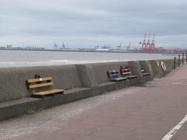
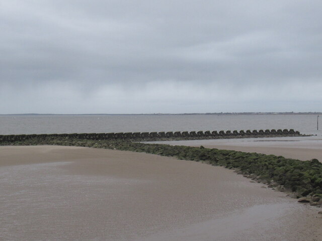
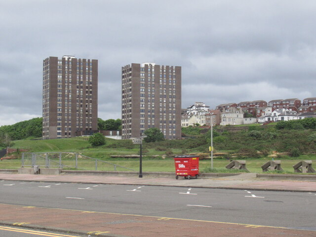
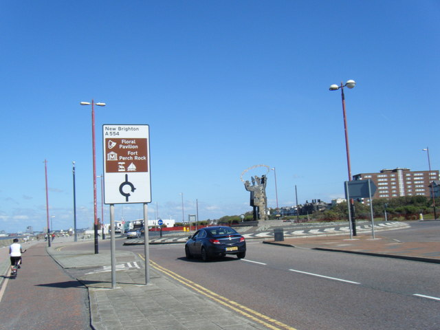
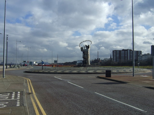
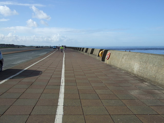
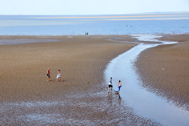
Vale Park Images

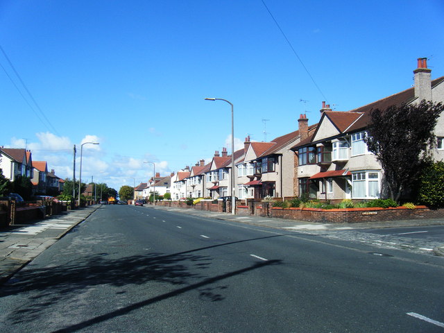
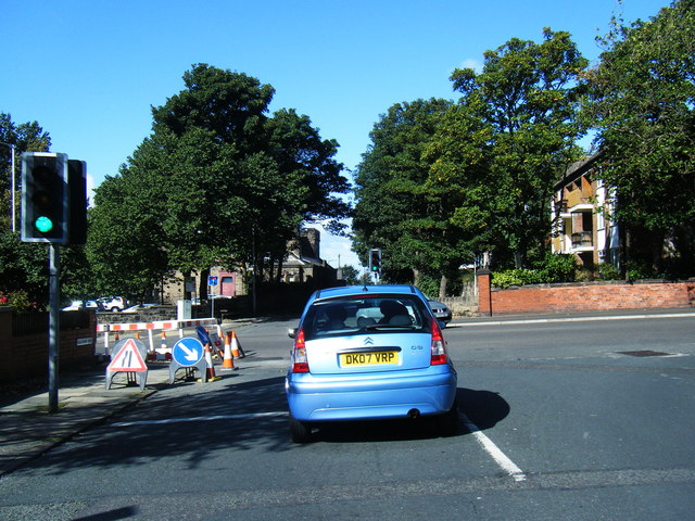
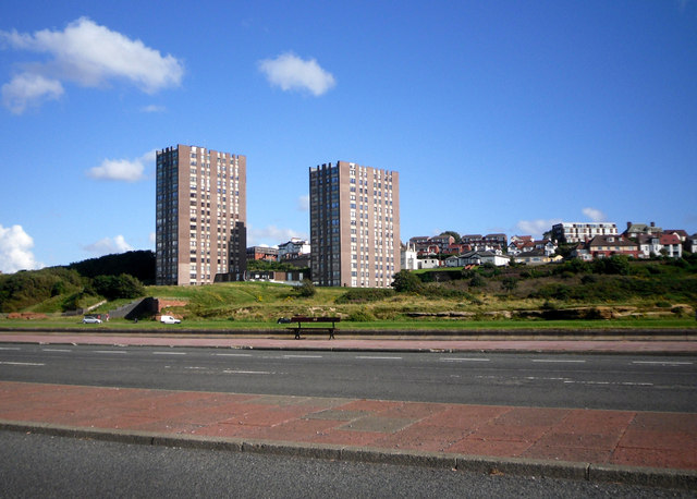
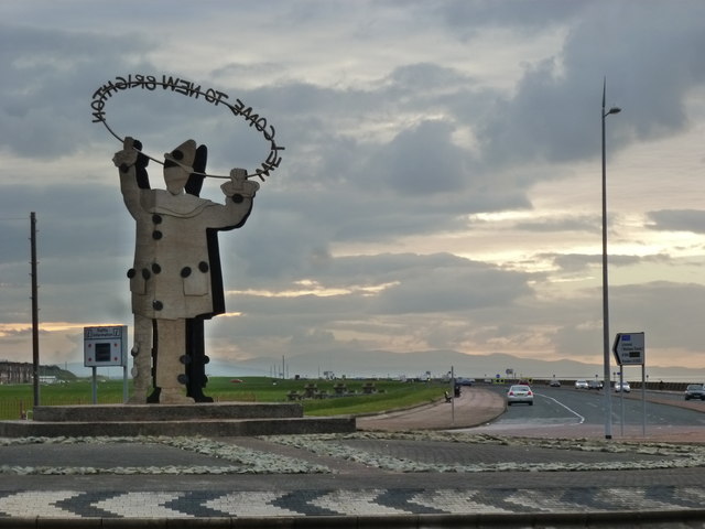
Images are sourced within 2km of 53.433517/-3.03465 or Grid Reference SJ3193. Thanks to Geograph Open Source API. All images are credited.

King's Parade, New Brighton
Breakwater, New Brighton
The Cliff, New Brighton Flats with a view.  Between the towers and sea there is a large area of undeveloped links.
The Cliff, New Brighton
Flats with a view. Between the towers and sea there is a large area of undeveloped links.
Kings Parade roundabout
'Welcome to New Brighton' Clown sign on roundabout
Rolleston Drive at Oldfield Road
Rolleston Drive/Grove Road junction
Eyesore Seashore Two random tower blocks dumped on the sea front, with trad buildings behind peering round them for a glimpse of the beach.
I guess the people in the blocks get a nice view.
Pity about everyone else.
Eyesore Seashore
Two random tower blocks dumped on the sea front, with trad buildings behind peering round them for a glimpse of the beach. I guess the people in the blocks get a nice view. Pity about everyone else.
Welcome to New Brighton - from behind
Roundabout on Kings Parade, New Brighton
Promenade, New Brighton Heading west.
Promenade, New Brighton
Heading west.
West end of New Brighton beach
Breakwater at the west end of New Brighton beach
Breakwater at the west end of New Brighton beach The sandbanks have changed completely since the mapping.
Breakwater at the west end of New Brighton beach
The sandbanks have changed completely since the mapping.
Welcome to New Brighton Three clowns stand in the centre of the roundabout on Kings Parade/Coastal Drive holding the sign "Welcome to New Brighton". Alas New Brighton Baths are no more as nearby stood the outdoor swimming baths opened in 1934, fondly remembered by all as white paint, blue water, beauty contests and freezing water even on the hottest days. The wonderful art deco building was bulldozed in 1990 and all that remains is a weedstrewn eyesore.Interesting website at: <span class="nowrap"><a title="http://www.merseyside.net/newbrighton/Pages/pool.htm" rel="nofollow ugc noopener" href="http://www.merseyside.net/newbrighton/Pages/pool.htm">Link</a><img style="margin-left:2px;" alt="External link" title="External link - shift click to open in new window" src="https://s1.geograph.org.uk/img/external.png" width="10" height="10"/></span>
Welcome to New Brighton
Three clowns stand in the centre of the roundabout on Kings Parade/Coastal Drive holding the sign "Welcome to New Brighton". Alas New Brighton Baths are no more as nearby stood the outdoor swimming baths opened in 1934, fondly remembered by all as white paint, blue water, beauty contests and freezing water even on the hottest days. The wonderful art deco building was bulldozed in 1990 and all that remains is a weedstrewn eyesore.Interesting website at: LinkExternal link
The Red Noses An outcrop of red sandstone known locally as the Red Noses, there are also yellow noses nearby. Here there are wide grassy area for camping and playing games and nearby a miniature golf course and tennis courts and at the other side of the railway Warren Park Golf Course and Harrison Park.
The Red Noses
An outcrop of red sandstone known locally as the Red Noses, there are also yellow noses nearby. Here there are wide grassy area for camping and playing games and nearby a miniature golf course and tennis courts and at the other side of the railway Warren Park Golf Course and Harrison Park.
Grove Road and Rolleston Drive The sun is rising above Wallasey and fittingly, the lights are on red. I love the skyscape in this photo with the houses silhouetted in the sunrise.
Grove Road and Rolleston Drive
The sun is rising above Wallasey and fittingly, the lights are on red. I love the skyscape in this photo with the houses silhouetted in the sunrise.
Taunton Road Wallasey Sandhills are seen in the background. The skyscape is absolutely amazing here with the pinks, the reds and the blues all merging into one.
Taunton Road
Wallasey Sandhills are seen in the background. The skyscape is absolutely amazing here with the pinks, the reds and the blues all merging into one.
Show me another place!

Vale Park is located at Grid Ref: SJ3193 (Lat: 53.433517, Lng: -3.03465)

Unitary Authority: Wirral

Police Authority: Merseyside

What 3 Words

///tasty.pints.bucket. Near Wallasey, Merseyside

Related Wikis

Vale Park, New Brighton

Vale Park is a historic Victorian park in New Brighton, Merseyside, England. It features formal gardens, a rose garden, and a bandstand. The park opened...

Tower Athletic Ground

The Tower Athletic Ground was a sports ground in New Brighton, Merseyside, England. It was the home ground of both New Brighton Tower and New Brighton...

New Brighton Tower

New Brighton Tower was a steel lattice observation tower at New Brighton in the town of Wallasey, Cheshire (now in the Borough of Wirral, in Merseyside...

Sandheys Park

Sandheys Park was a football ground in New Brighton, England. It was the home ground of New Brighton A.F.C. from 1921 until World War II. == History... ==

Nearby Amenities

Located within 500m of 53.433517,-3.03465
Source: PGS
Lat/Long: 53.4293796/-3.0317743
Source: PGS
Lat/Long: 53.4304489/-3.0324494
Source: PGS
Lat/Long: 53.4307757/-3.0325538
Source: PGS
Lat/Long: 53.4320705/-3.0331208
Source: PGS
Lat/Long: 53.43341/-3.0335022
Source: PGS
Lat/Long: 53.434472/-3.0338938
Source: PGS
Lat/Long: 53.4358899/-3.0344451
Source: PGS
Lat/Long: 53.4367995/-3.0347341
Source: PGS
Lat/Long: 53.4375302/-3.0351466
Dr Dominic Joseph Poggi
Colour: blue
Fixme: Inscription surpasses character limit
Historic: memorial
Inscription: Dr Dominic Joseph Poggi 29th August 1811 to 15th October 1880 This Shelter marks the position of Dr Poggi's New Brighton College which was burnt down on or about 27th October 1862. The family were given shelter by Mr Holland a magistrate who owned Vale Ho
Inscription 2: fixme
Material: metal
Memorial: plaque
Openplaques Id: 39891
Lat/Long: 53.4326526/-3.0335745
Bus Stop
MAGAZINE LANE/SEABANK ROAD
Bus: yes
Naptan AtcoCode: 2800S23005A
Naptan Bearing: W
Naptan CommonName: MAGAZINE LANE/SEABANK ROAD
Naptan Indicator: MAGAZINE LANE/SEABANK ROAD
Naptan Landmark: OPP GORDON ROAD
Naptan NaptanCode: mergmadp
Naptan Notes: No Notes
Naptan ShortCommonName: Magazine Ln
Naptan Street: MAGAZINE LANE
Naptan Verified: no
Public Transport: platform
Source: naptan_import
Lat/Long: 53.4325301/-3.0398754
Bus Stop
SEABANK ROAD/MAGAZINE LANE
Bus: yes
Naptan AtcoCode: 2800S23005B
Naptan Bearing: S
Naptan CommonName: SEABANK ROAD/MAGAZINE LANE
Naptan Indicator: SEABANK ROAD/MAGAZINE LANE
Naptan Landmark: O/S 182
Naptan NaptanCode: meramwtd
Naptan Notes: No Notes
Naptan ShortCommonName: Magazine Ln
Naptan Street: SEABANK ROAD
Naptan Verified: no
Public Transport: platform
Source: naptan_import
Lat/Long: 53.4328843/-3.0404862
Bus Stop
MAGAZINE LANE/SEABANK ROAD
Bus: yes
Naptan AtcoCode: 2800S23005D
Naptan Bearing: E
Naptan CommonName: MAGAZINE LANE/SEABANK ROAD
Naptan Indicator: MAGAZINE LANE/SEABANK ROAD
Naptan Landmark: OPP 30 NR CORNER STANFORD AVENUE
Naptan NaptanCode: meramwtg
Naptan Notes: No Notes
Naptan ShortCommonName: Magazine Ln
Naptan Street: MAGAZINE LANE
Naptan Verified: no
Public Transport: platform
Source: naptan_import
Lat/Long: 53.4323869/-3.0408353
Bus Stop
SEABANK ROAD/ASH GROVE
Bus: yes
Naptan AtcoCode: 2800S23006A
Naptan Bearing: NW
Naptan CommonName: SEABANK ROAD/ASH GROVE
Naptan Indicator: SEABANK ROAD/SANDFIELD ROAD
Naptan Landmark: O/S 221 ADJ NEW BRIGHTON BAPTIST CHURCH
Naptan NaptanCode: meramwtj
Naptan Notes: No Notes
Naptan ShortCommonName: Seabank Rd/Ash Gr
Naptan Street: SEABANK ROAD
Naptan Verified: no
Public Transport: platform
Source: naptan_import
Lat/Long: 53.4313276/-3.0396354
Bus Stop
SEABANK ROAD/ASH GROVE
Bus: yes
Naptan AtcoCode: 2800S23006B
Naptan Bearing: S
Naptan CommonName: SEABANK ROAD/ASH GROVE
Naptan Indicator: SEABANK ROAD
Naptan Landmark: BETWEEN ASH GROVE AND BIRCH GROVE O/S SHOP 126
Naptan NaptanCode: meramwtm
Naptan Notes: No Notes
Naptan ShortCommonName: Seabank Rd/Ash Gr
Naptan Street: SEABANK ROAD
Naptan Verified: no
Public Transport: platform
Source: naptan_import
Lat/Long: 53.4309812/-3.0391603
Bus Stop
DALMORTON ROAD/WALLASEY PRIMARY SCHOOL
Bus: yes
Naptan AtcoCode: 2800S23059E
Naptan Bearing: W
Naptan CommonName: DALMORTON ROAD/WALLASEY PRIMARY SCHOOL
Naptan Indicator: DALMORTON ROAD
Naptan Landmark: O/S WALLASEY PRIMARY SCHOOL
Naptan NaptanCode: mergmagw
Naptan Notes: No Notes
Naptan ShortCommonName: Wallasey Prim Sch
Naptan Street: DALMORTON ROAD
Naptan Verified: no
Public Transport: platform
Source: naptan_import
Lat/Long: 53.4346282/-3.0384214
Bus Stop
DALMORTON ROAD/WALLASEY PRIMARY SCHOOL
Bus: yes
Naptan AtcoCode: 2800S23059F
Naptan Bearing: E
Naptan CommonName: DALMORTON ROAD/WALLASEY PRIMARY SCHOOL
Naptan Indicator: DALMORTON ROAD
Naptan Landmark: OPP WALLASEY PRIMARY SCHOOL O/S 43
Naptan NaptanCode: mergmaja
Naptan Notes: No Notes
Naptan ShortCommonName: Wallasey Prim Sch
Naptan Street: DALMORTON ROAD
Naptan Verified: no
Public Transport: platform
Source: naptan_import
Lat/Long: 53.4347266/-3.038484
Bus Stop
MAGAZINE LANE/VALE PARK
Bus: yes
Naptan AtcoCode: 2800S23061A
Naptan Bearing: NW
Naptan CommonName: MAGAZINE LANE/VALE PARK
Naptan Indicator: MAGAZINE LANE
Naptan Landmark: OPP VALE PARK O/S 100
Naptan NaptanCode: mergmajd
Naptan Notes: No Notes
Naptan ShortCommonName: Magazine Lane
Naptan Street: MAGAZINE LANE
Naptan Verified: no
Public Transport: platform
Source: naptan_import
Lat/Long: 53.4326666/-3.0355437
Bus Stop
MAGAZINE LANE/VALE PARK
Bus: yes
Naptan AtcoCode: 2800S23061B
Naptan Bearing: SE
Naptan CommonName: MAGAZINE LANE/VALE PARK
Naptan Indicator: MAGAZINE LANE
Naptan Landmark: O/S VALE PARK OPP 106
Naptan NaptanCode: merapdwp
Naptan Notes: No Notes
Naptan ShortCommonName: Magazine Ln/Vale Pk
Naptan Street: MAGAZINE LANE
Naptan Verified: no
Public Transport: platform
Source: naptan_import
Lat/Long: 53.4326429/-3.0351668
Bus Stop
MAGAZINE BROW/THE PILOT BOAT
Bus: yes
Naptan AtcoCode: 2800S23062A
Naptan Bearing: N
Naptan CommonName: MAGAZINE BROW/THE PILOT BOAT
Naptan Indicator: MAGAZINE BROW/MARINERS ROAD
Naptan Landmark: O/S THE MAGAZINE PH
Naptan NaptanCode: mergmajg
Naptan Notes: No Notes
Naptan ShortCommonName: Magazine Brow
Naptan Street: MAGAZINE BROW
Naptan Verified: no
Public Transport: platform
Source: naptan_import
Lat/Long: 53.4311529/-3.0338813
Bus Stop
MAGAZINE BROW/THE PILOT BOAT
Bus: yes
Naptan AtcoCode: 2800S23062B
Naptan Bearing: S
Naptan CommonName: MAGAZINE BROW/THE PILOT BOAT
Naptan Indicator: MAGAZINE BROW
Naptan Landmark: OPP PILOT BOAT PH O/S 20
Naptan NaptanCode: merapdwt
Naptan Notes: No Notes
Naptan ShortCommonName: Pilot Boat
Naptan Street: MAGAZINE BROW
Naptan Verified: no
Public Transport: platform
Source: naptan_import
Lat/Long: 53.4314584/-3.0338887
Bus Stop
HAYDOCK ROAD/DENTON DRIVE
Bus: yes
Naptan AtcoCode: 2800S23063A
Naptan Bearing: SE
Naptan CommonName: HAYDOCK ROAD/DENTON DRIVE
Naptan Indicator: HAYDOCK ROAD
Naptan Landmark: O/S 15 BETWEEN DENTON DRIVE AND HALE ROAD
Naptan NaptanCode: merapgad
Naptan Notes: No Notes
Naptan ShortCommonName: Haydock Rd
Naptan Street: HAYDOCK ROAD
Naptan Verified: no
Public Transport: platform
Source: naptan_import
Lat/Long: 53.4295284/-3.033586
Bus Stop
HAYDOCK ROAD/DENTON DRIVE
Bus: yes
Naptan AtcoCode: 2800S23063B
Naptan Bearing: NW
Naptan CommonName: HAYDOCK ROAD/DENTON DRIVE
Naptan Indicator: HAYDOCK ROAD
Naptan Landmark: O/S 10 BETWEEN DENTON DRIVE AND HALE ROAD
Naptan NaptanCode: mergmajm
Naptan Notes: No Notes
Naptan ShortCommonName: Haydock Rd
Naptan Street: HAYDOCK ROAD
Naptan Verified: no
Public Transport: platform
Source: naptan_import
Lat/Long: 53.4295449/-3.0337519
Bus Stop
VAUGHAN ROAD/GORDON ROAD
Bus: yes
Naptan AtcoCode: 2800S23078A
Naptan Bearing: E
Naptan CommonName: VAUGHAN ROAD/GORDON ROAD
Naptan Indicator: VAUGHAN ROAD/SEABANK ROAD
Naptan Landmark: O/S 7 OPP GORDON ROAD
Naptan NaptanCode: mergmapa
Naptan Notes: No Notes
Naptan ShortCommonName: Vaughan Rd
Naptan Street: VAUGHAN ROAD
Naptan Verified: no
Public Transport: platform
Source: naptan_import
Lat/Long: 53.4337315/-3.0402359
Bus Stop
VAUGHAN ROAD/WALLASEY PRIMARY SCHOOL
Bus: yes
Naptan AtcoCode: 2800S23078B
Naptan Bearing: E
Naptan CommonName: VAUGHAN ROAD/WALLASEY PRIMARY SCHOOL
Naptan Indicator: VAUGHAN ROAD
Naptan Landmark: O/S 38 OPPPRIMARY SCHOOL
Naptan NaptanCode: mergmapd
Naptan Notes: No Notes
Naptan ShortCommonName: Wallasey Prim Sch
Naptan Street: VAUGHAN ROAD
Naptan Verified: no
Public Transport: platform
Source: naptan_import
Lat/Long: 53.4340343/-3.0384972
Bus Stop
KIRKLAND ROAD/VAUGHAN ROAD
Bus: yes
Naptan AtcoCode: 2800S23079A
Naptan Bearing: N
Naptan CommonName: KIRKLAND ROAD/VAUGHAN ROAD
Naptan Indicator: KIRKLAND ROAD/VAUGHAN ROAD
Naptan Landmark: KIRKLAND ROAD/VAUGHAN ROAD
Naptan NaptanCode: mergmapg
Naptan Notes: No Notes
Naptan ShortCommonName: Kirkland Rd
Naptan Street: KIRKLAND ROAD
Naptan Verified: no
Public Transport: platform
Source: naptan_import
Lat/Long: 53.4346639/-3.0353514
Bus Stop
KIRKLAND ROAD
Bus: yes
Naptan AtcoCode: 2800S23079B
Naptan Bearing: N
Naptan CommonName: KIRKLAND ROAD
Naptan Indicator: KIRKLAND ROAD
Naptan Landmark: O/S 6
Naptan NaptanCode: mergmapj
Naptan Notes: No Notes
Naptan ShortCommonName: Kirkland Rd
Naptan Street: KIRKLAND ROAD
Naptan Verified: no
Public Transport: platform
Source: naptan_import
Lat/Long: 53.4348621/-3.035296
Pub
The Magazines
Lat/Long: 53.4309416/-3.033908
Pub
The Pilot Boat
Addr Housenumber: 15
Addr Postcode: CH45 1HP
Addr Street: Magazine Brow
Fhrs Id: 394380
Source Addr: FHRS Open Data
Lat/Long: 53.4314268/-3.0342678
Noexit: yes
Lat/Long: 53.4373009/-3.0360295
Post Box
Collection Times: Mo-Fr 16:45; Sa 12:00
Description: QE II post box by Carron Company CH45 68 outside Seabank Road post office.
Manufacturer: Carron Company
Operator: Royal Mail
Operator Wikidata: Q638098
Post Box Type: pillar
Ref: CH45 68
Royal Cypher: EIIR
Royal Cypher Wikidata: Q33102113
Source: survey
Wikimedia Commons: File:Post box at Seabank Road post office.jpg
Lat/Long: 53.4307994/-3.0393102
Cafe
Vale House Cafe & Tea Rooms
Opening Hours: Mo-Sa 09:00-17:00; Su 10:00-17:00d
Source: survey
Lat/Long: 53.4334253/-3.0360295
Black Pearl Pirate Ship
Artwork Type: sculpture
Tourism: attraction
Lat/Long: 53.436602/-3.0345361
Crossing
Crossing: traffic_signals
Crossing Ref: puffin
Kerb: lowered
Tactile Paving: yes
Lat/Long: 53.4322552/-3.0401337
Toilets
Fee: no
Wheelchair: no
Lat/Long: 53.4336416/-3.0369042
Addr Housenumber: 205
Addr Postcode: CH45 1HD
Addr Street: Seabank Road
Lat/Long: 53.4306812/-3.0393509
Addr Housenumber: 207
Addr Postcode: CH45 1HD
Addr Street: Seabank Road
Lat/Long: 53.4307291/-3.0393857
Addr Housenumber: 1
Addr Postcode: CH45 1JG
Addr Street: Birch Grove
Lat/Long: 53.4313332/-3.0391229
Addr Housenumber: 21
Addr Postcode: CH45 1LT
Addr Street: Magazine Lane
Lat/Long: 53.4326745/-3.0376357
Addr Housenumber: 23
Addr Postcode: CH45 1LT
Addr Street: Magazine Lane
Lat/Long: 53.4326968/-3.0375659
Addr Housenumber: 19
Addr Postcode: CH45 1LT
Addr Street: Magazine Lane
Lat/Long: 53.4326441/-3.037751
Addr Housenumber: 17
Addr Postcode: CH45 1LT
Addr Street: Magazine Lane
Lat/Long: 53.4326217/-3.0378127
Addr Housenumber: 15
Addr Postcode: CH45 1LT
Addr Street: Magazine Lane
Lat/Long: 53.4325882/-3.037912
Addr Housenumber: 11
Addr Postcode: CH45 1LT
Addr Street: Magazine Lane
Lat/Long: 53.4325322/-3.0380648
Waste Basket
Lat/Long: 53.4327878/-3.0369586
Post Box
Collection Times: Mo-Fr 09:00; Sa 07:00
Description: QE II pole mounted post box CH45 155 on Magazine Brow opposite Mariner's Road.
Operator: Royal Mail
Operator Wikidata: Q638098
Post Box Type: lamp
Ref: CH45 155
Royal Cypher: EIIR
Royal Cypher Wikidata: Q33102113
Wikimedia Commons: File:Post box on Magazine Brow.jpg
Lat/Long: 53.4313922/-3.033839
Barrier: swing_gate
Lat/Long: 53.4306889/-3.0325499
Direction: WSW
Generator Method: photovoltaic
Generator Output Electricity: yes
Generator Solar Modules: 6
Generator Source: solar
Generator Type: solar_photovoltaic_panel
Location: roof
Power: generator
Source: survey
Lat/Long: 53.4351185/-3.0381822
Direction: ENE
Generator Method: photovoltaic
Generator Output Electricity: yes
Generator Solar Modules: 6
Generator Source: solar
Generator Type: solar_photovoltaic_panel
Location: roof
Power: generator
Source: survey
Lat/Long: 53.4351353/-3.0381031
Direction: 165
Generator Method: photovoltaic
Generator Output Electricity: yes
Generator Solar Modules: 9
Generator Source: solar
Generator Type: solar_photovoltaic_panel
Location: roof
Power: generator
Source: survey
Lat/Long: 53.435649/-3.0379013
Direction: SW
Generator Method: photovoltaic
Generator Output Electricity: yes
Generator Solar Modules: 10
Generator Source: solar
Generator Type: solar_photovoltaic_panel
Location: roof
Power: generator
Source: survey
Lat/Long: 53.4320558/-3.0381713
Historic: memorial
Memorial: war_memorial
Lat/Long: 53.4322405/-3.033465
Post Box
Description: Edward VII post box CH45 100 on Kirkland Road, New Brighton at its junction with Dalmorton Road.
Operator: Royal Mail
Operator Wikidata: Q638098
Post Box Design: type_b
Post Box Type: pillar
Ref: CH45 100
Royal Cypher: EVIIR
Royal Cypher Wikidata: Q33102324
Wikimedia Commons: File:Post box on Kirkland Road, New Brighton.jpg
Lat/Long: 53.4352966/-3.0356013
Post Box
Description: Victorian post box CH45 217 on the corner of Magazine Lane/Seabank Road.
Operator: Royal Mail
Operator Wikidata: Q638098
Post Box Type: pillar
Ref: CH45 217
Royal Cypher: VR
Royal Cypher Wikidata: Q33102356
Wikimedia Commons: File:Post box on Magazine Lane.jpg
Lat/Long: 53.4324487/-3.0401487
Direction: WSW
Generator Method: photovoltaic
Generator Output Electricity: yes
Generator Solar Modules: 16
Generator Source: solar
Generator Type: solar_photovoltaic_panel
Location: roof
Power: generator
Lat/Long: 53.4303165/-3.0331851
Direction: 145
Generator Method: photovoltaic
Generator Output Electricity: yes
Generator Solar Modules: 12
Generator Source: solar
Generator Type: solar_photovoltaic_panel
Location: roof
Power: generator
Lat/Long: 53.4325361/-3.0371835
Direction: ENE
Generator Method: photovoltaic
Generator Output Electricity: yes
Generator Solar Modules: 6
Generator Source: solar
Generator Type: solar_photovoltaic_panel
Location: roof
Power: generator
Lat/Long: 53.4327569/-3.0382425
Direction: 170
Generator Method: photovoltaic
Generator Output Electricity: yes
Generator Solar Modules: 12
Generator Source: solar
Generator Type: solar_photovoltaic_panel
Location: roof
Power: generator
Lat/Long: 53.4323135/-3.0348624
Direction: SSE
Generator Method: photovoltaic
Generator Output Electricity: yes
Generator Solar Modules: 8
Generator Source: solar
Generator Type: solar_photovoltaic_panel
Location: roof
Power: generator
Lat/Long: 53.4327988/-3.0382465
Direction: 170
Generator Method: photovoltaic
Generator Output Electricity: yes
Generator Solar Modules: 7
Generator Source: solar
Generator Type: solar_photovoltaic_panel
Location: roof
Power: generator
Lat/Long: 53.4319093/-3.0396584
Direction: 145
Generator Method: photovoltaic
Generator Output Electricity: yes
Generator Solar Modules: 10
Generator Source: solar
Generator Type: solar_photovoltaic_panel
Location: roof
Power: generator
Lat/Long: 53.4319268/-3.0356934
Four Seasons
Shop: convenience
Lat/Long: 53.4323261/-3.0404869
Fast Food
Ocean Wave
Cuisine: fish_and_chips
Drive Through: no
Phone: +44 151 638 1385
Lat/Long: 53.4319065/-3.0401707
Flying Dutchman
Shop: hardware
Lat/Long: 53.4318425/-3.0401023
Restaurant
Magic Spices
Cuisine: indian
Phone: +44 151 691 1919
Website: http://www.magicspices.co.uk/
Lat/Long: 53.4313238/-3.0397613
Fast Food
New World Takeaway
Cuisine: fish_and_chips
Phone: +44 151 639 4298
Lat/Long: 53.4321204/-3.0397738
Direction: 165
Generator Method: photovoltaic
Generator Output Electricity: yes
Generator Solar Modules: 14
Generator Source: solar
Generator Type: solar_photovoltaic_panel
Location: roof
Power: generator
Lat/Long: 53.432028/-3.0414098
Direction: 255
Generator Method: photovoltaic
Generator Output Electricity: yes
Generator Solar Modules: 7
Generator Source: solar
Generator Type: solar_photovoltaic_panel
Location: roof
Power: generator
Lat/Long: 53.4318286/-3.0413696
Bench
Backrest: yes
Lat/Long: 53.4293576/-3.0318291
Waste Basket
Lat/Long: 53.4293815/-3.0318331
Life Ring
Emergency: life_ring
Lat/Long: 53.4321424/-3.0333412
Waste Basket
Lat/Long: 53.4321232/-3.0333378
Rope Ladder
Emergency: rope_ladder
Ref: 48
Lat/Long: 53.4321531/-3.0333438
Traffic Calming: hump
Lat/Long: 53.4341829/-3.0381236
Noexit: yes
Lat/Long: 53.4374473/-3.0380295
The data included in this document is from www.openstreetmap.org. The data is made available under ODbL.

Have you been to Vale Park?

Leave your review of Vale Park below (or comments, questions and feedback).