Vale of Health
Settlement in Middlesex
England
Vale of Health

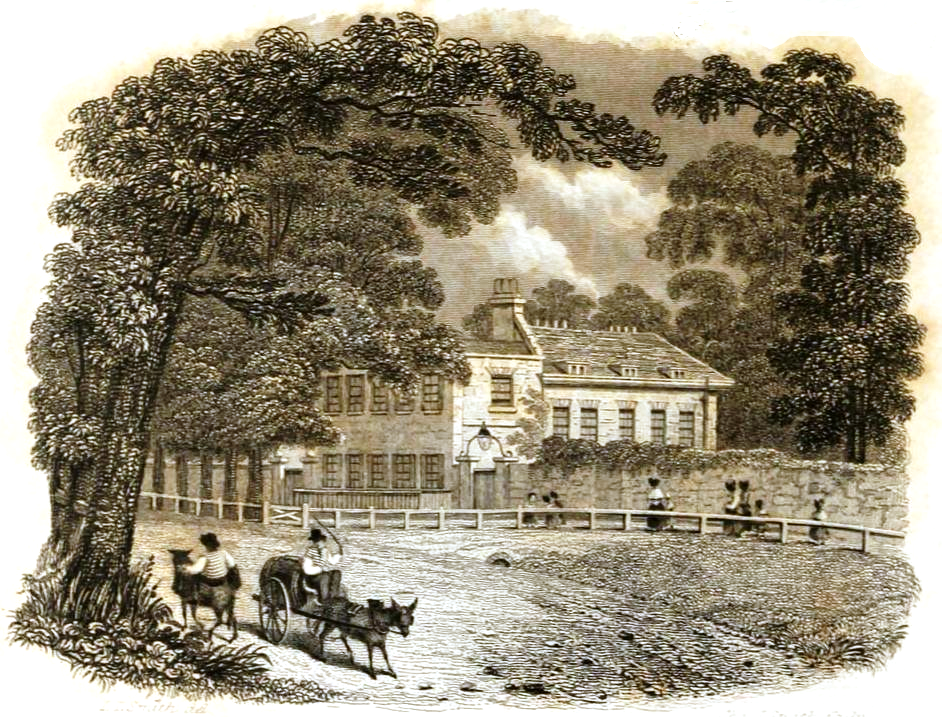
Vale of Health is a small and picturesque village located in Middlesex, England. Situated on the edge of Hampstead Heath, it is nestled between the bustling neighborhoods of Hampstead and Highgate. Despite its close proximity to these urban areas, the Vale of Health has managed to maintain its quaint and rural charm.
The village takes its name from the natural spring that flows through the area, which was believed to have healing properties. This natural feature has made Vale of Health a popular destination for those seeking a peaceful retreat and a connection with nature.
The village is predominantly residential, with a mix of charming cottages and larger, more modern houses. The architecture reflects the area's rich history, with some buildings dating back to the 18th century. The winding streets and leafy lanes add to the village's idyllic atmosphere.
Vale of Health is also known for its vibrant artistic community. Over the years, many artists, writers, and musicians have been drawn to the village's tranquility and beauty. This creative atmosphere is evident in the numerous art galleries and studios that can be found in the area.
Despite its small size, Vale of Health is well-served by local amenities. There are several shops, cafes, and pubs where residents and visitors can enjoy a range of goods and services. The village also benefits from its close proximity to Hampstead Heath, offering ample opportunities for outdoor activities such as walking, jogging, and picnicking.
Overall, Vale of Health is a charming and peaceful village that offers a welcome respite from the hustle and bustle of city life. Its natural beauty, rich history, and artistic community make it a truly unique place to live or visit.
If you have any feedback on the listing, please let us know in the comments section below.
Vale of Health Images
Images are sourced within 2km of 51.560863/-0.17771203 or Grid Reference TQ2686. Thanks to Geograph Open Source API. All images are credited.


Vale of Health is located at Grid Ref: TQ2686 (Lat: 51.560863, Lng: -0.17771203)
Unitary Authority: Camden
Police Authority: Metropolitan
What 3 Words
///either.shaped.cook. Near Belsize Park, London
Nearby Locations
Related Wikis
Upper Flask
The Upper Flask was a tavern near the top of Hampstead hill in the 18th century which sold flasks of water from the spa at Hampstead Wells. It was located...

Gang Moor
Gang Moor is a house on Whitestone Lane in Hampstead in the London Borough of Camden. It is listed Grade II on the National Heritage List for England.The...

Hampstead Meeting House
The Hampstead Meeting House is a Friends meeting house (a Quaker place of worship) at 120 Heath Street in Hampstead, London N3. It was designed by Fred...

Cannon Hall, Hampstead
Cannon Hall at 14 Cannon Place, Hampstead, London is a grade II* listed building that dates from around 1720. The house is the former home of the actor...

Netley Cottage
Netley Cottage at 10 Lower Terrace is a house in Hampstead in the London Borough of Camden. It is listed Grade II on the National Heritage List for England...
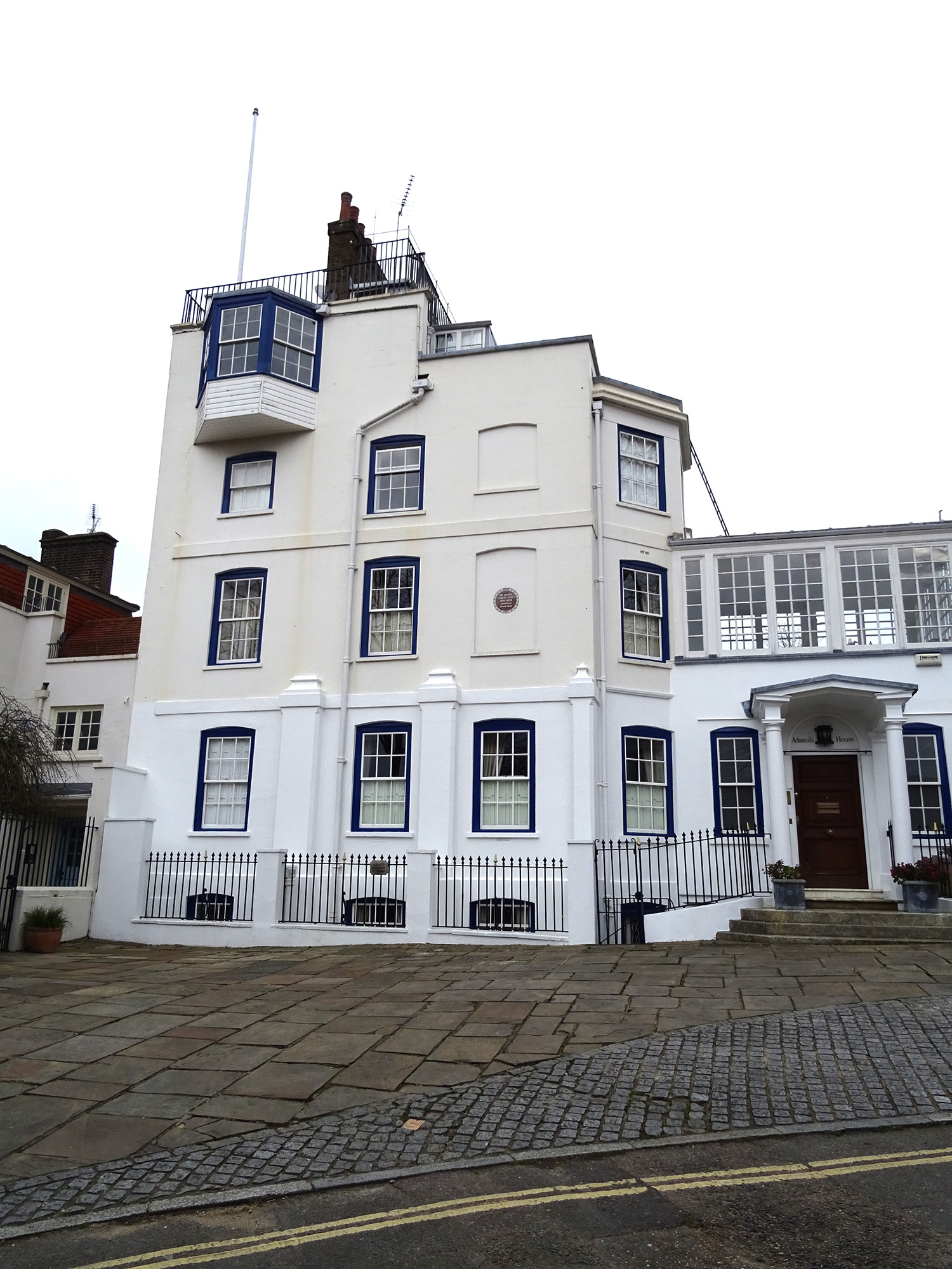
Admiral's House, Hampstead
Admiral's House (originally known as Golden Spikes and later as The Grove) is a Grade II listed house in Hampstead in the London Borough of Camden. The...
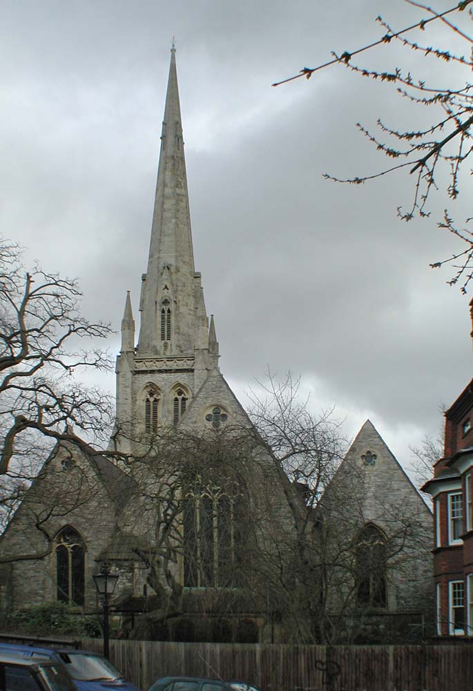
Christ Church, Hampstead
Christ Church, Hampstead, is a Church of England church in Hampstead, London. It is a church with particular connections to the old village of Hampstead...

New End Theatre
The New End Theatre, Hampstead, was an 80-seat fringe theatre venue in London, at 27 New End in the London Borough of Camden which operated from 1974 until...
Nearby Amenities
Located within 500m of 51.560863,-0.17771203Have you been to Vale of Health?
Leave your review of Vale of Health below (or comments, questions and feedback).