Bowling Green

Settlement in Gloucestershire Cotswold

England

Bowling Green

Cirencester marketplace looking ESE
Cirencester marketplace Credit: mym

Bowling Green is a charming village located in the picturesque county of Gloucestershire, England. Situated in the Cotswold District, it is nestled in the heart of the stunning Cotswold Hills, renowned for their natural beauty and idyllic landscapes. With a population of around 500 residents, Bowling Green exudes a peaceful and close-knit community atmosphere.

The village is characterized by its quintessential English charm, boasting a collection of traditional Cotswold stone houses and thatched cottages. These architectural gems, along with the surrounding rolling hills and lush green meadows, create a postcard-perfect setting that attracts visitors from far and wide.

Despite its small size, Bowling Green is well-equipped with amenities to cater to the needs of its residents and visitors. The village offers a range of essential services, including a local pub, a post office, and a village hall that serves as a hub for community events and gatherings. Its close proximity to larger towns, such as Cheltenham and Gloucester, provides easy access to additional amenities and services.

Nature enthusiasts will find themselves in paradise in Bowling Green, as the village is surrounded by ample opportunities for outdoor activities. The nearby Cotswold Way, a famous long-distance footpath, offers scenic walks and hikes with breathtaking views of the countryside. Additionally, the area is dotted with charming villages and historic landmarks, providing ample opportunities for exploration and discovery.

In summary, Bowling Green in Gloucestershire is a captivating village that offers a peaceful and picturesque escape from the hustle and bustle of modern life. With its stunning natural surroundings, traditional architecture, and strong sense of community, it is a place that truly encapsulates the charm and beauty of the Cotswolds.

If you have any feedback on the listing, please let us know in the comments section below.

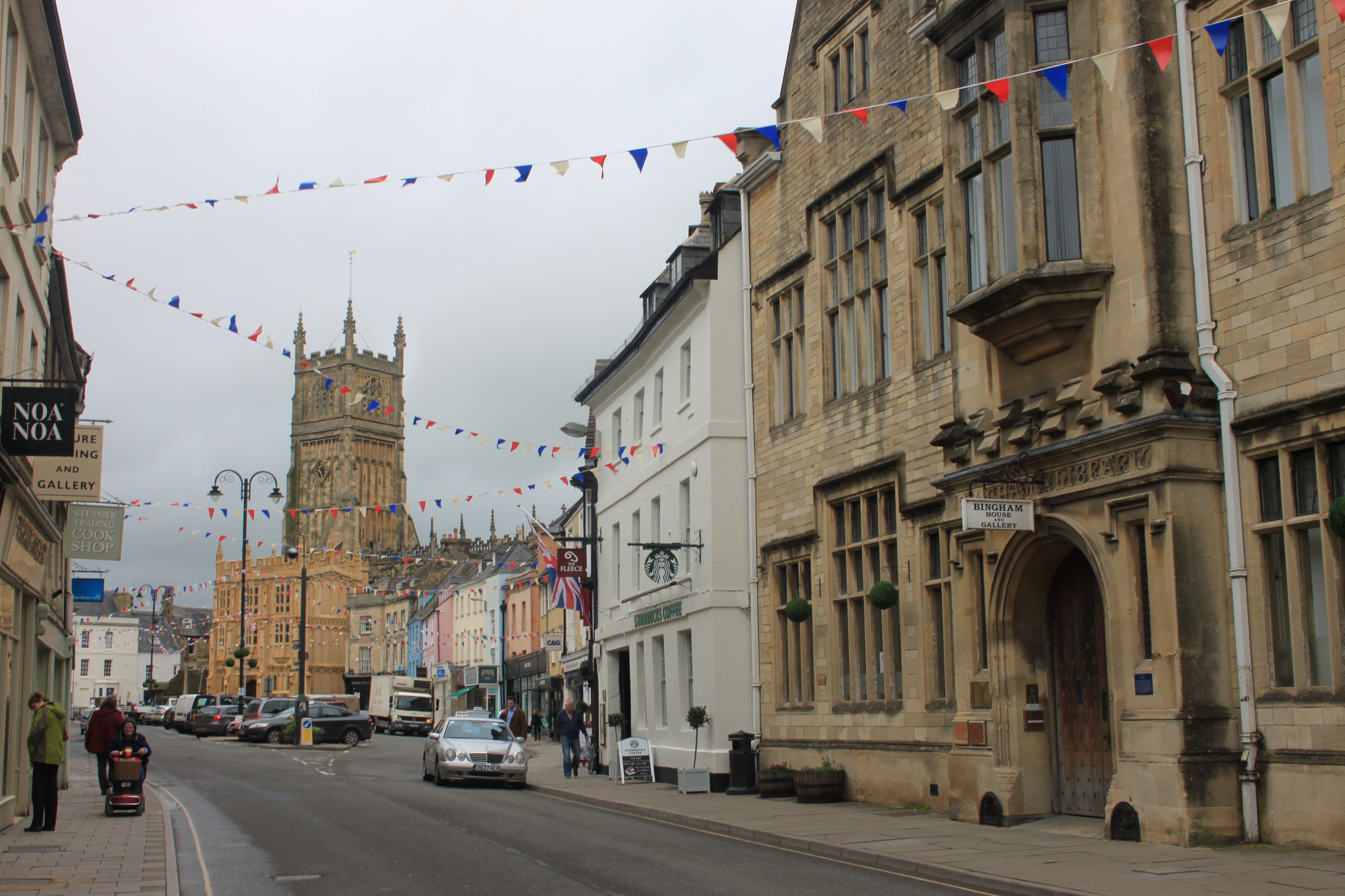
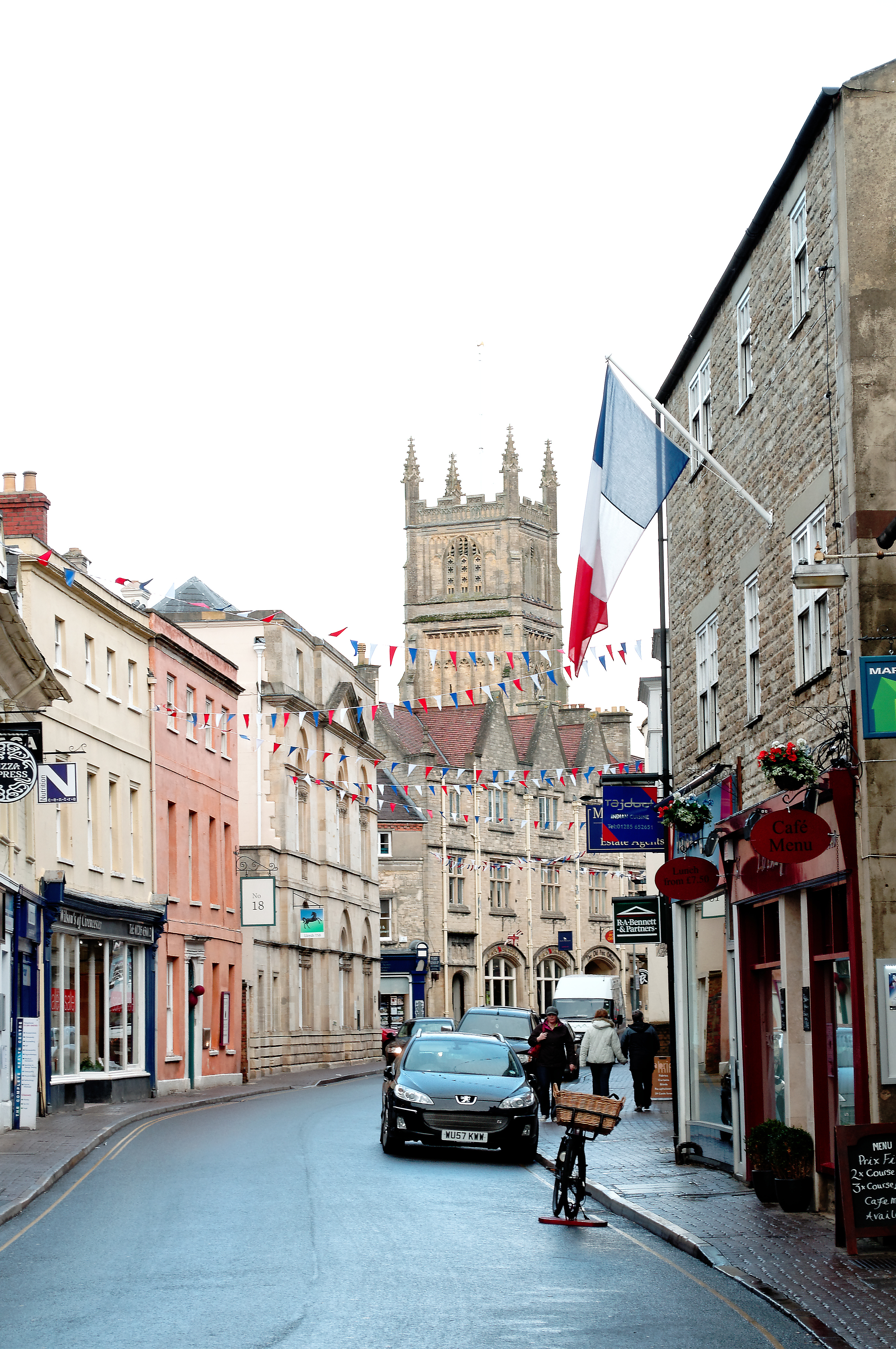
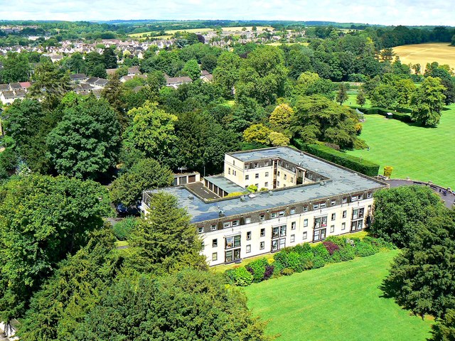
Bowling Green Images

Images are sourced within 2km of 51.72504/-1.9647865 or Grid Reference SP0202. Thanks to Geograph Open Source API. All images are credited.

Cirencester marketplace looking ESE
Cirencester marketplace
looking ESE
Cirencester Parish Church View from south. Dedicated to St John the Baptist
Cirencester Parish Church
View from south. Dedicated to St John the Baptist
Ermin Street, Stratton Ermin Street running south-east through the village of Stratton, a community separated from Cirencester by former water meadows and mainly composed of a large housing estate
Ermin Street, Stratton
Ermin Street running south-east through the village of Stratton, a community separated from Cirencester by former water meadows and mainly composed of a large housing estate
Watermoor Church Watermoor Church, designed by George Gilbert Scott and completed in 1851/2. This area formerly contained both of Cirencester's railway stations as well as most of its commercial activity
Watermoor Church
Watermoor Church, designed by George Gilbert Scott and completed in 1851/2. This area formerly contained both of Cirencester's railway stations as well as most of its commercial activity
Golden Farm Road Golden Farm Road on the Beeches Estate. The main features of this square are a number of 1950's housing estates, a bypass and a section of old Roman city wall
Golden Farm Road
Golden Farm Road on the Beeches Estate. The main features of this square are a number of 1950's housing estates, a bypass and a section of old Roman city wall
Cirencester Park and Cecily Hill Barracks Looking east towards Cirencester Parish Church down the main ride of the park, home of Earl Bathurst. On the left are the former barracks, built in 1857 to house the local militia.
Cirencester Park and Cecily Hill Barracks
Looking east towards Cirencester Parish Church down the main ride of the park, home of Earl Bathurst. On the left are the former barracks, built in 1857 to house the local militia.
Cirencester House and Church Looking east across parkland towards Cirencester House and the parish church. In addition to the park, this square also contains the hospital and the cemetery.
Cirencester House and Church
Looking east across parkland towards Cirencester House and the parish church. In addition to the park, this square also contains the hospital and the cemetery.
Cirencester Golf Course Looking west from the Cheltenham Road across Cirencester Golf Course, designed in 1910
Cirencester Golf Course
Looking west from the Cheltenham Road across Cirencester Golf Course, designed in 1910
A417 near Cirencester Looking north-west from the White Way along the A417, Swindon to Gloucester road, near Baunton
A417 near Cirencester
Looking north-west from the White Way along the A417, Swindon to Gloucester road, near Baunton
Ashcroft Methodist Church Cirencester In Ashcroft Road Cirencester
Ashcroft Methodist Church Cirencester
In Ashcroft Road Cirencester
Salvation Army Thomas Street Cirencester Opposite to the Friends Meeting House
Salvation Army Thomas Street Cirencester
Opposite to the Friends Meeting House
Stratton Church Possibly on the line between squares! This is looking into the square. The church like many locally is some way from the modern suburb, separated by a main road, the old road to Gloucester.
Stratton Church
Possibly on the line between squares! This is looking into the square. The church like many locally is some way from the modern suburb, separated by a main road, the old road to Gloucester.
London Road Cirencester The edge of town as at early 2006. London Road is the A417 which meanders off towards Reading
London Road Cirencester
The edge of town as at early 2006. London Road is the A417 which meanders off towards Reading
Roman Amphitheatre The scale of this is enormous .. people look very small from the top.
Roman Amphitheatre
The scale of this is enormous .. people look very small from the top.
Cirencester Fire Station Cirencester Fire Station, Chesterton Lane, Cirencester is station W21 of the Gloucestershire Fire & Rescue Service.
Cirencester Fire Station
Cirencester Fire Station, Chesterton Lane, Cirencester is station W21 of the Gloucestershire Fire & Rescue Service.
Baunton Church (winter!) View of the south side of the church
Baunton Church (winter!)
View of the south side of the church
Cirencester, The Fleece Hotel Another of our fine old buildings.
Cirencester, The Fleece Hotel
Another of our fine old buildings.
Cirencester, The King's Head Hotel Another of the town's fine old buildings.
Cirencester, The King's Head Hotel
Another of the town's fine old buildings.
Show me another place!

Bowling Green is located at Grid Ref: SP0202 (Lat: 51.72504, Lng: -1.9647865)

Administrative County: Gloucestershire

District: Cotswold

Police Authority: Gloucestershire

What 3 Words

///shuttling.waiters.taped. Near Cirencester, Gloucestershire

Related Wikis

Cirencester Abbey

Cirencester Abbey or St Mary's Abbey, Cirencester in Gloucestershire was founded as an Augustinian monastery in 1117 on the site of an earlier church,...

Cotswold District

Cotswold is a local government district in Gloucestershire, England. It is named after the wider Cotswolds region and range of hills. The council is based...

Cirencester

Cirencester ( , occasionally ; see below for more variations) is a market town in Gloucestershire, England, 80 miles (130 km) west of London. Cirencester...

Battle of Cirencester

The Battle of Cirencester was fought in 628 at Cirencester in modern-day England. The conflict involved the armies of Mercia, under King Penda, and the...

Corinium Dobunnorum

Corinium Dobunnorum was the Romano-British settlement at Cirencester in the present-day English county of Gloucestershire. Its 2nd-century walls enclosed...

Abbey House, Cirencester

Abbey House was a country house in the English county of Gloucestershire that developed on the site of the former Cirencester Abbey following the dissolution...

Church of St. John the Baptist, Cirencester

The Church of St. John Baptist, Cirencester is a parish church in the Church of England in Cirencester, Gloucestershire, England. It is a Grade I listed...

Corinium Radio

Corinium Radio is an online community radio station in Cirencester, Gloucestershire. Launched in 2006, it first broadcast on a two-day Restricted Service...

Nearby Amenities

Located within 500m of 51.72504,-1.9647865
Post Box
Lat/Long: 51.7263261/-1.9630927
Bus Stop
Bowling Green Ave
Bus: yes
Naptan AtcoCode: 1600GL588
Naptan Bearing: E
Naptan CommonName: Bowling Green Ave
Naptan NaptanCode: glogadmp
Naptan Street: Bowling Green Rd
Naptan Verified: no
Public Transport: platform
Source: naptan_import
Lat/Long: 51.7245536/-1.9692057
Bus Stop
Abbey Way
Bus: yes
Naptan AtcoCode: 1600GLC191
Naptan Bearing: SW
Naptan CommonName: Abbey Way
Naptan NaptanCode: glogadtg
Naptan Street: Spitalgate Lane
Naptan Verified: no
Public Transport: platform
Source: naptan_import
Lat/Long: 51.7213255/-1.9684261
Bus Stop
Spitalgate Lane
Bus: yes
Naptan AtcoCode: 1600GLC206
Naptan Bearing: NW
Naptan CommonName: Spitalgate Lane
Naptan NaptanCode: glogadpj
Naptan Street: Abbey Way
Naptan Verified: no
Public Transport: platform
Source: naptan_import
Lat/Long: 51.7219822/-1.9696128
Bus Stop
Shepherds Way
Bus: yes
Naptan AtcoCode: 1600GLC304
Naptan Bearing: E
Naptan CommonName: Shepherds Way
Naptan NaptanCode: glogagdp
Naptan Street: Bowling Green Rd
Naptan Verified: no
Public Transport: platform
Source: naptan_import
Lat/Long: 51.7252182/-1.9666281
Bus Stop
Bowling Green Rd
Bus: yes
Naptan AtcoCode: 1600GLC305
Naptan Bearing: NE
Naptan CommonName: Bowling Green Rd
Naptan NaptanCode: glogagjt
Naptan Street: The Whiteway
Naptan Verified: no
Public Transport: platform
Source: naptan_import
Lat/Long: 51.7246424/-1.9652387
Bus Stop
Bowling Green Rd
Bus: yes
Naptan AtcoCode: 1600GLC306
Naptan Bearing: SW
Naptan CommonName: Bowling Green Rd
Naptan Indicator: Opp
Naptan NaptanCode: glogagmd
Naptan Street: The Whiteway
Naptan Verified: no
Public Transport: platform
Source: naptan_import
Lat/Long: 51.7246064/-1.9651374
Traffic Signals
Lat/Long: 51.7216456/-1.9682038
Holmes Beauty
Shop: beauty
Lat/Long: 51.7256903/-1.9617272
Bus Stop
Shepherds Way
Bus: yes
Naptan AtcoCode: 1600GLC302
Naptan Bearing: N
Naptan CommonName: Shepherds Way
Naptan Indicator: Opp
Naptan NaptanCode: glogadaw
Naptan Street: Bowling Green Ln
Naptan Verified: no
Public Transport: platform
Source: naptan_import
Lat/Long: 51.7235239/-1.9712546
Material: wood
Poles: bipole
Power: pole
Lat/Long: 51.7260729/-1.9713217
Material: wood
Poles: bipole
Power: pole
Lat/Long: 51.727387/-1.9689359
Material: wood
Power: pole
Lat/Long: 51.7280748/-1.9671267
Material: wood
Power: pole
Lat/Long: 51.7281512/-1.9638383
Material: wood
Power: pole
Lat/Long: 51.7281612/-1.9623417
Material: wood
Power: pole
Lat/Long: 51.7281479/-1.960212
Barrier: stile
Lat/Long: 51.728222/-1.9682611
Material: wood
Poles: bipole
Power: pole
Source: bing
Lat/Long: 51.7260247/-1.9711313
Material: wood
Poles: bipole
Power: pole
Source: bing
Lat/Long: 51.7259873/-1.9711822
Material: wood
Power: pole
Source: bing
Lat/Long: 51.7260147/-1.9682077
Material: wood
Power: pole
Source: bing
Lat/Long: 51.7262971/-1.9688246
Material: wood
Power: pole
Source: bing
Lat/Long: 51.7266427/-1.969589
Material: wood
Power: pole
Source: bing
Lat/Long: 51.7269659/-1.9702703
Material: wood
Poles: bipole
Power: pole
Lat/Long: 51.7268545/-1.9703588
Location Transition: yes
Material: wood
Power: pole
Source: bing
Lat/Long: 51.7246216/-1.9714478
Childcare
Mrs Berry's Montessori Nursery
Addr City: Cirencester
Addr Housenumber: 10
Addr Postcode: GL7 2HE
Addr Street: Berry Hill Road
Website: http://www.mrsberrysnursery.co.uk
Lat/Long: 51.7260243/-1.9650273
Camera Direction: 300
Camera Mount: pole
Camera Type: fixed
Man Made: surveillance
Surveillance: traffic
Surveillance Type: camera
Surveillance Zone: traffic
Lat/Long: 51.7214688/-1.9678084
The data included in this document is from www.openstreetmap.org. The data is made available under ODbL.

Have you been to Bowling Green?

Leave your review of Bowling Green below (or comments, questions and feedback).