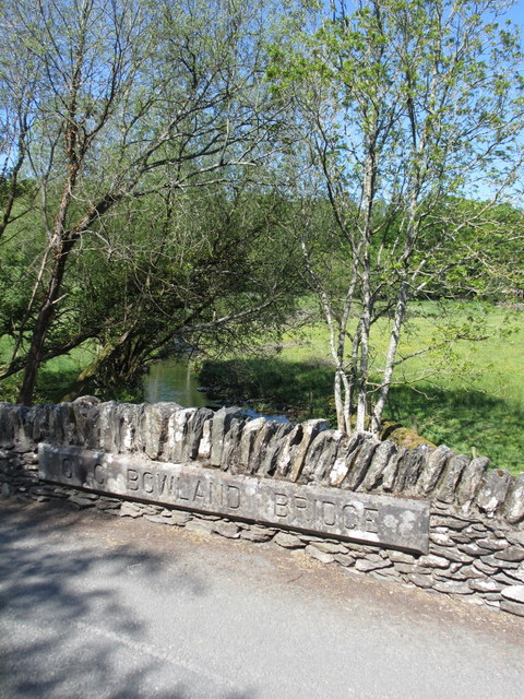
Bowland Bridge

Settlement in Westmorland South Lakeland

England

Bowland Bridge

Head Lane
Head Lane Credit: Anthony Parkes

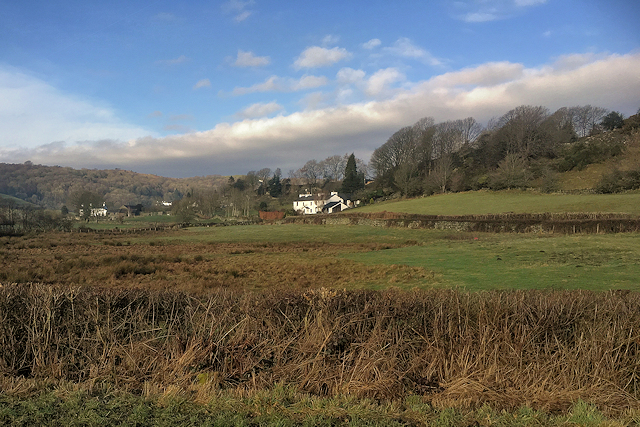
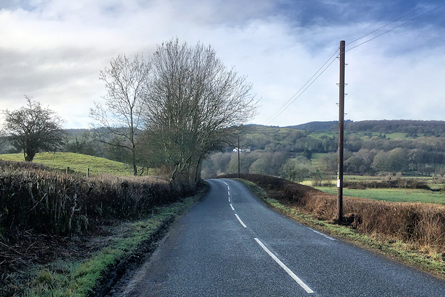
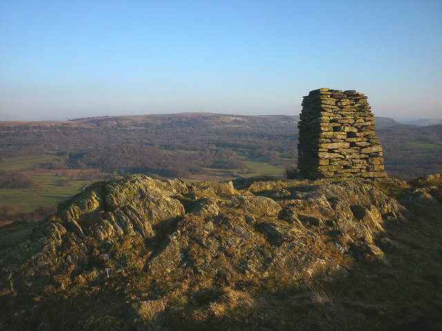
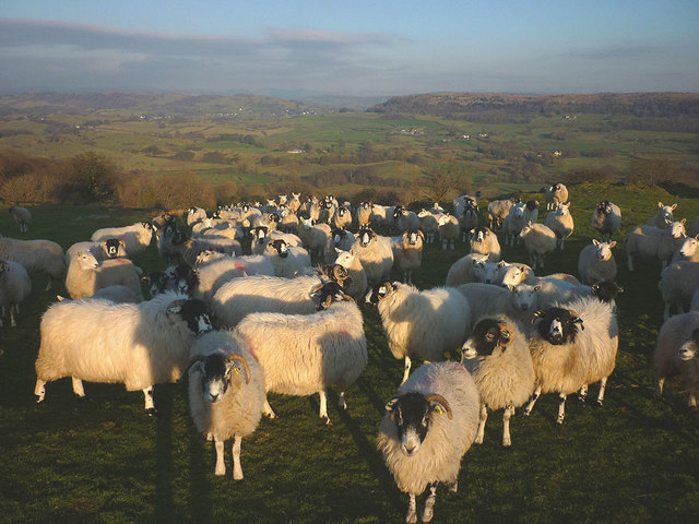
Bowland Bridge is a small village located in the historic county of Westmorland, in the northwestern region of England. Situated within the South Lakeland district of Cumbria, it lies approximately 6 miles to the west of Kendal and 10 miles to the southeast of Windermere. With its picturesque setting in the Lake District National Park, Bowland Bridge offers stunning views of the surrounding landscape.

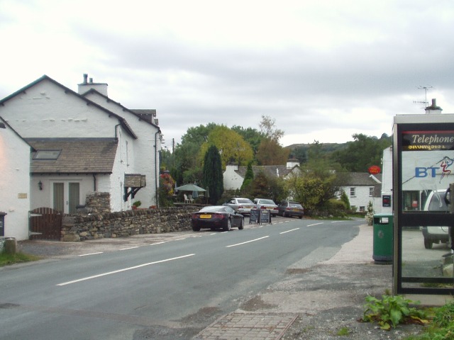
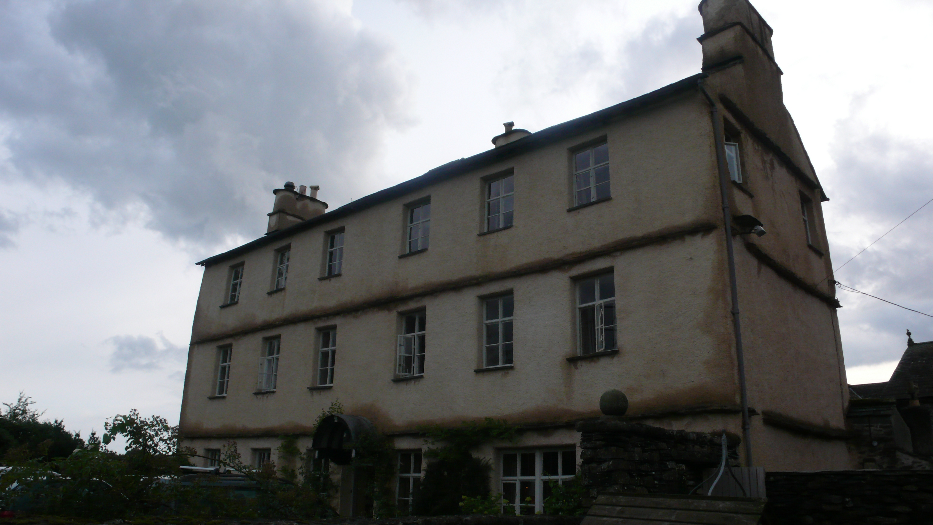
The village itself is characterized by its charming, traditional stone-built houses and cottages, giving it a quintessentially English countryside feel. It is particularly renowned for its local pub, The Hare & Hounds, which has been a focal point of the community for many years and is popular among locals and visitors alike.

Bowland Bridge is ideally located for those looking to explore the natural beauty of the Lake District. The nearby area offers numerous walking and hiking trails, including access to the iconic Lake Windermere. Visitors can also enjoy various water activities, such as boating, fishing, and kayaking.

Although small in size, Bowland Bridge benefits from its proximity to larger towns and villages, providing access to a range of amenities including shops, restaurants, and cultural attractions. The village is well-connected by road, making it easily accessible for tourists and residents alike.

In summary, Bowland Bridge is a tranquil and idyllic village in Westmorland, offering a peaceful retreat within the stunning landscapes of the Lake District National Park.

If you have any feedback on the listing, please let us know in the comments section below.

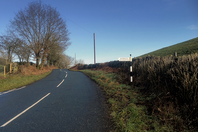
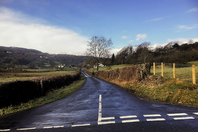
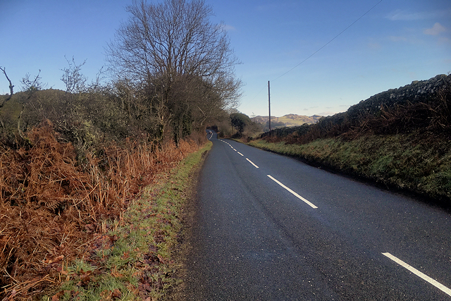
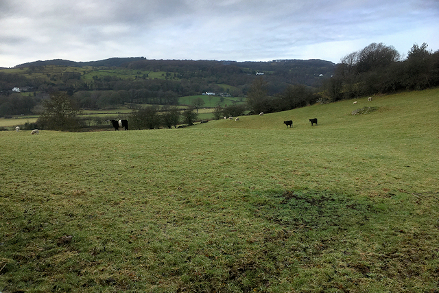
Bowland Bridge Images

Images are sourced within 2km of 54.298792/-2.894264 or Grid Reference SD4189. Thanks to Geograph Open Source API. All images are credited.

Head Lane
Head Lane
Whinny Knott
Whinny Knott
North west from Whitbarrow The view over the environs of the Winster Valley from the western edge of the northern Whitbarrow plateau. In the foreground is typical pastoral and sylvan Silurian country with the wilder high fell country of the Borrowdale volcanic rocks beyond.
North west from Whitbarrow
The view over the environs of the Winster Valley from the western edge of the northern Whitbarrow plateau. In the foreground is typical pastoral and sylvan Silurian country with the wilder high fell country of the Borrowdale volcanic rocks beyond.
Cut benchmark at Low House At an altitude of 28.982m asl.
Cut benchmark at Low House
At an altitude of 28.982m asl.
Broad Oak South Lakeland farmstead below the steep western escarpment of Whitbarrow. The Coniston fells rise beyond the wooded flanks of the Winster Valley.
Broad Oak
South Lakeland farmstead below the steep western escarpment of Whitbarrow. The Coniston fells rise beyond the wooded flanks of the Winster Valley.
Fell Edge Aptly-named large stone dwelling below Whitbarrow Scar.
Fell Edge
Aptly-named large stone dwelling below Whitbarrow Scar.
Ordnance Survey Cut Mark This OS cut mark can be found on the roadside building at Blewthwaite. It marks a point 63.110m above mean sea level.
Ordnance Survey Cut Mark
This OS cut mark can be found on the roadside building at Blewthwaite. It marks a point 63.110m above mean sea level.
Worn grooves, porch of Cartmel Fell Church Grooves worn in the stonework on both sides of the porch are reputed to be where bowmen of the parish sharpened their arrows during archery practice.
Worn grooves, porch of Cartmel Fell Church
Grooves worn in the stonework on both sides of the porch are reputed to be where bowmen of the parish sharpened their arrows during archery practice.
View towards Haycote Farm (Bowland Bridge)
Smithy Lane, Bowland Bridge
Signpost on Smithy Lane
Minor Road towards Winster
Smithy Lane near Bowland Bridge
Farmland West of Smithy Lane (Bowland Bridge)
The monument on Raven's Barrow The purpose of the monument (if there ever was one) is no longer apparent, there being no inscription apart from very old graffiti. Despite the lowly height the view is excellent over the valley towards Whitbarrow.
The monument on Raven's Barrow
The purpose of the monument (if there ever was one) is no longer apparent, there being no inscription apart from very old graffiti. Despite the lowly height the view is excellent over the valley towards Whitbarrow.
Hungry sheep on Raven's Barrow Hoping for a hand-out but sadly disappointed.
Hungry sheep on Raven's Barrow
Hoping for a hand-out but sadly disappointed.
Smithy Lane and Bowland Bridge Looking across Smithy Lane with Bowland Bridge on the left.  The county boundary follows the River Winster under the bridge, which has a name stone and two boundary stones.
Smithy Lane and Bowland Bridge
Looking across Smithy Lane with Bowland Bridge on the left. The county boundary follows the River Winster under the bridge, which has a name stone and two boundary stones.
Bowland Bridge name stones Bowland Bridge carries its name on the bridge parapet on the north side of the road.  The county boundary follows the River Winster under the bridge and the county boundary stones are on the south parapet opposite.
Bowland Bridge name stones
Bowland Bridge carries its name on the bridge parapet on the north side of the road. The county boundary follows the River Winster under the bridge and the county boundary stones are on the south parapet opposite.
Show me another place!

Bowland Bridge is located at Grid Ref: SD4189 (Lat: 54.298792, Lng: -2.894264)

Administrative County: Cumbria

District: South Lakeland

Police Authority: Cumbria

What 3 Words

///envoy.supper.tech. Near Windermere, Cumbria

Related Wikis

Bowland Bridge

Bowland Bridge is a village in Cumbria, England. == See also == == External links == Media related to Bowland Bridge at Wikimedia Commons

Cowmire Hall

Cowmire Hall is a country house near Crosthwaite in Cumbria, England. The hall, the garden wall and gate piers are recorded in the National Heritage List...

St Anthony's Church, Cartmel Fell

St Anthony's Church, is in the village of Cartmel Fell, Cumbria, England. It is an active Anglican parish church in the deanery of Kendal, the archdeaconry...

South Lakeland

South Lakeland was a local government district in Cumbria, England, from 1974 to 2023. Its council was based in Kendal. The district covered the southern...

Westmorland and Lonsdale (UK Parliament constituency)

Westmorland and Lonsdale is a constituency in the south of Cumbria, represented in the House of Commons of the UK Parliament since 2005 by Tim Farron,...

Sedbergh Rural District

Sedbergh Rural District was a rural district in the West Riding of Yorkshire in England from 1894 to its abolition in 1974. The district consisted of the...

Cartmel Fell

Cartmel Fell is a hamlet and a civil parish in the South Lakeland district of Cumbria, England. In the 2001 census the parish had a population of 309,...

Heights Tarn

Heights Tarn is a small lake to the east of Windermere and north of Simpson Ground Reservoir, near Cartmel Fell, in the Lake District of Cumbria, England...

Nearby Amenities

Located within 500m of 54.298792,-2.894264
Barrier: kissing_gate
Lat/Long: 54.2981384/-2.8973297
Barrier: stile
Stile: ladder
Lat/Long: 54.2985569/-2.8929248
Barrier: stile
Stile: ladder
Lat/Long: 54.2991303/-2.889623
Post Box
Collection Times: Mo-Fr 16:00, Sa 10:15
Post Box Type: wall
Ref: LA11 126
Royal Cypher: EIIR
Royal Cypher Wikidata: Q33102113
Source: survey
Lat/Long: 54.2988293/-2.8962127
Waste Basket
Check Date: 2021-06-17
Lat/Long: 54.2990357/-2.8960674
Bench
Backrest: yes
Check Date: 2021-06-17
Lat/Long: 54.2990223/-2.8960953
Barrier: kissing_gate
Lat/Long: 54.2987199/-2.9002948
Barrier: stile
Material: stone
Stile: stepover
Lat/Long: 54.2978305/-2.8958853
Barrier: stile
Material: stone
Stile: stepover
Lat/Long: 54.2949666/-2.8931051
Bowland Bridge Farm
Name En: Bowland Bridge Farm
Note: this name is signed from the road
Place: farm
Lat/Long: 54.2997125/-2.89438
Hagg Wood
Natural: wood
Lat/Long: 54.2955766/-2.897012
Burblethwaite Mill
Place: locality
Lat/Long: 54.29528/-2.8949425
Power: pole
Lat/Long: 54.299307/-2.9018085
Power: pole
Lat/Long: 54.2986299/-2.9007888
Power: pole
Lat/Long: 54.2980274/-2.900215
Power: pole
Lat/Long: 54.2953684/-2.8987709
Power: pole
Lat/Long: 54.2952638/-2.8979774
Power: pole
Lat/Long: 54.2951244/-2.8970687
Power: pole
Lat/Long: 54.2951032/-2.8958891
Power: pole
Lat/Long: 54.2960493/-2.898451
Power: pole
Lat/Long: 54.2967826/-2.8977449
Power: pole
Lat/Long: 54.2977249/-2.8968
Power: pole
Lat/Long: 54.3020541/-2.8963029
Power: pole
Lat/Long: 54.2994315/-2.8871904
Power: pole
Lat/Long: 54.2993406/-2.8880585
Power: pole
Lat/Long: 54.2991564/-2.8896477
Power: pole
Lat/Long: 54.2988875/-2.8912347
Power: pole
Lat/Long: 54.2985788/-2.8929519
Power: pole
Lat/Long: 54.2982527/-2.8941699
Power: pole
Lat/Long: 54.2978245/-2.895887
The data included in this document is from www.openstreetmap.org. The data is made available under ODbL.

Have you been to Bowland Bridge?

Leave your review of Bowland Bridge below (or comments, questions and feedback).