Midway, Upper

Settlement in Derbyshire South Derbyshire

England

Midway, Upper

The Angel Inn The Angel has been here since the 19th century. It was, most recently, owned by Admiral Taverns but in mid-2021, it was sold after an internal review, as it was considered to have no long-term future. As of late-2021, it is threatened with demolition.
The Angel Inn Credit: Ian Calderwood

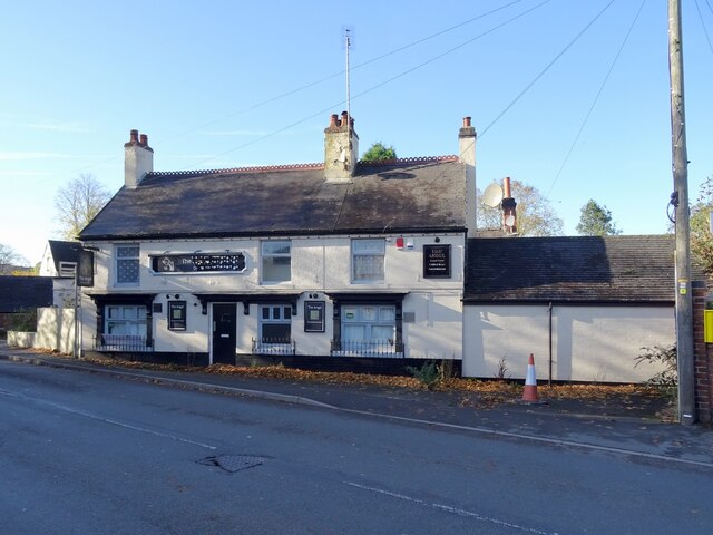
Midway is a small village located in the Upper district of Derbyshire, England. Situated in the heart of the county, Midway is a picturesque settlement known for its charming countryside views and rich historical significance. The village is located approximately 4 miles south of Swadlincote and 12 miles northwest of Derby.

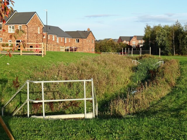
Midway is surrounded by lush green fields, rolling hills, and scenic landscapes, making it an ideal spot for nature lovers and outdoor enthusiasts. The village is also in close proximity to several popular attractions, such as the National Forest, Calke Abbey, and the historic town of Ashby-de-la-Zouch.

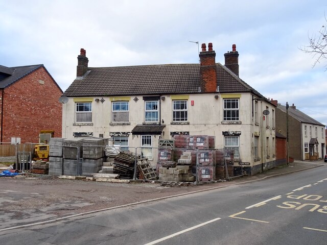
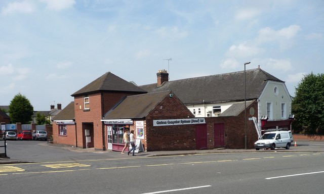
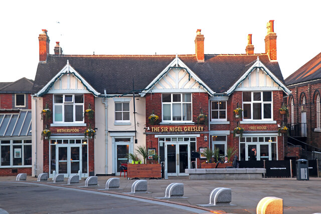
Despite its small size, Midway offers a range of amenities to its residents and visitors. The village has a primary school, a post office, a few local shops, and a community center, ensuring that the basic needs of its population are met. Additionally, there are several pubs and restaurants in the area, providing a warm and welcoming atmosphere for locals and tourists alike.

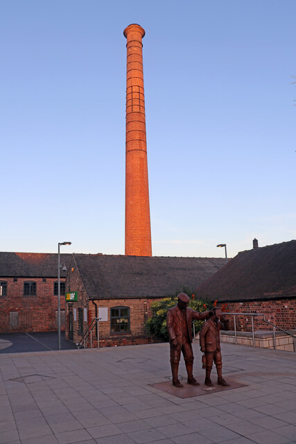
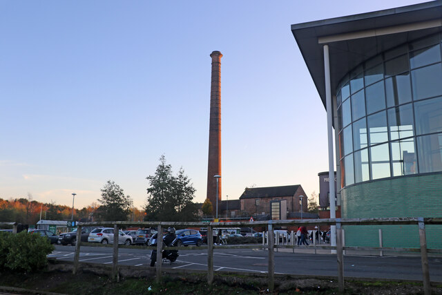
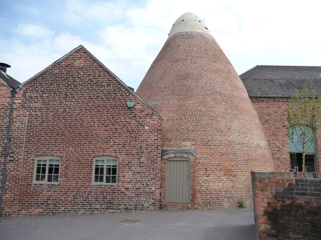
The history of Midway dates back centuries, with evidence of human activity in the area dating back to the Roman era. The village has witnessed various developments over the years, including the establishment of coal mines during the Industrial Revolution. Today, Midway retains its rustic charm while embracing modernity.

Overall, Midway, Upper, Derbyshire is a tranquil and idyllic village that offers a peaceful escape from the hustle and bustle of city life. With its stunning surroundings, historical significance, and range of amenities, it is a delightful destination for those seeking a slice of rural beauty in the heart of England.

If you have any feedback on the listing, please let us know in the comments section below.

Midway, Upper Images

Images are sourced within 2km of 52.784563/-1.558863 or Grid Reference SK2920. Thanks to Geograph Open Source API. All images are credited.
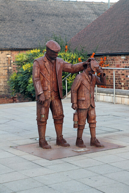
The Angel Inn The Angel has been here since the 19th century. It was, most recently, owned by Admiral Taverns but in mid-2021, it was sold after an internal review, as it was considered to have no long-term future. As of late-2021, it is threatened with demolition.
The Angel Inn
The Angel has been here since the 19th century. It was, most recently, owned by Admiral Taverns but in mid-2021, it was sold after an internal review, as it was considered to have no long-term future. As of late-2021, it is threatened with demolition.
Redevelopment at the Barley Mow The saga of the conversion of the Barley Mow to housing has been a long one, with a planning application being submitted as early as 2009. As of late 2021, the three terraced houses alongside appear to be complete but unoccupied and the pub, itself, is externally, at least, unaltered.
Redevelopment at the Barley Mow
The saga of the conversion of the Barley Mow to housing has been a long one, with a planning application being submitted as early as 2009. As of late 2021, the three terraced houses alongside appear to be complete but unoccupied and the pub, itself, is externally, at least, unaltered.
Swadlincote - chimney and former works This is the former firebrick and pipe works of Wragg and Woodward. This is now subsumed into a large retail complex but the magnificent chimney has been retained. The statue represents two miners carrying their safety lamps.
Swadlincote - chimney and former works
This is the former firebrick and pipe works of Wragg and Woodward. This is now subsumed into a large retail complex but the magnificent chimney has been retained. The statue represents two miners carrying their safety lamps.
Statue of two colliers, Swadlincote In the new development centred on the former firebrick and pipe works of Wragg and Woodward. One of the surviving old buildings is seen in the background. There is also an enormous brick chimney that is very prominent in the area.
Statue of two colliers, Swadlincote
In the new development centred on the former firebrick and pipe works of Wragg and Woodward. One of the surviving old buildings is seen in the background. There is also an enormous brick chimney that is very prominent in the area.
Chimney and Morrisons superstore, Swadlincote
Sharpe's Pottery Museum, Swadlincote A former loo pottery in West Street, converted into a museum, cafe, tourist information centre and shop. See <span class="nowrap"><a title="http://www.sharpes.org.uk" rel="nofollow ugc noopener" href="http://www.sharpes.org.uk">Link</a><img style="margin-left:2px;" alt="External link" title="External link - shift click to open in new window" src="https://s1.geograph.org.uk/img/external.png" width="10" height="10"/></span> for more information.
Sharpe's Pottery Museum, Swadlincote
A former loo pottery in West Street, converted into a museum, cafe, tourist information centre and shop. See LinkExternal link for more information.
Computer store, Swadlincote On the west side of Alexandra Road.
Computer store, Swadlincote
On the west side of Alexandra Road.
Private car park, east of Alexandra Road Around the main shopping street, Swadlincote has many empty spaces where presumably there was once industry.
Private car park, east of Alexandra Road
Around the main shopping street, Swadlincote has many empty spaces where presumably there was once industry.
Blocked entrance to former car park Part of the former Kwik Save supermarket site, on the west side of Alexandra Road.
Blocked entrance to former car park
Part of the former Kwik Save supermarket site, on the west side of Alexandra Road.
Union of Democratic Mineworkers, South Derbyshire Section Built by the South Derbyshire Miners' Association [SDMA above the door]. Now also used as a Mineworkers Claims Centre.
Union of Democratic Mineworkers, South Derbyshire Section
Built by the South Derbyshire Miners' Association [SDMA above the door]. Now also used as a Mineworkers Claims Centre.
New footpath and footbridge at Cadley Village As part of the Cadley Village housing development, some of the old footpaths in the area have been diverted and upgraded to all-weather surfaces.
New footpath and footbridge at Cadley Village
As part of the Cadley Village housing development, some of the old footpaths in the area have been diverted and upgraded to all-weather surfaces.
New road and construction site at Cadley Village Cadley Village is a substantial development of new houses on the edge of Swadlincote.
New road and construction site at Cadley Village
Cadley Village is a substantial development of new houses on the edge of Swadlincote.
Balancing pond at Cadley Village Flood alleviation at the new housing estate on the edge of Swadlincote.
Balancing pond at Cadley Village
Flood alleviation at the new housing estate on the edge of Swadlincote.
Darklands Lane A remnant of an old lane hemmed-in by modern development.
Darklands Lane
A remnant of an old lane hemmed-in by modern development.
Darklands Lane Allotments On a sliver of land previously occupied by Railway Cottages.
Darklands Lane Allotments
On a sliver of land previously occupied by Railway Cottages.
Darklands Brook Photographed from a new footpath crossing for the new houses being built on the north side of the brook.
Darklands Brook
Photographed from a new footpath crossing for the new houses being built on the north side of the brook.
1st Gresley Scout Group hall A meeting place for Beavers, Cubs and Scouts.
1st Gresley Scout Group hall
A meeting place for Beavers, Cubs and Scouts.
The Sir Nigel Gresley, Swadlincote How could I resist photographing a public house named after a famous locomotive designer and chief engineer of a railway company. Although he was born in Edinburgh he was raised in the nearby village of Netherseal, hence the local connection.
The Sir Nigel Gresley, Swadlincote
How could I resist photographing a public house named after a famous locomotive designer and chief engineer of a railway company. Although he was born in Edinburgh he was raised in the nearby village of Netherseal, hence the local connection.
Show me another place!

Midway, Upper is located at Grid Ref: SK2920 (Lat: 52.784563, Lng: -1.558863)

Administrative County: Derbyshire

District: South Derbyshire

Police Authority: Derbyshire

What 3 Words

///gears.stole.exile. Near Swadlincote, Derbyshire

Nearby Locations

Midway, Upper Upper Midway

Related Wikis

The Pingle Academy

The Pingle Academy is a co-educational secondary school and sixth form located at Coronation Street in Swadlincote, South Derbyshire, England. The name...

Bees, Wasps and Ants Recording Society

The Bees, Wasps and Ants Recording Society (BWARS) is a British society dedicated to recording bees, wasps and ants. The recording of these insects is...

Swadlincote railway station

Swadlincote railway station was a station that served the town of Swadlincote, South Derbyshire. The station was located off Midland Road near the present...

Swadlincote

Swadlincote is a historic mining town in the district of South Derbyshire, in the ceremonial county of Derbyshire, England. It lies within The National...

Nearby Amenities

Located within 500m of 52.784563,-1.558863
Upper Midway
Place: suburb
Source: OS_OpenData_StreetView
Lat/Long: 52.7846464/-1.5588311
Post Box
Brand: Royal Mail
Brand Wikidata: Q638098
Operator: Royal Mail
Operator Wikidata: Q638098
Post Box Type: pillar
Ref: DE11 1216
Lat/Long: 52.7866698/-1.5558973
Post Box
Operator: Royal Mail
Operator Wikidata: Q638098
Ref: DE11 1239
Lat/Long: 52.7829937/-1.5558817
Post Box
Operator: Royal Mail
Operator Wikidata: Q638098
Ref: DE11 1181
Lat/Long: 52.7837474/-1.5622523
Source: survey
Traffic Calming: hump
Lat/Long: 52.7836754/-1.5592855
Source: survey
Traffic Calming: hump
Lat/Long: 52.7842588/-1.5598336
Elmsleigh Foodstore
Addr City: Swadlincote
Addr Postcode: DE11 0ER
Addr Street: Elmsleigh Drive
Fhrs Id: 234141
Shop: convenience
Source: survey
Lat/Long: 52.784364/-1.5606884
Springfield News
Addr City: Swadlincote
Addr Housenumber: 34
Addr Postcode: DE11 0BZ
Addr Street: Springfield Road
Fhrs Id: 283262
Shop: convenience
Source: survey
Lat/Long: 52.7853294/-1.557074
Turning Circle
Lat/Long: 52.7844484/-1.5628842
Turning Circle
Lat/Long: 52.7866807/-1.5600441
Turning Circle
Lat/Long: 52.7822213/-1.5626446
Turning Circle
Lat/Long: 52.7871658/-1.5585568
Turning Circle
Lat/Long: 52.7877353/-1.5578232
Turning Circle
Lat/Long: 52.7882307/-1.5598228
Turning Circle
Lat/Long: 52.7886176/-1.5609641
Doctors
Bradcare Community Care HQ
Healthcare: doctor
Opening Hours: Community Care Only
Lat/Long: 52.7816388/-1.5628317
Bus Stop
Springwood Farm Road
Bus: yes
Naptan AtcoCode: 1000DMLA2307
Naptan NaptanCode: dbsatwjg
Public Transport: platform
Lat/Long: 52.7869954/-1.5564591
Bus Stop
Springwood Farm Road
Bus: yes
Naptan AtcoCode: 1000DMLA4631
Naptan NaptanCode: dbsatwjm
Public Transport: platform
Lat/Long: 52.7870635/-1.5568399
Bus Stop
Lime Tree Avenue
Bus: yes
Naptan AtcoCode: 1000DMCA4630
Naptan NaptanCode: dbsdtmpd
Public Transport: platform
Lat/Long: 52.7857171/-1.5603241
Bus Stop
Lime Tree Avenue
Bus: yes
Naptan AtcoCode: 1000DMCA4703
Naptan NaptanCode: dbsdtmpg
Public Transport: platform
Lat/Long: 52.7856863/-1.5609303
Bus Stop
Chestnut Avenue
Bench: no
Bin: no
Bus: yes
Lit: yes
Public Transport: platform
Shelter: no
Tactile Paving: no
Lat/Long: 52.7857398/-1.5644065
Bus Stop
Chestnut Avenue
Bench: no
Bin: no
Bus: yes
Lit: yes
Naptan AtcoCode: 100052717
Naptan NaptanCode: dbsjdaja
Public Transport: platform
Shelter: no
Tactile Paving: no
Lat/Long: 52.7858015/-1.5642831
Bus Stop
Springfield Junior School
Bus: yes
Naptan AtcoCode: 1000DSSR4701
Naptan NaptanCode: dbsgwapj
Public Transport: platform
Lat/Long: 52.7802549/-1.5571216
Bus Stop
Eastfield Road
Bus: yes
Public Transport: platform
Lat/Long: 52.7831167/-1.5568829
Bus Stop
Eastfield Road
Bus: yes
Naptan AtcoCode: 1000DMSR4702
Naptan NaptanCode: dbsajaga
Public Transport: platform
Lat/Long: 52.7829861/-1.557029
Bus Stop
Acacia Avenue
Bus: yes
Public Transport: platform
Lat/Long: 52.7854186/-1.5568507
Bus Stop
Acacia Avenue
Bus: yes
Naptan AtcoCode: 1000DMSR4611
Naptan NaptanCode: dbsajadw
Public Transport: platform
Lat/Long: 52.785649/-1.5566844
Bus Stop
Boardmans Hill
Bus: yes
Naptan AtcoCode: 1000DSUR4725
Naptan NaptanCode: dbsadmtd
Public Transport: platform
Lat/Long: 52.7812267/-1.563697
Bus Stop
Boardmans Hill
Bus: yes
Public Transport: platform
Lat/Long: 52.7806199/-1.562089
Generator Method: photovoltaic
Generator Output Electricity: yes
Generator Source: solar
Generator Type: solar_photovoltaic_panel
Location: roof
Power: generator
Lat/Long: 52.7819635/-1.5541827
Generator Method: photovoltaic
Generator Output Electricity: yes
Generator Source: solar
Generator Type: solar_photovoltaic_panel
Location: roof
Power: generator
Lat/Long: 52.782971/-1.5527852
Generator Method: photovoltaic
Generator Output Electricity: yes
Generator Source: solar
Generator Type: solar_photovoltaic_panel
Location: roof
Power: generator
Lat/Long: 52.7828817/-1.5527396
Generator Method: photovoltaic
Generator Output Electricity: yes
Generator Source: solar
Generator Type: solar_photovoltaic_panel
Location: roof
Power: generator
Lat/Long: 52.7839719/-1.5523695
Generator Method: photovoltaic
Generator Output Electricity: yes
Generator Source: solar
Generator Type: solar_photovoltaic_panel
Location: roof
Power: generator
Lat/Long: 52.783409/-1.5566637
Generator Method: photovoltaic
Generator Output Electricity: yes
Generator Source: solar
Generator Type: solar_photovoltaic_panel
Location: roof
Power: generator
Lat/Long: 52.7849882/-1.5552716
Generator Method: photovoltaic
Generator Output Electricity: yes
Generator Source: solar
Generator Type: solar_photovoltaic_panel
Location: roof
Power: generator
Lat/Long: 52.7818507/-1.5580531
Generator Method: photovoltaic
Generator Output Electricity: yes
Generator Source: solar
Generator Type: solar_photovoltaic_panel
Location: roof
Power: generator
Lat/Long: 52.7809617/-1.5611363
Generator Method: photovoltaic
Generator Output Electricity: yes
Generator Source: solar
Generator Type: solar_photovoltaic_panel
Location: roof
Power: generator
Lat/Long: 52.7818868/-1.5604791
Generator Method: photovoltaic
Generator Output Electricity: yes
Generator Source: solar
Generator Type: solar_photovoltaic_panel
Location: roof
Power: generator
Lat/Long: 52.7819095/-1.5605489
Generator Method: photovoltaic
Generator Output Electricity: yes
Generator Source: solar
Generator Type: solar_photovoltaic_panel
Location: roof
Power: generator
Lat/Long: 52.7858177/-1.5564744
Generator Method: photovoltaic
Generator Output Electricity: yes
Generator Source: solar
Generator Type: solar_photovoltaic_panel
Location: roof
Power: generator
Lat/Long: 52.7858148/-1.5565361
Generator Method: photovoltaic
Generator Output Electricity: yes
Generator Source: solar
Generator Type: solar_photovoltaic_panel
Location: roof
Power: generator
Lat/Long: 52.7858177/-1.5578837
Generator Method: photovoltaic
Generator Output Electricity: yes
Generator Source: solar
Generator Type: solar_photovoltaic_panel
Location: roof
Power: generator
Lat/Long: 52.7856506/-1.5592634
Generator Method: photovoltaic
Generator Output Electricity: yes
Generator Source: solar
Generator Type: solar_photovoltaic_panel
Location: roof
Power: generator
Lat/Long: 52.7839279/-1.5638961
Generator Method: photovoltaic
Generator Output Electricity: yes
Generator Source: solar
Generator Type: solar_photovoltaic_panel
Location: roof
Power: generator
Lat/Long: 52.7839011/-1.5639726
Generator Method: photovoltaic
Generator Output Electricity: yes
Generator Source: solar
Generator Type: solar_photovoltaic_panel
Location: roof
Power: generator
Lat/Long: 52.7838727/-1.5650092
Generator Method: photovoltaic
Generator Output Electricity: yes
Generator Source: solar
Generator Type: solar_photovoltaic_panel
Location: roof
Power: generator
Lat/Long: 52.7838667/-1.5650758
Generator Method: photovoltaic
Generator Output Electricity: yes
Generator Source: solar
Generator Type: solar_photovoltaic_panel
Location: roof
Power: generator
Lat/Long: 52.7828322/-1.5642416
Generator Method: photovoltaic
Generator Output Electricity: yes
Generator Source: solar
Generator Type: solar_photovoltaic_panel
Location: roof
Power: generator
Lat/Long: 52.78278/-1.5641231
Generator Method: photovoltaic
Generator Output Electricity: yes
Generator Source: solar
Generator Type: solar_photovoltaic_panel
Location: roof
Power: generator
Lat/Long: 52.7827143/-1.5639528
Generator Method: photovoltaic
Generator Output Electricity: yes
Generator Source: solar
Generator Type: solar_photovoltaic_panel
Location: roof
Power: generator
Lat/Long: 52.7825426/-1.5643823
Generator Method: photovoltaic
Generator Output Electricity: yes
Generator Source: solar
Generator Type: solar_photovoltaic_panel
Location: roof
Power: generator
Lat/Long: 52.78391/-1.5661075
Generator Method: photovoltaic
Generator Output Electricity: yes
Generator Source: solar
Generator Type: solar_photovoltaic_panel
Location: roof
Power: generator
Lat/Long: 52.7840026/-1.5661766
Generator Method: photovoltaic
Generator Output Electricity: yes
Generator Source: solar
Generator Type: solar_photovoltaic_panel
Location: roof
Power: generator
Lat/Long: 52.7839981/-1.5662358
Generator Method: photovoltaic
Generator Output Electricity: yes
Generator Source: solar
Generator Type: solar_photovoltaic_panel
Location: roof
Power: generator
Lat/Long: 52.7841071/-1.5656435
Generator Method: photovoltaic
Generator Output Electricity: yes
Generator Source: solar
Generator Type: solar_photovoltaic_panel
Location: roof
Power: generator
Lat/Long: 52.7843847/-1.5655225
Generator Method: photovoltaic
Generator Output Electricity: yes
Generator Source: solar
Generator Type: solar_photovoltaic_panel
Location: roof
Power: generator
Lat/Long: 52.7843817/-1.5656213
Generator Method: photovoltaic
Generator Output Electricity: yes
Generator Source: solar
Generator Type: solar_photovoltaic_panel
Location: roof
Power: generator
Lat/Long: 52.7843758/-1.5650635
Generator Method: photovoltaic
Generator Output Electricity: yes
Generator Source: solar
Generator Type: solar_photovoltaic_panel
Location: roof
Power: generator
Lat/Long: 52.7843787/-1.5648932
Generator Method: photovoltaic
Generator Output Electricity: yes
Generator Source: solar
Generator Type: solar_photovoltaic_panel
Location: roof
Power: generator
Lat/Long: 52.7850848/-1.5650116
Generator Method: photovoltaic
Generator Output Electricity: yes
Generator Source: solar
Generator Type: solar_photovoltaic_panel
Location: roof
Power: generator
Lat/Long: 52.7855909/-1.5648537
Generator Method: photovoltaic
Generator Output Electricity: yes
Generator Source: solar
Generator Type: solar_photovoltaic_panel
Location: roof
Power: generator
Lat/Long: 52.7855819/-1.5653942
Generator Method: photovoltaic
Generator Output Electricity: yes
Generator Source: solar
Generator Type: solar_photovoltaic_panel
Location: roof
Power: generator
Lat/Long: 52.7855774/-1.5658755
Generator Method: photovoltaic
Generator Output Electricity: yes
Generator Source: solar
Generator Type: solar_photovoltaic_panel
Location: roof
Power: generator
Lat/Long: 52.7853341/-1.5661692
Generator Method: photovoltaic
Generator Output Electricity: yes
Generator Source: solar
Generator Type: solar_photovoltaic_panel
Location: roof
Power: generator
Lat/Long: 52.7859774/-1.561252
Generator Method: photovoltaic
Generator Output Electricity: yes
Generator Source: solar
Generator Type: solar_photovoltaic_panel
Location: roof
Power: generator
Lat/Long: 52.7860131/-1.5612332
Generator Method: photovoltaic
Generator Output Electricity: yes
Generator Source: solar
Generator Type: solar_photovoltaic_panel
Location: roof
Power: generator
Lat/Long: 52.7859434/-1.5616838
Generator Method: photovoltaic
Generator Output Electricity: yes
Generator Source: solar
Generator Type: solar_photovoltaic_panel
Location: roof
Power: generator
Lat/Long: 52.7862986/-1.5602783
Generator Method: photovoltaic
Generator Output Electricity: yes
Generator Source: solar
Generator Type: solar_photovoltaic_panel
Location: roof
Power: generator
Lat/Long: 52.7874925/-1.5625287
Generator Method: photovoltaic
Generator Output Electricity: yes
Generator Source: solar
Generator Type: solar_photovoltaic_panel
Location: roof
Power: generator
Lat/Long: 52.7877245/-1.5628747
Generator Method: photovoltaic
Generator Output Electricity: yes
Generator Source: solar
Generator Type: solar_photovoltaic_panel
Location: roof
Power: generator
Lat/Long: 52.7877099/-1.5628157
Generator Method: photovoltaic
Generator Output Electricity: yes
Generator Source: solar
Generator Type: solar_photovoltaic_panel
Location: roof
Power: generator
Lat/Long: 52.7883955/-1.5615393
Generator Method: photovoltaic
Generator Output Electricity: yes
Generator Source: solar
Generator Type: solar_photovoltaic_panel
Location: roof
Power: generator
Lat/Long: 52.7878213/-1.5607051
Generator Method: photovoltaic
Generator Output Electricity: yes
Generator Source: solar
Generator Type: solar_photovoltaic_panel
Location: roof
Power: generator
Lat/Long: 52.7878018/-1.5606515
Generator Method: photovoltaic
Generator Output Electricity: yes
Generator Source: solar
Generator Type: solar_photovoltaic_panel
Location: roof
Power: generator
Lat/Long: 52.7877677/-1.5602009
Generator Method: photovoltaic
Generator Output Electricity: yes
Generator Source: solar
Generator Type: solar_photovoltaic_panel
Location: roof
Power: generator
Lat/Long: 52.7877483/-1.5601204
Crossing
Lat/Long: 52.7853261/-1.5600984
Turning Circle
Lat/Long: 52.7882936/-1.5602216
Speed Camera
Direction: 170
Maxspeed: 30 mph
Lat/Long: 52.7872793/-1.5560195
Turning Circle
Lat/Long: 52.7878446/-1.557992
Waste Basket
Colour: black
Material: metal
Operator: South Derbyshire District Council
Waste: trash
Lat/Long: 52.7811016/-1.5630769
Waste Basket
Colour: red
Operator: South Derbyshire District Council
Waste: dog_excrement
Lat/Long: 52.7828875/-1.5553978
Waste Basket
Colour: black
Material: metal
Operator: South Derbyshire District Council
Waste: trash
Lat/Long: 52.7887088/-1.5576244
Waste Basket
Colour: black
Material: metal
Operator: South Derbyshire District Council
Waste: trash
Lat/Long: 52.7874796/-1.5601797
Waste Basket
Colour: black
Material: metal
Operator: South Derbyshire District Council
Waste: trash
Lat/Long: 52.7872737/-1.556128
Waste Basket
Colour: black
Material: metal
Operator: South Derbyshire District Council
Waste: trash
Lat/Long: 52.7871555/-1.5564811
Waste Basket
Colour: black
Material: plastic
Operator: South Derbyshire District Council
Waste: trash
Lat/Long: 52.7866201/-1.5559179
Waste Basket
Colour: black
Material: metal
Operator: South Derbyshire District Council
Waste: trash
Lat/Long: 52.786472/-1.5552778
Waste Basket
Colour: black
Material: metal
Operator: South Derbyshire District Council
Waste: trash
Lat/Long: 52.7853098/-1.5569072
Waste Basket
Colour: black
Material: metal
Operator: South Derbyshire District Council
Waste: trash
Lat/Long: 52.7830894/-1.556171
Waste Basket
Colour: black
Material: metal
Operator: South Derbyshire District Council
Waste: trash
Lat/Long: 52.7853889/-1.5600202
Waste Basket
Colour: black
Material: metal
Operator: South Derbyshire District Council
Waste: trash
Lat/Long: 52.7847152/-1.5604023
Waste Basket
Colour: black
Material: metal
Operator: South Derbyshire District Council
Waste: trash
Lat/Long: 52.7844563/-1.5606986
Waste Basket
Colour: black
Material: metal
Operator: South Derbyshire District Council
Waste: trash
Lat/Long: 52.7836074/-1.5603975
Waste Basket
Colour: black
Material: metal
Operator: South Derbyshire District Council
Waste: trash
Lat/Long: 52.7831859/-1.559893
Waste Basket
Colour: green
Material: metal
Operator: South Derbyshire District Council
Waste: trash
Lat/Long: 52.7859368/-1.563724
Waste Basket
Colour: green
Material: metal
Operator: South Derbyshire District Council
Waste: trash
Lat/Long: 52.7859483/-1.5640234
Waste Basket
Colour: black
Material: metal
Operator: South Derbyshire District Council
Waste: trash
Lat/Long: 52.7862438/-1.5639354
Waste Basket
Colour: black
Material: metal
Operator: South Derbyshire District Council
Waste: trash
Lat/Long: 52.7867756/-1.5638973
Bicycle Parking
Access: yes
Bicycle Parking: stands
Capacity: 6
Covered: no
Fee: no
Lat/Long: 52.7862544/-1.5636185
Defibrillator
Defibrillator Location: On teh wall to the right of the main entrance.
Emergency: defibrillator
Indoor: no
Lat/Long: 52.7862304/-1.5636438
The data included in this document is from www.openstreetmap.org. The data is made available under ODbL.

Have you been to Midway, Upper?

Leave your review of Midway, Upper below (or comments, questions and feedback).