Hardwick, Upper

Settlement in Herefordshire

England

Hardwick, Upper

Children's play area, Pembridge
Children's play area, Pembridge Credit: Jonathan Thacker

Hardwick, Upper is a small village located in the county of Herefordshire, England. Situated in the western part of the county, it lies within the civil parish of Upper Sapey and is approximately 12 miles north of the city of Hereford. The village is nestled in a rural setting, surrounded by picturesque countryside and rolling hills.

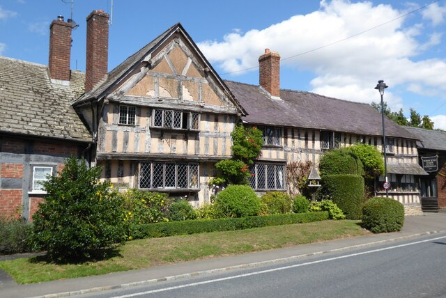
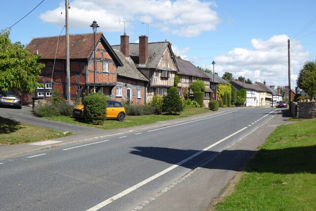
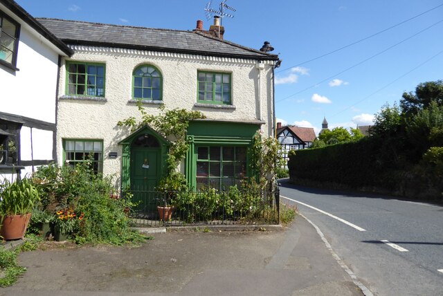
Hardwick, Upper has a relatively small population, with a tight-knit community that embodies the charm and simplicity of rural life. The village is characterized by its quaint thatched cottages, traditional architecture, and well-maintained gardens, evoking a sense of timeless beauty.

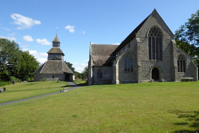
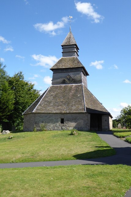
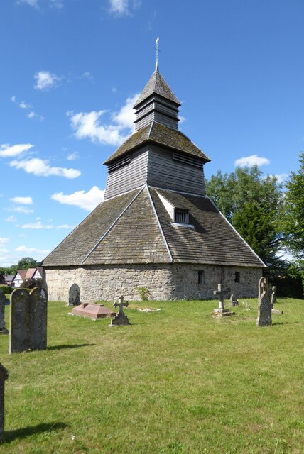
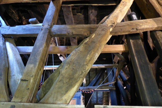
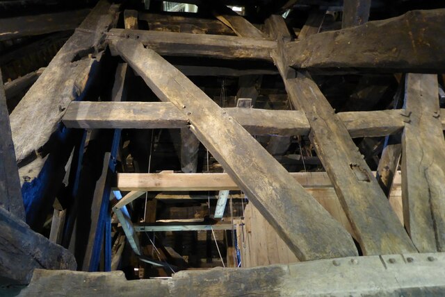
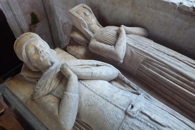
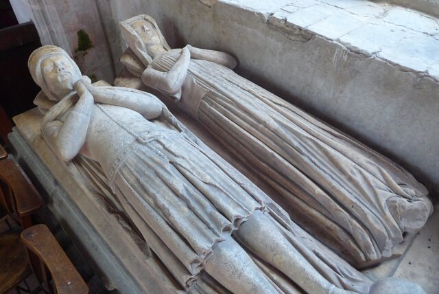
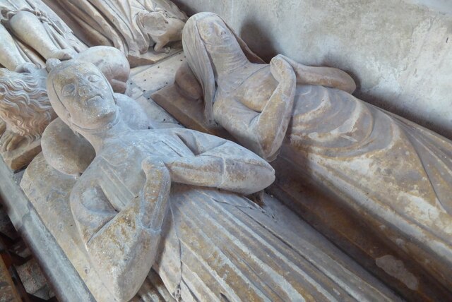
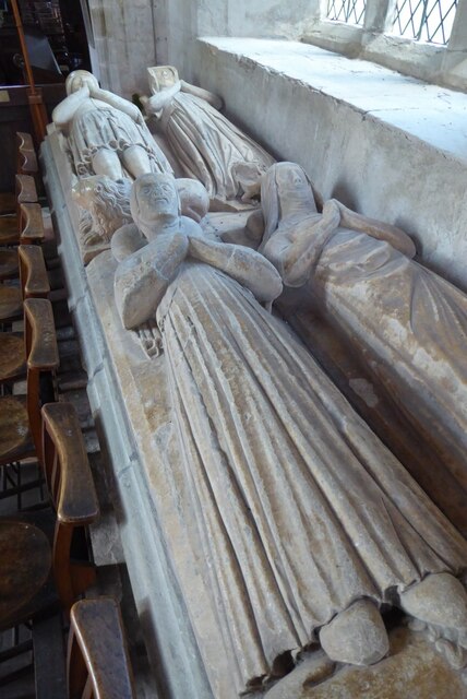
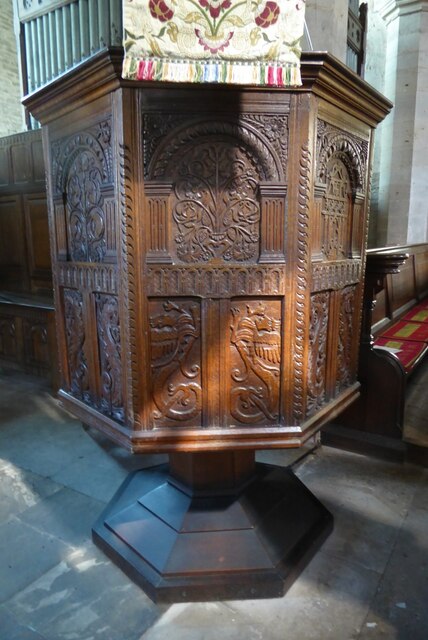
The village is known for its historic church, St. John the Baptist, which dates back to the 13th century. This beautiful place of worship boasts intricate stained glass windows and a peaceful atmosphere, making it a popular destination for visitors seeking tranquility and architectural history.

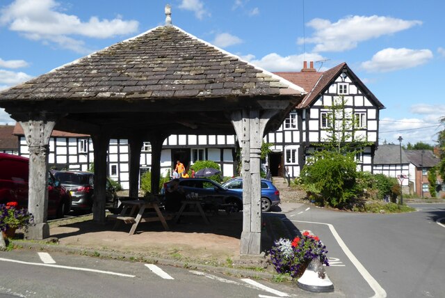
Although small in size, Hardwick, Upper offers a range of amenities for its residents and visitors. These include a local pub, which serves as a hub for social gatherings and community events, as well as a village hall that hosts various activities and meetings.

The surrounding area provides ample opportunities for outdoor enthusiasts, with numerous walking and cycling trails that showcase the stunning Herefordshire countryside. The village is also within close proximity to larger towns and cities, such as Hereford and Worcester, offering access to a wider range of amenities and services.

Overall, Hardwick, Upper is a charming and idyllic village that provides a peaceful retreat from the bustle of city life, while still offering a sense of community and connection to the surrounding area.

If you have any feedback on the listing, please let us know in the comments section below.

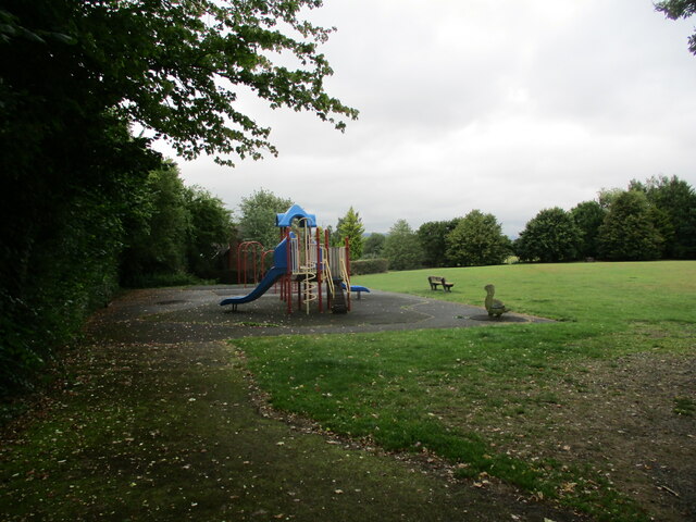
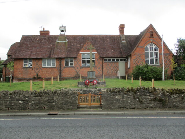
Hardwick, Upper Images

Images are sourced within 2km of 52.210829/-2.8742698 or Grid Reference SO4057. Thanks to Geograph Open Source API. All images are credited.

Children's play area, Pembridge
School and War Memorial, Pembridge
West End Farmhouse West End Farmhouse in Pembridge.  This timber-framed house may date back to the 14th century; the house is Grade II listed, see: <span class="nowrap"><a title="https://historicengland.org.uk/listing/the-list/list-entry/1301087?section=official-list-entry" rel="nofollow ugc noopener" href="https://historicengland.org.uk/listing/the-list/list-entry/1301087?section=official-list-entry">Link</a><img style="margin-left:2px;" alt="External link" title="External link - shift click to open in new window" src="https://s1.geograph.org.uk/img/external.png" width="10" height="10"/></span>
West End Farmhouse
West End Farmhouse in Pembridge. This timber-framed house may date back to the 14th century; the house is Grade II listed, see: LinkExternal link
The A44 entering Pembridge The A44 entering Pembridge from the west.
The A44 entering Pembridge
The A44 entering Pembridge from the west.
Georgian house on West Street Georgian house on West Street in Pembridge.
Georgian house on West Street
Georgian house on West Street in Pembridge.
The Market Hall, Pembridge Pembridge's Market Hall is Grade II* listed and dates from the 16th century <span class="nowrap"><a title="https://historicengland.org.uk/listing/the-list/list-entry/1081729?section=official-list-entry" rel="nofollow ugc noopener" href="https://historicengland.org.uk/listing/the-list/list-entry/1081729?section=official-list-entry">Link</a><img style="margin-left:2px;" alt="External link" title="External link - shift click to open in new window" src="https://s1.geograph.org.uk/img/external.png" width="10" height="10"/></span> The New Inn can be seen in the background.
The Market Hall, Pembridge
Pembridge's Market Hall is Grade II* listed and dates from the 16th century LinkExternal link The New Inn can be seen in the background.
Pembridge Church St Mary's church, Pembridge dates back to the 12th century and is Grade I listed <span class="nowrap"><a title="https://historicengland.org.uk/listing/the-list/list-entry/1081754?section=official-list-entry" rel="nofollow ugc noopener" href="https://historicengland.org.uk/listing/the-list/list-entry/1081754?section=official-list-entry">Link</a><img style="margin-left:2px;" alt="External link" title="External link - shift click to open in new window" src="https://s1.geograph.org.uk/img/external.png" width="10" height="10"/></span>.  The church is rare due to its detached bell tower which is reminiscent of Norwegian stave churches.  Detached towers are a feature of Herefordshire, this is one of seven churches in the county with detached bell towers.  Some of the timbers in the bell tower date from the early 13th century and is Grade I listed, see: <span class="nowrap"><a title="https://historicengland.org.uk/listing/the-list/list-entry/1081754?section=official-list-entry" rel="nofollow ugc noopener" href="https://historicengland.org.uk/listing/the-list/list-entry/1081754?section=official-list-entry">Link</a><img style="margin-left:2px;" alt="External link" title="External link - shift click to open in new window" src="https://s1.geograph.org.uk/img/external.png" width="10" height="10"/></span>
Pembridge Church
St Mary's church, Pembridge dates back to the 12th century and is Grade I listed LinkExternal link. The church is rare due to its detached bell tower which is reminiscent of Norwegian stave churches. Detached towers are a feature of Herefordshire, this is one of seven churches in the county with detached bell towers. Some of the timbers in the bell tower date from the early 13th century and is Grade I listed, see: LinkExternal link
Pembridge bell tower The bell tower which is reminiscent of Norwegian stave churches.  Detached bell towers are a feature of Herefordshire, this is one of seven churches in the county with detached bell towers.  Some of the timbers in the bell tower date from the early 13th century and is Grade I listed, see: <span class="nowrap"><a title="https://historicengland.org.uk/listing/the-list/list-entry/1081754?section=official-list-entry" rel="nofollow ugc noopener" href="https://historicengland.org.uk/listing/the-list/list-entry/1081754?section=official-list-entry">Link</a><img style="margin-left:2px;" alt="External link" title="External link - shift click to open in new window" src="https://s1.geograph.org.uk/img/external.png" width="10" height="10"/></span>
Pembridge bell tower
The bell tower which is reminiscent of Norwegian stave churches. Detached bell towers are a feature of Herefordshire, this is one of seven churches in the county with detached bell towers. Some of the timbers in the bell tower date from the early 13th century and is Grade I listed, see: LinkExternal link
Timbers within Pembridge bell tower Some of these timbers within the bell tower at Pembridge have been dated to the beginning of the 13th century.  Here is a view of the tower from outside <a href="https://www.geograph.org.uk/photo/7269358">SO3958 : Pembridge bell tower</a> <a href="https://www.geograph.org.uk/photo/7269352">SO3958 : Pembridge Church</a>.  It is reminiscent of Stave churches I have seen in Norway when travelling in Scandinavia many years ago, though the timbers are much heavier in this tower.
Timbers within Pembridge bell tower
Some of these timbers within the bell tower at Pembridge have been dated to the beginning of the 13th century. Here is a view of the tower from outside SO3958 : Pembridge bell tower SO3958 : Pembridge Church. It is reminiscent of Stave churches I have seen in Norway when travelling in Scandinavia many years ago, though the timbers are much heavier in this tower.
Memorial effigies in Pembridge church These two late 14th century memorial effigies are thought to be of John Gour and his wife.  He is thought to be wearing the clothes of someone in the legal profession or possibly a Sergent-at-Law in the service of the Mortimers.
Memorial effigies in Pembridge church
These two late 14th century memorial effigies are thought to be of John Gour and his wife. He is thought to be wearing the clothes of someone in the legal profession or possibly a Sergent-at-Law in the service of the Mortimers.
Memorial in Pembridge church Memorial effigies from the mid-14th century possibly of Nicholas Gour and his wife.
Memorial in Pembridge church
Memorial effigies from the mid-14th century possibly of Nicholas Gour and his wife.
Memorial effigies, Pembridge church These 14th century memorial effigies in Pembridge church are thought to be of Nicholas Gour and his wife in the foreground and beyond the effigy of his son John and his wife.
Memorial effigies, Pembridge church
These 14th century memorial effigies in Pembridge church are thought to be of Nicholas Gour and his wife in the foreground and beyond the effigy of his son John and his wife.
Pulpit in Pembridge church Jacobean pulpit in Pembridge church.
Pulpit in Pembridge church
Jacobean pulpit in Pembridge church.
Pulpit in Pembridge church Jacobean pulpit in Pembridge church.
Pulpit in Pembridge church
Jacobean pulpit in Pembridge church.
Jacobean lectern Jacobean lectern with intricate carving in St Mary the Virgin church, Pembridge.
Jacobean lectern
Jacobean lectern with intricate carving in St Mary the Virgin church, Pembridge.
Show me another place!

Hardwick, Upper is located at Grid Ref: SO4057 (Lat: 52.210829, Lng: -2.8742698)

Unitary Authority: County of Herefordshire

Police Authority: West Mercia

What 3 Words

///swanky.chitchat.crowds. Near Weobley, Herefordshire

Related Wikis

Pembridge

Pembridge is a village and civil parish in the Arrow valley in Herefordshire, England. The village is on the A44 road about 6 miles (10 km) east of Kington...

Burton Court, Eardisland

Burton Court is a Grade II* listed English country manor house in the Parish of Eardisland, southwest of Leominster, Herefordshire, England. The manor...

Eardisland

Eardisland ( URDZ-lənd) is a village and civil parish on the River Arrow, about 5 miles (8 km) west of the market town of Leominster, Herefordshire. The...

Pembridge railway station

Pembridge railway station was a station in Pembridge, Herefordshire, England. The station was opened in 1856 and closed in 1955. The station was located...

Dilwyn

Dilwyn is a village in Herefordshire, England located about 18 km (11 mi) from the city of Hereford and 9 km (6 mi) from its nearest town, Leominster....

Shobdon Airfield

Shobdon Airfield (ICAO: EGBS) is an airport 6 NM (11 km; 6.9 mi) west of Leominster, Herefordshire, England. == RAF Shobdon == Shobdon started as a British...

Ox House railway station

Ox House railway station was a station to the southwest of Shobdon, Herefordshire, England, close to Shobdon Aerodrome. Ox House was a private station...

St Cosmas and St Damian's Church, Stretford

St Cosmas and St Damian's Church is a redundant Anglican church standing in a farmyard in Stretford, Herefordshire, England. It is recorded in the National...

Nearby Amenities

Located within 500m of 52.210829,-2.8742698
Upper Hardwick
Place: hamlet
Source: NPE
Lat/Long: 52.2120049/-2.8716472
Building: yes
Lat/Long: 52.2144056/-2.8705524
Power: pole
Lat/Long: 52.2125053/-2.8678031
Power: pole
Lat/Long: 52.2127527/-2.8690584
Power: pole
Lat/Long: 52.2129721/-2.8702989
Power: pole
Lat/Long: 52.2129409/-2.872332
Power: pole
Lat/Long: 52.2128916/-2.8743196
Power: pole
Lat/Long: 52.2128373/-2.8766933
Power: pole
Lat/Long: 52.212779/-2.8789531
Power: pole
Lat/Long: 52.2127773/-2.8808132
Description: Footpath direction(s): South or West. East is is private. (2021 May)
Information: guidepost
Tourism: information
Lat/Long: 52.2145963/-2.8775089
Information: guidepost
Tourism: information
Lat/Long: 52.2108167/-2.8753985
Barrier: stile
Description: 2021 May: Overgrown. Fallen tree. Passable.
Material: wood
Stile: stepover
Lat/Long: 52.2119092/-2.875537
Barrier: stile
Material: metal
Stile: stepover
Lat/Long: 52.2128795/-2.8768391
Information: guidepost
Tourism: information
Lat/Long: 52.2128739/-2.8768301
Description: 2021 May: advises to head North or East (not through this gate).
Information: guidepost
Tourism: information
Lat/Long: 52.212746/-2.877753
Ford: yes
Lat/Long: 52.2146347/-2.8779441
Barrier: stile
Description: Stile is part of fence: 3 solid wood planks/rungs. (2021 May)
Material: wood
Stile: stepover
Lat/Long: 52.2145712/-2.8775109
The data included in this document is from www.openstreetmap.org. The data is made available under ODbL.

Have you been to Hardwick, Upper?

Leave your review of Hardwick, Upper below (or comments, questions and feedback).