Hackney, Upper

Settlement in Derbyshire Derbyshire Dales

England

Hackney, Upper

View to the tower of Smedley's Hydro Seen from Wellington Street. Smedley's Hydro was a hydropathic facility developed in the second half of the nineteenth century. In the 1950's the old building was taken over by Derbyshire County Council, becoming the organisations administrative hub. The mist in the valley was related to a high pressure weather system settling over the north of England. The illuminated building on the corner was part of the old Matlock tram depot.
View to the tower of Smedley's Hydro Credit: Neil Theasby

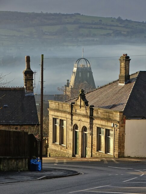
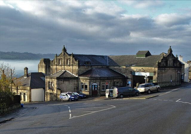
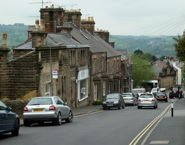
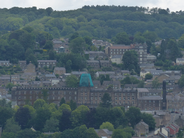
Hackney, Upper is a small village located in the county of Derbyshire, England. Situated in the picturesque Peak District National Park, it is surrounded by rolling hills, lush green meadows, and stunning natural landscapes. The village is part of the larger Hackney Parish, and despite its small size, it offers a tranquil and idyllic setting for residents and visitors alike.

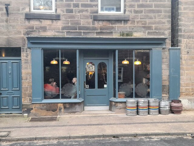
Hackney, Upper is known for its charming traditional cottages and quaint stone-built houses, which add to its rural charm. The village is primarily residential, with a close-knit community that takes pride in maintaining its historic character. The local pub, The Hackney Arms, serves as a gathering place for villagers and visitors, offering a friendly atmosphere and a selection of traditional British fare.

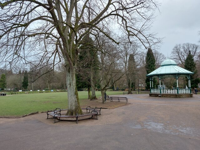
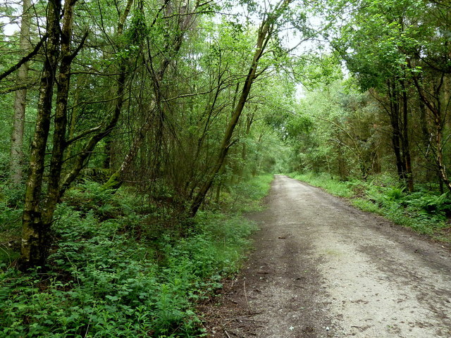
Nature enthusiasts will find plenty to explore in the surrounding area, with beautiful walking trails and hiking routes that showcase the stunning scenery of the Peak District. The nearby High Peak Trail, a former railway line, provides excellent opportunities for cycling and horse riding.

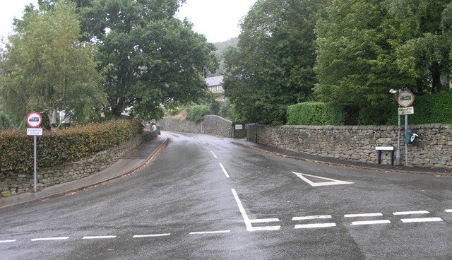
Despite its rural setting, Hackney, Upper benefits from good transport links to nearby towns and cities. The village is conveniently located within a short drive of the town of Matlock, which offers a range of amenities including shops, schools, and medical facilities.

Overall, Hackney, Upper in Derbyshire is a charming village that offers a peaceful and picturesque retreat for those seeking a rural lifestyle surrounded by natural beauty.

If you have any feedback on the listing, please let us know in the comments section below.

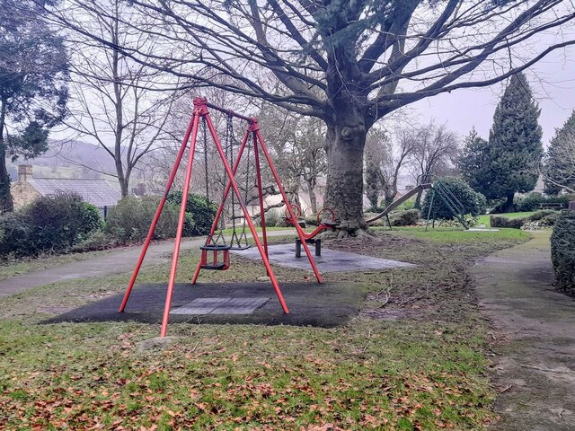
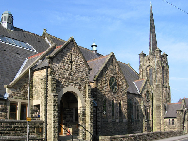
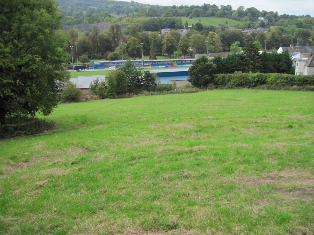
Hackney, Upper Images

Images are sourced within 2km of 53.149855/-1.572324 or Grid Reference SK2861. Thanks to Geograph Open Source API. All images are credited.

View to the tower of Smedley's Hydro Seen from Wellington Street. Smedley's Hydro was a hydropathic facility developed in the second half of the nineteenth century. In the 1950's the old building was taken over by Derbyshire County Council, becoming the organisations administrative hub. The mist in the valley was related to a high pressure weather system settling over the north of England. The illuminated building on the corner was part of the old Matlock tram depot.
View to the tower of Smedley's Hydro
Seen from Wellington Street. Smedley's Hydro was a hydropathic facility developed in the second half of the nineteenth century. In the 1950's the old building was taken over by Derbyshire County Council, becoming the organisations administrative hub. The mist in the valley was related to a high pressure weather system settling over the north of England. The illuminated building on the corner was part of the old Matlock tram depot.
Former tram depot on Matlock Bank
Hall Leys Park, Matlock
The Newsroom micropub A micropub in an old newsagents shop.
The Newsroom micropub
A micropub in an old newsagents shop.
Children's play area in Sparrow Park
Matlock - Methodist & United Reformed Church On Oak Road.
Matlock - Methodist & United Reformed Church
On Oak Road.
Towards Matlock Town FC ground
Forest track, Matlock Moor Heading through the forest east of the trig point at 302m.
Forest track, Matlock Moor
Heading through the forest east of the trig point at 302m.
Wellington Street, Matlock A view down the road which slants across the hillside to the top of the steep Matlock Bank road.
Wellington Street, Matlock
A view down the road which slants across the hillside to the top of the steep Matlock Bank road.
Buildings in Matlock Looking across the end of Hopewell Road to buildings on Smedley Street.
Buildings in Matlock
Looking across the end of Hopewell Road to buildings on Smedley Street.
Smedley Street, Matlock Former industrial buildings now form part of an imposing office complex with bridges over the street.
Smedley Street, Matlock
Former industrial buildings now form part of an imposing office complex with bridges over the street.
Matlock Telephone Exchange Matlock Strowger Telephone Exchange - pre-digital
Matlock Telephone Exchange
Matlock Strowger Telephone Exchange - pre-digital
Matlock Town football ground Looking across to the Twigg Stand.
Matlock Town football ground
Looking across to the Twigg Stand.
Coloured bonnets Not the traditional Easter variety!
Coloured bonnets
Not the traditional Easter variety!
Top end of Rutland Street, Matlock In earlier days the Matlock Spa Hotel was just below this point, it's grand central tower still visible in this picture. The building is now Derbyshire County Council offices.

The garage was originally the tram barn for the Matlock Cable Tramway cable trams from the station and the centre of town at the bottom of the hill up to the hotel. More details of that at; <span class="nowrap"><a title="http://en.wikipedia.org/wiki/Matlock_Cable_Tramway" rel="nofollow ugc noopener" href="http://en.wikipedia.org/wiki/Matlock_Cable_Tramway">Link</a><img style="margin-left:2px;" alt="External link" title="External link - shift click to open in new window" src="https://s1.geograph.org.uk/img/external.png" width="10" height="10"/></span>
Top end of Rutland Street, Matlock
In earlier days the Matlock Spa Hotel was just below this point, it's grand central tower still visible in this picture. The building is now Derbyshire County Council offices. The garage was originally the tram barn for the Matlock Cable Tramway cable trams from the station and the centre of town at the bottom of the hill up to the hotel. More details of that at; LinkExternal link
Warming up for a match at the Autoworld Arena Matlock Town FC will shortly be playing a league game.
Warming up for a match at the Autoworld Arena
Matlock Town FC will shortly be playing a league game.
Evo-Stik League match at Matlock Town The two obvious features in the distance are Riber Castle and St Giles' Church.
Evo-Stik League match at Matlock Town
The two obvious features in the distance are Riber Castle and St Giles' Church.
Matlock county offices
Show me another place!

Hackney, Upper is located at Grid Ref: SK2861 (Lat: 53.149855, Lng: -1.572324)

Administrative County: Derbyshire

District: Derbyshire Dales

Police Authority: Derbyshire

What 3 Words

///vast.decanter.beaker. Near Matlock, Derbyshire

Related Wikis

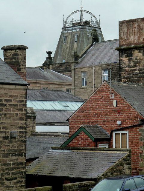
Whitworth Hospital, Matlock

Whitworth Hospital is a healthcare facility on the Bakewell Road between Darley Dale and Matlock in Derbyshire, England. It is managed by Derbyshire Community...

Hackney, Derbyshire

Hackney and Upper Hackney are areas of settlement in Derbyshire, England. The population taken at the 2011 Census is included in the civil parish of Darley...

St Elphin's School

St Elphins School was a boarding school for the daughters of the clergy of the Church of England. It was originally based in Warrington, Lancashire, England...

Farley, Derbyshire

Farley is a hamlet in the Derbyshire Dales district, in the English county of Derbyshire. It is near the town of Matlock. The nearest main road is the...

Nearby Amenities

Located within 500m of 53.149855,-1.572324
Parking
Whitworth Hospital
Lat/Long: 53.1511588/-1.5748977
Post Box
Operator: Royal Mail
Operator Wikidata: Q638098
Ref: DE4 955
Lat/Long: 53.1494446/-1.5659191
Post Box
Operator: Royal Mail
Operator Wikidata: Q638098
Ref: DE4 947
Lat/Long: 53.1499686/-1.5649687
Post Box
Brand: Royal Mail
Brand Wikidata: Q638098
Brand Wikipedia: en:Royal Mail
Operator: Royal Mail
Operator Wikidata: Q638098
Ref: DE4 1361
Lat/Long: 53.1509253/-1.5751731
Barrier: stile
Ele: 80
Steps: 1
Stile: stepover
Lat/Long: 53.149406/-1.5789304
Crossing Barrier: no
Railway: level_crossing
Lat/Long: 53.1478475/-1.5761611
Abbeybrook Cactus Nursery
Addr City: Matlock
Addr Postcode: DE4 3FP
Addr Street: Poppy Fields Close
Ele: 123
Note: Just the northern bit of the old garden centr
Shop: garden_centre
Lat/Long: 53.1491081/-1.5725995
Barrier: stile
Ele: 95
Stile: squeezer
Lat/Long: 53.1512272/-1.5789211
Ele: 107
Lat/Long: 53.1524247/-1.5776287
Ele: 94.0000000
Lat/Long: 53.1510849/-1.5790123
Ele: 131
Lat/Long: 53.148995/-1.5692916
Ele: 133
Lat/Long: 53.1487254/-1.5685414
Post Box
Lat/Long: 53.1476304/-1.5659602
Barrier: stile
Stile: squeezer
Lat/Long: 53.151191/-1.5696822
Barrier: stile
Stile: squeezer
Lat/Long: 53.1511339/-1.5685362
Barrier: stile
Stile: squeezer
Lat/Long: 53.1489362/-1.5696329
Crossing
Crossing: uncontrolled
Lat/Long: 53.1460819/-1.572493
Barrier: entrance
Lat/Long: 53.1476733/-1.5763539
Defibrillator
Emergency: defibrillator
Lat/Long: 53.1486031/-1.5746539
Generator Method: photovoltaic
Generator Output Electricity: yes
Generator Source: solar
Generator Type: solar_photovoltaic_panel
Location: roof
Power: generator
Lat/Long: 53.1480039/-1.5684249
Generator Method: photovoltaic
Generator Output Electricity: yes
Generator Source: solar
Generator Type: solar_photovoltaic_panel
Location: roof
Power: generator
Lat/Long: 53.1473701/-1.569935
Generator Method: photovoltaic
Generator Output Electricity: yes
Generator Source: solar
Generator Type: solar_photovoltaic_panel
Location: roof
Power: generator
Lat/Long: 53.1473588/-1.5701388
Generator Method: photovoltaic
Generator Output Electricity: yes
Generator Source: solar
Generator Type: solar_photovoltaic_panel
Location: roof
Power: generator
Lat/Long: 53.1473331/-1.5702032
Generator Method: photovoltaic
Generator Output Electricity: yes
Generator Source: solar
Generator Type: solar_photovoltaic_panel
Location: roof
Power: generator
Lat/Long: 53.1472704/-1.5703373
Generator Method: photovoltaic
Generator Output Electricity: yes
Generator Source: solar
Generator Type: solar_photovoltaic_panel
Location: roof
Power: generator
Lat/Long: 53.1471433/-1.5698438
Generator Method: photovoltaic
Generator Output Electricity: yes
Generator Source: solar
Generator Type: solar_photovoltaic_panel
Location: roof
Power: generator
Lat/Long: 53.1478029/-1.5720901
Generator Method: photovoltaic
Generator Output Electricity: yes
Generator Source: solar
Generator Type: solar_photovoltaic_panel
Location: roof
Power: generator
Lat/Long: 53.1478142/-1.5720231
Generator Method: photovoltaic
Generator Output Electricity: yes
Generator Source: solar
Generator Type: solar_photovoltaic_panel
Location: roof
Power: generator
Lat/Long: 53.1481311/-1.5712667
Generator Method: photovoltaic
Generator Output Electricity: yes
Generator Source: solar
Generator Type: solar_photovoltaic_panel
Location: roof
Power: generator
Lat/Long: 53.1483257/-1.5690244
Generator Method: photovoltaic
Generator Output Electricity: yes
Generator Source: solar
Generator Type: solar_photovoltaic_panel
Location: roof
Power: generator
Lat/Long: 53.1486668/-1.5692658
Generator Method: photovoltaic
Generator Output Electricity: yes
Generator Source: solar
Generator Type: solar_photovoltaic_panel
Location: roof
Power: generator
Lat/Long: 53.1497542/-1.5736673
Generator Method: photovoltaic
Generator Output Electricity: yes
Generator Source: solar
Generator Type: solar_photovoltaic_panel
Location: roof
Power: generator
Lat/Long: 53.1497944/-1.573501
Generator Method: photovoltaic
Generator Output Electricity: yes
Generator Source: solar
Generator Type: solar_photovoltaic_panel
Location: roof
Power: generator
Lat/Long: 53.1497799/-1.5738684
Generator Method: photovoltaic
Generator Output Electricity: yes
Generator Source: solar
Generator Type: solar_photovoltaic_panel
Location: roof
Power: generator
Lat/Long: 53.1502126/-1.5719104
Generator Method: photovoltaic
Generator Output Electricity: yes
Generator Source: solar
Generator Type: solar_photovoltaic_panel
Location: roof
Power: generator
Lat/Long: 53.1522095/-1.568147
Generator Method: photovoltaic
Generator Output Electricity: yes
Generator Source: solar
Generator Type: solar_photovoltaic_panel
Location: roof
Power: generator
Lat/Long: 53.1516964/-1.5687398
Generator Method: photovoltaic
Generator Output Electricity: yes
Generator Source: solar
Generator Type: solar_photovoltaic_panel
Location: roof
Power: generator
Lat/Long: 53.1538646/-1.5702579
Bus Stop
Old Hackney Lane
Bus: yes
Naptan AtcoCode: 100000008502
Naptan NaptanCode: dbsgajap
Public Transport: platform
Lat/Long: 53.1520695/-1.5770088
Bus Stop
Whitworth Hospital
Bus: yes
Naptan AtcoCode: 1000DDDW2245
Naptan NaptanCode: dbsgdadt
Public Transport: platform
Lat/Long: 53.1499317/-1.575146
Bus Stop
Whitworth Hospital
Bus: yes
Naptan AtcoCode: 1000DDDW2555
Naptan NaptanCode: dbsgdadw
Public Transport: platform
Lat/Long: 53.1500174/-1.5753405
Bus Stop
Hooley Estate
Bus: yes
Naptan AtcoCode: 1000DDDB2554
Naptan NaptanCode: dbsgdwap
Public Transport: platform
Lat/Long: 53.1470177/-1.5729225
Bus Stop
Hooley Estate
Bus: yes
Public Transport: platform
Lat/Long: 53.1457456/-1.5724323
The data included in this document is from www.openstreetmap.org. The data is made available under ODbL.

Have you been to Hackney, Upper?

Leave your review of Hackney, Upper below (or comments, questions and feedback).