Elkstone, Upper

Settlement in Staffordshire Staffordshire Moorlands

England

Elkstone, Upper

Ford at Lower Elkstone This interesting cattle bridge ford is found on the Warslow Brook at Lower Elkstone.
Ford at Lower Elkstone Credit: John Walton

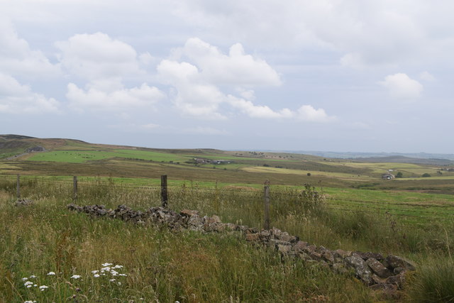
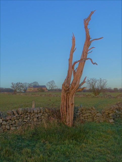
Elkstone is a small village located in the Upper Staffordshire region of England. Nestled amidst the picturesque countryside, it is surrounded by rolling hills, lush green meadows, and dense woodlands. The village is situated approximately 7 miles southwest of the Stafford town center.

The history of Elkstone can be traced back to medieval times, as evident from the presence of a 13th-century church, St. John the Baptist, which still stands as a prominent landmark in the village. The church showcases stunning architectural details and offers a glimpse into the village's rich heritage.

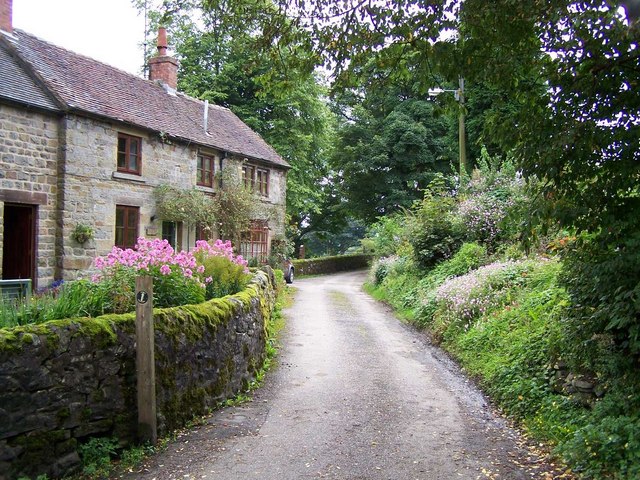
The village itself is characterized by a quaint and peaceful atmosphere, making it an ideal retreat for those seeking a tranquil countryside experience. The local community is close-knit and welcoming, with residents often engaging in various social activities and events.

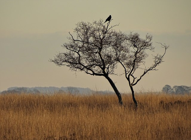
Elkstone is also known for its proximity to several natural attractions. It boasts numerous walking trails and hiking routes, allowing visitors to explore the breathtaking landscapes and enjoy the serenity of nature. The nearby Cannock Chase, an Area of Outstanding Natural Beauty, is a popular destination for outdoor enthusiasts.

While Elkstone is primarily a residential area, it offers a limited range of amenities to cater to the needs of its residents. These include a village hall, a primary school, and a few local shops. However, for more extensive facilities and entertainment options, residents can easily access the nearby towns of Stafford and Stone, which offer a wider range of services.

In conclusion, Elkstone is a charming village in Upper Staffordshire that offers a tranquil retreat amidst beautiful natural surroundings. Its rich history, friendly community, and close proximity to the Staffordshire countryside make it an appealing destination for both residents and visitors alike.

If you have any feedback on the listing, please let us know in the comments section below.

Elkstone, Upper Images

Images are sourced within 2km of 53.128663/-1.922103 or Grid Reference SK0559. Thanks to Geograph Open Source API. All images are credited.

Ford at Lower Elkstone This interesting cattle bridge ford is found on the Warslow Brook at Lower Elkstone.
Ford at Lower Elkstone
This interesting cattle bridge ford is found on the Warslow Brook at Lower Elkstone.
View from Morridge Looking east south-east from the road a short distance from the more popular viewpoint which looks west off the ridge.
View from Morridge
Looking east south-east from the road a short distance from the more popular viewpoint which looks west off the ridge.
Building at  Mixon's former copper mine
Building at Mixon's former copper mine
View to Brund Hays from Black Brook
Footbridge over The River Hamps
Approaching Black Brook When another Geograph member passed by here in 2011, the farm appeared to be abandoned but it has clearly enjoyed rejuvenation since then:- <a title="https://www.geograph.org.uk/photo/2515522" href="https://www.geograph.org.uk/photo/2515522">Link</a>
Approaching Black Brook
When another Geograph member passed by here in 2011, the farm appeared to be abandoned but it has clearly enjoyed rejuvenation since then:- Link
View across the Hamps Valley from Mixon
Stoneyfold Lane
Stoneyfold Lane
Farm ruin at Moorside with sheep I put "ruin" rather than "barn" in the title as barns do not normally have chimneys.
Farm ruin at Moorside with sheep
I put "ruin" rather than "barn" in the title as barns do not normally have chimneys.
The path to Warslow from Cowhay Head
Dead tree and view to Moorside Farm
Rough moorland pasture north of Averhill Side Sitting atop the spindly tree is an unidentified bird - surveying its domain. From studying an enhanced and magnified image, I suspect that it was a bird of prey though it may have been a corvid.
Rough moorland pasture north of Averhill Side
Sitting atop the spindly tree is an unidentified bird - surveying its domain. From studying an enhanced and magnified image, I suspect that it was a bird of prey though it may have been a corvid.
Staffordshire Moorlands Averhill Side farm track.
Staffordshire Moorlands
Averhill Side farm track.
Upper Elkstone
Upper Elkstone
Church of St. John the Baptist Upper Elkstone. Built in the late 1780s <span class="nowrap"><a title="http://www.british-history.ac.uk/report.asp?compid=22908" rel="nofollow ugc noopener" href="http://www.british-history.ac.uk/report.asp?compid=22908">Link</a><img style="margin-left:2px;" alt="External link" title="External link - shift click to open in new window" src="https://s1.geograph.org.uk/img/external.png" width="10" height="10"/></span> . Do not confuse with <a href="https://www.geograph.org.uk/photo/131437">SO9612 : Elkstone Church</a> which is dedicated to St John the Evangelist.
Church of St. John the Baptist
Upper Elkstone. Built in the late 1780s LinkExternal link . Do not confuse with SO9612 : Elkstone Church which is dedicated to St John the Evangelist.
Crow Trees Farm Lower Elkstone
Crow Trees Farm
Lower Elkstone
Stoneyfold Farm Lower Elkstone nestling in the sheltered valley of the Warslow Brook.
Stoneyfold Farm
Lower Elkstone nestling in the sheltered valley of the Warslow Brook.
Motorbike meet An area next to the reservoir is used for dirt racing, clearly with the cooperation of the landowner. Riders were not straying onto other tracks or open land
Motorbike meet
An area next to the reservoir is used for dirt racing, clearly with the cooperation of the landowner. Riders were not straying onto other tracks or open land
Show me another place!

Elkstone, Upper is located at Grid Ref: SK0559 (Lat: 53.128663, Lng: -1.922103)

Administrative County: Staffordshire

District: Staffordshire Moorlands

Police Authority: Staffordshire

What 3 Words

///strides.same.kilowatt. Near Leek, Staffordshire

Related Wikis

Warslow and Elkstones

Warslow and Elkstones is a civil parish in the district of Staffordshire Moorlands in north-east Staffordshire, England. It includes the village of Warslow...

Elkstones

Elkstones is a small hamlet in the parish of Warslow and Elkstones, consisting of Upper Elkstone and Lower Elkstone. Situated high in the Staffordshire...

River Hamps

The River Hamps is a river in Staffordshire, England. It is a tributary of the River Manifold, which itself flows into the River Dove near Ilam. For much...

Merryton Low

Merryton Low is a hill in Staffordshire, England, a few miles east of Leek. It is in the civil parish of Fawfieldhead in the local government district...

Nearby Amenities

Located within 500m of 53.128663,-1.922103
Bus Stop
Grove House
Naptan AtcoCode: 3800C812800
Naptan Bearing: NW
Naptan CommonName: Grove House
Naptan Indicator: Adj
Naptan Landmark: Grove House
Naptan Street: Main Rd
Naptan Verified: no
Source: naptan_import
Lat/Long: 53.1285528/-1.917846
Bus Stop
Grove House
Naptan AtcoCode: 3800C812801
Naptan Bearing: SE
Naptan CommonName: Grove House
Naptan Indicator: Adj
Naptan Landmark: Grove House
Naptan Street: Main Road
Naptan Verified: no
Source: naptan_import
Lat/Long: 53.1285976/-1.9176815
Barrier: stile
Lat/Long: 53.1244085/-1.9211856
Barrier: stile
Material: stone
Source: survey;bing
Stile: squeezer
Lat/Long: 53.1284242/-1.9175781
Barrier: stile
Steps: 2
Stile: stepover
Lat/Long: 53.1245496/-1.9250545
Barrier: stile
Material: wood
Source: survey;gps
Stile: stepover
Lat/Long: 53.1258703/-1.9248249
Upper Elkstone
Place: hamlet
Lat/Long: 53.1291047/-1.9178961
Barrier: stile
Material: stone
Source: survey
Stile: squeezer
Lat/Long: 53.1245506/-1.9250637
Fixme: stile or gate?
Lat/Long: 53.1254682/-1.9206312
Barrier: stile
Material: wood
Source: survey;gps
Stile: stepover
Lat/Long: 53.1261246/-1.9200483
Barrier: stile
Material: wood
Source: survey;gps
Stile: stepover
Lat/Long: 53.126794/-1.9209682
Barrier: stile
Material: wood
Source: survey;gps
Stile: stepover
Lat/Long: 53.1268241/-1.9216778
Barrier: stile
Material: wood
Source: survey;gps
Stile: stepover
Lat/Long: 53.1271183/-1.9195805
Barrier: stile
Material: stone
Source: survey;gps
Stile: squeezer
Lat/Long: 53.1281467/-1.919261
Barrier: stile
Material: wood
Source: survey;gps
Stile: stepover
Lat/Long: 53.1316903/-1.9181646
Post Box
Lat/Long: 53.1284091/-1.9175694
The data included in this document is from www.openstreetmap.org. The data is made available under ODbL.

Have you been to Elkstone, Upper?

Leave your review of Elkstone, Upper below (or comments, questions and feedback).