Eastern Green, Upper

Settlement in Warwickshire

England

Eastern Green, Upper

Old lane to Pickford Green
Old lane to Pickford Green Credit: Alan Hughes

Eastern Green is a small village located in the Upper district of Warwickshire, England. Situated just a few miles outside of the city of Coventry, Eastern Green is known for its picturesque countryside setting and peaceful atmosphere.

The village is primarily residential, with a mix of traditional cottages and newer housing developments. There are also a few local amenities, including a village shop, pub, and primary school, making it a convenient place to live for families.

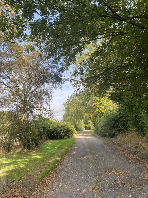
Eastern Green is surrounded by lush green fields and rolling hills, offering residents plenty of opportunities for outdoor activities such as walking, cycling, and horseback riding. The village is also located near several nature reserves and parks, providing even more options for nature lovers.

Despite its rural setting, Eastern Green is well-connected to nearby towns and cities via major roadways, making it easy for residents to commute to work or access amenities and services. Overall, Eastern Green offers a charming and peaceful place to live for those seeking a quiet village lifestyle with easy access to urban conveniences.

If you have any feedback on the listing, please let us know in the comments section below.

Eastern Green, Upper Images

Images are sourced within 2km of 52.414547/-1.587559 or Grid Reference SP2879. Thanks to Geograph Open Source API. All images are credited.

Old lane to Pickford Green
Birmingham Road at the junction of Allesley Croft
Rye Hill, Allesley
Rye Hill, Allesley
St Andrew's Church, Eastern Green This parish church of the Church of England stands on the western edge of Coventry, surrounded by fields. A red brick building in the Gothic revival style, it opened in 1875, according to the parish website, which doesn't mention the name of the architect <span class="nowrap"><a title="https://standrewseg.co.uk/information/history-of-st-andrews-church/" rel="nofollow ugc noopener" href="https://standrewseg.co.uk/information/history-of-st-andrews-church/">Link</a><img style="margin-left:2px;" alt="External link" title="External link - shift click to open in new window" src="https://s1.geograph.org.uk/img/external.png" width="10" height="10"/></span> . 

Two Giant Sequoia (Sequoiadendron giganteum) trees, otherwise known as Giant Redwood or Wellingtonia, were planted in the churchyard, on either side of the path from gate to church. One has been felled and only a huge stump remains. The other now towers over the church, and can be seen to the left of the steeple.
St Andrew's Church, Eastern Green
This parish church of the Church of England stands on the western edge of Coventry, surrounded by fields. A red brick building in the Gothic revival style, it opened in 1875, according to the parish website, which doesn't mention the name of the architect LinkExternal link . Two Giant Sequoia (Sequoiadendron giganteum) trees, otherwise known as Giant Redwood or Wellingtonia, were planted in the churchyard, on either side of the path from gate to church. One has been felled and only a huge stump remains. The other now towers over the church, and can be seen to the left of the steeple.
Gate, St Andrew's Church, Eastern Green Upper Eastern Green Lane can be seen through the churchyard gates and their decorative lamp overthrow. For more on the church itself see <a href="https://www.geograph.org.uk/photo/7524219">SP2780 : St Andrew's Church, Eastern Green</a>.
Gate, St Andrew's Church, Eastern Green
Upper Eastern Green Lane can be seen through the churchyard gates and their decorative lamp overthrow. For more on the church itself see SP2780 : St Andrew's Church, Eastern Green.
Oak tree and fencing, Pickford The fencing indicates that this still-rural part of western Coventry, to the south of the A45, is soon to be built up with housing.
Oak tree and fencing, Pickford
The fencing indicates that this still-rural part of western Coventry, to the south of the A45, is soon to be built up with housing.
Oak tree by building site fence, Pickford The fence indicates that these fields on the western edge of Coventry, south of the A45, are soon to be built up with housing. I hope the mature trees will survive the earth moving and will be incorporated into the new development. Having misread the map I was on the wrong side of the hedge; the public footpath runs along the other side, off to the right of the photo.
Oak tree by building site fence, Pickford
The fence indicates that these fields on the western edge of Coventry, south of the A45, are soon to be built up with housing. I hope the mature trees will survive the earth moving and will be incorporated into the new development. Having misread the map I was on the wrong side of the hedge; the public footpath runs along the other side, off to the right of the photo.
Footpath alongside Windmill Village Golf Club, Allesley The footpath runs down the slope from the A45 dual carriageway to a footbridge over the Pickford Brook, where it forks, with paths continuing to Lower and to Upper Eastern Green. The footpath marker has been overgrown by the hedge surrounding the golf course, but a Henry Moore hole has been cut in the hedge to reveal it. The A45 is a formidable barrier to pedestrians here and is too dangerous to cross on foot.
Footpath alongside Windmill Village Golf Club, Allesley
The footpath runs down the slope from the A45 dual carriageway to a footbridge over the Pickford Brook, where it forks, with paths continuing to Lower and to Upper Eastern Green. The footpath marker has been overgrown by the hedge surrounding the golf course, but a Henry Moore hole has been cut in the hedge to reveal it. The A45 is a formidable barrier to pedestrians here and is too dangerous to cross on foot.
Barn at Windmill Village Hotel, Allesley This barn once formed part of Windmill Farm and now belongs to the Windmill Village golf hotel complex. It has been converted sensitively, on the outside at least; whatever it may be used for now, its frontage facing the busy A45 Birmingham Road still displays the plain lines of a traditional barn, with its high double doors.
Barn at Windmill Village Hotel, Allesley
This barn once formed part of Windmill Farm and now belongs to the Windmill Village golf hotel complex. It has been converted sensitively, on the outside at least; whatever it may be used for now, its frontage facing the busy A45 Birmingham Road still displays the plain lines of a traditional barn, with its high double doors.
HPL Building, Allesley This factory with a fine art deco frontage greets travellers approaching Coventry along the A45 from Birmingham. It dates from the late 1930s, according to the Heritage Gateway site <span class="nowrap"><a title="https://www.heritagegateway.org.uk/Gateway/Results_Single.aspx?uid=MCT6355&resourceID=1029" rel="nofollow ugc noopener" href="https://www.heritagegateway.org.uk/Gateway/Results_Single.aspx?uid=MCT6355&resourceID=1029">Link</a><img style="margin-left:2px;" alt="External link" title="External link - shift click to open in new window" src="https://s1.geograph.org.uk/img/external.png" width="10" height="10"/></span> and is locally listed; see the Coventry City Council site <span class="nowrap"><a title="https://www.coventry.gov.uk/downloads/file/17245/local_list_of_buildings_of_architectural_or_historic_interest.pdf" rel="nofollow ugc noopener" href="https://www.coventry.gov.uk/downloads/file/17245/local_list_of_buildings_of_architectural_or_historic_interest.pdf">Link</a><img style="margin-left:2px;" alt="External link" title="External link - shift click to open in new window" src="https://s1.geograph.org.uk/img/external.png" width="10" height="10"/></span> . It was built for Triumph, the motorcycle manufacturers, for their service division, and was known as the 'Model Garage', according to Dave Gleed, who worked there and is quoted by Our Warwickshire <span class="nowrap"><a title="https://www.ourwarwickshire.org.uk/content/article/old-standard-triumph-buildings" rel="nofollow ugc noopener" href="https://www.ourwarwickshire.org.uk/content/article/old-standard-triumph-buildings">Link</a><img style="margin-left:2px;" alt="External link" title="External link - shift click to open in new window" src="https://s1.geograph.org.uk/img/external.png" width="10" height="10"/></span> :  "I loved my job, working with a great bunch of lads. It was like being in the army again, a band of brothers. I mean, you spend more time with them than with your wives."

On reflection, I think the style is more art moderne than art deco, like the Tollgate pub not far away on Holyhead Road in Allesley - a sleek, streamlined style for the new motor roads of the 1930s. The strong horizontal lines, curved corners and glass bricks all suggest art moderne; see the Architectural Styles blog <span class="nowrap"><a title="https://architecturestyles.org/art-deco/" rel="nofollow ugc noopener" href="https://architecturestyles.org/art-deco/">Link</a><img style="margin-left:2px;" alt="External link" title="External link - shift click to open in new window" src="https://s1.geograph.org.uk/img/external.png" width="10" height="10"/></span> .
HPL Building, Allesley
This factory with a fine art deco frontage greets travellers approaching Coventry along the A45 from Birmingham. It dates from the late 1930s, according to the Heritage Gateway site LinkExternal link and is locally listed; see the Coventry City Council site LinkExternal link . It was built for Triumph, the motorcycle manufacturers, for their service division, and was known as the 'Model Garage', according to Dave Gleed, who worked there and is quoted by Our Warwickshire LinkExternal link : "I loved my job, working with a great bunch of lads. It was like being in the army again, a band of brothers. I mean, you spend more time with them than with your wives." On reflection, I think the style is more art moderne than art deco, like the Tollgate pub not far away on Holyhead Road in Allesley - a sleek, streamlined style for the new motor roads of the 1930s. The strong horizontal lines, curved corners and glass bricks all suggest art moderne; see the Architectural Styles blog LinkExternal link .
Flats, Birmingham Road, Allesley These council flats in Allesley resemble the ones built around 1950 by the Coventry Corporation City Architect's department under Donald Gibson in the Stonebridge estate on the south side of the city; see <a href="https://www.geograph.org.uk/photo/7588116">SP3375 : Flats, Gregory Hood Road, Coventry</a>. The layout is similar, too; some, like these, face onto a green and the main road, others are laid out in monotonous parallel lines, as at Stonebridge.
Flats, Birmingham Road, Allesley
These council flats in Allesley resemble the ones built around 1950 by the Coventry Corporation City Architect's department under Donald Gibson in the Stonebridge estate on the south side of the city; see SP3375 : Flats, Gregory Hood Road, Coventry. The layout is similar, too; some, like these, face onto a green and the main road, others are laid out in monotonous parallel lines, as at Stonebridge.
Western approach to Allesley Village Allesley is a historic Warwickshire village which has become a suburb of Coventry on the city's western edge. A fine ash tree, with a sweet chestnut alongside (to the left in this photo) stand at the junction of Rye Hill and Birmingham Road where visitors enter the village from the west.
Western approach to Allesley Village
Allesley is a historic Warwickshire village which has become a suburb of Coventry on the city's western edge. A fine ash tree, with a sweet chestnut alongside (to the left in this photo) stand at the junction of Rye Hill and Birmingham Road where visitors enter the village from the west.
Boundary Marker by Birmingham Road, Allesley This cast iron post marks the boundary between the city of Coventry and the parish of Allesley from 1st April 1926, when Coventry was extended westward with the purchase of land from the Stoneleigh estate, which was to become the western suburbs of the city. In 1974 Allesley, too, became part of Coventry, though it retains its own parish council.
Boundary Marker by Birmingham Road, Allesley
This cast iron post marks the boundary between the city of Coventry and the parish of Allesley from 1st April 1926, when Coventry was extended westward with the purchase of land from the Stoneleigh estate, which was to become the western suburbs of the city. In 1974 Allesley, too, became part of Coventry, though it retains its own parish council.
Quality Hotel, Allesley Situated on the Birmingham Road on the western approach to Coventry, this building has a 1930s appearance, with a pair of Dutch gables and two pairs of gate piers topped with prancing horses. The A45 bypass, which runs past it, was built at this time.
Quality Hotel, Allesley
Situated on the Birmingham Road on the western approach to Coventry, this building has a 1930s appearance, with a pair of Dutch gables and two pairs of gate piers topped with prancing horses. The A45 bypass, which runs past it, was built at this time.
Pond on Windmill Hill, Allesley A public footpath that crosses the ridge, roughly parallel to the Birmingham Road, runs past this pond. The Coventry Hill Hotel can be seen in the distance.
Pond on Windmill Hill, Allesley
A public footpath that crosses the ridge, roughly parallel to the Birmingham Road, runs past this pond. The Coventry Hill Hotel can be seen in the distance.
Field path from Flint's Green to Upper Eastern Green The path runs from Back Lane to Church Lane by Eastern Green church.
Field path from Flint's Green to Upper Eastern Green
The path runs from Back Lane to Church Lane by Eastern Green church.
Field path with ash tree, Upper Eastern Green We are on the western edge of Coventry; the city boundary passes between the viewer and the tree. The path runs between Flint's Green and Upper Eastern Green in the Meriden Gap between Coventry and Birmingham, part of the ancient countryside of Arden.
Field path with ash tree, Upper Eastern Green
We are on the western edge of Coventry; the city boundary passes between the viewer and the tree. The path runs between Flint's Green and Upper Eastern Green in the Meriden Gap between Coventry and Birmingham, part of the ancient countryside of Arden.
Upper Eastern Green, seen from Church Lane The grand Victorian house seen across a field of oilseed rape presumably is, or was, the vicarage. The Coventry Society tells us that Eastern Green was historically the green at the eastern end of Meriden parish. Today it forms part of Coventry, at the western edge of the city <span class="nowrap"><a title="https://www.coventrysociety.org.uk/coventry-neighbourhoods/eastern-green/" rel="nofollow ugc noopener" href="https://www.coventrysociety.org.uk/coventry-neighbourhoods/eastern-green/">Link</a><img style="margin-left:2px;" alt="External link" title="External link - shift click to open in new window" src="https://s1.geograph.org.uk/img/external.png" width="10" height="10"/></span> .
Upper Eastern Green, seen from Church Lane
The grand Victorian house seen across a field of oilseed rape presumably is, or was, the vicarage. The Coventry Society tells us that Eastern Green was historically the green at the eastern end of Meriden parish. Today it forms part of Coventry, at the western edge of the city LinkExternal link .
Show me another place!

Eastern Green, Upper is located at Grid Ref: SP2879 (Lat: 52.414547, Lng: -1.587559)

Unitary Authority: Coventry

Police Authority: West Midlands

What 3 Words

///newest.first.class. Near Berkswell, West Midlands

Related Wikis

Eastern Green

Eastern Green is a mainly residential suburb in the far west of Coventry, England, and was formerly a village in Warwickshire. Its most western area is...

Woodlands Academy, Coventry

Woodlands Academy (formerly The Woodlands School and Sports College) was a boys secondary school situated in west Coventry in the West Midlands, England...

Massey Ferguson F.C.

Massey Ferguson Sports & Social F.C. are a football club based in Coventry, England. They joined the Midland Combination Division Two in 1993. They currently...

Tile Hill Wood

Tile Hill Wood is a wood between Hawthorn Lane and Banner Lane in the Tile Hill area of Coventry, England. It has been designated as a Site of Special...

Nearby Amenities

Located within 500m of 52.414547,-1.587559
Eastern Green
Created By: Potlatch 0.10f
Is In: Coventry
Place: suburb
Wikidata: Q5330162
Lat/Long: 52.4153063/-1.5878573
Bus Stop
Upper Eastern Green Lane / Windermere Ave
NaPTANAreaCode: 43000073601
Bench: yes
Bin: yes
Bus: yes
Naptan AtcoCode: 43000073601
Naptan Bearing: E
Naptan BusStopType: MKD
Naptan CommonName: Windermere Ave
Naptan Indicator: opp
Naptan NaptanCode: nwmgagag
Naptan PlusbusZoneRef: BHAMNWS
Naptan Status: ACT
Naptan StopType: BCT
Naptan Street: UPPER EASTERN GREEN LANE
Naptan Towards: City Centre
Naptan Verified: no
Public Transport: platform
Route Ref: 10;43W
Shelter: yes
Shelter Ref: 711411
Source: WMCA
Tactile Paving: no
Lat/Long: 52.4169915/-1.5842897
Bus Stop
Upper Eastern Green Lane / Windermere Ave
Bench: no
Bin: no
Bus: yes
Naptan AtcoCode: 43000073602
Naptan Bearing: W
Naptan BusStopType: MKD
Naptan CommonName: Windermere Ave
Naptan Indicator: adj
Naptan NaptanCode: nwmgagaj
Naptan PlusbusZoneRef: BHAMNWS
Naptan Status: ACT
Naptan StopType: BCT
Naptan Street: UPPER EASTERN GREEN LANE
Naptan Towards: Eastern Green
Naptan Verified: no
Public Transport: platform
Route Ref: 10;43;43A;43W
Shelter: no
Source: WMCA
Tactile Paving: no
Lat/Long: 52.4169543/-1.5830972
Bus Stop
Broad Lane / Vesey & Sharples Works
Bench: no
Bin: no
Bus: yes
Lit: yes
Naptan AtcoCode: 43000075101
Naptan Bearing: E
Naptan BusStopType: MKD
Naptan CommonName: Vesey & Sharples Works
Naptan Indicator: opp
Naptan NaptanCode: nwmgagmt
Naptan PlusbusZoneRef: BHAMNWS
Naptan Status: ACT
Naptan StopType: BCT
Naptan Street: BROAD LANE
Naptan Towards: City Centre
Naptan Verified: no
Public Transport: platform
Route Ref: 6A;43;43A;43W
Shelter: no
Source: WMCA
Tactile Paving: no
Lat/Long: 52.412252/-1.5828587
Bus Stop
Broad Lane / Vesey & Sharples Works
Bench: no
Bin: no
Bus: yes
Lit: yes
Naptan AtcoCode: 43000075102
Naptan Bearing: W
Naptan BusStopType: MKD
Naptan CommonName: Vesey & Sharples Works
Naptan Indicator: adj
Naptan NaptanCode: nwmgagmw
Naptan PlusbusZoneRef: BHAMNWS
Naptan Status: ACT
Naptan StopType: BCT
Naptan Street: BROAD LANE
Naptan Towards: Eastern Green
Naptan Verified: no
Public Transport: platform
Route Ref: 6A;43W
Shelter: no
Source: WMCA
Tactile Paving: no
Lat/Long: 52.4122471/-1.5832986
Bus Stop
Broad Lane / Hawthorn Lane
NaPTANAreaCode: 43000075201
Bench: yes
Bin: no
Bus: yes
Lit: yes
Naptan AtcoCode: 43000075201
Naptan Bearing: E
Naptan BusStopType: MKD
Naptan CommonName: Hawthorn Lane
Naptan Indicator: opp
Naptan NaptanCode: nwmgagpa
Naptan PlusbusZoneRef: BHAMNWS
Naptan Status: ACT
Naptan StopType: BCT
Naptan Street: BROAD LANE
Naptan Towards: City Centre
Public Transport: platform
Route Ref: 6A;43;43A;43W
Shelter: yes
Shelter Ref: 711407
Source: WMCA
Tactile Paving: no
Lat/Long: 52.4127453/-1.585718
Bus Stop
Broad Lane / Hawthorn Lane
Bench: no
Bin: no
Bus: yes
Lit: yes
Naptan AtcoCode: 43000075202
Naptan Bearing: W
Naptan BusStopType: MKD
Naptan CommonName: Hawthorn Lane
Naptan Indicator: adj
Naptan NaptanCode: nwmgagpd
Naptan PlusbusZoneRef: BHAMNWS
Naptan Status: ACT
Naptan StopType: BCT
Naptan Street: BROAD LANE
Naptan Towards: Eastern Green
Naptan Verified: no
Public Transport: platform
Route Ref: 6A;43W
Shelter: no
Source: WMCA
Tactile Paving: yes
Lat/Long: 52.4127949/-1.5868074
Bus Stop
Broad Lane / Farcroft Ave
Bench: no
Bin: no
Bus: yes
Lit: yes
Naptan AtcoCode: 43000075301
Naptan Bearing: E
Naptan BusStopType: MKD
Naptan CommonName: Farcroft Ave
Naptan Indicator: adj
Naptan NaptanCode: nwmgagpg
Naptan PlusbusZoneRef: BHAMNWS
Naptan Status: ACT
Naptan StopType: BCT
Naptan Street: BROAD LANE
Naptan Towards: City Centre
Naptan Verified: no
Public Transport: platform
Route Ref: 6A;43;43A;43W
Shelter: no
Source: WMCA
Tactile Paving: no
Lat/Long: 52.4133729/-1.5916682
Bus Stop
Upper Eastern Green Lane / Sutton Ave
Bench: no
Bin: yes
Bus: yes
Naptan AtcoCode: 43000075501
Naptan Bearing: NW
Naptan BusStopType: MKD
Naptan CommonName: Sutton Ave
Naptan Indicator: adj
Naptan NaptanCode: nwmgagpw
Naptan PlusbusZoneRef: BHAMNWS
Naptan Status: ACT
Naptan StopType: BCT
Naptan Street: UPPER EASTERN GREEN LANE
Naptan Towards: Eastern Green
Naptan Verified: no
Public Transport: platform
Route Ref: 10;43;43A;43W
Shelter: no
Source: WMCA
Tactile Paving: no
Lat/Long: 52.4172655/-1.5867694
Bus Stop
Upper Eastern Green Lane / Sutton Avenue
Bench: no
Bin: no
Bus: yes
Naptan AtcoCode: 43000075502
Naptan Bearing: SE
Naptan BusStopType: MKD
Naptan CommonName: Sutton Avenue
Naptan Indicator: opp
Naptan NaptanCode: nwmgagta
Naptan PlusbusZoneRef: BHAMNWS
Naptan Status: ACT
Naptan StopType: BCT
Naptan Street: UPPER EASTERN GREEN LANE
Naptan Towards: City Centre
Naptan Verified: no
Public Transport: platform
Route Ref: 10;43W
Shelter: no
Source: WMCA
Tactile Paving: no
Lat/Long: 52.4172778/-1.5863617
Bus Stop
Unicorn Ave / Sutton Avenue
Bench: no
Bin: no
Bus: yes
Naptan AtcoCode: 43000177501
Naptan Bearing: W
Naptan BusStopType: MKD
Naptan CommonName: Sutton Avenue
Naptan Indicator: opp
Naptan NaptanCode: nwmdpdtw
Naptan PlusbusZoneRef: BHAMNWS
Naptan Status: ACT
Naptan StopType: BCT
Naptan Street: UNICORN AVE
Naptan Towards: Eastern Green
Naptan Verified: no
Public Transport: platform
Shelter: no
Source: WMCA
Tactile Paving: no
Lat/Long: 52.415682/-1.5871574
Bus Stop
Unicorn Ave / Sutton Avenue
Bench: no
Bin: no
Bus: yes
Naptan AtcoCode: 43000177502
Naptan Bearing: E
Naptan BusStopType: MKD
Naptan CommonName: Sutton Avenue
Naptan Indicator: adj
Naptan NaptanCode: nwmtgpjt
Naptan PlusbusZoneRef: BHAMNWS
Naptan Status: ACT
Naptan StopType: BCT
Naptan Street: UNICORN AVE
Naptan Towards: Mount Nod
Naptan Verified: no
Public Transport: platform
Shelter: no
Source: WMCA
Tactile Paving: no
Lat/Long: 52.4159863/-1.5887278
Bus Stop
Farcroft Avenue / Sutton Avenue
NaPTANAreaCode: 43000077401
Bench: yes
Bin: no
Bus: yes
Naptan AtcoCode: 43000077401
Naptan Bearing: S
Naptan BusStopType: MKD
Naptan CommonName: Sutton Avenue
Naptan Indicator: opp
Naptan NaptanCode: nwmgajgj
Naptan PlusbusZoneRef: BHAMNWS
Naptan Status: ACT
Naptan StopType: BCT
Naptan Street: FARCROFT AVENUE
Naptan Towards: Eastern Green
Naptan Verified: no
Public Transport: platform
Route Ref: 10;43;43A;43W
Shelter: yes
Shelter Ref: 711442
Source: WMCA
Tactile Paving: no
Lat/Long: 52.4151119/-1.5925969
Bus Stop
Farcroft Avenue / Sutton Avenue
NaPTANAreaCode: 43000077402
Bench: yes
Bin: no
Bus: yes
Naptan AtcoCode: 43000077402
Naptan Bearing: N
Naptan BusStopType: MKD
Naptan CommonName: Sutton Avenue
Naptan Indicator: adj
Naptan NaptanCode: nwmtgpma
Naptan PlusbusZoneRef: BHAMNWS
Naptan Status: ACT
Naptan StopType: BCT
Naptan Street: FARCROFT AVENUE
Naptan Towards: City Centre
Naptan Verified: no
Public Transport: platform
Route Ref: 10;43W
Shelter: yes
Shelter Ref: 0077402
Source: WMCA
Tactile Paving: no
Lat/Long: 52.4150677/-1.5927337
Unicorn Ave / Windermere Avenue
Naptan AtcoCode: 43000077501
Naptan Bearing: E
Naptan BusStopType: MKD
Naptan CommonName: Windermere Avenue
Naptan Indicator: adj
Naptan NaptanCode: nwmgajgm
Naptan PlusbusZoneRef: BHAMNWS
Naptan Status: ACT
Naptan StopType: BCT
Naptan Street: UNICORN AVE
Naptan Towards: Mount Nod
Naptan Verified: no
Note: DOES NOT EXIST
Source: WMCA
Lat/Long: 52.415989/-1.5844846
Bus Stop
Unicorn Ave / Windermere Avenue
Bench: no
Bin: no
Bus: yes
Naptan AtcoCode: 43000077502
Naptan Bearing: W
Naptan BusStopType: MKD
Naptan CommonName: Windermere Avenue
Naptan Indicator: opp
Naptan NaptanCode: nwmtgpjw
Naptan PlusbusZoneRef: BHAMNWS
Naptan Status: ACT
Naptan StopType: BCT
Naptan Street: UNICORN AVE
Naptan Towards: Eastern Green
Naptan Verified: no
Public Transport: platform
Shelter: no
Source: WMCA
Tactile Paving: no
Lat/Long: 52.415935/-1.5844149
Bus Stop
Unicorn Ave / Kimberley Close
Bench: no
Bin: no
Bus: yes
Naptan AtcoCode: 43000114001
Naptan Bearing: E
Naptan BusStopType: MKD
Naptan CommonName: Kimberley Close
Naptan Indicator: adj
Naptan NaptanCode: nwmdpamt
Naptan PlusbusZoneRef: BHAMNWS
Naptan Status: ACT
Naptan StopType: BCT
Naptan Street: UNICORN AVE
Naptan Towards: Mount Nod
Naptan Verified: no
Public Transport: platform
Shelter: no
Source: WMCA
Tactile Paving: no
Lat/Long: 52.4161173/-1.5818843
Bus Stop
Broad Lane / The Woodlands School
Bench: no
Bin: no
Bus: yes
Lit: yes
Naptan AtcoCode: 43001056101
Naptan Bearing: W
Naptan BusStopType: MKD
Naptan CommonName: The Woodlands School
Naptan Indicator: adj
Naptan NaptanCode: nwmtwtwp
Naptan PlusbusZoneRef: BHAMNWS
Naptan Status: ACT
Naptan StopType: BCT
Naptan Street: BROAD LANE
Naptan Towards: Eastern Green
Naptan Verified: no
Public Transport: platform
Route Ref: 6A;43W
Shelter: no
Source: WMCA
Tactile Paving: yes
Lat/Long: 52.41315/-1.5906415
Bus Stop
Upper Eastern Green Lane / Rose Cottage Flats
Bench: no
Bin: no
Bus: yes
Naptan AtcoCode: 43001549401
Naptan Bearing: SE
Naptan BusStopType: MKD
Naptan CommonName: Rose Cottage Flats
Naptan Indicator: opp
Naptan NaptanCode: nwmtptwt
Naptan PlusbusZoneRef: BHAMNWS
Naptan Status: ACT
Naptan StopType: BCT
Naptan Street: UPPER EASTERN GREEN LANE
Naptan Towards: City Centre
Naptan Verified: no
Public Transport: platform
Route Ref: 10;43W
Shelter: no
Source: WMCA
Tactile Paving: no
Lat/Long: 52.4181474/-1.5908243
Bus Stop
Upper Eastern Green Lane / Rose Cottage Flats
Bench: no
Bin: no
Bus: yes
Naptan AtcoCode: 43001549402
Naptan Bearing: NW
Naptan BusStopType: MKD
Naptan CommonName: Rose Cottage Flats
Naptan Indicator: adj
Naptan NaptanCode: nwmtpwad
Naptan PlusbusZoneRef: BHAMNWS
Naptan Status: ACT
Naptan StopType: BCT
Naptan Street: UPPER EASTERN GREEN LANE
Naptan Towards: Eastern Green
Naptan Verified: no
Public Transport: platform
Route Ref: 10;43;43A;43W
Shelter: no
Source: WMCA
Tactile Paving: no
Lat/Long: 52.4179526/-1.5903059
Post Box
Collection Times: Mo-Fr 16:00, Sa 10:30
Operator: Royal Mail
Operator Wikidata: Q638098
Post Box Type: pillar
Ref: CV5 129
Royal Cypher: EIIR
Royal Cypher Wikidata: Q33102113
Source: survey
Lat/Long: 52.4127013/-1.5851292
Crossing
Button Operated: yes
Crossing: traffic_signals
Crossing Island: no
Crossing Ref: pelican
Tactile Paving: yes
Traffic Signals Sound: yes
Traffic Signals Vibration: no
Lat/Long: 52.4134529/-1.5924899
the Robins
Addr City: Coventry
Addr Housenumber: 30
Addr Postcode: CV5 7GE
Addr Street: Handsworth Crescent
Lat/Long: 52.4129999/-1.5814579
Crossing
Crossing: uncontrolled
Crossing Island: no
Kerb: lowered
Lat/Long: 52.4135488/-1.5933074
Post Box
Collection Times: Mo-Fr 16:00, Sa 10:30
Operator: Royal Mail
Operator Wikidata: Q638098
Post Box Type: pillar
Ref: CV5 401
Royal Cypher: EIIR
Royal Cypher Wikidata: Q33102113
Source: survey
Lat/Long: 52.4155511/-1.5926603
Bus Stop
Unicorn Ave / Derwent Close
Bench: no
Bin: no
Bus: yes
Naptan AtcoCode: 43000177901
Naptan Bearing: E
Naptan BusStopType: MKD
Naptan CommonName: Derwent Close
Naptan Indicator: adj
Naptan NaptanCode: nwmwatpj
Naptan Status: ACT
Naptan StopType: BCT
Naptan Street: UNICORN AVE
Naptan Towards: Mount Nod
Public Transport: platform
Shelter: no
Source: WMCA
Tactile Paving: no
Lat/Long: 52.4158784/-1.5852774
Bus Stop
Sutton Ave / Moyle Crescent
Bench: no
Bin: no
Bus: yes
Naptan AtcoCode: 43000177801
Naptan Bearing: W
Naptan BusStopType: MKD
Naptan CommonName: Moyle Crescent
Naptan Indicator: opp
Naptan NaptanCode: nwmwatpg
Naptan Status: ACT
Naptan StopType: BCT
Naptan Street: SUTTON AVE
Naptan Towards: Eastern Green
Public Transport: platform
Shelter: no
Source: WMCA
Tactile Paving: no
Lat/Long: 52.4153732/-1.5907855
Generator Method: photovoltaic
Generator Output Electricity: yes
Generator Source: solar
Generator Type: solar_photovoltaic_panel
Location: roof
Power: generator
Lat/Long: 52.4175485/-1.5910488
Generator Method: photovoltaic
Generator Output Electricity: yes
Generator Source: solar
Generator Type: solar_photovoltaic_panel
Location: roof
Power: generator
Lat/Long: 52.4160034/-1.5926166
Generator Method: photovoltaic
Generator Output Electricity: yes
Generator Source: solar
Generator Type: solar_photovoltaic_panel
Location: roof
Power: generator
Lat/Long: 52.4160206/-1.5916657
Generator Method: photovoltaic
Generator Output Electricity: yes
Generator Source: solar
Generator Type: solar_photovoltaic_panel
Location: roof
Power: generator
Lat/Long: 52.4163985/-1.592752
Generator Method: photovoltaic
Generator Output Electricity: yes
Generator Source: solar
Generator Type: solar_photovoltaic_panel
Location: roof
Power: generator
Lat/Long: 52.4163559/-1.5932643
Generator Method: photovoltaic
Generator Output Electricity: yes
Generator Source: solar
Generator Type: solar_photovoltaic_panel
Location: roof
Power: generator
Lat/Long: 52.4113104/-1.5855932
Generator Method: photovoltaic
Generator Output Electricity: yes
Generator Source: solar
Generator Type: solar_photovoltaic_panel
Location: roof
Power: generator
Lat/Long: 52.4138709/-1.5849173
Generator Method: photovoltaic
Generator Output Electricity: yes
Generator Source: solar
Generator Type: solar_photovoltaic_panel
Location: roof
Power: generator
Lat/Long: 52.412778/-1.5830746
Generator Method: photovoltaic
Generator Output Electricity: yes
Generator Source: solar
Generator Type: solar_photovoltaic_panel
Location: roof
Power: generator
Lat/Long: 52.4171412/-1.584861
Generator Method: photovoltaic
Generator Output Electricity: yes
Generator Source: solar
Generator Type: solar_photovoltaic_panel
Location: roof
Power: generator
Lat/Long: 52.417241/-1.5855771
Generator Method: photovoltaic
Generator Output Electricity: yes
Generator Source: solar
Generator Type: solar_photovoltaic_panel
Location: roof
Power: generator
Lat/Long: 52.4172606/-1.5856603
Generator Method: photovoltaic
Generator Output Electricity: yes
Generator Source: solar
Generator Type: solar_photovoltaic_panel
Location: roof
Power: generator
Lat/Long: 52.4173031/-1.5859526
Generator Method: photovoltaic
Generator Output Electricity: yes
Generator Source: solar
Generator Type: solar_photovoltaic_panel
Location: roof
Power: generator
Lat/Long: 52.4173162/-1.5860519
Generator Method: photovoltaic
Generator Output Electricity: yes
Generator Source: solar
Generator Type: solar_photovoltaic_panel
Location: roof
Power: generator
Lat/Long: 52.4173751/-1.5863469
Generator Method: photovoltaic
Generator Output Electricity: yes
Generator Source: solar
Generator Type: solar_photovoltaic_panel
Location: roof
Power: generator
Lat/Long: 52.4178953/-1.5887475
Generator Method: photovoltaic
Generator Output Electricity: yes
Generator Source: solar
Generator Type: solar_photovoltaic_panel
Location: roof
Power: generator
Lat/Long: 52.4169972/-1.5919179
Generator Method: photovoltaic
Generator Output Electricity: yes
Generator Source: solar
Generator Type: solar_photovoltaic_panel
Location: roof
Power: generator
Lat/Long: 52.4173833/-1.5917033
Generator Method: photovoltaic
Generator Output Electricity: yes
Generator Source: solar
Generator Type: solar_photovoltaic_panel
Location: roof
Power: generator
Lat/Long: 52.4175305/-1.5905526
Generator Method: photovoltaic
Generator Output Electricity: yes
Generator Source: solar
Generator Type: solar_photovoltaic_panel
Location: roof
Power: generator
Lat/Long: 52.4175321/-1.5909603
Generator Method: photovoltaic
Generator Output Electricity: yes
Generator Source: solar
Generator Type: solar_photovoltaic_panel
Location: roof
Power: generator
Lat/Long: 52.4147069/-1.5867399
Generator Method: photovoltaic
Generator Output Electricity: yes
Generator Source: solar
Generator Type: solar_photovoltaic_panel
Location: roof
Power: generator
Lat/Long: 52.416513/-1.5864877
Generator Method: photovoltaic
Generator Output Electricity: yes
Generator Source: solar
Generator Type: solar_photovoltaic_panel
Location: roof
Power: generator
Lat/Long: 52.4145089/-1.5929599
Generator Method: photovoltaic
Generator Output Electricity: yes
Generator Source: solar
Generator Type: solar_photovoltaic_panel
Location: roof
Power: generator
Lat/Long: 52.4169939/-1.5879737
Generator Method: photovoltaic
Generator Output Electricity: yes
Generator Source: solar
Generator Type: solar_photovoltaic_panel
Location: roof
Power: generator
Lat/Long: 52.4147772/-1.5861364
Generator Method: photovoltaic
Generator Output Electricity: yes
Generator Source: solar
Generator Type: solar_photovoltaic_panel
Location: roof
Power: generator
Lat/Long: 52.4168287/-1.590275
Generator Method: photovoltaic
Generator Output Electricity: yes
Generator Source: solar
Generator Type: solar_photovoltaic_panel
Location: roof
Power: generator
Lat/Long: 52.4171951/-1.5872441
Generator Method: photovoltaic
Generator Output Electricity: yes
Generator Source: solar
Generator Type: solar_photovoltaic_panel
Location: roof
Power: generator
Lat/Long: 52.4175649/-1.5912138
Generator Method: photovoltaic
Generator Output Electricity: yes
Generator Source: solar
Generator Type: solar_photovoltaic_panel
Location: roof
Power: generator
Lat/Long: 52.4145989/-1.5888159
Generator Method: photovoltaic
Generator Output Electricity: yes
Generator Source: solar
Generator Type: solar_photovoltaic_panel
Location: roof
Power: generator
Lat/Long: 52.4161531/-1.5912272
Ford: stepping_stones
Lat/Long: 52.4150284/-1.5859436
The data included in this document is from www.openstreetmap.org. The data is made available under ODbL.

Have you been to Eastern Green, Upper?

Leave your review of Eastern Green, Upper below (or comments, questions and feedback).