Bruntingthorpe, Upper

Settlement in Leicestershire Harborough

England

Bruntingthorpe, Upper

Bruntingthorpe Aerodrome: aerial 2021 (1)
Bruntingthorpe Aerodrome: aerial 2021 (1) Credit: Simon Tomson

Bruntingthorpe is a small village located in the district of Harborough, in the county of Leicestershire, England. It is situated approximately 6 miles south of Lutterworth and 15 miles east of Leicester.

The village is primarily an agricultural community, surrounded by rolling fields and picturesque countryside. It has a population of around 300 residents, making it a peaceful and close-knit community.

One of the notable features of Bruntingthorpe is its proximity to Bruntingthorpe Airfield and Proving Ground. This former Royal Air Force station is now privately owned and serves as a testing ground for various automotive and aviation companies. The airfield also hosts regular events such as car shows and aviation exhibitions, attracting visitors from across the region.

Within the village, there is a primary school, providing education for local children up to the age of 11. Additionally, there is a village hall which serves as a community hub, hosting various events and activities throughout the year.

The village is well-connected to nearby towns and cities, with good road links via the A426 and the M1 motorway. This allows residents easy access to amenities and services in larger urban areas.

Overall, Bruntingthorpe offers a tranquil and picturesque setting, with its rural charm and community spirit making it an attractive place to live for those seeking a peaceful countryside lifestyle.

If you have any feedback on the listing, please let us know in the comments section below.

Bruntingthorpe, Upper Images

Images are sourced within 2km of 52.487895/-1.106366 or Grid Reference SP6088. Thanks to Geograph Open Source API. All images are credited.

Bruntingthorpe Aerodrome: aerial 2021 (1)
Bruntingthorpe Aerodrome: aerial 2021 (2)
Bruntingthorpe Aerodrome aerial 2021 (3)
Bruntingthorpe Aerodrome: aerial 2021 (4)
Mere Road Heading north from Walton.
Mere Road
Heading north from Walton.
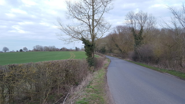
The road to Bruntingthorpe The minor road from Peatling Parva towards Bruntingthorpe.
The road to Bruntingthorpe
The minor road from Peatling Parva towards Bruntingthorpe.
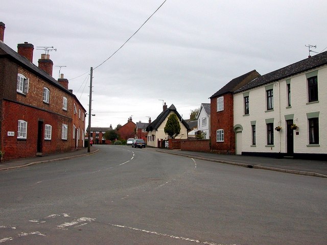
Walton village Houses in the centre of Walton village.
Walton village
Houses in the centre of Walton village.
Former R.A.F. Bruntingthorpe: aerial 2018 (3)
Bruntingthorpe-The Plough On Main Street, one of two public houses in the village.
Bruntingthorpe-The Plough
On Main Street, one of two public houses in the village.
Bruntingthorpe Proving Ground With car club outing
Bruntingthorpe Proving Ground
With car club outing
Bruntingthorpe Plough Main Street.
Bruntingthorpe Plough
Main Street.
Bruntingthorpe Joiners Arms Church Walk. Gastropub.
Bruntingthorpe Joiners Arms
Church Walk. Gastropub.
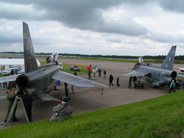
Bruntingthorpe Lightning F.6 English Electric Lightning F.6 fighter taxiing at Bruntingthorpe, Fast Jets Day, August 26th, 2012.
Bruntingthorpe Lightning F.6
English Electric Lightning F.6 fighter taxiing at Bruntingthorpe, Fast Jets Day, August 26th, 2012.
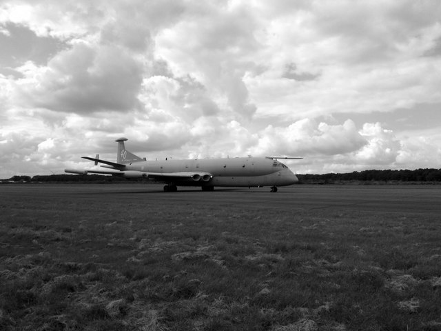
Bruntingthorpe Fast Jets Day August 2012, Nimrod HS Nimrod taxiing down before starting a fast run at Bruntingthorpe Fast Jets Day August 26th, 2012.
Bruntingthorpe Fast Jets Day August 2012, Nimrod
HS Nimrod taxiing down before starting a fast run at Bruntingthorpe Fast Jets Day August 26th, 2012.
Bruntingthorpe Fast Jets Day August 2012, Nimrod HS Nimrod taxiing before commencing it's run at Bruntingthorpe Fast Jets Day, August 26th, 2012. Up-close and loud!.
Bruntingthorpe Fast Jets Day August 2012, Nimrod
HS Nimrod taxiing before commencing it's run at Bruntingthorpe Fast Jets Day, August 26th, 2012. Up-close and loud!.
Bruntingthorpe Fast Jets Day August 2012, Buccaneer Buccaneer at the start of its fast run at Bruntingthorpe Open Day, August 26th, 2012.
Bruntingthorpe Fast Jets Day August 2012, Buccaneer
Buccaneer at the start of its fast run at Bruntingthorpe Open Day, August 26th, 2012.
Show me another place!

Bruntingthorpe, Upper is located at Grid Ref: SP6088 (Lat: 52.487895, Lng: -1.106366)

Administrative County: Leicestershire

District: Harborough

Police Authority: Leicestershire

What 3 Words

///disgraced.regal.pardon. Near Husbands Bosworth, Leicestershire

Related Wikis

Walton, Leicestershire

Walton is a village in the civil parish of Kimcote and Walton, in the Harborough district, in the county of Leicestershire, England, south of Leicester...

Bruntingthorpe Aerodrome

Bruntingthorpe Aerodrome and Proving Ground (IATA: none, ICAO: n/a) is a privately owned former airport near the village of Bruntingthorpe, Leicestershire...

Bruntingthorpe

Bruntingthorpe is a village and civil parish in the Harborough district of Leicestershire, England. According to the census in 2001 the parish had a population...

St Mary's Church, Bruntingthorpe

St Mary's Church is a church in Bruntingthorpe, Leicestershire. It is a Grade II listed building. == History == The church consists of a nave, north aisle...

Nearby Amenities

Located within 500m of 52.487895,-1.106366
Bus Stop
Churchill Drive
Bench: no
Bin: no
Bus: yes
Lit: no
Naptan AtcoCode: 260018005
Naptan Bearing: W
Naptan BusStopType: CUS
Naptan CommonName: Churchill Drive
Naptan Indicator: opposite
Naptan Landmark: Churchill Drive
Naptan NaptanCode: leijmdam
Naptan Notes: Non-Hourly - County
Naptan Street: Mere Road
Naptan Verified: no
Public Transport: platform
Shelter: yes
Source: naptan_import
Tactile Paving: no
Lat/Long: 52.4875094/-1.102408
Bus Stop
Churchill Drive
Bench: no
Bin: no
Bus: yes
Lit: no
Naptan AtcoCode: 260018006
Naptan Bearing: E
Naptan BusStopType: CUS
Naptan CommonName: Churchill Drive
Naptan Indicator: adjacent to
Naptan Landmark: Churchill Drive
Naptan NaptanCode: leijmdap
Naptan Notes: Non-Hourly - County
Naptan Street: Mere Road
Naptan Verified: no
Public Transport: platform
Shelter: yes
Source: naptan_import
Tactile Paving: no
Lat/Long: 52.4876896/-1.1024485
Upper Bruntingthorpe
Note: Could be classified as a hamlet. Needs checking.
Place: hamlet
Lat/Long: 52.4882716/-1.1041887
Material: wood
Power: pole
Lat/Long: 52.4882928/-1.1123899
Material: wood
Power: pole
Lat/Long: 52.4877979/-1.1094797
Material: wood
Power: pole
Lat/Long: 52.4874974/-1.1077282
Material: wood
Power: pole
Lat/Long: 52.4873276/-1.1062261
Material: wood
Power: pole
Lat/Long: 52.4870679/-1.1042386
Material: wood
Power: pole
Lat/Long: 52.4868947/-1.1026481
Material: wood
Power: pole
Lat/Long: 52.4866808/-1.1010522
Material: wood
Power: pole
Lat/Long: 52.4864537/-1.0994321
Generator Method: photovoltaic
Generator Output Electricity: 3.99 kW
Generator Source: solar
Generator Type: solar_photovoltaic_panel
Location: roof
Power: generator
Lat/Long: 52.4879517/-1.1041083
Generator Method: photovoltaic
Generator Output Electricity: yes
Generator Source: solar
Generator Type: solar_photovoltaic_panel
Location: roof
Power: generator
Lat/Long: 52.4878422/-1.1037858
Generator Method: photovoltaic
Generator Output Electricity: yes
Generator Source: solar
Generator Type: solar_photovoltaic_panel
Location: roof
Power: generator
Lat/Long: 52.4880321/-1.1044676
Generator Method: photovoltaic
Generator Output Electricity: yes
Generator Source: solar
Generator Type: solar_photovoltaic_panel
Location: roof
Power: generator
Lat/Long: 52.4886463/-1.1035395
Generator Method: photovoltaic
Generator Output Electricity: yes
Generator Source: solar
Generator Type: solar_photovoltaic_panel
Location: roof
Power: generator
Lat/Long: 52.4888923/-1.1035558
The data included in this document is from www.openstreetmap.org. The data is made available under ODbL.

Have you been to Bruntingthorpe, Upper?

Leave your review of Bruntingthorpe, Upper below (or comments, questions and feedback).