Brandon Parva, Upper

Settlement in Norfolk South Norfolk

England

Brandon Parva, Upper

Runhall: Banham Hill, Black Horse Road junction
Runhall: Banham Hill, Black Horse Road junction Credit: Michael Garlick

Brandon Parva is a small village located in the civil parish of Upper, Norfolk, England. Situated in the Breckland district, it lies approximately 11 miles southwest of the town of Thetford. The village is nestled amidst picturesque Norfolk countryside, offering a tranquil and idyllic setting for its residents.

With a population of just over 100 residents, Brandon Parva features a charming mix of residential properties, including period cottages and modern houses. The village retains its rural character and is surrounded by farmland, providing a peaceful and scenic environment for its inhabitants.

While Brandon Parva does not have its own amenities, it benefits from its close proximity to neighboring towns and villages. The nearby village of Great Ellingham, approximately 2 miles away, offers a range of facilities including a primary school, village hall, and local shops. Additionally, the market town of Attleborough, located around 3 miles to the southeast, provides further amenities, such as supermarkets, restaurants, and a wider range of services.

The village of Brandon Parva is well-connected by road, with the A11 highway passing just a couple of miles to the west, providing convenient access to Norwich, Cambridge, and London. The surrounding countryside offers ample opportunities for outdoor activities, including walking, cycling, and exploring the nearby Thetford Forest Park.

In conclusion, Brandon Parva is a peaceful and picturesque village in the Upper, Norfolk area. Its rural charm, combined with its proximity to nearby amenities and transport links, makes it an attractive location for those seeking a tranquil countryside lifestyle.

If you have any feedback on the listing, please let us know in the comments section below.

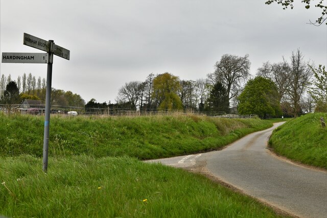
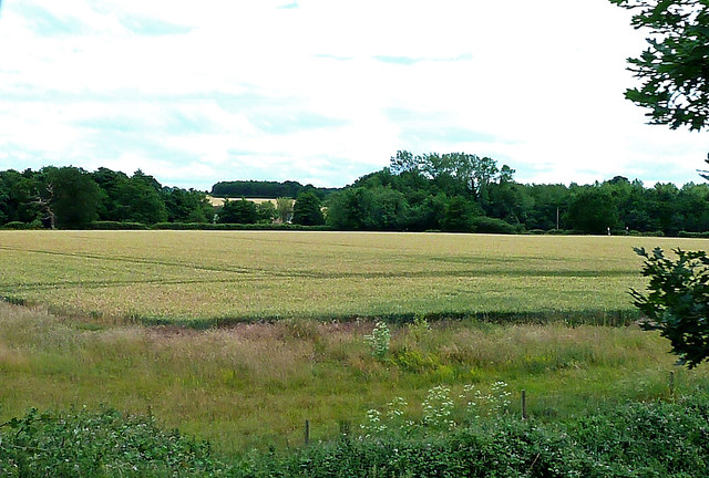
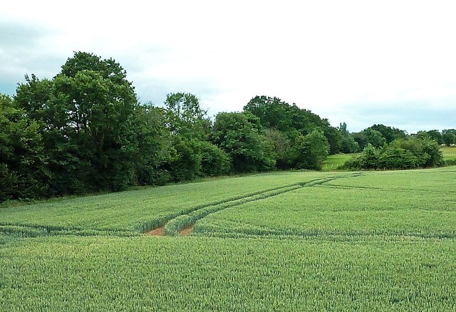
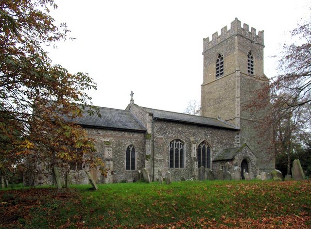
Brandon Parva, Upper Images

Images are sourced within 2km of 52.631398/1.0130029 or Grid Reference TG0408. Thanks to Geograph Open Source API. All images are credited.

Runhall: Banham Hill, Black Horse Road junction
Hardingham: The village boundary
Runhall: Oil seed rape crop with Wood Farm in the background
Thuxton station, Mid Norfolk railway The Lynn & Dereham Railway and the Norfolk Railway both obtained Parliament’s permission to build lines to Dereham in 1845. The Norfolk Railway, building its line from Wymondham, reached Dereham first, and opened its railway to passengers on the 15th February 1847.

As a result of modernisation, the line witnessed its last scheduled steam-hauled passenger train on the 17th September 1955. Diesel units took over the next day, But steam-hauled freight continued into the early 1960s. By 1960 there was an hourly passenger service to Norwich. The increased use of road transport, led to a decline in passenger numbers, and it became one of the many railways to be threatened by the “Beeching Report” in 1963. In June 1965, the Wymondham to Dereham section was reduced to single track with a passing loop at Hardingham, and the service between Wymondham and Dereham ceased in October 1969. 

Although the Mid Norfolk Railway is physically connected to the Norwich to Cambridge line at Wymondham, it actually starts from Wymondham Abbey station for its 11+ mile run to Dereham. It is hoped to extend the line to North Elmham and eventually to Fakenham. See <span class="nowrap"><a title="http://www.mnr.org.uk/history-of-the-line/" rel="nofollow ugc noopener" href="http://www.mnr.org.uk/history-of-the-line/">Link</a><img style="margin-left:2px;" alt="External link" title="External link - shift click to open in new window" src="https://s1.geograph.org.uk/img/external.png" width="10" height="10"/></span>   and <span class="nowrap"><a title="https://en.wikipedia.org/wiki/Mid-Norfolk_Railway" rel="nofollow ugc noopener" href="https://en.wikipedia.org/wiki/Mid-Norfolk_Railway">Link</a><img style="margin-left:2px;" alt="External link" title="External link - shift click to open in new window" src="https://s1.geograph.org.uk/img/external.png" width="10" height="10"/></span>   for much fuller histories.

Thuxton station was opened with the line. The station reopened as part of the Mid Norfolk Railway on 26th July 1997. It has been the main area for building works by the MNR for a number of years. The railway has also reinstated the passing loop at this half way point between Dereham and Wymondham. The down platform is seen here from an up train bound for Wymondham Abbey.
Thuxton station, Mid Norfolk railway
The Lynn & Dereham Railway and the Norfolk Railway both obtained Parliament’s permission to build lines to Dereham in 1845. The Norfolk Railway, building its line from Wymondham, reached Dereham first, and opened its railway to passengers on the 15th February 1847. As a result of modernisation, the line witnessed its last scheduled steam-hauled passenger train on the 17th September 1955. Diesel units took over the next day, But steam-hauled freight continued into the early 1960s. By 1960 there was an hourly passenger service to Norwich. The increased use of road transport, led to a decline in passenger numbers, and it became one of the many railways to be threatened by the “Beeching Report” in 1963. In June 1965, the Wymondham to Dereham section was reduced to single track with a passing loop at Hardingham, and the service between Wymondham and Dereham ceased in October 1969. Although the Mid Norfolk Railway is physically connected to the Norwich to Cambridge line at Wymondham, it actually starts from Wymondham Abbey station for its 11+ mile run to Dereham. It is hoped to extend the line to North Elmham and eventually to Fakenham. See LinkExternal link and LinkExternal link for much fuller histories. Thuxton station was opened with the line. The station reopened as part of the Mid Norfolk Railway on 26th July 1997. It has been the main area for building works by the MNR for a number of years. The railway has also reinstated the passing loop at this half way point between Dereham and Wymondham. The down platform is seen here from an up train bound for Wymondham Abbey.
Thuxton station, Mid Norfolk railway The Lynn & Dereham Railway and the Norfolk Railway both obtained Parliament’s permission to build lines to Dereham in 1845. The Norfolk Railway, building its line from Wymondham, reached Dereham first, and opened its railway to passengers on the 15th February 1847.

As a result of modernisation, the line witnessed its last scheduled steam-hauled passenger train on the 17th September 1955. Diesel units took over the next day, But steam-hauled freight continued into the early 1960s. By 1960 there was an hourly passenger service to Norwich. The increased use of road transport, led to a decline in passenger numbers, and it became one of the many railways to be threatened by the “Beeching Report” in 1963. In June 1965, the Wymondham to Dereham section was reduced to single track with a passing loop at Hardingham, and the service between Wymondham and Dereham ceased in October 1969. 

Although the Mid Norfolk Railway is physically connected to the Norwich to Cambridge line at Wymondham, it actually starts from Wymondham Abbey station for its 11+ mile run to Dereham. It is hoped to extend the line to North Elmham and eventually to Fakenham. See <span class="nowrap"><a title="http://www.mnr.org.uk/history-of-the-line/" rel="nofollow ugc noopener" href="http://www.mnr.org.uk/history-of-the-line/">Link</a><img style="margin-left:2px;" alt="External link" title="External link - shift click to open in new window" src="https://s1.geograph.org.uk/img/external.png" width="10" height="10"/></span>   and <span class="nowrap"><a title="https://en.wikipedia.org/wiki/Mid-Norfolk_Railway" rel="nofollow ugc noopener" href="https://en.wikipedia.org/wiki/Mid-Norfolk_Railway">Link</a><img style="margin-left:2px;" alt="External link" title="External link - shift click to open in new window" src="https://s1.geograph.org.uk/img/external.png" width="10" height="10"/></span>   for much fuller histories.

Thuxton station was opened with the line. The station reopened as part of the Mid Norfolk Railway on 26th July 1997. It has been the main area for building works by the MNR for a number of years. The railway has also reinstated the passing loop at this half way point between Dereham and Wymondham. The down platform is seen here from an up train bound for Wymondham Abbey. The train is passing over the level crossing at Station Lane just ahead. See also <a title="https://www.geograph.org.uk/photo/4623134" href="https://www.geograph.org.uk/photo/4623134">Link</a>
Thuxton station, Mid Norfolk railway
The Lynn & Dereham Railway and the Norfolk Railway both obtained Parliament’s permission to build lines to Dereham in 1845. The Norfolk Railway, building its line from Wymondham, reached Dereham first, and opened its railway to passengers on the 15th February 1847. As a result of modernisation, the line witnessed its last scheduled steam-hauled passenger train on the 17th September 1955. Diesel units took over the next day, But steam-hauled freight continued into the early 1960s. By 1960 there was an hourly passenger service to Norwich. The increased use of road transport, led to a decline in passenger numbers, and it became one of the many railways to be threatened by the “Beeching Report” in 1963. In June 1965, the Wymondham to Dereham section was reduced to single track with a passing loop at Hardingham, and the service between Wymondham and Dereham ceased in October 1969. Although the Mid Norfolk Railway is physically connected to the Norwich to Cambridge line at Wymondham, it actually starts from Wymondham Abbey station for its 11+ mile run to Dereham. It is hoped to extend the line to North Elmham and eventually to Fakenham. See LinkExternal link and LinkExternal link for much fuller histories. Thuxton station was opened with the line. The station reopened as part of the Mid Norfolk Railway on 26th July 1997. It has been the main area for building works by the MNR for a number of years. The railway has also reinstated the passing loop at this half way point between Dereham and Wymondham. The down platform is seen here from an up train bound for Wymondham Abbey. The train is passing over the level crossing at Station Lane just ahead. See also Link
Thuxton Level Crossing Viewed from a passing train on the Mid-Norfolk Railway.
Thuxton Level Crossing
Viewed from a passing train on the Mid-Norfolk Railway.
Fields And Woods Near Thuxton A mid-June scene, viewed from the Mid-Norfolk Railway.
Fields And Woods Near Thuxton
A mid-June scene, viewed from the Mid-Norfolk Railway.
Farmland Near Thuxton Viewed from the Mid-Norfolk Railway on a disappointingly dull June afternoon.
Farmland Near Thuxton
Viewed from the Mid-Norfolk Railway on a disappointingly dull June afternoon.
Arable Land Near Garvestone Viewed from the Mid-Norfolk Railway in disappointing June weather.
Arable Land Near Garvestone
Viewed from the Mid-Norfolk Railway in disappointing June weather.
Garvestone Rural View Viewed from the Mid-Norfolk Railway close to Garvestone.
Garvestone Rural View
Viewed from the Mid-Norfolk Railway close to Garvestone.
Garveston War Memorial The memorial includes the adjacent parish of Thuxton and lists the names of eight men lost in WW1 and of four lost in WW2
Garveston War Memorial
The memorial includes the adjacent parish of Thuxton and lists the names of eight men lost in WW1 and of four lost in WW2
Thuxton Village Sign Thuxton is a small village a few hundred yards north-east of the B1135, Wymondham to Dereham road. The village sign is located on Station Lane close to St Paul's Church.
Thuxton Village Sign
Thuxton is a small village a few hundred yards north-east of the B1135, Wymondham to Dereham road. The village sign is located on Station Lane close to St Paul's Church.
St Paul's, Thuxton St Paul's is a medieval flint parish church with later alterations. In the 15th century the tower was rebuilt but it was never fully finished. Instead it was topped with an octagonal cap. The church is a Grade I listed building. <span class="nowrap"><a title="https://www.britishlistedbuildings.co.uk/101077310-church-of-st-paul-garvestone#.WfiJFzFLE5s" rel="nofollow ugc noopener" href="https://www.britishlistedbuildings.co.uk/101077310-church-of-st-paul-garvestone#.WfiJFzFLE5s">Link</a><img style="margin-left:2px;" alt="External link" title="External link - shift click to open in new window" src="https://s1.geograph.org.uk/img/external.png" width="10" height="10"/></span>
St Paul's, Thuxton
St Paul's is a medieval flint parish church with later alterations. In the 15th century the tower was rebuilt but it was never fully finished. Instead it was topped with an octagonal cap. The church is a Grade I listed building. LinkExternal link
Farmland in a shallow valley, north-west of Tanners Green Looking east from the Mid-Norfolk Railway.
Farmland in a shallow valley, north-west of Tanners Green
Looking east from the Mid-Norfolk Railway.
Farmland west of Waterloo Farm On the east side of the Mid-Norfolk Railway.
Farmland west of Waterloo Farm
On the east side of the Mid-Norfolk Railway.
Private track off a public footpath, Thuxton The track in the foreground is a public footpath from Thuxton to Tanners Green.
Private track off a public footpath, Thuxton
The track in the foreground is a public footpath from Thuxton to Tanners Green.
Detached house on the north side of Thuxton Seen from the Mid-Norfolk Railway.
Detached house on the north side of Thuxton
Seen from the Mid-Norfolk Railway.
East platform, Thuxton Station, Mid-Norfolk Railway Seen from a train waiting to head south.
East platform, Thuxton Station, Mid-Norfolk Railway
Seen from a train waiting to head south.
Show me another place!

Brandon Parva, Upper is located at Grid Ref: TG0408 (Lat: 52.631398, Lng: 1.0130029)

Administrative County: Norfolk

District: South Norfolk

Police Authority: Norfolk

What 3 Words

///nuzzling.husband.cafe. Near Mattishall, Norfolk

Related Wikis

Thuxton railway station

Thuxton is a railway station in the village of Thuxton in the English county of Norfolk. The station is served by heritage services operated by the Mid...

Wymondham to Wells Branch

The Wymondham to Wells Branch was a railway built in stages by the Norfolk Railway, Eastern Counties Railway and Wells and Fakenham Company between 1847...

Mid-Norfolk Railway

The Mid-Norfolk Railway (MNR) is a 17+1⁄2 miles (28.2 km) preserved standard gauge heritage railway, one of the longest in Great Britain. Preservation...

Garvestone

Garvestone (or Garveston) is a village and former civil parish, now in the parish of Garvestone, Reymerston and Thuxton, in the Breckland district, in...

Runhall

Runhall is a village and former civil parish, now in the parish of Brandon Parva, Coston, Runhall and Welborne, in the South Norfolk district, in Norfolk...

Thuxton

Thuxton is a small village and former civil parish, now in the parish of Garvestone, Reymerston and Thuxton, in the Breckland district, in the county of...

Breckland District

Breckland is a local government district in Norfolk, England. Its council is based in Dereham, although the largest town is Thetford. The district also...

Brakefield Green

Brakefield Green is a village in Norfolk, England. The population is included in the civil parish of Whinburgh and Westfield. == External links == Media...

Nearby Amenities

Located within 500m of 52.631398,1.0130029
The data included in this document is from www.openstreetmap.org. The data is made available under ODbL.

Have you been to Brandon Parva, Upper?

Leave your review of Brandon Parva, Upper below (or comments, questions and feedback).