Borth, Upper

Settlement in Cardiganshire

Wales

Borth, Upper

B4353 Princess Street in Borth
B4353 Princess Street in Borth Credit: Mat Fascione

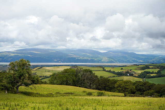
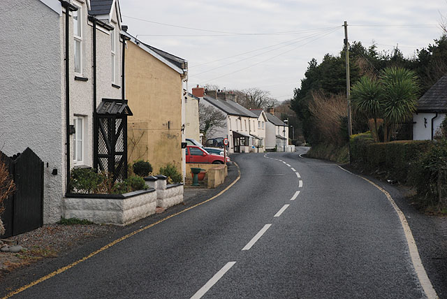
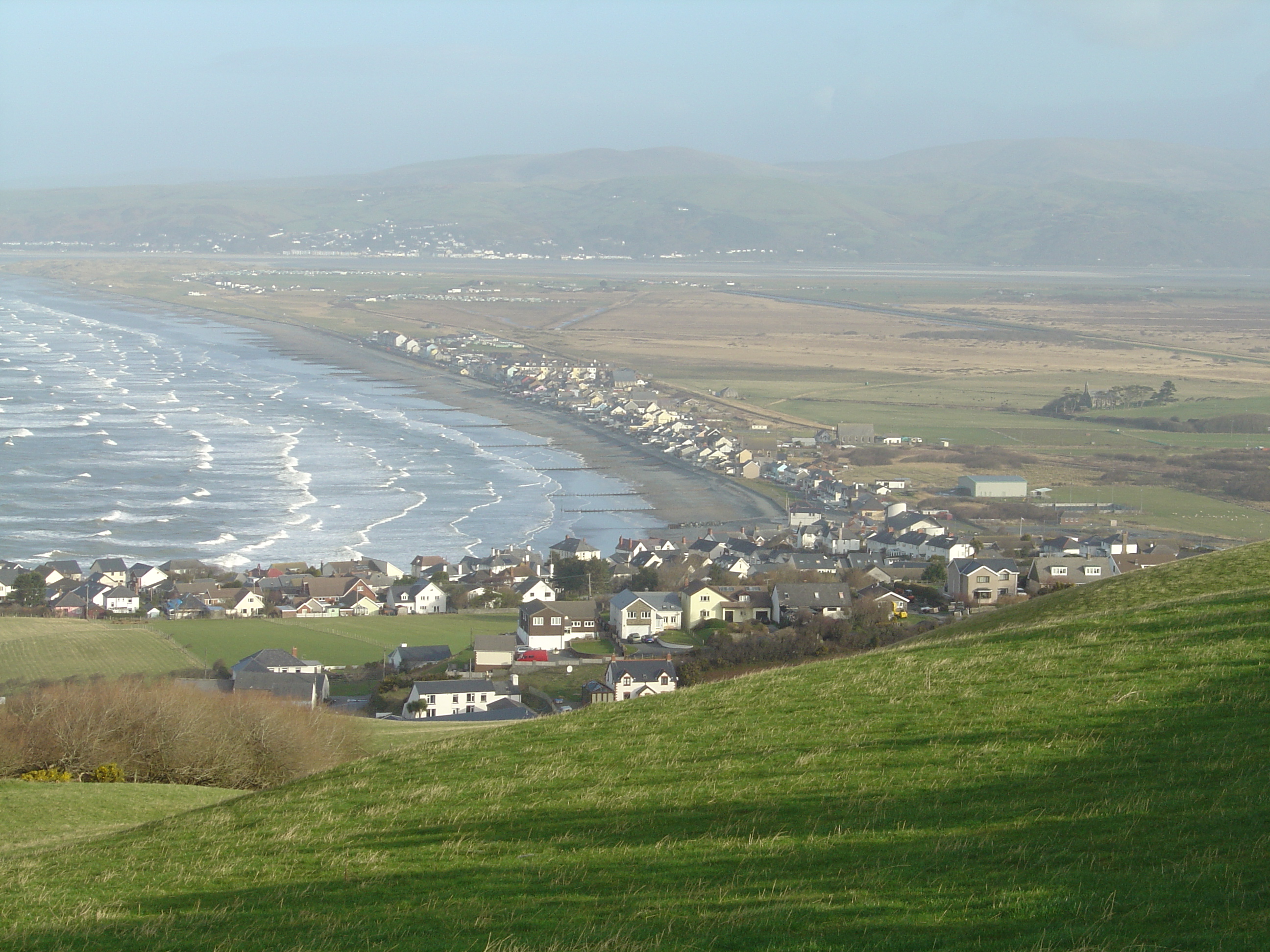
Borth is a small coastal village located in the county of Ceredigion, formerly known as Cardiganshire, in Wales. Situated on the western coast of Wales, Borth lies approximately 7 miles north of Aberystwyth and 20 miles south of Aberdovey. The village sits on the northern shore of the Dyfi Estuary, with the Cambrian Mountains forming a picturesque backdrop to the east.

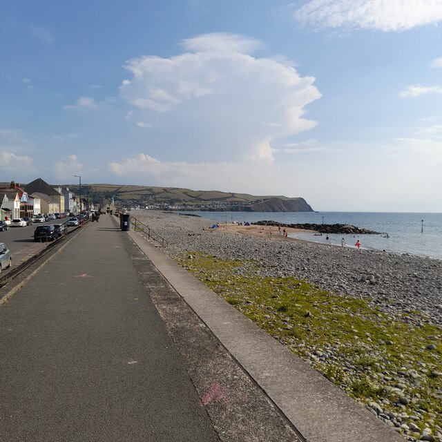
Borth is known for its beautiful sandy beach, which stretches for almost four miles, making it a popular destination for tourists and locals alike. The coastline is also famous for its fossil-rich cliffs, which date back millions of years and attract geology enthusiasts from all over.

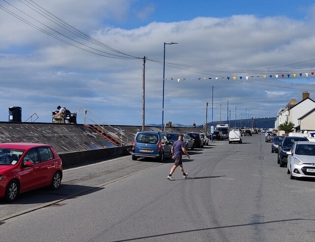
The village itself has a population of around 2,500 people and offers a range of amenities and facilities to cater to both residents and visitors. These include several shops, pubs, cafes, and restaurants, as well as a primary school, a post office, and a train station on the Cambrian Line.

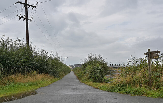
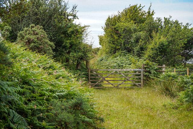
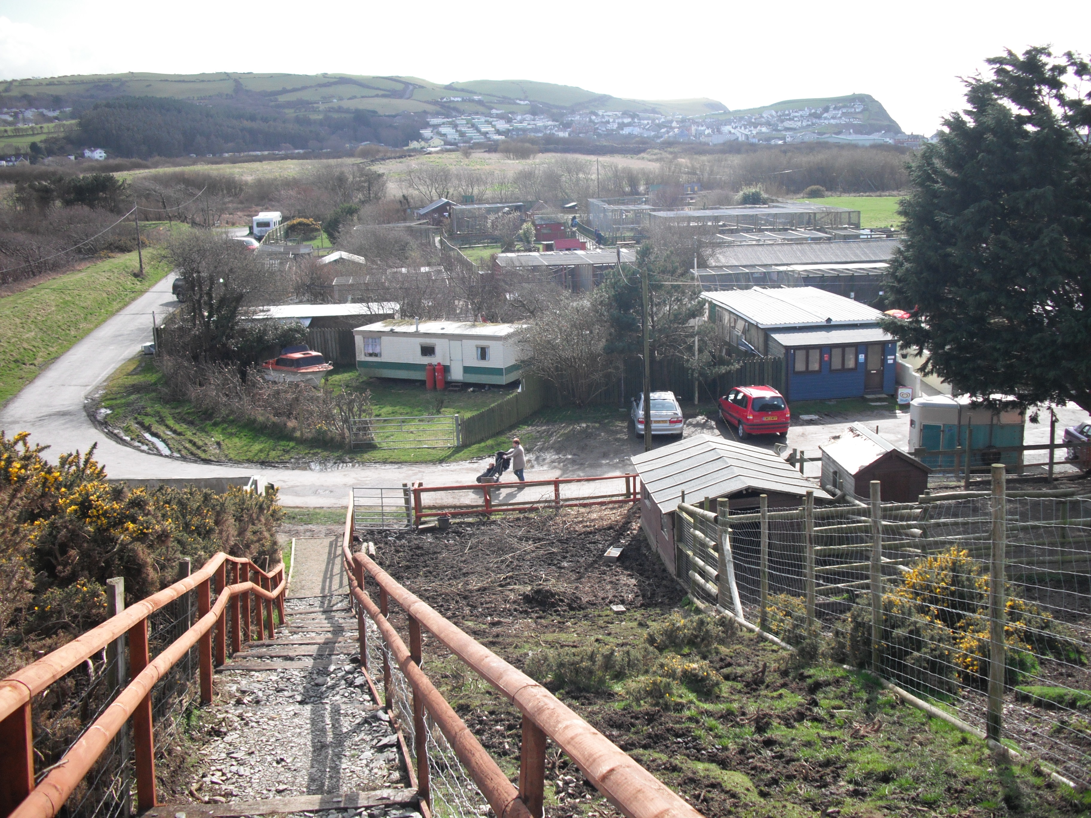
Borth is surrounded by stunning natural landscapes, making it an excellent base for outdoor activities such as hiking, cycling, and birdwatching. The nearby Cors Fochno Nature Reserve is a haven for wildlife, home to a variety of rare and protected species, including butterflies, birds, and plants.

Overall, Borth, Upper, Cardiganshire is a charming coastal village that offers visitors a mix of natural beauty, historical interest, and a warm community atmosphere.

If you have any feedback on the listing, please let us know in the comments section below.

Borth, Upper Images

Images are sourced within 2km of 52.476341/-4.055585 or Grid Reference SN6088. Thanks to Geograph Open Source API. All images are credited.
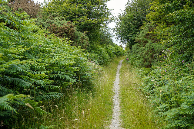
B4353 Princess Street in Borth
Cambrian Terrace and Borth Station Borth Station was built by the Aberystwyth & Welsh Coast Railway, and for a short time served as the terminus of the line, before the line was extended to Aberystwyth.

The terrace on the right was built around the same time, by the entrepreneur Thomas Savin, who was also involved in building the railway. His intention was to take advantage of the railway to develop Borth as a resort. The buildings on the left are modern. Seen on a rainy day.
Cambrian Terrace and Borth Station
Borth Station was built by the Aberystwyth & Welsh Coast Railway, and for a short time served as the terminus of the line, before the line was extended to Aberystwyth. The terrace on the right was built around the same time, by the entrepreneur Thomas Savin, who was also involved in building the railway. His intention was to take advantage of the railway to develop Borth as a resort. The buildings on the left are modern. Seen on a rainy day.
Borth from the promenade The yellow building on the left is the village's post office.
Borth from the promenade
The yellow building on the left is the village's post office.
Borth Beach from the promenade Looking towards Upper Borth and the two cliffs, Craig yr Wylfa and Craig y Delyn. Borth's war memorial sits atop the former.
Borth Beach from the promenade
Looking towards Upper Borth and the two cliffs, Craig yr Wylfa and Craig y Delyn. Borth's war memorial sits atop the former.
Site of the Cambrian Hotel, Borth On the left of the building, a plaque which states 'Uppingham School in Grateful Memory of 1876 and 1877'.

This simple statement is a clue to a very important event which links  the history of Borth and Uppingham school in Rutland. The story is told in the description for <a href="https://www.geograph.org.uk/photo/6817576">SN6189 : Uppingham School Memorial, Borth</a>.

The Cambrian Hotel was demolished in 1976.
Site of the Cambrian Hotel, Borth
On the left of the building, a plaque which states 'Uppingham School in Grateful Memory of 1876 and 1877'. This simple statement is a clue to a very important event which links the history of Borth and Uppingham school in Rutland. The story is told in the description for SN6189 : Uppingham School Memorial, Borth. The Cambrian Hotel was demolished in 1976.
Looking north from Borth station A mile of quite straight track skirting Cors Fochno [bog].
Looking north from Borth station
A mile of quite straight track skirting Cors Fochno [bog].
Borth Promenade
Borth Promenade
Shingle beach at Borth
St. Matthew's Church, Borth Seen on the drier part of a fairly damp day.
St. Matthew's Church, Borth
Seen on the drier part of a fairly damp day.
Lane from St. Matthew's Church to Borth Although open to vehicles, vehicular access to the church is encouraged to use a newly tarred lane to the south, which has a more satifactory railway crossing.
Lane from St. Matthew's Church to Borth
Although open to vehicles, vehicular access to the church is encouraged to use a newly tarred lane to the south, which has a more satifactory railway crossing.
Footpath across the hills Leading from Llandre to Borth.
Footpath across the hills
Leading from Llandre to Borth.
On the path from Llandre to Borth Above Coed Tynyllechwedd with a view towards the Dyfi Estuary.
On the path from Llandre to Borth
Above Coed Tynyllechwedd with a view towards the Dyfi Estuary.
Gate on the hillside On the path from Llandre to Borth.
Gate on the hillside
On the path from Llandre to Borth.
Borth  Viewed from near Cilolwg on the old road from Llandre.
Borth
Viewed from near Cilolwg on the old road from Llandre.
Above Borth The elevated St Matthew Church is seen on the right. Further on are Ynyslas and the Dyfi Estuary.
Above Borth
The elevated St Matthew Church is seen on the right. Further on are Ynyslas and the Dyfi Estuary.
Path becomes a metalled road By Cillolwg farm, above Borth.
Path becomes a metalled road
By Cillolwg farm, above Borth.
Minor roads crossing  In the hills above Borth.
Minor roads crossing
In the hills above Borth.
Minor road heading down to Upper Borth
Show me another place!

Borth, Upper is located at Grid Ref: SN6088 (Lat: 52.476341, Lng: -4.055585)

Unitary Authority: Ceredigion

Police Authority: Dyfed Powys

What 3 Words

///sometime.hotspots.fork. Near Borth, Ceredigion

Related Wikis

Nearby Amenities

Located within 500m of 52.476341,-4.055585
Source: PGS
Lat/Long: 52.4796498/-4.0527913
Source: PGS
Lat/Long: 52.4795824/-4.0529172
Source: PGS
Lat/Long: 52.4794079/-4.0538739
Source: PGS
Lat/Long: 52.4792767/-4.0544517
Source: PGS
Lat/Long: 52.4789697/-4.0558366
Source: PGS
Lat/Long: 52.4786746/-4.0566429
Source: PGS
Lat/Long: 52.4786827/-4.0580356
Source: PGS
Lat/Long: 52.478404/-4.0584719
Created By: dmgroom_coastlines
Source: PGS
Lat/Long: 52.4781254/-4.0589617
Created By: dmgroom_coastlines
Source: PGS
Lat/Long: 52.4778938/-4.0596089
Created By: dmgroom_coastlines
Source: PGS
Lat/Long: 52.47743/-4.060138
Created By: dmgroom_coastlines
Source: PGS
Lat/Long: 52.4771158/-4.0607166
Created By: dmgroom_coastlines
Source: PGS
Lat/Long: 52.4768473/-4.0611485
Created By: dmgroom_coastlines
Source: PGS
Lat/Long: 52.4767068/-4.061751
Created By: dmgroom_coastlines
Source: PGS
Lat/Long: 52.4761579/-4.0614057
Created By: dmgroom_coastlines
Source: PGS
Lat/Long: 52.475883/-4.061151
Created By: dmgroom_coastlines
Source: PGS
Lat/Long: 52.474855/-4.061545
Created By: dmgroom_coastlines
Source: PGS
Lat/Long: 52.474339/-4.061952
Turning Circle
Lat/Long: 52.4786463/-4.0529126
Turning Circle
Lat/Long: 52.4785689/-4.0529869
Post Box
Ref: SY24 211
Lat/Long: 52.4783466/-4.0536447
Post Box
Operator: Royal Mail
Ref: SY24 202
Lat/Long: 52.4794465/-4.0516032
War Memorial
Heritage: yes
Historic: memorial
Wikidata: Q29496591
Lat/Long: 52.4767022/-4.0602382
Bus Stop
Heol Aberwennol
Public Transport: platform
Shelter: yes
Lat/Long: 52.4772408/-4.0517258
Craig Yr Wylfa
Natural: peak
Lat/Long: 52.4764944/-4.0603517
Tourism: viewpoint
Lat/Long: 52.4767629/-4.0602024
Upper Borth
Place: village
Wikidata: Q7898508
Wikipedia: en:Upper Borth
Lat/Long: 52.4772392/-4.0548778
Bench
Lat/Long: 52.4784366/-4.056522
Bench
Lat/Long: 52.4786547/-4.0561572
Bench
Lat/Long: 52.478667/-4.0560982
Direction: 195
Generator Method: photovoltaic
Generator Output Electricity: yes
Generator Solar Modules: 16
Generator Source: solar
Generator Type: solar_photovoltaic_panel
Location: roof
Power: generator
Lat/Long: 52.4788548/-4.0503891
Direction: E
Generator Method: photovoltaic
Generator Output Electricity: yes
Generator Solar Modules: 8
Generator Source: solar
Generator Type: solar_photovoltaic_panel
Location: roof
Power: generator
Lat/Long: 52.4775414/-4.052496
Direction: 105
Generator Method: photovoltaic
Generator Output Electricity: yes
Generator Solar Modules: 10
Generator Source: solar
Generator Type: solar_photovoltaic_panel
Location: roof
Power: generator
Lat/Long: 52.4766151/-4.0522492
Direction: 165
Generator Method: photovoltaic
Generator Output Electricity: yes
Generator Solar Modules: 10
Generator Source: solar
Generator Type: solar_photovoltaic_panel
Location: roof
Power: generator
Lat/Long: 52.4765203/-4.0523645
Direction: SSE
Generator Method: photovoltaic
Generator Output Electricity: yes
Generator Solar Modules: 2
Generator Source: solar
Generator Type: solar_photovoltaic_panel
Location: roof
Power: generator
Lat/Long: 52.4785738/-4.0538304
Direction: SSE
Generator Method: photovoltaic
Generator Output Electricity: yes
Generator Solar Modules: 6
Generator Source: solar
Generator Type: solar_photovoltaic_panel
Location: roof
Power: generator
Lat/Long: 52.4785935/-4.0537646
Direction: 165
Generator Method: photovoltaic
Generator Output Electricity: yes
Generator Solar Modules: 16
Generator Source: solar
Generator Type: solar_photovoltaic_panel
Location: roof
Power: generator
Lat/Long: 52.4776394/-4.0551111
Direction: 170
Generator Method: photovoltaic
Generator Output Electricity: yes
Generator Solar Modules: 6
Generator Source: solar
Generator Type: solar_photovoltaic_panel
Location: roof
Power: generator
Lat/Long: 52.477462/-4.057516
Direction: SSE
Generator Method: photovoltaic
Generator Output Electricity: yes
Generator Solar Modules: 16
Generator Source: solar
Generator Type: solar_photovoltaic_panel
Location: roof
Power: generator
Lat/Long: 52.4777668/-4.0552104
Direction: SSE
Generator Method: photovoltaic
Generator Output Electricity: yes
Generator Solar Modules: 10
Generator Source: solar
Generator Type: solar_photovoltaic_panel
Location: roof
Power: generator
Lat/Long: 52.4790648/-4.0535568
The data included in this document is from www.openstreetmap.org. The data is made available under ODbL.

Have you been to Borth, Upper?

Leave your review of Borth, Upper below (or comments, questions and feedback).