Booth, Upper

Settlement in Derbyshire High Peak

England

Booth, Upper

Hills at the head of Edale The nearest hill is Colborne, and Whitemoor Clough runs off it.
Hills at the head of Edale Credit: Bill Boaden

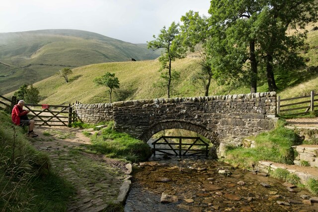
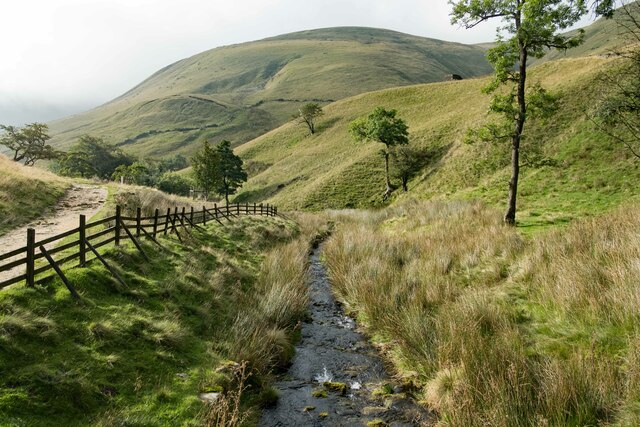
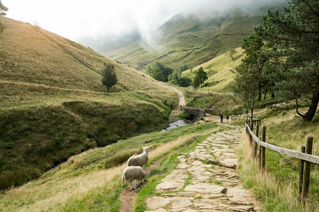
Booth is a small village located in the Upper Derwent Valley, within the county of Derbyshire, England. Situated in the Peak District National Park, this picturesque village is surrounded by stunning landscapes and offers a peaceful retreat for nature lovers and outdoor enthusiasts.

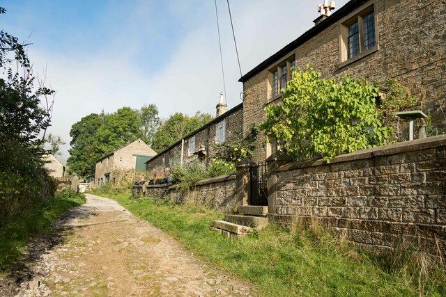
The village of Booth is characterized by its charming stone cottages and traditional architecture, giving it a quintessentially English countryside feel. The community is small, with a population of approximately 200 residents, which contributes to the village's close-knit and friendly atmosphere.

One of the main attractions in Booth is its proximity to the Ladybower Reservoir, a vast man-made lake that offers breathtaking views and a variety of outdoor activities. Visitors can enjoy walking or cycling along the reservoir's shores, fishing, or even taking a boat trip to explore its tranquil waters.

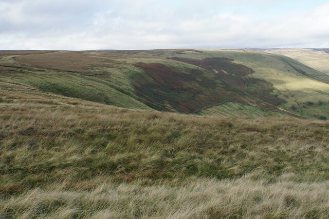
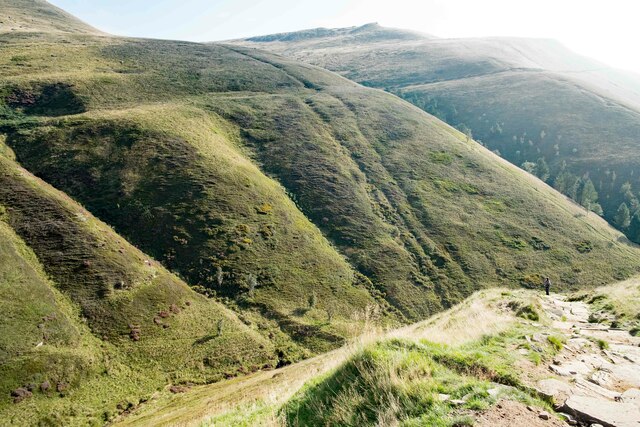
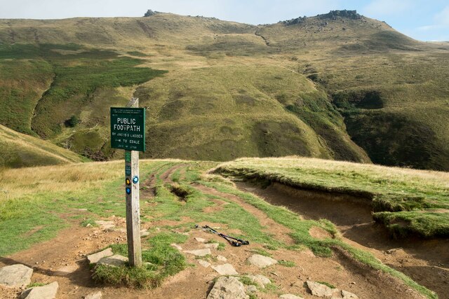
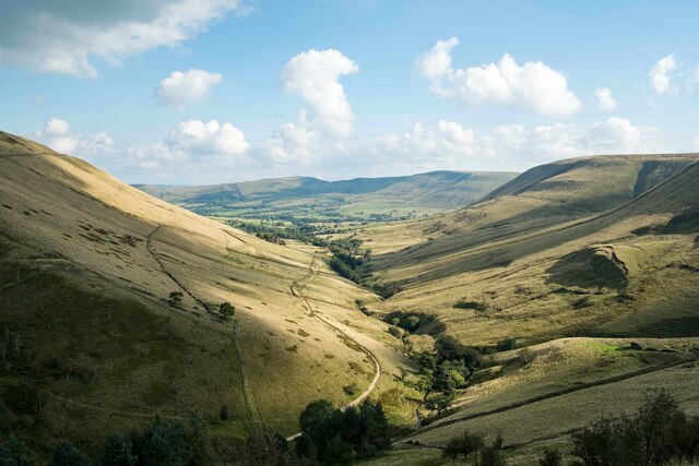
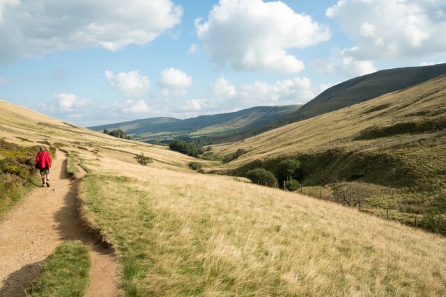
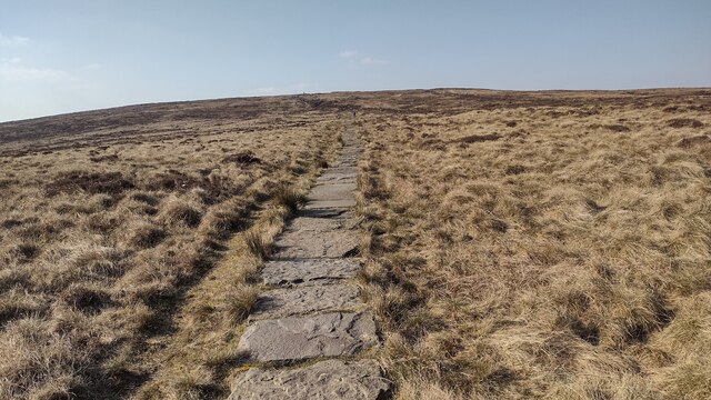
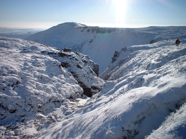
For those seeking a more challenging adventure, Booth provides easy access to the surrounding hills and moorlands, including Kinder Scout, the highest point in the Peak District. Hikers and climbers can explore the rugged terrain, while birdwatchers can spot various species in the area, such as peregrine falcons and curlews.

Although Booth is a small village, it boasts a strong sense of community spirit. The village has a local pub, The Snake Pass Inn, which serves as a gathering place for residents and visitors alike. Additionally, the nearby town of Bamford offers a wider range of amenities, including shops, cafes, and a railway station.

Overall, Booth, Upper, Derbyshire is a charming and tranquil village that provides an idyllic base for exploring the natural beauty of the Peak District National Park. Whether seeking adventure or a peaceful retreat, this village offers a warm welcome to all who visit.

If you have any feedback on the listing, please let us know in the comments section below.

Booth, Upper Images

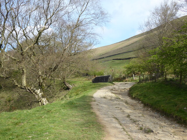
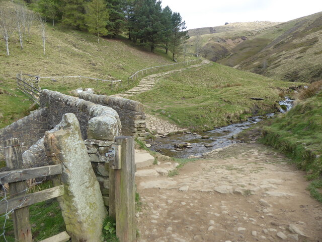
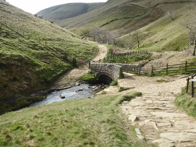
Images are sourced within 2km of 53.364728/-1.844731 or Grid Reference SK1085. Thanks to Geograph Open Source API. All images are credited.

Hills at the head of Edale The nearest hill is Colborne, and Whitemoor Clough runs off it.
Hills at the head of Edale
The nearest hill is Colborne, and Whitemoor Clough runs off it.
The Pennine Way at Lee Farm Passing through the National Trust owned Lee Farm on the Pennine Way.
The Pennine Way at Lee Farm
Passing through the National Trust owned Lee Farm on the Pennine Way.
The Pack Horse Bridge below Jacob's Ladder Walkers ascending Jacob's Ladder on the Pennine Way from Upper Booth will first of all walk across this ancient pack horse bridge which crosses the River Noe.
The Pack Horse Bridge below Jacob's Ladder
Walkers ascending Jacob's Ladder on the Pennine Way from Upper Booth will first of all walk across this ancient pack horse bridge which crosses the River Noe.
The River Noe below Jacob's Ladder Looking south along the River Noe from the old packhorse bridge below Jacob's Ladder.
The River Noe below Jacob's Ladder
Looking south along the River Noe from the old packhorse bridge below Jacob's Ladder.
On Jacob's Ladder Looking down on Jacob's Ladder towards the old packhorse bridge and the River Noe.
On Jacob's Ladder
Looking down on Jacob's Ladder towards the old packhorse bridge and the River Noe.
View from Jacob's Ladder View of the Peak District landscape from Jacob's Ladder.
View from Jacob's Ladder
View of the Peak District landscape from Jacob's Ladder.
The Pennine Way at the top of Jacob's Ladder The Pennine Way where it reaches the top of Jacob's Ladder.
The Pennine Way at the top of Jacob's Ladder
The Pennine Way where it reaches the top of Jacob's Ladder.
The Vale of Edale The view southeast along the Vale of Edale from the top of Jacob's Ladder.
The Vale of Edale
The view southeast along the Vale of Edale from the top of Jacob's Ladder.
The Pennine Way along the Vale of Edale Walking the Pennine Way as it heads along the Vale of Edale towards Upper Booth.
The Pennine Way along the Vale of Edale
Walking the Pennine Way as it heads along the Vale of Edale towards Upper Booth.
The Pennine Way near Lee House
The Pennine Way at the start of Jacob's Ladder
The Pennine Way near to the bottom of Jacob's Ladder
Row of buildings at Lee House Farm in 1993 A barn or store shed and two houses at the farm which is passed by the Pennine Way.
Row of buildings at Lee House Farm in 1993
A barn or store shed and two houses at the farm which is passed by the Pennine Way.
Path heading to Brown Knoll From Colborne the paved path heading to Brown Knoll summit
Path heading to Brown Knoll
From Colborne the paved path heading to Brown Knoll summit
Packhorse  bridge  over  infant  River  Noe  Vale  of  Edale At the base of Jacob's Ladder the steep climb behind me, this bridge is known locally as Youngate Bridge after the now ruinous farm at Edale Head. It was a wet day and the low cloud was down on the hills, this is part of the Pennine Way.
Packhorse bridge over infant River Noe Vale of Edale
At the base of Jacob's Ladder the steep climb behind me, this bridge is known locally as Youngate Bridge after the now ruinous farm at Edale Head. It was a wet day and the low cloud was down on the hills, this is part of the Pennine Way.
Extreme  Camping  Edale  Head At the top of Jacob's Ladder in wet weather, look at the low cloud on Kinder Scout behind, miles from anywhere, it is a "I want to be alone" statement
Extreme Camping Edale Head
At the top of Jacob's Ladder in wet weather, look at the low cloud on Kinder Scout behind, miles from anywhere, it is a "I want to be alone" statement
Edale Valley Looking back to Edale the Pennine Way can be seen to the left of the River Noe, this is the first mile or two for many hikers on the long trek to Kirk Yetholm.
Edale Valley
Looking back to Edale the Pennine Way can be seen to the left of the River Noe, this is the first mile or two for many hikers on the long trek to Kirk Yetholm.
On The Pennine Way Beyond Lee House
On The Pennine Way
Beyond Lee House
Show me another place!

Booth, Upper is located at Grid Ref: SK1085 (Lat: 53.364728, Lng: -1.844731)

Administrative County: Derbyshire

District: High Peak

Police Authority: Derbyshire

What 3 Words

///joys.coverage.tracks. Near High Peak, Derbyshire

Nearby Locations

Booth, Upper Upper Booth

Related Wikis

Edale War Memorial

Edale War Memorial is a 20th-century grade II listed war memorial in Edale, Derbyshire. == History == The war memorial features the names of local residents...

Vale of Edale

The Vale of Edale is the upper valley of the River Noe, in the Derbyshire Peak District of England. The village of Edale lies in the middle of the valley...

Grindslow Knoll

Grindslow Knoll is a hill in the Dark Peak area of the Peak District National Park in Derbyshire, England. It is joined to Kinder Scout by a high col though...

High Peak, Derbyshire

High Peak is a local government district with borough status in Derbyshire, England, covering a high moorland plateau in the Dark Peak area of the Peak...

Nearby Amenities

Located within 500m of 53.364728,-1.844731
Upper Booth
Place: village
Lat/Long: 53.3644597/-1.8465173
Telephone
Booth: K6
Covered: booth
Operator: BT
Phone: +44 1433 620095
Lat/Long: 53.3643387/-1.847331
Post Box
Brand: Royal Mail
Brand Wikidata: Q638098
Collection Times: Mo-Fr 09:00; Sa 07:00
Operator: Royal Mail
Operator Wikidata: Q638098
Post Box Type: wall
Ref: S33 330
Royal Cypher: EVIIR
Royal Cypher Wikidata: Q33102324
Source: unknown;survey
Lat/Long: 53.3647207/-1.8469398
Toilets
Access: customers
Lat/Long: 53.3651803/-1.8470509
Barrier: stile
Foot: yes
Material: stone
Source: survey
Step Count: 3
Stile: stepover
Lat/Long: 53.3647001/-1.8465784
Barrier: stile
Material: stone
Source: survey;gps
Stile: stepover
Lat/Long: 53.3623295/-1.8490207
Barrier: stile
Material: wood
Source: survey;gps
Stile: stepover
Lat/Long: 53.3635609/-1.8484253
The Gate
Place: isolated_dwelling
Source: Bing
Lat/Long: 53.366287/-1.8503068
Upper Booth Farm
Place: farm
Source: Bing
Lat/Long: 53.3653683/-1.8465531
Power: pole
Lat/Long: 53.3645663/-1.8518025
Power: pole
Lat/Long: 53.3640021/-1.8509536
Power: pole
Lat/Long: 53.3639709/-1.8486938
Power: pole
Lat/Long: 53.3636844/-1.8495883
Power: pole
Lat/Long: 53.3635179/-1.8501368
Power: pole
Lat/Long: 53.3634947/-1.8502146
Power: pole
Lat/Long: 53.3628645/-1.849829
Power: pole
Lat/Long: 53.3621438/-1.8493952
Power: pole
Lat/Long: 53.3619077/-1.8487608
Power: pole
Lat/Long: 53.3617829/-1.8491739
Power: pole
Lat/Long: 53.3615348/-1.849642
Power: pole
Lat/Long: 53.361073/-1.8487474
The data included in this document is from www.openstreetmap.org. The data is made available under ODbL.

Have you been to Booth, Upper?

Leave your review of Booth, Upper below (or comments, questions and feedback).