Bowburn

Settlement in Durham

England

Bowburn

The A688 seen from Durham Services
The A688 seen from Durham Services Credit: habiloid

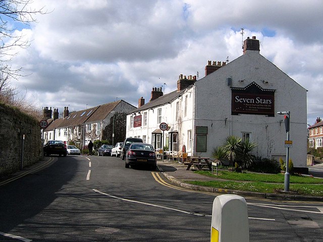
Bowburn is a small village located in County Durham, England. Situated approximately 5 miles south-east of Durham city, it falls within the Bowburn and Cassop parish. With a population of around 4,500 residents, Bowburn retains a quaint and close-knit community atmosphere.

The village boasts a rich history, dating back to the medieval era when it was primarily an agricultural settlement. Over time, Bowburn experienced significant growth, particularly during the 19th and 20th centuries with the advent of coal mining and the establishment of local collieries. However, following the decline of the coal industry in the 1980s, Bowburn has adapted to become a residential area with a diverse range of housing options.

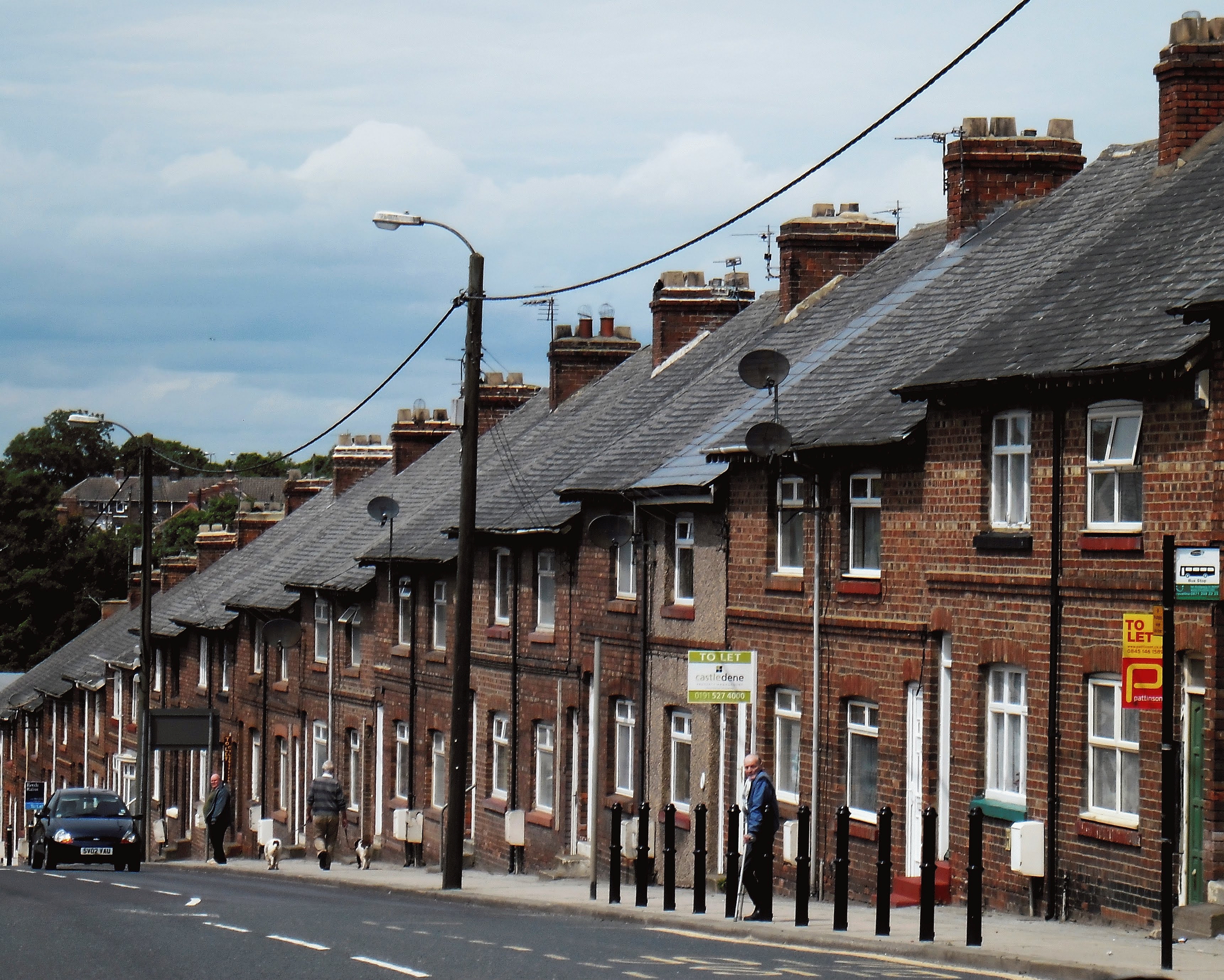
Bowburn offers several amenities to its residents, including a primary school, a community center, a public library, and a medical center. The village has a variety of shops, pubs, and restaurants, catering to the needs of its inhabitants. Additionally, there are regular bus services connecting Bowburn to Durham city and nearby towns.

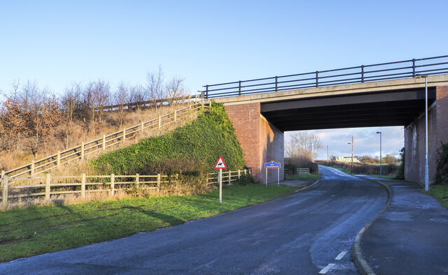
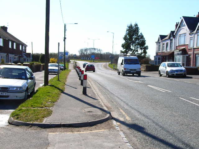
The village benefits from its proximity to the natural beauty of County Durham, with picturesque countryside and walks nearby. Additionally, Bowburn is conveniently located near major road networks, such as the A1(M), enabling easy access to surrounding areas.

Overall, Bowburn offers a peaceful and friendly environment, making it an attractive place to live for those seeking a balance between rural tranquility and accessibility to urban amenities.

If you have any feedback on the listing, please let us know in the comments section below.

Bowburn Images

Images are sourced within 2km of 54.739819/-1.520796 or Grid Reference NZ3038. Thanks to Geograph Open Source API. All images are credited.

The A688 seen from Durham Services
The Days Inn hotel, Durham Services
Integra 61 Groundwork Preparatory work for construction of new industrial units as part of the Integra 61 development.
Integra 61 Groundwork
Preparatory work for construction of new industrial units as part of the Integra 61 development.
Curious Cow A minor footpath blockage in the shape of curious young cows.
Curious Cow
A minor footpath blockage in the shape of curious young cows.
Bowburn Hall Hotel Formerly known as Bowburn Grange.
Bowburn Hall Hotel
Formerly known as Bowburn Grange.
Ice, mud and ruts at field entrance Fields north-west of the small village at Quarrington Hill accessed from a gate on minor road.
Ice, mud and ruts at field entrance
Fields north-west of the small village at Quarrington Hill accessed from a gate on minor road.
Bridge carrying A688 over access road for Old Quarrington The road beneath the bridge is the only public motor road access for the small settlement at Old Quarrington. The blue and yellow road sign is typical of many found in County Durham.
Bridge carrying A688 over access road for Old Quarrington
The road beneath the bridge is the only public motor road access for the small settlement at Old Quarrington. The blue and yellow road sign is typical of many found in County Durham.
Unmade road east of Old Quarrington The tarmacked road reaching Old Quarrington ends there as a public road but continues as an unmade one to the east of the village where it joins another road. OS mapping differs according to its age and source in how access along the routes applies. Some maps including paper ones in the possession of the photographer show the upper road as a bridleway continuing to Quarrington Hill. Others show the bridleway ending east of Quarrington Farm.
The County Durham definitive map, (January 2022), now shows the lower, southern road to be the route of the bridleway and that must be considered to be the actual current situation. The explanation is that the upper, northern road is now in use by Tarmac as a quarry access road and is a private way.
Part of Tarmac's Quarrington Quarry can be seen in the image.
Unmade road east of Old Quarrington
The tarmacked road reaching Old Quarrington ends there as a public road but continues as an unmade one to the east of the village where it joins another road. OS mapping differs according to its age and source in how access along the routes applies. Some maps including paper ones in the possession of the photographer show the upper road as a bridleway continuing to Quarrington Hill. Others show the bridleway ending east of Quarrington Farm. The County Durham definitive map, (January 2022), now shows the lower, southern road to be the route of the bridleway and that must be considered to be the actual current situation. The explanation is that the upper, northern road is now in use by Tarmac as a quarry access road and is a private way. Part of Tarmac's Quarrington Quarry can be seen in the image.
Durham  Services  car  park Looking along the frontage of Days Inn Motel
Durham Services car park
Looking along the frontage of Days Inn Motel
Durham  Services  car  park  with  A688  beyond Leading to A1(M) Junction 61
Durham Services car park with A688 beyond
Leading to A1(M) Junction 61
Cuckooflower Cardamine pratensis, commonly called Cuckooflower or Lady's Smock. The County Flower of Cheshire as assigned by Plantlife in their 2002 County Flowers campaign.
Cuckooflower
Cardamine pratensis, commonly called Cuckooflower or Lady's Smock. The County Flower of Cheshire as assigned by Plantlife in their 2002 County Flowers campaign.
Claring Street, Bowburn Bowburn's tightly packed terraced houses are typical of a Durham mining village although here, at least, the windows have been replaced. Steavenson Street, with its unusual spelling, leads off to the left and each pair of streets has a lane running between the back yards.
Claring Street, Bowburn
Bowburn's tightly packed terraced houses are typical of a Durham mining village although here, at least, the windows have been replaced. Steavenson Street, with its unusual spelling, leads off to the left and each pair of streets has a lane running between the back yards.
Approach to the Site of Whitwell Colliery Although Whitwell Colliery closed before 1900, a shallow cutting with a junction can still be made out on the former waggonway from Cassop Vale on the approach to the site of the colliery.
Approach to the Site of Whitwell Colliery
Although Whitwell Colliery closed before 1900, a shallow cutting with a junction can still be made out on the former waggonway from Cassop Vale on the approach to the site of the colliery.
Shincliffe : A1(M) Heading north on the A1(M).
Shincliffe : A1(M)
Heading north on the A1(M).
Durham Road, Bowburn The A177 Durham to Stockton road passes through the village
Durham Road, Bowburn
The A177 Durham to Stockton road passes through the village
Durham Road, Bowburn On the A177 looking up to junction 61 on the A1(M)
Durham Road, Bowburn
On the A177 looking up to junction 61 on the A1(M)
Jet petrol station on the A177, Bowburn
Whitwell South Farm, Bowburn The rather faded sign makes reference to the "Whitwell School of Motoring" - another example of agricultural diversification?
Whitwell South Farm, Bowburn
The rather faded sign makes reference to the "Whitwell School of Motoring" - another example of agricultural diversification?
Show me another place!

Bowburn is located at Grid Ref: NZ3038 (Lat: 54.739819, Lng: -1.520796)

Unitary Authority: County Durham

Police Authority: Durham

What 3 Words

///keener.distorts.reshaping. Near Bowburn, Co. Durham

Nearby Locations

Bowburn

Related Wikis

Bowburn

Bowburn is a village in County Durham, England. It is situated about 3 miles (4.8 km) to the south-east of Durham, on the A177, between Coxhoe to the south...
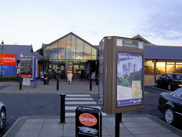
Durham Services

Durham Motorway Services are at junction 61 on the A1 (M), six miles from Durham City between the villages of Bowburn and Coxhoe in County Durham, England...

Old Quarrington

Old Quarrington is a hamlet in County Durham, in England. It is situated between Bowburn and Quarrington Hill. It is also known locally as Heugh Hall,...

High Shincliffe

High Shincliffe is a village in County Durham, England. It is situated about two miles south-east of Durham City, on the A177 road to Stockton-on-Tees...

Cassop-cum-Quarrington

Cassop-cum-Quarrington is a civil parish in County Durham, England. According to the 2001 census it had a population of 4,735, increasing to 5,219 at...

Coxhoe railway station

Coxhoe railway station served the village of Coxhoe, County Durham, England from 1838 to 1902 on the Coxhoe branch of the Clarence Railway. == History... ==

Cassop Vale

Cassop Vale is a Site of Special Scientific Interest in the Durham City district of County Durham, England. It lies between the villages of Bowburn and...

Tursdale

Tursdale is a hamlet in County Durham, England. It is situated in rural landscape about two miles to the west of Coxhoe, two miles North of Cornforth and...

Nearby Amenities

Located within 500m of 54.739819,-1.520796
Bowburn
Place: village
Wikidata: Q9178231
Wikipedia: en:Bowburn
Lat/Long: 54.7395825/-1.5242761
Ele: 101.54
Lat/Long: 54.7412011/-1.5252843
Traffic Calming: cushion
Lat/Long: 54.7414585/-1.5161398
Turning Circle
Lat/Long: 54.7384935/-1.5274828
"Bowburn" entry sign
Ele: 101.0000000
Fixme: Needs tags or delete name
Lat/Long: 54.7373083/-1.5168998
Traffic Calming: cushion
Lat/Long: 54.7417291/-1.5163478
Ele: 106.35
Lat/Long: 54.741686/-1.5269063
Disused Amenity: pub
Ele: 98.42
Old Name: Oak Tree
Lat/Long: 54.7396396/-1.5247691
Ele: 100.82
Lat/Long: 54.7427689/-1.5235378
Ele: 104.19
Lat/Long: 54.7410323/-1.5211886
Ele: 106.11
Lat/Long: 54.7419071/-1.5219694
Ele: 103.95
Lat/Long: 54.7402977/-1.5276034
Post Box
Ele: 94.57
Postal Code: DH6 5BH
Ref: DH6 319
Lat/Long: 54.7393394/-1.5255724
Barrier: bollard
Ele: 84.96
Lat/Long: 54.7361838/-1.5250487
Ele: 94.33
Lat/Long: 54.737273/-1.5226961
Turning Circle
Lat/Long: 54.7361134/-1.5243886
Ele: 91.69
Lat/Long: 54.7360242/-1.5225347
Ele: 90.97
Lat/Long: 54.7360936/-1.52226
Community Centre
Created By: Potlatch 0.10b
Ele: 98.9006348
Lat/Long: 54.7393155/-1.5203624
The Co-operative Food
Ele: 103.95
Shop: supermarket
Lat/Long: 54.7396157/-1.5238911
Parking
Access: customers
Created By: Potlatch 0.10b
Lat/Long: 54.7394376/-1.5240187
Turning Circle
Lat/Long: 54.7371251/-1.5253721
Bench
Ele: 91.21
Lat/Long: 54.7357273/-1.5218484
Bowburn War Memorial
Historic: memorial
Lat/Long: 54.7394377/-1.5285436
Crossing
Lat/Long: 54.7421052/-1.5274635
Ele: 101.54
Shop: vacant
Lat/Long: 54.7401123/-1.5239673
Waste Basket
Ele: 107.0716553
Vending: excrement_bags
Waste: dog_excrement
Lat/Long: 54.7399195/-1.5187193
Post Box
Created By: Potlatch 0.10b
Ele: 105.6297607
Postal Code: DH6 5DE
Ref: DH6 292
Lat/Long: 54.7412932/-1.5167151
Ele: 108.0330811
Note: Formerly there was a bench here, now gone.
Lat/Long: 54.7421209/-1.5172076
Turning Circle
Lat/Long: 54.7395776/-1.5181442
Traffic Calming: table
Lat/Long: 54.7410277/-1.519936
Traffic Calming: table
Lat/Long: 54.7407028/-1.520684
Ele: 104.19
Lat/Long: 54.7398501/-1.5226417
Waste Basket
Ele: 112.3590088
Vending: excrement_bags
Waste: dog_excrement
Lat/Long: 54.7411037/-1.5206247
Waste Basket
Ele: 101.3
Lat/Long: 54.7392774/-1.5280358
Waste Basket
Ele: 101.78
Waste: dog_excrement
Lat/Long: 54.7392858/-1.5281214
Mabey Hire Ltd
Ele: 89.77
Landuse: industrial
Lat/Long: 54.7364564/-1.5250659
Waste Basket
Ele: 100.3425293
Vending: excrement_bags
Waste: dog_excrement
Lat/Long: 54.7373186/-1.5204053
Ele: 101.06
Lat/Long: 54.7384979/-1.5204825
Ele: 102.5054932
Lat/Long: 54.7387903/-1.5202937
Created By: Potlatch 0.10b
Landuse: garages
Lat/Long: 54.738379/-1.5209975
Ele: 99.1408691
Lat/Long: 54.7374375/-1.5187659
Waste Basket
Ele: 97.4586182
Vending: excrement_bags
Waste: dog_excrement
Lat/Long: 54.736497/-1.5197777
Ele: 103
Lat/Long: 54.7386119/-1.516603
Waste Basket
Ele: 100.3425293
Vending: excrement_bags
Waste: dog_excrement
Lat/Long: 54.7368726/-1.5183024
Ele: 98.1796875
Lat/Long: 54.7372691/-1.5188088
Leisure: pitch
Sport: soccer
Lat/Long: 54.73607/-1.520851
Bowburn Hall Hotel
Addr City: Durham
Addr Country: GB
Addr Postcode: DH6 5NH
Addr Street: Bowburn Hall Road
Addr Village: Bowburn
Fax: +44 191 3773459
Fhrs Id: 303017
Phone: +44 1913 770311
Source Addr: FHRS Open Data
Source Contact: Bowburn Interchange No. 55
Tourism: hotel
Lat/Long: 54.7407822/-1.5195471
Waste Basket
Ele: 99.6215820
Vending: excrement_bags
Waste: dog_excrement
Lat/Long: 54.7373781/-1.5189805
Waste Basket
Ele: 100.1022949
Vending: excrement_bags
Waste: dog_excrement
Lat/Long: 54.7366596/-1.5196843
Salt Bin
Ele: 97.46
Lat/Long: 54.7359212/-1.5189719
Shop: vacant
Lat/Long: 54.7397862/-1.5240192
Board Type: notice
Information: board
Tourism: information
Lat/Long: 54.7393345/-1.5256484
Vodafone
Communication Mobile Phone: yes
Man Made: mast
Tower Type: communication
Lat/Long: 54.7415026/-1.5143352
Traffic Calming: table
Lat/Long: 54.7412924/-1.5189159
Traffic Calming: table
Lat/Long: 54.7415242/-1.5180653
Traffic Calming: table
Lat/Long: 54.7417681/-1.5173023
Post Box
Collection Times: Mo-Fr 09:00, Sa 07:00
Ele: 101.78
Postal Code: DH6 5EQ
Ref: DH6 321
Lat/Long: 54.7415459/-1.5234185
Parking
Ele: 100.58
Lat/Long: 54.7370413/-1.5226018
Grit Bin
Ele: 104.19
Operator: Durham County Council
Operator Type: government
Operator Wikidata: Q5316492
Ref: DU420
Lat/Long: 54.7376409/-1.5229795
Bus Stop
Philip Avenue
Ele: 109.48
Naptan AtcoCode: 13005124B
Naptan Bearing: NE
Naptan CommonName: Philip Avenue
Naptan Indicator: north east bound
Naptan Landmark: Outside No 21
Naptan NaptanCode: durdgwmg
Naptan Street: Philip Avenue
Naptan Verified: no
Source: naptan_import
Lat/Long: 54.7418056/-1.5223559
Bus Stop
Philip Avenue
Naptan AtcoCode: 13005124F
Naptan Bearing: SW
Naptan CommonName: Philip Avenue
Naptan Indicator: south west bound
Naptan Landmark: Outside No 32
Naptan NaptanCode: durdgwmj
Naptan Street: Philip Avenue
Naptan Verified: no
Source: naptan_import
Lat/Long: 54.7415651/-1.5229024
Bus Stop
Prince Charles Avenue
Bench: no
Naptan AtcoCode: 13005125E
Naptan Bearing: S
Naptan CommonName: Prince Charles Avenue
Naptan Indicator: south bound
Naptan Landmark: Outside No 60
Naptan NaptanCode: durdgwmt
Naptan Street: Prince Charles Avenue
Shelter: no
Source: naptan_import
Tactile Paving: no
Lat/Long: 54.7417451/-1.5256534
Bus Stop
Prince Charles Avenue
Bench: no
Naptan AtcoCode: 13005125H
Naptan Bearing: NW
Naptan CommonName: Prince Charles Avenue
Naptan Indicator: north west bound
Naptan Landmark: adjacent to junction with Robson Crescent
Naptan NaptanCode: durdgwmw
Naptan Street: Prince Charles Avenue
Shelter: no
Source: naptan_import
Tactile Paving: no
Lat/Long: 54.7413146/-1.5254838
Bus Stop
Crow Trees Lane (Welfare Park)
Ele: 102.0
Naptan AtcoCode: 13005156A
Naptan Bearing: N
Naptan CommonName: Crow Trees Lane (Welfare Park)
Naptan Indicator: north bound
Naptan Landmark: Near junction with Broadmeadows
Naptan NaptanCode: durdjatw
Naptan Street: Grange Park Crescent
Naptan Verified: no
Source: naptan_import
Lat/Long: 54.7366594/-1.51719
Bus Stop
Crow Trees Lane (Welfare Park)
Ele: 103.71
Naptan AtcoCode: 13005156E
Naptan Bearing: S
Naptan CommonName: Crow Trees Lane (Welfare Park)
Naptan Indicator: south bound
Naptan Landmark: Near junction with Broadmeadows
Naptan NaptanCode: durdjawa
Naptan Street: Grange Park Crescent
Naptan Verified: no
Source: naptan_import
Lat/Long: 54.7365344/-1.5170473
Bus Stop
The Vicarage-Prince Charles Avenue
Naptan AtcoCode: 13005163C
Naptan Bearing: E
Naptan CommonName: The Vicarage-Prince Charles Avenue
Naptan Indicator: east bound
Naptan Landmark: Outside Vicarage
Naptan NaptanCode: durgapga
Naptan Street: Prince Charles Avenue
Naptan Verified: no
Shelter: no
Source: naptan_import
Lat/Long: 54.7393803/-1.5280578
Bus Stop
The Vicarage-Prince Charles Avenue
Naptan AtcoCode: 13005163G
Naptan Bearing: W
Naptan CommonName: The Vicarage-Prince Charles Avenue
Naptan Indicator: west bound
Naptan Landmark: Outside Police Office
Naptan NaptanCode: durdjdap
Naptan Street: Prince Charles Avenue
Naptan Verified: no
Shelter: no
Source: naptan_import
Lat/Long: 54.7392752/-1.5280636
Bus Stop
Prince Charles Ave Oak tree
Bench: no
Ele: 100.58
Naptan AtcoCode: 13005198D
Naptan Bearing: SE
Naptan CommonName: Prince Charles Ave Oak tree
Naptan Indicator: south east bound
Naptan Landmark: adjacent to Oak Tree PH
Naptan NaptanCode: durgapaw
Naptan Street: Prince Charles Avenue
Naptan Verified: no
Shelter: yes
Source: naptan_import
Tactile Paving: no
Lat/Long: 54.7401504/-1.5242393
Bus Stop
Bowburn Hall
Naptan AtcoCode: 13005415D
Naptan Bearing: SE
Naptan CommonName: Bowburn Hall
Naptan Indicator: south east bound
Naptan Landmark: Landmark not known
Naptan NaptanCode: durdmamp
Naptan Street: Tail-Upon-End-Lane
Source: naptan_import
Lat/Long: 54.7417829/-1.516277
Bus Stop
Bowburn Hall
Naptan AtcoCode: 13005415H
Naptan Bearing: NW
Naptan CommonName: Bowburn Hall
Naptan Indicator: north west bound
Naptan Landmark: Landmark not known
Naptan NaptanCode: durdmamt
Naptan Street: Tail-Upon-End-Lane
Source: naptan_import
Lat/Long: 54.7415428/-1.5162753
Bus Stop
Tail upon End Lane
Naptan AtcoCode: 13005416C
Naptan Bearing: E
Naptan CommonName: Tail upon End Lane
Naptan Indicator: east bound
Naptan Landmark: Outside Robert Terrace
Naptan NaptanCode: durdmamw
Naptan Street: Tail-Upon-End-Lane
Shelter: yes
Source: naptan_import
Lat/Long: 54.7424408/-1.5214113
Bus Stop
Tail upon End Lane
Bench: no
Bin: no
Ele: 109.48
Lit: yes
Naptan AtcoCode: 13005416G
Naptan Bearing: W
Naptan CommonName: Tail upon End Lane
Naptan Indicator: west bound
Naptan Landmark: Outside Henry Avenue
Naptan NaptanCode: durdmapa
Naptan Street: Tail-Upon-End-Lane
Naptan Verified: no
Route Ref: 854 School Service
Shelter: yes
Source: naptan_import
Tactile Paving: no
Lat/Long: 54.742463/-1.5227055
Bus Stop
Henry Avenue
Ele: 102.27
Naptan AtcoCode: 13005417D
Naptan Bearing: SE
Naptan CommonName: Henry Avenue
Naptan Indicator: south east bound
Naptan Landmark: Landmark not known
Naptan NaptanCode: durdmapd
Naptan Street: Tail-Upon-End-Lane
Naptan Verified: no
Source: naptan_import
Lat/Long: 54.7433252/-1.5248647
Bus Stop
Henry Avenue
Ele: 102.02
Naptan AtcoCode: 13005417F
Naptan Bearing: SW
Naptan CommonName: Henry Avenue
Naptan Indicator: south west bound
Naptan Landmark: Landmark not known
Naptan NaptanCode: durdmapg
Naptan Street: George Street
Naptan Verified: no
Source: naptan_import
Lat/Long: 54.7431476/-1.5254003
Bus Stop
Surtees Av-Burn Street
Naptan AtcoCode: 13005418F
Naptan Bearing: SW
Naptan CommonName: Surtees Av-Burn Street
Naptan Indicator: south west bound
Naptan Landmark: Landmark not known
Naptan NaptanCode: durdmapt
Naptan Notes: At side of no 1 burn street-on surtees avenue- bowburn- durham
Naptan Street: Surtees Avenue
Naptan Verified: no
Source: naptan_import
Lat/Long: 54.7369698/-1.5267305
Bus Stop
21 Surtees Avenue
Naptan AtcoCode: 13005419B
Naptan Bearing: NE
Naptan CommonName: 21 Surtees Avenue
Naptan Indicator: north east bound
Naptan Landmark: Landmark not known
Naptan NaptanCode: durdmapw
Naptan Notes: outside and between numbers 19 and 21 surtees avenue-bowburn- durham
Naptan Street: Surtees Avenue
Naptan Verified: no
Shelter: no
Source: naptan_import
Lat/Long: 54.737809/-1.5253074
Bus Stop
21 Surtees Avenue
Naptan AtcoCode: 13005419F
Naptan Bearing: SE
Naptan CommonName: 21 Surtees Avenue
Naptan Indicator: south east bound
Naptan Landmark: Landmark not known
Naptan NaptanCode: durdmata
Naptan Notes: opposite 19 and next to number 20 surtees avenue-bowburn- durham
Naptan Street: Surtees Avenue
Naptan Verified: no
Shelter: no
Source: naptan_import
Lat/Long: 54.737728/-1.5252773
Bus Stop
Edward Av-Lawson Road
Ele: 103.71
Naptan AtcoCode: 13005420F
Naptan Bearing: SW
Naptan CommonName: Edward Av-Lawson Road
Naptan Indicator: south west bound
Naptan Landmark: adjacent to No 16
Naptan NaptanCode: durdmatd
Naptan Street: Edward Avenue
Naptan Verified: no
Source: naptan_import
Lat/Long: 54.7385258/-1.5216228
Bus Stop
25 Edward Avenue
Naptan AtcoCode: 13005421D
Naptan Bearing: SE
Naptan BusStopType: CUS
Naptan CommonName: 25 Edward Avenue
Naptan Indicator: south east bound
Naptan Landmark: Landmark not known
Naptan NaptanCode: durdmatg
Naptan Notes: between numbers 25 and 27 edward avenue- bowburn- durham
Naptan Street: Edward Avenue
Naptan Verified: no
Note: Customer request stop, so may not be marked
Source: naptan_import
Lat/Long: 54.7391069/-1.5239875
Bus Stop
25 Edward Avenue
Naptan AtcoCode: 13005421H
Naptan Bearing: NW
Naptan BusStopType: CUS
Naptan CommonName: 25 Edward Avenue
Naptan Indicator: north west bound
Naptan Landmark: Landmark not known
Naptan NaptanCode: durdmatj
Naptan Notes: between 26 and 28 edward avenue- bowburn- durham
Naptan Street: Edward Avenue
Naptan Verified: no
Note: Customer request stop, so may not be marked
Source: naptan_import
Lat/Long: 54.7390265/-1.5240972
Material: wood
Power: pole
Lat/Long: 54.7427749/-1.5163493
Material: wood
Power: pole
Lat/Long: 54.742886/-1.5177049
Material: wood
Power: pole
Lat/Long: 54.7430105/-1.519224
Material: wood
Power: pole
Lat/Long: 54.7432427/-1.5220566
Material: wood
Power: pole
Lat/Long: 54.7431252/-1.5206228
Note: Position triangulated from straightness of the two lines...
Power: pole
Lat/Long: 54.742656/-1.5149331
Note: Triangulated from road.
Power: pole
Lat/Long: 54.7434582/-1.5247694
Note: Triangulated from road.
Power: pole
Lat/Long: 54.7434438/-1.5246062
Bench
Ele: 97.4586182
Lat/Long: 54.7418228/-1.5166953
Fast Food
China Delight
Addr City: Durham
Addr Housenumber: 29a
Addr Postcode: DH6 5DJ
Addr Street: Prince Charles Avenue
Addr Village: Bowburn
Cuisine: chinese
Fhrs Id: 491737
Source Addr: FHRS Open Data
Lat/Long: 54.7399323/-1.5238275
Ele: 98.1796875
Information: board
Tourism: information
Lat/Long: 54.7370854/-1.5188658
Ele: 97.6989746
Information: board
Tourism: information
Lat/Long: 54.7368609/-1.5191206
Ele: 99.3812256
Leisure: picnic_table
Lat/Long: 54.7368101/-1.5191969
Ele: 98.9006348
Leisure: picnic_table
Lat/Long: 54.736741/-1.519381
Ele: 97.6989746
Leisure: picnic_table
Lat/Long: 54.7366771/-1.5195268
Waste Basket
Ele: 96.9780273
Vending: excrement_bags
Waste: dog_excrement
Lat/Long: 54.7362144/-1.5199515
Waste Basket
Ele: 97.4586182
Lat/Long: 54.736176/-1.5200246
Waste Basket
Ele: 88.57
Lat/Long: 54.7357801/-1.521523
Waste Basket
Ele: 90.01
Vending: excrement_bags
Waste: dog_excrement
Lat/Long: 54.7356902/-1.5218645
Addr City: Durham
Addr Housenumber: 25
Addr Postcode: DH6 5FE
Addr Street: Cavell Drive
Addr Village: Bowburn
Lat/Long: 54.7419674/-1.5184932
Addr City: Durham
Addr Housenumber: 95
Addr Postcode: DH6 5EN
Addr Street: Henry Avenue
Addr Village: Bowburn
Lat/Long: 54.7420309/-1.5174204
Addr City: Durham
Addr Housenumber: 97
Addr Postcode: DH6 5EN
Addr Street: Henry Avenue
Addr Village: Bowburn
Lat/Long: 54.7419112/-1.5172398
Addr Street: Cavell Drive
Lat/Long: 54.7418062/-1.5185413
Addr City: Durham
Addr Housenumber: 90
Addr Postcode: DH6 5EN
Addr Street: Henry Avenue
Addr Village: Bowburn
Lat/Long: 54.7421807/-1.5185155
Addr City: Durham
Addr Housenumber: 27
Addr Postcode: DH6 5FE
Addr Street: Cavell Drive
Addr Village: Bowburn
Lat/Long: 54.7421305/-1.5184317
Addr City: Durham
Addr Housenumber: 94
Addr Postcode: DH6 5EN
Addr Street: Henry Avenue
Addr Village: Bowburn
Lat/Long: 54.7420777/-1.5176061
Addr City: Durham
Addr Housenumber: 26
Addr Postcode: DH6 5FE
Addr Street: Cavell Drive
Addr Village: Bowburn
Lat/Long: 54.7420092/-1.5184909
Addr City: Durham
Addr Housenumber: 92
Addr Postcode: DH6 5EN
Addr Street: Henry Avenue
Addr Village: Bowburn
Showroom: yes
Lat/Long: 54.7421132/-1.5177823
Addr City: Durham
Addr Housenumber: 31
Addr Postcode: DH6 5FE
Addr Street: Cavell Drive
Addr Village: Bowburn
Lat/Long: 54.7418444/-1.5181298
Addr City: Durham
Addr Housenumber: 93
Addr Postcode: DH6 5EN
Addr Village: Bowburn
Lat/Long: 54.7421012/-1.5176907
Addr City: Durham
Addr Housenumber: 29
Addr Postcode: DH6 5FE
Addr Street: Cavell Drive
Addr Village: Bowburn
Lat/Long: 54.7419988/-1.5180895
Addr City: Durham
Addr Housenumber: 34
Addr Postcode: DH6 5FE
Addr Street: Cavell Drive
Addr Village: Bowburn
Lat/Long: 54.7418267/-1.5176629
Addr City: Durham
Addr Housenumber: 96
Addr Postcode: DH6 5EN
Addr Street: Henry Avenue
Addr Village: Bowburn
Lat/Long: 54.7420046/-1.5173388
Addr City: Durham
Addr Housenumber: 35
Addr Postcode: DH6 5FE
Addr Street: Cavell Drive
Addr Village: Bowburn
Lat/Long: 54.7418372/-1.517562
Addr City: Durham
Addr Housenumber: 33
Addr Postcode: DH6 5FE
Addr Street: Cavell Drive
Addr Village: Bowburn
Lat/Long: 54.741821/-1.5178811
Addr City: Durham
Addr Housenumber: 24
Addr Postcode: DH6 5FE
Addr Street: Cavell Drive
Addr Village: Bowburn
Lat/Long: 54.7418701/-1.5184941
Addr City: Durham
Addr Housenumber: 30
Addr Postcode: DH6 5FE
Addr Street: Cavell Drive
Addr Village: Bowburn
Lat/Long: 54.7419504/-1.5181005
Addr City: Durham
Addr Housenumber: 32
Addr Postcode: DH6 5FE
Addr Street: Cavell Drive
Addr Village: Bowburn
Lat/Long: 54.7417795/-1.5180643
Addr City: Durham
Addr Housenumber: 53
Addr Postcode: DH6 5FE
Addr Village: Bowburn
Lat/Long: 54.7419603/-1.5211953
Addr City: Durham
Addr Housenumber: 72
Addr Postcode: DH6 5EN
Addr Street: Henry Avenue
Addr Village: Bowburn
Lat/Long: 54.7422286/-1.5213867
Addr City: Durham
Addr Housenumber: 57
Addr Postcode: DH6 5FE
Addr Village: Bowburn
Lat/Long: 54.742221/-1.5211134
Addr City: Durham
Addr Housenumber: 81
Addr Postcode: DH6 5EN
Addr Street: Henry Avenue
Addr Village: Bowburn
Lat/Long: 54.7421606/-1.5197361
Addr City: Durham
Addr Housenumber: 48
Addr Postcode: DH6 5FE
Addr Village: Bowburn
Lat/Long: 54.7416404/-1.5209042
Addr City: Durham
Addr Housenumber: 52
Addr Postcode: DH6 5FE
Addr Village: Bowburn
Lat/Long: 54.7418574/-1.5211134
Addr City: Durham
Addr Housenumber: 84
Addr Postcode: DH6 5EN
Addr Street: Henry Avenue
Addr Village: Bowburn
Lat/Long: 54.7421738/-1.5193098
Addr City: Durham
Addr Housenumber: 83
Addr Postcode: DH6 5EN
Addr Street: Henry Avenue
Addr Village: Bowburn
Lat/Long: 54.7421521/-1.5194593
Addr City: Durham
Addr Housenumber: 80
Addr Postcode: DH6 5EN
Addr Street: Henry Avenue
Addr Village: Bowburn
Lat/Long: 54.7421878/-1.5198848
Addr City: Durham
Addr Housenumber: 51
Addr Postcode: DH6 5FE
Addr Village: Bowburn
Lat/Long: 54.7418178/-1.5210699
Addr City: Durham
Addr Housenumber: 74
Addr Postcode: DH6 5EN
Addr Street: Henry Avenue
Addr Village: Bowburn
Lat/Long: 54.7422461/-1.5206566
Addr City: Durham
Addr Housenumber: 6
Addr Postcode: DH6 5FE
Addr Village: Bowburn
Lat/Long: 54.7417864/-1.5206249
Addr City: Durham
Addr Housenumber: 47
Addr Postcode: DH6 5FE
Addr Village: Bowburn
Lat/Long: 54.741602/-1.5208771
Barrier: bollard
Lat/Long: 54.7412117/-1.5206336
Addr City: Durham
Addr Housenumber: 89
Addr Postcode: DH6 5EN
Addr Street: Henry Avenue
Addr Village: Bowburn
Lat/Long: 54.7421489/-1.5186995
Addr City: Durham
Addr Housenumber: 3
Addr Postcode: DH6 5FE
Addr Village: Bowburn
Lat/Long: 54.7420474/-1.5207341
Addr City: Durham
Addr Housenumber: 79
Addr Postcode: DH6 5EN
Addr Street: Henry Avenue
Addr Village: Bowburn
Lat/Long: 54.7421948/-1.519965
Addr City: Durham
Addr Housenumber: 9
Addr Postcode: DH6 5FE
Addr Village: Bowburn
Lat/Long: 54.7418804/-1.5202381
Addr City: Durham
Addr Housenumber: 45
Addr Postcode: DH6 5FE
Addr Village: Bowburn
Lat/Long: 54.7414743/-1.5207371
Addr City: Durham
Addr Housenumber: 49
Addr Postcode: DH6 5FE
Addr Village: Bowburn
Lat/Long: 54.7417272/-1.5209867
Addr City: Durham
Addr Housenumber: 4
Addr Postcode: DH6 5FE
Addr Village: Bowburn
Lat/Long: 54.7419334/-1.5206975
Addr City: Durham
Addr Housenumber: 88
Addr Postcode: DH6 5EN
Addr Street: Henry Avenue
Addr Village: Bowburn
Lat/Long: 54.7421514/-1.5187894
Addr City: Durham
Addr Housenumber: 55
Addr Postcode: DH6 5FE
Addr Village: Bowburn
Lat/Long: 54.7420549/-1.5212001
Addr City: Durham
Addr Housenumber: 71
Addr Postcode: DH6 5EN
Addr Street: Henry Avenue
Addr Village: Bowburn
Lat/Long: 54.742214/-1.5214664
Addr City: Durham
Addr Housenumber: 85
Addr Postcode: DH6 5EN
Addr Street: Henry Avenue
Addr Village: Bowburn
Lat/Long: 54.7421715/-1.5192212
Addr City: Durham
Addr Housenumber: 8
Addr Postcode: DH6 5FE
Addr Village: Bowburn
Note: House number assumed. None displayed.
Lat/Long: 54.7418467/-1.5203706
Addr City: Durham
Addr Housenumber: 82
Addr Postcode: DH6 5EN
Addr Street: Henry Avenue
Addr Village: Bowburn
Lat/Long: 54.742163/-1.5195952
Addr City: Durham
Addr Housenumber: 76
Addr Postcode: DH6 5EN
Addr Street: Henry Avenue
Addr Village: Bowburn
Lat/Long: 54.7422075/-1.5203896
Addr City: Durham
Addr Housenumber: 77
Addr Postcode: DH6 5EN
Addr Street: Henry Avenue
Addr Village: Bowburn
Lat/Long: 54.7421908/-1.5202635
Addr City: Durham
Addr Housenumber: 5
Addr Postcode: DH6 5FE
Addr Village: Bowburn
Lat/Long: 54.7418959/-1.520655
Addr City: Durham
Addr Housenumber: 86
Addr Postcode: DH6 5EN
Addr Street: Henry Avenue
Addr Village: Bowburn
Lat/Long: 54.7421364/-1.5190868
Addr City: Durham
Addr Housenumber: 87
Addr Postcode: DH6 5EN
Addr Street: Henry Avenue
Addr Village: Bowburn
Lat/Long: 54.7421386/-1.518943
Addr City: Durham
Addr Housenumber: 50
Addr Postcode: DH6 5FE
Addr Village: Bowburn
Lat/Long: 54.7417752/-1.5210332
Addr City: Durham
Addr Housenumber: 73
Addr Postcode: DH6 5EN
Addr Street: Henry Avenue
Addr Village: Bowburn
Lat/Long: 54.7422655/-1.5211897
Addr City: Durham
Addr Housenumber: 44
Addr Postcode: DH6 5FE
Addr Village: Bowburn
Lat/Long: 54.7414284/-1.520694
Addr City: Durham
Addr Housenumber: 7
Addr Postcode: DH6 5FE
Addr Village: Bowburn
Lat/Long: 54.7417558/-1.5205105
Addr City: Durham
Addr Housenumber: 46
Addr Postcode: DH6 5FE
Addr Village: Bowburn
Lat/Long: 54.7415572/-1.520839
Addr City: Durham
Addr Housenumber: 1
Addr Postcode: DH6 5FE
Addr Village: Bowburn
Lat/Long: 54.7422153/-1.5207624
Addr City: Durham
Addr Housenumber: 56
Addr Postcode: DH6 5FE
Addr Village: Bowburn
Lat/Long: 54.7421029/-1.5211913
Addr City: Durham
Addr Housenumber: 54
Addr Postcode: DH6 5FE
Addr Village: Bowburn
Lat/Long: 54.7420107/-1.5211889
Addr City: Durham
Addr Housenumber: 2
Addr Postcode: DH6 5FE
Addr Village: Bowburn
Lat/Long: 54.7420833/-1.5207284
Addr City: Durham
Addr Housenumber: 75
Addr Postcode: DH6 5EN
Addr Street: Henry Avenue
Addr Village: Bowburn
Lat/Long: 54.7422098/-1.5204831
Addr City: Durham
Addr Housenumber: 78
Addr Postcode: DH6 5EN
Addr Street: Henry Avenue
Addr Village: Bowburn
Lat/Long: 54.7421728/-1.5201239
Waste Basket
Lat/Long: 54.7408164/-1.516348
Phone
Check Date: 2021-08-20
Emergency: phone
Lat/Long: 54.7394908/-1.5147985
Addr City: Durham
Addr Housenumber: 41
Addr Postcode: DH6 5EN
Addr Village: Bowburn
Survey Date: 2013-06-26
Lat/Long: 54.7433738/-1.5255103
Addr City: Durham
Addr Housenumber: 42
Addr Postcode: DH6 5EN
Addr Village: Bowburn
Survey Date: 2013-06-26
Lat/Long: 54.7433413/-1.5254263
Addr City: Durham
Addr Housenumber: 43
Addr Postcode: DH6 5EN
Addr Village: Bowburn
Survey Date: 2013-06-26
Lat/Long: 54.7432064/-1.5250554
Addr City: Durham
Addr Housenumber: 44
Addr Postcode: DH6 5EN
Addr Village: Bowburn
Survey Date: 2013-06-26
Lat/Long: 54.7431714/-1.5249397
Addr City: Durham
Addr Housenumber: 45
Addr Postcode: DH6 5EN
Addr Village: Bowburn
Survey Date: 2013-06-26
Lat/Long: 54.7431314/-1.5248408
Addr City: Durham
Addr Housenumber: 47
Addr Postcode: DH6 5EN
Addr Village: Bowburn
Survey Date: 2013-06-26
Lat/Long: 54.7429238/-1.5246978
Addr City: Durham
Addr Housenumber: 48
Addr Postcode: DH6 5EN
Addr Village: Bowburn
Survey Date: 2013-06-26
Lat/Long: 54.7428739/-1.5247027
Addr City: Durham
Addr Housenumber: 49
Addr Postcode: DH6 5EN
Addr Village: Bowburn
Survey Date: 2013-06-26
Lat/Long: 54.7427855/-1.5246472
Addr City: Durham
Addr Housenumber: 50
Addr Postcode: DH6 5EN
Addr Village: Bowburn
Survey Date: 2013-06-26
Lat/Long: 54.7427378/-1.5245503
Addr City: Durham
Addr Housenumber: 51
Addr Postcode: DH6 5EN
Addr Village: Bowburn
Survey Date: 2013-06-26
Lat/Long: 54.7427077/-1.5244697
Addr City: Durham
Addr Housenumber: 52
Addr Postcode: DH6 5EN
Addr Village: Bowburn
Survey Date: 2013-06-26
Lat/Long: 54.742683/-1.524406
Addr City: Durham
Addr Housenumber: 53
Addr Postcode: DH6 5EN
Addr Village: Bowburn
Survey Date: 2013-06-26
Lat/Long: 54.7426239/-1.5242187
Addr City: Durham
Addr Housenumber: 54
Addr Postcode: DH6 5EN
Addr Village: Bowburn
Survey Date: 2013-06-26
Lat/Long: 54.7425991/-1.5241358
Addr City: Durham
Addr Housenumber: 55
Addr Postcode: DH6 5EN
Addr Village: Bowburn
Survey Date: 2013-06-26
Lat/Long: 54.7425695/-1.5240522
Addr City: Durham
Addr Housenumber: 56
Addr Postcode: DH6 5EN
Addr Village: Bowburn
Survey Date: 2013-06-26
Lat/Long: 54.7426162/-1.5238567
Addr City: Durham
Addr Housenumber: 56
Addr Postcode: DH6 5EN
Addr Village: Bowburn
Survey Date: 2013-06-26
Lat/Long: 54.743099/-1.5247327
Addr City: Durham
Addr Housenumber: 58
Addr Postcode: DH6 5EN
Addr Village: Bowburn
Survey Date: 2013-06-26
Lat/Long: 54.7426596/-1.5235061
Addr City: Durham
Addr Housenumber: 59
Addr Postcode: DH6 5EN
Addr Village: Bowburn
Survey Date: 2013-06-26
Lat/Long: 54.7426715/-1.5236198
Addr City: Durham
Addr Housenumber: 62
Addr Postcode: DH6 5EN
Addr Village: Bowburn
Survey Date: 2013-06-26
Lat/Long: 54.7424073/-1.5232249
Addr City: Durham
Addr Housenumber: 63
Addr Postcode: DH6 5EN
Addr Village: Bowburn
Survey Date: 2013-06-26
Lat/Long: 54.7422673/-1.523096
Addr City: Durham
Addr Housenumber: 64
Addr Postcode: DH6 5EN
Addr Village: Bowburn
Survey Date: 2013-06-26
Lat/Long: 54.7422142/-1.5230331
Addr City: Durham
Addr Housenumber: 65
Addr Postcode: DH6 5EN
Addr Village: Bowburn
Survey Date: 2013-06-26
Lat/Long: 54.7421119/-1.5228138
Addr City: Durham
Addr Housenumber: 66
Addr Postcode: DH6 5EN
Addr Village: Bowburn
Survey Date: 2013-06-26
Lat/Long: 54.7422085/-1.5228977
Addr City: Durham
Addr Housenumber: 67
Addr Postcode: DH6 5EN
Addr Village: Bowburn
Survey Date: 2013-06-26
Lat/Long: 54.7421288/-1.5226018
Addr City: Durham
Addr Housenumber: 68
Addr Postcode: DH6 5EN
Addr Village: Bowburn
Survey Date: 2013-06-26
Lat/Long: 54.7421538/-1.5225345
Atm
Lat/Long: 54.739584/-1.5239677
Traffic Calming: bump
Lat/Long: 54.7420805/-1.5168839
Traffic Calming: bump
Lat/Long: 54.7416306/-1.5162634
Traffic Calming: bump
Lat/Long: 54.7422766/-1.517979
Traffic Calming: bump
Lat/Long: 54.7423253/-1.5192565
Traffic Calming: bump
Lat/Long: 54.7423612/-1.5204383
Addr City: Durham
Addr Housenumber: 91
Addr Postcode: DH6 5EN
Addr Street: Henry Avenue
Addr Village: Bowburn
Lat/Long: 54.7421495/-1.5179653
Phone
Emergency: phone
Lat/Long: 54.7394925/-1.5143618
Give Way
Lat/Long: 54.7411227/-1.5156699
Ele: 94.57
Lat/Long: 54.73807/-1.5277773
The data included in this document is from www.openstreetmap.org. The data is made available under ODbL.

Have you been to Bowburn?

Leave your review of Bowburn below (or comments, questions and feedback).