Uig

Settlement in Argyllshire

Scotland

Uig

Isle of Coll airport
Isle of Coll airport Credit: Euan Nelson

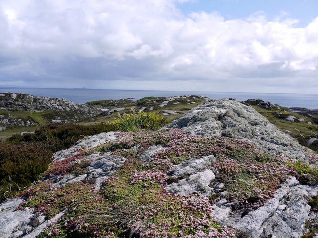
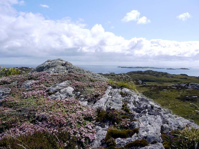
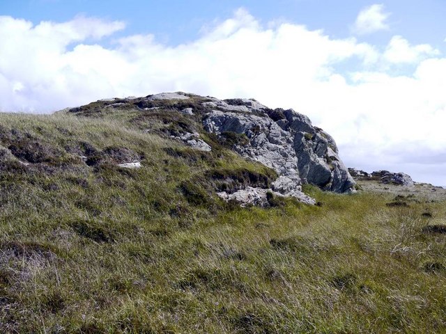
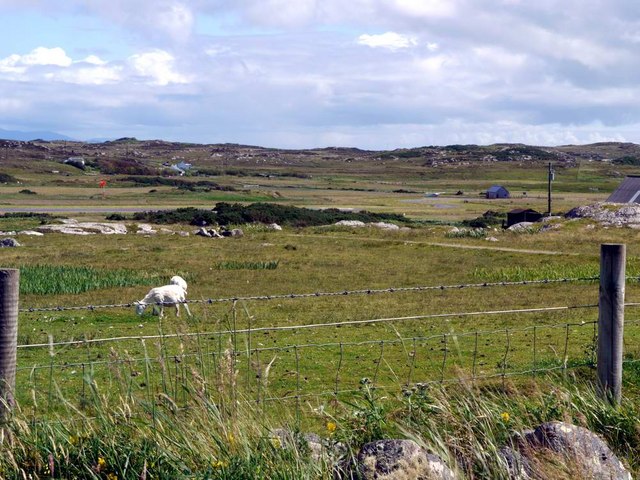
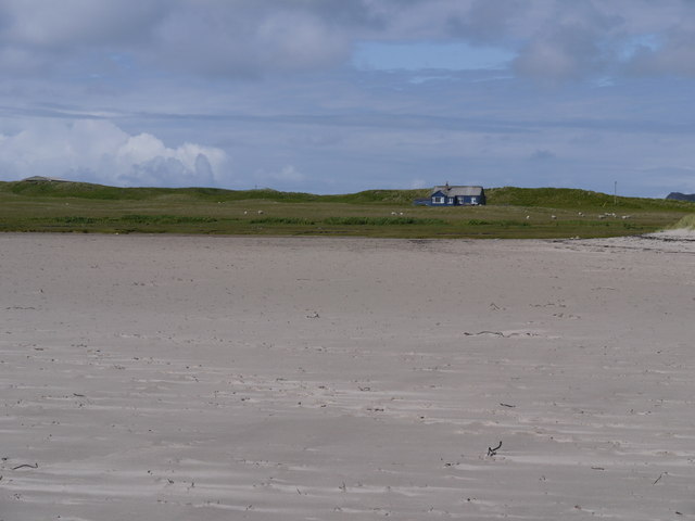
Uig, Argyllshire, is a small coastal village located on the west coast of Scotland. Situated in the county of Argyllshire, Uig is surrounded by stunning natural beauty, characterized by rolling green hills, rugged cliffs, and breathtaking sea views.

The village itself is quiet and picturesque, with a population of around 200 people. Uig is known for its tranquility and is a popular destination for those seeking a peaceful retreat away from the hustle and bustle of city life.

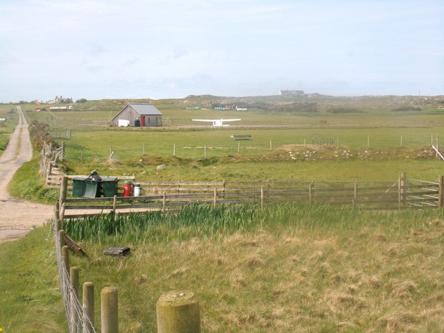
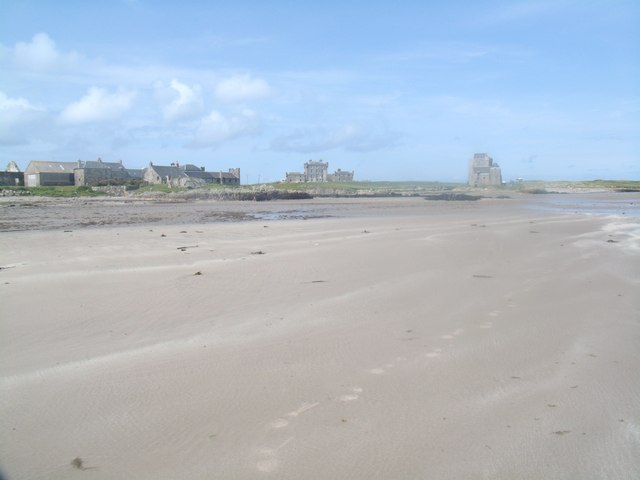
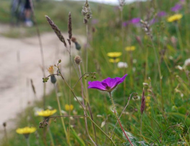
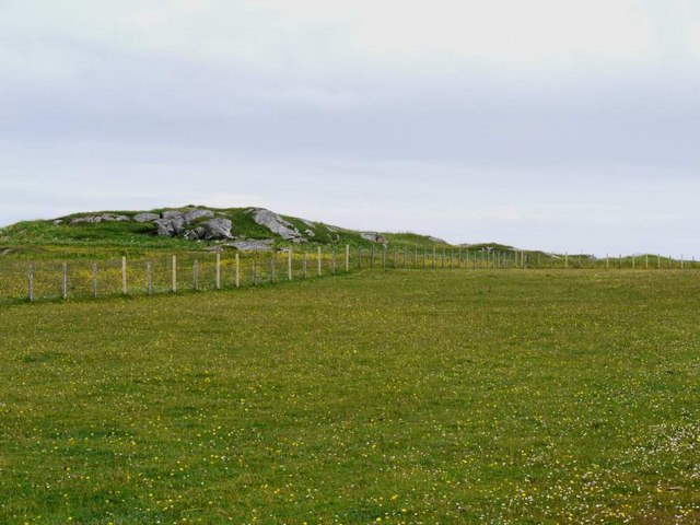
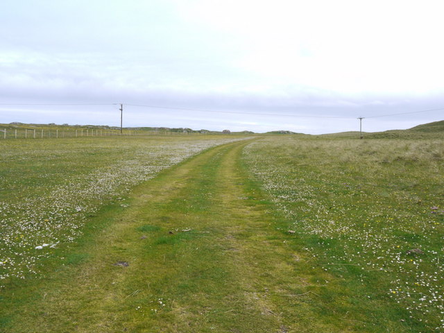
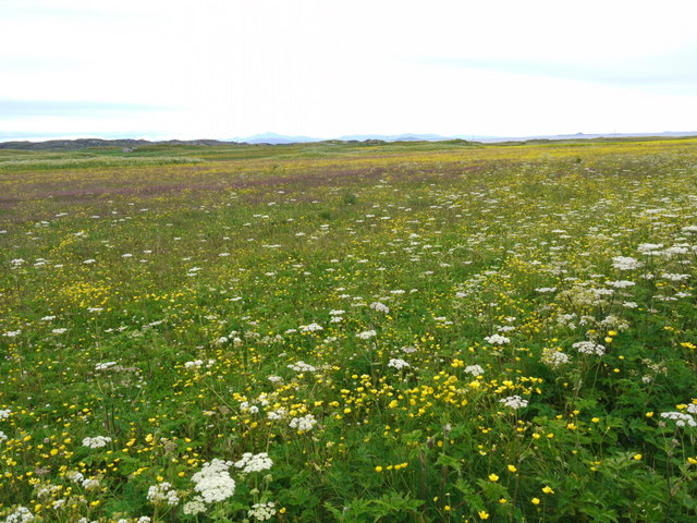
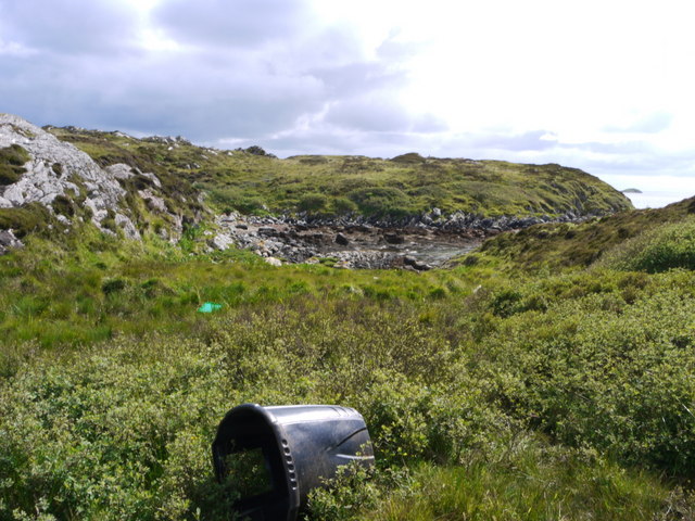
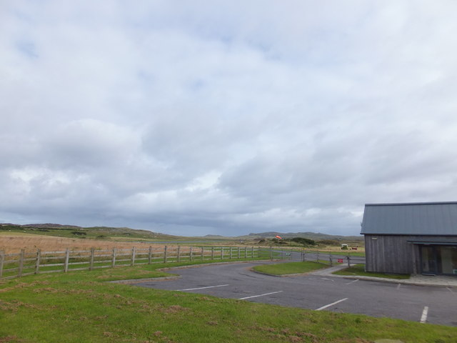
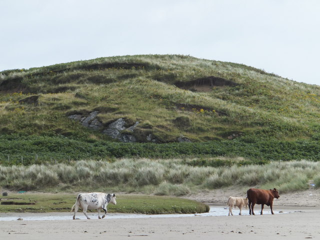
The landscape around Uig offers numerous opportunities for outdoor activities. The nearby Atlantic Ocean provides excellent fishing and boating opportunities, while the surrounding hills and moorland attract hikers and nature enthusiasts. Uig is also home to a variety of wildlife, including seals, otters, and a wide range of bird species.

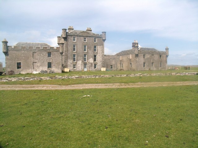
One of the notable features of Uig is its ancient history. The village is home to several well-preserved archaeological sites, including Iron Age forts and standing stones. These sites provide a glimpse into the rich history of the area and offer visitors a chance to explore the region's past.

Despite its small size, Uig has a strong sense of community. The village has a local pub and a community hall, which hosts various events and gatherings throughout the year. The residents of Uig are known for their warm hospitality and welcoming nature, making it a delightful place to visit.

Overall, Uig, Argyllshire, is a hidden gem on Scotland's west coast. With its stunning scenery, rich history, and friendly community, it offers a unique and memorable experience for visitors.

If you have any feedback on the listing, please let us know in the comments section below.

Uig Images

Images are sourced within 2km of 56.598064/-6.6157542 or Grid Reference NM1654. Thanks to Geograph Open Source API. All images are credited.

Isle of Coll airport
Isle of Coll airport A photograph of the airstrip serving Coll.
Isle of Coll airport
A photograph of the airstrip serving Coll.
Breachacha Castle Breachacha Castle was constructed sometime in the fifteenth century and rapidly became the scene of much internecine feuding between the Coll Macleans and the Duart Macleans.
Breachacha Castle
Breachacha Castle was constructed sometime in the fifteenth century and rapidly became the scene of much internecine feuding between the Coll Macleans and the Duart Macleans.
Breachacha Castle (new) This rather grand-looking mansion was built in 1750 by Hector Maclean, 13th of Coll, and in 1773 entertained Boswell and Johnson.
Breachacha Castle (new)
This rather grand-looking mansion was built in 1750 by Hector Maclean, 13th of Coll, and in 1773 entertained Boswell and Johnson.
Breachacha beach In the background are the 15th and 18th century castles at Breachacha.
Breachacha beach
In the background are the 15th and 18th century castles at Breachacha.
Looking south from Ceann Fasachd Looking due south, and the next bit of land is Islay.
Looking south from Ceann Fasachd
Looking due south, and the next bit of land is Islay.
Looking south-west from Ceann Fasachd The island of Soa and outlying skerries in the distance.
Looking south-west from Ceann Fasachd
The island of Soa and outlying skerries in the distance.
Small rock outcrop on Ceann Fasachd
Flowers of the Coll machair The purple of bloody cranesbill to the fore.
Flowers of the Coll machair
The purple of bloody cranesbill to the fore.
The runway at Coll Aerodrome The terminal building can be seen to the right, with a small private plane parked nearby.
The runway at Coll Aerodrome
The terminal building can be seen to the right, with a small private plane parked nearby.
Coll machair White and yellow flowers here, but elsewhere the purple of bloody cranesbill stains the banks with colour.
Coll machair
White and yellow flowers here, but elsewhere the purple of bloody cranesbill stains the banks with colour.
Track over the machair This is the track from the parking place to Feall Bay.  Vehicles obviously use it to save what is a very pleasant walk, although a sign at the car park asks them not to.
Track over the machair
This is the track from the parking place to Feall Bay. Vehicles obviously use it to save what is a very pleasant walk, although a sign at the car park asks them not to.
There's a corncrake in there somewhere! Coll's machair in full bloom, and the haunting rasp of the corncrake calling.  It's in there somewhere but this elusive bird cannot be seen in the long vegetation.  The island of Bac Mor (Dutchman's Cap) in the right distance.
There's a corncrake in there somewhere!
Coll's machair in full bloom, and the haunting rasp of the corncrake calling. It's in there somewhere but this elusive bird cannot be seen in the long vegetation. The island of Bac Mor (Dutchman's Cap) in the right distance.
Blue house on a silver beach At Loch Breachacha
Blue house on a silver beach
At Loch Breachacha
Inlet at the east side of Loch Breachacha
Parking, Coll Aerodrome It may not be an international hub, but Coll has its own airport.
Parking, Coll Aerodrome
It may not be an international hub, but Coll has its own airport.
Cattle, Loch Breachacha
Old Breachacha Castle
Show me another place!

Uig is located at Grid Ref: NM1654 (Lat: 56.598064, Lng: -6.6157542)

Unitary Authority: Argyll and Bute

Police Authority: Argyll and West Dunbartonshire

What 3 Words

///entry.seeing.young. Near Arinagour, Argyll & Bute

Related Wikis

Coll Airport

Coll Island Airport (IATA: COL, ICAO: EGEL) (Scottish Gaelic: Port-adhair Cholla) is located 5 NM (9.3 km; 5.8 mi) west southwest of Arinagour on the island...
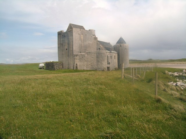
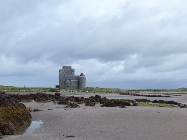
Breachacha Castle

Breachacha Castle (also spelled Breacachadh) is either of two structures on the shore of Loch Breachacha, on the Inner Hebridean island of Coll, Scotland...

Dùn an Achaidh

Dùn an Achaidh, sometimes Anglicised as Dun Acha, is a dun located near the village of Acha on the Inner Hebridean island of Coll. It is considered the...

Acha, Coll

Acha (Gaelic: An t-Achadh, tranlsating to "The Field") is a small hamlet on the Scottish island of Coll. == References == == See also == Dùn an Achaidh...
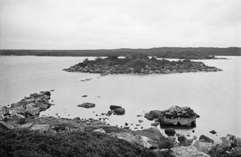
Breachacha crannog

The Breachacha crannog is a crannog located near Loch Breachacha, on the Inner Hebridean island of Coll. The crannog is recognised in the United Kingdom...

Dùn Beic

Dùn Beic is a dun located on the Inner Hebridean island of Coll. It is located at grid reference NM15495644 and is thought to date to between 1000 BCE...

Totamore dun

Totamore Dun is a dun located at grid reference NM17625713; near the settlement of Totamore, on the Inner Hebridean island of Coll. It occupies the summit...

Dùn Anlaimh

Dùn Anlaimh, also known as Dùn Amhlaidh, and Eilean nan Cinneachan, is a crannog (an artificial island), located within Loch nan Cinneachan on the Inner...

Nearby Amenities

Located within 500m of 56.598064,-6.6157542
Aeroway: holding_position
Lat/Long: 56.5993298/-6.6187368
Aeroway: windsock
Lit: yes
Lat/Long: 56.6001757/-6.6175963
Passing Place
Lat/Long: 56.5967191/-6.6089429
Post Box
Post Box Type: lamp
Ref: PA78 113
Royal Cypher: scottish_crown
Lat/Long: 56.5980997/-6.6163862
Aeroway: threshold
Ele: 6
Ref: 02
Lat/Long: 56.5999167/-6.6189444
Uig
Name Gd: Ùig
Place: hamlet
Wikidata: Q75717947
Lat/Long: 56.5970881/-6.6126404
Power: pole
Lat/Long: 56.5961006/-6.6190508
Power: pole
Lat/Long: 56.5962306/-6.6198984
Power: pole
Lat/Long: 56.5963856/-6.6210035
Power: pole
Lat/Long: 56.5965466/-6.6220897
Power: pole
Lat/Long: 56.5966987/-6.6231653
Power: pole
Lat/Long: 56.5965082/-6.6128996
Power: pole
Lat/Long: 56.5966293/-6.6116748
Power: pole
Lat/Long: 56.5944562/-6.619602
Power: pole
Lat/Long: 56.5945353/-6.6188988
Power: pole
Lat/Long: 56.5938214/-6.6178515
Power: pole
Lat/Long: 56.5940435/-6.618827
Power: pole
Lat/Long: 56.5952561/-6.6189749
Power: pole
Lat/Long: 56.597344/-6.6120465
Power: pole
Lat/Long: 56.5979113/-6.6123358
Power: pole
Lat/Long: 56.5986146/-6.6126272
Power: pole
Lat/Long: 56.5990459/-6.6121394
Power: pole
Lat/Long: 56.5995585/-6.6115904
Power: pole
Lat/Long: 56.6000805/-6.6110118
Passing Place
Lat/Long: 56.5977256/-6.6131203
The data included in this document is from www.openstreetmap.org. The data is made available under ODbL.

Have you been to Uig?

Leave your review of Uig below (or comments, questions and feedback).