Bovingdon

Settlement in Hertfordshire Dacorum

England

Bovingdon

Grove Lane, Whelpley Hill
Grove Lane, Whelpley Hill Credit: David Howard

Bovingdon is a village located in Hertfordshire, England. It is situated approximately 29 miles northwest of central London and falls within the local government district of Dacorum. With a population of around 4,600 residents, Bovingdon retains a small-town atmosphere while offering convenient access to nearby urban areas.

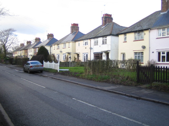
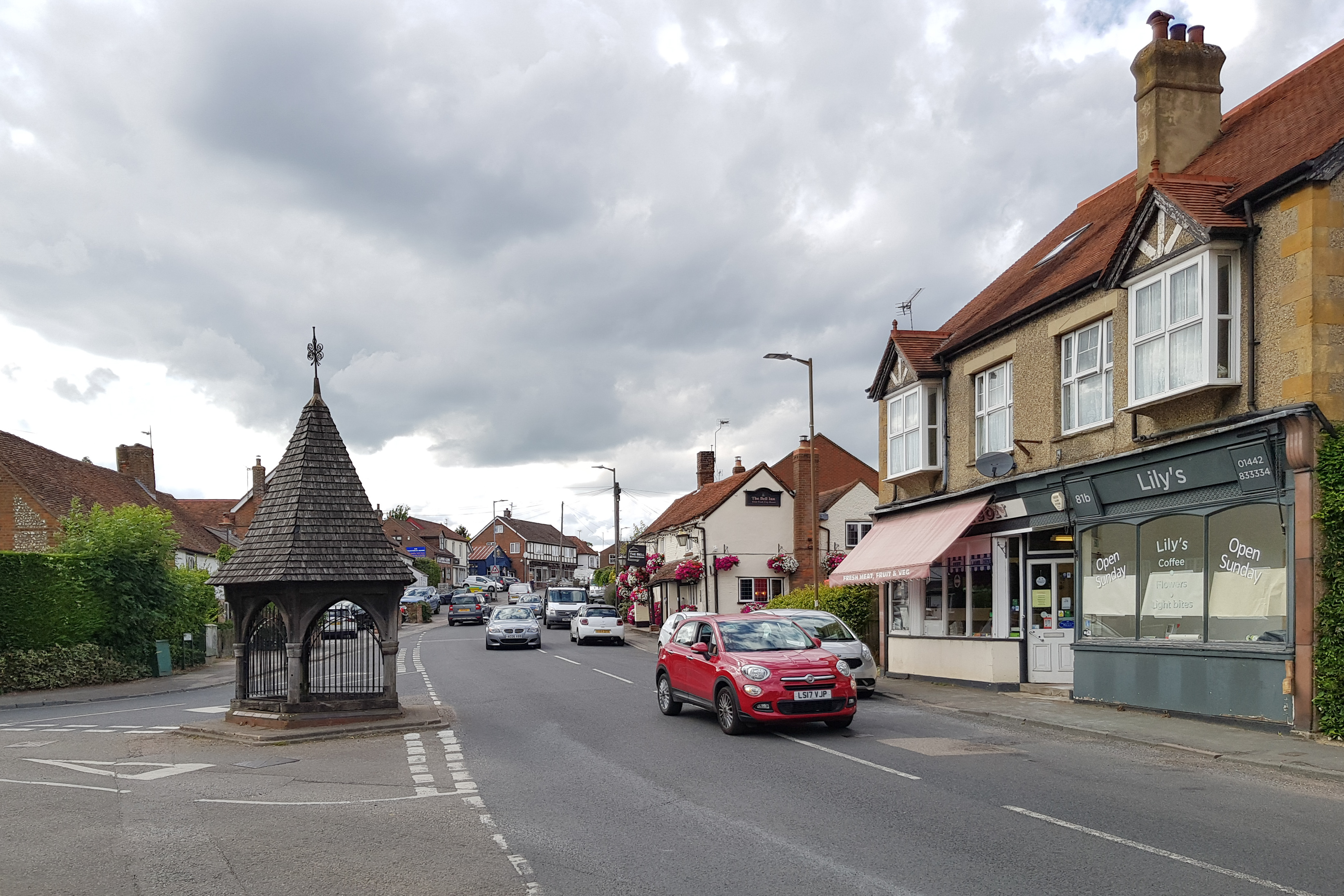
The village boasts a rich history, with evidence of settlement dating back to Roman times. Today, Bovingdon features a diverse architectural landscape, with a mix of traditional cottages, modern houses, and several listed buildings. The village center provides a range of amenities, including a post office, local shops, pubs, and restaurants, catering to the needs of its residents.

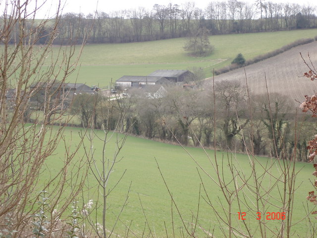
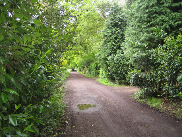
Nature enthusiasts can take advantage of the surrounding countryside, which offers picturesque walks and cycling routes. The nearby Ashridge Estate, managed by the National Trust, provides a stunning natural backdrop and extensive woodlands. Bovingdon also benefits from its proximity to the Chiltern Hills, an Area of Outstanding Natural Beauty, which offers further opportunities for outdoor activities.

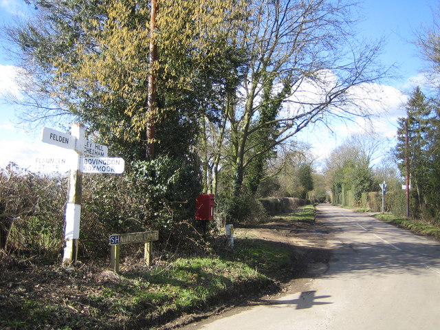
The village is well-connected to transportation networks, with easy access to the M1 and M25 motorways, providing convenient links to London and beyond. Public transportation options include regular bus services to neighboring towns and villages, as well as a nearby train station in Hemel Hempstead.

Overall, Bovingdon offers a charming and well-connected location, combining a rich history with a range of amenities and access to beautiful natural surroundings.

If you have any feedback on the listing, please let us know in the comments section below.
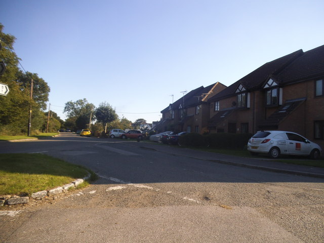
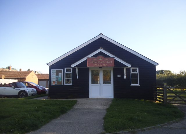
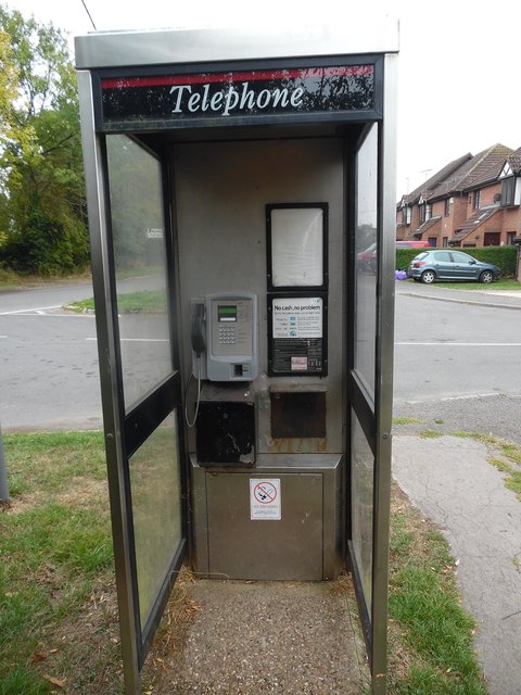
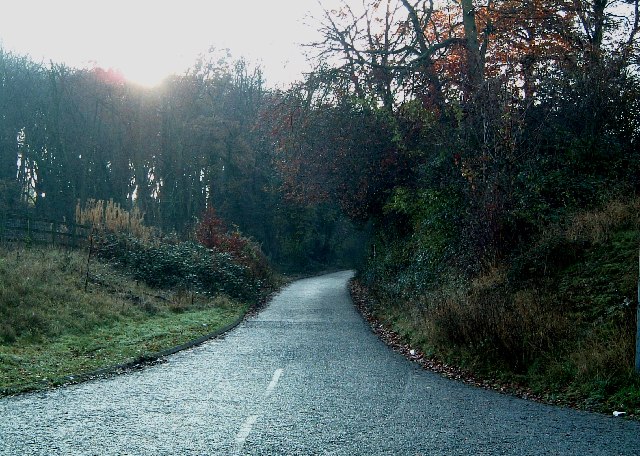
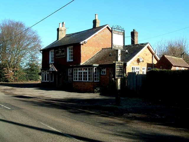
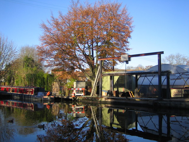
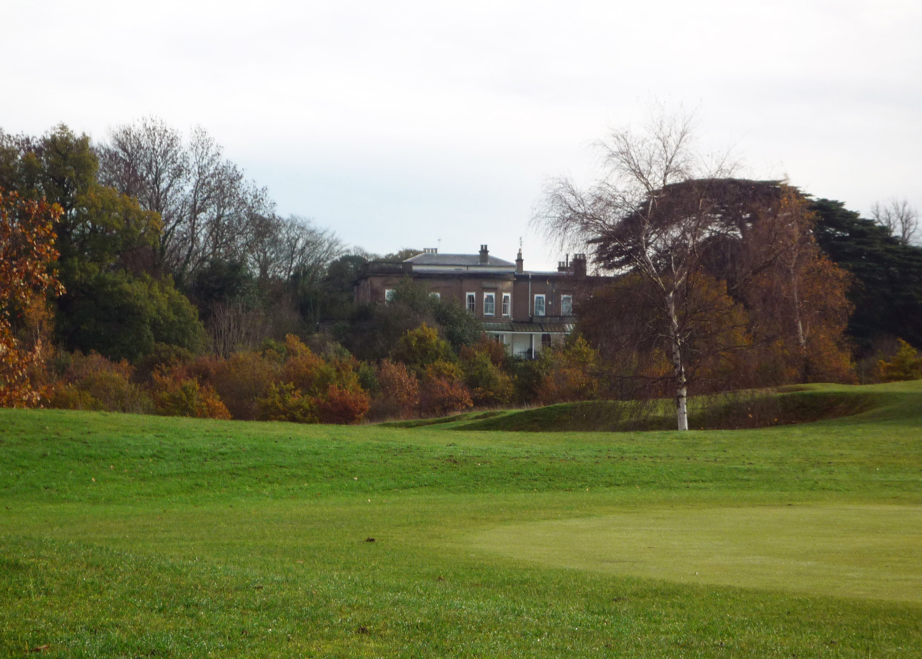
Bovingdon Images

Images are sourced within 2km of 51.722289/-0.53128417 or Grid Reference TL0103. Thanks to Geograph Open Source API. All images are credited.

Grove Lane, Whelpley Hill
Coronation Hall, Whelpley Hill
Former KX100 Telephone Kiosk at Whelpley Hill Located in the centre of Whelpley Hill, this telephone kiosk has a payphone which still seems to be in use, although it no longer accepts cash. It remains to be seen how long it will remain there, as some other similar kiosks have since been removed in recent years from our streets. For SatNav purposes, its postcode is HP5 3RS. Update: this telephone kiosk has since been removed from this location.
Former KX100 Telephone Kiosk at Whelpley Hill
Located in the centre of Whelpley Hill, this telephone kiosk has a payphone which still seems to be in use, although it no longer accepts cash. It remains to be seen how long it will remain there, as some other similar kiosks have since been removed in recent years from our streets. For SatNav purposes, its postcode is HP5 3RS. Update: this telephone kiosk has since been removed from this location.
Upper Bourne End Lane entrance Upper Bourne End Lane was chopped in two by the construction of the new A41 a few years ago. This southern section is heading into Hanging Wood and comes to a dead end.
Upper Bourne End Lane entrance
Upper Bourne End Lane was chopped in two by the construction of the new A41 a few years ago. This southern section is heading into Hanging Wood and comes to a dead end.
Bovingdon Market Situated on the old main runways of the former World War II Bovingdon Airfield, Bovingdon Market is a popular venue for traders and the public alike. The operator's website is here <span class="nowrap"><a title="http://www.wendyfairmarkets.com/categoryView.asp?category=983" rel="nofollow ugc noopener" href="http://www.wendyfairmarkets.com/categoryView.asp?category=983">Link</a><img style="margin-left:2px;" alt="External link" title="External link - shift click to open in new window" src="https://s1.geograph.org.uk/img/external.png" width="10" height="10"/></span>
Bovingdon Market
Situated on the old main runways of the former World War II Bovingdon Airfield, Bovingdon Market is a popular venue for traders and the public alike. The operator's website is here LinkExternal link
Bovingdon Raceway The stock car and banger racing circuit on the former World War II Bovingdon Airfield. Full details of the circuit, meetings, etc., can be found here <span class="nowrap"><a title="http://www.spedeworth.co.uk/raceways/bovingdon.htm" rel="nofollow ugc noopener" href="http://www.spedeworth.co.uk/raceways/bovingdon.htm">Link</a><img style="margin-left:2px;" alt="External link" title="External link - shift click to open in new window" src="https://s1.geograph.org.uk/img/external.png" width="10" height="10"/></span>
Bovingdon Raceway
The stock car and banger racing circuit on the former World War II Bovingdon Airfield. Full details of the circuit, meetings, etc., can be found here LinkExternal link
Bovingdon: The Bell and The Bull Public Houses Bovingdon was once a centre of straw plaiting for hatmakers in Luton. Looking south eastwards down the High Street, The Bell is the near public house on the left, with The Bull the next building but one.
Bovingdon: The Bell and The Bull Public Houses
Bovingdon was once a centre of straw plaiting for hatmakers in Luton. Looking south eastwards down the High Street, The Bell is the near public house on the left, with The Bull the next building but one.
Bovingdon: Longcroft Lane Hedge flailing was in progress just down the lane in this view taken looking northwards from the junction with Chipperfield Road.
Bovingdon: Longcroft Lane
Hedge flailing was in progress just down the lane in this view taken looking northwards from the junction with Chipperfield Road.
Bovingdon: Boundary Cottages A neat row of semi-detached houses on Chipperfield Road.
Bovingdon: Boundary Cottages
A neat row of semi-detached houses on Chipperfield Road.
Bovingdon: Holly Hedges Lane Aptly named and looking south eastwards towards Belsize.
Bovingdon: Holly Hedges Lane
Aptly named and looking south eastwards towards Belsize.
Bovingdon: Bovingdon Green Viewed looking northwards along The Green towards Bovingdon.
Bovingdon: Bovingdon Green
Viewed looking northwards along The Green towards Bovingdon.
Bovingdon: Long Lane Mast Viewed looking westwards from Long Lane.
Bovingdon: Long Lane Mast
Viewed looking westwards from Long Lane.
Bovingdon: Shantock Lane Viewed looking westwards from the junction with Long Lane.
Bovingdon: Shantock Lane
Viewed looking westwards from the junction with Long Lane.
Vale Farm
Vale Farm
Bourne End Service Station, A41
Bovingdon: Little Hay Golf Club This municipal golf course is owned by Dacorum Borough Council, and was opened on the farmland of the former Little Hay Farm in 1977. The Club's website is here <span class="nowrap"><a title="http://www.littlehaygolfclub.co.uk/" rel="nofollow ugc noopener" href="http://www.littlehaygolfclub.co.uk/">Link</a><img style="margin-left:2px;" alt="External link" title="External link - shift click to open in new window" src="https://s1.geograph.org.uk/img/external.png" width="10" height="10"/></span>
Bovingdon: Little Hay Golf Club
This municipal golf course is owned by Dacorum Borough Council, and was opened on the farmland of the former Little Hay Farm in 1977. The Club's website is here LinkExternal link
Bovingdon: Shothanger Way Although this is a private road, there is a public right of way along it, and it is viewed from the junction of Bushfield Road and Stoney Lane on the Hertfordshire Way between Bovingdon and Bourne End.
Bovingdon: Shothanger Way
Although this is a private road, there is a public right of way along it, and it is viewed from the junction of Bushfield Road and Stoney Lane on the Hertfordshire Way between Bovingdon and Bourne End.
Bovingdon Reservoir & radio masts The reservoir is a covered one to the north-east of the former Bovingdon Airfield.
Bovingdon Reservoir & radio masts
The reservoir is a covered one to the north-east of the former Bovingdon Airfield.
Show me another place!

Bovingdon is located at Grid Ref: TL0103 (Lat: 51.722289, Lng: -0.53128417)

Administrative County: Hertfordshire

District: Dacorum

Police Authority: Hertfordshire

What 3 Words

///other.pushes.pilots. Near Bovingdon, Hertfordshire

Nearby Locations

Bovingdon Bovingdon

Related Wikis

Bovingdon

Bovingdon is a village in Hertfordshire, England, 4 miles (6.4 km) southwest of Hemel Hempstead, and it is a civil parish within the local authority area...

HM Prison The Mount

HM Prison The Mount is a Category C men's prison, located on the outskirts of Bovingdon village in Hertfordshire, England. The Mount Prison is operated...
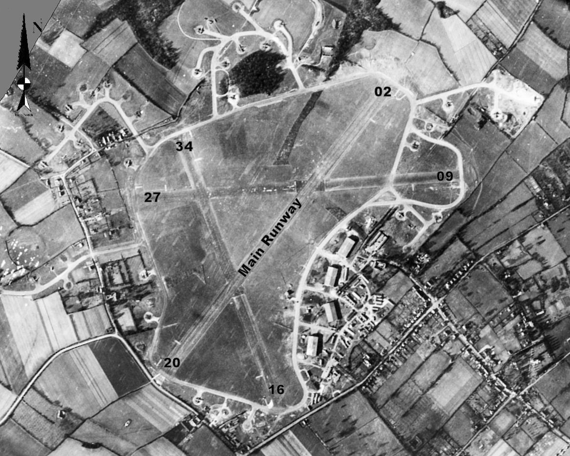
RAF Bovingdon

Royal Air Force Bovingdon or more simply RAF Bovingdon is a former Royal Air Force station located near the village of Bovingdon, Hertfordshire, England...

South West Hertfordshire (UK Parliament constituency)

South West Hertfordshire is a constituency in the House of Commons of the UK Parliament, represented since 2019 by Gagan Mohindra, a Conservative. ��2...

Heathrow arrival stacks

Inbound aircraft to London Heathrow Airport typically follow one of a number of Standard Arrival Routes (STARs). The STARs each terminate at one of four...

Whelpley Hill

Whelpley Hill is a hamlet in the parish of Ashley Green in Buckinghamshire, England. It is located to the east of Chesham, near the border with Hertfordshire...

Bourne End, Hertfordshire

Bourne End is a village in Hertfordshire, England. It is situated on the ancient Roman Akeman Street between Berkhamsted and Hemel Hempstead, on the former...

Westbrook Hay

Westbrook Hay School is a culturally significant great house located in Hemel Hempstead, Hertfordshire, England, that has housed the independent Westbrook...

Related Videos

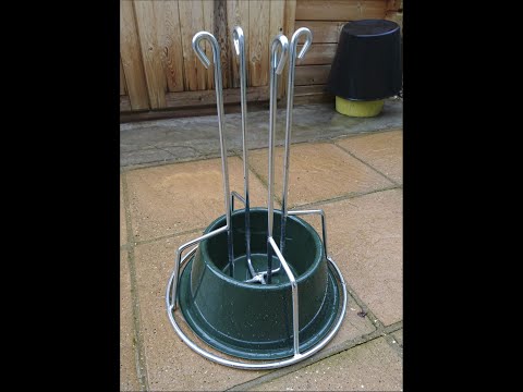
099. The Quick Stand (Heavy-duty Medium) - Christmas Tree Stand - Review & Demonstration

I've owned one of these 'Quick Stand' Christmas tree stands for a few years now, purchased from a local grower on the outskirts of ...

Wishes you all Eid Mubarak

Eid al-Fitr in Arabic: عيد الفطر: Eid . 'Holiday of Breaking the Fast, is the earlier of the two official holidays celebrated within Islam ...

First time DRIFTING the 350Z + Bonus part | Drift Limits

Hello Adrenaline maniacs! We are finally releasing this quick video of our first experience drifting our 350Z in a drift open day at ...

Nearby Amenities

Located within 500m of 51.722289,-0.53128417
Mini Roundabout
Direction: clockwise
Lat/Long: 51.7246922/-0.5347657
Bovingdon
Place: village
Wikidata: Q19926
Wikipedia: en:Bovingdon
Lat/Long: 51.7234367/-0.5327056
Post Box
Collection Times: Mo-Fr 09:00; Sa 07:00
Operator: Royal Mail
Post Box Type: wall
Ref: HP3 119D
Royal Cypher: EIIR
Royal Cypher Wikidata: Q33102113
Source: survey
Survey Date: 2016-03-25
Lat/Long: 51.7246798/-0.5349335
Bus Stop
Nye Way
Bus: yes
Naptan AtcoCode: 210021403600
Naptan Bearing: NE
Naptan CommonName: Nye Way
Naptan Crossing: opp Homefield
Naptan Indicator: adj
Naptan Landmark: opp Homefield
Naptan NaptanCode: hrtdjpda
Naptan ShortCommonName: NA
Naptan Street: Green Lane
Naptan Verified: no
Public Transport: platform
Shelter: no
Source: naptan_import
Lat/Long: 51.7198938/-0.532406
Bus Stop
Austins Mead
Naptan AtcoCode: 210021403920
Naptan Bearing: NW
Naptan CommonName: Austins Mead
Naptan Crossing: Farmers Close
Naptan Indicator: adj
Naptan Landmark: Farmers Close
Naptan NaptanCode: hrtdjmjg
Naptan ShortCommonName: NA
Naptan Street: Chipperfield Road
Naptan Verified: no
Public Transport: platform
Source: naptan_import
Lat/Long: 51.7204828/-0.5274399
Bus Stop
Memorial Hall
Bus: yes
Naptan AtcoCode: 210021403940
Naptan Bearing: NW
Naptan CommonName: Memorial Hall
Naptan Crossing: Post Office
Naptan Indicator: opp
Naptan Landmark: Post Office
Naptan NaptanCode: hrtdjmjm
Naptan ShortCommonName: NA
Naptan Street: High Street
Naptan Verified: no
Public Transport: platform
Shelter: yes
Source: naptan_import
Lat/Long: 51.7227458/-0.5318701
Bus Stop
Hempstead Road
Bus: yes
Naptan AtcoCode: 210021403960
Naptan Bearing: NW
Naptan CommonName: Hempstead Road
Naptan Crossing: Chesham Road
Naptan Indicator: N-bound
Naptan Landmark: Chesham Road
Naptan NaptanCode: hrtdjmjp
Naptan ShortCommonName: NA
Naptan Street: High Street
Naptan Verified: no
Public Transport: platform
Shelter: no
Source: naptan_import
Lat/Long: 51.7242049/-0.5343556
Old Dean
Naptan AtcoCode: 210021403970
Naptan Bearing: S
Naptan BusStopType: CUS
Naptan CommonName: Old Dean
Naptan Crossing: Dean Field
Naptan Indicator: S-bound
Naptan Landmark: Dean Field
Naptan NaptanCode: hrtdjmjt
Naptan ShortCommonName: NA
Naptan Street: Old Dean
Naptan Verified: no
Source: naptan_import
Lat/Long: 51.7217233/-0.5353191
Bus Stop
High Street
Bus: yes
Naptan AtcoCode: 210021403980
Naptan Bearing: NE
Naptan CommonName: High Street
Naptan Crossing: Newhouse Road
Naptan Indicator: opp
Naptan Landmark: Newhouse Road
Naptan NaptanCode: hrtdjmjw
Naptan ShortCommonName: NA
Naptan Street: Hempstead Road
Naptan Verified: no
Public Transport: platform
Shelter: no
Source: naptan_import
Lat/Long: 51.7255591/-0.5336125
Bus Stop
High Street
Bus: yes
Local Ref: NR
Naptan AtcoCode: 210021408820
Naptan Bearing: SW
Naptan CommonName: High Street
Naptan Crossing: Vicarage Lane
Naptan Indicator: nr
Naptan Landmark: Vicarage Lane
Naptan NaptanCode: hrtdgwjw
Naptan ShortCommonName: NA
Naptan Street: Hempstead Road
Naptan Verified: no
Public Transport: platform
Shelter: yes
Source: naptan_import
Lat/Long: 51.7256389/-0.5333295
Bus Stop
Hempstead Road
Bench: yes
Bus: yes
Naptan AtcoCode: 210021408840
Naptan Bearing: SE
Naptan CommonName: Hempstead Road
Naptan Crossing: Chesham Road
Naptan Indicator: S-bound
Naptan Landmark: Chesham Road
Naptan NaptanCode: hrtdgwma
Naptan ShortCommonName: NA
Naptan Street: High Street
Naptan Verified: no
Public Transport: platform
Shelter: no
Source: naptan_import
Lat/Long: 51.7239093/-0.5336934
Bus Stop
Memorial Hall
Bus: yes
Naptan AtcoCode: 210021408860
Naptan Bearing: SE
Naptan CommonName: Memorial Hall
Naptan Crossing: Church Lane
Naptan Indicator: adj
Naptan Landmark: Church Lane
Naptan NaptanCode: hrtdgwmd
Naptan ShortCommonName: NA
Naptan Street: High Street
Naptan Verified: no
Public Transport: platform
Shelter: yes
Source: naptan_import
Lat/Long: 51.7225117/-0.5314373
Bus Stop
Austins Mead
Bus: yes
Naptan AtcoCode: 210021408880
Naptan Bearing: SE
Naptan CommonName: Austins Mead
Naptan Crossing: opp Austins Mead
Naptan Indicator: opp
Naptan Landmark: opp Austins Mead
Naptan NaptanCode: hrtdgwmg
Naptan ShortCommonName: NA
Naptan Street: Chipperfield Road
Naptan Verified: no
Public Transport: platform
Shelter: no
Source: naptan_import
Lat/Long: 51.720194/-0.5266386
Bus Stop
Nye Way
Bus: yes
Naptan AtcoCode: 210021409330
Naptan Bearing: SW
Naptan CommonName: Nye Way
Naptan Crossing: opp Orchard Way
Naptan Indicator: opp
Naptan Landmark: opp Orchard Way
Naptan NaptanCode: hrtdgwat
Naptan ShortCommonName: NA
Naptan Street: Green Lane
Naptan Verified: no
Public Transport: platform
Shelter: no
Source: naptan_import
Lat/Long: 51.7192753/-0.533008
Pub
The Bell Inn
Fhrs Id: 201968
Website: https://bellbovingdon.co.uk/
Wikidata: Q26467462
Lat/Long: 51.7218654/-0.5302453
Fast Food
Seaways
Cuisine: fish_and_chips
Lat/Long: 51.7233073/-0.5331232
Coop
Shop: convenience
Lat/Long: 51.7232728/-0.5330679
Mini Roundabout
Direction: clockwise
Lat/Long: 51.7245872/-0.5348062
The Bull
Disused Amenity: pub
Toilets: yes
Toilets Access: customers
Lat/Long: 51.721633/-0.5295062
W Jarman & Sons
Shop: doityourself
Lat/Long: 51.7232022/-0.532948
Zakhama Hair Co
Addr Housenumber: 1b
Addr Street: High Street
Shop: hairdresser
Lat/Long: 51.7247404/-0.5343413
Fast Food
Bovingdon Kebab & Pizza
Cuisine: pizza
Lat/Long: 51.7241566/-0.5344539
Bovingdon Village Stores
Shop: convenience
Lat/Long: 51.7218596/-0.5309524
Traffic Calming: island
Lat/Long: 51.7245571/-0.5349089
Crossing
Crossing: traffic_signals
Crossing Ref: pelican
Lat/Long: 51.7243931/-0.5351676
Post Box
Collection Times: Mo-Fr 17:00; Sa 12:00
Operator: Royal Mail
Post Box Type: pillar
Ref: HP3 118
Royal Cypher: EIIR
Royal Cypher Wikidata: Q33102113
Source: survey
Survey Date: 2016-03-25
Lat/Long: 51.7228109/-0.5319714
Wildgoose
Addr City: Bovingdon
Addr Housename: Unit 8D
Addr Postcode: HP3 0JN
Addr Street: Chipperfield Road
Website: https://wearewildgoose.com/team-events/
Lat/Long: 51.7208596/-0.5294441
Addr Housenumber: 33a
Addr Street: High Street
Shop: newsagent
Lat/Long: 51.7236791/-0.5330916
Bovingdon Dry Clean
Addr Housenumber: 33b
Addr Street: High Street
Shop: laundry
Lat/Long: 51.7236401/-0.5330273
Ameyzoo
Shop: pet
Lat/Long: 51.7240405/-0.5342692
Cafe
KS Cafe
Cuisine: sandwich
Lat/Long: 51.7233808/-0.5324573
Bench
Lat/Long: 51.7229738/-0.5322467
New Wine Rack
Shop: alcohol
Lat/Long: 51.7234946/-0.5327751
Pharmacy
Manor Pharmacy
Dispensing: yes
Lat/Long: 51.7235195/-0.5328174
Bus Stop
Bus: yes
Public Transport: platform
Shelter: no
Lat/Long: 51.7237671/-0.5336415
Crossing
Button Operated: yes
Crossing: traffic_signals
Crossing Ref: pelican
Tactile Paving: yes
Lat/Long: 51.7231401/-0.5323685
Restaurant
Zeera
Addr Housenumber: 49
Addr Street: High Street
Cuisine: indian
Website: https://www.zeeraindianrestaurant.com/
Lat/Long: 51.7222642/-0.5310591
Barrier: kissing_gate
Lat/Long: 51.721077/-0.5245987
Financial Resolutions
Office: accountant
Website: https://www.finres.co.uk/
Lat/Long: 51.7246731/-0.5344301
The Barbers of Bovingdon
Shop: hairdresser
Lat/Long: 51.7247105/-0.5343765
Pendley Estates
Office: estate_agent
Lat/Long: 51.7241157/-0.5343899
Bovingdon Flooring
Addr Housenumber: 14
Addr Street: High Street
Shop: flooring
Lat/Long: 51.7239869/-0.5341928
Storage Centre
Addr Housenumber: 24
Addr Street: High Street
Shop: storage_rental
Lat/Long: 51.7236122/-0.5337663
Bench
Backrest: yes
Lat/Long: 51.7237636/-0.5336526
Cutting Garden
Shop: hairdresser
Lat/Long: 51.7236106/-0.5335651
The Beauty Garden
Shop: beauty
Lat/Long: 51.723579/-0.5335142
Post Office
Bovingdon Post Office
Addr Country: GB
Addr Postcode: HP3 0HG
Brand: Post Office
Brand Wikidata: Q1783168
Contact Website: https://www.postoffice.co.uk/branch-finder/0871265/bovingdon
Description: Inside Newsagent
Ref Pol Id: 130870
Lat/Long: 51.723697/-0.5330642
Waste Basket
Waste: trash
Lat/Long: 51.7236131/-0.5331353
Post Box
Lat/Long: 51.7236617/-0.5331943
Churchills
Shop: butcher
Lat/Long: 51.7235732/-0.5329067
Wilsons
Office: estate_agent
Lat/Long: 51.7235491/-0.5328631
Bicycle Parking
Bicycle Parking: wall_loops
Capacity: 4
Lat/Long: 51.7233084/-0.532338
Entrance: main
Lat/Long: 51.7232692/-0.5322788
Waste Basket
Waste: trash
Lat/Long: 51.723201/-0.5321972
Doctors
Archway Surgery
Website: https://www.archwaysurgery.co.uk/
Lat/Long: 51.7229327/-0.5326492
Welcome to Bovingdon Village
Board Type: history
Information: board
Tourism: information
Lat/Long: 51.7229902/-0.5322706
Waste Basket
Waste: trash
Lat/Long: 51.7229119/-0.5318425
Dentist
Simon Michaels
Website: https://www.bovingdondentalclinic.co.uk/
Lat/Long: 51.7227624/-0.5322066
Batemans Solicitor
Office: lawyer
Website: https://batemans-solicitors.co.uk/
Lat/Long: 51.7228346/-0.5322213
Bench
Lat/Long: 51.7228371/-0.5320631
Dentist
S.D Davis Dental Laboratory
Addr Housenumber: 60
Addr Street: High Street
Lat/Long: 51.7227707/-0.5321255
Waste Basket
Waste: trash
Lat/Long: 51.722801/-0.5316507
Toilets
Access: yes
Lat/Long: 51.722737/-0.5313919
3rd Air Division, US Air Force
Historic: memorial
Memorial: plaque
Lat/Long: 51.722626/-0.5312985
Bench
Backrest: yes
Lat/Long: 51.7230585/-0.5306067
Waste Basket
Waste: trash
Lat/Long: 51.7230112/-0.5307532
Bench
Backrest: no
Lat/Long: 51.7231991/-0.5304333
Playground: swing
Lat/Long: 51.7231698/-0.5305161
Playground: slide
Lat/Long: 51.7231055/-0.5305088
Clock
Display: analog
Faces: 1
Support: wall_mounted
Visibility: street
Lat/Long: 51.7226843/-0.5313174
Bench
Backrest: yes
Lat/Long: 51.7225812/-0.5312242
Dentist
Laurel Cottage Dental Practice
Website: https://laurelcottagedental.co.uk/
Lat/Long: 51.7221899/-0.5308273
Chiltern Piano Gallery
Shop: musical_instrument
Website: https://www.chilternpianos.co.uk
Lat/Long: 51.7222091/-0.5314261
Gentlemans Lounge Barber
Shop: hairdresser
Lat/Long: 51.7221235/-0.5313751
G.C. Parish & Sons
Office: removals
Website: https://www.parish-removals.co.uk/
Lat/Long: 51.7220238/-0.531245
G.C. Parish & Sons
Shop: coal
Website: https://coalmerchantschesham.co.uk/
Lat/Long: 51.7219947/-0.5311894
Waste Basket
Waste: trash
Lat/Long: 51.7219841/-0.5309329
Waste Basket
Waste: dog_excrement
Lat/Long: 51.7215424/-0.5300313
Shop: convenience
Lat/Long: 51.72176/-0.5299542
Cafe
Lily's
Addr Housenumber: 81b
Addr Street: High Street
Fhrs Id: 201953
Lat/Long: 51.7217411/-0.5298791
Bench
Backrest: yes
Lat/Long: 51.72339/-0.5283449
Bench
Backrest: yes
Lat/Long: 51.7234986/-0.528364
Bench
Backrest: yes
Lat/Long: 51.7235877/-0.5284334
Waste Basket
Waste: dog_excrement
Lat/Long: 51.7235175/-0.5289839
Welcome to Bovingdon Churchyard
Board Type: nature
Information: board
Tourism: information
Lat/Long: 51.7233871/-0.529004
Bench
Backrest: yes
Lat/Long: 51.7231968/-0.5293608
Bench
Backrest: yes
Lat/Long: 51.7233397/-0.5293474
Bench
Backrest: yes
Lat/Long: 51.7227648/-0.5297323
Bench
Backrest: yes
Lat/Long: 51.7229219/-0.5295157
Bench
Backrest: yes
Lat/Long: 51.7231603/-0.5295847
Bench
Backrest: yes
Lat/Long: 51.7232579/-0.5285132
Bench
Backrest: yes
Lat/Long: 51.7232317/-0.5284931
Bench
Backrest: yes
Lat/Long: 51.7232245/-0.5281219
Bench
Backrest: yes
Lat/Long: 51.722673/-0.52854
Bench
Backrest: yes
Lat/Long: 51.7228558/-0.5287962
Bench
Backrest: yes
Lat/Long: 51.7229119/-0.5291931
Board Type: notice
Information: board
Tourism: information
Lat/Long: 51.7220599/-0.5291313
Welcome to Bovingdon Churchyard
Board Type: nature
Information: board
Tourism: information
Lat/Long: 51.7221305/-0.5291556
Welcome to Bovingdon Village
Board Type: history
Information: board
Tourism: information
Lat/Long: 51.7214464/-0.5295881
Waste Basket
Waste: trash
Lat/Long: 51.721414/-0.5294473
Bench
Backrest: yes
Lat/Long: 51.7214003/-0.5294117
Waste Basket
Waste: dog_excrement
Lat/Long: 51.7210393/-0.5286688
Barrier: kissing_gate
Lat/Long: 51.7188657/-0.5282922
Direction: 220
Generator Method: photovoltaic
Generator Output Electricity: yes
Generator Solar Modules: 12
Generator Source: solar
Generator Type: solar_photovoltaic_panel
Location: roof
Power: generator
Lat/Long: 51.7199673/-0.5325703
Direction: 220
Generator Method: photovoltaic
Generator Output Electricity: yes
Generator Solar Modules: 16
Generator Source: solar
Generator Type: solar_photovoltaic_panel
Location: roof
Power: generator
Lat/Long: 51.7202988/-0.5321323
Direction: 130
Generator Method: photovoltaic
Generator Output Electricity: yes
Generator Solar Modules: 12
Generator Source: solar
Generator Type: solar_photovoltaic_panel
Location: roof
Power: generator
Lat/Long: 51.7210148/-0.5327849
Direction: 130
Generator Method: photovoltaic
Generator Output Electricity: yes
Generator Solar Modules: 6
Generator Source: solar
Generator Type: solar_photovoltaic_panel
Location: roof
Power: generator
Lat/Long: 51.7211113/-0.5325903
Direction: 130
Generator Method: photovoltaic
Generator Output Electricity: yes
Generator Solar Modules: 6
Generator Source: solar
Generator Type: solar_photovoltaic_panel
Location: roof
Power: generator
Lat/Long: 51.7212445/-0.5318324
Direction: 130
Generator Method: photovoltaic
Generator Output Electricity: yes
Generator Solar Modules: 7
Generator Source: solar
Generator Type: solar_photovoltaic_panel
Location: roof
Power: generator
Lat/Long: 51.7213676/-0.5316453
Direction: 130
Generator Method: photovoltaic
Generator Output Electricity: yes
Generator Solar Modules: 17
Generator Source: solar
Generator Type: solar_photovoltaic_panel
Location: roof
Power: generator
Lat/Long: 51.7204315/-0.5334444
Direction: 220
Generator Method: photovoltaic
Generator Output Electricity: yes
Generator Solar Modules: 16
Generator Source: solar
Generator Type: solar_photovoltaic_panel
Location: roof
Power: generator
Lat/Long: 51.7199266/-0.5334456
Direction: 220
Generator Method: photovoltaic
Generator Output Electricity: yes
Generator Solar Modules: 10
Generator Source: solar
Generator Type: solar_photovoltaic_panel
Location: roof
Power: generator
Lat/Long: 51.7196768/-0.5337904
Direction: 220
Generator Method: photovoltaic
Generator Output Electricity: yes
Generator Solar Modules: 10
Generator Source: solar
Generator Type: solar_photovoltaic_panel
Location: roof
Power: generator
Lat/Long: 51.7238407/-0.5377411
Direction: 220
Generator Method: photovoltaic
Generator Output Electricity: yes
Generator Solar Modules: 9
Generator Source: solar
Generator Type: solar_photovoltaic_panel
Location: roof
Power: generator
Lat/Long: 51.7249996/-0.5358383
Traffic Calming: island
Lat/Long: 51.7247457/-0.5346852
Direction: 220
Generator Method: photovoltaic
Generator Output Electricity: yes
Generator Solar Modules: 8
Generator Source: solar
Generator Type: solar_photovoltaic_panel
Location: roof
Power: generator
Lat/Long: 51.7248752/-0.5341509
Direction: 120
Generator Method: photovoltaic
Generator Output Electricity: yes
Generator Solar Modules: 10
Generator Source: solar
Generator Type: solar_photovoltaic_panel
Location: roof
Power: generator
Lat/Long: 51.7255614/-0.5328437
Direction: 120
Generator Method: photovoltaic
Generator Output Electricity: yes
Generator Solar Modules: 127
Generator Source: solar
Generator Type: solar_photovoltaic_panel
Location: roof
Power: generator
Lat/Long: 51.725169/-0.5327109
Direction: 220
Generator Method: photovoltaic
Generator Output Electricity: yes
Generator Solar Modules: 6
Generator Source: solar
Generator Type: solar_photovoltaic_panel
Location: roof
Power: generator
Lat/Long: 51.7237813/-0.5322973
Direction: 130
Generator Method: photovoltaic
Generator Output Electricity: yes
Generator Solar Modules: 8
Generator Source: solar
Generator Type: solar_photovoltaic_panel
Location: roof
Power: generator
Lat/Long: 51.7194805/-0.5269662
Fixme: survey needed: solar panel?
Lat/Long: 51.7199721/-0.5316928
Direction: 220
Generator Method: photovoltaic
Generator Output Electricity: yes
Generator Solar Modules: 16
Generator Source: solar
Generator Type: solar_photovoltaic_panel
Location: roof
Power: generator
Lat/Long: 51.7226119/-0.5335454
Traffic Signals
Traffic Signals Direction: forward
Lat/Long: 51.7244164/-0.5351353
Traffic Signals
Traffic Signals Direction: backward
Lat/Long: 51.724372/-0.5351994
Tesco Express
Addr Housenumber: 2
Addr Postcode: HP3 0HG
Addr Street: High Street
Brand: Tesco Express
Brand Wikidata: Q98456772
Contact Website: https://www.tesco.com/store-locator/hertfordshire/2-high-street
Fhrs Id: 1611458
Ref Store: 6261
Shop: convenience
Lat/Long: 51.7243657/-0.5347238
The data included in this document is from www.openstreetmap.org. The data is made available under ODbL.

Have you been to Bovingdon?

Leave your review of Bovingdon below (or comments, questions and feedback).