Tyddyn Phillip

Settlement in Merionethshire

Wales

Tyddyn Phillip

Old railway bridge at Frongoch This old bridge crosses the Afon Tryweryn just south of the site of the old Frongoch Station.  These days it carries a track to Rhyd-y-defaid Farm, but originally carried the Bala to Blaneau Ffestiniog branch of the Great Western Railway.  The line closed in 1965.
Old railway bridge at Frongoch Credit: Bob Walters

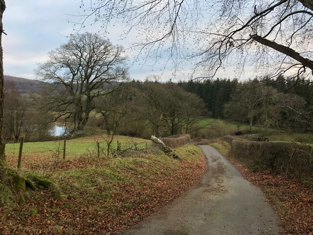
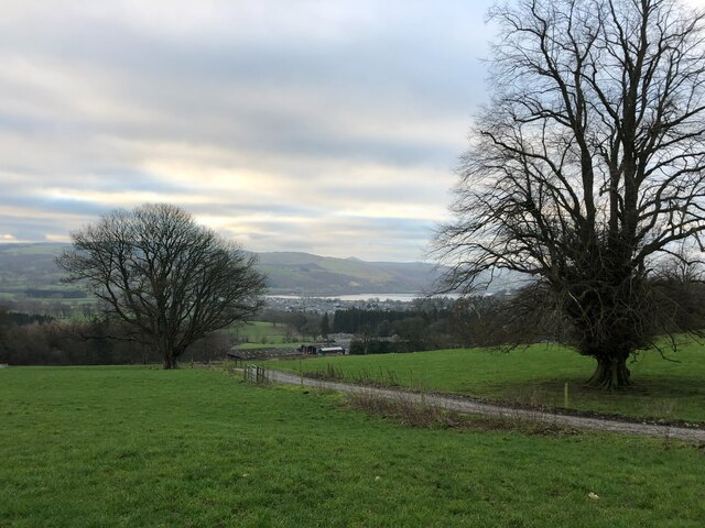
Tyddyn Phillip is a small rural village situated in the county of Merionethshire, Wales. It is located in the northwestern part of the country, near the coast of Cardigan Bay. The village is nestled amidst picturesque rolling hills and stunning natural beauty, making it a popular destination for nature enthusiasts and outdoor lovers.

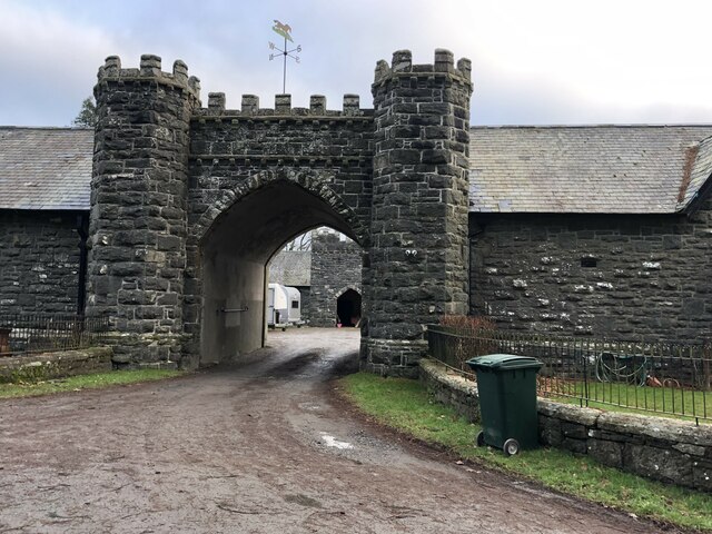
The population of Tyddyn Phillip is relatively small, with only a few dozen residents. The village itself consists of a cluster of traditional stone cottages and farmhouses, showcasing the area's rich historical and cultural heritage. The local community is close-knit and friendly, creating a warm and welcoming atmosphere for visitors.

One of the main attractions in Tyddyn Phillip is the nearby Snowdonia National Park, which offers a plethora of outdoor activities such as hiking, mountain biking, and birdwatching. The park is renowned for its breathtaking landscapes, including majestic mountains, tranquil lakes, and dense forests. Visitors can also explore the charming nearby towns of Barmouth and Harlech, which boast historic castles and stunning coastal views.

Despite its small size, Tyddyn Phillip has a few amenities to cater to both residents and visitors. There is a local pub that serves traditional Welsh cuisine, offering a taste of the region's culinary delights. Additionally, the village is well-connected to the surrounding areas by road, making it easily accessible for those wishing to explore the wider region.

Overall, Tyddyn Phillip is a tranquil and idyllic village, offering a peaceful retreat for those seeking a break from the hustle and bustle of city life. Its natural beauty, friendly community, and proximity to stunning landscapes make it a hidden gem in Merionethshire.

If you have any feedback on the listing, please let us know in the comments section below.

Tyddyn Phillip Images

Images are sourced within 2km of 52.928173/-3.618388 or Grid Reference SH9137. Thanks to Geograph Open Source API. All images are credited.

Old railway bridge at Frongoch This old bridge crosses the Afon Tryweryn just south of the site of the old Frongoch Station.  These days it carries a track to Rhyd-y-defaid Farm, but originally carried the Bala to Blaneau Ffestiniog branch of the Great Western Railway.  The line closed in 1965.
Old railway bridge at Frongoch
This old bridge crosses the Afon Tryweryn just south of the site of the old Frongoch Station. These days it carries a track to Rhyd-y-defaid Farm, but originally carried the Bala to Blaneau Ffestiniog branch of the Great Western Railway. The line closed in 1965.
Y Foel Hill near Frongoch
Y Foel
Hill near Frongoch
Frondderw
Frondderw
Moorland north-west of Bala Golf Course
Rhyd-y-Defaid Farmhouse Rhyd-y-Defaid Farmhouse offers excellent bed & breakfast facilities for those touring in North Wales.
Rhyd-y-Defaid Farmhouse
Rhyd-y-Defaid Farmhouse offers excellent bed & breakfast facilities for those touring in North Wales.
Pen Rhos Isaf Pair of semi-detached houses on the road north out of Llanfor
Pen Rhos Isaf
Pair of semi-detached houses on the road north out of Llanfor
View south from the hills above Llanfor Llyn Tegid in the distance
View south from the hills above Llanfor
Llyn Tegid in the distance
Steep hill heading to Llanfor
Farm track to Pen-Rhyd-Galed Also a public footpath passes by this farm to Rhiwlas. Bala and its lake in the distance
Farm track to Pen-Rhyd-Galed
Also a public footpath passes by this farm to Rhiwlas. Bala and its lake in the distance
Farm rubbish Don't suppose it's fly-tipping if it's on your own land...
Farm rubbish
Don't suppose it's fly-tipping if it's on your own land...
Cottages at Rhiwlas
Cottages at Rhiwlas
Game Larder at Rhiwlas Near Rhiwlas Hall, this mid C19 game store was built to serve the neighbouring Rhiwlas Hall and is Grade II listed.
Game Larder at Rhiwlas
Near Rhiwlas Hall, this mid C19 game store was built to serve the neighbouring Rhiwlas Hall and is Grade II listed.
Entrance to the Quadrangular Stable Complex at Rhiwlas Grade II listed, a pointed ached crenellated gateway with octagonal flanking turrets
Entrance to the Quadrangular Stable Complex at Rhiwlas
Grade II listed, a pointed ached crenellated gateway with octagonal flanking turrets
Coleg y Bala
Coleg y Bala
Tryweryn valley View across the Tryweryn valley.
Tryweryn valley
View across the Tryweryn valley.
Tryweryn valley Tryweryn valley to the north of Bala.
Tryweryn valley
Tryweryn valley to the north of Bala.
The old railway near Frongoch
Frongoch Station Station building on the former GWR Blaenau Ffestiniog to Bala junction line, closed in 1960's due to the construction of the Llyn Celyn reservoir.
Frongoch Station
Station building on the former GWR Blaenau Ffestiniog to Bala junction line, closed in 1960's due to the construction of the Llyn Celyn reservoir.
Show me another place!

Tyddyn Phillip is located at Grid Ref: SH9137 (Lat: 52.928173, Lng: -3.618388)

Unitary Authority: Gwynedd

Police Authority: North Wales

What 3 Words

///folks.stupidly.stance. Near Bala, Gwynedd

Related Wikis

Rhyd-uchaf

Rhyd-uchaf is a hamlet in Gwynedd, Wales, approximately 2.4 miles (3.9 km) northwest of Bala and 1.4 miles (2.3 km) south of Frongoch (by footpath), on...

Frongoch internment camp

Frongoch internment camp at Frongoch in Merionethshire, Wales was a makeshift place of imprisonment during the First World War and the 1916 Easter Rising...

Frongoch railway station

Frongoch railway station served the village of Frongoch on the Great Western Railway's Bala Ffestiniog Line in Gwynedd, Wales.The station closed to passengers...

Pen Ty-Nant

Pen Ty-Nant (English: Summit above the house by the stream) is a hill within the Snowdonia National Park in Gwynedd, North Wales. == Location and summit... ==

Nearby Amenities

Located within 500m of 52.928173,-3.618388
Created By: POI Editor
Source: npe
Lat/Long: 52.9321217/-3.6212006
Source: npe
Lat/Long: 52.9305154/-3.6191874
Created By: POI Editor
Source: npe
Lat/Long: 52.9307359/-3.6173399
Source: npe
Lat/Long: 52.9298087/-3.6139101
Created By: POI Editor
Source: npe
Lat/Long: 52.927392/-3.6124318
Post Box
Collection Times: Mo-Fr 16:15; Sa 07:30
Operator: Royal Mail
Post Box Type: lamp
Ref: LL23 33
Royal Cypher: EIIR
Royal Cypher Wikidata: Q33102113
Lat/Long: 52.92995/-3.6157128
Power: pole
Lat/Long: 52.9323232/-3.6155223
Power: pole
Lat/Long: 52.9321533/-3.6174381
Power: pole
Lat/Long: 52.9321/-3.6180131
Power: pole
Lat/Long: 52.9319817/-3.6193649
The data included in this document is from www.openstreetmap.org. The data is made available under ODbL.

Have you been to Tyddyn Phillip?

Leave your review of Tyddyn Phillip below (or comments, questions and feedback).