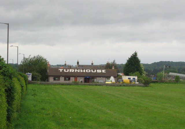
Turnhouse

Settlement in Midlothian

Scotland

Turnhouse

Cammo Once a big house, it is now a ruin, the grounds reverting to wild woodland with some fine specimen trees. The estate is managed as a park by the city council.
Cammo Credit: Richard Webb

Turnhouse is a small village located in the county of Midlothian, Scotland. Situated approximately 9 miles west of Edinburgh, it lies on the southern bank of the River Almond. The village is known for its picturesque surroundings and historical significance.

The name Turnhouse is derived from the old English term "turn" which refers to a turret or tower, possibly indicating the presence of a defensive structure in the past. Today, it is primarily a residential area with a population of around 500 people.

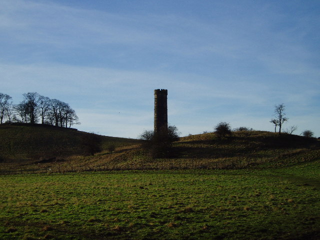
One of the prominent features of Turnhouse is the historic Turnhouse Castle, a 16th-century tower house that once served as a stronghold during tumultuous times. Although the castle is now privately owned, its architectural charm and historical importance make it a notable landmark in the village.

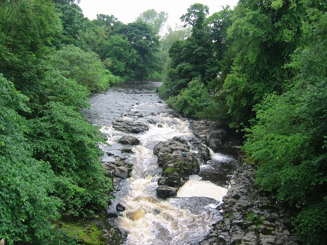
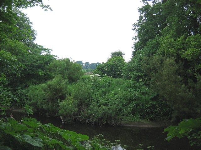
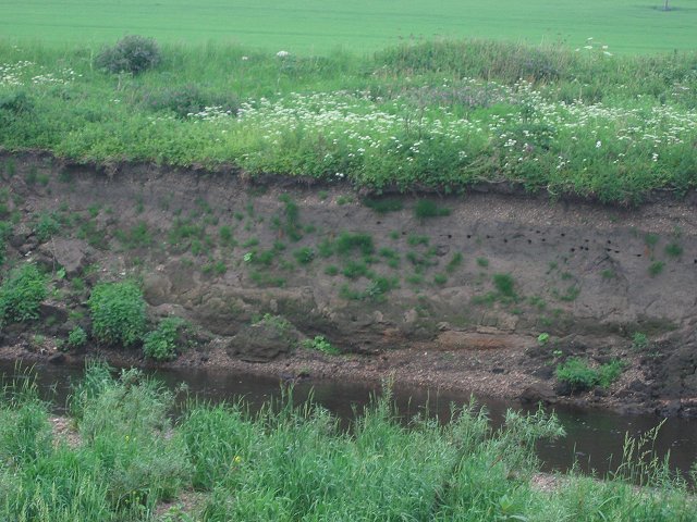
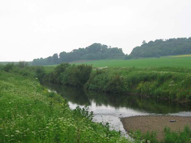
The village also offers easy access to the beautiful countryside of Midlothian, with several nature trails and walking paths nearby. The River Almond provides opportunities for fishing and wildlife observation. Additionally, the nearby Pentland Hills offer stunning views and are popular among hikers and nature enthusiasts.

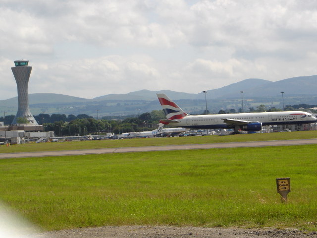
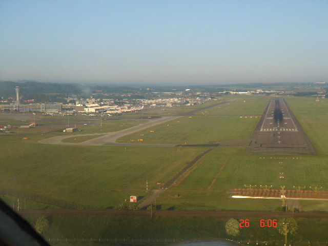
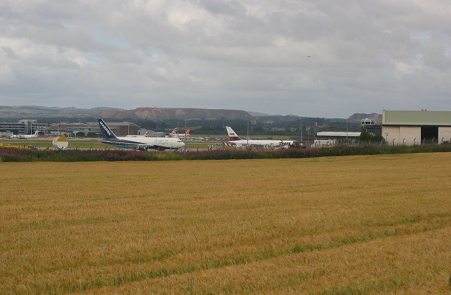
Turnhouse benefits from its proximity to Edinburgh, with excellent transport links to the city. The nearby Edinburgh Airport adds to the convenience, making it an attractive location for commuters and travelers.

Overall, Turnhouse is a tranquil village with a rich history and natural beauty, making it an appealing place to live or visit for those seeking a peaceful escape from the city while still enjoying its amenities.

If you have any feedback on the listing, please let us know in the comments section below.

Turnhouse Images

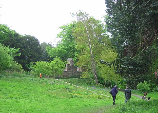
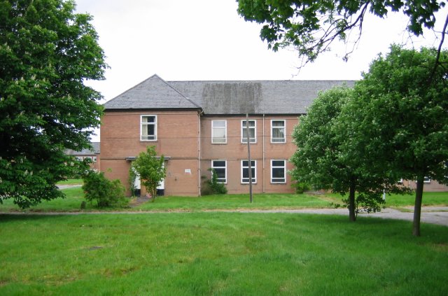
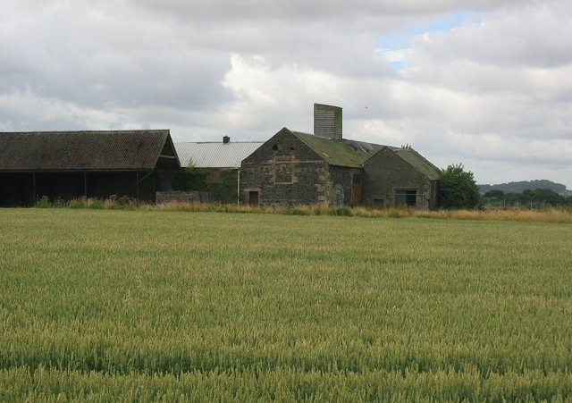
Images are sourced within 2km of 55.951659/-3.3467529 or Grid Reference NT1674. Thanks to Geograph Open Source API. All images are credited.

Cammo Once a big house, it is now a ruin, the grounds reverting to wild woodland with some fine specimen trees. The estate is managed as a park by the city council.
Cammo
Once a big house, it is now a ruin, the grounds reverting to wild woodland with some fine specimen trees. The estate is managed as a park by the city council.
RAF Turnhouse Recently closed RAF base by Edinburgh Airport. To be redeveloped as industrial units. Taken through the fence right up against the grid line.
RAF Turnhouse
Recently closed RAF base by Edinburgh Airport. To be redeveloped as industrial units. Taken through the fence right up against the grid line.
In case Biggles is lost. Helpful writing on a bungalow near the old Turnhouse base/Edinburgh Airport. The house/hedge is on the old A9, which was severed when Edinburgh Airport's main runway was built.
In case Biggles is lost.
Helpful writing on a bungalow near the old Turnhouse base/Edinburgh Airport. The house/hedge is on the old A9, which was severed when Edinburgh Airport's main runway was built.
River Almond Rapids seen from Grotto Bridge. The exciting nature of the Almond is well hidden in a wooded gorge.
River Almond
Rapids seen from Grotto Bridge. The exciting nature of the Almond is well hidden in a wooded gorge.
Giant Hogweed. The Almond is cursed with all of the big three invasive alien plants. Here is an example of the Giant Hogweed, notorious for the effect its sap has on skin, sensitising it to ultraviolet light. A garden escapee, native to the Crimea.
Giant Hogweed.
The Almond is cursed with all of the big three invasive alien plants. Here is an example of the Giant Hogweed, notorious for the effect its sap has on skin, sensitising it to ultraviolet light. A garden escapee, native to the Crimea.
Sandmartin colony Sand martin holes in the bank of the Almond. These small members of the swallow family nest in burrows up to a metre long.
Sandmartin colony
Sand martin holes in the bank of the Almond. These small members of the swallow family nest in burrows up to a metre long.
Clove Craig The split hill of Clove Craig over the River Almond and arable farmland. The craggy gap carries the Kirkliston-Cramond road.
Clove Craig
The split hill of Clove Craig over the River Almond and arable farmland. The craggy gap carries the Kirkliston-Cramond road.
New control tower and runway Edinburgh Airport
Runway 24 Edinburgh Airport
Meadowfield Old farm buildings in a field of spring sown wheat. A thin strip of farmland, Edinburgh is expanding westward and there is pressure to expand the airport. If the city bypass is ever completed, it will run through this area.
Meadowfield
Old farm buildings in a field of spring sown wheat. A thin strip of farmland, Edinburgh is expanding westward and there is pressure to expand the airport. If the city bypass is ever completed, it will run through this area.
EDI Cargo terminal, Turnhouse. Air cargo terminal near the old RAF base at Edinburgh Airport.
EDI Cargo terminal, Turnhouse.
Air cargo terminal near the old RAF base at Edinburgh Airport.
Royal Bank of Scotland Bridge. Simple arch bridge over the A8.
Royal Bank of Scotland Bridge.
Simple arch bridge over the A8.
Park and ride, Ingliston. Amongst all the airport car parks, a new addition. Just before opening, an attempt to free up traffic in the city.
Park and ride, Ingliston.
Amongst all the airport car parks, a new addition. Just before opening, an attempt to free up traffic in the city.
Mill, Ingliston Grampian Country Foods plant between the airport and Royal Highland Showground. Airport fuel tanks can also be seen.
Mill, Ingliston
Grampian Country Foods plant between the airport and Royal Highland Showground. Airport fuel tanks can also be seen.
Ingliston House. Royal Highland Show venue.
Ingliston House.
Royal Highland Show venue.
Boathouse Bridge. Where the A9 once crossed the Almond. It is closed here as the airport was built over it. Radar towers beyond the river.
Boathouse Bridge.
Where the A9 once crossed the Almond. It is closed here as the airport was built over it. Radar towers beyond the river.
Note to plane spotters. A very sensible move to recruit the plane spotters as part of the airport security network. It goes as well for us as well, although I have been questioned by the police re activities for this site - they know about us now!

Boathouse Bridge is an amazing place to see planes  take off. The public road is close to the runway just where most take off.
Note to plane spotters.
A very sensible move to recruit the plane spotters as part of the airport security network. It goes as well for us as well, although I have been questioned by the police re activities for this site - they know about us now! Boathouse Bridge is an amazing place to see planes take off. The public road is close to the runway just where most take off.
Cammo Tower This tower which can be easily seen from the Maybury Road was a water tower for Cammo House. A wind driven pump would fill a cistern near the top and gravity would provide the mansion with water.
Cammo Tower
This tower which can be easily seen from the Maybury Road was a water tower for Cammo House. A wind driven pump would fill a cistern near the top and gravity would provide the mansion with water.
Show me another place!

Turnhouse is located at Grid Ref: NT1674 (Lat: 55.951659, Lng: -3.3467529)

Unitary Authority: City of Edinburgh

Police Authority: Edinburgh

What 3 Words

///much.tags.costs. Near Ratho Station, Edinburgh

Nearby Locations

Turnhouse Lennie

Related Wikis

Turnhouse railway station

Turnhouse railway station served the suburb of Turnhouse, Edinburgh, Scotland from 1897 to 1930 on the Forth Bridge Connecting Lines of the North British...

Edinburgh Airport Rail Link

The Edinburgh Airport Rail Link (EARL) was a proposed rail link to Edinburgh Airport, Scotland. The project was passed by the Scottish Parliament in 2007...

Turnhouse

Turnhouse is a suburb in the west of Edinburgh, the capital of Scotland, near Maybury, Gogar, Cammo and West Craigs. The area is south east of Edinburgh...

Edinburgh West (UK Parliament constituency)

Edinburgh West is a burgh constituency of the House of Commons of the Parliament of the United Kingdom, first contested at the 1885 general election. Prior...

Nearby Amenities

Located within 500m of 55.951659,-3.3467529
Bus Stop
Cargo Terminal
Naptan AtcoCode: 6200202440
Naptan Bearing: E
Naptan CommonName: Cargo Terminal
Naptan Indicator: Airport Cargo Terminal
Naptan Landmark: Cargo Terminal
Naptan NaptanCode: 36237935
Naptan PlusbusZoneRef: EDINBUR
Naptan Street: Turnhouse Road
Naptan Verified: no
Public Transport: platform
Source: naptan_import
Lat/Long: 55.9524334/-3.3528166
Bus Stop
RAF
Mapillary: 2954339911516427
Naptan AtcoCode: 6200202450
Naptan Bearing: E
Naptan CommonName: RAF
Naptan Indicator: At RAF Turnhouse Control Tower
Naptan Landmark: RAF
Naptan NaptanCode: 36237938
Naptan PlusbusZoneRef: EDINBUR
Naptan Street: Turnhouse Road
Naptan Verified: no
Public Transport: platform
Shelter: yes
Source: naptan_import
Survey Date: 2020-05-01
Lat/Long: 55.9518454/-3.3474309
Bus Stop
Turnhouse Farm Road
Bus: yes
Naptan AtcoCode: 6200202460
Naptan Bearing: N
Naptan CommonName: Turnhouse Farm Road
Naptan Indicator: adj
Naptan Landmark: Turnhouse Farm Road
Naptan NaptanCode: 36237978
Naptan PlusbusZoneRef: EDINBUR
Naptan Street: Turnhouse Road
Naptan Verified: no
Public Transport: platform
Source: naptan_import
Lat/Long: 55.9512936/-3.340284
Bus Stop
Turnhouse Farm Road
Bus: yes
Naptan AtcoCode: 6200247440
Naptan Bearing: W
Naptan CommonName: Turnhouse Farm Road
Naptan Indicator: At 37
Naptan Landmark: Turnhouse Farm Road
Naptan NaptanCode: 36237932
Naptan PlusbusZoneRef: EDINBUR
Naptan Street: Turnhouse Road
Naptan Verified: no
Public Transport: platform
Source: naptan_import
Lat/Long: 55.9513027/-3.3410397
Bus Stop
RAF
Naptan AtcoCode: 6200247450
Naptan Bearing: W
Naptan CommonName: RAF
Naptan Indicator: At RAF Barracks
Naptan Landmark: RAF
Naptan NaptanCode: 36237937
Naptan PlusbusZoneRef: EDINBUR
Naptan Street: Turnhouse Road
Naptan Verified: no
Public Transport: platform
Source: naptan_import
Lat/Long: 55.9515812/-3.3469413
Post Box
Post Box Design: type_g
Post Box Type: pillar
Ref: EH12 351
Royal Cypher: scottish_crown
Lat/Long: 55.952059/-3.350282
Turning Circle
Lat/Long: 55.9539071/-3.3460358
Crossing
Crossing: uncontrolled
Crossing Markings: yes
Lat/Long: 55.9503886/-3.3494841
Crossing
Crossing: uncontrolled
Crossing Markings: yes
Lat/Long: 55.9511007/-3.3500458
Crossing
Crossing: uncontrolled
Crossing Markings: yes
Lat/Long: 55.9513164/-3.348693
Crossing
Crossing: uncontrolled
Crossing Markings: yes
Lat/Long: 55.9513976/-3.3498611
Barrier: lift_gate
Lat/Long: 55.9525314/-3.3545457
Aeroway: parking_position
Ref: 210
Lat/Long: 55.9503189/-3.3482358
Aeroway: parking_position
Ref: 211
Lat/Long: 55.9500969/-3.3473713
Aeroway: parking_position
Ref: 212
Lat/Long: 55.94983/-3.3465312
Aeroway: parking_position
Ref: 208
Lat/Long: 55.9511819/-3.3523019
Aeroway: parking_position
Ref: 209
Lat/Long: 55.9512304/-3.3524578
Aeroway: parking_position
Ref: 207
Lat/Long: 55.9513937/-3.3530078
Aeroway: parking_position
Ref: 206
Lat/Long: 55.9515567/-3.3535486
Aeroway: parking_position
Ref: 205
Lat/Long: 55.9518387/-3.353974
Aeroway: parking_position
Ref: 204
Lat/Long: 55.9519951/-3.3545891
Clock
Old Lennie Schoolhouse
Display: analog
Lit: yes
Support: wall_mounted
Lat/Long: 55.9527557/-3.351297
TNT
Addr City: Edinburgh
Addr Housenumber: 171
Addr Street: Turnhouse Road
Branch: Edinburgh Airport
Brand: TNT Express
Brand Wikidata: Q1105744
Brand Wikipedia: en:TNT Express
Office: courier
Lat/Long: 55.9512309/-3.3492823
Addr City: Edinburgh
Addr Housenumber: 171
Addr Street: Turnhouse Road
Lat/Long: 55.9514278/-3.3491405
Aeroway: holding_position
Lat/Long: 55.9503373/-3.353658
Aeroway: holding_position
Ref: G3
Lat/Long: 55.9475479/-3.3497198
Aeroway: parking_position
Ref: 316
Lat/Long: 55.9473453/-3.3460798
Aeroway: holding_position
Ref: H6
Lat/Long: 55.9476082/-3.3475493
Aeroway: holding_position
Ref: M4
Lat/Long: 55.947954/-3.3485055
Aeroway: holding_position
Ref: S1
Lat/Long: 55.9487964/-3.3486447
Golf: pin
Lat/Long: 55.9532531/-3.3418795
Addr City: Edinburgh
Addr Housenumber: 2
Addr Street: Turnhouse Farm Road
Lat/Long: 55.9545657/-3.343529
Addr City: Edinburgh
Addr Housenumber: 5
Addr Street: Turnhouse Farm Road
Lat/Long: 55.954814/-3.3442248
Colour: white
Marker: pole
Utility: gas
Lat/Long: 55.9547123/-3.3460551
Addr City: Edinburgh
Addr Housenumber: 29
Addr Street: Lennymuir
Lat/Long: 55.9536888/-3.345952
Addr City: Edinburgh
Addr Housenumber: 28
Addr Street: Lennymuir
Lat/Long: 55.9536792/-3.3460311
Addr City: Edinburgh
Addr Housenumber: 27
Addr Street: Lennymuir
Lat/Long: 55.9536501/-3.3462577
Addr City: Edinburgh
Addr Housenumber: 26
Addr Street: Lennymuir
Lat/Long: 55.9536417/-3.3463334
Addr City: Edinburgh
Addr Housenumber: 25
Addr Street: Lennymuir
Lat/Long: 55.9536337/-3.3465282
Addr City: Edinburgh
Addr Housenumber: 24
Addr Street: Lennymuir
Lat/Long: 55.9536227/-3.3466086
Addr City: Edinburgh
Addr Housenumber: 23
Addr Street: Lennymuir
Lat/Long: 55.9536097/-3.346693
Addr City: Edinburgh
Addr Housenumber: 22
Addr Street: Lennymuir
Lat/Long: 55.9535972/-3.3467763
Addr City: Edinburgh
Addr Housenumber: 21
Addr Street: Lennymuir
Lat/Long: 55.9535959/-3.3469727
Addr City: Edinburgh
Addr Housenumber: 20
Addr Street: Lennymuir
Lat/Long: 55.9536095/-3.3470547
Addr City: Edinburgh
Addr Housenumber: 19
Addr Street: Lennymuir
Lat/Long: 55.9536234/-3.3471353
Addr City: Edinburgh
Addr Housenumber: 18
Addr Street: Lennymuir
Lat/Long: 55.9536374/-3.3472189
Addr City: Edinburgh
Addr Housenumber: 17
Addr Street: Lennymuir
Lat/Long: 55.9537029/-3.3473815
Addr City: Edinburgh
Addr Housenumber: 16
Addr Street: Lennymuir
Lat/Long: 55.9537382/-3.3474334
Addr City: Edinburgh
Addr Housenumber: 15
Addr Street: Lennymuir
Lat/Long: 55.9537745/-3.3474915
Addr City: Edinburgh
Addr Housenumber: 14
Addr Street: Lennymuir
Lat/Long: 55.9538121/-3.3475465
Addr City: Edinburgh
Addr Housenumber: 13
Addr Street: Lennymuir
Lat/Long: 55.9539103/-3.3476509
Addr City: Edinburgh
Addr Housenumber: 11
Addr Street: Lennymuir
Lat/Long: 55.9539978/-3.3477293
Addr City: Edinburgh
Addr Housenumber: 10
Addr Street: Lennymuir
Lat/Long: 55.95404/-3.3477667
Lennymuir
Location: indoor
Operator: SP Energy Networks
Operator Wikidata: Q116022116
Power: substation
Substation: minor_distribution
Lat/Long: 55.9540336/-3.3481532
Addr City: Edinburgh
Addr Housenumber: 9
Addr Street: Lennymuir
Lat/Long: 55.9538979/-3.3482681
Addr City: Edinburgh
Addr Housenumber: 8
Addr Street: Lennymuir
Lat/Long: 55.9538744/-3.3483418
Addr City: Edinburgh
Addr Housenumber: 7
Addr Street: Lennymuir
Lat/Long: 55.9538482/-3.3484198
Addr City: Edinburgh
Addr Housenumber: 6
Addr Street: Lennymuir
Lat/Long: 55.9538223/-3.348494
Camera Mount: pole
Camera Type: dome
Man Made: surveillance
Surveillance: outdoor
Surveillance Type: camera
Lat/Long: 55.9528702/-3.3510279
Camera Mount: pole
Camera Type: dome
Man Made: surveillance
Surveillance: outdoor
Surveillance Type: camera
Lat/Long: 55.9526637/-3.3518104
Camera Mount: pole
Camera Type: dome
Man Made: surveillance
Surveillance: outdoor
Surveillance Type: camera
Lat/Long: 55.9526044/-3.3518466
Addr City: Edinburgh
Addr Housenumber: 1
Addr Street: Lennymuir
Lat/Long: 55.9526952/-3.351162
Clock
Old Lennie Schoolhouse
Display: analog
Lit: yes
Support: wall_mounted
Lat/Long: 55.9525736/-3.351396
Communication Mobile Phone: yes
Man Made: mast
Operator: Three
Operator Wikidata: Q19840922
Tower Construction: freestanding
Tower Type: communication
Lat/Long: 55.9515667/-3.3467719
Barrier: block
Lat/Long: 55.951394/-3.3479595
Location: indoor
Power: substation
Substation: minor_distribution
Lat/Long: 55.9513286/-3.3440334
Location: indoor
Power: substation
Substation: distribution
Lat/Long: 55.9513609/-3.3441574
Colour: white
Marker: pole
Utility: gas
Lat/Long: 55.9512595/-3.3399779
Colour: white
Marker: pole
Utility: gas
Lat/Long: 55.9511409/-3.3400771
Addr City: Edinburgh
Addr Housenumber: 37
Addr Postcode: EH12 0AE
Addr Street: Turnhouse Road
Lat/Long: 55.9512547/-3.3407542
Addr City: Edinburgh
Addr Housenumber: 12
Addr Street: Lennymuir
Lat/Long: 55.9539538/-3.3476897
Addr Housenumber: 3
Lat/Long: 55.951722/-3.34119
Addr Housenumber: 4
Lat/Long: 55.9516103/-3.3414249
Addr Housenumber: 2
Lat/Long: 55.951805/-3.3410146
Addr Housenumber: 1
Lat/Long: 55.951905/-3.3408186
Colour: white
Marker: post
Utility: gas
Lat/Long: 55.9524347/-3.3412613
Colour: white
Marker: post
Utility: gas
Lat/Long: 55.9524174/-3.3414383
Station Electrical Intake Cubicle
Colour: beige
Man Made: street_cabinet
Utility: power
Lat/Long: 55.9509753/-3.3401864
Pipeline: valve
Lat/Long: 55.9509483/-3.3398974
Pipeline: valve
Lat/Long: 55.9509564/-3.3399233
Pipeline: valve
Lat/Long: 55.9509633/-3.3399468
Turnhouse
Historic Railway: station
Railway: site
Wikidata: Q97187734
Wikipedia: en:Turnhouse railway station
Lat/Long: 55.9508031/-3.3413031
Crossing
Crossing: uncontrolled
Crossing Markings: yes
Lat/Long: 55.9519951/-3.3515654
Crossing
Crossing: uncontrolled
Crossing Markings: yes
Lat/Long: 55.9522405/-3.352594
Give Way
Direction: forward
Lat/Long: 55.9523699/-3.3527479
Give Way
Direction: backward
Lat/Long: 55.9523214/-3.3509157
Give Way
Direction: forward
Lat/Long: 55.952133/-3.349813
Crossing
Crossing: uncontrolled
Crossing Markings: yes
Lat/Long: 55.9514453/-3.3485552
Give Way
Lat/Long: 55.9501422/-3.3441994
Railway: signal
Railway Signal Direction: forward
Railway Signal Main: GB-NR:main
Ref: EAL1012
Lat/Long: 55.9515033/-3.3422575
The data included in this document is from www.openstreetmap.org. The data is made available under ODbL.

Have you been to Turnhouse?

Leave your review of Turnhouse below (or comments, questions and feedback).