Tuffley

Settlement in Gloucestershire Gloucester

England

Tuffley

Trigpoint, Robinswood Hill, Gloucestershire This is the trigpoint at the top of Robinswood Hill, Gloucester and Cheltenham are visible in the distance. The beacon was used during the Golden Jubilee.
Trigpoint, Robinswood Hill, Gloucestershire Credit: Bob G

Tuffley is a suburban area located in Gloucestershire, England. It is situated on the outskirts of the city of Gloucester and is bordered by the River Severn to the west. With its convenient location, Tuffley offers residents easy access to both the city center and the surrounding countryside.

The area is primarily residential, characterized by a mix of housing styles ranging from modern estates to traditional cottages. Tuffley has seen significant development over the years, resulting in a range of amenities for its inhabitants. These include several schools, a medical center, a library, and a variety of shops and eateries.

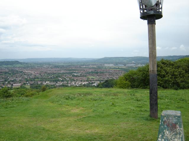
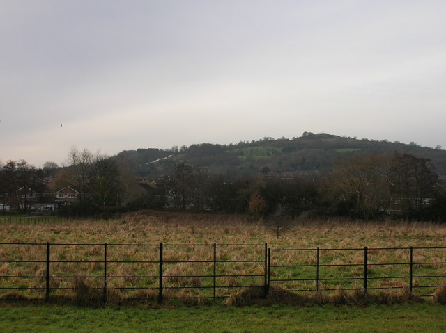
Tuffley is surrounded by green spaces, making it a great place for outdoor enthusiasts. The nearby Robinswood Hill Country Park offers stunning views of the city and the surrounding countryside, providing opportunities for walking, cycling, and wildlife spotting. The area is also home to several sports facilities, including football pitches and a leisure center.

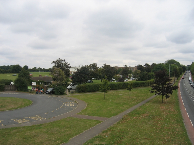
Transport links in Tuffley are excellent, with regular bus services connecting the area to Gloucester city center and other nearby towns. The M5 motorway is easily accessible, providing convenient links to Bristol, Birmingham, and beyond.

Overall, Tuffley is a thriving suburban area with a range of amenities, beautiful green spaces, and excellent transport links. Its proximity to both urban and rural attractions makes it an ideal place to live for individuals and families alike.

If you have any feedback on the listing, please let us know in the comments section below.
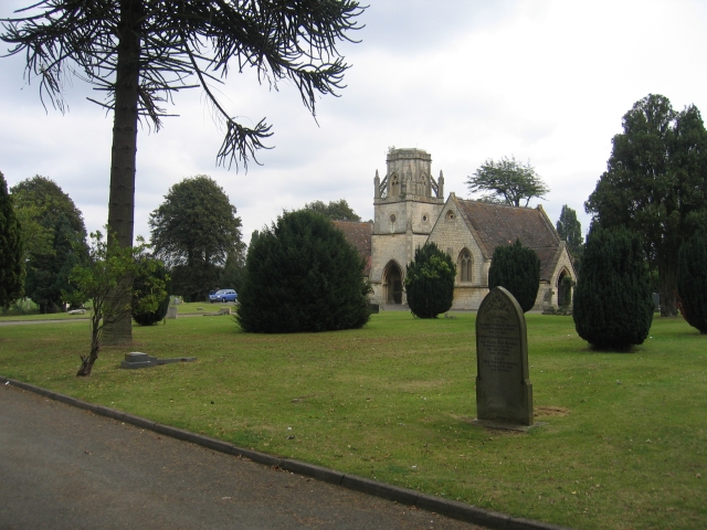
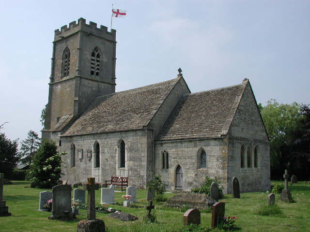
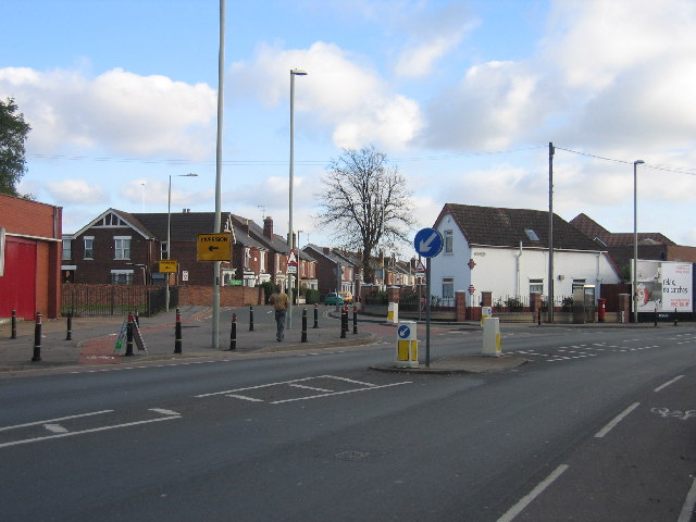
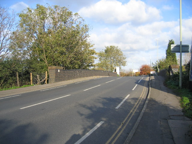
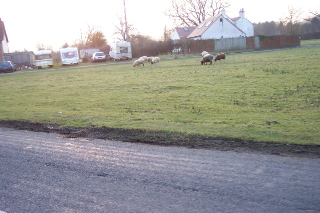
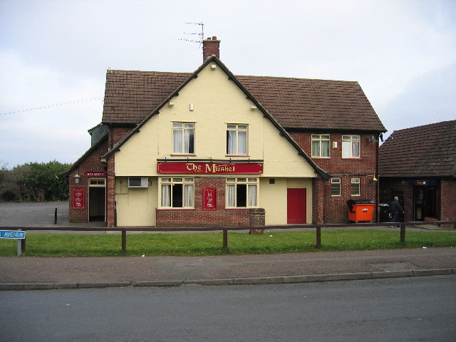
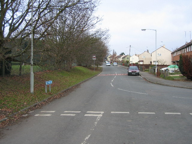
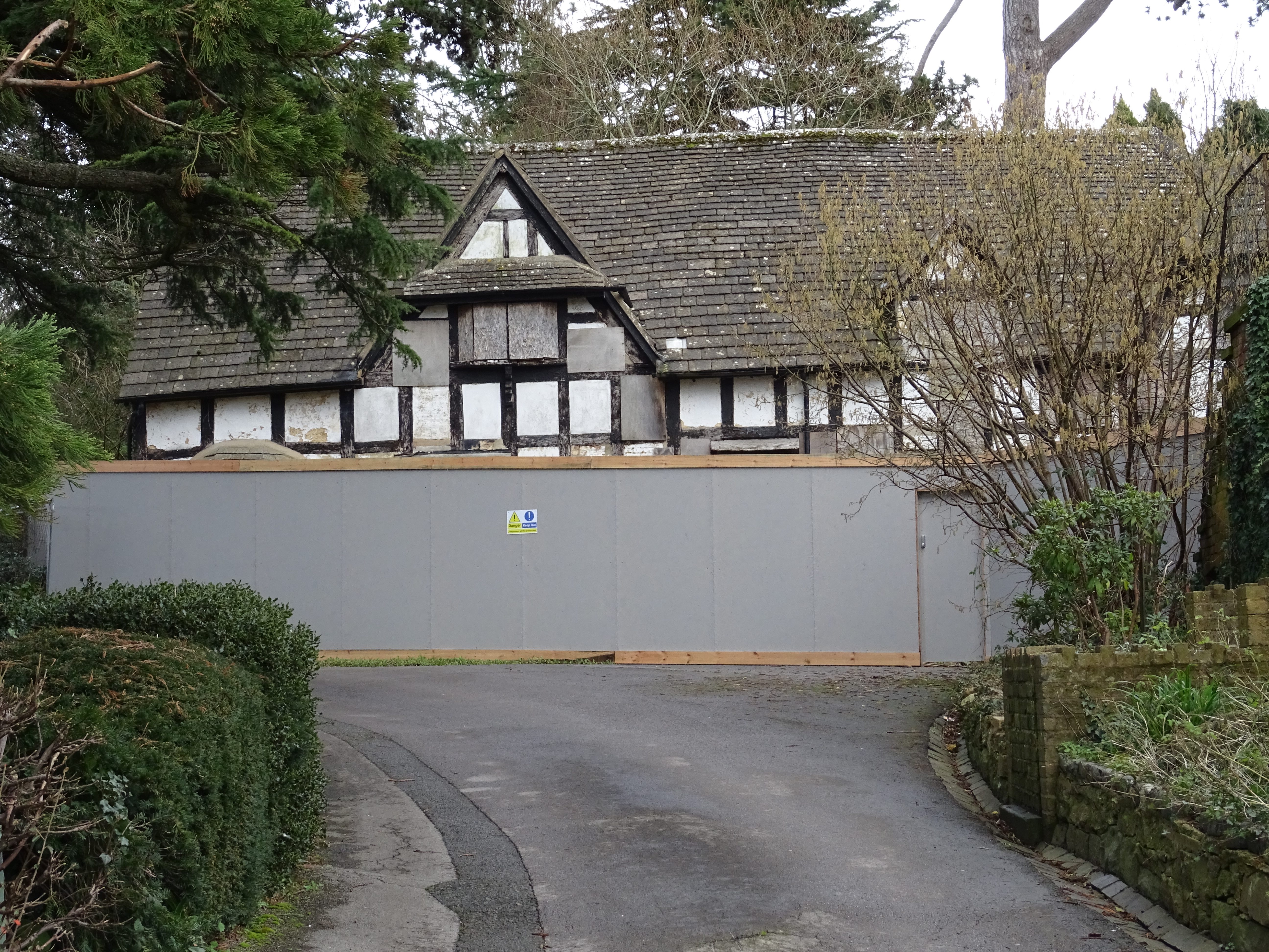
Tuffley Images

Images are sourced within 2km of 51.837817/-2.241336 or Grid Reference SO8315. Thanks to Geograph Open Source API. All images are credited.

Trigpoint, Robinswood Hill, Gloucestershire This is the trigpoint at the top of Robinswood Hill, Gloucester and Cheltenham are visible in the distance. The beacon was used during the Golden Jubilee.
Trigpoint, Robinswood Hill, Gloucestershire
This is the trigpoint at the top of Robinswood Hill, Gloucester and Cheltenham are visible in the distance. The beacon was used during the Golden Jubilee.
The Crypt School, Gloucester. The school was founded in 1539 at the Church of St Mary de Crypt in the centre of Gloucester (see <a href="https://www.geograph.org.uk/photo/61705">SO8318 : The Old Crypt School Room</a>).  The school moved to these premises in 1944 as the Crypt Grammar School, and today has a special status in Science.  See:- <span class="nowrap"><a title="http://www.cryptschool.org/" rel="nofollow ugc noopener" href="http://www.cryptschool.org/">Link</a><img style="margin-left:2px;" alt="External link" title="External link - shift click to open in new window" src="https://s1.geograph.org.uk/img/external.png" width="10" height="10"/></span> On the day the photograph was taken a bring and buy sale was in full swing on the playing fields.  In the distance the clump of trees on the top of May Hill can be seen.
The Crypt School, Gloucester.
The school was founded in 1539 at the Church of St Mary de Crypt in the centre of Gloucester (see SO8318 : The Old Crypt School Room). The school moved to these premises in 1944 as the Crypt Grammar School, and today has a special status in Science. See:- LinkExternal link On the day the photograph was taken a bring and buy sale was in full swing on the playing fields. In the distance the clump of trees on the top of May Hill can be seen.
Crypt School, Podsmead, Gloucester The playing fields and entrance to school drive with the school in amongst the trees.
Crypt School, Podsmead, Gloucester
The playing fields and entrance to school drive with the school in amongst the trees.
St Barnabas's Church, Gloucester By the roundabout at the junction of Stroud Road and Cole Avenue.
St Barnabas's Church, Gloucester
By the roundabout at the junction of Stroud Road and Cole Avenue.
Tredworth Cemetery, Gloucester The chapel in this large cemetery near the old Gloucester bypass.
Tredworth Cemetery, Gloucester
The chapel in this large cemetery near the old Gloucester bypass.
Tuffley Avenue, Gloucester The house on the left is typical of many in this part of this mainly residential square.  The building on the right replaced a house demolished when a 'plane crashed into it on the 27th March 1963.  A twin engined Vickers Varsity aircraft crashed onto the house. The three elderly occupants survived unhurt apart from shock and scratches, however the house and the neighbouring property that the Drury family also owned were flooded with aviation fuel.  The plane was on a training run from Staverton Airport and tragically the crew of two were killed. See:- <span class="nowrap"><a title="http://aviation-safety.net/database/record.php?id=19630327-0" rel="nofollow ugc noopener" href="http://aviation-safety.net/database/record.php?id=19630327-0">Link</a><img style="margin-left:2px;" alt="External link" title="External link - shift click to open in new window" src="https://s1.geograph.org.uk/img/external.png" width="10" height="10"/></span> and <span class="nowrap"><a title="http://www.visit-gloucestershire.co.uk/boards/topic/72-g-apaz-the-tuffley-varsity/" rel="nofollow ugc noopener" href="http://www.visit-gloucestershire.co.uk/boards/topic/72-g-apaz-the-tuffley-varsity/">Link</a><img style="margin-left:2px;" alt="External link" title="External link - shift click to open in new window" src="https://s1.geograph.org.uk/img/external.png" width="10" height="10"/></span> .
From a personal perspective I remember cycling home from school nearby and seeing the area cordonned off and the remains of the fuselage embedded in the top half of the house.
Tuffley Avenue, Gloucester
The house on the left is typical of many in this part of this mainly residential square. The building on the right replaced a house demolished when a 'plane crashed into it on the 27th March 1963. A twin engined Vickers Varsity aircraft crashed onto the house. The three elderly occupants survived unhurt apart from shock and scratches, however the house and the neighbouring property that the Drury family also owned were flooded with aviation fuel. The plane was on a training run from Staverton Airport and tragically the crew of two were killed. See:- LinkExternal link and LinkExternal link . From a personal perspective I remember cycling home from school nearby and seeing the area cordonned off and the remains of the fuselage embedded in the top half of the house.
Tuffley Junction This used to be four tracks.  The right hand two line were the former GWR main line to Paddington, whilst the left hand pair were the ex-LMS main line to Bristol.  Whilst the two routes ran parallel south from here to Standish Junction, there was no connection between them at this point.  The LMS line curved left beyond the bridge in the distance along the now abandoned route into Gloucester Eastgate Station.  Just beyond the point at which the bank on the left finishes a single track branch from Hempsted and the Gas Works converged with the LMS lines.  The tracks were reduced to the current two in the 1960s and the route to Eastgate closed in the 1970s.
Tuffley Junction
This used to be four tracks. The right hand two line were the former GWR main line to Paddington, whilst the left hand pair were the ex-LMS main line to Bristol. Whilst the two routes ran parallel south from here to Standish Junction, there was no connection between them at this point. The LMS line curved left beyond the bridge in the distance along the now abandoned route into Gloucester Eastgate Station. Just beyond the point at which the bank on the left finishes a single track branch from Hempsted and the Gas Works converged with the LMS lines. The tracks were reduced to the current two in the 1960s and the route to Eastgate closed in the 1970s.
Whaddon (Glos) St Margaret's Church
St Paul's, Stroud Road This church is situated at the junction of Park End Road and Stroud Road.
St Paul's, Stroud Road
This church is situated at the junction of Park End Road and Stroud Road.
Painswick Road Crossing This view, looking east from Stroud Road at the junction with Tredworth Road show the site of the level crossing with former Midland Railway line through Gloucester.  This line was plagued with a succession of level crossings and was eventually closed in the 1970s.  All that can be seen today is the slight rise in the road (just the right of the further "diversion" sign) and the former railway cottage (the white building to the right of the picture). Compare with <a href="https://www.geograph.org.uk/photo/302764">SO8317 : Painswick Road Crossing</a>  and <a href="https://www.geograph.org.uk/photo/302769">SO8317 : Painswick Road Crossing gates</a>.
Painswick Road Crossing
This view, looking east from Stroud Road at the junction with Tredworth Road show the site of the level crossing with former Midland Railway line through Gloucester. This line was plagued with a succession of level crossings and was eventually closed in the 1970s. All that can be seen today is the slight rise in the road (just the right of the further "diversion" sign) and the former railway cottage (the white building to the right of the picture). Compare with SO8317 : Painswick Road Crossing and SO8317 : Painswick Road Crossing gates.
Timber yards, Bristol Road This length of the Bristol Road is lined with timber yards.  On the other side of these yards is the Gloucester and Sharpness Canal by which they originally received their supplies.  Although several of the yards have disappeared over the years several still survive although sadly now only making use of road transport.
Timber yards, Bristol Road
This length of the Bristol Road is lined with timber yards. On the other side of these yards is the Gloucester and Sharpness Canal by which they originally received their supplies. Although several of the yards have disappeared over the years several still survive although sadly now only making use of road transport.
Bristol Road bridge This old bridge on the Bristol Road approaching Gloucester is one of the few remaining visible signs of the old goods line from Tuffley Junction to Llanthony and Gloucester Docks.
Bristol Road bridge
This old bridge on the Bristol Road approaching Gloucester is one of the few remaining visible signs of the old goods line from Tuffley Junction to Llanthony and Gloucester Docks.
Sneedham's Green Sneedham's Green is common land with sheep grazing. These sheep have no fences or animal grids to enclose them. Apparently the flock has learned where it is allowed to go.
Sneedham's Green
Sneedham's Green is common land with sheep grazing. These sheep have no fences or animal grids to enclose them. Apparently the flock has learned where it is allowed to go.
Bristol Road industrial area from Hempsted Village Gasholder now redundant
Bristol Road industrial area from Hempsted Village
Gasholder now redundant
Curlew Road Gloucester The houses in this part of town all face onto the wrong road, the address being the vehicle access at the back, very confusing for visitors and deliverymen.
Curlew Road Gloucester
The houses in this part of town all face onto the wrong road, the address being the vehicle access at the back, very confusing for visitors and deliverymen.
The Musket Matson
The Musket Matson
Matson Lane Looking North A large housing estate to the right and a country park to the left
Matson Lane Looking North
A large housing estate to the right and a country park to the left
Bodiam Avenue Tuffley
Show me another place!

Tuffley is located at Grid Ref: SO8315 (Lat: 51.837817, Lng: -2.241336)

Administrative County: Gloucestershire

District: Gloucester

Police Authority: Gloucestershire

What 3 Words

///trail.voted.lift. Near Gloucester, Gloucestershire

Nearby Locations

Tuffley

Related Wikis

333 Stroud Road

333 Stroud Road is a former farmhouse on Stroud Road, Tuffley, Gloucester. It became a Grade II listed building on 12 March 1973. == History == It was...

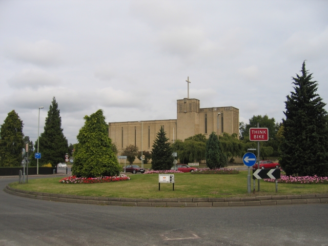
St Barnabas Church, Gloucester

St Barnabas Church is a Grade II listed building located in Stroud Road, Gloucester, Gloucestershire, England. It was built in 1938–40 and obtained its...

Robin's Wood Hill Quarry

Robin's Wood Hill Quarry (grid reference SO836148) is a 1.67-hectare (4.1-acre) geological Site of Special Scientific Interest in Gloucestershire, on Robinswood...
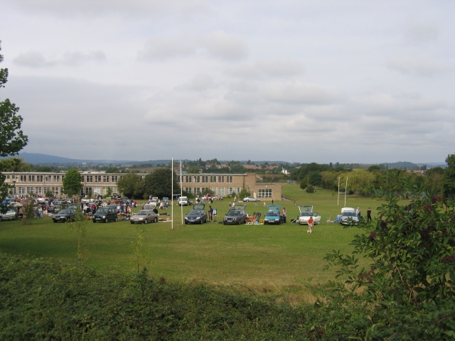
The Crypt School

The Crypt School is a grammar school with academy status for boys and girls located in the city of Gloucester. Founded in the 16th century, it was originally...

Robinswood Hill

Robinswood Hill (grid reference SO840150) is a hill and country park to the south of the city centre of Gloucester, close to the Stroud Road (A4173). It...

Gloucestershire Wildlife Trust

The Gloucestershire Wildlife Trust is the Gloucestershire local partner in a conservation network of 46 Wildlife Trusts. The Wildlife Trusts are local...

White City, Gloucester

White City is an estate in the City of Gloucester. It takes its name from the original white concrete houses.Following World War I, there was a national...

Ribston Hall High School

Ribston Hall High School is a selective grammar school with academy status in Gloucester, England, for girls between the ages of 11 and 18. It was founded...

Nearby Amenities

Located within 500m of 51.837817,-2.241336
Post Box
Postal Code: GL4
Ref: GL4 121
Lat/Long: 51.8349304/-2.2468989
Traffic Calming: cushion
Lat/Long: 51.8386915/-2.24508
Created By: Potlatch 0.10f
Tourism: viewpoint
Lat/Long: 51.8334395/-2.2423404
Post Box
Collection Times: Mo-Fr 17:45; Sa 09:00
Post Box Type: lamp
Ref: GL4 55
Royal Cypher: GR
Royal Cypher Wikidata: Q33102273
Source: survey
Lat/Long: 51.839794/-2.2419905
Barrier: stile
Lat/Long: 51.8415101/-2.2375198
Bus Stop
The Knoll Nursing Home
Bus: yes
Ele: 43.8654785
Naptan AtcoCode: 1600GLB411
Naptan Bearing: S
Naptan CommonName: The Knoll Nursing Home
Naptan NaptanCode: glodadmd
Naptan PlusbusZoneRef: GLOSTER
Naptan Street: Stroud Rd
Naptan Verified: no
Note: No reference on stop :(
Public Transport: platform
Source: naptan_import
Lat/Long: 51.8367967/-2.2429465
Tuffley Junction
Historic Railway: junction
Railway: site
Lat/Long: 51.8406266/-2.2452268
Bus Stop
St Barnabas Church
Bus: yes
Naptan AtcoCode: 1600GL4555
Naptan Bearing: SE
Naptan CommonName: St Barnabas Church
Naptan NaptanCode: glodadmp
Naptan PlusbusZoneRef: GLOSTER
Naptan Street: Stroud Rd
Naptan Verified: no
Operator: Stagecoach
Public Transport: platform
Shelter: yes
Source: naptan_import
Lat/Long: 51.8407483/-2.2430643
Bus Stop
St Barnabas Church
Bus: yes
Naptan AtcoCode: 1600GL4556
Naptan Bearing: NW
Naptan CommonName: St Barnabas Church
Naptan Indicator: Opp
Naptan NaptanCode: glodadjp
Naptan PlusbusZoneRef: GLOSTER
Naptan Street: Stroud Rd
Naptan Verified: no
Operator: Stagecoach
Public Transport: platform
Shelter: yes
Source: naptan_import
Lat/Long: 51.8405099/-2.2430535
Bus Stop
Elmira Road
Bus: yes
Naptan AtcoCode: 1600GLB277
Naptan Bearing: SE
Naptan CommonName: Elmira Rd
Naptan NaptanCode: glodagmd
Naptan PlusbusZoneRef: GLOSTER
Naptan Street: Elmira Rd
Naptan Verified: no
Public Transport: platform
Source: naptan_import
Lat/Long: 51.842025/-2.2408699
Bus Stop
The Knoll Nursing Home
Bus: yes
Naptan AtcoCode: 1600GLB412
Naptan Bearing: N
Naptan CommonName: The Knoll Nursing Home
Naptan Indicator: Opp
Naptan NaptanCode: glodadjw
Naptan PlusbusZoneRef: GLOSTER
Naptan Street: Stroud Rd
Naptan Verified: no
Operator: Stagecoach
Public Transport: platform
Shelter: yes
Source: naptan_import
Lat/Long: 51.8372102/-2.2429922
Bus Stop
Robinswood Hill Car Park
Bus: yes
Naptan AtcoCode: 1600GLB539
Naptan Bearing: SW
Naptan CommonName: Robinswood Hill Car Park
Naptan NaptanCode: glodajdg
Naptan PlusbusZoneRef: GLOSTER
Naptan Street: Reservoir Rd
Naptan Verified: no
Public Transport: platform
Source: naptan_import
Lat/Long: 51.8410235/-2.2381066
Bus Stop
Robinswood Hill Car Park
Bus: yes
Naptan AtcoCode: 1600GLB540
Naptan Bearing: NE
Naptan CommonName: Robinswood Hill Car Park
Naptan Indicator: Opp
Naptan NaptanCode: glodajaw
Naptan PlusbusZoneRef: GLOSTER
Naptan Street: Reservoir Rd
Naptan Verified: no
Public Transport: platform
Source: naptan_import
Lat/Long: 51.8411673/-2.2381509
Robinswood Hill Country Park
Access: yes
Parking: surface
Lat/Long: 51.8408802/-2.2374713
Railway: switch
Lat/Long: 51.8409569/-2.2447795
Crossing
Lat/Long: 51.8396933/-2.2424972
Crossing
Crossing: uncontrolled
Crossing Island: no
Flashing Lights: belisha
Tactile Paving: yes
Lat/Long: 51.836462/-2.2431351
Crossing
Lat/Long: 51.8399005/-2.2420738
Railway: switch
Lat/Long: 51.8402709/-2.2456467
Railway: switch
Lat/Long: 51.8413273/-2.2441618
Historic: memorial
Memorial: war_memorial
Lat/Long: 51.8403515/-2.242307
Crossing
Foot: yes
Lat/Long: 51.8409402/-2.2433571
Crossing
Lat/Long: 51.8397029/-2.2423707
Crossing
Source: Bing
Lat/Long: 51.8416946/-2.2404663
Crossing
Crossing Island: yes
Lat/Long: 51.8408145/-2.2414131
Source: Bing
Tactile Paving: yes
Lat/Long: 51.8407888/-2.2413329
Source: Bing
Tactile Paving: yes
Lat/Long: 51.8408435/-2.2414992
Crossing
Lat/Long: 51.8398426/-2.2420988
Crossing
Lat/Long: 51.8400957/-2.2421285
Crossing
Lat/Long: 51.8401568/-2.2422095
Bench
Backrest: no
Lat/Long: 51.8371411/-2.2386395
Bus Stop
Flaxley Road
Bus: yes
Public Transport: platform
Lat/Long: 51.8350899/-2.2467076
Bus Stop
Beechwood Grove
Bus: yes
Naptan AtcoCode: 160000672
Naptan Bearing: S
Naptan CommonName: Beechwood Grove
Naptan Indicator: opp
Naptan NaptanCode: glojajgj
Naptan Verified: no
Public Transport: platform
Lat/Long: 51.8376338/-2.2452866
Railway: switch
Lat/Long: 51.8405889/-2.2452804
Man Made: water_well
Lat/Long: 51.8378631/-2.2371818
Tuffley Junction
Historic Railway: junction
Railway: site
Lat/Long: 51.8419568/-2.243415
Bus: yes
Public Transport: stop_position
Lat/Long: 51.835059/-2.2467884
Traffic Calming: table
Lat/Long: 51.835018/-2.24681
Traffic Calming: cushion
Lat/Long: 51.8375169/-2.2453607
Traffic Calming: cushion
Lat/Long: 51.8358693/-2.2464382
Traffic Calming: hump
Lat/Long: 51.8389339/-2.2451075
Crossing
Crossing: unmarked
Crossing Island: yes
Crossing Markings: no
Tactile Paving: yes
Lat/Long: 51.8392255/-2.2446166
Crossing
Crossing: unmarked
Crossing Island: yes
Crossing Markings: no
Tactile Paving: yes
Lat/Long: 51.8390209/-2.2459102
Bus Bay: left
Lat/Long: 51.8368172/-2.2430322
Turning Circle
Lat/Long: 51.8379524/-2.2412639
Turning Circle
Lat/Long: 51.8379553/-2.2414134
Defibrillator
Defibrillator Location: Next to female toilets entrance
Emergency: defibrillator
Indoor: no
Note: In an emergency call 999 for the access code
Operator: DefibSafe
Lat/Long: 51.840443/-2.2368393
Bus Stop
St Barnabas Church
Bus: yes
Public Transport: platform
Lat/Long: 51.8405694/-2.2418327
The data included in this document is from www.openstreetmap.org. The data is made available under ODbL.

Have you been to Tuffley?

Leave your review of Tuffley below (or comments, questions and feedback).