Troed-rhiw-dalar

Settlement in Brecknockshire

Wales

Troed-rhiw-dalar

B4358 near Pentre-Lleyn-Llwyd
B4358 near Pentre-Lleyn-Llwyd Credit: Steven Brown

Troed-rhiw-dalar is a small village located in the historic county of Brecknockshire, Wales. Situated in the Brecon Beacons National Park, the village is surrounded by picturesque landscapes and offers stunning views of the nearby mountains. It is part of the community of Llangorse.

The village itself is home to a tight-knit community of residents. The population is relatively small, with only a few dozen inhabitants. The village is characterized by its peaceful and tranquil atmosphere, making it an ideal retreat for those seeking a break from the hustle and bustle of city life.

Troed-rhiw-dalar is known for its proximity to Llangorse Lake, the largest natural lake in South Wales. The lake provides ample opportunities for outdoor activities such as fishing, boating, and birdwatching. The village also benefits from its location within the Brecon Beacons National Park, which offers a multitude of walking trails and hiking routes for nature enthusiasts.

In terms of amenities, Troed-rhiw-dalar has limited facilities. There is a small village hall that serves as a community center, hosting various events and gatherings. However, for more extensive services, residents often rely on neighboring towns and villages.

Overall, Troed-rhiw-dalar is a charming and idyllic village that offers a peaceful lifestyle within a stunning natural setting. It is a haven for those who appreciate the beauty of the countryside and enjoy outdoor pursuits.

If you have any feedback on the listing, please let us know in the comments section below.

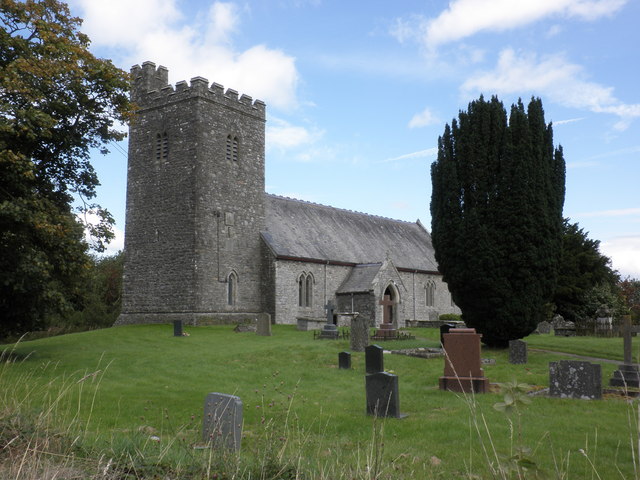
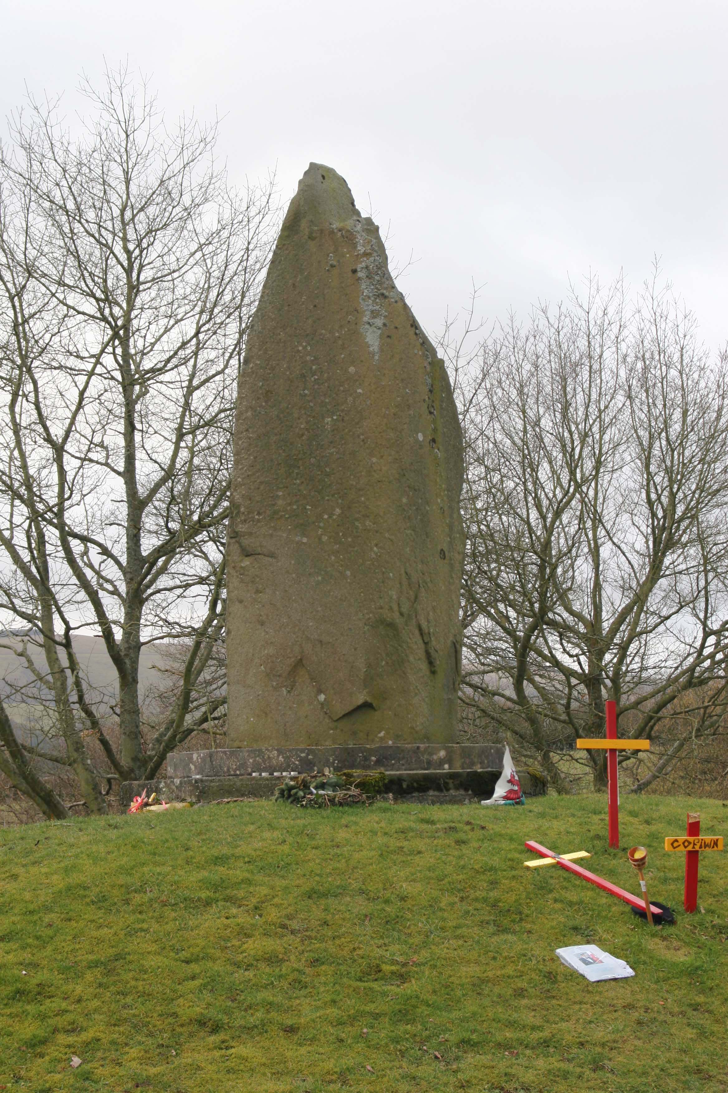
Troed-rhiw-dalar Images

Images are sourced within 2km of 52.168218/-3.533784 or Grid Reference SN9553. Thanks to Geograph Open Source API. All images are credited.

B4358 near Pentre-Lleyn-Llwyd
Rough pasture near Bryn Llwyd Farm
Pasture and oak trees north-east of Beulah, Powys These very "expressive" trees can be seen south of the B4538 Newbridge road about a mile and a half out of Beulah. it must have been trees like this which Tolkien observed when developing his fantasy "ents" of Middle-earth.
Pasture and oak trees north-east of Beulah, Powys
These very "expressive" trees can be seen south of the B4538 Newbridge road about a mile and a half out of Beulah. it must have been trees like this which Tolkien observed when developing his fantasy "ents" of Middle-earth.
Double oak tree north-east of Beulah, Powys There are some wonderful Tolkienesque tree shapes to be observed in our countryside. In fact, the image of this growth in wider context gives the stronger impression of the tree walking towards the other, ent-like.

See <a href="https://www.geograph.org.uk/photo/2932613">SN9352 : Pasture and oak trees north-east of Beulah, Powys</a>.
Double oak tree north-east of Beulah, Powys
There are some wonderful Tolkienesque tree shapes to be observed in our countryside. In fact, the image of this growth in wider context gives the stronger impression of the tree walking towards the other, ent-like. See SN9352 : Pasture and oak trees north-east of Beulah, Powys.
The B4538 to Newbridge, Powys Looking towards Newbridge, about a mile and a half out of Beulah.
The B4358 links Beulah with Newbridge-on-Wye and Llandrindod Wells.
The B4538 to Newbridge, Powys
Looking towards Newbridge, about a mile and a half out of Beulah. The B4358 links Beulah with Newbridge-on-Wye and Llandrindod Wells.
Pasture north-east of Beulah, Powys Flat grazing land near the farm at Llwyn Gwrgan, about a mile and a half from Beulah.
Pasture north-east of Beulah, Powys
Flat grazing land near the farm at Llwyn Gwrgan, about a mile and a half from Beulah.
Farmland west of Glandulas, Powys Looking across Cwm Dulas towards the 301 metre (987 feet) high forested summit of Garth Bank.
Farmland west of Glandulas, Powys
Looking across Cwm Dulas towards the 301 metre (987 feet) high forested summit of Garth Bank.
The B4358 to Beulah, Powys The road connects Llandrindod Wells and Newbridge-on-Wye with Beulah, and is seen here west of Glandulas, where it is about to descend into the Deuffrywd valley.
The B4358 to Beulah, Powys
The road connects Llandrindod Wells and Newbridge-on-Wye with Beulah, and is seen here west of Glandulas, where it is about to descend into the Deuffrywd valley.
The B4358 passing through Glandulas, Powys The B4358 links Beulah with Newbridge-on-Wye and Llandrindod Wells.
The B4358 passing through Glandulas, Powys
The B4358 links Beulah with Newbridge-on-Wye and Llandrindod Wells.
Pasture on a dull day near Glandulas, Powys Looking across the wide Dulas valley towards the stone quarry.
Pasture on a dull day near Glandulas, Powys
Looking across the wide Dulas valley towards the stone quarry.
The B4358 in the valley at Glandulas, Powys Looking towards Newbridge, the B4358 links Beulah with Newbridge-on-Wye and Llandrindod Wells.
The B4358 in the valley at Glandulas, Powys
Looking towards Newbridge, the B4358 links Beulah with Newbridge-on-Wye and Llandrindod Wells.
Farmland at Glandulas, Powys This is a wide angle view across the valley, with the B4358 passing through Glandulas on the right.
Farmland at Glandulas, Powys
This is a wide angle view across the valley, with the B4358 passing through Glandulas on the right.
Across Cwm Dulas, Powys This telephoto assisted view across the valley shows pasture, Rhysgog Villa (a quarter of a mile distant), and a wooded hillside.
Across Cwm Dulas, Powys
This telephoto assisted view across the valley shows pasture, Rhysgog Villa (a quarter of a mile distant), and a wooded hillside.
Crossroads at Glandulas, Powys Looking across the B4358 towards the lane to Capel Rhos. Left leads to Beulah; right to Newbridge.
Crossroads at Glandulas, Powys
Looking across the B4358 towards the lane to Capel Rhos. Left leads to Beulah; right to Newbridge.
Farmland and depot at Glandulas, Powys By the B4358, looking north-west. The large building is marked as a depot; I'm not quite sure for what.
Farmland and depot at Glandulas, Powys
By the B4358, looking north-west. The large building is marked as a depot; I'm not quite sure for what.
The B4538 at Glandulas, Powys Looking towards Beulah. The road links Llandrindod Wells (and Newbridge-on-Wye) with Beulah.
The B4538 at Glandulas, Powys
Looking towards Beulah. The road links Llandrindod Wells (and Newbridge-on-Wye) with Beulah.
Road signs on the B4538 at Glandulas, Powys This is at the crossroads, looking up the hill (10% gradient) towards Newbridge.
Road signs on the B4538 at Glandulas, Powys
This is at the crossroads, looking up the hill (10% gradient) towards Newbridge.
Hillside and residence near Glandulas, Powys A telephoto shot of the hillside to the west from the B4538 crossroads. I'm not sure whether Bwlch-y-dderwen on the hill is a new building or a very good conversion. Very smart, anyway!
Hillside and residence near Glandulas, Powys
A telephoto shot of the hillside to the west from the B4538 crossroads. I'm not sure whether Bwlch-y-dderwen on the hill is a new building or a very good conversion. Very smart, anyway!
Show me another place!

Troed-rhiw-dalar is located at Grid Ref: SN9553 (Lat: 52.168218, Lng: -3.533784)

Unitary Authority: Powys

Police Authority: Dyfed Powys

Also known as: Troedrhiwdalar

What 3 Words

///found.lookout.grumbles. Near Llwyn-Madoc, Powys

Related Wikis

Garth Bank Quarry

Garth Bank Quarry is a Site of Special Scientific Interest in Brecknock, Powys, Wales. The Countryside Council for Wales describes the significance of...

Llanafan Fawr

Llanafan Fawr is a village and community and ecclesiastical parish in Powys, Wales. Located in the former cantref of Buellt (Builth) and historic county...

Llanfechan

Llanfechan is a small church settlement in the community of Treflys, consisting of a church and a farm, and the surrounding area, it is beside the A483...

Beulah, Powys

Beulah is a village in southern Powys, Wales, in the community of Treflys, lying on the Afon Cammarch. The village sits astride the main A483 road about...

Garth, Powys

Garth is a village in Powys, mid Wales, in the community of Treflys. It lies on the A483 road between Builth Wells and Beulah at the point where the B4519...

Garth railway station (Powys)

Garth railway station (Powys) serves the village of Garth, Powys, Wales. The railway station is located at street level at the end of the Llais yr Afon...

Dulas, Irfon

Dulas is a left-bank tributary of the Afon Irfon, itself a tributary of the River Wye. It rises on the southeastern slopes of the Elenydd and runs southeast...

Battle of Orewin Bridge

The Battle of Orewin Bridge (also known as the Battle of Irfon Bridge) was fought between English (led by the Marcher Lords) and Welsh armies on 11 December...

Nearby Amenities

Located within 500m of 52.168218,-3.533784
Power: pole
Lat/Long: 52.1710744/-3.5307044
Power: pole
Lat/Long: 52.1707734/-3.5298273
Power: pole
Lat/Long: 52.1697246/-3.5300258
Power: pole
Lat/Long: 52.1686134/-3.5307835
Power: pole
Lat/Long: 52.1680993/-3.5317102
Power: pole
Lat/Long: 52.1682531/-3.5336575
Power: pole
Lat/Long: 52.1679175/-3.5344541
Power: pole
Lat/Long: 52.167572/-3.5353553
Power: pole
Lat/Long: 52.1671599/-3.5363424
Power: pole
Lat/Long: 52.167118/-3.5389066
Power: pole
Lat/Long: 52.167586/-3.5401712
The data included in this document is from www.openstreetmap.org. The data is made available under ODbL.

Have you been to Troed-rhiw-dalar?

Leave your review of Troed-rhiw-dalar below (or comments, questions and feedback).