Bottom House

Settlement in Staffordshire Staffordshire Moorlands

England

Bottom House

Pasture south-east of Leek, Staffordshire Land by Woodleigh Farm is seen here from a passing railway train.
Pasture south-east of Leek, Staffordshire Credit: Roger Kidd

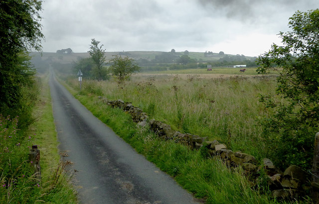
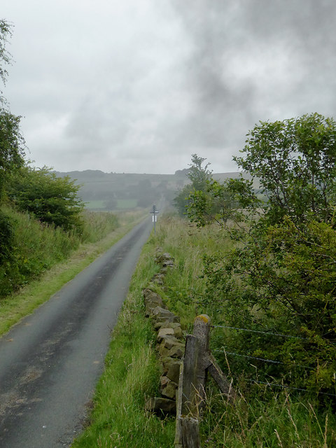
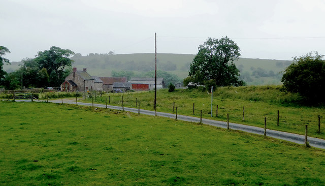
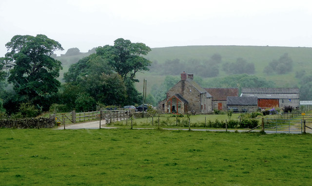
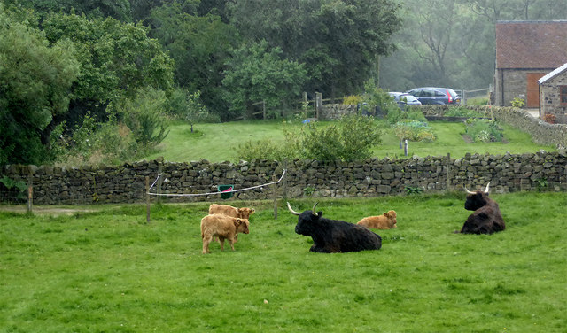
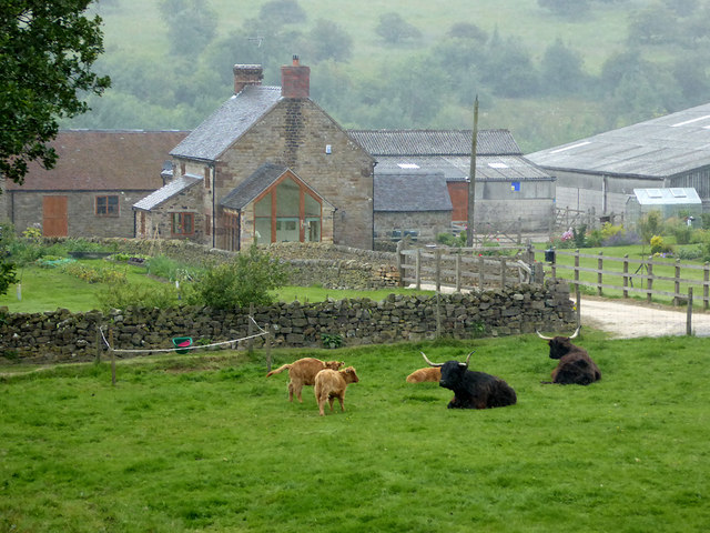
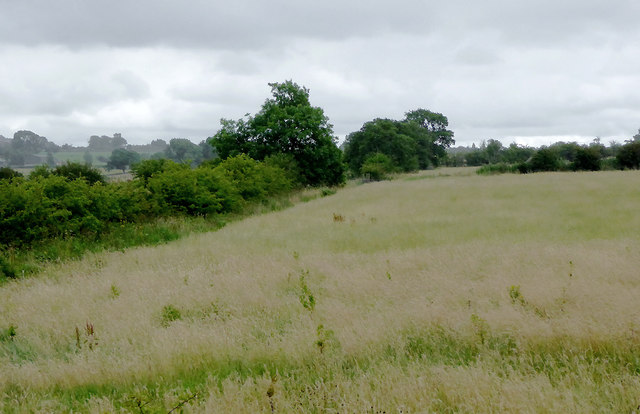
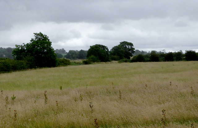
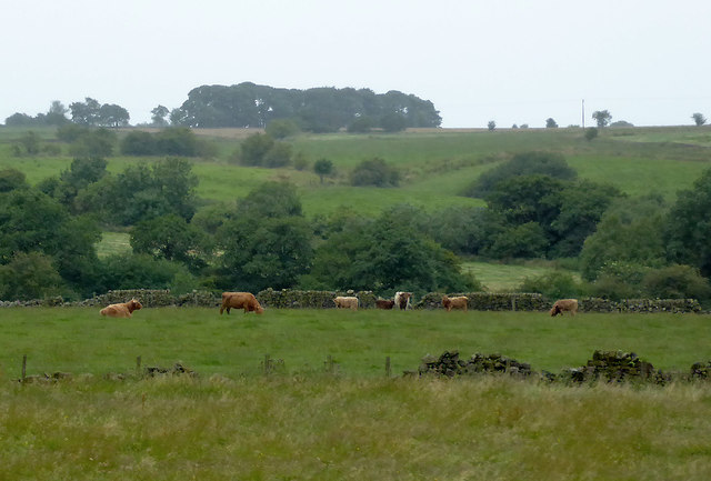
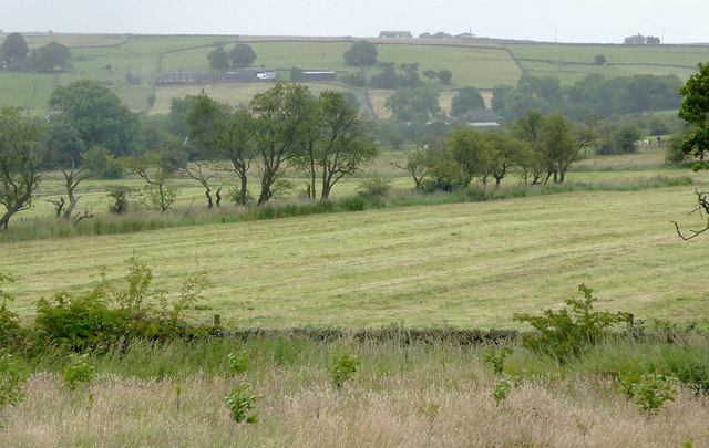
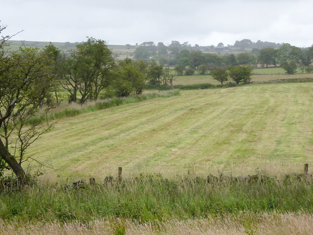
Bottom House is a small village located in the county of Staffordshire, England. Situated approximately 4 miles south of the town of Leek, Bottom House is nestled in the picturesque countryside of the Staffordshire Moorlands. The village is surrounded by rolling hills and lush green fields, offering residents and visitors a tranquil and scenic setting.

Despite its small size, Bottom House boasts a close-knit community that prides itself on its friendly and welcoming atmosphere. The village is home to a handful of residential properties, as well as a local pub and a village hall, which serves as a hub for various community activities and events.

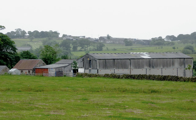
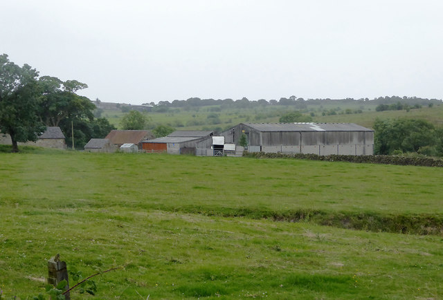
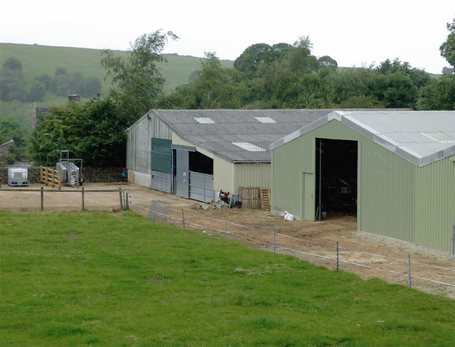
One of the notable features of Bottom House is the nearby Bottomhouse Farm, a working farm that has been a part of the village for generations. The farm not only adds to the rural charm of the area but also provides employment opportunities for locals.

For those who enjoy outdoor pursuits, Bottom House offers easy access to the surrounding countryside, with numerous walking and cycling trails in the vicinity. The nearby Peak District National Park is also within reach, offering stunning landscapes, hiking trails, and opportunities for outdoor adventures.

In terms of amenities, the village is well-connected to the wider area, with regular bus services to nearby towns and villages. The town of Leek provides a range of amenities, including shops, schools, and healthcare facilities, ensuring that residents have access to all necessary services.

Overall, Bottom House is a peaceful and idyllic village, perfect for those seeking a quiet and rural lifestyle while still being within reach of essential amenities and nearby attractions.

If you have any feedback on the listing, please let us know in the comments section below.
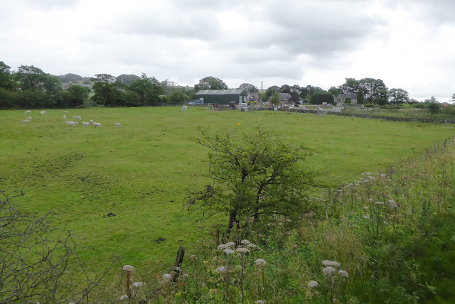
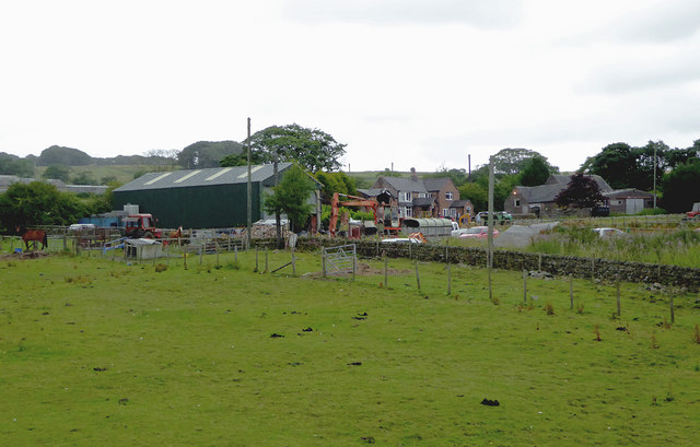
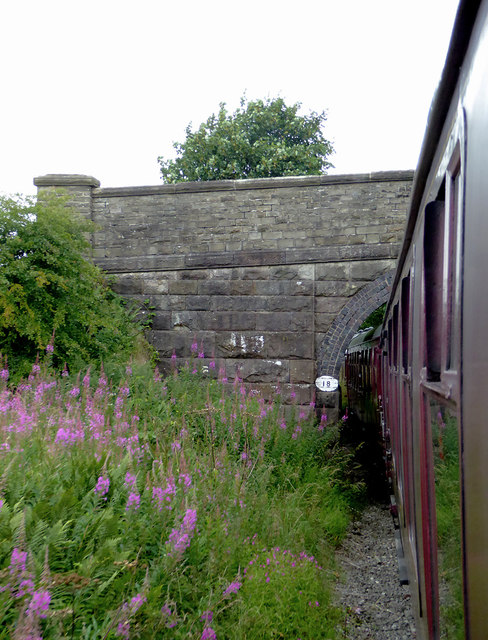
Bottom House Images

Images are sourced within 2km of 53.071861/-1.938176 or Grid Reference SK0452. Thanks to Geograph Open Source API. All images are credited.

Pasture south-east of Leek, Staffordshire Land by Woodleigh Farm is seen here from a passing railway train.
Pasture south-east of Leek, Staffordshire
Land by Woodleigh Farm is seen here from a passing railway train.
Pasture and farm south-east of Leek, Staffordshire Woodleigh Farm is seen here from a passing railway train.
Pasture and farm south-east of Leek, Staffordshire
Woodleigh Farm is seen here from a passing railway train.
Woodleigh Farm Bridge near Bradnop, Staffordshire This is a farmer's accommodation bridge across the (now) Churnet Valley Railway, looking north-west towards Leekbrook.
Woodleigh Farm Bridge near Bradnop, Staffordshire
This is a farmer's accommodation bridge across the (now) Churnet Valley Railway, looking north-west towards Leekbrook.
Farm buildings south-east of Bradnop, Staffordshire Part of Ladymeadows Farm seen from a passing railway train. In the mist on the hill is Bradshaw Farm.
Farm buildings south-east of Bradnop, Staffordshire
Part of Ladymeadows Farm seen from a passing railway train. In the mist on the hill is Bradshaw Farm.
Railway and bridge south-east of Bradnop, Staffordshire The bridge is an accommodation bridge for the nearby Ladymeadows Farm. Its main function has now been superseded by a lane and level crossing on the far side of the bridge.

This line is currently being used as far as the former Ipstones Station by the Churnet Valley Railway.

The line is currently owned by the Moorland and City Railways Company, with plans to reopen lines as far as Leek and Stoke, and agreements likely that CVR will have access to all of its tracks.
Railway and bridge south-east of Bradnop, Staffordshire
The bridge is an accommodation bridge for the nearby Ladymeadows Farm. Its main function has now been superseded by a lane and level crossing on the far side of the bridge. This line is currently being used as far as the former Ipstones Station by the Churnet Valley Railway. The line is currently owned by the Moorland and City Railways Company, with plans to reopen lines as far as Leek and Stoke, and agreements likely that CVR will have access to all of its tracks.
Lane and farmland south-east of Leek, Staffordshire Seen from a passing railway train, this private lane links Ladymeadows Farm to the public road system.
Lane and farmland south-east of Leek, Staffordshire
Seen from a passing railway train, this private lane links Ladymeadows Farm to the public road system.
Lane near Bradnop, Staffordshire Seen from a passing railway train, this private lane links Ladymeadows Farm to the A523 public road.
Lane near Bradnop, Staffordshire
Seen from a passing railway train, this private lane links Ladymeadows Farm to the A523 public road.
Farmland south-east of Bradnop, Staffordshire Ladymeadows Farm seen from the railway on a drizzly afternoon.
Farmland south-east of Bradnop, Staffordshire
Ladymeadows Farm seen from the railway on a drizzly afternoon.
Farmland south-east of Bradnop, Staffordshire Ladymeadows Farm seen from the railway on a drizzly afternoon.
Farmland south-east of Bradnop, Staffordshire
Ladymeadows Farm seen from the railway on a drizzly afternoon.
Grazing south-east of Bradnop, Staffordshire Longhorn cattle seen from a passing railway train.
Grazing south-east of Bradnop, Staffordshire
Longhorn cattle seen from a passing railway train.
Farm south-east of Bradnop, Staffordshire Longhorn cattle seen from a passing railway train.
Farm south-east of Bradnop, Staffordshire
Longhorn cattle seen from a passing railway train.
Grass field south-east of Bradnop, Staffordshire By the railway near Ladymeadows Farm and definitely in need of mowing. Some other local fields are being cut now.
Grass field south-east of Bradnop, Staffordshire
By the railway near Ladymeadows Farm and definitely in need of mowing. Some other local fields are being cut now.
Farm buildings south-east of Bradnop, Staffordshire At Ladymeadows Farm, and seen from a passing railway train. The nearer of these barns is not yet shown on maps or currently available aerial images.
Farm buildings south-east of Bradnop, Staffordshire
At Ladymeadows Farm, and seen from a passing railway train. The nearer of these barns is not yet shown on maps or currently available aerial images.
Grass field south-east of Bradnop, Staffordshire By the railway near Ladymeadows Farm and definitely in need of mowing. Some other local fields are being cut now.
Grass field south-east of Bradnop, Staffordshire
By the railway near Ladymeadows Farm and definitely in need of mowing. Some other local fields are being cut now.
Pasture south-east of Bradnop, Staffordshire The cattle are grazing in fields in the Combes Brook valley.
Pasture south-east of Bradnop, Staffordshire
The cattle are grazing in fields in the Combes Brook valley.
Grassfield south-east of Bradnop, Staffordshire Seen from a passing train on the Cauldon Branch of the Churnet Valley Railway. Thornbank Farm is on the hillside a kilometre distant.
Grassfield south-east of Bradnop, Staffordshire
Seen from a passing train on the Cauldon Branch of the Churnet Valley Railway. Thornbank Farm is on the hillside a kilometre distant.
Grassfields south-east of Bradnop, Staffordshire Seen from a passing train on the Cauldon Branch of the Churnet Valley Railway.
Grassfields south-east of Bradnop, Staffordshire
Seen from a passing train on the Cauldon Branch of the Churnet Valley Railway.
Show me another place!

Bottom House is located at Grid Ref: SK0452 (Lat: 53.071861, Lng: -1.938176)

Administrative County: Staffordshire

District: Staffordshire Moorlands

Police Authority: Staffordshire

What 3 Words

///crunches.factories.stumble. Near Leek, Staffordshire

Nearby Locations

Bottom House

Related Wikis

Ipstones railway station

Ipstones railway station was a railway station that served the village of Ipstones, Staffordshire. It was opened by the North Staffordshire Railway (NSR...

Onecote

Onecote is a village and civil parish on the B5053 road, near Leek, in the Staffordshire Moorlands district, in the county of Staffordshire, England. The...

Peak Wildlife Park

Peak Wildlife Park is a zoo in central England. The nearest towns are Leek, Ashbourne and Stoke-on-Trent. The zoo was originally known as Blackbrook Zoological...

Winkhill railway station

Winkhill railway station was a railway station that served the hamlet of Winkhill, Staffordshire. It was opened by the North Staffordshire Railway (NSR...

Morridge

Morridge is a geographical feature, a few mile east of Leek, in Staffordshire, England. It is in the local government district of Staffordshire Moorlands...

Staffordshire Moorlands (UK Parliament constituency)

Staffordshire Moorlands is a constituency represented in the House of Commons of the UK Parliament since 2010 by Karen Bradley, a Conservative who served...

Ipstones

Ipstones is a village and civil parish in the north of the English county of Staffordshire. Ipstones is part of the Staffordshire Moorlands district; within...

Bradnop

Bradnop is a village in Staffordshire, England, located just a few miles to the southeast of the market town of Leek. The name Bradnop was first recorded...

Nearby Amenities

Located within 500m of 53.071861,-1.938176
Bus Stop
The Green Man PH
Naptan AtcoCode: 3800C802900
Naptan Bearing: SE
Naptan BusStopType: CUS
Naptan CommonName: The Green Man PH
Naptan Indicator: Opp
Naptan Landmark: Green Man PH
Naptan Street: Cook's Hollow
Naptan Verified: no
Source: naptan_import
Lat/Long: 53.0722125/-1.9404762
Bus Stop
The Green Man PH
Bus: yes
Naptan AtcoCode: 3800C802901
Naptan Bearing: NW
Naptan CommonName: The Green Man PH
Naptan Indicator: Adj
Naptan Landmark: The Green Man PH
Naptan Street: Cook's Hollow
Naptan Verified: no
Public Transport: platform
Shelter: yes
Source: naptan_import
Lat/Long: 53.0721178/-1.9405317
Bus Stop
Green Man PH
Naptan AtcoCode: 3800C817701
Naptan Bearing: NE
Naptan CommonName: Green Man PH
Naptan Indicator: Adj
Naptan Landmark: Green Man PH
Naptan Street: Bottom Lane
Naptan Verified: no
Source: naptan_import
Lat/Long: 53.071691/-1.9401038
Bus Stop
Green Man PH
Naptan AtcoCode: 3800C817702
Naptan Bearing: SW
Naptan CommonName: Green Man PH
Naptan Indicator: Opp
Naptan Landmark: Green Man PH
Naptan Street: Bottom Ln
Naptan Verified: no
Source: naptan_import
Lat/Long: 53.0715472/-1.940104
Speed Camera
Maxspeed: 50 mph
Lat/Long: 53.0714995/-1.9381953
Bottomhouse
Note: local signage has it as one word not two
Place: hamlet
Source: visit
Lat/Long: 53.0722289/-1.9395691
The Green Man
Old Amenity: pub
Source: survey
Tourism: apartments
Website: https://www.peakvenues.co.uk/venues/9/the-green-man/
Lat/Long: 53.0718713/-1.9400951
Restaurant
Mehek
Addr Postcode: ST13 7QN
Addr Street: Ashbourne Road
Cuisine: indian
Old Amenity: pub
Old Fhrs Id: 623117
Source: survey
Source Postcode: FHRS Open Data
Lat/Long: 53.0715327/-1.9377023
Building: yes
Lat/Long: 53.0746429/-1.9427732
Power: pole
Lat/Long: 53.0719005/-1.9428047
Power: pole
Lat/Long: 53.0723242/-1.9413482
Power: pole
Lat/Long: 53.0711076/-1.9449799
Power: pole
Lat/Long: 53.0715153/-1.9441216
Power: pole
Lat/Long: 53.0736408/-1.939012
Power: pole
Lat/Long: 53.0724612/-1.9408708
Power: pole
Lat/Long: 53.0730671/-1.9399159
Stop
Direction: forward
Stop: minor
Lat/Long: 53.0719334/-1.9395633
Stop
Direction: forward
Stop: minor
Lat/Long: 53.0718688/-1.9396842
Speed Camera
Direction: 130
Maxspeed: 50 mph
Lat/Long: 53.0734325/-1.9436336
Direction: 225
Maxspeed: 50 mph
Maxspeed Type: sign
Traffic Sign: maxspeed
Lat/Long: 53.0711395/-1.9410072
Direction: 225
Maxspeed: 50 mph
Maxspeed Type: sign
Traffic Sign: maxspeed
Lat/Long: 53.0710822/-1.9409093
Direction: 45
Maxspeed: national
Maxspeed Type: sign
Traffic Sign: maxspeed
Lat/Long: 53.0711446/-1.9409996
Direction: 45
Maxspeed: national
Maxspeed Type: sign
Traffic Sign: maxspeed
Lat/Long: 53.0710878/-1.9408991
Direction: 45
Lit: no
Maxspeed: 50 mph
Traffic Sign: maxspeed
Lat/Long: 53.0726263/-1.9382011
Direction: 225
Lit: no
Maxspeed: national
Traffic Sign: maxspeed
Lat/Long: 53.0726234/-1.9382065
Direction: 225
Lit: no
Maxspeed: national
Traffic Sign: maxspeed
Lat/Long: 53.0726753/-1.9383001
Direction: 45
Lit: no
Maxspeed: 50 mph
Traffic Sign: maxspeed
Lat/Long: 53.0726788/-1.9382947
The data included in this document is from www.openstreetmap.org. The data is made available under ODbL.

Have you been to Bottom House?

Leave your review of Bottom House below (or comments, questions and feedback).