Àird Uig

Settlement in Ross-shire

Scotland

Àird Uig

Stacanan Neideaclibh Looking out from the shore at Aird Uig on the island of Lewis towards Stacanan Neideaclibh
Stacanan Neideaclibh Credit: Steve Houldsworth

Àird Uig is a small coastal village located in the Ross-shire region of the Scottish Highlands. Situated on the northwestern coast of the Isle of Lewis, Àird Uig is surrounded by stunning natural beauty and offers a peaceful and picturesque setting for residents and visitors alike.

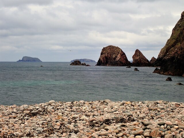
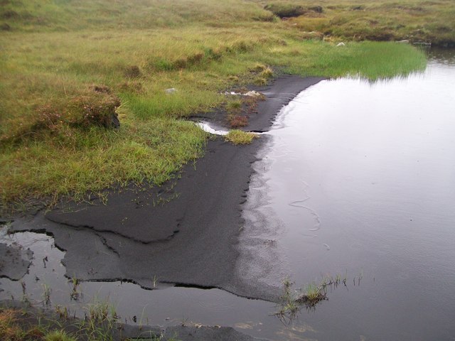
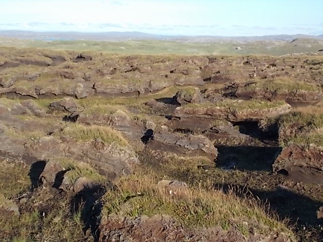
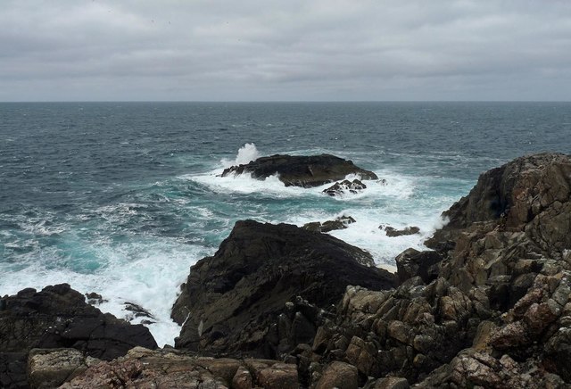
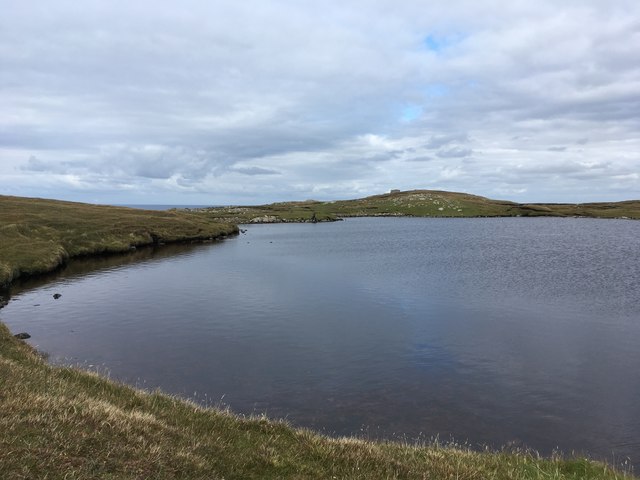
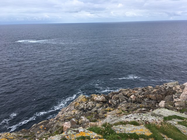
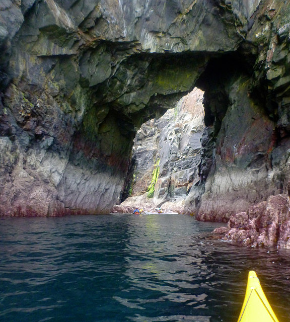
The village is characterized by its rugged coastline, with steep cliffs and sandy beaches that provide breathtaking views of the Atlantic Ocean. The area is known for its diverse wildlife, including seals, otters, and various species of birds, making it a haven for nature enthusiasts and birdwatchers.

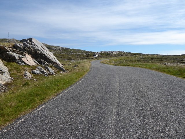
Despite its remote location, Àird Uig is well-connected to other parts of the island. The nearby village of Uig is just a short drive away, offering amenities such as shops, restaurants, and a ferry terminal that connects Àird Uig to the mainland.

Historically, Àird Uig was a traditional crofting community, with agriculture and fishing being the primary sources of livelihood for the locals. Today, while crofting still plays a role in the community, tourism has become an increasingly important industry, attracting visitors who come to explore the rugged landscapes, engage in outdoor activities such as hiking and fishing, or simply enjoy the tranquility of the area.

With its stunning natural surroundings and rich cultural heritage, Àird Uig offers a unique experience for those seeking a peaceful retreat in the heart of the Scottish Highlands.

If you have any feedback on the listing, please let us know in the comments section below.
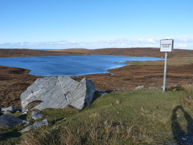
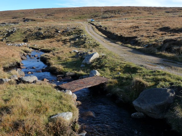
Àird Uig Images

Images are sourced within 2km of 58.231411/-7.0285879 or Grid Reference NB0437. Thanks to Geograph Open Source API. All images are credited.

Stacanan Neideaclibh Looking out from the shore at Aird Uig on the island of Lewis towards Stacanan Neideaclibh
Stacanan Neideaclibh
Looking out from the shore at Aird Uig on the island of Lewis towards Stacanan Neideaclibh
The bay at Aird Uig Looking along the path towards the beach at Aird Uig on the island of Lewis with the stream visible off to the right.
The bay at Aird Uig
Looking along the path towards the beach at Aird Uig on the island of Lewis with the stream visible off to the right.
Shingle Beach Aird Uig Looking across the shingle beach at Aird Uig on the island of Lewis.
Shingle Beach Aird Uig
Looking across the shingle beach at Aird Uig on the island of Lewis.
Loch Deireadh Banaig Failed to catch fish from here and saw none, but beautifully remote. Not sure of name translation, the "last white loch"?
Loch Deireadh Banaig
Failed to catch fish from here and saw none, but beautifully remote. Not sure of name translation, the "last white loch"?
Peat beach at western end of Loch Deireadh Banaig
Peat hags Stay up slope as much as you can to avoid walking through this "moonscape". A line from the end of Loch Deireadh Banaig to Rubha Mor should avoid the worst but not all, tough walking!
Peat hags
Stay up slope as much as you can to avoid walking through this "moonscape". A line from the end of Loch Deireadh Banaig to Rubha Mor should avoid the worst but not all, tough walking!
Gallan Beag, Isle of Lewis Gallan Beag is the rock offshore.
Gallan Beag, Isle of Lewis
Gallan Beag is the rock offshore.
Former military camp with radar station, Àird Uig
Loch a' Rubha Chaoil Apparently this was stocked with trout for servicemen to fish for when it was a RAF station, the end has a small dam to raise the level. I think the fish have long gone, nothing came to my fly anyway! No obvious spawning areas.
Loch a' Rubha Chaoil
Apparently this was stocked with trout for servicemen to fish for when it was a RAF station, the end has a small dam to raise the level. I think the fish have long gone, nothing came to my fly anyway! No obvious spawning areas.
Gallan Head and Sgeir Gallan
Bogha na Lic of Gallan Head Bogha na Lic is the projecting point of An Gallan Uigeach - Gallan Head, and is the sloping rocky promontory catching the sun towards the left of the photo. Either side are deep embayments hiding caves to attract sea kayakers. Unfortunately, although the sea doesn't look rough, there was a long swell, making close approach a bit too dangerous. Round the corner on the sheltered side towards Aird Uig, and along the coast towards  Bhaltos there are plenty more, most of which we were able to get into later in the day.
Bogha na Lic of Gallan Head
Bogha na Lic is the projecting point of An Gallan Uigeach - Gallan Head, and is the sloping rocky promontory catching the sun towards the left of the photo. Either side are deep embayments hiding caves to attract sea kayakers. Unfortunately, although the sea doesn't look rough, there was a long swell, making close approach a bit too dangerous. Round the corner on the sheltered side towards Aird Uig, and along the coast towards Bhaltos there are plenty more, most of which we were able to get into later in the day.
Geodh'an Da Dhoirus There are a series of impressive sea caves along the eastern (sheltered) side of Gallan Head, and despite a lot of swell on the exposed side of the headland, it was calm enough to enter most of these. In the case of this one, the back of the cave has broken through to another Geodh, allowing a large collapse and plenty of light to enter from above. There's no exit by boat (and no easy exit on foot)  at the back, but at least it is better for photography than the usual deep dark recesses - and there's plenty of room to turn round.
Geodh'an Da Dhoirus
There are a series of impressive sea caves along the eastern (sheltered) side of Gallan Head, and despite a lot of swell on the exposed side of the headland, it was calm enough to enter most of these. In the case of this one, the back of the cave has broken through to another Geodh, allowing a large collapse and plenty of light to enter from above. There's no exit by boat (and no easy exit on foot) at the back, but at least it is better for photography than the usual deep dark recesses - and there's plenty of room to turn round.
Loch a' Rubha Chaoil on Gallan Head
Minor road from Aird Uig to the B8011
Road out of Aird Uig
Abandoned croft at Aird Uig
Loch Mheacleit Boulder cleared during the road cutting work.
Loch Mheacleit
Boulder cleared during the road cutting work.
Outflow from Loch Mheacleit A rudimentary foot bridge crosses the burn
Outflow from Loch Mheacleit
A rudimentary foot bridge crosses the burn
Show me another place!

Àird Uig is located at Grid Ref: NB0437 (Lat: 58.231411, Lng: -7.0285879)

Unitary Authority: Na h-Eileanan an Iar

Police Authority: Highlands and Islands

What 3 Words

///amended.workbench.manual. Near Carloway, Na h-Eileanan Siar

Related Wikis

Aird Uig

Aird Uig (Scottish Gaelic: Àird Ùig) is a village on the Isle of Lewis, in the Outer Hebrides, Scotland. Aird Uig is within the parish of Uig, and is situated...

Camas Uig

Camas Uig (Uig Bay) is a bay on the west coast of the Isle of Lewis, in the Outer Hebrides of Scotland. The Lewis Chessmen were discovered in the dunes...

Cliff, Lewis

Cliff (Scottish Gaelic: Cliobh) is a small settlement on the Isle of Lewis, in the Outer Hebrides, Scotland. Cliff is within the parish of Uig. The settlement...

Timsgarry

Timsgarry (Scottish Gaelic: Tuimisgearraidh) is a village on the Isle of Lewis, in the Outer Hebrides, Scotland. Timsgarry is home to the Baile na Cille...

Kneep

Kneep (Scottish Gaelic: Cnìp) is a village on the Isle of Lewis, in the Outer Hebrides, Scotland. Kneep is within the parish of Uig.Various archaeological...

Pabaigh Mòr

Pabay Mòr or Pabaigh Mòr is an uninhabited island in the Outer Hebrides of Scotland. == History == The island's name comes from papey, an Old Norse name...

Ardroil

Ardroil (Scottish Gaelic: Eadar Dhà Fhadhail) is a village on the Isle of Lewis in the Outer Hebrides, Scotland. Ardroil is within the parish of Uig....

Uig, Lewis

Uig (Scottish Gaelic: Ùig [uːkʲ]), also known as Sgìr' Ùig, is a civil parish and community in the west of the Isle of Lewis in the Outer Hebrides, Scotland...

Nearby Amenities

Located within 500m of 58.231411,-7.0285879
Barrier: cattle_grid
Lat/Long: 58.2312838/-7.0284555
Aird Uig
Naptan AtcoCode: 6010731505
Naptan Bearing: SE
Naptan BusStopType: CUS
Naptan CommonName: Aird Uig
Naptan Indicator: Village
Naptan Landmark: opposite restaurant
Naptan NaptanCode: 94723936
Naptan Street: Village
Naptan Verified: no
Source: naptan_import
Lat/Long: 58.2315083/-7.029283
Passing Place
Lat/Long: 58.2348331/-7.0322311
Àird Ùig
Alt Name Gd: An Àrd
Name Gd: Àird Ùig
Place: village
Wikidata: Q4698585
Wikipedia: en:Aird Uig
Lat/Long: 58.2306352/-7.0286001
Barrier: cattle_grid
Lat/Long: 58.2339522/-7.0293875
Power: pole
Lat/Long: 58.2272672/-7.0257184
Power: pole
Lat/Long: 58.2276451/-7.026479
Power: pole
Lat/Long: 58.2279518/-7.0265986
Power: pole
Lat/Long: 58.2283615/-7.0274682
Power: pole
Lat/Long: 58.2292124/-7.0291983
Power: pole
Lat/Long: 58.2296725/-7.0301313
Power: pole
Lat/Long: 58.2299368/-7.0306722
Power: pole
Lat/Long: 58.2302489/-7.0312921
Power: pole
Lat/Long: 58.2304876/-7.0317926
Power: pole
Lat/Long: 58.2308767/-7.0326002
Power: pole
Lat/Long: 58.2315697/-7.0325347
Power: pole
Lat/Long: 58.2322727/-7.0324851
Power: pole
Lat/Long: 58.2330771/-7.0324286
Power: pole
Lat/Long: 58.233796/-7.0323745
Power: pole
Lat/Long: 58.2345208/-7.0323045
Power: pole
Lat/Long: 58.2350104/-7.0322594
Comas na h-Airde
Natural: bay
Lat/Long: 58.2343981/-7.0239526
Turning Circle
Lat/Long: 58.2321859/-7.0300861
SEAcroft
Addr City: Eilean Leòdhais
Addr City En: Isle of Lewis
Addr Country: GB
Addr Housenumber: 3A
Addr Postcode: HS2 9JA
Addr Street: Aird
Guest House: bed_and_breakfast
Tourism: guest_house
Website: https://seacroftuig.co.uk/
Lat/Long: 58.2322963/-7.0280997
Creag a´Mhoil
Natural: cape
Lat/Long: 58.2334954/-7.0263823
The data included in this document is from www.openstreetmap.org. The data is made available under ODbL.

Have you been to Àird Uig?

Leave your review of Àird Uig below (or comments, questions and feedback).