Tournaig

Settlement in Ross-shire

Scotland

Tournaig

A832 The A832 runs 127 miles from the Black Isle to Braemore Junction <a href="https://www.geograph.org.uk/photo/7232275">NH2077 : Braemore Junction</a>.
<span class="nowrap"><a title="https://www.sabre-roads.org.uk/wiki/index.php?title=A832" rel="nofollow ugc noopener" href="https://www.sabre-roads.org.uk/wiki/index.php?title=A832">Link</a><img style="margin-left:2px;" alt="External link" title="External link - shift click to open in new window" src="https://s1.geograph.org.uk/img/external.png" width="10" height="10"/></span>
A832 Credit: N Chadwick

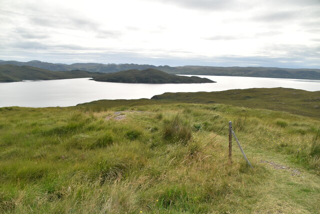
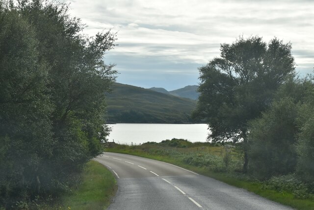
Tournaig is a small village located in Ross-shire, a historic county in the Scottish Highlands. Nestled amidst stunning natural surroundings, Tournaig is situated on the eastern shores of Loch Maree, the fourth largest freshwater loch in Scotland. The village is surrounded by picturesque landscapes, with rolling hills, dense forests, and breathtaking views of the loch.

With a population of around 100 residents, Tournaig is a close-knit community that offers a tranquil and peaceful lifestyle. The village is predominantly residential, with a scattering of traditional stone houses and cottages dotting the landscape. Many of these properties have been beautifully preserved, showcasing the architectural charm of the region.

The main attraction in Tournaig is Loch Maree, which offers numerous recreational activities for visitors and locals alike. Fishing enthusiasts flock to the loch's shores to indulge in salmon and trout fishing. The surrounding hills also provide excellent opportunities for hiking and bird-watching, with several nature trails and viewpoints offering breathtaking panoramas.

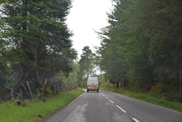
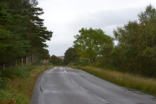
While Tournaig itself is a small village, it is conveniently located within reasonable proximity to larger towns such as Gairloch and Achnasheen, where amenities such as shops, restaurants, and schools can be found. The village is also well-connected by road, making it easily accessible for visitors and residents.

Tournaig's idyllic setting, coupled with its peaceful atmosphere and access to outdoor activities, make it an ideal destination for those seeking a serene retreat in the heart of the Scottish Highlands.

If you have any feedback on the listing, please let us know in the comments section below.

Tournaig Images

Images are sourced within 2km of 57.791144/-5.5749847 or Grid Reference NG8783. Thanks to Geograph Open Source API. All images are credited.

A832 The A832 runs 127 miles from the Black Isle to Braemore Junction <a href="https://www.geograph.org.uk/photo/7232275">NH2077 : Braemore Junction</a>.
<span class="nowrap"><a title="https://www.sabre-roads.org.uk/wiki/index.php?title=A832" rel="nofollow ugc noopener" href="https://www.sabre-roads.org.uk/wiki/index.php?title=A832">Link</a><img style="margin-left:2px;" alt="External link" title="External link - shift click to open in new window" src="https://s1.geograph.org.uk/img/external.png" width="10" height="10"/></span>
A832
The A832 runs 127 miles from the Black Isle to Braemore Junction NH2077 : Braemore Junction. LinkExternal link
NC500 The North Coast 500 is a 516 mile scenic route around the north coast of Scotland, starting and ending at Inverness Castle. The route is also known as the NC500 and was launched in 2015, linking many features in the north Highlands of Scotland in one touring route.
The route has increased visitor numbers to parts of the north of Scotland, which has brought economic benefits to some areas. The increase in traffic has also led to more instances of bad and dangerous driving, as well as damage to the roads and concerns about the environmental impact. 
Apparently the route was amended in 2022 with detours etc being removed.
Wikipedia: <span class="nowrap"><a title="https://en.wikipedia.org/wiki/North_Coast_500" rel="nofollow ugc noopener" href="https://en.wikipedia.org/wiki/North_Coast_500">Link</a><img style="margin-left:2px;" alt="External link" title="External link - shift click to open in new window" src="https://s1.geograph.org.uk/img/external.png" width="10" height="10"/></span> 
Original route map: <span class="nowrap"><a title="https://en.wikipedia.org/wiki/North_Coast_500#/media/File:North_Coast_500,_Scotland.svg" rel="nofollow ugc noopener" href="https://en.wikipedia.org/wiki/North_Coast_500#/media/File:North_Coast_500,_Scotland.svg">Link</a><img style="margin-left:2px;" alt="External link" title="External link - shift click to open in new window" src="https://s1.geograph.org.uk/img/external.png" width="10" height="10"/></span> 
Latest route map: <span class="nowrap"><a title="https://www.northcoast500.com/explore-the-route/" rel="nofollow ugc noopener" href="https://www.northcoast500.com/explore-the-route/">Link</a><img style="margin-left:2px;" alt="External link" title="External link - shift click to open in new window" src="https://s1.geograph.org.uk/img/external.png" width="10" height="10"/></span>
NC500
The North Coast 500 is a 516 mile scenic route around the north coast of Scotland, starting and ending at Inverness Castle. The route is also known as the NC500 and was launched in 2015, linking many features in the north Highlands of Scotland in one touring route. The route has increased visitor numbers to parts of the north of Scotland, which has brought economic benefits to some areas. The increase in traffic has also led to more instances of bad and dangerous driving, as well as damage to the roads and concerns about the environmental impact. Apparently the route was amended in 2022 with detours etc being removed. Wikipedia: LinkExternal link Original route map: LinkExternal link Latest route map: LinkExternal link
View toward Loch Thunaig
Loch Thunaig
Loch Thunaig
Coastal grasses
Coastal grasses
Difficult to sit here! The North Coast 500 is a 516 mile scenic route around the north coast of Scotland, starting and ending at Inverness Castle. The route is also known as the NC500 and was launched in 2015, linking many features in the north Highlands of Scotland in one touring route.
The route has increased visitor numbers to parts of the north of Scotland, which has brought economic benefits to some areas. The increase in traffic has also led to more instances of bad and dangerous driving, as well as damage to the roads and concerns about the environmental impact. 
Apparently the route was amended in 2022 with detours etc being removed.
Wikipedia: <span class="nowrap"><a title="https://en.wikipedia.org/wiki/North_Coast_500" rel="nofollow ugc noopener" href="https://en.wikipedia.org/wiki/North_Coast_500">Link</a><img style="margin-left:2px;" alt="External link" title="External link - shift click to open in new window" src="https://s1.geograph.org.uk/img/external.png" width="10" height="10"/></span> 
Original route map: <span class="nowrap"><a title="https://en.wikipedia.org/wiki/North_Coast_500#/media/File:North_Coast_500,_Scotland.svg" rel="nofollow ugc noopener" href="https://en.wikipedia.org/wiki/North_Coast_500#/media/File:North_Coast_500,_Scotland.svg">Link</a><img style="margin-left:2px;" alt="External link" title="External link - shift click to open in new window" src="https://s1.geograph.org.uk/img/external.png" width="10" height="10"/></span> 
Latest route map: <span class="nowrap"><a title="https://www.northcoast500.com/explore-the-route/" rel="nofollow ugc noopener" href="https://www.northcoast500.com/explore-the-route/">Link</a><img style="margin-left:2px;" alt="External link" title="External link - shift click to open in new window" src="https://s1.geograph.org.uk/img/external.png" width="10" height="10"/></span>
Difficult to sit here!
The North Coast 500 is a 516 mile scenic route around the north coast of Scotland, starting and ending at Inverness Castle. The route is also known as the NC500 and was launched in 2015, linking many features in the north Highlands of Scotland in one touring route. The route has increased visitor numbers to parts of the north of Scotland, which has brought economic benefits to some areas. The increase in traffic has also led to more instances of bad and dangerous driving, as well as damage to the roads and concerns about the environmental impact. Apparently the route was amended in 2022 with detours etc being removed. Wikipedia: LinkExternal link Original route map: LinkExternal link Latest route map: LinkExternal link
A832 The A832 runs 127 miles from the Black Isle to Braemore Junction <a href="https://www.geograph.org.uk/photo/7232275">NH2077 : Braemore Junction</a>.
<span class="nowrap"><a title="https://www.sabre-roads.org.uk/wiki/index.php?title=A832" rel="nofollow ugc noopener" href="https://www.sabre-roads.org.uk/wiki/index.php?title=A832">Link</a><img style="margin-left:2px;" alt="External link" title="External link - shift click to open in new window" src="https://s1.geograph.org.uk/img/external.png" width="10" height="10"/></span>
A832
The A832 runs 127 miles from the Black Isle to Braemore Junction NH2077 : Braemore Junction. LinkExternal link
A832 nearing Tournaig
Loch nan Dilthean
Loch nan Dilthean
Outcrops on Druim Lochan na Ba Caoile
From the A832 viewpoint towards Inverewe Garden A misty day.  The shallow promontory in Loch Ewe is Leac Bhuidhe.
From the A832 viewpoint towards Inverewe Garden
A misty day. The shallow promontory in Loch Ewe is Leac Bhuidhe.
Information board and sculpture describing the place of Loch Ewe in the story of the Arctic convoys during WW2 Loch Ewe (a sea loch) lies beyond.
Information board and sculpture describing the place of Loch Ewe in the story of the Arctic convoys during WW2
Loch Ewe (a sea loch) lies beyond.
The A832 passing forestry on Meall an Doire
Pinewood walk, Inverewe
A forestry track east of Inverewe Gardens
Water tower by track A relic of the wartime installations. The track leads to a jetty on Loch Thùrnaig.
Water tower by track
A relic of the wartime installations. The track leads to a jetty on Loch Thùrnaig.
Show me another place!

Tournaig is located at Grid Ref: NG8783 (Lat: 57.791144, Lng: -5.5749847)

Unitary Authority: Highland

Police Authority: Highlands and Islands

What 3 Words

///walking.certified.stilted. Near Gairloch, Highland

Related Wikis

Tournaig

Tournaig is a remote scattered crofting and fishing hamlet, that sits on the confluence of the sea loch, Loch Thùrnaig to the west, and Loch Nan Dailthean...

Inverewe Garden

Inverewe Garden (Scottish Gaelic: Gàradh Inbhir Iù) is a botanical garden in Wester Ross in the Scottish Highlands. It is located just to the north of...

Londubh

Londubh (Scottish Gaelic: An Lòn Dubh) is a village on the south shore of Loch Ewe in Poolewe, Ross-shire, Scottish Highlands and is in the Scottish council...

Poolewe Stone

The Poolewe Stone is a Class-I Pictish stone discovered in 1992 in the cemetery at Poolewe (Poll Iùbh) in Wester Ross. The stone carries the common Pictish...

Poolewe

Poolewe (Scottish Gaelic: Poll Iù) is a small village in Wester Ross in the North West Highlands of Scotland, about 75 miles (120 kilometres) northwest...

Loch Ewe distillery

Loch Ewe distillery in Drumchork near Aultbea in the Scottish Highlands was the smallest legally operated distillery in Scotland. It was set up in 2005...

Isle of Ewe

The Isle of Ewe (Scottish Gaelic: Eilean Iùbh) is a small Scottish island on the west coast of Ross and Cromarty. The island is inhabited by a single family...

Aultbea

Aultbea (Gaelic: An t-Allt Beithe) is a small coastal fishing village in the North-West Highlands of Scotland. It is situated on the southeast shore of...

Nearby Amenities

Located within 500m of 57.791144,-5.5749847
Source: PGS
Lat/Long: 57.7941399/-5.579898
Source: PGS
Lat/Long: 57.7937711/-5.5796097
Source: PGS
Lat/Long: 57.7938533/-5.5790464
Source: PGS
Lat/Long: 57.7934169/-5.5784455
Source: PGS
Lat/Long: 57.7930142/-5.5777257
Source: PGS
Lat/Long: 57.7928141/-5.5776393
Source: PGS
Lat/Long: 57.7917847/-5.5781113
Source: PGS
Lat/Long: 57.7915377/-5.5788611
Source: PGS
Lat/Long: 57.7906199/-5.579096
Source: PGS
Lat/Long: 57.7903572/-5.5795566
Source: PGS
Lat/Long: 57.7903528/-5.5805525
Source: PGS
Lat/Long: 57.7902922/-5.5809075
Source: PGS
Lat/Long: 57.7900073/-5.5814436
Source: PGS
Lat/Long: 57.7898113/-5.5817818
Power: pole
Lat/Long: 57.7905566/-5.5755489
Power: pole
Lat/Long: 57.7898/-5.5752609
Power: pole
Lat/Long: 57.7891845/-5.5750639
Power: pole
Lat/Long: 57.7885976/-5.5752733
Power: pole
Lat/Long: 57.7875127/-5.5758314
Power: pole
Lat/Long: 57.7893402/-5.5758011
Power: pole
Lat/Long: 57.788912/-5.575684
Power: pole
Lat/Long: 57.7883817/-5.5759224
Power: pole
Lat/Long: 57.7877882/-5.576249
Power: pole
Lat/Long: 57.7871991/-5.5765507
Power: pole
Lat/Long: 57.7940467/-5.5728881
Power: pole
Lat/Long: 57.7933299/-5.5732877
Power: pole
Lat/Long: 57.7925822/-5.573679
Power: pole
Lat/Long: 57.7916994/-5.574153
Power: pole
Lat/Long: 57.7923854/-5.5732298
Power: pole
Lat/Long: 57.7930332/-5.5728853
Power: pole
Lat/Long: 57.7938308/-5.5724416
Power: pole
Lat/Long: 57.7944653/-5.5720888
Power: pole
Lat/Long: 57.7952291/-5.5717112
Power: pole
Lat/Long: 57.794784/-5.5724678
Power: pole
Lat/Long: 57.7897343/-5.5741784
Power: pole
Lat/Long: 57.7902525/-5.5737283
Power: pole
Lat/Long: 57.7909766/-5.5731511
Power: pole
Lat/Long: 57.790821/-5.5711633
Power: pole
Lat/Long: 57.7907959/-5.5724431
Power: pole
Lat/Long: 57.7911956/-5.5742059
Power: pole
Lat/Long: 57.791204/-5.5744336
Power: pole
Lat/Long: 57.790639/-5.5756206
Power: pole
Lat/Long: 57.7902274/-5.5764843
Power: pole
Lat/Long: 57.7896429/-5.5760498
Power: pole
Lat/Long: 57.7915737/-5.5736458
Power: pole
Lat/Long: 57.7909989/-5.5747268
The data included in this document is from www.openstreetmap.org. The data is made available under ODbL.

Have you been to Tournaig?

Leave your review of Tournaig below (or comments, questions and feedback).