Tongue End

Settlement in Lincolnshire South Holland

England

Tongue End

Twenty railway station
Twenty railway station Credit: Terry Butcher

Tongue End is a small village located in the county of Lincolnshire, England. Situated approximately 6 miles east of the town of Spalding, Tongue End is a picturesque rural community with a population of around 300 residents.

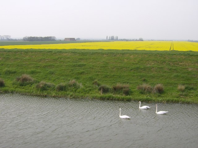
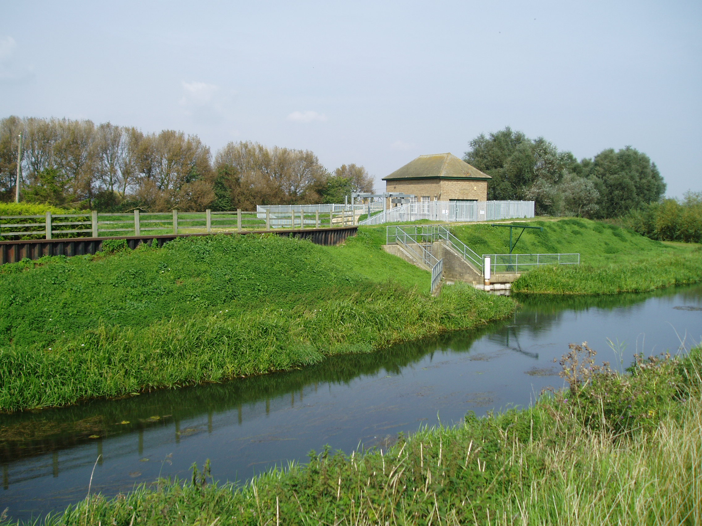
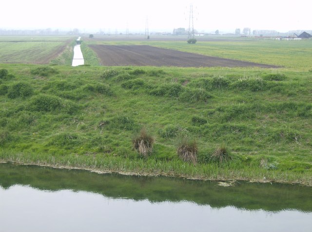
The village is characterized by its beautiful open countryside and agricultural landscape. Surrounded by vast fields and farmland, Tongue End offers a tranquil and peaceful setting for its inhabitants. The River Welland flows nearby, adding to the natural charm of the area.

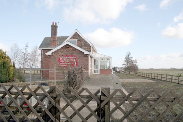
Tongue End is known for its traditional architecture, with many of its buildings dating back several centuries. The village features a mix of charming cottages, farmhouses, and other historic structures, giving it a distinct and timeless feel.

While Tongue End is primarily a residential area, it also has a small community hall that serves as a gathering place for local events and activities. The village is proud of its close-knit community, with residents often coming together to organize social gatherings and celebrations.

Despite its small size, Tongue End is conveniently located near larger towns and cities. The A16 road runs nearby, providing easy access to Spalding and other neighboring areas. This allows residents to enjoy the tranquility of village life while still being within reach of amenities and services.

Overall, Tongue End offers a peaceful and idyllic setting for those seeking a rural lifestyle. Its natural beauty, historic charm, and strong sense of community make it a truly special place to call home.

If you have any feedback on the listing, please let us know in the comments section below.

Tongue End Images

Images are sourced within 2km of 52.752423/-0.280492 or Grid Reference TF1618. Thanks to Geograph Open Source API. All images are credited.

Twenty railway station
Swans and Rape A very remote square.  The south-east corner is crossed by the River Glen, channelled with floodbanks on both sides.  From the south-eastern bank the landscape opposite is vast fields of rape.  On the river are many swans.
Swans and Rape
A very remote square. The south-east corner is crossed by the River Glen, channelled with floodbanks on both sides. From the south-eastern bank the landscape opposite is vast fields of rape. On the river are many swans.
Rickety farm bridge crossing Counter Drain
Counter Drain heading towards Tongue End
Soil marks on Deeping Fen near Twenty and River Glen: aerial 2021 (1) Former creeks.
Soil marks on Deeping Fen near Twenty and River Glen: aerial 2021 (1)
Former creeks.
Soil marks on Deeping Fen near Twenty and River Glen: aerial 2021 (2)
Farm track to Roses Cottage A straight farmland track near Tongue End. This link shows the same view, from a slightly different angle, some five and-a-half years earlier: <a href="https://www.geograph.org.uk/photo/105828">TF1517 : Farm track, Tongue End, Lincs</a>.
Farm track to Roses Cottage
A straight farmland track near Tongue End. This link shows the same view, from a slightly different angle, some five and-a-half years earlier: TF1517 : Farm track, Tongue End, Lincs.
Drain and distant wind farm Looking across the Fens from Tongue End towards Deeping St. Nicholas wind farm.
Drain and distant wind farm
Looking across the Fens from Tongue End towards Deeping St. Nicholas wind farm.
Counter Drain Drove Looking east along Counter Drain Drove from its southern verge, at Tongue End.
Counter Drain Drove
Looking east along Counter Drain Drove from its southern verge, at Tongue End.
River Glen The River Glen viewed from South Fen bridge.
River Glen
The River Glen viewed from South Fen bridge.
Farmland south of South Fen Road A gated farm track and arable field on the south side of South Fen Road, towards the River Glen.
Farmland south of South Fen Road
A gated farm track and arable field on the south side of South Fen Road, towards the River Glen.
River Glen River Glen, north of Tongue End - not far from Bourne Eau pump house.
River Glen
River Glen, north of Tongue End - not far from Bourne Eau pump house.
Counter Drain Looking northeast along Counter Drain, close to Tongue End.
Counter Drain
Looking northeast along Counter Drain, close to Tongue End.
Farm track A bridge over North Drove Drain and farm track leading, eventually, to Lonsdale Farm, Deeping St. Nicholas.
Farm track
A bridge over North Drove Drain and farm track leading, eventually, to Lonsdale Farm, Deeping St. Nicholas.
Blue Sky on South Fen Road Plastic recycling plant.
Blue Sky on South Fen Road
Plastic recycling plant.
The River Glen from Long Drove
Entering Tongue End
Entering Tongue End
Show me another place!

Tongue End is located at Grid Ref: TF1618 (Lat: 52.752423, Lng: -0.280492)

Division: Parts of Kesteven

Administrative County: Lincolnshire

District: South Holland

Police Authority: Lincolnshire

What 3 Words

///motivator.revived.suave. Near Baston, Lincolnshire

Nearby Locations

Tongue End

Related Wikis

Tongue End

Tongue End is a small village in the South Holland district of Lincolnshire, England. It is situated 4 miles (6 km) east from Bourne and 6 miles (10 km...

Gilbert Heathcote's tunnel

Gilbert Heathcote's tunnel was an engineering project dating from the 1630s as one of the earliest modern attempts to drain The Fens in Lincolnshire....

Twenty railway station

Twenty railway station served the village of Twenty in Lincolnshire, England. It was on the route of the Spalding and Bourne Railway (opened 1866), later...

Twenty, Lincolnshire

Twenty is a village in the South Kesteven district of Lincolnshire, England. It is situated approximately 3 miles (5 km) east of Bourne, and 5 miles (8...

Nearby Amenities

Located within 500m of 52.752423,-0.280492
Bus Stop
Everard Road
Bus: yes
Naptan AtcoCode: 270002700099
Naptan Bearing: NE
Naptan CommonName: Everard Road
Naptan Indicator: opp
Naptan Landmark: Everard Road
Naptan NaptanCode: linjtapa
Naptan Street: Counter Drain Drove
Naptan Verified: no
Public Transport: platform
Source: naptan_import
Lat/Long: 52.7515297/-0.2854071
Bus Stop
Everard Road
Bus: yes
Naptan AtcoCode: 2700LTEE6587
Naptan Bearing: SW
Naptan CommonName: Everard Road
Naptan Indicator: adj
Naptan Landmark: Everard Road
Naptan NaptanCode: lingdpja
Naptan Street: Counter Drain Drove
Naptan Verified: no
Public Transport: platform
Source: naptan_import
Lat/Long: 52.7514381/-0.2852922
Tongue End
Place: hamlet
Source: Bing
Wikidata: Q9359975
Lat/Long: 52.7509139/-0.2856694
Power: tower
Lat/Long: 52.7489836/-0.2841638
Power: tower
Lat/Long: 52.749568/-0.2802155
Power: tower
Lat/Long: 52.7501395/-0.2763317
Counter Drain Washes
Place: locality
Source: Bing
Lat/Long: 52.7556036/-0.2811027
Marker: plate
Note: gas hp lts
Utility: gas
Lat/Long: 52.7557941/-0.2782367
The data included in this document is from www.openstreetmap.org. The data is made available under ODbL.

Have you been to Tongue End?

Leave your review of Tongue End below (or comments, questions and feedback).