Tokyngton

Settlement in Middlesex

England

Tokyngton

Former Alperton bus garage, Bridgwater Road frontage Taken on 11th September the day on which the garage ceased operation. The building seen here housed offices and other staff facilities. The garage was opened on 7th June 1939 by the London Passenger Transport Board and since June 2013 had been operated by Metroline West.
Former Alperton bus garage, Bridgwater Road frontage Credit: David Kemp

Tokyngton is a suburban area located in the London Borough of Brent, Middlesex, England. Situated approximately 9 miles northwest of central London, it falls within the HA9 postcode district. Historically, Tokyngton was a small hamlet that expanded in the 20th century due to urban development.

The area is primarily residential, characterized by a mix of housing types ranging from Victorian terraces to modern apartment complexes. Tokyngton benefits from its proximity to Wembley Stadium and Wembley Arena, attracting sports and music enthusiasts. It is also adjacent to the picturesque Tokyngton Recreation Ground, a green open space offering recreational activities for locals.

Transport links in Tokyngton are excellent, with Tokyngton Avenue serving as a major road connecting the area to surrounding neighborhoods. The nearby North Circular Road and A404 provide easy access to the wider London area. Additionally, the area is served by the Tokyngton Underground Station on the Bakerloo line, offering convenient connections to central London and beyond.

Residents of Tokyngton enjoy a range of amenities, including shops, supermarkets, schools, and healthcare facilities. The area is culturally diverse, with a vibrant community that celebrates various traditions and hosts multicultural events. The nearby Wembley Park offers a plethora of entertainment options, including shopping centers, restaurants, and a cinema.

Overall, Tokyngton offers a suburban lifestyle with excellent transport links, recreational spaces, and a diverse community, making it an attractive place to live within Greater London.

If you have any feedback on the listing, please let us know in the comments section below.
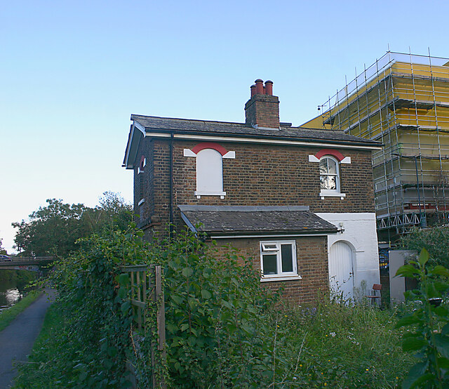
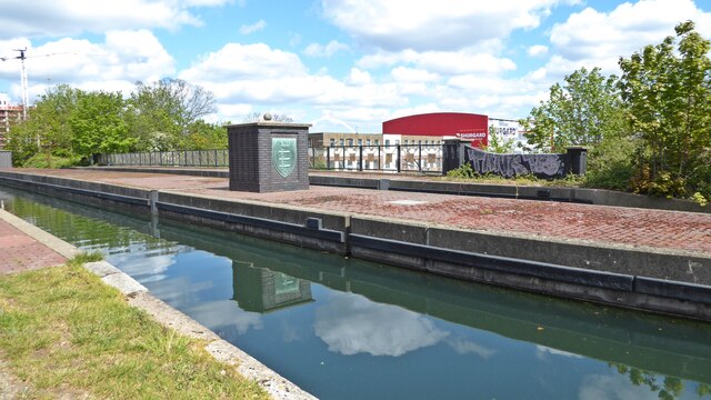
Tokyngton Images

Images are sourced within 2km of 51.548152/-0.276075 or Grid Reference TQ1984. Thanks to Geograph Open Source API. All images are credited.

Former Alperton bus garage, Bridgwater Road frontage Taken on 11th September the day on which the garage ceased operation. The building seen here housed offices and other staff facilities. The garage was opened on 7th June 1939 by the London Passenger Transport Board and since June 2013 had been operated by Metroline West.
Former Alperton bus garage, Bridgwater Road frontage
Taken on 11th September the day on which the garage ceased operation. The building seen here housed offices and other staff facilities. The garage was opened on 7th June 1939 by the London Passenger Transport Board and since June 2013 had been operated by Metroline West.
Former Alperton bus garage, Bridgwater Road entrances Taken on 18th September a week after the day on which the garage ceased operation. It will be apparent from the high-rise buildings in the background that the garage stood on a prime site ripe for re-development. It is intended that in due course a replacement garage will be opened in nearby Athlon Road. The main entrance lies straight ahead with another entrance leading into the running shed partly visible on the left.
Former Alperton bus garage, Bridgwater Road entrances
Taken on 18th September a week after the day on which the garage ceased operation. It will be apparent from the high-rise buildings in the background that the garage stood on a prime site ripe for re-development. It is intended that in due course a replacement garage will be opened in nearby Athlon Road. The main entrance lies straight ahead with another entrance leading into the running shed partly visible on the left.
Former Alperton bus garage, Ealing Road frontage Taken on 18th September  a week after the day on which the garage ceased operation. The garage was opened on 7th June 1939 by the London Passenger Transport Board and since June 2013 had been operated by Metroline West.
Former Alperton bus garage, Ealing Road frontage
Taken on 18th September a week after the day on which the garage ceased operation. The garage was opened on 7th June 1939 by the London Passenger Transport Board and since June 2013 had been operated by Metroline West.
Unoccupied cottage, Grand Union Canal (Paddington Branch) This cottage is situated on land between the canal towpath and Twyford Abbey Road. Although the garden was overgrown, it looked as though the building was the subject of refurbishment.
Unoccupied cottage, Grand Union Canal (Paddington Branch)
This cottage is situated on land between the canal towpath and Twyford Abbey Road. Although the garden was overgrown, it looked as though the building was the subject of refurbishment.
Stonebridge Park aqueduct The Stonebridge Park aqueduct carries the Paddington Arm of the Grand Union Canal across the A406 North Circular Road.

The original aqueduct was opened in 1933 and consisted of two arches across the new North Circular road.

The newer, larger structure dates from 1993 and has a single arch in order to accommodate a widened North Circular.  The Middlesex coat of arms on the centre island of the aqueduct is from the original 1933 structure.
Stonebridge Park aqueduct
The Stonebridge Park aqueduct carries the Paddington Arm of the Grand Union Canal across the A406 North Circular Road. The original aqueduct was opened in 1933 and consisted of two arches across the new North Circular road. The newer, larger structure dates from 1993 and has a single arch in order to accommodate a widened North Circular. The Middlesex coat of arms on the centre island of the aqueduct is from the original 1933 structure.
Grand Union Canal Paddington Arm, Alperton Looking west towards to the Hazel Grove footbridge.
Grand Union Canal Paddington Arm, Alperton
Looking west towards to the Hazel Grove footbridge.
Wembley Stadium Rugby League Challenge cup Final 2021. Castleford V St Helens.
Wembley Stadium
Rugby League Challenge cup Final 2021. Castleford V St Helens.
COYF. Come On You Ford, Wembley Stadium Wembley Way. Rugby League Challenge Cup Final
COYF. Come On You Ford, Wembley Stadium
Wembley Way. Rugby League Challenge Cup Final
Wembley Stadium from Olympic Way Wembley Stadium for the Rugby League Challenge Cup final 2008, where St Helens beat Hull 28-16
Wembley Stadium from Olympic Way
Wembley Stadium for the Rugby League Challenge Cup final 2008, where St Helens beat Hull 28-16
Wembley Stadium Wembley Stadium from nearby car park
Wembley Stadium
Wembley Stadium from nearby car park
Closed Bus Garage, Alperton (1) Taken from the A4005 Bridgewater Road, this photo shows the bus garage which closed on Saturday 11th September 2021. It had opened on Wednesday 7th June 1939 and during the 1970s, modernisation and enlargement of the garage took place so increasing the number of vehicles to about 80. A large lorry can be seen inside the garage area to the left of the photo.
Closed Bus Garage, Alperton (1)
Taken from the A4005 Bridgewater Road, this photo shows the bus garage which closed on Saturday 11th September 2021. It had opened on Wednesday 7th June 1939 and during the 1970s, modernisation and enlargement of the garage took place so increasing the number of vehicles to about 80. A large lorry can be seen inside the garage area to the left of the photo.
Closed Bus Garage, Alperton (2) Taken from A4089 Ealing Road HA0 4LL, this Metroline bus garage closed on Saturday 11th September 2021 having operated routes 83, 204, 483, 487 and N83 at its closure. The routes and vehicles were then transferred to other Metroline garages at Edgware (TQ1991), Perivale East (TQ1782) and Willesden Junction (TQ2183). It is almost certain that this bus garage will soon be demolished and housing built on that site.
Closed Bus Garage, Alperton (2)
Taken from A4089 Ealing Road HA0 4LL, this Metroline bus garage closed on Saturday 11th September 2021 having operated routes 83, 204, 483, 487 and N83 at its closure. The routes and vehicles were then transferred to other Metroline garages at Edgware (TQ1991), Perivale East (TQ1782) and Willesden Junction (TQ2183). It is almost certain that this bus garage will soon be demolished and housing built on that site.
Wembley Park Station This is the new entrance but the others have not been changed.
Wembley Park Station
This is the new entrance but the others have not been changed.
New block on North End Road, Wembley Park It appears to be residential
New block on North End Road, Wembley Park
It appears to be residential
New block under construction on North End Road, Wembley Park The whole road has been built up with new tower blocks
New block under construction on North End Road, Wembley Park
The whole road has been built up with new tower blocks
New block under construction on North End Road, Wembley Park The whole road has been built up with new tower blocks
New block under construction on North End Road, Wembley Park
The whole road has been built up with new tower blocks
Olympic Way Home of English football and the second largest football stadium in Europe seating 90,000 people. The New stadium was rebuilt between 2003-07 <span class="nowrap"><a title="http://www.wembleystadium.com/TheStadium.aspx" rel="nofollow ugc noopener" href="http://www.wembleystadium.com/TheStadium.aspx">Link</a><img style="margin-left:2px;" alt="External link" title="External link - shift click to open in new window" src="https://s1.geograph.org.uk/img/external.png" width="10" height="10"/></span>
Olympic Way
Home of English football and the second largest football stadium in Europe seating 90,000 people. The New stadium was rebuilt between 2003-07 LinkExternal link
Take That Progress Live tour at Wembley Stadium Home of English football and the second largest football stadium in Europe seating 90,000 people. The New stadium was rebuilt between 2003-07 <span class="nowrap"><a title="http://www.wembleystadium.com/TheStadium.aspx" rel="nofollow ugc noopener" href="http://www.wembleystadium.com/TheStadium.aspx">Link</a><img style="margin-left:2px;" alt="External link" title="External link - shift click to open in new window" src="https://s1.geograph.org.uk/img/external.png" width="10" height="10"/></span>
Take That Progress Live tour at Wembley Stadium
Home of English football and the second largest football stadium in Europe seating 90,000 people. The New stadium was rebuilt between 2003-07 LinkExternal link
Show me another place!

Tokyngton is located at Grid Ref: TQ1984 (Lat: 51.548152, Lng: -0.276075)

Unitary Authority: Brent

Police Authority: Metropolitan

What 3 Words

///smooth.scale.vent. Near Wembley, London

Nearby Locations

Tokyngton

Related Wikis

Tokyngton

Tokyngton, also locally known as Monks Park, is a locality that forms the southeastern part of the town of Wembley in Greater London, in the London Borough...

Brent South (UK Parliament constituency)

Brent South was a constituency for the House of Commons of the UK Parliament; the areas of the constituency chiefly fell into the new Brent Central for...

Stonebridge Park station

Stonebridge Park is a London Overground and London Underground station in Tokyngton and Stonebridge, north-west London. It is on both the London Overground...

Mapesbury

Mapesbury is a residential area of northwest London, England. It forms one of twenty-one electoral wards of the London Borough of Brent. == Geography... ==

Nearby Amenities

Located within 500m of 51.548152,-0.276075
Mini Roundabout
Lat/Long: 51.5443101/-0.2757579
Maxspeed: 30 mph
Traffic Sign: maxspeed
Lat/Long: 51.5439724/-0.2740457
Railway: switch
Lat/Long: 51.5449606/-0.2782532
Railway: switch
Lat/Long: 51.5476723/-0.2829436
Stonebridge Junction
Railway: switch
Lat/Long: 51.5444416/-0.2770913
Railway: switch
Lat/Long: 51.5439935/-0.2772986
Railway: switch
Lat/Long: 51.5446674/-0.2797046
Railway: switch
Lat/Long: 51.546055/-0.2806251
Railway: switch
Lat/Long: 51.5457612/-0.2800717
Railway: buffer_stop
Lat/Long: 51.5466972/-0.2826123
Railway: switch
Lat/Long: 51.5462732/-0.2810707
Flamsted Avenue
Bus: yes
Public Transport: stop_position
Lat/Long: 51.5484511/-0.2786305
Man Made: surveillance
Note: Looking South East
Surveillance: public
Lat/Long: 51.5464928/-0.2738756
Pub
The Innisfree Free House
Food: yes
Sky: yes
Sport: yes
Lat/Long: 51.5459657/-0.2731942
Crossing
Crossing: traffic_signals
Crossing Island: no
Crossing Ref: pelican
Proposed Crossing Ref: toucan
Lat/Long: 51.5464174/-0.2739509
Note: Speed Camera Looking West
Lat/Long: 51.547662/-0.2766943
Telephone
Booth: KX100
Covered: booth
Lat/Long: 51.5482164/-0.2782147
Speed Camera
Note: Speed Camera Looking North West Max Speed 30mph
Lat/Long: 51.5494347/-0.2810344
Bus Stop
Stonebridge Park Station
Bench: yes
Bin: yes
Bus: yes
Lit: yes
Local Ref: A
Naptan AtcoCode: 490000224A
Naptan Bearing: S
Naptan CommonName: Stonebridge Park
Naptan Indicator: A
Naptan Street: ARGENTA WAY
Naptan Verified: no
Public Transport: platform
Ref: 47409
Shelter: yes
Tactile Paving: no
Lat/Long: 51.5441089/-0.275294
Bus Stop
Stonebridge Park Station
Bench: yes
Bin: no
Bus: yes
Lit: yes
Local Ref: B
Naptan AtcoCode: 490000224B
Naptan Bearing: E
Naptan CommonName: Stonebridge Park
Naptan Indicator: B
Naptan Street: NORTH CIRCULAR ROAD
Naptan Verified: no
Public Transport: platform
Ref: 49709
Shelter: yes
Source Ref: naptan
Tactile Paving: no
Lat/Long: 51.5441815/-0.2741894
Bus Stop
Stonebridge Park Station
Bench: no
Bus: yes
Local Ref: F
Naptan AtcoCode: 490000224L
Naptan Bearing: N
Naptan CommonName: Stonebridge Park
Naptan Indicator: Stop F
Naptan Street: ARGENTA WAY
Naptan Verified: no
Note: Alighting point only.
Public Transport: platform
Ref: 73997
Shelter: no
Lat/Long: 51.544093/-0.2756229
Bus Stop
Flamsted Avenue
Bench: yes
Bin: yes
Bus: yes
Naptan AtcoCode: 490006871N
Naptan Bearing: N
Naptan CommonName: Flamsted Avenue
Naptan Street: HARROW ROAD
Naptan Verified: no
Public Transport: platform
Shelter: yes
Lat/Long: 51.5484478/-0.2789245
Harrow Road
Bus: yes
Local Ref: H
Public Transport: stop_position
Lat/Long: 51.5450483/-0.2712128
Bus Stop
Harrow Road
Bench: yes
Bin: no
Bus: yes
Lit: yes
Local Ref: E
Naptan AtcoCode: 490007855N
Naptan Bearing: N
Naptan CommonName: Harrow Rd / North Circular Rd
Naptan Indicator: Stop E
Naptan Street: NORTH CIRCULAR ROAD
Naptan Verified: no
Public Transport: platform
Ref: 50529
Shelter: yes
Tactile Paving: no
Lat/Long: 51.5454564/-0.2714388
Bus Stop
Flamsted Avenue
Bus: yes
Naptan AtcoCode: 490007867E
Naptan Bearing: E
Naptan CommonName: Harrow Tavern
Naptan Street: HARROW ROAD
Naptan Verified: no
Public Transport: platform
Shelter: yes
Lat/Long: 51.5484715/-0.2784691
Bus Stop
Stonebridge Park Station / Point Place
Bench: yes
Bin: yes
Bus: yes
Local Ref: C
Naptan AtcoCode: 490009981N
Naptan Bearing: N
Naptan CommonName: Monks Park
Naptan Indicator: Stop C
Naptan Street: HARROW ROAD
Naptan Verified: no
Public Transport: platform
Ref: 51436
Shelter: yes
Source Ref: naptan
Lat/Long: 51.5458802/-0.2734839
Bus Stop
Stonebridge Park Station / Point Place
Bus: yes
Local Ref: D
Naptan AtcoCode: 490010337D
Naptan Bearing: S
Naptan CommonName: North Circular RoadMonks Park
Naptan Indicator: Stop D
Naptan Street: HARROW ROAD
Naptan Verified: no
Public Transport: platform
Ref: 50929
Shelter: yes
Source Ref: naptan
Lat/Long: 51.5456172/-0.2730054
Bus Stop
Point Place
Bus: yes
Local Ref: G
Naptan AtcoCode: 490010337S
Naptan Bearing: S
Naptan CommonName: North Circular RoadMonks Park
Naptan Indicator: Stop G
Naptan Verified: no
Public Transport: platform
Ref: 74452
Source Ref: naptan
Lat/Long: 51.5450854/-0.2738605
Bus Stop
Tring Avenue
Bench: no
Bin: no
Naptan AtcoCode: 490013797N
Naptan Bearing: N
Naptan CommonName: Tring Avenue
Naptan Street: HARROW ROAD
Naptan Verified: no
Public Transport: platform
Shelter: no
Lat/Long: 51.5502236/-0.2820076
Bus Stop
Tring Avenue
Bench: yes
Bin: no
Naptan AtcoCode: 490013797S
Naptan Bearing: S
Naptan CommonName: Tring Avenue
Naptan Street: HARROW ROAD
Naptan Verified: no
Public Transport: platform
Shelter: yes
Lat/Long: 51.5499146/-0.2813015
Bus Stop
Wyld Way
Bus: yes
Naptan AtcoCode: 490014975E
Naptan Bearing: E
Naptan CommonName: Wyld Way
Naptan Street: HARROW ROAD
Naptan Verified: no
Public Transport: platform
Ref: 57860
Shelter: yes
Source Ref: naptan
Lat/Long: 51.5472213/-0.2751894
Crossing
Button Operated: yes
Crossing: traffic_signals
Crossing Island: no
Crossing Markings: dots
Crossing Ref: toucan
Tactile Paving: yes
Lat/Long: 51.544865/-0.272935
Give Way
Direction: forward
Lat/Long: 51.5449515/-0.2729311
Traffic Signals
Traffic Signals Direction: forward
Lat/Long: 51.5450436/-0.2725026
Crossing
Button Operated: yes
Crossing: traffic_signals
Crossing Island: no
Crossing Markings: dots
Crossing Ref: toucan
Tactile Paving: yes
Lat/Long: 51.544586/-0.2718334
Railway: switch
Lat/Long: 51.5438304/-0.2762314
Railway: switch
Lat/Long: 51.5438232/-0.2766677
Railway: switch
Lat/Long: 51.5438969/-0.2763694
Railway: switch
Lat/Long: 51.5439243/-0.276481
Railway: wash
Lat/Long: 51.5441422/-0.2777083
Railway: wash
Lat/Long: 51.5443464/-0.2781449
Stonebridge Junction
Railway: switch
Lat/Long: 51.5444229/-0.2771262
Railway: switch
Lat/Long: 51.5445279/-0.2789339
Stonebridge Park Signal WS32
Railway: site
Ref Tiploc: STNBS32
Lat/Long: 51.5446068/-0.2775549
Railway: switch
Lat/Long: 51.5446294/-0.2790033
Railway: switch
Lat/Long: 51.5447315/-0.2801802
Railway: switch
Lat/Long: 51.5446827/-0.2776408
Railway: switch
Lat/Long: 51.5448085/-0.2780007
Railway: switch
Lat/Long: 51.5447915/-0.2797912
Railway: switch
Lat/Long: 51.5448184/-0.2806494
Railway: switch
Lat/Long: 51.5448139/-0.2808836
Railway: switch
Lat/Long: 51.5449363/-0.2782894
Railway: switch
Lat/Long: 51.5452285/-0.2791115
Railway: switch
Lat/Long: 51.5463867/-0.2808652
Railway: switch
Lat/Long: 51.5463925/-0.2813533
Railway: switch
Lat/Long: 51.5464535/-0.2809739
Railway: switch
Lat/Long: 51.5464358/-0.2813829
Railway: switch
Lat/Long: 51.5465102/-0.281712
Railway: switch
Lat/Long: 51.546577/-0.2825965
Railway: switch
Lat/Long: 51.5465273/-0.2815535
Railway: switch
Lat/Long: 51.5465929/-0.2817032
Railway: switch
Lat/Long: 51.5466315/-0.2816888
Railway: switch
Lat/Long: 51.546666/-0.2818168
Railway: buffer_stop
Lat/Long: 51.546777/-0.282499
Railway: switch
Lat/Long: 51.546849/-0.2814479
Railway: switch
Lat/Long: 51.5471798/-0.2820377
Railway: switch
Lat/Long: 51.5474533/-0.2824542
Railway: switch
Lat/Long: 51.547591/-0.2827119
Railway: switch
Lat/Long: 51.5475722/-0.2826375
Railway: switch
Lat/Long: 51.5477464/-0.2832608
Railway: buffer_stop
Lat/Long: 51.547971/-0.2830811
Railway: buffer_stop
Lat/Long: 51.5479899/-0.2830427
Turning Circle
Lat/Long: 51.5456018/-0.2720656
Traffic Calming: cushion
Lat/Long: 51.5476616/-0.2725393
Traffic Calming: cushion
Lat/Long: 51.5482079/-0.2720534
Turning Circle
Lat/Long: 51.5482829/-0.2738567
Ref GB Tflcid: RWG271526
Traffic Calming: cushion
Lat/Long: 51.5485445/-0.2737157
Turning Circle
Lat/Long: 51.5489676/-0.2703034
Traffic Calming: cushion
Lat/Long: 51.5490608/-0.2747965
Ref GB Tflcid: RWG271528
Traffic Calming: cushion
Lat/Long: 51.5495125/-0.2727065
Ref GB Tflcid: RWG271500
Traffic Calming: cushion
Lat/Long: 51.5495302/-0.2792674
Ref GB Tflcid: RWG271532
Traffic Calming: cushion
Lat/Long: 51.5499373/-0.2745675
Traffic Calming: cushion
Lat/Long: 51.5501193/-0.2742203
Ref GB Tflcid: RWG271521
Traffic Calming: cushion
Lat/Long: 51.5501301/-0.2754322
Ref GB Tflcid: RWG271570
Traffic Calming: cushion
Lat/Long: 51.5502925/-0.2725512
Ref GB Tflcid: RWG271569
Traffic Calming: cushion
Lat/Long: 51.5504514/-0.2726504
Turning Circle
Lat/Long: 51.550461/-0.2799629
Ref GB Tflcid: RWG271552
Traffic Calming: cushion
Lat/Long: 51.5505677/-0.27029
Traffic Calming: cushion
Lat/Long: 51.5507107/-0.2738971
Ref GB Tflcid: RWG271568
Traffic Calming: cushion
Lat/Long: 51.5508945/-0.2724029
Ref GB Tflcid: RWG271566
Traffic Calming: cushion
Lat/Long: 51.5511736/-0.2722464
Turning Circle
Lat/Long: 51.5512164/-0.274983
Ref GB Tflcid: RWG271593
Traffic Calming: cushion
Lat/Long: 51.5512535/-0.2769127
Ref GB Tflcid: RWG271594
Traffic Calming: cushion
Lat/Long: 51.551301/-0.2760209
Ref GB Tflcid: RWG271592
Traffic Calming: cushion
Lat/Long: 51.5514752/-0.2778601
Turning Circle
Lat/Long: 51.5515241/-0.2780266
Ref GB Tflcid: RWG271585
Traffic Calming: cushion
Lat/Long: 51.5516357/-0.2758873
Ref GB Tflcid: RWG271563
Traffic Calming: table
Lat/Long: 51.55164/-0.2719819
Ref GB Tflcid: RWG272466
Traffic Calming: cushion
Lat/Long: 51.5517714/-0.2790127
Ref GB Tflcid: RWG271561
Traffic Calming: cushion
Lat/Long: 51.5518414/-0.2725541
Ref GB Tflcid: RWG271584
Traffic Calming: cushion
Lat/Long: 51.5519241/-0.2764794
Turning Circle
Lat/Long: 51.5519885/-0.2732042
Ref GB Tflcid: RWG272465
Traffic Calming: cushion
Lat/Long: 51.5519816/-0.2798152
Traffic Calming: cushion
Lat/Long: 51.5520039/-0.2745688
Ref GB Tflcid: RWG271575
Traffic Calming: cushion
Lat/Long: 51.5521314/-0.2738197
Turning Circle
Lat/Long: 51.5521876/-0.277606
Traffic Calming: cushion
Lat/Long: 51.552165/-0.2731105
Turning Circle
Lat/Long: 51.5522684/-0.2744337
Ref GB Tflcid: RWG271578
Traffic Calming: cushion
Lat/Long: 51.5523187/-0.2746686
Ref GB Tflcid: RWG271579
Traffic Calming: cushion
Lat/Long: 51.552545/-0.2756585
Crossing
Button Operated: yes
Crossing: traffic_signals
Crossing Island: no
Crossing Markings: dots
Crossing Ref: toucan
Tactile Paving: yes
Lat/Long: 51.5444609/-0.272351
Crossing
Button Operated: yes
Crossing: traffic_signals
Crossing Island: no
Crossing Markings: dots
Crossing Ref: toucan
Tactile Paving: yes
Lat/Long: 51.5448967/-0.2727742
Give Way
Lat/Long: 51.5443034/-0.2735938
Railway: level_crossing
Lat/Long: 51.5447938/-0.2795865
Railway: level_crossing
Lat/Long: 51.5447529/-0.2795898
Railway: level_crossing
Lat/Long: 51.5445872/-0.2796528
Railway: level_crossing
Lat/Long: 51.5446556/-0.2796262
Crossing
Button Operated: yes
Crossing: traffic_signals
Crossing Island: no
Crossing Markings: dots
Crossing Ref: toucan
Tactile Paving: yes
Lat/Long: 51.5444605/-0.2721734
Crossing
Button Operated: yes
Crossing: traffic_signals
Crossing Island: no
Crossing Markings: dots
Crossing Ref: toucan
Tactile Paving: yes
Lat/Long: 51.5447445/-0.2727342
Crossing
Button Operated: yes
Crossing: traffic_signals
Crossing Island: no
Crossing Markings: dots
Crossing Ref: toucan
Tactile Paving: yes
Lat/Long: 51.5445254/-0.2719647
Crossing
Bicycle: yes
Crossing: unmarked
Crossing Island: no
Lat/Long: 51.5451895/-0.2730596
Kiran Supermarket
Shop: convenience
Source: survey
Lat/Long: 51.5461308/-0.2733024
Fast Food
Royal Chicken
Addr City: Wembley
Addr Housenumber: 20
Addr Postcode: HA9 6PG
Addr Street: Harrow Road
Cuisine: chicken
Fhrs Id: 531783
Source: survey
Source Addr: FHRS Open Data
Lat/Long: 51.5457049/-0.2729811
Ruheta Food & Wine
Shop: convenience
Source: survey
Lat/Long: 51.5453507/-0.2726753
Post Box
Collection Times: Mo-Fr 17:00; Sa 12:00
Operator: Royal Mail
Operator Wikidata: Q638098
Ref: HA9 269
Lat/Long: 51.5496675/-0.273186
Traffic Signals
Traffic Signals: signal
Traffic Signals Direction: forward
Lat/Long: 51.5446805/-0.2719427
Give Way
Direction: backward
Lat/Long: 51.5449069/-0.2711936
Give Way
Direction: forward
Lat/Long: 51.5450251/-0.2722695
Harshil Newsagents
Addr City: Wembley
Addr Housenumber: 151
Addr Postcode: HA9 6DN
Addr Street: Harrow Road
Fhrs Id: 531797
Shop: convenience
Source Addr: FHRS Open Data
Lat/Long: 51.5485388/-0.2793325
Local Express
Addr City: Wembley
Addr Housenumber: 24-26
Addr Postcode: HA9 6PG
Addr Street: Harrow Road
Fhrs Id: 531785
Shop: convenience
Source Addr: FHRS Open Data
Lat/Long: 51.545791/-0.27315
Fast Food
The Wright Jerk Centre
Cuisine: chicken
Lat/Long: 51.546378/-0.273536
Corner Shop
Addr City: Wembley
Addr Housenumber: 2
Addr Postcode: HA9 6PG
Addr Street: Harrow Road
Check Date: 2023-10-23
Fhrs Id: 531782
Shop: convenience
Source Addr: FHRS Open Data
Lat/Long: 51.545213/-0.272511
A Plus Superstore
Addr City: Wembley
Addr Housenumber: 155
Addr Postcode: HA9 6DN
Addr Street: Harrow Road
Fhrs Id: 531799
Shop: convenience
Source Addr: FHRS Open Data
Lat/Long: 51.548624/-0.2795487
Doctors
The Law Medical Group Practice
Healthcare: doctor
Lat/Long: 51.548208/-0.277281
Ref GB Tflcid: RWG271192
Traffic Calming: hump
Lat/Long: 51.5458899/-0.2774639
Flamsted Avenue
Bus: yes
Public Transport: stop_position
Lat/Long: 51.5485218/-0.2788379
Stonebridge Park
Operator: Transport for London
Public Transport: stop_position
Railway: stop
Subway: yes
Train: yes
Lat/Long: 51.5439389/-0.2757082
Stonebridge Park
Operator: Transport for London
Public Transport: stop_position
Railway: stop
Subway: yes
Train: yes
Lat/Long: 51.5443193/-0.2768422
Bus Stop
Harrow Road
Bench: no
Bus: yes
Local Ref: H
Naptan AtcoCode: 490007855H
Naptan Bearing: N
Naptan CommonName: Harrow Rd / North Circular Rd
Naptan Indicator: Stop H
Naptan Verified: no
Public Transport: platform
Ref: 73618
Shelter: no
Lat/Long: 51.5450027/-0.2711493
Harrow Road
Bus: yes
Local Ref: E
Public Transport: stop_position
Lat/Long: 51.5454164/-0.2713666
Crossing
Button Operated: yes
Crossing: traffic_signals
Crossing Island: no
Crossing Markings: dots
Crossing Ref: toucan
Tactile Paving: yes
Lat/Long: 51.5446541/-0.271989
Crossing
Button Operated: yes
Crossing: traffic_signals
Crossing Island: no
Crossing Markings: dots
Crossing Ref: toucan
Tactile Paving: yes
Lat/Long: 51.5449376/-0.2723699
Crossing
Button Operated: yes
Crossing: traffic_signals
Crossing Island: no
Crossing Markings: dots
Crossing Ref: pelican
Tactile Paving: yes
Lat/Long: 51.5450358/-0.272442
Crossing
Button Operated: yes
Crossing: traffic_signals
Crossing Island: no
Crossing Markings: dots
Crossing Ref: toucan
Tactile Paving: yes
Lat/Long: 51.544949/-0.2725571
Street Lamp
Lamp Model: CU Phosco P850
Lamp Type: LED
Source: Personal memory
Lat/Long: 51.5462277/-0.2695614
Street Lamp
Lamp Model: CU Phosco P850
Lamp Type: LED
Source: Personal memory
Lat/Long: 51.5456189/-0.2704573
Street Lamp
Lamp Model: CU Phosco P850
Lamp Type: LED
Source: Personal memory
Lat/Long: 51.5458342/-0.2699402
Street Lamp
Lamp Model: CU Phosco P850
Lamp Type: LED
Source: Personal memory
Lat/Long: 51.5460808/-0.2699563
Street Lamp
Lamp Model: CU Phosco P850
Lamp Type: LED
Source: Personal memory
Lat/Long: 51.5451116/-0.2715602
Street Lamp
Lamp Model: CU Phosco P850
Lamp Type: LED
Source: Personal memory
Lat/Long: 51.544863/-0.2720779
Street Lamp
Lamp Model: CU Phosco P850
Lamp Type: LED
Source: Personal memory
Lat/Long: 51.5453618/-0.2710211
Street Lamp
Lamp Model: CU Phosco P850
Lamp Type: LED
Source: Personal memory
Lat/Long: 51.5447946/-0.2718445
Street Lamp
Lamp Model: CU Phosco P850
Lamp Type: LED
Source: Personal memory
Lat/Long: 51.5450782/-0.2710023
Street Lamp
Lamp Model: CU Phosco P850
Lamp Type: LED
Source: Personal memory
Lat/Long: 51.5448965/-0.2713939
Street Lamp
Lamp Model: CU Phosco P850
Lamp Type: LED
Source: Personal memory
Lat/Long: 51.5452116/-0.270718
Maxspeed: 30 mph
Traffic Sign: maxspeed
Lat/Long: 51.5447564/-0.271804
Maxspeed: 30 mph
Traffic Sign: maxspeed
Lat/Long: 51.5447331/-0.2717688
Street Lamp
Lamp Model: CU Phosco P850
Lamp Type: LED
Source: Personal memory
Lat/Long: 51.5449432/-0.2722415
Street Lamp
Lamp Model: CU Phosco P850
Lamp Type: LED
Source: Personal memory
Lat/Long: 51.5446278/-0.2722737
Street Lamp
Lamp Model: CU Phosco P850
Lamp Type: LED
Source: Personal memory
Lat/Long: 51.544783/-0.2724936
Street Lamp
Lamp Model: CU Phosco P850
Lamp Type: LED
Source: Personal memory
Lat/Long: 51.5446262/-0.2717051
Street Lamp
Lamp Model: CU Phosco P850
Lamp Type: LED
Source: Personal memory
Lat/Long: 51.5455558/-0.2712271
Street Lamp
Lamp Model: CU Phosco P850
Lamp Type: LED
Source: Personal memory
Lat/Long: 51.5457689/-0.2707717
Street Lamp
Lamp Model: CU Phosco P850
Lamp Type: LED
Source: Personal memory
Lat/Long: 51.5459579/-0.2704707
Street Lamp
Lamp Model: CU Phosco P850
Lamp Type: LED
Source: Personal memory
Lat/Long: 51.5445545/-0.2726653
Street Lamp
Lamp Model: CU Phosco P850
Lamp Type: LED
Source: Personal memory
Lat/Long: 51.5441075/-0.2731213
Street Lamp
Lamp Model: CU Phosco P850
Lamp Type: LED
Source: Personal memory
Lat/Long: 51.5443712/-0.2724046
Street Lamp
Lamp Model: CU Phosco P850
Lamp Type: LED
Source: Personal memory
Lat/Long: 51.5443226/-0.273073
Street Lamp
Lamp Model: CU Phosco P850
Lamp Type: LED
Source: Personal memory
Lat/Long: 51.5440841/-0.273486
Street Lamp
Lamp Model: CU Phosco P850
Lamp Type: LED
Source: Personal memory
Lat/Long: 51.5442658/-0.272845
Maxspeed: 40 mph
Traffic Sign: maxspeed
Lat/Long: 51.5451256/-0.2719727
Maxspeed: 40 mph
Traffic Sign: maxspeed
Lat/Long: 51.5460396/-0.2699265
Maxspeed: 30 mph
Traffic Sign: maxspeed
Lat/Long: 51.5462362/-0.2696365
Street Lamp
Lamp Model: CU Phosco P851
Lamp Type: LED
Source: Personal memory
Lat/Long: 51.5445462/-0.2718901
Street Lamp
Lamp Model: CU Phosco P851
Lamp Type: LED
Source: Personal memory
Lat/Long: 51.5443209/-0.2725205
Give Way
Direction: forward
Lat/Long: 51.5442463/-0.272678
Street Lamp
Lamp Model: CU Phosco P850
Lamp Type: LED
Source: Personal memory
Lat/Long: 51.5439874/-0.2747144
Street Lamp
Lamp Model: CU Phosco P850
Lamp Type: LED
Source: Personal memory
Lat/Long: 51.5442459/-0.2740224
Street Lamp
Lamp Model: CU Phosco P850
Lamp Type: LED
Source: Personal memory
Lat/Long: 51.5446913/-0.2729496
Street Lamp
Lamp Model: CU Phosco P850
Lamp Type: LED
Source: Personal memory
Lat/Long: 51.5440292/-0.2742793
Street Lamp
Lamp Model: CU Phosco P850
Lamp Type: LED
Source: Personal memory
Lat/Long: 51.5441644/-0.2738771
Street Lamp
Lamp Model: CU Phosco P850
Lamp Type: LED
Source: Personal memory
Lat/Long: 51.5443611/-0.2736088
Street Lamp
Lamp Model: CU Phosco P850
Lamp Type: LED
Source: Personal memory
Lat/Long: 51.5439808/-0.2741534
Speed Camera
Maxspeed: 50 mph
Lat/Long: 51.5446349/-0.2720666
Speed Camera
Maxspeed: 50 mph
Lat/Long: 51.5448636/-0.2724231
Stonebridge Park
Fare Zone: 3
Layer: 1
Line: Bakerloo
Naptan AtcoCode: 9100STNBGPK
Network: London Underground;London Overground
Network Subway: London Overground
Network Train: London Overground
Network Website: https://www.nationalrail.co.uk/stations/sbp/
Network Wikidata: Q26334
Operator: Transport for London
Public Transport: station
Railway: station
Ref Crs: SBP
Ref Stanox: 72098
Ref Tiploc: STNBGPK
Source Network: Sign
Station: subway
Subway: yes
Wheelchair: no
Wikidata: Q801474
Wikipedia: en:Stonebridge Park station
Lat/Long: 51.5441099/-0.2762285
William Hill
Brand: William Hill
Brand Wikidata: Q4053147
Operator: William Hill
Shop: bookmaker
Lat/Long: 51.5485768/-0.2794325
Crossing
Bicycle: yes
Crossing: unmarked
Crossing Island: no
Lat/Long: 51.5437198/-0.2749021
Traffic Signals
Traffic Signals: signal
Traffic Signals Direction: forward
Lat/Long: 51.5447158/-0.2727892
Traffic Signals
Traffic Signals: signal
Traffic Signals Direction: forward
Lat/Long: 51.5447286/-0.2725726
Traffic Signals
Traffic Signals: signal
Traffic Signals Direction: forward
Lat/Long: 51.5444313/-0.2721316
Traffic Signals
Traffic Signals: crossing
Traffic Signals Direction: forward
Lat/Long: 51.5446269/-0.2718187
Traffic Signals
Traffic Signals: signal
Traffic Signals Direction: forward
Lat/Long: 51.5450103/-0.272637
Traffic Signals
Traffic Signals: crossing
Traffic Signals Direction: forward
Lat/Long: 51.5448171/-0.2729363
Traffic Signals
Traffic Signals: signal
Traffic Signals Direction: forward
Lat/Long: 51.5446726/-0.2721667
Barrier: bollard
Bollard: removable
Lat/Long: 51.5454546/-0.2715284
Traffic Signals
Traffic Signals Direction: forward
Lat/Long: 51.5486831/-0.2792864
Traffic Signals
Traffic Signals Direction: backward
Lat/Long: 51.5487291/-0.2794061
Crossing
Button Operated: yes
Crossing: traffic_signals
Crossing Island: no
Crossing Ref: pelican
Tactile Paving: yes
Lat/Long: 51.548705/-0.2793449
Traffic Signals
Traffic Signals Direction: backward
Lat/Long: 51.5464363/-0.2739838
Traffic Signals
Traffic Signals Direction: forward
Lat/Long: 51.5463962/-0.2739167
Railway: switch
Lat/Long: 51.5477204/-0.2827211
Railway: buffer_stop
Lat/Long: 51.5479622/-0.2831854
Railway: buffer_stop
Lat/Long: 51.5449114/-0.279509
Direction: SSW
Generator Method: photovoltaic
Generator Output Electricity: yes
Generator Solar Modules: 36
Generator Source: solar
Generator Type: solar_photovoltaic_panel
Location: roof
Power: generator
Lat/Long: 51.5507641/-0.2811597
Direction: SSW
Generator Method: photovoltaic
Generator Output Electricity: yes
Generator Solar Modules: 21
Generator Source: solar
Generator Type: solar_photovoltaic_panel
Location: roof
Power: generator
Lat/Long: 51.5507841/-0.2813221
Communication Mobile Phone: yes
Man Made: mast
Tower Type: communication
Lat/Long: 51.5482372/-0.2782867
Post Box
Post Box Type: pillar
Lat/Long: 51.5485073/-0.278665
Railway: wash
Lat/Long: 51.5441828/-0.2776848
Railway: wash
Lat/Long: 51.5443154/-0.2781861
Railway: switch
Lat/Long: 51.5448323/-0.2779761
Railway: railway_crossing
Lat/Long: 51.5448849/-0.2781276
Railway: owner_change
Lat/Long: 51.5449729/-0.2783707
Railway: owner_change
Lat/Long: 51.544998/-0.2783366
Stonebridge Junction
Railway: junction
Lat/Long: 51.5449526/-0.2784244
Ref GB Tflcid: RWG271540
Traffic Calming: cushion
Lat/Long: 51.5473686/-0.2735665
Bicycle Parking
Bicycle Parking: stands
Capacity: 2
Ref GB Tflcid: RWG260772
Lat/Long: 51.5458252/-0.2731503
Bicycle Parking
Bicycle Parking: stands
Capacity: 2
Ref GB Tflcid: RWG260773
Lat/Long: 51.5457093/-0.2730776
Bicycle Parking
Capacity: 18
Ref GB Tflcid: RWG260786
Lat/Long: 51.5465672/-0.2740491
Bicycle Parking
Bicycle Parking: stands
Capacity: 2
Ref GB Tflcid: RWG260781
Lat/Long: 51.5462295/-0.273542
Bicycle Parking
Bicycle Parking: stands
Capacity: 4
Ref GB Tflcid: RWG260808
Lat/Long: 51.5488447/-0.2702182
Bicycle Parking
Capacity: 4
Ref GB Tflcid: RWG260807
Lat/Long: 51.5475692/-0.2725297
Bicycle Parking
Bicycle Parking: stands
Capacity: 4
Covered: no
Ref GB Tflcid: RWG260770
Lat/Long: 51.5451752/-0.2726605
Bicycle Parking
Bicycle Parking: stands
Capacity: 10
Ref GB Tflcid: RWG260806
Lat/Long: 51.5473794/-0.2726124
Ref GB Tflcid: RWG271518
Traffic Calming: cushion
Lat/Long: 51.5500667/-0.2757014
Ref GB Tflcid: RWG271550
Traffic Calming: cushion
Lat/Long: 51.5497206/-0.2707162
Ref GB Tflcid: RWG272461
Traffic Calming: cushion
Lat/Long: 51.5522574/-0.2778833
Ref GB Tflcid: RWG271567
Traffic Calming: cushion
Lat/Long: 51.5509702/-0.2721168
Ref GB Tflcid: RWG271514
Traffic Calming: cushion
Lat/Long: 51.5486357/-0.2766039
Ref GB Tflcid: RWG271523
Traffic Calming: cushion
Lat/Long: 51.5478774/-0.2754357
Ref GB Tflcid: RWG271510
Traffic Calming: cushion
Lat/Long: 51.5507726/-0.2782842
Ref GB Tflcid: RWG271533
Traffic Calming: cushion
Lat/Long: 51.5496663/-0.2744649
Ref GB Tflcid: RWG271504
Traffic Calming: cushion
Lat/Long: 51.5501833/-0.2788532
Ref GB Tflcid: RWG271573
Traffic Calming: cushion
Lat/Long: 51.5510838/-0.2736925
Ref GB Tflcid: RWG271501
Traffic Calming: cushion
Lat/Long: 51.5499981/-0.2787217
Ref GB Tflcid: RWG272467
Traffic Calming: cushion
Lat/Long: 51.5515896/-0.2783005
Ref GB Tflcid: RWG271547
Traffic Calming: cushion
Lat/Long: 51.5492191/-0.2714117
Ref GB Tflcid: RWG271571
Traffic Calming: cushion
Lat/Long: 51.5501482/-0.2728146
Ref GB Tflcid: RWG271525
Traffic Calming: cushion
Lat/Long: 51.5479627/-0.2740342
Ref GB Tflcid: RWG271586
Traffic Calming: cushion
Lat/Long: 51.5513343/-0.274917
Ref GB Tflcid: RWG271574
Traffic Calming: cushion
Lat/Long: 51.5517654/-0.2733227
Ref GB Tflcid: RWG271509
Traffic Calming: cushion
Lat/Long: 51.5510045/-0.2783628
Ref GB Tflcid: RWG271591
Traffic Calming: cushion
Lat/Long: 51.5518871/-0.2777965
Ref GB Tflcid: RWG272468
Traffic Calming: cushion
Lat/Long: 51.5511559/-0.2798227
Ref GB Tflcid: RWG271508
Traffic Calming: cushion
Lat/Long: 51.5508613/-0.2786587
Ref GB Tflcid: RWG271529
Traffic Calming: cushion
Lat/Long: 51.5497864/-0.2730193
Ref GB Tflcid: RWG271506
Traffic Calming: cushion
Lat/Long: 51.5506401/-0.278587
Ref GB Tflcid: RWG271583
Traffic Calming: cushion
Lat/Long: 51.5521391/-0.2773987
Ref GB Tflcid: RWG271589
Traffic Calming: cushion
Lat/Long: 51.5505117/-0.277131
Ref GB Tflcid: RWG271546
Traffic Calming: cushion
Lat/Long: 51.5488707/-0.2714691
Ref GB Tflcid: RWG271576
Traffic Calming: cushion
Lat/Long: 51.5524712/-0.2743297
Ref GB Tflcid: RWG271530
Traffic Calming: cushion
Lat/Long: 51.5498339/-0.2741065
Ref GB Tflcid: RWG271520
Traffic Calming: cushion
Lat/Long: 51.5503086/-0.2755482
Ref GB Tflcid: RWG271549
Traffic Calming: cushion
Lat/Long: 51.5499648/-0.2704991
Ref GB Tflcid: RWG271524
Traffic Calming: cushion
Lat/Long: 51.548039/-0.2749031
Ref GB Tflcid: RWG271588
Traffic Calming: cushion
Lat/Long: 51.550848/-0.2752112
Ref GB Tflcid: RWG271527
Traffic Calming: cushion
Lat/Long: 51.5492712/-0.2733011
Ref GB Tflcid: RWG271516
Traffic Calming: cushion
Lat/Long: 51.5494972/-0.2762523
Ref GB Tflcid: RWG271590
Traffic Calming: cushion
Lat/Long: 51.5513951/-0.2781101
Ref GB Tflcid: RWG271519
Traffic Calming: cushion
Lat/Long: 51.5502126/-0.2758049
Ref GB Tflcid: RWG271535
Traffic Calming: cushion
Lat/Long: 51.5483999/-0.2751535
Ref GB Tflcid: RWG271551
Traffic Calming: cushion
Lat/Long: 51.5504017/-0.2701124
Crossing
Crossing: unmarked
Crossing Island: no
Crossing Markings: no
Lat/Long: 51.5439195/-0.2749882
Traffic Calming: island
Lat/Long: 51.5438756/-0.2748989
Crossing
Crossing: unmarked
Crossing Island: no
Crossing Markings: no
Tactile Paving: yes
Lat/Long: 51.5448899/-0.2752619
Crossing
Crossing: unmarked
Crossing Island: no
Crossing Markings: no
Tactile Paving: yes
Traffic Calming: table
Lat/Long: 51.546257/-0.2738643
Give Way
Direction: forward
Lat/Long: 51.5460591/-0.2742228
Give Way
Direction: forward
Lat/Long: 51.5448681/-0.2752907
Give Way
Direction: forward
Lat/Long: 51.5454782/-0.2732389
Tring Avenue
Bus: yes
Public Transport: stop_position
Lat/Long: 51.5502473/-0.2819284
Stonebridge Park Station / Point Place
Bus: yes
Local Ref: C
Public Transport: stop_position
Lat/Long: 51.5459002/-0.2733812
Stonebridge Park Station / Point Place
Bus: yes
Local Ref: D
Public Transport: stop_position
Lat/Long: 51.5455929/-0.2731044
Wyld Way
Bus: yes
Public Transport: stop_position
Lat/Long: 51.5471538/-0.2752461
Tring Avenue
Bus: yes
Public Transport: stop_position
Lat/Long: 51.5498698/-0.2813906
Barrier: bollard
Lat/Long: 51.5467564/-0.2733654
Crossing
Crossing: unmarked
Crossing Island: no
Crossing Markings: no
Traffic Calming: table
Lat/Long: 51.5463658/-0.2737342
Give Way
Direction: forward
Lat/Long: 51.5450006/-0.2729276
Turning Circle
Lat/Long: 51.5486575/-0.2727263
Traffic Calming: cushion
Lat/Long: 51.5496567/-0.2759621
Cycleway: asl
Lat/Long: 51.544981/-0.2726012
The data included in this document is from www.openstreetmap.org. The data is made available under ODbL.

Have you been to Tokyngton?

Leave your review of Tokyngton below (or comments, questions and feedback).