Thurlwood

Settlement in Cheshire

England

Thurlwood

Wilbraham Arms Alsager The first pub as you enter Alsager from the M6 at Sandbach.

Built on the site of Cresswellshawe Farm and named after the Wilbraham family major landowners of part of Alsager in days gone by.
Wilbraham Arms Alsager Credit: Dennis Thorley

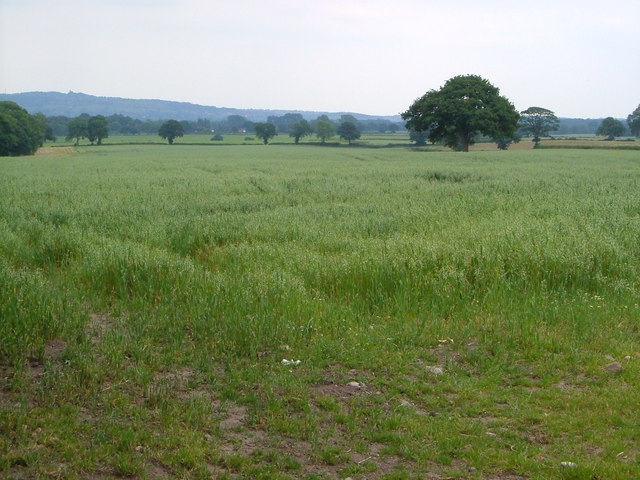
Thurlwood is a small village located in the county of Cheshire in North West England. Situated approximately 8 miles south of the city of Stoke-on-Trent, Thurlwood is surrounded by picturesque countryside and offers a peaceful and idyllic setting.

The village is known for its strong sense of community and friendly atmosphere. The residents of Thurlwood take great pride in maintaining their village and preserving its natural beauty. The area is dotted with charming cottages and well-kept gardens, adding to its quaint and welcoming ambiance.

Thurlwood is rich in history, with evidence of human habitation dating back to the Roman era. The village has a small but notable church, St. Michael's, which dates back to the 12th century and features stunning architectural details.

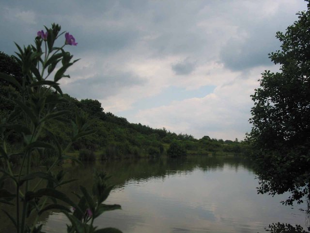
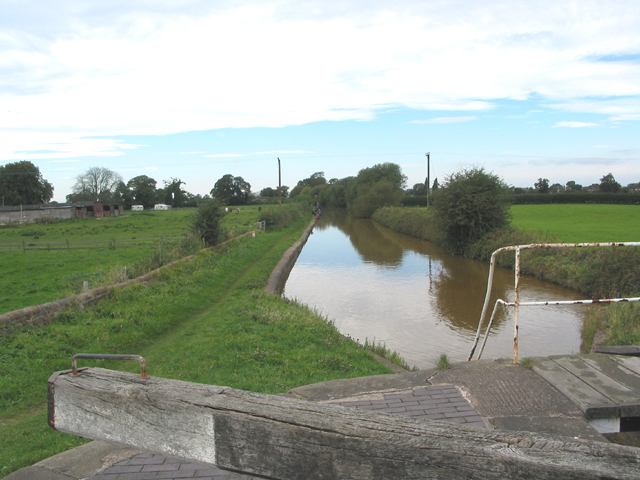
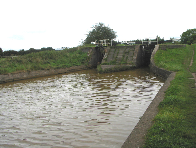
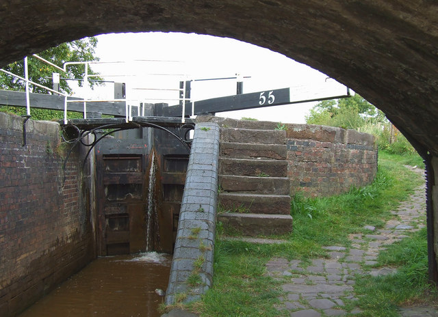
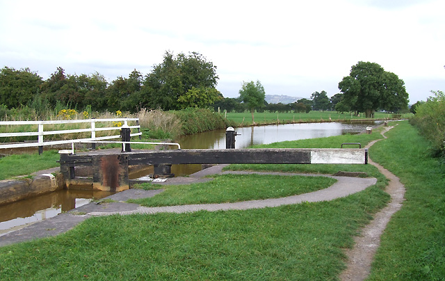
Nature enthusiasts will appreciate Thurlwood's proximity to several beautiful natural landmarks. The village is located near the Trent and Mersey Canal, offering opportunities for peaceful walks along the water. Additionally, the nearby Thurlwood Country Park provides ample space for outdoor activities such as picnics, hiking, and bird watching.

While Thurlwood is primarily a residential area, it benefits from its close proximity to larger towns and cities. The village offers easy access to amenities such as shops, schools, and healthcare facilities, making it an ideal place for families and individuals seeking a peaceful countryside lifestyle without sacrificing convenience.

Overall, Thurlwood is a charming village that offers a tranquil and close-knit community, surrounded by beautiful countryside and with easy access to modern amenities.

If you have any feedback on the listing, please let us know in the comments section below.
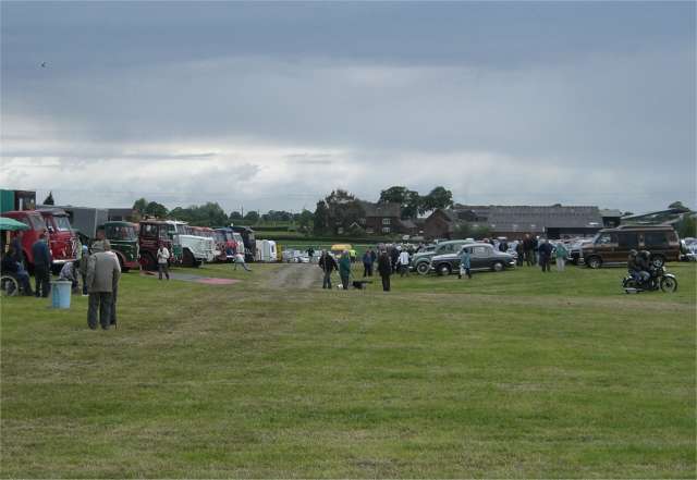
Thurlwood Images

Images are sourced within 2km of 53.116997/-2.295055 or Grid Reference SJ8057. Thanks to Geograph Open Source API. All images are credited.

Wilbraham Arms Alsager The first pub as you enter Alsager from the M6 at Sandbach.

Built on the site of Cresswellshawe Farm and named after the Wilbraham family major landowners of part of Alsager in days gone by.
Wilbraham Arms Alsager
The first pub as you enter Alsager from the M6 at Sandbach. Built on the site of Cresswellshawe Farm and named after the Wilbraham family major landowners of part of Alsager in days gone by.
Salt Line Alsager The Salt Line is now a linear nature trail and cycleway starting near to the Wilbraham Arms in Alsager.

It follows the old mineral line from the Potteries through to Sandbach and the salt towns of S Cheshire.

Coal and limestone was carried into Cheshire where brine was heated in large open pans to leave white salt crystals which were then used in the making of washing soda, glass, soap and detergents.

The Salt Line is now in the ownership of Congleton Borough Council.
Salt Line Alsager
The Salt Line is now a linear nature trail and cycleway starting near to the Wilbraham Arms in Alsager. It follows the old mineral line from the Potteries through to Sandbach and the salt towns of S Cheshire. Coal and limestone was carried into Cheshire where brine was heated in large open pans to leave white salt crystals which were then used in the making of washing soda, glass, soap and detergents. The Salt Line is now in the ownership of Congleton Borough Council.
The Borrow Pit A worked out sand pit alongside the Salt Line (see SJ7956). 

Now flooded and stocked with fish.

Small flock of Canada geese, coot and other waterfowl.
The Borrow Pit
A worked out sand pit alongside the Salt Line (see SJ7956). Now flooded and stocked with fish. Small flock of Canada geese, coot and other waterfowl.
Trent & Mersey Canal at Chellshill looking east
Trent & Mersey Canal at Chellshill
looking east
View from Love Lane A less romantic landscape than one might hope. Beyond the South Cheshire plain rises Mow Cop on the Staffordshire border.
View from Love Lane
A less romantic landscape than one might hope. Beyond the South Cheshire plain rises Mow Cop on the Staffordshire border.
Canal Bridge and farm. Trent and Mersey Part of the Cheshire Ring Canal Walk at Chelshill.
The sign on the bridge says 'Bridge 147'.
Canal Bridge and farm. Trent and Mersey
Part of the Cheshire Ring Canal Walk at Chelshill. The sign on the bridge says 'Bridge 147'.
Lock on Trent and Mersey Canal Roughwood farm is on the left.
The tow path is popular with anglers and walkers.
Lock on Trent and Mersey Canal
Roughwood farm is on the left. The tow path is popular with anglers and walkers.
Twin locks on the Trent & Mersey Canal
Smallwood Vintage Rally View across part of the rally field looking towards Love Lane Farm. Of course it only looks like this a couple of days a year. Normally it's just a boring old field.
Smallwood Vintage Rally
View across part of the rally field looking towards Love Lane Farm. Of course it only looks like this a couple of days a year. Normally it's just a boring old field.
Trent and Mersey Canal, Lock 55, near Hassall Green, Cheshire This is Lock 55 (the first of the two "Pierpoint Locks"), seen from under Bridge 145.
Trent and Mersey Canal, Lock 55, near Hassall Green, Cheshire
This is Lock 55 (the first of the two "Pierpoint Locks"), seen from under Bridge 145.
Trent and Mersey Canal at Pierpoint Lock No 55, Hassall Green, Cheshire
Trent & Mersey Canal Betchton - the South Cheshire Way following the towpath of the Trent & Mersey Canal just east of Chell's Aqueduct.
Trent & Mersey Canal
Betchton - the South Cheshire Way following the towpath of the Trent & Mersey Canal just east of Chell's Aqueduct.
British Waterways boat on the Trent and Mersey Canal Just beyond this point, the canal crosses the B5078 on a high embankment and aqueduct - the aqueduct walls can be seen in the background.
British Waterways boat on the Trent and Mersey Canal
Just beyond this point, the canal crosses the B5078 on a high embankment and aqueduct - the aqueduct walls can be seen in the background.
B5078 at Lawton Heath End
Fields beside Trent and Mersey Canal
A pair of semis on Cappers Lane
Matthews Nurseries, Hassall Green
Field west of Chance Hall Lane
Show me another place!

Thurlwood is located at Grid Ref: SJ8057 (Lat: 53.116997, Lng: -2.295055)

Unitary Authority: Cheshire East

Police Authority: Cheshire

What 3 Words

///referral.doghouse.hesitate. Near Rode Heath, Cheshire

Related Wikis

Rode Heath

Rode Heath is a small village in the civil parish of Odd Rode, near Alsager and within the unitary authority of Cheshire East and the ceremonial county...

Betchton Hall

Betchton Hall is a country house in the parish of Betchton, Cheshire, England. It was originally a timber-framed house, and was substantially rebuilt...

Rode Hall

Rode Hall, a Georgian country house, is the seat of the Wilbraham family, members of the landed gentry in the parish of Odd Rode, Cheshire, England. The...

Alsager Town F.C.

Alsager Town Football Club is a football club, based in Alsager, Cheshire, England. The club are currently members of North West Counties League Division...

Nearby Amenities

Located within 500m of 53.116997,-2.295055
Turning Circle
Lat/Long: 53.1166343/-2.2960904
Turning Circle
Lat/Long: 53.1144964/-2.2890616
Traffic Calming: cushion
Lat/Long: 53.1156198/-2.2980816
Traffic Calming: cushion
Lat/Long: 53.1153189/-2.2967796
Traffic Calming: cushion
Lat/Long: 53.1146378/-2.2954338
Traffic Calming: cushion
Lat/Long: 53.1145986/-2.2944625
Turning Circle
Lat/Long: 53.1160765/-2.2987748
Noexit: yes
Lat/Long: 53.115415/-2.2959983
Noexit: yes
Lat/Long: 53.1147616/-2.2969902
Noexit: yes
Lat/Long: 53.1143978/-2.2962848
Noexit: yes
Lat/Long: 53.1150264/-2.2952514
Turning Circle
Lat/Long: 53.1140132/-2.2948951
Noexit: yes
Lat/Long: 53.1132162/-2.2940381
Noexit: yes
Lat/Long: 53.1142217/-2.2954951
Noexit: yes
Lat/Long: 53.115353/-2.299015
Seamark Type: gate
Waterway: lock_gate
Lat/Long: 53.1132346/-2.2942868
Seamark Type: gate
Waterway: lock_gate
Lat/Long: 53.1133704/-2.2945868
Seamark Type: gate
Waterway: lock_gate
Lat/Long: 53.1153687/-2.2987482
Seamark Type: gate
Waterway: lock_gate
Lat/Long: 53.1153285/-2.2988341
Seamark Type: gate
Waterway: lock_gate
Lat/Long: 53.1155029/-2.2990361
Ele: 71.0225830
Lat/Long: 53.1169038/-2.2989474
Bus Stop
Rode Heath, Sandbach Road / Farams Road
Bench: no
Bin: no
Bus: yes
Naptan AtcoCode: 0600CO161
Naptan Bearing: SE
Naptan CommonName: Farams Road
Naptan Crossing: Farams Road
Naptan Indicator: opp
Naptan Landmark: Farams Road
Naptan LocalityName: Rode Heath
Naptan NaptanCode: chemdjm
Naptan ShortCommonName: Farams Road
Naptan Street: Sandbach Road
Naptan Verified: no
Network: Cheshire East Council
Operator: Ansa Transport
Public Transport: platform
Shelter: no
Source: naptan_import
Tactile Paving: no
Lat/Long: 53.1137384/-2.2932297
Bus Stop
Rode Heath, Sandbach Road / Farams Road
Bus: yes
Naptan AtcoCode: 0600CO162
Naptan Bearing: NW
Naptan CommonName: Farams Road
Naptan Crossing: Farams Road
Naptan Indicator: cnr
Naptan Landmark: Farams Road
Naptan LocalityName: Rode Heath
Naptan NaptanCode: chemdjp
Naptan ShortCommonName: Farams Road
Naptan Street: Sandbach Road
Naptan Verified: no
Network: Cheshire East Council
Operator: Ansa Transport
Public Transport: platform
Source: naptan_import
Lat/Long: 53.1136461/-2.2933856
Bus Stop
Thurlwood, Sandbach Road / Royal Oak Inn
Bus: yes
Naptan AtcoCode: 0600CO163
Naptan Bearing: SE
Naptan CommonName: Royal Oak Inn
Naptan Indicator: o/s
Naptan Landmark: Royal Oak Inn
Naptan LocalityName: Thurlwood
Naptan NaptanCode: chemdjt
Naptan ShortCommonName: Royal Oak Inn
Naptan Street: Sandbach Road
Naptan Verified: no
Network: Cheshire East Council
Operator: Ansa Transport
Public Transport: platform
Source: naptan_import
Lat/Long: 53.1161503/-2.2957263
Bus Stop
Thurlwood, Sandbach Road / Royal Oak Inn
Bus: yes
Naptan AtcoCode: 0600CO164
Naptan Bearing: NW
Naptan CommonName: Royal Oak Inn
Naptan Indicator: opp
Naptan Landmark: Royal Oak Inn
Naptan LocalityName: Thurlwood
Naptan NaptanCode: chemdjw
Naptan ShortCommonName: Royal Oak Inn
Naptan Street: Sandbach Road
Naptan Verified: no
Network: Cheshire East Council
Operator: Ansa Transport
Public Transport: platform
Source: naptan_import
Lat/Long: 53.1162381/-2.2965636
Bus Stop
Thurlwood, Heath Avenue / Sandbach Road
Bus: yes
Naptan AtcoCode: 0600CO165
Naptan Bearing: NE
Naptan CommonName: Sandbach Road
Naptan Crossing: Sandbach Road
Naptan Indicator: by
Naptan Landmark: Bus Shelter
Naptan LocalityName: Thurlwood
Naptan NaptanCode: cheapjw
Naptan ShortCommonName: Sandbach Road
Naptan Street: Heath Avenue
Naptan Verified: no
Network: Cheshire East Council
Operator: Ansa Transport
Public Transport: platform
Source: naptan_import
Lat/Long: 53.1152588/-2.2943321
Bus Stop
Thurlwood, Heath Avenue / Sandbach Road
Bus: yes
Naptan AtcoCode: 0600CO166
Naptan Bearing: SW
Naptan BusStopType: CUS
Naptan CommonName: Sandbach Road
Naptan Crossing: Sandbach Road
Naptan Indicator: nr
Naptan Landmark: Bus Shelter opposite
Naptan LocalityName: Thurlwood
Naptan NaptanCode: cheapma
Naptan ShortCommonName: Sandbach Road
Naptan Street: Heath Avenue
Naptan Verified: no
Network: Cheshire East Council
Operator: Ansa Transport
Public Transport: platform
Source: naptan_import
Lat/Long: 53.1151912/-2.2942409
Access: no
Barrier: motorcycle_barrier
Foot: yes
Material: metal
Motorcycle: no
Lat/Long: 53.1156065/-2.2992251
Fast Food
Jade Garden
Addr Housenumber: 47
Addr Postcode: ST7 3RW
Addr Street: Sandbach Road
Cuisine: chinese
Fhrs Id: 890909
Source Addr: FHRS Open Data
Lat/Long: 53.1159974/-2.2952405
Barrier: stile
Lat/Long: 53.11942/-2.2973967
Seamark Type: gate
Waterway: lock_gate
Lat/Long: 53.1155471/-2.29895
Turning Circle
Lat/Long: 53.1159929/-2.2988033
Thurlwood
Place: village
Source: OS_OpenData_StreetView
Lat/Long: 53.1174413/-2.2937795
Turning Circle
Lat/Long: 53.1144289/-2.2923327
Turning Circle
Lat/Long: 53.114945/-2.297848
Turning Circle
Lat/Long: 53.115003/-2.2979472
Barrier: bollard
Lat/Long: 53.1150054/-2.2942464
Barrier: bollard
Lat/Long: 53.1150337/-2.2941466
Barrier: bollard
Lat/Long: 53.1150546/-2.2940478
Shelter
Lat/Long: 53.1152894/-2.2943669
Turning Circle
Lat/Long: 53.1186073/-2.3007973
Addr Housenumber: 3
Building: house
Building Levels: 2
Lat/Long: 53.1134235/-2.2943063
Addr Housename: Trundle Cottage
Addr Housenumber: 1
Building: yes
Lat/Long: 53.1134662/-2.2943559
Addr Housenumber: 7
Building: house
Lat/Long: 53.1132363/-2.2939333
Addr Housenumber: 9
Building: house
Lat/Long: 53.1132253/-2.2938682
Noexit: yes
Lat/Long: 53.1126967/-2.2932012
Bus Stop
Rode Heath, Heath Avenue / Woodland Road
Bus: yes
Naptan AtcoCode: 0600COIM1940
Naptan Bearing: SE
Naptan BusStopType: CUS
Naptan CommonName: Woodland Road
Naptan Crossing: Woodland Road
Naptan Indicator: nr
Naptan Landmark: Woodland Road
Naptan LocalityName: Rode Heath
Naptan NaptanCode: cheagjmp
Naptan ShortCommonName: Woodland Road
Naptan Street: Heath Avenue
Network: Cheshire East Council
Operator: Ansa Transport
Public Transport: platform
Source: naptan_import
Lat/Long: 53.1152258/-2.2916357
Power: pole
Lat/Long: 53.1179794/-2.3008016
Power: pole
Lat/Long: 53.115708/-2.3020193
Power: pole
Lat/Long: 53.1172003/-2.3012334
Power: pole
Lat/Long: 53.1162626/-2.3017511
The data included in this document is from www.openstreetmap.org. The data is made available under ODbL.

Have you been to Thurlwood?

Leave your review of Thurlwood below (or comments, questions and feedback).