Aird Dell

Settlement in Ross-shire

Scotland

Aird Dell

The Linux Centre On the industrial estate at South Dell (Dail bho Dheas).  A year later it had closed and the premises were to let <a href="https://www.geograph.org.uk/photo/1004368">NB4861 : Former Linux Centre / Ionad Linux a bha</a>.
The Linux Centre Credit: Tiger

Aird Dell is a small village located in Ross-shire, Scotland. Situated on the west coast of the Scottish Highlands, it is nestled between the stunning mountains and the picturesque coastline. The village is surrounded by breathtaking landscapes, making it a popular destination for nature enthusiasts and outdoor activities.

Aird Dell is known for its serene and peaceful atmosphere, offering a much-needed escape from the hustle and bustle of city life. The village is home to a close-knit community, creating a welcoming and friendly environment for both residents and visitors.

The natural beauty of Aird Dell is a major draw for tourists. The nearby mountains provide opportunities for hiking, climbing, and mountaineering, while the coastline offers stunning beaches and opportunities for water sports such as surfing and kayaking.

Despite its small size, Aird Dell boasts a few amenities for its residents and visitors. There is a local pub where locals often gather, offering a place for socializing and enjoying traditional Scottish cuisine. A small grocery store provides essential supplies, and there are a few guesthouses and bed and breakfasts for those looking to stay in the area.

Overall, Aird Dell is a charming village that showcases the natural beauty of the Scottish Highlands. With its stunning landscapes and friendly community, it offers a perfect retreat for those seeking tranquility and outdoor adventures.

If you have any feedback on the listing, please let us know in the comments section below.

Aird Dell Images

Images are sourced within 2km of 58.472552/-6.324451 or Grid Reference NB4761. Thanks to Geograph Open Source API. All images are credited.

The Linux Centre On the industrial estate at South Dell (Dail bho Dheas).  A year later it had closed and the premises were to let <a href="https://www.geograph.org.uk/photo/1004368">NB4861 : Former Linux Centre / Ionad Linux a bha</a>.
The Linux Centre
On the industrial estate at South Dell (Dail bho Dheas). A year later it had closed and the premises were to let NB4861 : Former Linux Centre / Ionad Linux a bha.
Lewis moorland at South Dell
Boggy land with cotton grass and stacked peat close to the A857 The Atlantic Ocean in the distance
Boggy land with cotton grass and stacked peat close to the A857
The Atlantic Ocean in the distance
OS Surface block, Àird Dhail, Isle of Lewis The block lies near to the cairn marked on the map.
OS Surface block, Àird Dhail, Isle of Lewis
The block lies near to the cairn marked on the map.
South Dell View Viewed from the edge of the adjoining square, looking towards North Dell.
South Dell View
Viewed from the edge of the adjoining square, looking towards North Dell.
Moorland track, Toman Corrach, Isle of Lewis The track provides access to peat cutting areas.
Moorland track, Toman Corrach, Isle of Lewis
The track provides access to peat cutting areas.
Croftland above Tràigh Dhail, Isle of Lewis The land is fenced into narrow strips running from behind the houses of Dail bho Dheas/South Dell to near the coast.
Croftland above Tràigh Dhail, Isle of Lewis
The land is fenced into narrow strips running from behind the houses of Dail bho Dheas/South Dell to near the coast.
Dunasbroc, Isle of Lewis The stack is of archaeological interest and Late Neolithic and Bronze Age pottery and tools have been found on it.  See <span class="nowrap"><a title="https://canmore.org.uk/site/69532" rel="nofollow ugc noopener" href="https://canmore.org.uk/site/69532">Link</a><img style="margin-left:2px;" alt="External link" title="External link - shift click to open in new window" src="https://s1.geograph.org.uk/img/external.png" width="10" height="10"/></span> .
Dunasbroc, Isle of Lewis
The stack is of archaeological interest and Late Neolithic and Bronze Age pottery and tools have been found on it. See LinkExternal link .
Sheep grazing above Cobha Sgeir, Isle of Lewis The fine beaches along the northwest tip of Lewis can be seen in the distance.
Sheep grazing above Cobha Sgeir, Isle of Lewis
The fine beaches along the northwest tip of Lewis can be seen in the distance.
(River) Abhainn Dhail at Dail bho Dheas
Àird Dhail Derelict house at the end of the road.
Àird Dhail
Derelict house at the end of the road.
Remains of old houses at Àird Dhail Looking south from the end of the road at Dell.
Remains of old houses at Àird Dhail
Looking south from the end of the road at Dell.
Modern croft house at Àird Dhail A step up from the blackhouse.
Modern croft house at Àird Dhail
A step up from the blackhouse.
Bus stop at Dhail Bho Dheas At the junction with the road from the township with the A857.
Bus stop at Dhail Bho Dheas
At the junction with the road from the township with the A857.
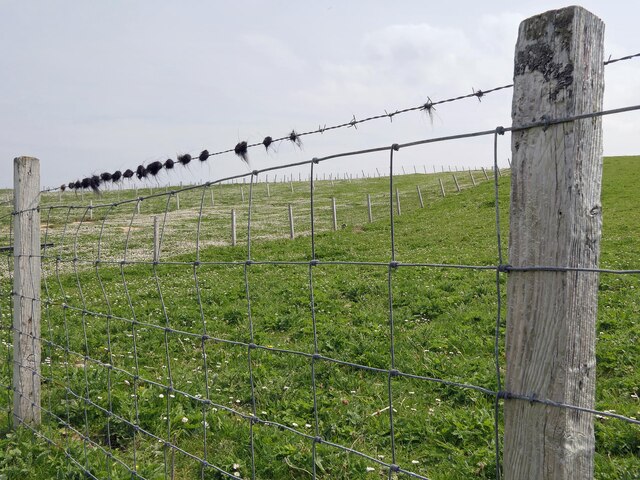
Fencescape at Buaile na Crois The subdivision of grazings in the crofting community of Dail bho Dheas.
Fencescape at Buaile na Crois
The subdivision of grazings in the crofting community of Dail bho Dheas.
Derelict house at Dail bho Dheas The impressive gate posts behind, to the left, may be something to do with a 'coastguard station' marked on the map?
Derelict house at Dail bho Dheas
The impressive gate posts behind, to the left, may be something to do with a 'coastguard station' marked on the map?
Small hill with cairn at Tobha Dhìobadail Peaty ground beside coast with rocky outcrop/small hill with a cairn at Tobha Dhìobadail.
Small hill with cairn at Tobha Dhìobadail
Peaty ground beside coast with rocky outcrop/small hill with a cairn at Tobha Dhìobadail.
Notice board for Cross Free Church (Continuing) The new FCC church for Cros <a href="https://www.geograph.org.uk/photo/1346098">NB4961 : Free Kirk at Cross</a> is actually in the township of Dail bho Thuath (North Dell) and was opened in December 2003 following the reconstitution of the Free Church of Scotland in 2000.  <span class="nowrap"><a title="http://www.freechurchcontinuing.org/find-us/congregations/item/cross" rel="nofollow ugc noopener" href="http://www.freechurchcontinuing.org/find-us/congregations/item/cross">Link</a><img style="margin-left:2px;" alt="External link" title="External link - shift click to open in new window" src="https://s1.geograph.org.uk/img/external.png" width="10" height="10"/></span>
Notice board for Cross Free Church (Continuing)
The new FCC church for Cros NB4961 : Free Kirk at Cross is actually in the township of Dail bho Thuath (North Dell) and was opened in December 2003 following the reconstitution of the Free Church of Scotland in 2000. LinkExternal link
Show me another place!

Aird Dell is located at Grid Ref: NB4761 (Lat: 58.472552, Lng: -6.324451)

Unitary Authority: Na h-Eileanan an Iar

Police Authority: Highlands and Islands

Also known as: Àird Dhail

What 3 Words

///desktop.exits.deployed. Near North Tolsta, Na h-Eileanan Siar

Related Wikis

South Dell

South Dell (Scottish Gaelic: Dail-bho-Dheas) is a village on the Isle of Lewis in the community of Ness, in the Outer Hebrides, Scotland. South Dell is...

North Dell

North Dell (Scottish Gaelic: Dail bho Thuath) is a village on the Isle of Lewis in the community of Ness, in the Outer Hebrides, Scotland. North Dell is...

Cross, Lewis

Cross (Scottish Gaelic: Cros) is a township on the Isle of Lewis in the community of Ness, in the Outer Hebrides, Scotland. Cross is within the parish...

Swainbost

Swainbost (Scottish Gaelic: Suaineabost) is a village on the Isle of Lewis in the district of Ness, in the Outer Hebrides, Scotland. The name Swainbost...

Nearby Amenities

Located within 500m of 58.472552,-6.324451
Bus Stop
Aird Dell
Bus: yes
Naptan AtcoCode: 6010731504
Naptan Bearing: S
Naptan BusStopType: CUS
Naptan CommonName: Aird Dell
Naptan Indicator: Village
Naptan Landmark: adjacent to house No 1
Naptan NaptanCode: 94724263
Naptan Street: Village
Naptan Verified: no
Public Transport: platform
Source: naptan_import
Lat/Long: 58.4724248/-6.3256605
Passing Place
Lat/Long: 58.4707034/-6.3192954
Passing Place
Lat/Long: 58.4724911/-6.3256704
Turning Circle
Lat/Long: 58.4726284/-6.3279171
Passing Place
Lat/Long: 58.4727729/-6.3231198
Passing Place
Lat/Long: 58.4713638/-6.3200581
Àird Dhail
Name En: Aird Dell
Name Gd: Àird Dhail
Place: hamlet
Lat/Long: 58.4726486/-6.3245215
Turning Circle
Lat/Long: 58.4735264/-6.32111
Passing Place
Lat/Long: 58.4721768/-6.320702
Power: pole
Lat/Long: 58.4726619/-6.3276674
Power: pole
Lat/Long: 58.4726959/-6.3268153
Power: pole
Lat/Long: 58.4727369/-6.3259505
Power: pole
Lat/Long: 58.4727687/-6.3251266
Power: pole
Lat/Long: 58.4727749/-6.3242286
Power: pole
Lat/Long: 58.4727685/-6.3234802
Power: pole
Lat/Long: 58.4727908/-6.3227441
Power: pole
Lat/Long: 58.4727918/-6.3219751
Power: pole
Lat/Long: 58.4727019/-6.3221167
Power: pole
Lat/Long: 58.4724059/-6.3217765
Power: pole
Lat/Long: 58.4717828/-6.3211013
Power: pole
Lat/Long: 58.4712015/-6.3204245
Power: pole
Lat/Long: 58.4706552/-6.3198075
Power: pole
Lat/Long: 58.4701281/-6.3192224
Power: pole
Lat/Long: 58.4695342/-6.3185735
The data included in this document is from www.openstreetmap.org. The data is made available under ODbL.

Have you been to Aird Dell?

Leave your review of Aird Dell below (or comments, questions and feedback).