Boroughbridge

Settlement in Yorkshire Harrogate

England

Boroughbridge

Milestone - A168 - Minskip, Boroughbridge Old Milestone in great condition on the A168, this was the Southbound carriage way of the old A1 Great North Road. Milestone is located behind the highways depot just to the South of the A6055 junction to Minskip. 
Inscriptions read: - Ferrybridge & Boroughbridge Road / Boroughbridge / Boroughbridge 1 Mile / Wetherby 11 1/4 Miles / Aberford 18 1/2 Miles / Ferrybridge 28 Miles / Doncaster 43 Miles
WR casting.

Unsure as to whether this MS is listed but I would presume that it is.
Edit: The Milestone Society has informed me that this is not a listed MS due to it being moved from its original position during the construction of the Roundabout at the A6055 junction.
Milestone - A168 - Minskip, Boroughbridge Credit: Tez Exley

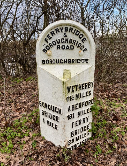
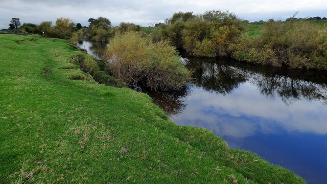
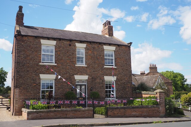
Boroughbridge is a historic town located in the Harrogate district of North Yorkshire, England. Situated on the banks of the River Ure, it is positioned approximately 16 miles northeast of the city of York. The town has a population of around 3,500 residents and is known for its picturesque charm and rich history.

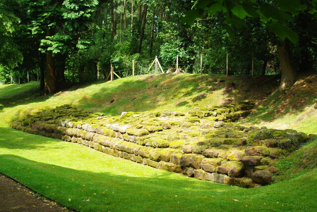
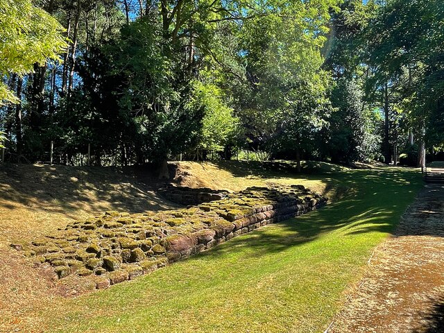
One of the notable landmarks in Boroughbridge is the Grade I listed structure, the Aldborough Roman Site. This archaeological site showcases the remains of the ancient Roman town of Isurium Brigantum, which was established around AD 71. Visitors can explore the partially excavated ruins, including the remains of a Roman bathhouse and forum.

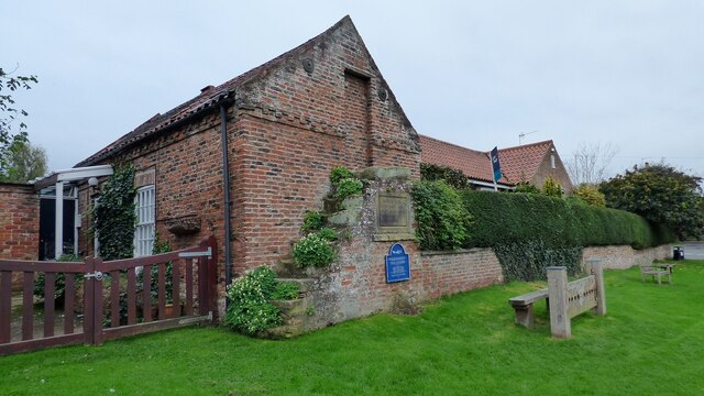
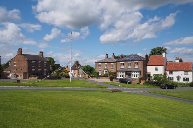
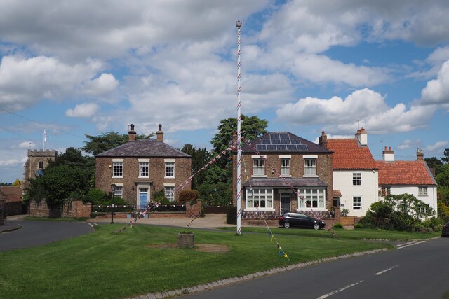
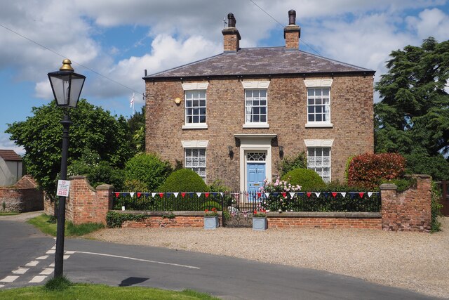
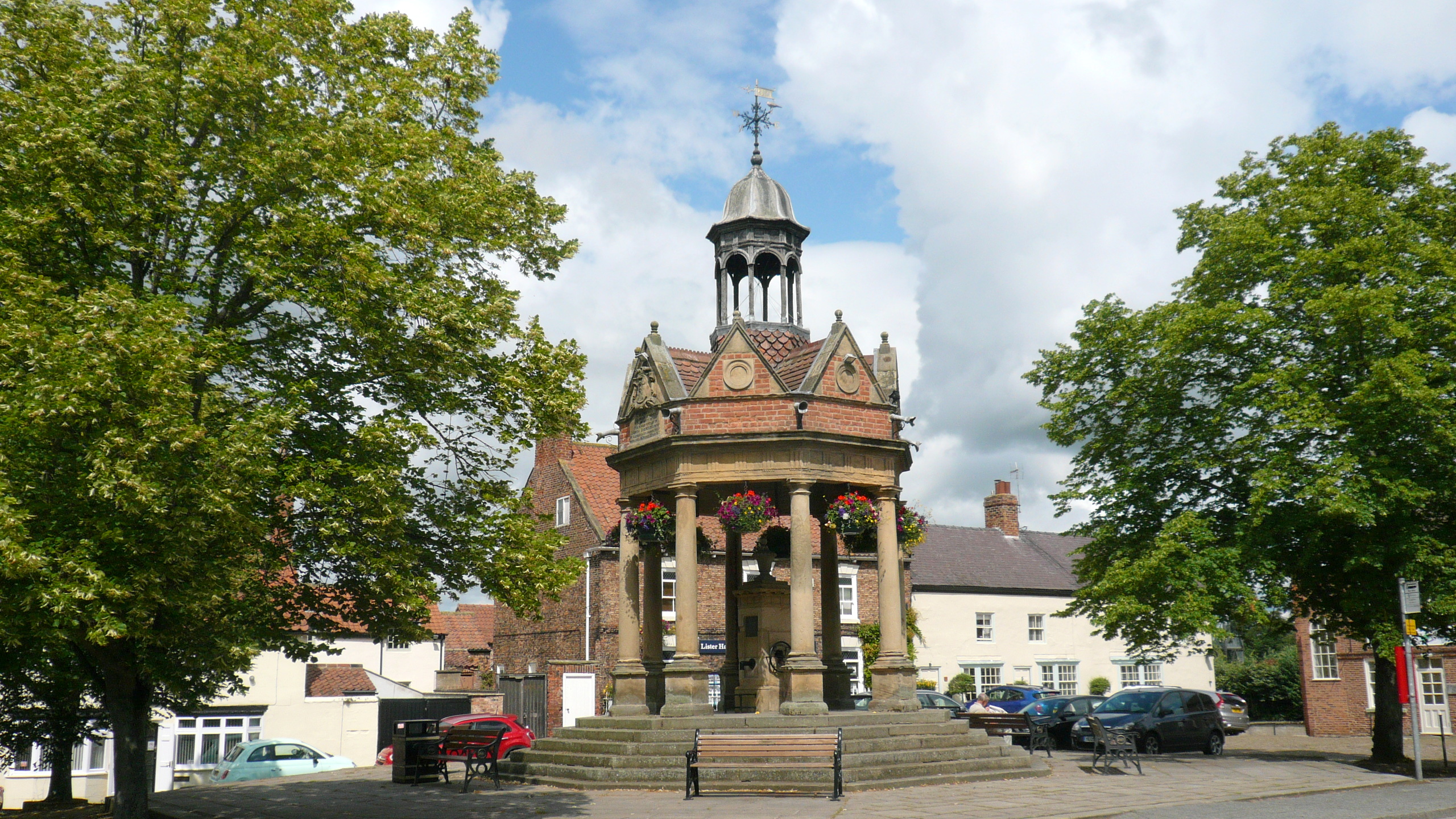
The town also boasts a number of historic buildings, such as the 14th-century All Saints Church, which features an impressive 13th-century tower. Other notable buildings include the Georgian-style Crown Hotel and the 18th-century Georgian Mansion House, now serving as the town's council offices.

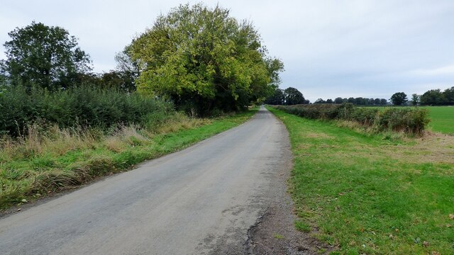
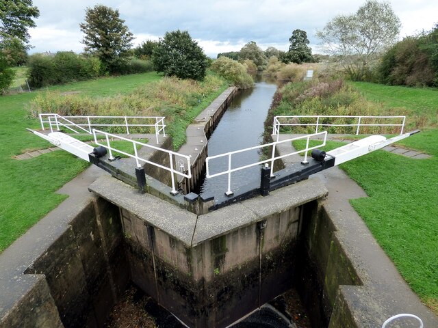
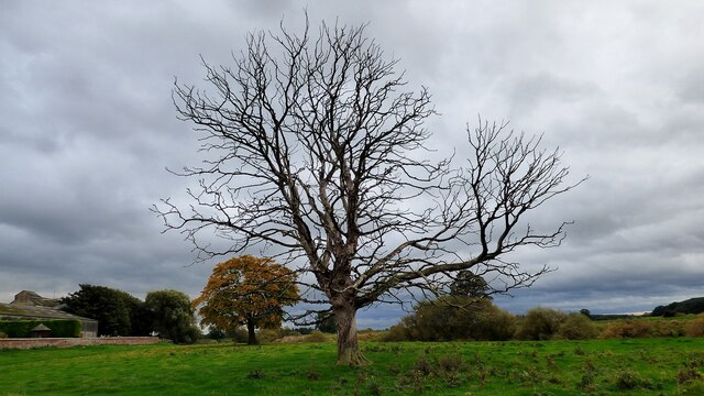
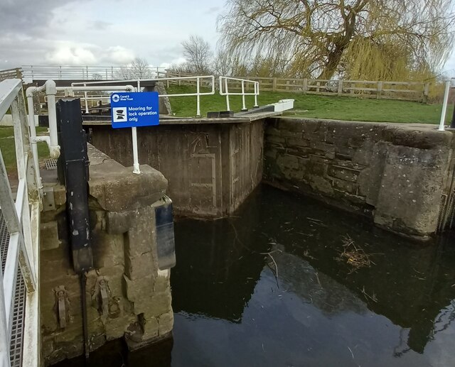
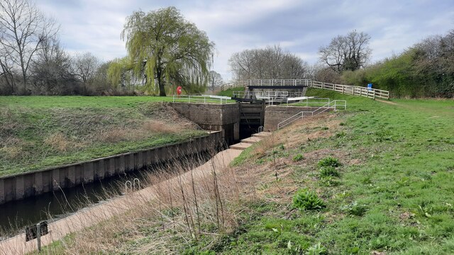
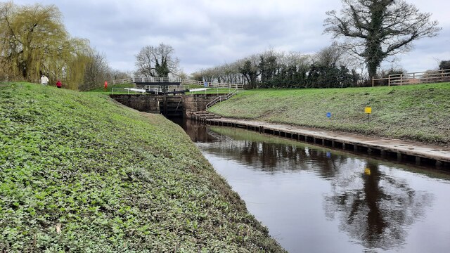
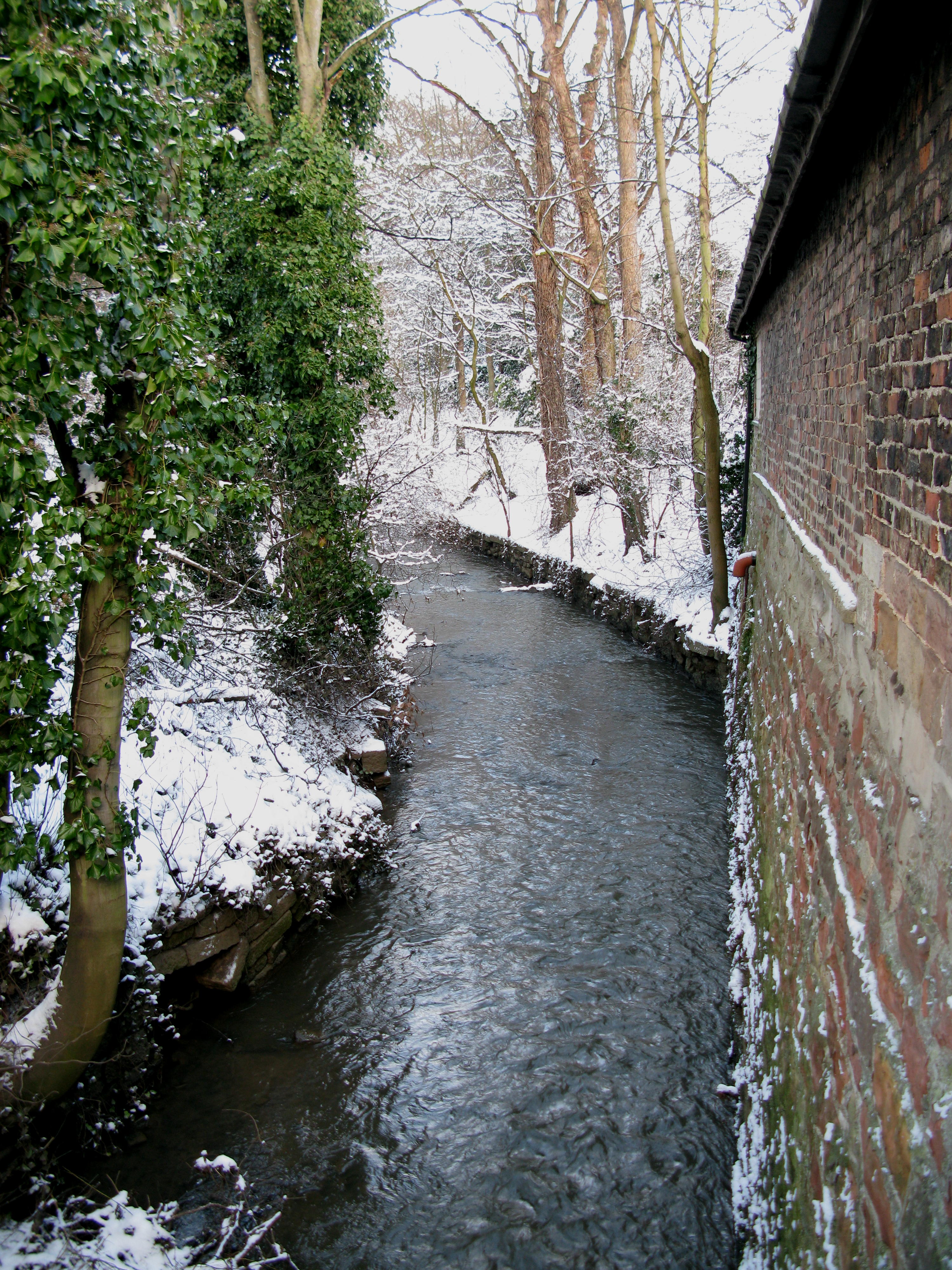
The surrounding countryside offers beautiful landscapes and opportunities for outdoor activities, with the nearby River Ure providing scenic walks and fishing spots. Boroughbridge is also conveniently located near the A1(M) motorway, making it easily accessible for travelers.

In terms of amenities, the town offers a range of local shops, cafes, and pubs, as well as a primary school and community center. Boroughbridge holds an annual summer carnival, attracting locals and visitors alike. Overall, Boroughbridge is a charming town that seamlessly blends its rich history with a friendly community and beautiful surroundings.

If you have any feedback on the listing, please let us know in the comments section below.

Boroughbridge Images

Images are sourced within 2km of 54.094208/-1.39544 or Grid Reference SE3966. Thanks to Geograph Open Source API. All images are credited.

Milestone - A168 - Minskip, Boroughbridge Old Milestone in great condition on the A168, this was the Southbound carriage way of the old A1 Great North Road. Milestone is located behind the highways depot just to the South of the A6055 junction to Minskip. 
Inscriptions read: - Ferrybridge & Boroughbridge Road / Boroughbridge / Boroughbridge 1 Mile / Wetherby 11 1/4 Miles / Aberford 18 1/2 Miles / Ferrybridge 28 Miles / Doncaster 43 Miles
WR casting.

Unsure as to whether this MS is listed but I would presume that it is.
Edit: The Milestone Society has informed me that this is not a listed MS due to it being moved from its original position during the construction of the Roundabout at the A6055 junction.
Milestone - A168 - Minskip, Boroughbridge
Old Milestone in great condition on the A168, this was the Southbound carriage way of the old A1 Great North Road. Milestone is located behind the highways depot just to the South of the A6055 junction to Minskip. Inscriptions read: - Ferrybridge & Boroughbridge Road / Boroughbridge / Boroughbridge 1 Mile / Wetherby 11 1/4 Miles / Aberford 18 1/2 Miles / Ferrybridge 28 Miles / Doncaster 43 Miles WR casting. Unsure as to whether this MS is listed but I would presume that it is. Edit: The Milestone Society has informed me that this is not a listed MS due to it being moved from its original position during the construction of the Roundabout at the A6055 junction.
Old Court House and stocks <span class="nowrap"><a title="https://historicengland.org.uk/listing/the-list/list-entry/1295964" rel="nofollow ugc noopener" href="https://historicengland.org.uk/listing/the-list/list-entry/1295964">Link</a><img style="margin-left:2px;" alt="External link" title="External link - shift click to open in new window" src="https://s1.geograph.org.uk/img/external.png" width="10" height="10"/></span>
Old Court House and stocks
River Ure at Aldborough
Roman road leading to Aldborough Holbecks Lane following the line of the earlier Roman road.
Roman road leading to Aldborough
Holbecks Lane following the line of the earlier Roman road.
Milby Lock Eastern lock gate.
Milby Lock
Eastern lock gate.
Dead tree at Ellenthorpe Hall
Milby Lock The rivet and arrowhead is cut into the lock structure, downstream of the lock gates.
Milby Lock
The rivet and arrowhead is cut into the lock structure, downstream of the lock gates.
Milby Lock There is a rivet and arrowhead cut into the lock structure, and is close to the blue information board. It is on the Boroughbridge side of the lock gates.
Milby Lock
There is a rivet and arrowhead cut into the lock structure, and is close to the blue information board. It is on the Boroughbridge side of the lock gates.
Milby, Grange Farm There is the remains of a very faint benchmark on the right hand edge of the roadside farm building of Grange Farm.
Milby, Grange Farm
There is the remains of a very faint benchmark on the right hand edge of the roadside farm building of Grange Farm.
Milby Lock and footbridge
The Maypole at Aldborough The Maypole was decorated with flags in honour of the Queen's Platinum Jubilee.
The Maypole at Aldborough
The Maypole was decorated with flags in honour of the Queen's Platinum Jubilee.
The Maypole at Aldborough The Maypole is decorated with flags in honour of the Queen's Platinum Jubilee.
The Maypole at Aldborough
The Maypole is decorated with flags in honour of the Queen's Platinum Jubilee.
Attractive 19th Century Stone House in Aldborough This very attractive house named Hazeldene dates from the early 19th century and is a Grade II listed building. It faces towards the green where the Maypole stands. The house is decorated with flags in honour of the Queen's Platinum Jubilee.
Attractive 19th Century Stone House in Aldborough
This very attractive house named Hazeldene dates from the early 19th century and is a Grade II listed building. It faces towards the green where the Maypole stands. The house is decorated with flags in honour of the Queen's Platinum Jubilee.
An attractive Brick built House in Aldborough A most attractive house named Fernleigh situated near the Maypole in the green just nearby. The house is decorated with flags in honour of the Queen's Platinum Jubilee.
An attractive Brick built House in Aldborough
A most attractive house named Fernleigh situated near the Maypole in the green just nearby. The house is decorated with flags in honour of the Queen's Platinum Jubilee.
Roman Masonry Along the line of the town walls
Roman Masonry
Along the line of the town walls
Remains of the town wall  At Aldborough Roman Town. Aldborough was once the prosperous Roman town of Isurium Brigantum, which began as a trading settlement around AD 70, and became the civilian ‘capital’ of an extensive region of north Britain from about AD 120 to about AD 400. Now in the care of English Heritage.
Remains of the town wall
At Aldborough Roman Town. Aldborough was once the prosperous Roman town of Isurium Brigantum, which began as a trading settlement around AD 70, and became the civilian ‘capital’ of an extensive region of north Britain from about AD 120 to about AD 400. Now in the care of English Heritage.
Two small buildings at Aldborough At Aldborough Roman Town. The buildings protect the mosaics found here, some of the finest in the UK.
Two small buildings at Aldborough
At Aldborough Roman Town. The buildings protect the mosaics found here, some of the finest in the UK.
Milby Lock and footbridge
Show me another place!

Boroughbridge is located at Grid Ref: SE3966 (Lat: 54.094208, Lng: -1.39544)

Division: West Riding

Administrative County: North Yorkshire

District: Harrogate

Police Authority: North Yorkshire

What 3 Words

///workroom.rinsed.affords. Near Boroughbridge, North Yorkshire

Related Wikis

Boroughbridge

Boroughbridge ( BURR-ə-brij) is a town and civil parish in North Yorkshire, England. Historically part of the West Riding of Yorkshire, it is 16 miles...

Battle of Boroughbridge

The Battle of Boroughbridge was fought on 16 March 1322 in England between a group of rebellious barons and the forces of King Edward II, near Boroughbridge...

River Tutt

The River Tutt is a 8.7-mile (14 km) long tributary of the River Ure in North Yorkshire, England. The river rises near to the villages of Nidd and Scotton...

Devil's Arrows

The Devil's Arrows are four standing stones or menhirs in an alignment approximately 660 feet (200 m) to the east of the A1(M), adjacent to Roecliffe Lane...

Nearby Amenities

Located within 500m of 54.094208,-1.39544
Created By: Merkaartor 0.13
Lat/Long: 54.0979917/-1.3972214
Waterway: weir
Lat/Long: 54.0979492/-1.3981265
Boroughbridge
Is In: UK,England,Yorkshire,North Yorkshire
Place: town
Wikidata: Q2569056
Wikipedia: en:Boroughbridge
Lat/Long: 54.0943398/-1.3947113
Created By: Merkaartor 0.13
Lat/Long: 54.0960933/-1.396146
Pub
Black Bull
Addr City: York
Addr Housenumber: 6
Addr Postcode: YO51 9AR
Addr Street: St James Square
Addr Suburb: Boroughbridge
Source: survey
Lat/Long: 54.0941784/-1.3957771
Barrier: bollard
Lat/Long: 54.0958197/-1.3985809
Battle of Boroughbridge
Date: 16 March 1322
Description: Royalist forces under Sir Andrew Harclay win a decisive victory and finally put down a northern baron's insurrection.
Historic: battlefield
Wikidata: Q2657536
Wikipedia: en:Battle of Boroughbridge
Lat/Long: 54.0970984/-1.3951381
Post Office
Boroughbridge Post Office
Addr City: York
Addr Country: GB
Addr Postcode: YO51 9AA
Addr Street: Horsefair
Addr Town: Boroughbridge
Brand: Post Office
Brand Wikidata: Q1783168
Opening Hours: Mo-Fr 08:30-17:30; Sa 08:30-12:30
Ref Pol Id: 4331
Source: survey
Website: https://www.postoffice.co.uk/branch-finder/1683497/boroughbridge
Lat/Long: 54.0964365/-1.3964445
Post Box
Post Box Type: wall
Ref: YO51 275
Royal Cypher: EIIR
Royal Cypher Wikidata: Q33102113
Source: survey
Lat/Long: 54.0963673/-1.3964372
Turning Circle
Lat/Long: 54.0956811/-1.4017585
Turning Circle
Lat/Long: 54.0909794/-1.3929072
Village Cross
Historic: monument
Lat/Long: 54.0942969/-1.3949862
War Memorial
Historic: monument
Lat/Long: 54.0955123/-1.3944564
Crossing
Lat/Long: 54.0928013/-1.3915436
Shop: bicycle
Lat/Long: 54.0949004/-1.3952356
Cafe
Bean Emporium Cafe
Addr City: Boroughbridge
Addr Postcode: YO51 9BA
Addr Street: Church Lane
Lat/Long: 54.0940525/-1.3943009
Pharmacy
D H & G Treharne
Addr City: Boroughbridge
Addr Postcode: YO51 9AW
Addr Street: High Street
Lat/Long: 54.0949948/-1.3949003
Havenhands
Addr City: Boroughbridge
Addr Postcode: YO51 9AR
Addr Street: St James Square
Shop: bakery
Lat/Long: 54.0940542/-1.3955011
Fast Food
Shan Woo
Cuisine: chinese
Lat/Long: 54.0948408/-1.3949432
Library
Boroughbridge Community Library
Addr City: Boroughbridge
Addr Postcode: YO51 9AR
Lat/Long: 54.0942492/-1.3944872
Spar
Brand: Spar
Brand Wikidata: Q610492
Shop: convenience
Website: https://www.spar.co.uk/store-locator/hal10315-spar-boroughbridge/
Lat/Long: 54.095072/-1.39519
Finks
Shop: greengrocer
Lat/Long: 54.0946835/-1.3950451
Telephone
Booth: K6
Covered: booth
Listed Status: Grade II
Lat/Long: 54.0942399/-1.394565
Cafe
Gilchrist's
Lat/Long: 54.0951789/-1.3951497
Winerray
Shop: alcohol
Lat/Long: 54.0952261/-1.3947796
Pybus
Shop: newsagent
Lat/Long: 54.0947385/-1.3953321
Cafe
Bowe & Co
Lat/Long: 54.0948172/-1.3952758
Cafe
Plenty
Lat/Long: 54.0942477/-1.3957157
Telephone
Booth: K6
Covered: booth
Listed Status: Grade II
Lat/Long: 54.0959244/-1.3956084
Post Box
Post Box Type: pillar
Ref: YO51 131
Royal Cypher: EIIR
Royal Cypher Wikidata: Q33102113
Lat/Long: 54.0944944/-1.395406
Crossing
Lat/Long: 54.093888/-1.3979341
Doctors
Church Lane Surgery
Addr City: Boroughbridge
Addr Postcode: YO51 9BD
Addr Street: Church Lane
Healthcare Speciality: general
Lat/Long: 54.093566/-1.3936638
Boroughbridge Community and Information Office
Addr City: Boroughbridge
Addr Postcode: YO51 9AN
Information: office
Tourism: information
Lat/Long: 54.0955543/-1.3948893
Defibrillator
Defibrillator Location: Outside Boroughbridge Tourist Information Office, Hall Square, Boroughbridge, YO51 9AN
Emergency: defibrillator
Indoor: no
Lat/Long: 54.0954954/-1.3948916
Pub
Three Horse Shoes
Addr City: Boroughbridge
Addr Postcode: YO51 9LF
Addr Street: Bridge Street
Wikidata: Q26538407
Lat/Long: 54.0967945/-1.3959425
Bench
Lat/Long: 54.0942505/-1.3949603
Bench
Lat/Long: 54.0943071/-1.395081
Bench
Lat/Long: 54.09426/-1.3950542
Bus Stop
Naptan AtcoCode: 3200YNA01358
Naptan NaptanCode: 32001358
Lat/Long: 54.0941891/-1.3949845
Bench
Lat/Long: 54.0942915/-1.3949121
Crossing
Lat/Long: 54.0968011/-1.4016049
Social Facility
Springfield Garth Care Home
Addr City: Boroughbridge
Addr Housename: Springfield Garth
Addr Postcode: YO51 9EW
Addr Street: York Road
Operator: NHS
Operator Type: public
Social Facility: group_home
Social Facility For: senior
Wheelchair: limited
Lat/Long: 54.0913642/-1.3897649
Generator Method: photovoltaic
Generator Output Electricity: yes
Generator Source: solar
Generator Type: solar_photovoltaic_panel
Power: generator
Lat/Long: 54.0920272/-1.3921175
Barrier: yes
Lat/Long: 54.0958945/-1.3996932
Generator Method: photovoltaic
Generator Output Electricity: yes
Generator Source: solar
Generator Type: solar_photovoltaic_panel
Power: generator
Lat/Long: 54.0939513/-1.400457
Generator Method: photovoltaic
Generator Output Electricity: yes
Generator Source: solar
Generator Type: solar_photovoltaic_panel
Power: generator
Lat/Long: 54.0939386/-1.4002598
Generator Method: photovoltaic
Generator Output Electricity: yes
Generator Source: solar
Generator Type: solar_photovoltaic_panel
Power: generator
Lat/Long: 54.0942919/-1.4015908
Generator Method: photovoltaic
Generator Output Electricity: yes
Generator Source: solar
Generator Type: solar_photovoltaic_panel
Power: generator
Lat/Long: 54.0942575/-1.4016231
Generator Method: photovoltaic
Generator Output Electricity: yes
Generator Source: solar
Generator Type: solar_photovoltaic_panel
Power: generator
Lat/Long: 54.0942594/-1.4016632
Generator Method: photovoltaic
Generator Output Electricity: yes
Generator Source: solar
Generator Type: solar_photovoltaic_panel
Power: generator
Lat/Long: 54.094272/-1.4018357
Generator Method: photovoltaic
Generator Output Electricity: yes
Generator Source: solar
Generator Type: solar_photovoltaic_panel
Power: generator
Lat/Long: 54.0944439/-1.4000325
The data included in this document is from www.openstreetmap.org. The data is made available under ODbL.

Have you been to Boroughbridge?

Leave your review of Boroughbridge below (or comments, questions and feedback).