Borley Green

Settlement in Essex Braintree

England

Borley Green

Old Gatepost and Stour Valley Path A lichen covered concrete gatepost on the old Stour Valley Railway <span class="nowrap"><a title="https://en.wikipedia.org/wiki/Stour_Valley_Railway" rel="nofollow ugc noopener" href="https://en.wikipedia.org/wiki/Stour_Valley_Railway">Link</a><img style="margin-left:2px;" alt="External link" title="External link - shift click to open in new window" src="https://s1.geograph.org.uk/img/external.png" width="10" height="10"/></span>  . It is part of the Stour Valley Path <span class="nowrap"><a title="https://ldwa.org.uk/ldp/members/show_path.php?path_name=Stour+Valley+Path+%28East+Anglia%29" rel="nofollow ugc noopener" href="https://ldwa.org.uk/ldp/members/show_path.php?path_name=Stour+Valley+Path+%28East+Anglia%29">Link</a><img style="margin-left:2px;" alt="External link" title="External link - shift click to open in new window" src="https://s1.geograph.org.uk/img/external.png" width="10" height="10"/></span> and the National Cycle Network .
Old Gatepost and Stour Valley Path Credit: Glyn Baker

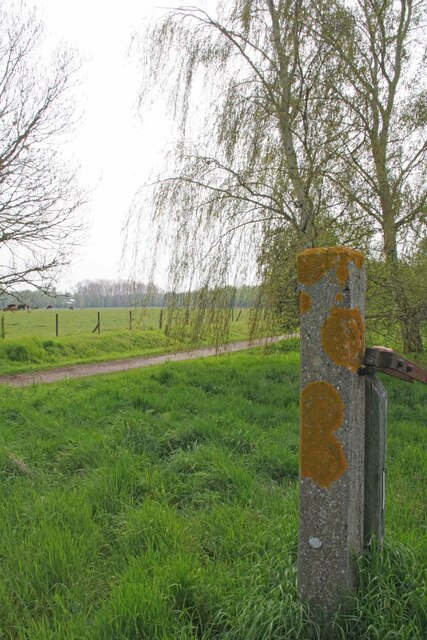
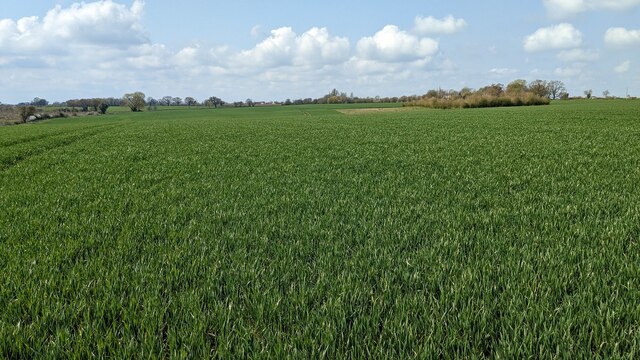
Borley Green is a small village located in the county of Essex, England. Situated approximately 5 miles northeast of the town of Sudbury, it is nestled in the picturesque countryside of the Stour Valley. The village is surrounded by green fields, rolling hills, and meandering rivers, providing a tranquil and idyllic setting.

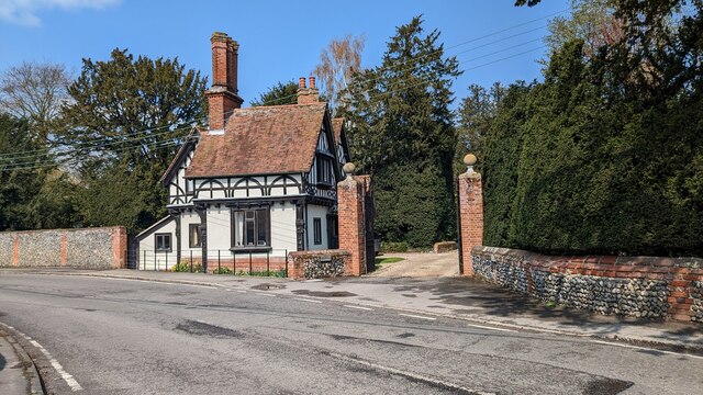
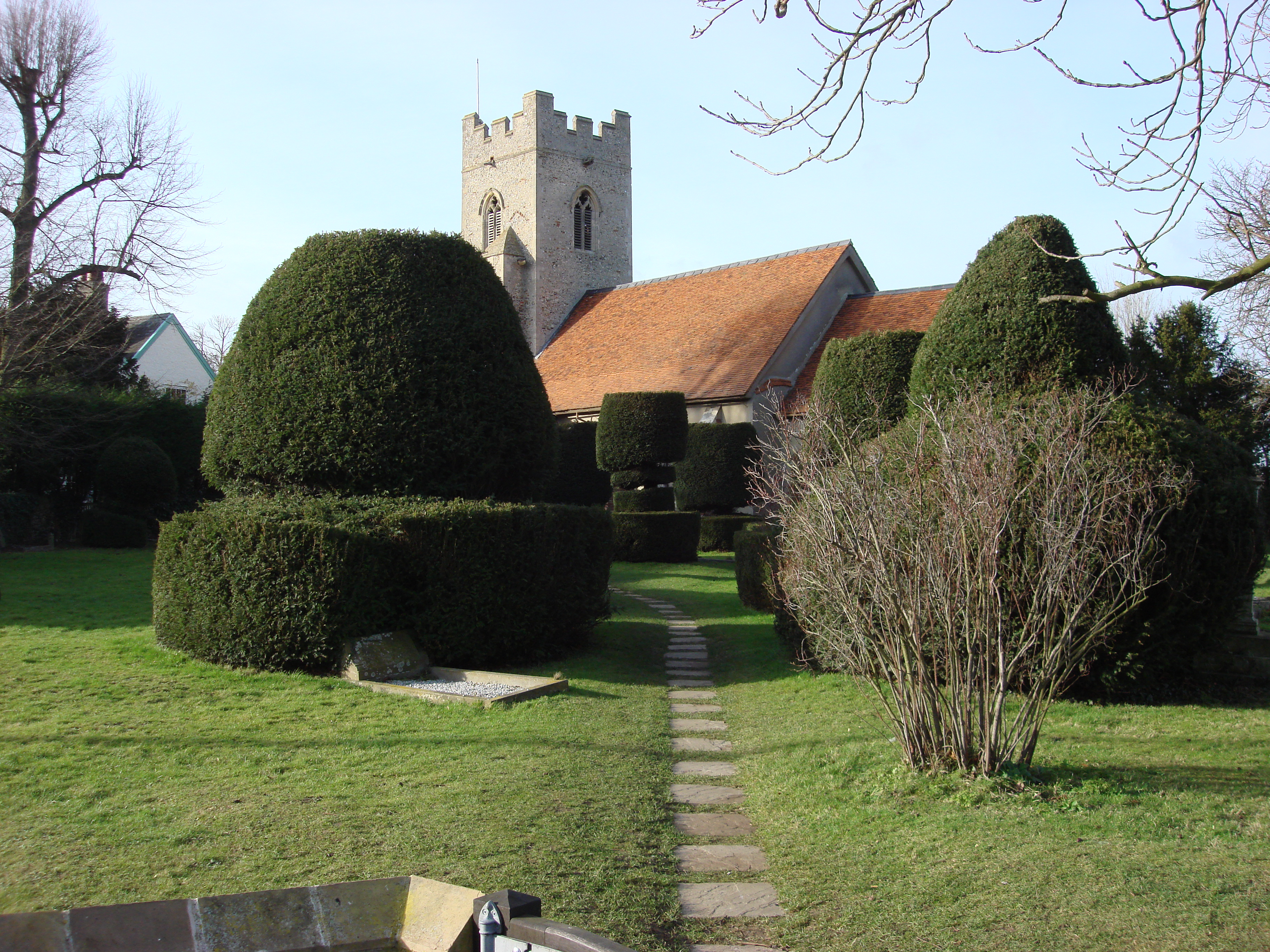
With a population of around 200 residents, Borley Green is a close-knit community characterized by its friendly and welcoming atmosphere. The village retains its rural charm, with traditional cottages and farmhouses dotting the landscape. The nearby St. Mary's Church, dating back to the 14th century, stands as a testament to the area's rich history.

Although small in size, Borley Green offers several amenities to its residents. The village boasts a local pub, The Green Inn, serving as a hub for social gatherings and community events. Additionally, a primary school provides education for the village's children, ensuring a strong sense of community for families.

Nature enthusiasts will find plenty to explore in the surrounding area, with numerous walking and cycling paths winding through the countryside. Borley Green is also home to several nature reserves and parks, offering opportunities for wildlife spotting and outdoor activities.

Overall, Borley Green is a charming and peaceful village, offering a serene escape from the hustle and bustle of city life. With its stunning natural surroundings and strong sense of community, it is a place where residents can truly embrace a slower pace of life.

If you have any feedback on the listing, please let us know in the comments section below.
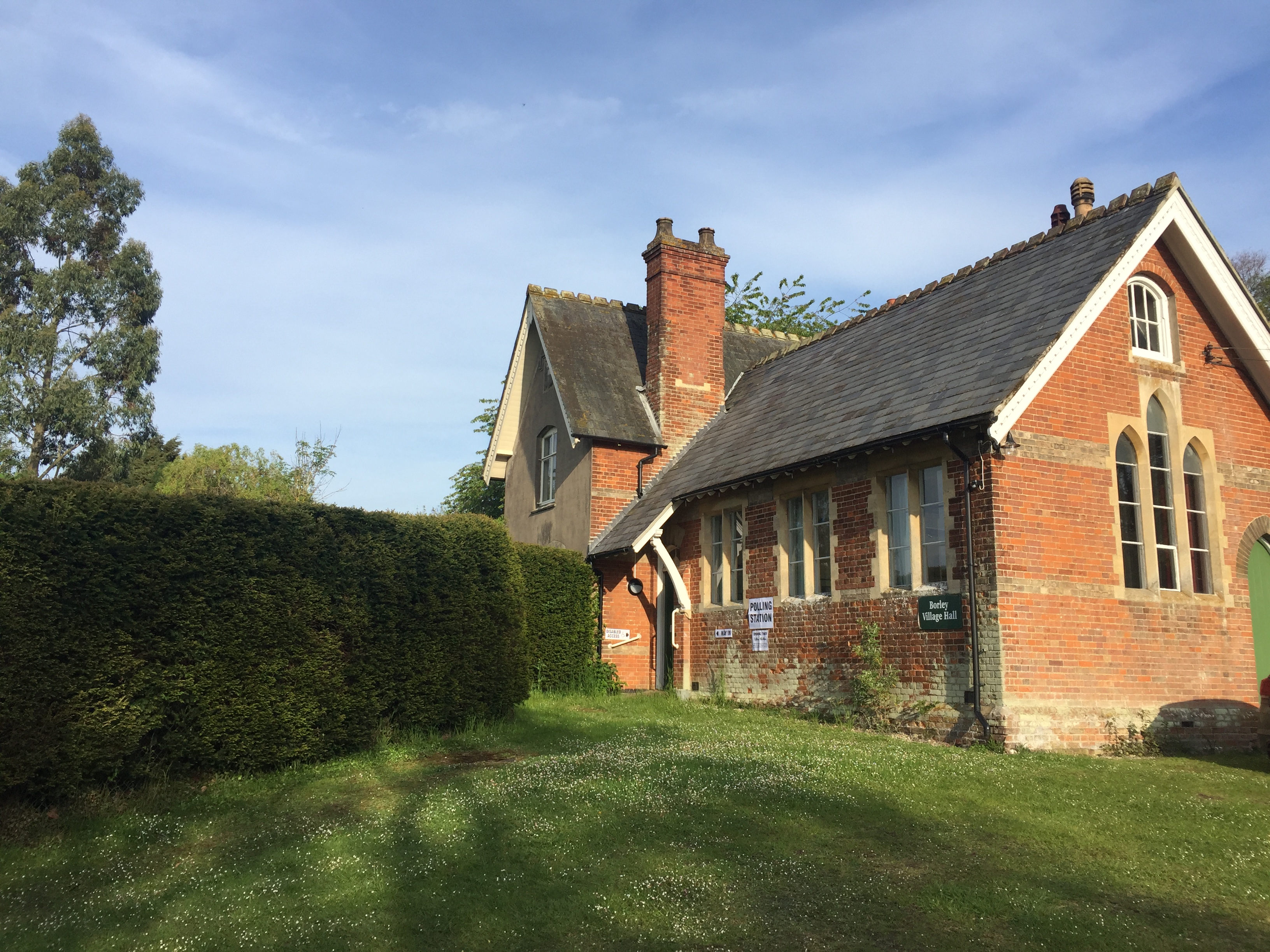
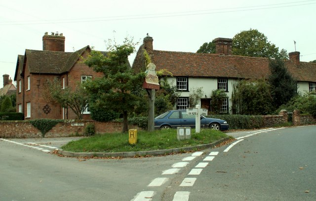
Borley Green Images

Images are sourced within 2km of 52.052962/0.679425 or Grid Reference TL8342. Thanks to Geograph Open Source API. All images are credited.

Old Gatepost and Stour Valley Path A lichen covered concrete gatepost on the old Stour Valley Railway <span class="nowrap"><a title="https://en.wikipedia.org/wiki/Stour_Valley_Railway" rel="nofollow ugc noopener" href="https://en.wikipedia.org/wiki/Stour_Valley_Railway">Link</a><img style="margin-left:2px;" alt="External link" title="External link - shift click to open in new window" src="https://s1.geograph.org.uk/img/external.png" width="10" height="10"/></span>  . It is part of the Stour Valley Path <span class="nowrap"><a title="https://ldwa.org.uk/ldp/members/show_path.php?path_name=Stour+Valley+Path+%28East+Anglia%29" rel="nofollow ugc noopener" href="https://ldwa.org.uk/ldp/members/show_path.php?path_name=Stour+Valley+Path+%28East+Anglia%29">Link</a><img style="margin-left:2px;" alt="External link" title="External link - shift click to open in new window" src="https://s1.geograph.org.uk/img/external.png" width="10" height="10"/></span> and the National Cycle Network .
Old Gatepost and Stour Valley Path
A lichen covered concrete gatepost on the old Stour Valley Railway LinkExternal link . It is part of the Stour Valley Path LinkExternal link and the National Cycle Network .
Brundon to Bardfield Bridge Bridleway
Belchamp Brook Looking upstream
Belchamp Brook
Looking upstream
Bardfield Bridge Gauging Station Looking down stream on <a href="https://www.geograph.org.uk/photo/7470537">TL8542 : Belchamp Brook</a>
Bardfield Bridge Gauging Station
Looking down stream on TL8542 : Belchamp Brook
Downstream on Beauchamp Brook Taken from <a href="https://www.geograph.org.uk/photo/7470548">TL8442 : Bardfield Bridge</a>.
Downstream on Beauchamp Brook
ITTOYA Its That Time Of Year Again (apologies to the late Ted Kavanagh <span class="nowrap"><a title="https://en.wikipedia.org/wiki/Ted_Kavanagh" rel="nofollow ugc noopener" href="https://en.wikipedia.org/wiki/Ted_Kavanagh">Link</a><img style="margin-left:2px;" alt="External link" title="External link - shift click to open in new window" src="https://s1.geograph.org.uk/img/external.png" width="10" height="10"/></span> ). Soon the whole countryside will be ablaze with the hi-viz yellow oilseed rape blossom
ITTOYA
Its That Time Of Year Again (apologies to the late Ted Kavanagh LinkExternal link ). Soon the whole countryside will be ablaze with the hi-viz yellow oilseed rape blossom
Harrowed Field Near Brundon Wood The wide field margin is a sign of modern farming subsidies.
Harrowed Field Near Brundon Wood
The wide field margin is a sign of modern farming subsidies.
Across the Border Looking from Essex into Suffolk.
Across the Border
Looking from Essex into Suffolk.
Former Pond Near Brundon Wood I suspect the fallen tree may have been a willow.
Former Pond Near Brundon Wood
I suspect the fallen tree may have been a willow.
Borley Place Barn and Farmhouse <span class="nowrap"><a title="https://historicengland.org.uk/listing/the-list/list-entry/1306411?section=official-list-entry" rel="nofollow ugc noopener" href="https://historicengland.org.uk/listing/the-list/list-entry/1306411?section=official-list-entry">Link</a><img style="margin-left:2px;" alt="External link" title="External link - shift click to open in new window" src="https://s1.geograph.org.uk/img/external.png" width="10" height="10"/></span> and <span class="nowrap"><a title="https://historicengland.org.uk/listing/the-list/list-entry/1337892?section=official-list-entry" rel="nofollow ugc noopener" href="https://historicengland.org.uk/listing/the-list/list-entry/1337892?section=official-list-entry">Link</a><img style="margin-left:2px;" alt="External link" title="External link - shift click to open in new window" src="https://s1.geograph.org.uk/img/external.png" width="10" height="10"/></span>
Borley Place Barn and Farmhouse
LinkExternal link and LinkExternal link
Barn at Borley Place <span class="nowrap"><a title="https://historicengland.org.uk/listing/the-list/list-entry/1123290?section=official-list-entry" rel="nofollow ugc noopener" href="https://historicengland.org.uk/listing/the-list/list-entry/1123290?section=official-list-entry">Link</a><img style="margin-left:2px;" alt="External link" title="External link - shift click to open in new window" src="https://s1.geograph.org.uk/img/external.png" width="10" height="10"/></span>
Barn at Borley Place
Borley Parish Church <span class="nowrap"><a title="https://historicengland.org.uk/listing/the-list/list-entry/1169675?section=official-list-entry" rel="nofollow ugc noopener" href="https://historicengland.org.uk/listing/the-list/list-entry/1169675?section=official-list-entry">Link</a><img style="margin-left:2px;" alt="External link" title="External link - shift click to open in new window" src="https://s1.geograph.org.uk/img/external.png" width="10" height="10"/></span>
Borley Parish Church
Big Field with Silage Crop View from a footpath.
Big Field with Silage Crop
View from a footpath.
Rectory Lodge, Foxearth <span class="nowrap"><a title="https://historicengland.org.uk/listing/the-list/list-entry/1216757?section=official-list-entry" rel="nofollow ugc noopener" href="https://historicengland.org.uk/listing/the-list/list-entry/1216757?section=official-list-entry">Link</a><img style="margin-left:2px;" alt="External link" title="External link - shift click to open in new window" src="https://s1.geograph.org.uk/img/external.png" width="10" height="10"/></span>
Rectory Lodge, Foxearth
Church of Saint Peter and Saint Paul, Foxearth <span class="nowrap"><a title="https://historicengland.org.uk/listing/the-list/list-entry/1216708?section=official-list-entry" rel="nofollow ugc noopener" href="https://historicengland.org.uk/listing/the-list/list-entry/1216708?section=official-list-entry">Link</a><img style="margin-left:2px;" alt="External link" title="External link - shift click to open in new window" src="https://s1.geograph.org.uk/img/external.png" width="10" height="10"/></span>
Church of Saint Peter and Saint Paul, Foxearth
Show me another place!

Borley Green is located at Grid Ref: TL8342 (Lat: 52.052962, Lng: 0.679425)

Administrative County: Essex

District: Braintree

Police Authority: Essex

What 3 Words

///grumbling.lighters.trustees. Near Long Melford, Suffolk

Nearby Locations

Borley Green

Related Wikis

Borley Church

Borley Church is the parish church in Borley, Essex. The church is in the ecclesiastical parish of Borley and Liston, one of the Fifteen Churches of the...

Borley Rectory

Borley Rectory was a house located in Borley, Essex, famous for being described as "the most haunted house in England" by psychic researcher Harry Price...

Borley

Borley is a village and civil parish in rural north Essex, England close to the border with Suffolk. It is located near the River Stour. The closest town...

Foxearth

Foxearth is a village and civil parish on the borders of north Essex and Suffolk in England, between Long Melford and Cavendish. The neighbouring parishes...

Nearby Amenities

Located within 500m of 52.052962,0.679425
Borleylodge Farm
Naptan AtcoCode: 1500BORLEYGN
Naptan Bearing: NE
Naptan BusStopType: CUS
Naptan CommonName: Borleylodge Farm
Naptan Indicator: Opp
Naptan Landmark: Borleylodge Farm
Naptan NaptanCode: esxdjgaj
Naptan Street: Borley Green Road
Naptan Verified: no
Source: naptan_import
Lat/Long: 52.05254/0.6825829
Post Box
Operator: Royal Mail
Post Box Type: lamp
Royal Cypher: EIIR
Source: gps survey and Bing
Lat/Long: 52.0524861/0.6825352
Telephone
Booth: K6
Covered: booth
Listed Status: Grade II
Operator: British Telecom
Phone: +44 1787 379022
Source: gps survey and Bing
Lat/Long: 52.0525499/0.6824227
Shelter
Shelter Type: public_transport
Lat/Long: 52.0525462/0.6824941
The data included in this document is from www.openstreetmap.org. The data is made available under ODbL.

Have you been to Borley Green?

Leave your review of Borley Green below (or comments, questions and feedback).