The Spring

Settlement in Warwickshire Warwick

England

The Spring

Red Lane near Long Meadow Barn Farm
Red Lane near Long Meadow Barn Farm Credit: Ian S

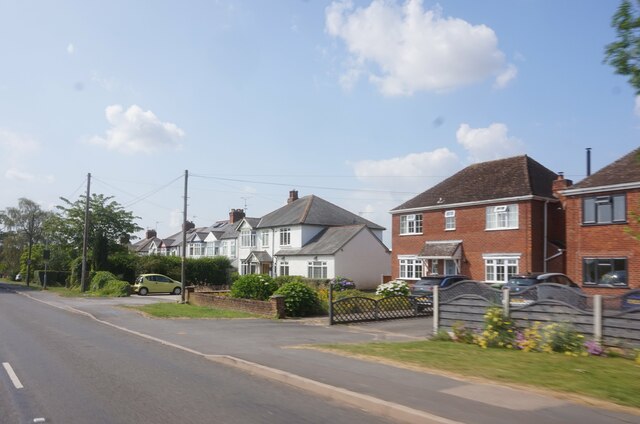
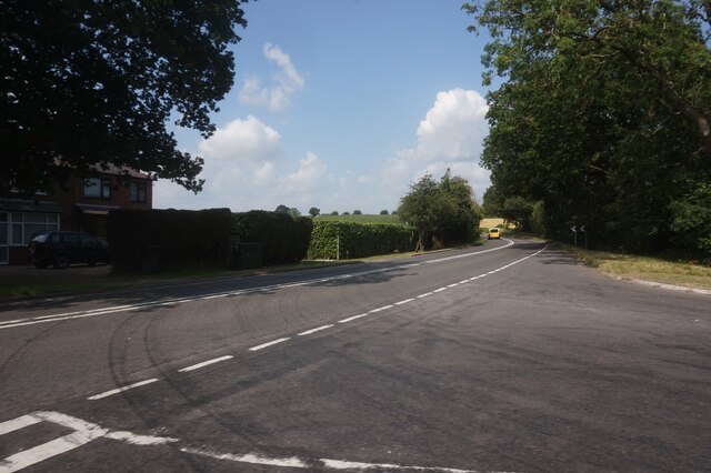
The Spring is a picturesque village located in the county of Warwickshire, England. Situated in the heart of the English countryside, this idyllic village is known for its stunning natural beauty and rich history. The Spring is surrounded by rolling green hills, lush meadows, and charming cottages, giving it a quintessential English village feel.

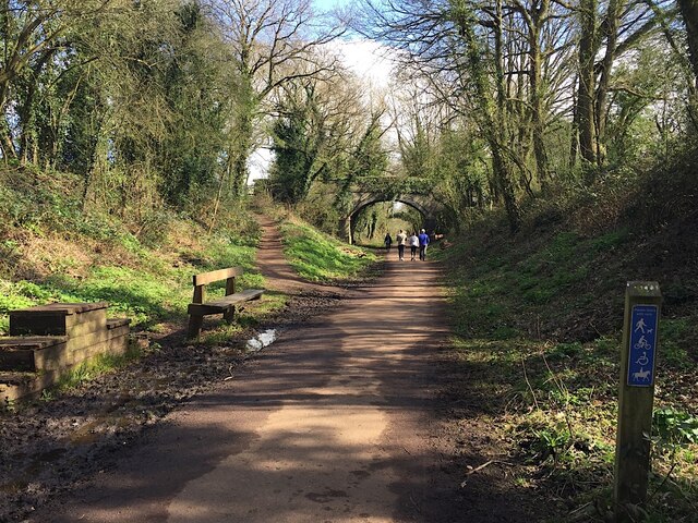
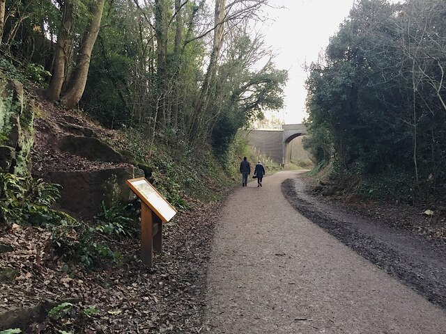
One of the main attractions in The Spring is its historic church, which dates back to the 12th century. This beautiful church, with its intricate architecture and serene atmosphere, is a must-visit for history enthusiasts and those seeking a moment of tranquility. The village also boasts a number of walking and cycling trails, allowing visitors to explore the stunning countryside and take in the breathtaking views.

In addition to its natural beauty, The Spring is known for its vibrant community spirit. The village hosts a range of annual events and festivals, including a summer fair and a Christmas market, which attract both locals and tourists alike. The community also takes pride in its local shops and pubs, which offer a warm welcome and a taste of traditional English hospitality.

For those looking to stay in The Spring, there are a variety of accommodation options available, including cozy bed and breakfasts and charming cottages. Visitors can also enjoy delicious meals at the village's restaurants, which serve up a mix of traditional English fare and international cuisine.

Overall, The Spring in Warwickshire is a charming village that offers a perfect blend of natural beauty, rich history, and warm community spirit.

If you have any feedback on the listing, please let us know in the comments section below.
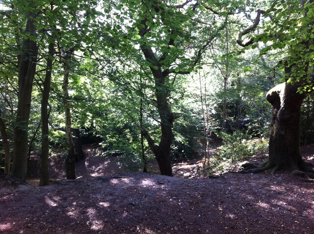
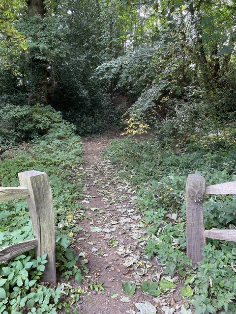
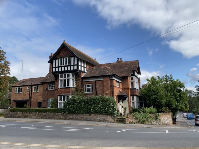
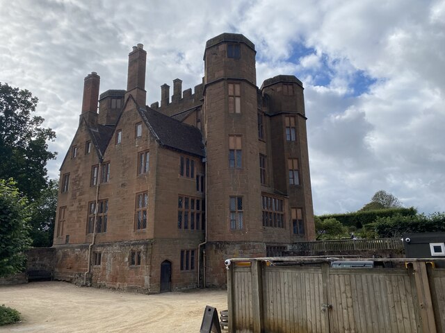
The Spring Images

Images are sourced within 2km of 52.356171/-1.579293 or Grid Reference SP2873. Thanks to Geograph Open Source API. All images are credited.

Red Lane near Long Meadow Barn Farm
A452 Birmingham Road at Red Lane
East on Kenilworth Greenway, Crackley The Greenway, a County Council amenity, follows the route of the former Kenilworth-Berkswell railway line. Here it is crossed by and connected to a public footpath, a track at this point, between north Kenilworth and south Coventry.
East on Kenilworth Greenway, Crackley
The Greenway, a County Council amenity, follows the route of the former Kenilworth-Berkswell railway line. Here it is crossed by and connected to a public footpath, a track at this point, between north Kenilworth and south Coventry.
Making a deck, The Engine public house, Mill End, Kenilworth In the later phase of the pandemic, pubs that had had to close invested in creating outdoor space so that they could safely serve socially-distanced patrons.
Making a deck, The Engine public house, Mill End, Kenilworth
In the later phase of the pandemic, pubs that had had to close invested in creating outdoor space so that they could safely serve socially-distanced patrons.
Kenilworth Greenway turns south, Crackley, Kenilworth The Greenway was created on a former railway line. The information board has accounts of the Kenilworth Sandstone, exposed here, and of the railway.
Kenilworth Greenway turns south, Crackley, Kenilworth
The Greenway was created on a former railway line. The information board has accounts of the Kenilworth Sandstone, exposed here, and of the railway.
Odibourne Allotments, Manor Road, Kenilworth The allotments were open to the public for the Heritage Open Days 2021 and Edible England events; members of the Kenilworth Allotment Tenants' Association (KATA) can be seen welcoming visitors. 

The Odibourne site was established in 1919, when Kenilworth Urban District Council bought land from the estate of the deceased William Thomas Pears. The council had recently decided to build on the 'Noah's Ark' allotments nearby, but was obliged under the 1908 Smallholding & Allotments Act to provide sufficient land for local people who wanted plots for growing food. The site is owned today by Kenilworth Town Council, but has been managed since 1983 by KATA (information taken from a notice board on the site).
Odibourne Allotments, Manor Road, Kenilworth
The allotments were open to the public for the Heritage Open Days 2021 and Edible England events; members of the Kenilworth Allotment Tenants' Association (KATA) can be seen welcoming visitors. The Odibourne site was established in 1919, when Kenilworth Urban District Council bought land from the estate of the deceased William Thomas Pears. The council had recently decided to build on the 'Noah's Ark' allotments nearby, but was obliged under the 1908 Smallholding & Allotments Act to provide sufficient land for local people who wanted plots for growing food. The site is owned today by Kenilworth Town Council, but has been managed since 1983 by KATA (information taken from a notice board on the site).
Plot 58a, Odibourne Allotments, Kenilworth These allotments, which to this city dweller appear impossibly idyllic, were open to the public for the Heritage Open Days 2021. Behind the idyll, of course, lies hard work and long term commitment, the challenge of group politics, the uncertainty of the weather and the threat, even here, of theft and vandalism. The Odibourne allotments were established in 1919.
Plot 58a, Odibourne Allotments, Kenilworth
These allotments, which to this city dweller appear impossibly idyllic, were open to the public for the Heritage Open Days 2021. Behind the idyll, of course, lies hard work and long term commitment, the challenge of group politics, the uncertainty of the weather and the threat, even here, of theft and vandalism. The Odibourne allotments were established in 1919.
I'm in the Green Zone A scarecrow, probably more decorative than functional, at the Odibourne allotments in Kenilworth, which were open to the public for the Heritage Open Days 2021.
I'm in the Green Zone
A scarecrow, probably more decorative than functional, at the Odibourne allotments in Kenilworth, which were open to the public for the Heritage Open Days 2021.
Apple Pressing at Odibourne Allotments, Kenilworth The allotment site was open to the public as part of the Heritage Open Days 2021 and Edible England events.
Apple Pressing at Odibourne Allotments, Kenilworth
The allotment site was open to the public as part of the Heritage Open Days 2021 and Edible England events.
'My Shed, My Rules' The sheds of the Odibourne Allotments, Kenilworth, are the subject of their own book, 'Odibourne Sheds: rural retreats in a Kenilworth allotment', by Peter James, published by the Bothy Press in 2020.
'My Shed, My Rules'
The sheds of the Odibourne Allotments, Kenilworth, are the subject of their own book, 'Odibourne Sheds: rural retreats in a Kenilworth allotment', by Peter James, published by the Bothy Press in 2020.
The Rules: Water butt on Odibourne Allotments, Kenilworth A water butt and rules governing its use, on the Odibourne Allotments, open to the public for the Heritage Open Days 2021 and Edible England events.
The Rules: Water butt on Odibourne Allotments, Kenilworth
A water butt and rules governing its use, on the Odibourne Allotments, open to the public for the Heritage Open Days 2021 and Edible England events.
Odibourne Allotments, Kenilworth, looking towards Lower Ladyes Hills Not normally open to the public, the allotments were welcoming visitors for the day as part of the Heritage Open Days 2021 and Edible England events. A scarecrow in the form of a Tokyo Olympics mascot can be seen to the right of the picture.
Odibourne Allotments, Kenilworth, looking towards Lower Ladyes Hills
Not normally open to the public, the allotments were welcoming visitors for the day as part of the Heritage Open Days 2021 and Edible England events. A scarecrow in the form of a Tokyo Olympics mascot can be seen to the right of the picture.
Bridge over the Finham Brook, Odibourne Allotments, Kenilworth No doubt flooding is another hazard of allotment life here, but the stream must have enriched the fertility of the valley over the years. Not normally accessible to the public, the allotments were open as part of the Heritage Open Days 2021 and Edible England events.
Bridge over the Finham Brook, Odibourne Allotments, Kenilworth
No doubt flooding is another hazard of allotment life here, but the stream must have enriched the fertility of the valley over the years. Not normally accessible to the public, the allotments were open as part of the Heritage Open Days 2021 and Edible England events.
Lower Ladyes Hills, Kenilworth, seen from the entrance to the Odibourne Allotments The allotments, which were established in the valley of the Finham Brook in 1919, were open to the public as part of the Heritage Open Days.
Lower Ladyes Hills, Kenilworth, seen from the entrance to the Odibourne Allotments
The allotments, which were established in the valley of the Finham Brook in 1919, were open to the public as part of the Heritage Open Days.
Kenilworth Common Once a heath used for grazing farm animals, the common was colonised by birch and oak trees once grazing stopped, and is now a wood with a few remnants of heathland. The land slopes down to the Finham Brook and is crossed by the Coventry to Leamington railway. The common is now a local nature reserve: see the website of the Warwickshire Wildlife Trust here <span class="nowrap"><a title="https://www.warwickshirewildlifetrust.org.uk/reserves/KenilworthCommon" rel="nofollow ugc noopener" href="https://www.warwickshirewildlifetrust.org.uk/reserves/KenilworthCommon">Link</a><img style="margin-left:2px;" alt="External link" title="External link - shift click to open in new window" src="https://s1.geograph.org.uk/img/external.png" width="10" height="10"/></span> .
Kenilworth Common
Once a heath used for grazing farm animals, the common was colonised by birch and oak trees once grazing stopped, and is now a wood with a few remnants of heathland. The land slopes down to the Finham Brook and is crossed by the Coventry to Leamington railway. The common is now a local nature reserve: see the website of the Warwickshire Wildlife Trust here LinkExternal link .
Path to castle earthworks Kenilworth Castle remains.
Path to castle earthworks
Kenilworth Castle remains.
House on Castle Road, Kenilworth B4103 near Kenilworth.
House on Castle Road, Kenilworth
B4103 near Kenilworth.
Gatehouse, Kenilworth Castle
Show me another place!

The Spring is located at Grid Ref: SP2873 (Lat: 52.356171, Lng: -1.579293)

Administrative County: Warwickshire

District: Warwick

Police Authority: Warwickshire

What 3 Words

///trains.with.employ. Near Kenilworth, Warwickshire

Nearby Locations

The Spring Spring, The

Related Wikis

Nearby Amenities

Located within 500m of 52.356171,-1.579293
Direction: forward
Maxspeed: 60 mph
Traffic Sign: maxspeed
Lat/Long: 52.3570924/-1.5839844
Post Box
Brand: Royal Mail
Brand Wikidata: Q638098
Brand Wikipedia: en:Royal Mail
Collection Times: Mo-Fr 09:00; Sa 07:00
Operator: Royal Mail
Operator Wikidata: Q638098
Post Box Type: lamp
Ref: CV8 384D
Royal Cypher: EIIR
Royal Cypher Wikidata: Q33102113
Source: survey
Lat/Long: 52.3544251/-1.573722
Turning Circle
Lat/Long: 52.3530221/-1.5842799
Bus Stop
Tainters Hill
Bus: yes
Covered: no
Naptan AtcoCode: 4200F108101
Naptan Bearing: SW
Naptan CommonName: Tainters Hill
Naptan Crossing: Tainters Hill
Naptan Indicator: Adj
Naptan NaptanCode: warajwpd
Naptan Street: Coventry Road
Naptan Verified: no
Passenger Information Display: no
Public Transport: platform
Shelter: yes
Source: naptan_import
Tactile Paving: no
Lat/Long: 52.3535007/-1.5761124
Bus Stop
Tainters Hill
Bus: yes
Covered: no
Naptan AtcoCode: 4200F108102
Naptan Bearing: NE
Naptan CommonName: Tainters Hill
Naptan Crossing: Tainters Hill
Naptan Indicator: Opp
Naptan NaptanCode: warajwpg
Naptan Street: Coventry Road
Naptan Verified: no
Passenger Information Display: no
Public Transport: platform
Shelter: no
Source: naptan_import
Lat/Long: 52.3535501/-1.5762206
Post Box
Brand: Royal Mail
Brand Wikidata: Q638098
Brand Wikipedia: en:Royal Mail
Collection Times: Mo-Fr 09:00; Sa 07:00
Operator: Royal Mail
Operator Wikidata: Q638098
Post Box Type: wall
Ref: CV8 382D
Royal Cypher: VR
Royal Cypher Wikidata: Q33102356
Source: survey
Lat/Long: 52.3542626/-1.5835028
Give Way
Direction: backward
Source: Warwickshire CC Aerial Imagery2013
Lat/Long: 52.3536982/-1.5758042
Give Way
Direction: forward
Source: Warwickshire CC Aerial Imagery2013
Lat/Long: 52.3539141/-1.5755457
Give Way
Direction: backward
Source: Warwickshire CC Aerial Imagery2013
Lat/Long: 52.3541443/-1.5749424
Give Way
Direction: forward
Source: Warwickshire CC Aerial Imagery2013
Lat/Long: 52.3544787/-1.5737633
Crossing
Button Operated: yes
Crossing: traffic_signals
Crossing Island: no
Source: Warwickshire CC Aerial Imagery2013
Tactile Paving: yes
Traffic Signals Sound: yes
Traffic Signals Vibration: yes
Lat/Long: 52.355001/-1.584451
Man Made: windmill
Lat/Long: 52.3523852/-1.5760826
Generator Method: photovoltaic
Generator Output Electricity: yes
Generator Source: solar
Generator Type: solar_photovoltaic_panel
Location: roof
Power: generator
Lat/Long: 52.3538742/-1.5824541
Generator Method: photovoltaic
Generator Output Electricity: yes
Generator Source: solar
Generator Type: solar_photovoltaic_panel
Location: roof
Power: generator
Lat/Long: 52.3538557/-1.582211
Generator Method: photovoltaic
Generator Output Electricity: yes
Generator Source: solar
Generator Type: solar_photovoltaic_panel
Location: roof
Power: generator
Lat/Long: 52.3545711/-1.5841328
Generator Method: photovoltaic
Generator Output Electricity: yes
Generator Source: solar
Generator Type: solar_photovoltaic_panel
Location: roof
Power: generator
Lat/Long: 52.3538519/-1.5812574
Direction: forward
Maxspeed: 60 mph
Traffic Sign: maxspeed
Lat/Long: 52.3543079/-1.5749825
Pipeline: substation
Substance: gas
Lat/Long: 52.3540611/-1.5755756
Colour: yellow
Marker: sign
Utility: gas
Lat/Long: 52.3540597/-1.5755921
Colour: yellow
Marker: sign
Utility: gas
Lat/Long: 52.3540512/-1.57558
The data included in this document is from www.openstreetmap.org. The data is made available under ODbL.

Have you been to The Spring?

Leave your review of The Spring below (or comments, questions and feedback).