Bordley

Settlement in Yorkshire Craven

England

Bordley

Mastiles Lane dropping towards Mastiles Gate Walled lanes make for an extra degree of freedom for the dog, not available when the fell is open and occupied by grazers, but beyond Mastiles gate at the junction of walls seen ahead, the lead will be back on and the walk will get slower. Most of the sheep on the fell ahead are in a large group (just out of view on the right) where a load of hay has just been dropped for them, but south of the track they are more randomly dotted about. The gate is at a slight low point in the lane (about 380m) before it climbs back 20m to the next rise.
Mastiles Lane dropping towards Mastiles Gate Credit: Andy Waddington

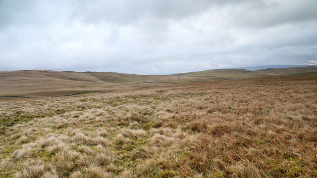
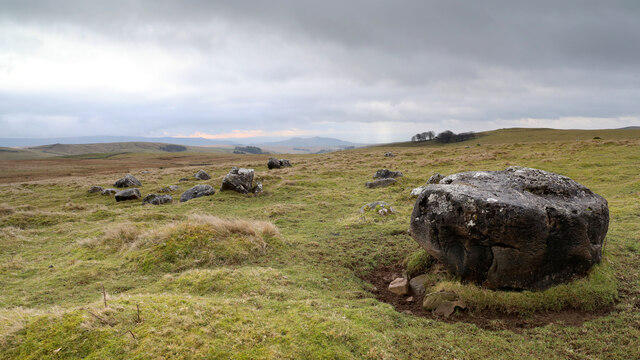
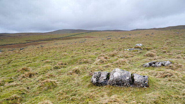
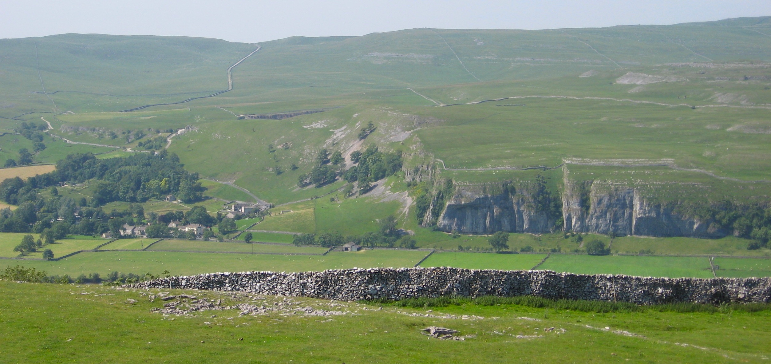
Bordley is a small village located in the Craven district of North Yorkshire, England. Situated in the heart of the Yorkshire Dales National Park, it is surrounded by picturesque countryside and rolling hills, making it a popular destination for nature enthusiasts and hikers.

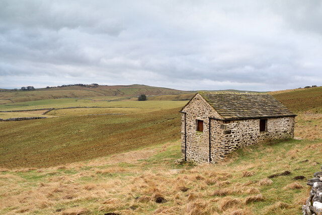
With a population of around 200 residents, Bordley retains a tranquil and peaceful atmosphere, offering a perfect escape from the hustle and bustle of city life. The village is characterized by its traditional stone-built houses, some of which date back several centuries, adding to its charm and historical appeal.

A notable feature of Bordley is its close proximity to the River Skirfare, which winds its way through the village, providing a scenic backdrop and opportunities for fishing and leisurely walks along its banks. The area is also known for its diverse wildlife, with several species of birds and mammals making their home in the surrounding woodlands and meadows.

Although small in size, Bordley is well-connected to nearby towns and villages, with Skipton being the closest major town, offering a wide range of amenities including shops, restaurants, and leisure facilities. The village itself has limited facilities, with no shops or schools, but its close-knit community spirit ensures a strong sense of belonging and support among its residents.

Overall, Bordley offers a tranquil and idyllic retreat for those seeking a rural lifestyle surrounded by natural beauty and a sense of community.

If you have any feedback on the listing, please let us know in the comments section below.
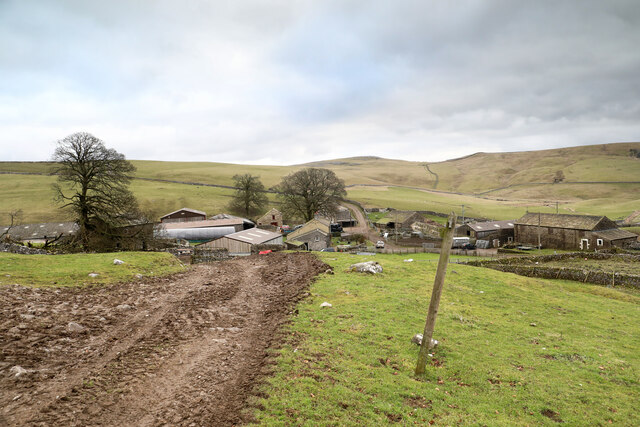
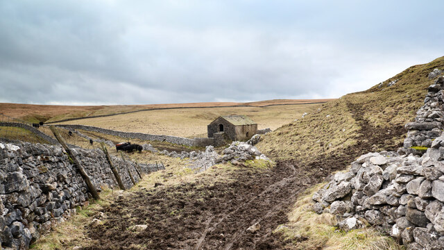
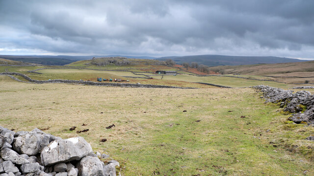
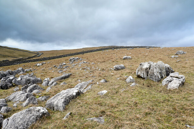
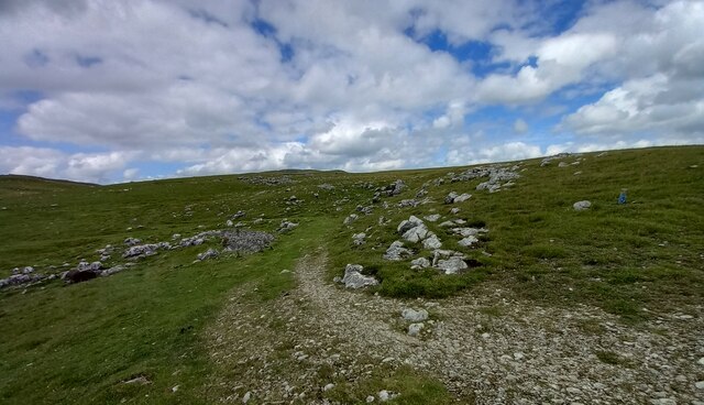
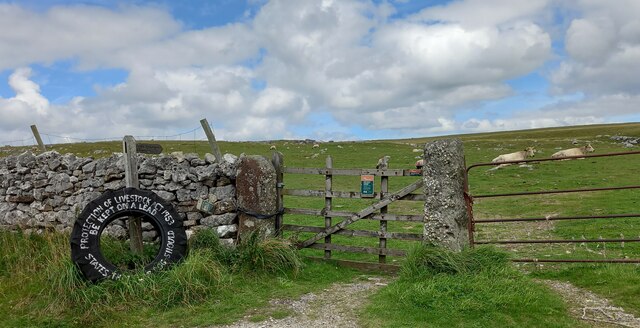
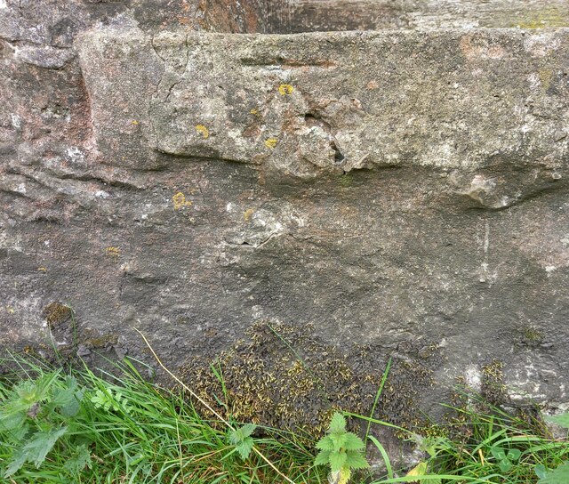
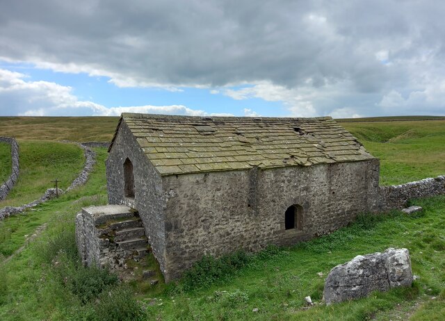
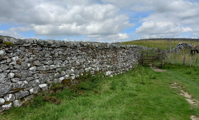
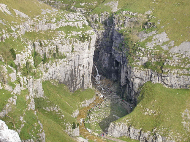
Bordley Images

Images are sourced within 2km of 54.080342/-2.090178 or Grid Reference SD9464. Thanks to Geograph Open Source API. All images are credited.

Mastiles Lane dropping towards Mastiles Gate Walled lanes make for an extra degree of freedom for the dog, not available when the fell is open and occupied by grazers, but beyond Mastiles gate at the junction of walls seen ahead, the lead will be back on and the walk will get slower. Most of the sheep on the fell ahead are in a large group (just out of view on the right) where a load of hay has just been dropped for them, but south of the track they are more randomly dotted about. The gate is at a slight low point in the lane (about 380m) before it climbs back 20m to the next rise.
Mastiles Lane dropping towards Mastiles Gate
Walled lanes make for an extra degree of freedom for the dog, not available when the fell is open and occupied by grazers, but beyond Mastiles gate at the junction of walls seen ahead, the lead will be back on and the walk will get slower. Most of the sheep on the fell ahead are in a large group (just out of view on the right) where a load of hay has just been dropped for them, but south of the track they are more randomly dotted about. The gate is at a slight low point in the lane (about 380m) before it climbs back 20m to the next rise.
High Long Ridge This gently sloping broad pasture is neither high, nor long, and hardly qualifies as a ridge, but drops gently towards the dry valley above Bordley Beck which, after the odd identity change, drains into the River Aire just east of Gargrave. The hill to the right of the photo on Malham Moor has the faint remains of a settlement and field system long predating the modern walls and farms. Being on limestone, the grassland is greener as the soil is noticeably more fertile than in the immediate foreground which provides only a scant living for sheep.
High Long Ridge
This gently sloping broad pasture is neither high, nor long, and hardly qualifies as a ridge, but drops gently towards the dry valley above Bordley Beck which, after the odd identity change, drains into the River Aire just east of Gargrave. The hill to the right of the photo on Malham Moor has the faint remains of a settlement and field system long predating the modern walls and farms. Being on limestone, the grassland is greener as the soil is noticeably more fertile than in the immediate foreground which provides only a scant living for sheep.
Limestone boulders on Tommy Low Pasture Although there is no bedrock in evidence, the short green grass is indicative that limestone lies close to the surface here, and there are lots of limestone bouders dotted about. The nearest has clearly been used by sheep as shelter from the wind, leading to a "moat" of eroded aoil around it and showing that the soil also contains rocks other than limestone in its matrix. In the middle distance, the group of trees are Kealcup plantation on the NE side of Kealcup Hill.
Limestone boulders on Tommy Low Pasture
Although there is no bedrock in evidence, the short green grass is indicative that limestone lies close to the surface here, and there are lots of limestone bouders dotted about. The nearest has clearly been used by sheep as shelter from the wind, leading to a "moat" of eroded aoil around it and showing that the soil also contains rocks other than limestone in its matrix. In the middle distance, the group of trees are Kealcup plantation on the NE side of Kealcup Hill.
Limestone boulders on Tommy High Pasture Although the bedrock is concealed by a layer of drift, there are plenty of boulders lying about to indicate that a lot of the local geology is limestone. The one in the immediate foreground has smoothed surfaces and characteristic grooves eroded by humic acids whilst partially buried in the soil. Now exposed, lichen finds it a congenial home. In the distance are Clapham High Mark and Parson's Pulpit, where the underlying limestone is much closer to the surface and forms numerous small outcrops.
Limestone boulders on Tommy High Pasture
Although the bedrock is concealed by a layer of drift, there are plenty of boulders lying about to indicate that a lot of the local geology is limestone. The one in the immediate foreground has smoothed surfaces and characteristic grooves eroded by humic acids whilst partially buried in the soil. Now exposed, lichen finds it a congenial home. In the distance are Clapham High Mark and Parson's Pulpit, where the underlying limestone is much closer to the surface and forms numerous small outcrops.
Mastiles Lane heading west Having endured a brief spell as a mere bridleway behind the photographer, Mastiles Lane here resumes its status as a byway open to all traffic as it heads for a Roman camp and on towards the public road system near Malham Tarn.
Mastiles Lane heading west
Having endured a brief spell as a mere bridleway behind the photographer, Mastiles Lane here resumes its status as a byway open to all traffic as it heads for a Roman camp and on towards the public road system near Malham Tarn.
Kealcup Laithe The building has been very well looked after with all mod cons - guttering is not common on such buildings well away from its farm. It looks out across rough grazing below the public bridleway from Smearbottoms Lane to Bordley on the southern slopes of Kealcup Hill. The lone tree in the centre of the view is above  Heber Beck within New House Farm National Nature Reserve.
Kealcup Laithe
The building has been very well looked after with all mod cons - guttering is not common on such buildings well away from its farm. It looks out across rough grazing below the public bridleway from Smearbottoms Lane to Bordley on the southern slopes of Kealcup Hill. The lone tree in the centre of the view is above Heber Beck within New House Farm National Nature Reserve.
Bordley Farms The hamlet of Bordley consists mainly of two farms, Bordley Green farm (on the left) and Bordley House Farm (on the right). From the perspective of a walker passing by, the farms seem to exist to house two sets of dogs who each compete to drown out the other during one's approach and passage between the buildings. Chickens and a cockerel have no hesitation in joining the fray, so I'm sure none of the human occupants would have heard my own dog's attempts to compete. The muddy approach is by a public bridleway, which can be seen continuing between walls beyond the farms. These are by no means the only rights of way which converge here, there being another bridleway and four separate public footpaths, walkers thereupon no doubt offering many opportunities for canine choir practice.
Bordley Farms
The hamlet of Bordley consists mainly of two farms, Bordley Green farm (on the left) and Bordley House Farm (on the right). From the perspective of a walker passing by, the farms seem to exist to house two sets of dogs who each compete to drown out the other during one's approach and passage between the buildings. Chickens and a cockerel have no hesitation in joining the fray, so I'm sure none of the human occupants would have heard my own dog's attempts to compete. The muddy approach is by a public bridleway, which can be seen continuing between walls beyond the farms. These are by no means the only rights of way which converge here, there being another bridleway and four separate public footpaths, walkers thereupon no doubt offering many opportunities for canine choir practice.
Height Laithe The public bridleway passes through a gate (on which the photographer is leaning) and heads off along the line of the wall towards the left of the view. A public footpath joins the bridleway over a stile just the far side of the stone barn, which, however, drops one directly in front of the cattle taking shelter from the bitter wind behind the ruins of a further wall. Since this seemed gratuitously confrontational (and though the cattle seemed laid back, the dog had it in mind to change that situation) we had skirted to the right of the barn to join the bridleway by the muddy tracks over the shoulder of the hillside on the right on the view, which seemed to make everyone's life more relaxed.
Height Laithe
The public bridleway passes through a gate (on which the photographer is leaning) and heads off along the line of the wall towards the left of the view. A public footpath joins the bridleway over a stile just the far side of the stone barn, which, however, drops one directly in front of the cattle taking shelter from the bitter wind behind the ruins of a further wall. Since this seemed gratuitously confrontational (and though the cattle seemed laid back, the dog had it in mind to change that situation) we had skirted to the right of the barn to join the bridleway by the muddy tracks over the shoulder of the hillside on the right on the view, which seemed to make everyone's life more relaxed.
Looking to the settlement above Cow Close Wood The immediate foreground is a path leading vaguely from the public bridleway above Height Laithe towards Height House. The hill beyond is marked with two antiquities, a "Settlement" and a "Hut circle and enclosure". Presumably these are different stages of development of a prehistoric community on the limestone hilltop where there is plenty of stone for building, a good view, and good soil suitable for farming. The more modern farm buildings, having less need for defence, perhaps, favour a more sheltered location below the hill, though today they find themselves on the windward side in a gusty and bitter breeze.
Looking to the settlement above Cow Close Wood
The immediate foreground is a path leading vaguely from the public bridleway above Height Laithe towards Height House. The hill beyond is marked with two antiquities, a "Settlement" and a "Hut circle and enclosure". Presumably these are different stages of development of a prehistoric community on the limestone hilltop where there is plenty of stone for building, a good view, and good soil suitable for farming. The more modern farm buildings, having less need for defence, perhaps, favour a more sheltered location below the hill, though today they find themselves on the windward side in a gusty and bitter breeze.
Limestone boulders on Malham Moor Just west of the bridleway from Height Laithe towards Mastiles Lane, just after crossing Malham Moor Lane, a vague track diverges to loop back and rejoin the right of way. From a geographer's point of view, its main benefit is in reaching a position which is assuredly inside the same square as the view to the west over the higher parts of the moor.
Limestone boulders on Malham Moor
Just west of the bridleway from Height Laithe towards Mastiles Lane, just after crossing Malham Moor Lane, a vague track diverges to loop back and rejoin the right of way. From a geographer's point of view, its main benefit is in reaching a position which is assuredly inside the same square as the view to the west over the higher parts of the moor.
Malham Moor According to the OS benchmark database there was a benchmark cut into a gatepost at this location. The gateposts have been replaced and are wooden. No benchmark was found.
Malham Moor
According to the OS benchmark database there was a benchmark cut into a gatepost at this location. The gateposts have been replaced and are wooden. No benchmark was found.
Kilnsey, Malham Moor The rivet benchmark is cut into a rock on the north-east side of the footpath.
Kilnsey, Malham Moor
The rivet benchmark is cut into a rock on the north-east side of the footpath.
Kilnsey, Malham Moor There is a rivet benchmark cut into the rock on the north-east side of the footpath.
Kilnsey, Malham Moor
There is a rivet benchmark cut into the rock on the north-east side of the footpath.
Skirethorn, Malham Moor Lane The benchmark is cut into a left hand gatepost on the north side of the lane.
Skirethorn, Malham Moor Lane
The benchmark is cut into a left hand gatepost on the north side of the lane.
Skirethorn, Malham Moor Lane There is a benchmark cut into the left hand gatepost on the north side of the lane.
Skirethorn, Malham Moor Lane
There is a benchmark cut into the left hand gatepost on the north side of the lane.
Skirethorn, Height field barn The benchmark is cut into the north facing wall of Height field barn located on the bridle path.
Skirethorn, Height field barn
The benchmark is cut into the north facing wall of Height field barn located on the bridle path.
Skirethorn, Height field barn There is a benchmark cut into the north facing wall of Height field barn located on the bridle path.
Skirethorn, Height field barn
There is a benchmark cut into the north facing wall of Height field barn located on the bridle path.
Skirethorn, Higher Heights According to the OS benchmark database there is a benchmark cut into this stretch of wall, at a very low height. Nothing was found.
Skirethorn, Higher Heights
According to the OS benchmark database there is a benchmark cut into this stretch of wall, at a very low height. Nothing was found.
Show me another place!

Bordley is located at Grid Ref: SD9464 (Lat: 54.080342, Lng: -2.090178)

Division: West Riding

Administrative County: North Yorkshire

District: Craven

Police Authority: North Yorkshire

What 3 Words

///smile.aimlessly.tribe. Near Grassington, North Yorkshire

Nearby Locations

Bordley Bark Plantation

Related Wikis

Nearby Amenities

Located within 500m of 54.080342,-2.090178
Bordley
Is In Country Code: GB
Is In County: North Yorkshire
Is In Municipality: Craven
Place: hamlet
Population: 23
Postal Code: BD23
Source: NPE
Wikidata: Q2113472
Wikipedia: en:Bordley
Lat/Long: 54.0802099/-2.0904813
Barrier: stile
Lat/Long: 54.0801888/-2.097166
Natural: spring
Source: OS 1:25k
Lat/Long: 54.0799377/-2.0929187
Ele: 328
Natural: peak
Source: OS Yorkshire 133 1852
Lat/Long: 54.0787874/-2.0936583
Ele: 343
Natural: peak
Source: OS Yorkshire 133 1852
Lat/Long: 54.0775408/-2.0949564
Power: pole
Source: Bing
Lat/Long: 54.0801153/-2.0905882
Power: pole
Source: Bing
Lat/Long: 54.0796132/-2.0897429
Power: pole
Source: Bing
Lat/Long: 54.0789289/-2.0889083
Power: pole
Source: Bing
Lat/Long: 54.0784581/-2.0883262
Power: pole
Source: Bing
Lat/Long: 54.0778938/-2.0876344
Power: pole
Source: Bing
Lat/Long: 54.0772424/-2.0868407
Power: pole
Source: Bing
Lat/Long: 54.0765713/-2.0860521
The data included in this document is from www.openstreetmap.org. The data is made available under ODbL.

Have you been to Bordley?

Leave your review of Bordley below (or comments, questions and feedback).