The Ryde

Settlement in Hertfordshire Welwyn Hatfield

England

The Ryde

Inside the Horse and Groom, Hatfield A lovely old public  house.
Inside the Horse and Groom, Hatfield Credit: Christine Matthews

The Ryde is a picturesque village located in Hertfordshire, England. Situated approximately 20 miles north of London, it falls within the district of Broxbourne. The village is known for its natural beauty and tranquil surroundings, making it an ideal place for those seeking a peaceful escape from the city.

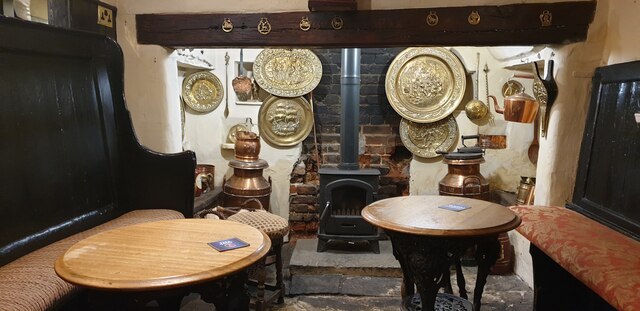
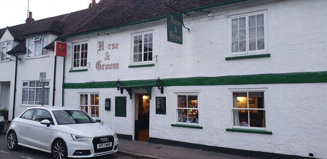
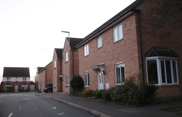
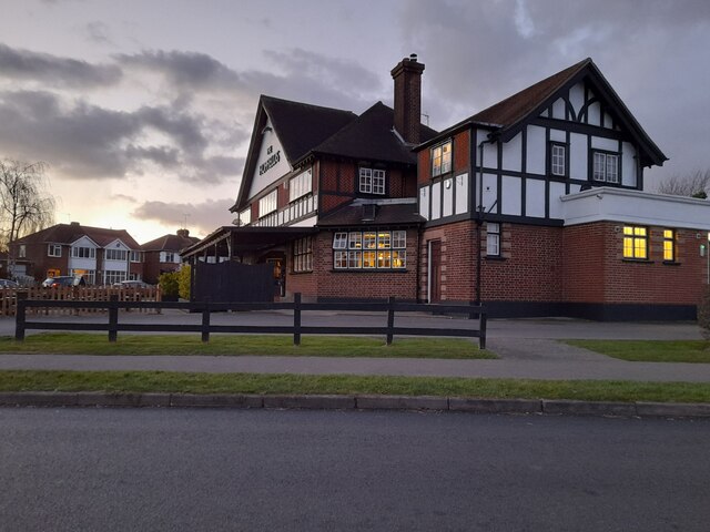
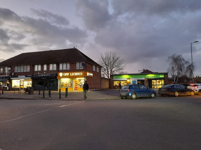
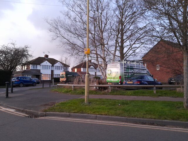
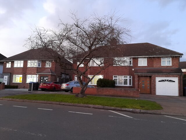
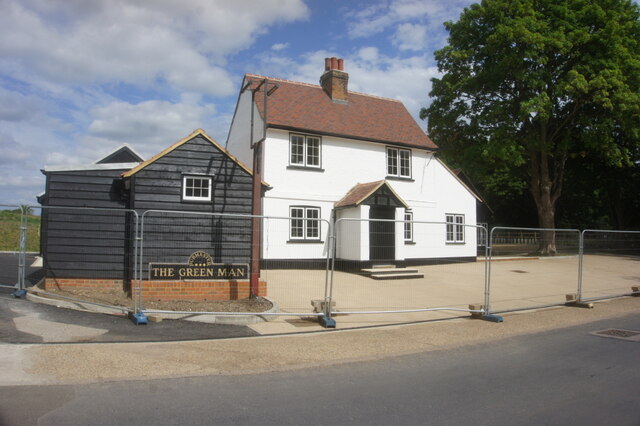
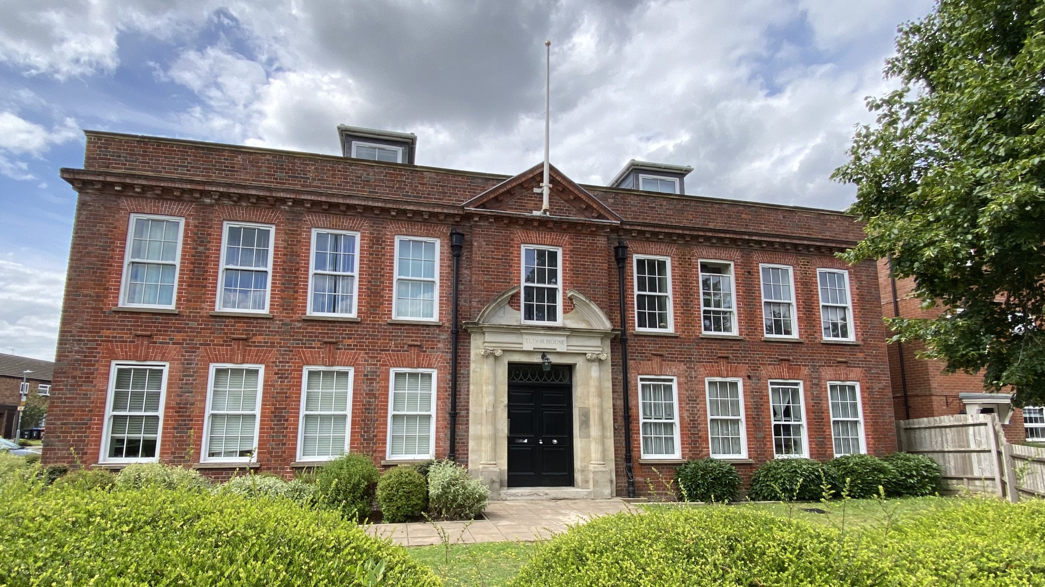
The Ryde is characterized by its charming architecture, with many historic buildings still standing, reflecting the village's rich history. The village center features a beautiful green open space, creating a focal point for community gatherings and events. Surrounding the green are a variety of amenities, including a local pub, a village shop, and a post office, providing residents with convenient access to essential services.

Nature enthusiasts will appreciate the village's proximity to several scenic areas, such as Lee Valley Regional Park and Rye Meads Nature Reserve, both offering opportunities for outdoor activities such as walking, cycling, and birdwatching. The Ryde is also conveniently located near the River Lea, providing residents with recreational options such as boating and fishing.

Transport links in the area are excellent, with easy access to the A10 and A414 roads, connecting the village to nearby towns and cities. The nearest railway station is located in the neighboring town of Hoddesdon, providing regular services to London Liverpool Street and other destinations.

Overall, The Ryde offers a tranquil and idyllic setting, with a strong sense of community and a range of amenities. Its convenient location and natural beauty make it a highly desirable place to live or visit.

If you have any feedback on the listing, please let us know in the comments section below.

The Ryde Images

Images are sourced within 2km of 51.773657/-0.217834 or Grid Reference TL2309. Thanks to Geograph Open Source API. All images are credited.

Inside the Horse and Groom, Hatfield A lovely old public  house.
Inside the Horse and Groom, Hatfield
A lovely old public house.
Horse and Groom, Hatfield A lovely old public  house.
Horse and Groom, Hatfield
A lovely old public house.
Old Hatfield at Night Moon behind clouds.
Old Hatfield at Night
Moon behind clouds.
KFC on Comet Way, Hatfield This is an original art deco building which has been fully restored
KFC on Comet Way, Hatfield
This is an original art deco building which has been fully restored
Hertford Road, Hatfield
Seat Garage on The Great North Road, Hatfield
Sovereign Place, Hatfield
Mount Pleasant Lane, Hatfield
The Hopfields, Birchwood A very typical suburban pub style.
The Hopfields, Birchwood
A very typical suburban pub style.
Shops on Birchwood Avenue, Hatfield
Birchwood Avenue, Hatfield
Houses on Birchwood Avenue, Hatfield
Houses on Cornerfield, Birchwood
Green on Cornerfield, Birchwood Looking towards Longmead
Green on Cornerfield, Birchwood
Looking towards Longmead
Path towards Mill Green Route of the (Welwyn Garden City) WGC Centenary 2020. A 20.20 km circular walk around the Outskirts of the city.
Path towards Mill Green
Route of the (Welwyn Garden City) WGC Centenary 2020. A 20.20 km circular walk around the Outskirts of the city.
Path towards Mill Green Route of the (Welwyn Garden City) WGC Centenary 2020. A 20.20 km circular walk around the Outskirts of the city.
Path towards Mill Green
Route of the (Welwyn Garden City) WGC Centenary 2020. A 20.20 km circular walk around the Outskirts of the city.
The former Green Man public house at Mill Green Route of the (Welwyn Garden City) WGC Centenary 2020. A 20.20 km circular walk around the Outskirts of the city.
The former Green Man public house at Mill Green
Route of the (Welwyn Garden City) WGC Centenary 2020. A 20.20 km circular walk around the Outskirts of the city.
Show me another place!

The Ryde is located at Grid Ref: TL2309 (Lat: 51.773657, Lng: -0.217834)

Administrative County: Hertfordshire

District: Welwyn Hatfield

Police Authority: Hertfordshire

What 3 Words

///cape.seat.driver. Near Hatfield, Hertfordshire

Nearby Locations

The Ryde Ryde, The

Related Wikis

Hatfield Town F.C.

Hatfield Town Football Club is a football club based in Hatfield, Hertfordshire. They are currently members of the Herts County League Premier Division...

The Wrestlers, Hatfield

The Wrestlers is a public house on the Great North Road in Hatfield, Hertfordshire, England. The Grade II listed building has an eighteenth-century chequered...

Hatfield Rural District

Hatfield Rural District was a rural district in Hertfordshire, England, from 1894 to 1974, covering an area in the south of the county. == Evolution... ==
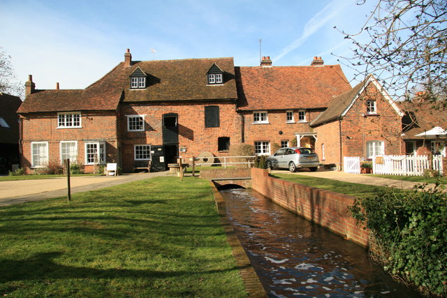
Mill Green Museum

Mill Green Museum is a working watermill in Hatfield, Hertfordshire, England. The building is listed grade II* ("The Old Mill House Museum and Mill Green...

Nearby Amenities

Located within 500m of 51.773657,-0.217834
Direction: both
Surface: asphalt
Traffic Calming: cushion
Lat/Long: 51.771777/-0.2229506
Mini Roundabout
Direction: clockwise
Lat/Long: 51.7734864/-0.2200973
Direction: both
Traffic Calming: cushion
Lat/Long: 51.7736704/-0.2182756
Direction: both
Surface: asphalt
Traffic Calming: cushion
Lat/Long: 51.7732198/-0.2202998
Direction: both
Surface: asphalt
Traffic Calming: table
Lat/Long: 51.7724567/-0.2217135
Mini Roundabout
Direction: clockwise
Lat/Long: 51.775749/-0.2212022
Give Way
Direction: backward
Lat/Long: 51.7764608/-0.221754
Give Way
Direction: forward
Lat/Long: 51.7775185/-0.2206032
Recycling
Recycling Cans: yes
Recycling Clothes: yes
Recycling Glass: yes
Recycling Type: container
Source: Yahoo! Aerial Imagery
Lat/Long: 51.7774842/-0.221057
Crossing
Crossing: unmarked
Crossing Island: no
Crossing Markings: no
Tactile Paving: yes
Lat/Long: 51.7756674/-0.2181813
Bus Stop
Mount Pleasant Lane
Bus: yes
Naptan AtcoCode: 210021602025
Naptan Bearing: S
Naptan CommonName: Mount Pleasant Lane
Naptan Crossing: H R Owen
Naptan Indicator: adj
Naptan Landmark: H R Owen
Naptan NaptanCode: hrtaptgt
Naptan PlusbusZoneRef: HATFILD
Naptan ShortCommonName: NA
Naptan Street: Great North Road
Naptan Verified: no
Public Transport: platform
Source: naptan_import
Lat/Long: 51.7749826/-0.2179461
Bus Stop
Hillfield
Bus: yes
Naptan AtcoCode: 210021602280
Naptan Bearing: W
Naptan CommonName: Hillfield
Naptan Indicator: nr
Naptan Landmark: Unknown
Naptan NaptanCode: hrtaptdp
Naptan PlusbusZoneRef: HATFILD
Naptan ShortCommonName: NA
Naptan Street: Longmead
Naptan Verified: no
Public Transport: platform
Source: naptan_import
Lat/Long: 51.7735053/-0.2195208
Bus Stop
Hopfields PH
Bus: yes
Naptan AtcoCode: 210021602300
Naptan Bearing: SW
Naptan CommonName: Hopfields PH
Naptan Crossing: Cornerfield Hopfields PH
Naptan Indicator: opp
Naptan Landmark: Cornerfield Hopfields PH
Naptan NaptanCode: hrtaptdw
Naptan PlusbusZoneRef: HATFILD
Naptan ShortCommonName: NA
Naptan Street: Cornerfield
Naptan Verified: no
Public Transport: platform
Source: naptan_import
Lat/Long: 51.7712068/-0.2233625
Bus Stop
Hopfields PH
Bus: yes
Naptan AtcoCode: 210021605440
Naptan Bearing: NE
Naptan CommonName: Hopfields PH
Naptan Crossing: Hopfields PH
Naptan Indicator: nr
Naptan Landmark: Hopfields PH
Naptan NaptanCode: hrtapata
Naptan PlusbusZoneRef: HATFILD
Naptan ShortCommonName: NA
Naptan Street: Cornerfield
Naptan Verified: no
Public Transport: platform
Source: naptan_import
Lat/Long: 51.7712743/-0.2235317
Bus Stop
Hillfield
Bus: yes
Naptan AtcoCode: 210021605460
Naptan Bearing: E
Naptan CommonName: Hillfield
Naptan Indicator: opp
Naptan Landmark: Unknown
Naptan NaptanCode: hrtapatg
Naptan PlusbusZoneRef: HATFILD
Naptan ShortCommonName: NA
Naptan Street: Longmead
Naptan Verified: no
Public Transport: platform
Source: naptan_import
Lat/Long: 51.7737019/-0.2185661
Bus Stop
Mount Pleasant Lane
Bus: yes
Naptan AtcoCode: 210021605465
Naptan Bearing: N
Naptan CommonName: Mount Pleasant Lane
Naptan Crossing: H R Owen
Naptan Indicator: nr
Naptan Landmark: H R Owen
Naptan NaptanCode: hrtapatj
Naptan PlusbusZoneRef: HATFILD
Naptan ShortCommonName: NA
Naptan Street: Great North Road
Naptan Verified: no
Public Transport: platform
Source: naptan_import
Lat/Long: 51.7747073/-0.2180716
Lowlands
Naptan AtcoCode: 210021605521
Naptan Bearing: NW
Naptan BusStopType: CUS
Naptan CommonName: Lowlands
Naptan Crossing: opp Mount Pleasant Close
Naptan Indicator: adj
Naptan Landmark: opp Mount Pleasant Close
Naptan NaptanCode: hrtapama
Naptan PlusbusZoneRef: HATFILD
Naptan ShortCommonName: NA
Naptan Street: Mount Pleasant Lane
Naptan Verified: no
Source: naptan_import
Lat/Long: 51.7736878/-0.2116909
Bus Stop
Tesco
Bus: yes
Naptan AtcoCode: 210021605710
Naptan Bearing: NW
Naptan CommonName: Tesco
Naptan Crossing: Great North Road
Naptan Indicator: o/s
Naptan Landmark: Great North Road
Naptan NaptanCode: hrtapaja
Naptan PlusbusZoneRef: HATFILD;WLWYNGC
Naptan ShortCommonName: NA
Naptan Street: Oldings Corner
Naptan Verified: no
Public Transport: platform
Source: naptan_import
Lat/Long: 51.7771464/-0.2203533
Give Way
Direction: forward
Lat/Long: 51.7764081/-0.221656
The Ryde
Is In: Hatfield
Place: suburb
Lat/Long: 51.7715212/-0.2119386
Post Box
Operator: Royal Mail
Operator Wikidata: Q638098
Post Box Type: pillar
Ref: AL9 36
Lat/Long: 51.7711885/-0.2141068
Post Box
Collection Times: Mo-Fr 18:30; Sa 12:00
Operator: Royal Mail
Operator Wikidata: Q638098
Post Box Type: pillar
Ref: AL10 259
Royal Cypher: EIIR
Royal Cypher Wikidata: Q33102113
Lat/Long: 51.773472/-0.219276
Give Way
Direction: forward
Lat/Long: 51.7762642/-0.2182832
Parking
Parking: layby
Lat/Long: 51.7771667/-0.2198556
Parking
Parking: layby
Lat/Long: 51.777268/-0.2195874
Give Way
Direction: forward
Lat/Long: 51.7758741/-0.217929
Crossing
Crossing: uncontrolled
Crossing Markings: zebra
Lat/Long: 51.7767827/-0.2212026
Crossing
Crossing: uncontrolled
Crossing Markings: zebra
Lat/Long: 51.7764498/-0.2220881
Crossing
Crossing: uncontrolled
Crossing Markings: zebra
Lat/Long: 51.7772461/-0.221183
Crossing
Crossing: uncontrolled
Crossing Markings: zebra
Lat/Long: 51.776788/-0.2217838
Mini Roundabout
Lat/Long: 51.7764574/-0.2216767
Crossing
Crossing: uncontrolled
Crossing Markings: zebra
Lat/Long: 51.7770303/-0.22147
Crossing
Crossing: uncontrolled
Crossing Markings: zebra
Lat/Long: 51.776669/-0.2219267
Crossing
Crossing: uncontrolled
Crossing Markings: zebra
Lat/Long: 51.7768881/-0.2216489
Crossing
Crossing: uncontrolled
Crossing Markings: zebra
Lat/Long: 51.7765544/-0.2220595
Crossing
Crossing: uncontrolled
Crossing Markings: zebra
Lat/Long: 51.7771369/-0.2213303
Turning Circle
Lat/Long: 51.7705454/-0.21978
Barrier: cycle_barrier
Lat/Long: 51.7755618/-0.2211896
Give Way
Lat/Long: 51.7757504/-0.2211344
Give Way
Direction: forward
Lat/Long: 51.7757893/-0.2182449
Give Way
Lat/Long: 51.775823/-0.221209
Give Way
Direction: forward
Lat/Long: 51.7759701/-0.2186046
Cafe
Costa
Branch: Hatfield Next
Brand: Costa
Brand Wikidata: Q608845
Cuisine: coffee_shop
Takeaway: yes
Lat/Long: 51.7761647/-0.2234857
Next Home
Addr City: Hatfield
Branch: Hatfield
Brand: Next Home
Brand Wikidata: Q116897680
Shop: furniture
Website: https://stores.next.co.uk/stores/single/235
Lat/Long: 51.7760377/-0.223451
Pets at Home
Branch: Hatfield
Brand: Pets at Home
Brand Wikidata: Q7179258
Shop: pet
Website: https://community.petsathome.com/store/hatfield/
Lat/Long: 51.7760282/-0.2237155
Next
Addr City: Hatfield
Addr Housenumber: 1A
Addr Street: Oldings Corner
Branch: Hatfield
Brand: Next
Brand Wikidata: Q246655
Shop: clothes
Website: https://stores.next.co.uk/stores/single/235
Lat/Long: 51.7760613/-0.2231254
Give Way
Direction: forward
Lat/Long: 51.7764746/-0.2216024
Crossing
Crossing: marked
Crossing Markings: zebra
Lat/Long: 51.7768379/-0.2200213
Give Way
Direction: forward
Lat/Long: 51.7771857/-0.2217764
Car Wash
Automated: no
Self Service: no
Lat/Long: 51.7774114/-0.2210245
Crossing
Crossing: uncontrolled
Crossing Island: no
Crossing Markings: zebra
Tactile Paving: yes
Traffic Calming: table
Lat/Long: 51.7734086/-0.221126
Direction: both
Surface: asphalt
Traffic Calming: cushion
Lat/Long: 51.7727002/-0.221263
Direction: both
Surface: asphalt
Traffic Calming: hump
Lat/Long: 51.7733112/-0.2228063
Direction: both
Surface: asphalt
Traffic Calming: hump
Lat/Long: 51.7732988/-0.2240838
Communication Mobile Phone: yes
Man Made: mast
Tower Type: communication
Lat/Long: 51.7777249/-0.2196413
Barrier: lift_gate
Lat/Long: 51.7737857/-0.2176512
Barrier: lift_gate
Lat/Long: 51.773824/-0.2170507
Communication Gsm-r: yes
Man Made: mast
Tower Type: communication
Lat/Long: 51.7758488/-0.2165336
Crossing
Crossing: zebra
Crossing Island: no
Crossing Markings: zebra
Tactile Paving: yes
Lat/Long: 51.7757608/-0.2209948
Noexit: yes
Lat/Long: 51.7718235/-0.2172317
Generator Method: photovoltaic
Generator Output Electricity: yes
Generator Source: solar
Generator Type: solar_photovoltaic_panel
Location: roof
Power: generator
Lat/Long: 51.7696491/-0.2201115
Generator Method: photovoltaic
Generator Output Electricity: yes
Generator Source: solar
Generator Type: solar_photovoltaic_panel
Location: roof
Power: generator
Lat/Long: 51.7696143/-0.2204695
Generator Method: photovoltaic
Generator Output Electricity: yes
Generator Source: solar
Generator Type: solar_photovoltaic_panel
Location: roof
Power: generator
Lat/Long: 51.7695562/-0.2207592
Generator Method: photovoltaic
Generator Output Electricity: yes
Generator Source: solar
Generator Type: solar_photovoltaic_panel
Location: roof
Power: generator
Lat/Long: 51.7700732/-0.219909
Generator Method: photovoltaic
Generator Output Electricity: yes
Generator Source: solar
Generator Type: solar_photovoltaic_panel
Location: roof
Power: generator
Lat/Long: 51.7701803/-0.2207592
Generator Method: photovoltaic
Generator Output Electricity: yes
Generator Source: solar
Generator Type: solar_photovoltaic_panel
Location: roof
Power: generator
Lat/Long: 51.7701869/-0.2210757
Generator Method: photovoltaic
Generator Output Electricity: yes
Generator Source: solar
Generator Type: solar_photovoltaic_panel
Location: roof
Power: generator
Lat/Long: 51.7711562/-0.2215934
Generator Method: photovoltaic
Generator Output Electricity: yes
Generator Source: solar
Generator Type: solar_photovoltaic_panel
Location: roof
Power: generator
Lat/Long: 51.7711662/-0.2212018
Generator Method: photovoltaic
Generator Output Electricity: yes
Generator Source: solar
Generator Type: solar_photovoltaic_panel
Location: roof
Power: generator
Lat/Long: 51.771167/-0.2211092
Generator Method: photovoltaic
Generator Output Electricity: yes
Generator Source: solar
Generator Type: solar_photovoltaic_panel
Location: roof
Power: generator
Lat/Long: 51.7711745/-0.2206318
Generator Method: photovoltaic
Generator Output Electricity: yes
Generator Source: solar
Generator Type: solar_photovoltaic_panel
Location: roof
Power: generator
Lat/Long: 51.7721994/-0.2234763
Generator Method: photovoltaic
Generator Output Electricity: yes
Generator Source: solar
Generator Type: solar_photovoltaic_panel
Location: roof
Power: generator
Lat/Long: 51.7720873/-0.2226797
Generator Method: photovoltaic
Generator Output Electricity: yes
Generator Source: solar
Generator Type: solar_photovoltaic_panel
Location: roof
Power: generator
Lat/Long: 51.7722815/-0.2233127
Generator Method: photovoltaic
Generator Output Electricity: yes
Generator Source: solar
Generator Type: solar_photovoltaic_panel
Location: roof
Power: generator
Lat/Long: 51.7723297/-0.2232322
Generator Method: photovoltaic
Generator Output Electricity: yes
Generator Source: solar
Generator Type: solar_photovoltaic_panel
Location: roof
Power: generator
Lat/Long: 51.7723844/-0.2231544
Generator Method: photovoltaic
Generator Output Electricity: yes
Generator Source: solar
Generator Type: solar_photovoltaic_panel
Location: roof
Power: generator
Lat/Long: 51.7722334/-0.22239
Generator Method: photovoltaic
Generator Output Electricity: yes
Generator Source: solar
Generator Type: solar_photovoltaic_panel
Location: roof
Power: generator
Lat/Long: 51.772328/-0.2222237
Generator Method: photovoltaic
Generator Output Electricity: yes
Generator Source: solar
Generator Type: solar_photovoltaic_panel
Location: roof
Power: generator
Lat/Long: 51.7726101/-0.2224892
Generator Method: photovoltaic
Generator Output Electricity: yes
Generator Source: solar
Generator Type: solar_photovoltaic_panel
Location: roof
Power: generator
Lat/Long: 51.7727927/-0.219402
Generator Method: photovoltaic
Generator Output Electricity: yes
Generator Source: solar
Generator Type: solar_photovoltaic_panel
Location: roof
Power: generator
Lat/Long: 51.7743387/-0.2217959
Generator Method: photovoltaic
Generator Output Electricity: yes
Generator Source: solar
Generator Type: solar_photovoltaic_panel
Location: roof
Power: generator
Lat/Long: 51.7741097/-0.2218978
Generator Method: photovoltaic
Generator Output Electricity: yes
Generator Source: solar
Generator Type: solar_photovoltaic_panel
Location: roof
Power: generator
Lat/Long: 51.7741279/-0.2217087
Generator Method: photovoltaic
Generator Output Electricity: yes
Generator Source: solar
Generator Type: solar_photovoltaic_panel
Location: roof
Power: generator
Lat/Long: 51.7743445/-0.2217342
Generator Method: photovoltaic
Generator Output Electricity: yes
Generator Source: solar
Generator Type: solar_photovoltaic_panel
Location: roof
Power: generator
Lat/Long: 51.7727603/-0.2235125
Generator Method: photovoltaic
Generator Output Electricity: yes
Generator Source: solar
Generator Type: solar_photovoltaic_panel
Location: roof
Power: generator
Lat/Long: 51.7727554/-0.2233985
Generator Method: photovoltaic
Generator Output Electricity: yes
Generator Source: solar
Generator Type: solar_photovoltaic_panel
Location: roof
Power: generator
Lat/Long: 51.7727562/-0.2232791
Generator Method: photovoltaic
Generator Output Electricity: yes
Generator Source: solar
Generator Type: solar_photovoltaic_panel
Location: roof
Power: generator
Lat/Long: 51.7731404/-0.2228996
Generator Method: photovoltaic
Generator Output Electricity: yes
Generator Source: solar
Generator Type: solar_photovoltaic_panel
Location: roof
Power: generator
Lat/Long: 51.7731388/-0.223019
Generator Method: photovoltaic
Generator Output Electricity: yes
Generator Source: solar
Generator Type: solar_photovoltaic_panel
Location: roof
Power: generator
Lat/Long: 51.7731238/-0.223424
Generator Method: photovoltaic
Generator Output Electricity: yes
Generator Source: solar
Generator Type: solar_photovoltaic_panel
Location: roof
Power: generator
Lat/Long: 51.7731259/-0.2238585
Generator Method: photovoltaic
Generator Output Electricity: yes
Generator Source: solar
Generator Type: solar_photovoltaic_panel
Location: roof
Power: generator
Lat/Long: 51.7731097/-0.2243923
Generator Method: photovoltaic
Generator Output Electricity: yes
Generator Source: solar
Generator Type: solar_photovoltaic_panel
Location: roof
Power: generator
Lat/Long: 51.7730807/-0.2244915
Generator Method: photovoltaic
Generator Output Electricity: yes
Generator Source: solar
Generator Type: solar_photovoltaic_panel
Location: roof
Power: generator
Lat/Long: 51.7728815/-0.2248201
Crossing
Crossing: unmarked
Crossing Island: no
Crossing Markings: no
Tactile Paving: yes
Lat/Long: 51.7758902/-0.2210953
Barrier: stile
Foot: yes
Material: wood
Stile: squeezer
Lat/Long: 51.7743409/-0.2180443
Crossing
Crossing: unmarked
Tactile Paving: yes
Lat/Long: 51.7749164/-0.2133346
Entrance: yes
Lat/Long: 51.7715236/-0.2230731
Entrance: yes
Lat/Long: 51.7715645/-0.2230337
Entrance: yes
Lat/Long: 51.7716472/-0.2229548
Entrance: yes
Lat/Long: 51.7716062/-0.2229942
Crossing
Crossing: unmarked
Crossing Island: no
Crossing Markings: no
Tactile Paving: no
Lat/Long: 51.7710207/-0.223618
Crossing
Crossing: unmarked
Crossing Markings: no
Tactile Paving: yes
Lat/Long: 51.7752563/-0.2180823
Crossing
Crossing: unmarked
Tactile Paving: yes
Lat/Long: 51.7758992/-0.2185798
Crossing
Crossing: unmarked
Tactile Paving: yes
Lat/Long: 51.7759639/-0.2186213
Noexit: yes
Lat/Long: 51.7748308/-0.217212
Direction: both
Surface: asphalt
Traffic Calming: cushion
Lat/Long: 51.773569/-0.2193733
Noexit: yes
Lat/Long: 51.7731491/-0.2206274
Bicycle Parking
Access: yes
Bicycle Parking: stands
Capacity: 6
Covered: no
Fee: no
Lat/Long: 51.7739954/-0.2215331
Bicycle Parking
Access: customers
Bicycle Parking: stands
Capacity: 18
Covered: yes
Fee: no
Operator: Teso
Operator Type: private
Lat/Long: 51.7765172/-0.2213366
The data included in this document is from www.openstreetmap.org. The data is made available under ODbL.

Have you been to The Ryde?

Leave your review of The Ryde below (or comments, questions and feedback).