The Mudd

Settlement in Cheshire

England

The Mudd

View South East from Hague End Pleasing view over the Etherow Valley towards the distant Dark Peak
View South East from Hague End Credit: Chris Heaton

The Mudd is a quaint village located in the county of Cheshire, England. Situated approximately 3 miles southeast of the market town of Congleton, The Mudd is known for its picturesque countryside and historic charm.

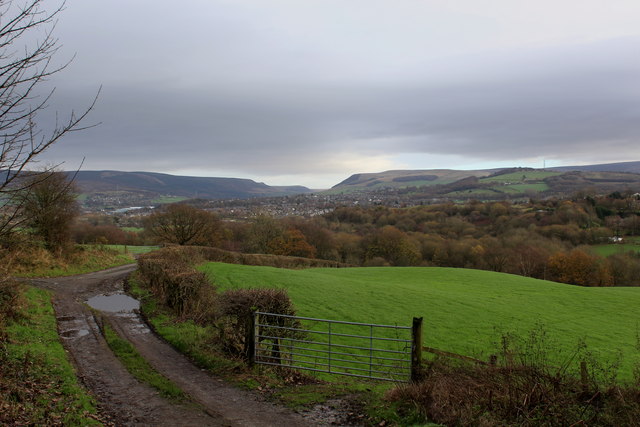
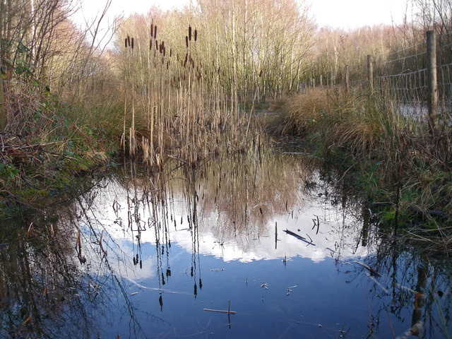
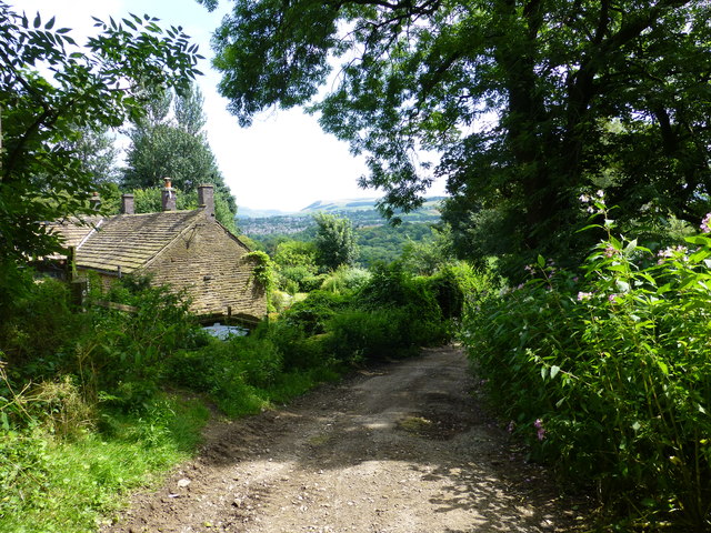
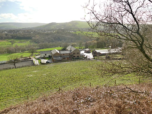
The village is surrounded by rolling hills and green fields, making it an idyllic destination for nature enthusiasts and those seeking a peaceful retreat. The Mudd is also home to several traditional English cottages, many of which date back to the 17th and 18th centuries, adding to its rustic appeal.

One of the notable landmarks in The Mudd is St. Peter's Church, a beautiful 19th-century church that stands at the heart of the village. The church features stunning stained glass windows and a peaceful churchyard, providing a tranquil spot for reflection.

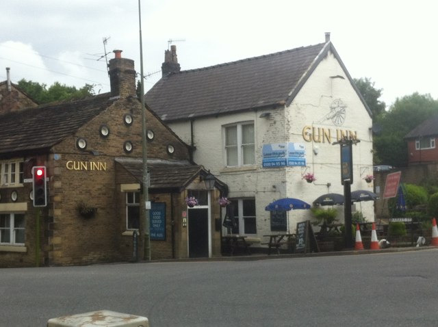
Despite its small size, The Mudd boasts a close-knit community that organizes various social events throughout the year. These events often take place in the village hall, providing an opportunity for residents to come together and celebrate. The Mudd also has a local pub, offering a cozy atmosphere and a selection of traditional British dishes.

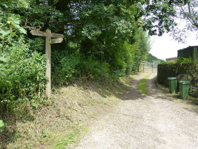
For those looking to explore the surrounding area, there are numerous walking and cycling trails that lead from The Mudd into the picturesque Cheshire countryside. Additionally, the nearby town of Congleton provides a range of amenities, including shops, restaurants, and leisure facilities.

Overall, The Mudd offers a peaceful and charming retreat for both residents and visitors, with its scenic beauty and community spirit making it a truly special place in Cheshire.

If you have any feedback on the listing, please let us know in the comments section below.
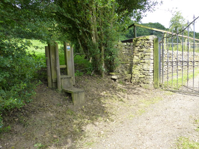
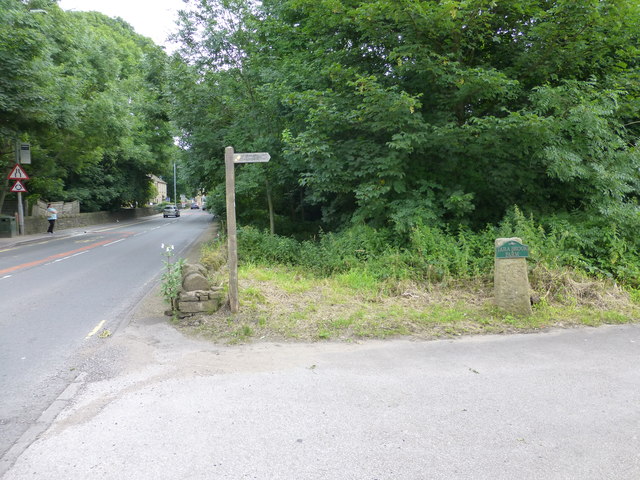
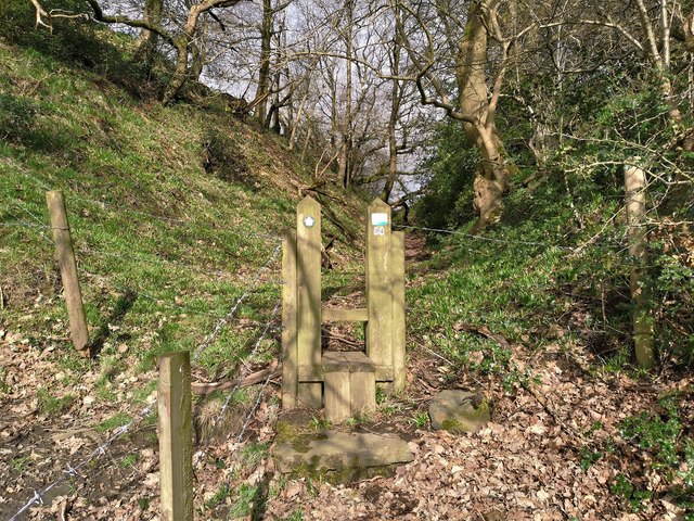
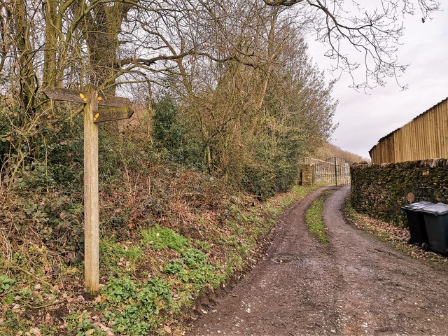
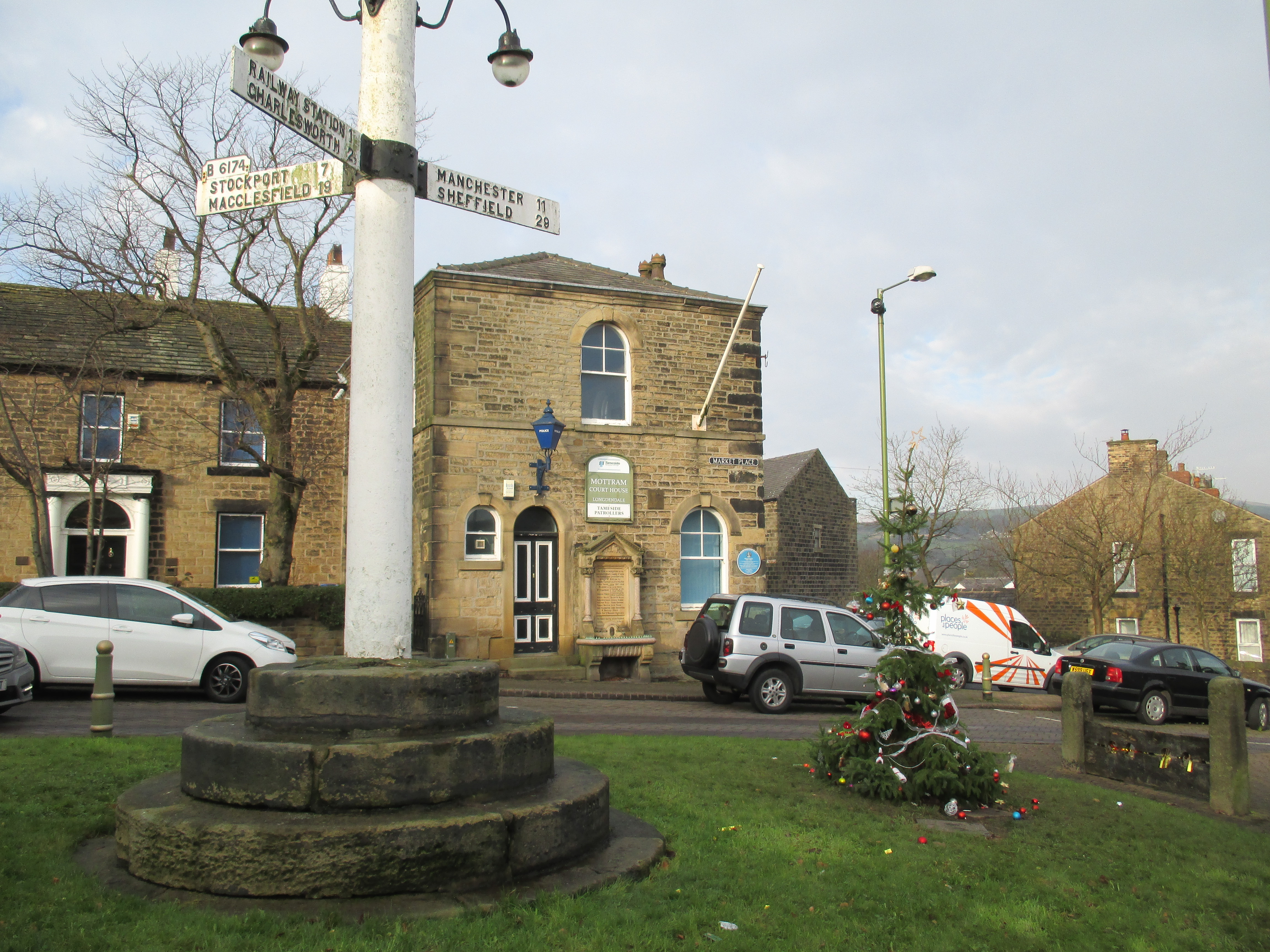
The Mudd Images

Images are sourced within 2km of 53.451758/-2.016525 or Grid Reference SJ9995. Thanks to Geograph Open Source API. All images are credited.

View South East from Hague End Pleasing view over the Etherow Valley towards the distant Dark Peak
View South East from Hague End
Pleasing view over the Etherow Valley towards the distant Dark Peak
Gamesley Woodlands (wildlife pond) Gamesley Woodlands runs alongside the Manchester to Glossop rail line, it was originally railway sidings which formed part of the Mottram and Dinting Marshalling Yard. When the sidings closed pioneer tree species appeared, recently a bridleway has been laid and this pond constructed for the benefit of the public.
Gamesley Woodlands (wildlife pond)
Gamesley Woodlands runs alongside the Manchester to Glossop rail line, it was originally railway sidings which formed part of the Mottram and Dinting Marshalling Yard. When the sidings closed pioneer tree species appeared, recently a bridleway has been laid and this pond constructed for the benefit of the public.
Hidden signpost near Pear Tree Farm The marker for the Etherow Goyt Valley Trail is on the left leading up stone steps. a large fingerpost is out of view marked Valley Way. The area is also marked on the map as The Hague, the manor house of this name is half a mile away.
Hidden signpost near Pear Tree Farm
The marker for the Etherow Goyt Valley Trail is on the left leading up stone steps. a large fingerpost is out of view marked Valley Way. The area is also marked on the map as The Hague, the manor house of this name is half a mile away.
Fingerpost at The Hague The way straight on towards the gate leads onto the path towards Woolley Bridge.
Fingerpost at The Hague
The way straight on towards the gate leads onto the path towards Woolley Bridge.
Parting of the ways at Pear Tree Farm The stole on the left leads onto the path for Mottram .The hidden unmarked bridleway for Woolley Bridge is beside the stone pillar next to the gate for Pear Tree Farm.
Parting of the ways at Pear Tree Farm
The stole on the left leads onto the path for Mottram .The hidden unmarked bridleway for Woolley Bridge is beside the stone pillar next to the gate for Pear Tree Farm.
Fingerpost for Mottram and The Hague at Woolley Bridge
Glossop Brook joins the River Etherow The River Etherow enters from the right and flows on into the distance, the faster flowing Glossop Brook enters from the left
Glossop Brook joins the River Etherow
The River Etherow enters from the right and flows on into the distance, the faster flowing Glossop Brook enters from the left
A57 through Hollingworth
Old Direction Sign - Signpost by the A57, Hollingworth, Mossley Parish Lantern finial - 3 arms; by the A57, in parish of Mossley (Tameside District), Hollingworth, junction of Mottram Moor and Woolley Lane, beside war memorial.

To be surveyed

Milestone Society National ID: CH_SK0096.
Old Direction Sign - Signpost by the A57, Hollingworth, Mossley Parish
Lantern finial - 3 arms; by the A57, in parish of Mossley (Tameside District), Hollingworth, junction of Mottram Moor and Woolley Lane, beside war memorial. To be surveyed Milestone Society National ID: CH_SK0096.
Looking over the Etherow Valley On a public footpath from Mottram
Looking over the Etherow Valley
On a public footpath from Mottram
Stile on path from Gamesley to Mottram On an old hollow way from the hamlet of The Hague up to Mottram
Stile on path from Gamesley to Mottram
On an old hollow way from the hamlet of The Hague up to Mottram
Paths for Broadbottom, Woolley Bridge and Melandra Castle
Elizabeth II postbox on Market Street, Hollingworth Outside the Post office.
Postbox No. SK14 190.

See <a href="https://www.geograph.org.uk/photo/6093743">SK0096 : Hollingworth Village Store and Post Office</a> for context.
Elizabeth II postbox on Market Street, Hollingworth
Outside the Post office. Postbox No. SK14 190. See SK0096 : Hollingworth Village Store and Post Office for context.
Hollingworth Village Store and Post Office On Market Street, Hollingworth.
Showing position of Postbox No. SK14 190.

See <a href="https://www.geograph.org.uk/photo/6093742">SK0096 : Elizabeth II postbox on Market Street, Hollingworth</a> for postbox.
Hollingworth Village Store and Post Office
On Market Street, Hollingworth. Showing position of Postbox No. SK14 190. See SK0096 : Elizabeth II postbox on Market Street, Hollingworth for postbox.
War Memorial, Hollingworth
The Gun Inn, Hollingworth On Market Street.
The Gun Inn, Hollingworth
On Market Street.
Sign for the Gun Inn, Hollingworth See <a href="https://www.geograph.org.uk/photo/6095012">SK0096 : The Gun Inn, Hollingworth</a> for context.
Sign for the Gun Inn, Hollingworth
Show me another place!

The Mudd is located at Grid Ref: SJ9995 (Lat: 53.451758, Lng: -2.016525)

Unitary Authority: Tameside

Police Authority: Greater Manchester

What 3 Words

///bluffing.soccer.spending. Near Longdendale, Manchester

Related Wikis

St Michael and All Angels Church, Mottram

St Michael and All Angels Church stands on Warhill overlooking the village of Mottram in Longdendale, Greater Manchester, England. The church is recorded...

Longendale Urban District

Longendale Urban District (also known as Longdendale Urban District) was, from 1936 to 1974, a local government district in the administrative county of...

Longdendale (ward)

Longdendale is an electoral ward of Tameside, England. It is represented in Westminster by Jonathan Reynolds Labour Co-operative MP for Stalybridge and...

Mottram in Longdendale

Mottram in Longdendale is a village in Tameside, Greater Manchester, England. At the 2011 census, the population for the ward of Longdendale, which includes...

Nearby Amenities

Located within 500m of 53.451758,-2.016525
Barrier: stile
Bicycle: yes
Foot: yes
Horse: yes
Note: Have to lift your bike
Lat/Long: 53.4495453/-2.0170621
Addr Housename: The Wagon
Description: no longer a pub..private housing
Disused Amenity: pub
Lat/Long: 53.4490846/-2.0164932
Barrier: stile
Material: wood
Stile: stepover
Lat/Long: 53.4497197/-2.0120597
Barrier: stile
Material: wood
Stile: stepover
Lat/Long: 53.4493236/-2.0113347
Barrier: stile
Lat/Long: 53.448324/-2.0169467
Barrier: stile
Lat/Long: 53.4479654/-2.0162431
Barrier: stile
Lat/Long: 53.4476068/-2.0155722
Barrier: stile
Lat/Long: 53.4474764/-2.0153502
Barrier: stile
Lat/Long: 53.4474035/-2.0151427
Barrier: stile
Lat/Long: 53.4474176/-2.0151106
Barrier: stile
Lat/Long: 53.4478741/-2.0145182
Barrier: stile
Lat/Long: 53.4492198/-2.0162281
Barrier: stile
Lat/Long: 53.4490955/-2.0148843
Barrier: stile
Lat/Long: 53.448906/-2.0133602
Barrier: stile
Lat/Long: 53.4490545/-2.0123671
Bus Stop
Ashworth Lane/Pack Horse Inn
Bench: no
Bin: no
Bus: yes
Naptan AtcoCode: 1800EH04981
Naptan Bearing: NE
Naptan CommonName: Ashworth Lane/Pack Horse Inn
Naptan Indicator: Car Park
Naptan Landmark: CAR PARK
Naptan NaptanCode: manawdpm
Naptan PlusbusZoneRef: MNCRPIC
Naptan ShortCommonName: Pack Horse Inn
Naptan Street: Ashworyth Lane
Naptan Verified: no
Network: TfGM
Public Transport: platform
Shelter: no
Source: naptan_import
Tactile Paving: no
Lat/Long: 53.4549882/-2.0129964
Bus Stop
Ashworth Lane/Gray Close
Bus: yes
Naptan AtcoCode: 1800EH04991
Naptan Bearing: NE
Naptan CommonName: Ashworth Lane/Gray Close
Naptan Indicator: O/s House 62
Naptan Landmark: O/S HOUSE 62
Naptan NaptanCode: manawdpt
Naptan PlusbusZoneRef: MNCRPIC
Naptan ShortCommonName: Gray Close
Naptan Street: ASHWORTH LANE
Naptan Verified: no
Network: TfGM
Public Transport: platform
Source: naptan_import
Lat/Long: 53.4524799/-2.0165043
Bus Stop
Ashworth Lane/Gray Close
Bench: no
Bin: no
Bus: yes
Lit: yes
Naptan AtcoCode: 1800EH05571
Naptan Bearing: SW
Naptan CommonName: Ashworth Lane/Gray Close
Naptan Indicator: Playing Fields
Naptan Landmark: PLAYING FIELDS
Naptan NaptanCode: mantdwgp
Naptan PlusbusZoneRef: MNCRPIC
Naptan ShortCommonName: Gray Close
Naptan Street: ASHWORTH LANE
Naptan Verified: no
Network: TfGM
Public Transport: platform
Shelter: no
Source: naptan_import
Tactile Paving: no
Lat/Long: 53.452417/-2.0163688
Bus Stop
Ashworth Lane/Day Grove
Bus: yes
Naptan AtcoCode: 1800EH13941
Naptan Bearing: NE
Naptan CommonName: Ashworth Lane/Day Grove
Naptan Indicator: House Number 40
Naptan Landmark: Mottram Cricket Club
Naptan NaptanCode: mantmtdm
Naptan Notes: NEW STOP
Naptan PlusbusZoneRef: MNCRPIC
Naptan ShortCommonName: Day Grove
Naptan Street: ASHWORTH LANE
Naptan Verified: no
Network: TfGM
Public Transport: platform
Source: naptan_import
Lat/Long: 53.4535228/-2.0152247
Bus Stop
Stockport Road/Ashworth Lane
Bus: yes
Naptan AtcoCode: 1800EH37161
Naptan Bearing: S
Naptan CommonName: Stockport Road/Ashworth Lane
Naptan Indicator: Os House 15
Naptan Landmark: HOUSE 15
Naptan NaptanCode: mandawtp
Naptan PlusbusZoneRef: MNCRPIC
Naptan ShortCommonName: Ashworth Lane
Naptan Street: STOCKPORT ROAD
Naptan Verified: no
Network: TfGM
Public Transport: platform
Source: naptan_import
Lat/Long: 53.4507978/-2.0238521
Bus Stop
Hattersley, John Kennedy Road / near John Kennedy Garden
Bus: yes
Naptan AtcoCode: 1800EH37401
Naptan Bearing: N
Naptan CommonName: John Kennedy Road/John Kennedy Garden
Naptan Indicator: Opp House 15
Naptan Landmark: OPP HOUSE 15
Naptan NaptanCode: mandgamd
Naptan PlusbusZoneRef: MNCRPIC
Naptan ShortCommonName: John Kennedy Gdns
Naptan Street: John Kennedy Road
Naptan Verified: no
Network: TfGM
Operator: TfGM
Public Transport: platform
Source: naptan_import
Lat/Long: 53.4557879/-2.0153611
Bus Stop
Hattersley, John Kennedy Road / opposite John Kennedy Garden
Bus: yes
Naptan AtcoCode: 1800EH37411
Naptan Bearing: SW
Naptan CommonName: John Kennedy Road/John Kennedy Garden
Naptan Indicator: Terminus
Naptan Landmark: TERMINUS
Naptan NaptanCode: mandgamg
Naptan PlusbusZoneRef: MNCRPIC
Naptan ShortCommonName: John Kennedy Gdns
Naptan Street: John Kennedy Road
Naptan Verified: no
Network: TfGM
Operator: TfGM
Public Transport: platform
Source: naptan_import
Lat/Long: 53.4551676/-2.0157223
Bus Stop
Hattersley, John Kennedy Road / near Longdale Drive
Bus: yes
Naptan AtcoCode: 1800EH37421
Naptan Bearing: N
Naptan CommonName: John Kennedy Road/Longdale Drive
Naptan Indicator: O/s House 30
Naptan Landmark: O/S HOUSE 30
Naptan NaptanCode: mandgamj
Naptan PlusbusZoneRef: MNCRPIC
Naptan ShortCommonName: Longdale Drive
Naptan Street: John Kennedy Road
Naptan Verified: no
Network: TfGM
Operator: TfGM
Public Transport: platform
Source: naptan_import
Lat/Long: 53.4544933/-2.0167762
Bus Stop
Hattersley, John Kennedy Road / near Longdale Drive
Bus: yes
Naptan AtcoCode: 1800EH37431
Naptan Bearing: SW
Naptan CommonName: John Kennedy Road/Longdale Drive
Naptan Indicator: O/s House 63
Naptan Landmark: O/S HOUSE 63
Naptan NaptanCode: mandgamp
Naptan PlusbusZoneRef: MNCRPIC
Naptan ShortCommonName: Longdale Drive
Naptan Street: John Kennedy Road
Naptan Verified: no
Network: TfGM
Operator: TfGM
Public Transport: platform
Source: naptan_import
Lat/Long: 53.4540798/-2.0172579
Bus Stop
Hattersley, John Kennedy Road / opposite Lowry Grove
Bus: yes
Naptan AtcoCode: 1800EH37441
Naptan Bearing: S
Naptan CommonName: John Kennedy Road/Lowry Grove
Naptan Indicator: Opp House 94
Naptan Landmark: HOUSE 33
Naptan NaptanCode: mandgamt
Naptan PlusbusZoneRef: MNCRPIC
Naptan ShortCommonName: Lowry Grove
Naptan Street: John Kennedy Road
Naptan Verified: no
Network: TfGM
Operator: TfGM
Public Transport: platform
Source: naptan_import
Lat/Long: 53.4525514/-2.0193354
Bus Stop
Hattersley, John Kennedy Road / near Lowry Grove
Bus: yes
Naptan AtcoCode: 1800EH37451
Naptan Bearing: N
Naptan CommonName: John Kennedy Road/Lowry Grove
Naptan Indicator: Flat Cap Pub
Naptan Landmark: HOUSE 17
Naptan NaptanCode: mandgamw
Naptan PlusbusZoneRef: MNCRPIC
Naptan ShortCommonName: Lowry Grove
Naptan Street: John Kennedy Road
Naptan Verified: no
Network: TfGM
Operator: TfGM
Public Transport: platform
Source: naptan_import
Lat/Long: 53.4519581/-2.0197116
Bus Stop
Ashworth Lane/Pack Horse Inn
Bus: yes
Naptan AtcoCode: 1800EH37461
Naptan Bearing: SW
Naptan CommonName: Ashworth Lane/Pack Horse Inn
Naptan Indicator: Opp Pack Horse
Naptan Landmark: OPP PACK HORSE
Naptan NaptanCode: mandgapa
Naptan PlusbusZoneRef: MNCRPIC
Naptan ShortCommonName: Pack Horse Inn
Naptan Street: ASHWORTH LANE
Naptan Verified: no
Network: TfGM
Public Transport: platform
Shelter: no
Source: naptan_import
Tactile Paving: no
Lat/Long: 53.4553658/-2.0124393
Bus Stop
Ashworth Lane/Day Grove
Bus: yes
Naptan AtcoCode: 1800EH37471
Naptan Bearing: SW
Naptan CommonName: Ashworth Lane/Day Grove
Naptan Indicator: Cricket Ground
Naptan Landmark: Mottram Cricket Club
Naptan NaptanCode: mandgapd
Naptan PlusbusZoneRef: MNCRPIC
Naptan ShortCommonName: Day Grove
Naptan Street: ASHWORTH LANE
Naptan Verified: no
Network: TfGM
Public Transport: platform
Source: naptan_import
Lat/Long: 53.4535857/-2.0148784
Bus Stop
Hattersley, Ashworth Lane / opposite John Kennedy Road
Bus: yes
Naptan AtcoCode: 1800EH37481
Naptan Bearing: W
Naptan CommonName: Ashworth Lane/John Kennedy Road
Naptan Indicator: Opp Flat Cap
Naptan Landmark: HOUSE 109
Naptan NaptanCode: mandgapg
Naptan PlusbusZoneRef: MNCRPIC
Naptan ShortCommonName: John Kennedy Road
Naptan Street: ASHWORTH LANE
Naptan Verified: no
Network: TfGM
Operator: TfGM
Public Transport: platform
Source: naptan_import
Lat/Long: 53.4513287/-2.0204341
Bus Stop
Hattersley, Ashworth Lane / opposite Garnett Road
Bus: yes
Naptan AtcoCode: 1800EH37491
Naptan Bearing: W
Naptan CommonName: Ashworth Lane/Garnett Road
Naptan Indicator: Nr House 119
Naptan Landmark: NR HOUSE 119
Naptan NaptanCode: mandgapj
Naptan PlusbusZoneRef: MNCRPIC
Naptan ShortCommonName: Garnett Road
Naptan Street: ASHWORTH LANE
Naptan Verified: no
Network: TfGM
Operator: TfGM
Public Transport: platform
Source: naptan_import
Lat/Long: 53.4513193/-2.0226326
Bus Stop
Hattersley, Ashworth Lane / near Garnett Road
Bus: yes
Naptan AtcoCode: 1800EH37501
Naptan Bearing: E
Naptan CommonName: Ashworth Lane/Garnett Road
Naptan Indicator: Opp House 117
Naptan Landmark: OPP HOUSE 117
Naptan NaptanCode: mandgapm
Naptan PlusbusZoneRef: MNCRPIC
Naptan ShortCommonName: Garnett Road
Naptan Street: ASHWORTH LANE
Naptan Verified: no
Network: TfGM
Operator: TfGM
Public Transport: platform
Source: naptan_import
Lat/Long: 53.4514183/-2.0222562
Bus Stop
Broadbottom Road/Mottram Library
Bus: yes
Naptan AtcoCode: 1800EH48621
Naptan Bearing: S
Naptan CommonName: Broadbottom Road/Mottram Library
Naptan Indicator: Library Opp
Naptan Landmark: LIBRARY OPP
Naptan NaptanCode: mandjdtw
Naptan PlusbusZoneRef: MNCRPIC
Naptan ShortCommonName: Mottram Library
Naptan Street: Broadbottom Road
Naptan Verified: no
Network: TfGM
Public Transport: platform
Source: naptan_import
Lat/Long: 53.4543411/-2.0120626
Bus Stop
Broadbottom Road/Mottram Library
Bench: yes
Bin: no
Bus: yes
Naptan AtcoCode: 1800EH48631
Naptan Bearing: N
Naptan CommonName: Broadbottom Road/Mottram Library
Naptan Indicator: Library
Naptan Landmark: LIBRARY
Naptan NaptanCode: mandjdwa
Naptan PlusbusZoneRef: MNCRPIC
Naptan ShortCommonName: Mottram Library
Naptan Street: Broadbottom Road
Naptan Verified: no
Network: TfGM
Public Transport: platform
Shelter: no
Source: naptan_import
Lat/Long: 53.4540984/-2.0124691
Bus Stop
Broadbottom Road/Pearl Way
Bus: yes
Naptan AtcoCode: 1800EH48641
Naptan Bearing: N
Naptan CommonName: Broadbottom Road/Pearl Way
Naptan Indicator: Op House 135
Naptan Landmark: OP HOUSE
Naptan NaptanCode: mandjdwd
Naptan Notes: INDICATOR AMENDED
Naptan PlusbusZoneRef: MNCRPIC
Naptan ShortCommonName: Pearl Way
Naptan Street: Broadbottom Road
Naptan Verified: no
Network: TfGM
Public Transport: platform
Shelter: no
Source: naptan_import
Lat/Long: 53.4513835/-2.0149379
Bus Stop
Broadbottom Road/Pearl Way
Bus: yes
Naptan AtcoCode: 1800EH48651
Naptan Bearing: S
Naptan CommonName: Broadbottom Road/Pearl Way
Naptan Indicator: O/s 135a
Naptan Landmark: O/S 135A
Naptan NaptanCode: mandjdwg
Naptan PlusbusZoneRef: MNCRPIC
Naptan ShortCommonName: Pearl Way
Naptan Street: Broadbottom Road
Naptan Verified: no
Network: TfGM
Public Transport: platform
Source: naptan_import
Wheelchair: no
Lat/Long: 53.4511947/-2.0149077
Bus Stop
Broadbottom Road/The Waggon
Bus: yes
Naptan AtcoCode: 1800EH48661
Naptan Bearing: S
Naptan CommonName: Broadbottom Road/The Waggon
Naptan Indicator: The Wagon
Naptan Landmark: HOUSE 195
Naptan NaptanCode: mandjdwj
Naptan PlusbusZoneRef: MNCRPIC
Naptan ShortCommonName: The Waggon
Naptan Street: Broadbottom Road
Naptan Verified: no
Network: TfGM
Public Transport: platform
Source: naptan_import
Lat/Long: 53.4488304/-2.0168342
Bus Stop
Broadbottom Road/The Waggon
Bus: yes
Naptan AtcoCode: 1800EH48671
Naptan Bearing: N
Naptan CommonName: Broadbottom Road/The Waggon
Naptan Indicator: The Wagon Opp
Naptan Landmark: WILMSLOW Avenue
Naptan NaptanCode: mandjdwm
Naptan PlusbusZoneRef: MNCRPIC
Naptan ShortCommonName: The Waggon
Naptan Street: Broadbottom Road
Naptan Verified: no
Network: TfGM
Public Transport: platform
Source: naptan_import
Lat/Long: 53.4487675/-2.01706
Power: tower
Lat/Long: 53.4536758/-2.0229033
Power: tower
Lat/Long: 53.4510565/-2.0227846
Fuel
Tesco petrol station
Brand: Tesco
Brand Wikidata: Q487494
Brand Wikipedia: en:Tesco
Name En: Tesco petrol station
Website: https://www.tesco.com/store-locator/hyde/stockport-road/petrol-filling-station
Lat/Long: 53.4517862/-2.0222584
Traffic Signals
Traffic Signals: signal
Lat/Long: 53.4514003/-2.0216702
Mini Roundabout
Direction: clockwise
Lat/Long: 53.4520418/-2.0229261
Crossing
Crossing: traffic_signals
Crossing Ref: puffin
Kerb: lowered
Tactile Paving: yes
Lat/Long: 53.4514835/-2.0240217
Crossing
Crossing: traffic_signals
Crossing Ref: puffin
Kerb: lowered
Tactile Paving: yes
Lat/Long: 53.4513621/-2.0238268
Barrier: cycle_barrier
Lat/Long: 53.4499514/-2.0210912
Defibrillator
Defibrillator Location: On outside wall.
Emergency: defibrillator
Lat/Long: 53.4516041/-2.0235944
Toilets
Lat/Long: 53.4531288/-2.0234202
Generator Method: photovoltaic
Generator Output Electricity: yes
Generator Source: solar
Generator Type: solar_photovoltaic_panel
Location: roof
Power: generator
Lat/Long: 53.4513164/-2.016869
Generator Method: photovoltaic
Generator Output Electricity: yes
Generator Source: solar
Generator Type: solar_photovoltaic_panel
Location: roof
Power: generator
Lat/Long: 53.450414/-2.015965
Direction: 125
Generator Method: photovoltaic
Generator Output Electricity: yes
Generator Solar Modules: 16
Generator Source: solar
Generator Type: solar_photovoltaic_panel
Location: roof
Power: generator
Lat/Long: 53.4556854/-2.0131496
Direction: 125
Generator Method: photovoltaic
Generator Output Electricity: yes
Generator Solar Modules: 14
Generator Source: solar
Generator Type: solar_photovoltaic_panel
Location: roof
Power: generator
Lat/Long: 53.4556273/-2.0132605
Direction: 215
Generator Method: photovoltaic
Generator Output Electricity: yes
Generator Solar Modules: 6
Generator Source: solar
Generator Type: solar_photovoltaic_panel
Location: roof
Power: generator
Lat/Long: 53.4554875/-2.0130786
Direction: 125
Generator Method: photovoltaic
Generator Output Electricity: yes
Generator Solar Modules: 16
Generator Source: solar
Generator Type: solar_photovoltaic_panel
Location: roof
Power: generator
Lat/Long: 53.45539/-2.0135403
Direction: 125
Generator Method: photovoltaic
Generator Output Electricity: yes
Generator Solar Modules: 9
Generator Source: solar
Generator Type: solar_photovoltaic_panel
Location: roof
Power: generator
Lat/Long: 53.4552931/-2.0136882
Direction: 125
Generator Method: photovoltaic
Generator Output Electricity: yes
Generator Solar Modules: 16
Generator Source: solar
Generator Type: solar_photovoltaic_panel
Location: roof
Power: generator
Lat/Long: 53.4554378/-2.0139917
Direction: 125
Generator Method: photovoltaic
Generator Output Electricity: yes
Generator Solar Modules: 16
Generator Source: solar
Generator Type: solar_photovoltaic_panel
Location: roof
Power: generator
Lat/Long: 53.4553592/-2.0140967
Direction: 125
Generator Method: photovoltaic
Generator Output Electricity: yes
Generator Solar Modules: 10
Generator Source: solar
Generator Type: solar_photovoltaic_panel
Location: roof
Power: generator
Lat/Long: 53.4551445/-2.0143652
Direction: 125
Generator Method: photovoltaic
Generator Output Electricity: yes
Generator Solar Modules: 16
Generator Source: solar
Generator Type: solar_photovoltaic_panel
Location: roof
Power: generator
Lat/Long: 53.4550605/-2.0144664
Direction: 125
Generator Method: photovoltaic
Generator Output Electricity: yes
Generator Solar Modules: 16
Generator Source: solar
Generator Type: solar_photovoltaic_panel
Location: roof
Power: generator
Lat/Long: 53.4550483/-2.0139864
Direction: 125
Generator Method: photovoltaic
Generator Output Electricity: yes
Generator Solar Modules: 16
Generator Source: solar
Generator Type: solar_photovoltaic_panel
Location: roof
Power: generator
Lat/Long: 53.4549667/-2.0140905
Direction: 125
Generator Method: photovoltaic
Generator Output Electricity: yes
Generator Solar Modules: 16
Generator Source: solar
Generator Type: solar_photovoltaic_panel
Location: roof
Power: generator
Lat/Long: 53.4548901/-2.0141863
Direction: 125
Generator Method: photovoltaic
Generator Output Electricity: yes
Generator Solar Modules: 16
Generator Source: solar
Generator Type: solar_photovoltaic_panel
Location: roof
Power: generator
Lat/Long: 53.4548188/-2.0142795
Direction: 125
Generator Method: photovoltaic
Generator Output Electricity: yes
Generator Solar Modules: 14
Generator Source: solar
Generator Type: solar_photovoltaic_panel
Location: roof
Power: generator
Lat/Long: 53.4547179/-2.0143853
Direction: 125
Generator Method: photovoltaic
Generator Output Electricity: yes
Generator Solar Modules: 16
Generator Source: solar
Generator Type: solar_photovoltaic_panel
Location: roof
Power: generator
Lat/Long: 53.4547477/-2.0148647
Direction: 125
Generator Method: photovoltaic
Generator Output Electricity: yes
Generator Solar Modules: 16
Generator Source: solar
Generator Type: solar_photovoltaic_panel
Location: roof
Power: generator
Lat/Long: 53.4549092/-2.0146623
Direction: 125
Generator Method: photovoltaic
Generator Output Electricity: yes
Generator Solar Modules: 16
Generator Source: solar
Generator Type: solar_photovoltaic_panel
Location: roof
Power: generator
Lat/Long: 53.4557479/-2.0136034
Direction: 125
Generator Method: photovoltaic
Generator Output Electricity: yes
Generator Solar Modules: 16
Generator Source: solar
Generator Type: solar_photovoltaic_panel
Location: roof
Power: generator
Lat/Long: 53.4556711/-2.0136999
Direction: 125
Generator Method: photovoltaic
Generator Output Electricity: yes
Generator Solar Modules: 16
Generator Source: solar
Generator Type: solar_photovoltaic_panel
Location: roof
Power: generator
Lat/Long: 53.4555921/-2.0137965
Direction: 125
Generator Method: photovoltaic
Generator Output Electricity: yes
Generator Solar Modules: 10
Generator Source: solar
Generator Type: solar_photovoltaic_panel
Location: roof
Power: generator
Lat/Long: 53.455527/-2.0138871
Generator Method: photovoltaic
Generator Output Electricity: yes
Generator Source: solar
Generator Type: solar_photovoltaic_panel
Location: roof
Power: generator
Lat/Long: 53.454875/-2.0157344
Direction: 125
Generator Method: photovoltaic
Generator Output Electricity: yes
Generator Solar Modules: 14
Generator Source: solar
Generator Type: solar_photovoltaic_panel
Location: roof
Power: generator
Lat/Long: 53.4543453/-2.0154153
Direction: 215
Generator Method: photovoltaic
Generator Output Electricity: yes
Generator Solar Modules: 14
Generator Source: solar
Generator Type: solar_photovoltaic_panel
Location: roof
Power: generator
Lat/Long: 53.4538149/-2.0166405
Direction: 215
Generator Method: photovoltaic
Generator Output Electricity: yes
Generator Solar Modules: 18
Generator Source: solar
Generator Type: solar_photovoltaic_panel
Location: roof
Power: generator
Lat/Long: 53.4536008/-2.0168204
Direction: SE
Generator Method: photovoltaic
Generator Output Electricity: yes
Generator Solar Modules: 18
Generator Source: solar
Generator Type: solar_photovoltaic_panel
Location: roof
Power: generator
Lat/Long: 53.4535881/-2.017843
Direction: SE
Generator Method: photovoltaic
Generator Output Electricity: yes
Generator Solar Modules: 18
Generator Source: solar
Generator Type: solar_photovoltaic_panel
Location: roof
Power: generator
Lat/Long: 53.4536406/-2.0177545
Direction: SE
Generator Method: photovoltaic
Generator Output Electricity: yes
Generator Solar Modules: 14
Generator Source: solar
Generator Type: solar_photovoltaic_panel
Location: roof
Power: generator
Lat/Long: 53.4537267/-2.0175774
Generator Method: photovoltaic
Generator Output Electricity: yes
Generator Source: solar
Generator Type: solar_photovoltaic_panel
Location: roof
Power: generator
Lat/Long: 53.4537937/-2.0182449
Generator Method: photovoltaic
Generator Output Electricity: yes
Generator Source: solar
Generator Type: solar_photovoltaic_panel
Location: roof
Power: generator
Lat/Long: 53.4539502/-2.0189289
Generator Method: photovoltaic
Generator Output Electricity: yes
Generator Source: solar
Generator Type: solar_photovoltaic_panel
Location: roof
Power: generator
Lat/Long: 53.4554244/-2.0159597
Generator Method: photovoltaic
Generator Output Electricity: yes
Generator Source: solar
Generator Type: solar_photovoltaic_panel
Location: roof
Power: generator
Lat/Long: 53.4561032/-2.0155305
Entrance: yes
Wheelchair: yes
Lat/Long: 53.4529405/-2.0232493
Atm
Fee: no
Lat/Long: 53.4530222/-2.0230419
Atm
Fee: no
Lat/Long: 53.4530265/-2.0229738
Direction: 125
Generator Method: photovoltaic
Generator Output Electricity: yes
Generator Solar Modules: 6
Generator Source: solar
Generator Type: solar_photovoltaic_panel
Location: roof
Power: generator
Lat/Long: 53.4554874/-2.013935
The data included in this document is from www.openstreetmap.org. The data is made available under ODbL.

Have you been to The Mudd?

Leave your review of The Mudd below (or comments, questions and feedback).