Boothgate

Settlement in Derbyshire Amber Va

England

Boothgate

Street Lane Methodists Church Street Lane Methodists Church, Street Lane (road name), Street Lane (Village name), Derbyshire. This village and church sit on the old Ryknield Street Roman Road.
Street Lane Methodists Church Credit: Rob Bradford

Boothgate is a small, picturesque village located in the county of Derbyshire, England. Situated in the heart of the Peak District National Park, it offers breathtaking views of rolling hills, lush green valleys, and charming stone cottages. The village is nestled within a tranquil and idyllic setting, making it a popular destination for tourists seeking a peaceful retreat.

Boothgate is known for its rich history, dating back to medieval times. The village retains its traditional character with well-preserved architectural gems, including the ancient St. Mary's Church, which dates back to the 12th century. The church is a prominent landmark, with its striking tower and beautiful stained glass windows.

In addition to its historical significance, Boothgate is also renowned for its outdoor activities. The surrounding landscape provides endless opportunities for hikers, cyclists, and nature enthusiasts to explore the breathtaking scenery. The village is a gateway to a network of well-maintained footpaths, leading to the nearby moors, woodlands, and picturesque viewpoints.

Despite its small size, Boothgate boasts a close-knit community that takes pride in organizing various events and festivals throughout the year. The village fair, held annually, attracts visitors from far and wide, showcasing local crafts, food, and entertainment.

Boothgate offers a range of amenities to cater to both residents and visitors, including quaint tea rooms, traditional pubs, and a handful of bed and breakfast accommodations. Its close proximity to larger towns and cities, such as Derby and Sheffield, ensures that all essential services are within easy reach.

Overall, Boothgate is a hidden gem in Derbyshire, offering a perfect blend of natural beauty, history, and community spirit, making it a must-visit destination for those seeking a tranquil and authentic English countryside experience.

If you have any feedback on the listing, please let us know in the comments section below.
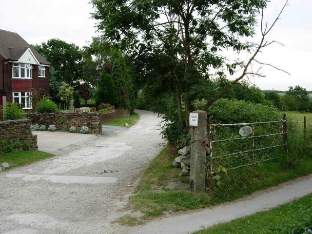
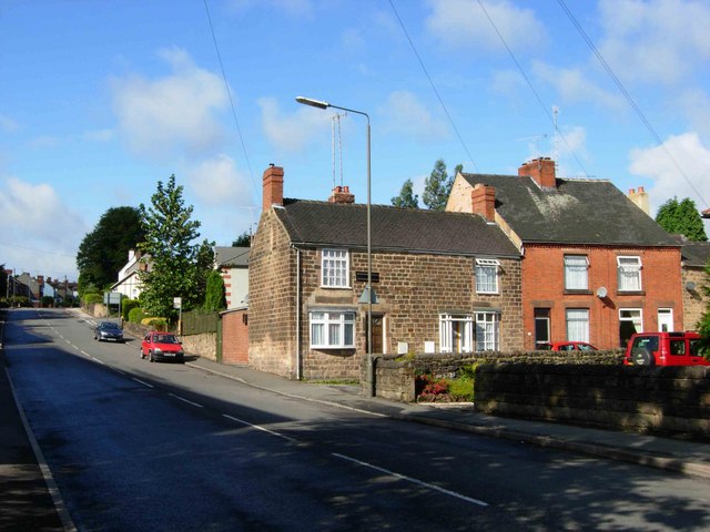
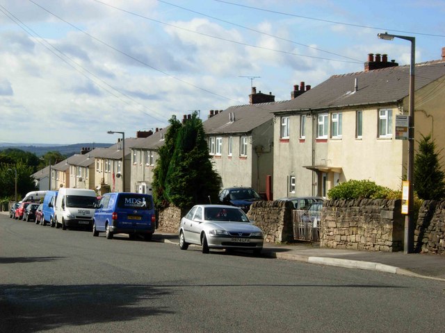
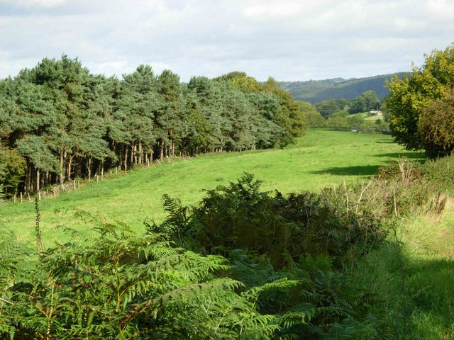
Boothgate Images

Images are sourced within 2km of 53.039307/-1.4482754 or Grid Reference SK3749. Thanks to Geograph Open Source API. All images are credited.

Street Lane Methodists Church Street Lane Methodists Church, Street Lane (road name), Street Lane (Village name), Derbyshire. This village and church sit on the old Ryknield Street Roman Road.
Street Lane Methodists Church
Street Lane Methodists Church, Street Lane (road name), Street Lane (Village name), Derbyshire. This village and church sit on the old Ryknield Street Roman Road.
Kilburn Road, Openwoodgate From this point the A609 descends into the Derwent Valley at Belper.  The pub is the Seven Stars.
Kilburn Road, Openwoodgate
From this point the A609 descends into the Derwent Valley at Belper. The pub is the Seven Stars.
Over Lane, Openwoodgate Looking towards Heage.
Over Lane, Openwoodgate
Looking towards Heage.
Morley Close, Openwoodgate A small modern development of bungalows off Over Lane between Openwoodgate and Heage.
Morley Close, Openwoodgate
A small modern development of bungalows off Over Lane between Openwoodgate and Heage.
Park Lane, Heage At the southern end of Heage, Park Lane becomes a 'road used as a public path' leading to Morley Park.
Park Lane, Heage
At the southern end of Heage, Park Lane becomes a 'road used as a public path' leading to Morley Park.
Street Lane Street Lane, running from Upper Hartshay towards Kilburn, is part of the Roman Ryknild Street - hence the straightness.
Street Lane
Street Lane, running from Upper Hartshay towards Kilburn, is part of the Roman Ryknild Street - hence the straightness.
Spencer Road, Belper Looking towards the town centre.
Spencer Road, Belper
Looking towards the town centre.
Crich Lane, Belper Looking down towards the town centre.
Crich Lane, Belper
Looking down towards the town centre.
View near Broadholm To the west of Crich Lane, just north of the built-up area of Belper.
View near Broadholm
To the west of Crich Lane, just north of the built-up area of Belper.
Farmland west of Heage Seen from the B6013 Belper - Heage road.
Farmland west of Heage
Seen from the B6013 Belper - Heage road.
Footpath at White Moor This footpath leads from White Moor towards Heage. Suburban development on the northern edge of Belper can be seen in the distance.
Footpath at White Moor
This footpath leads from White Moor towards Heage. Suburban development on the northern edge of Belper can be seen in the distance.
St Marks Church, Openwoodgate. The wrought iron gates to this church were made and erected as a memorial for the second world war.
St Marks Church, Openwoodgate.
The wrought iron gates to this church were made and erected as a memorial for the second world war.
Openwood Road Originally known as the Gang Road, this was an un-adopted un-surfaced lane which the council refused to maintain. In the early 50s a group of residence found old written records which enabled them to take the council to court and win the case. The first house on the right was built as a chip shop.
Openwood Road
Originally known as the Gang Road, this was an un-adopted un-surfaced lane which the council refused to maintain. In the early 50s a group of residence found old written records which enabled them to take the council to court and win the case. The first house on the right was built as a chip shop.
Morley Park furnaces The Morley Park area had mines for iron and coal; these two blast furnaces were built in 1780 and 1818, and were closed by 1874. This field was an ironworks, with tramways connecting iron casting sheds and coke ovens.
Morley Park furnaces
The Morley Park area had mines for iron and coal; these two blast furnaces were built in 1780 and 1818, and were closed by 1874. This field was an ironworks, with tramways connecting iron casting sheds and coke ovens.
Far Laund Near the junction with Ashford Rise.
Far Laund
Near the junction with Ashford Rise.
Far Laund Just over the rise the road becomes the Chesterfield Road.
Far Laund
Just over the rise the road becomes the Chesterfield Road.
Modern House, Arkwright Avenue
A38 at Upper Hartshay The stretch of the A38 north of Derby was built as completely new road rather than an improved alignment of an existing road. Looking south from the B6374 bridge.
A38 at Upper Hartshay
The stretch of the A38 north of Derby was built as completely new road rather than an improved alignment of an existing road. Looking south from the B6374 bridge.
Show me another place!

Boothgate is located at Grid Ref: SK3749 (Lat: 53.039307, Lng: -1.4482754)

Administrative County: Derbyshire

District: Amber Va

Police Authority: Derbyshire

What 3 Words

///twigs.soonest.fades. Near Heage, Derbyshire

Nearby Locations

Boothgate

Related Wikis

Morley Park

Morley Park is an area within Heage, in the parish of Ripley in the English county of Derbyshire, north of Derby. It is about five miles north of the village...

Heage

Heage is a village and former civil parish, now in the parish of Ripley, in the Amber Valley district, in the county of Derbyshire, England. It is situated...

St Luke's Church, Heage

St Luke's Church, Heage is a Grade II* listed parish church in the Church of England in Heage, Derbyshire. == History == There was a church in existence...
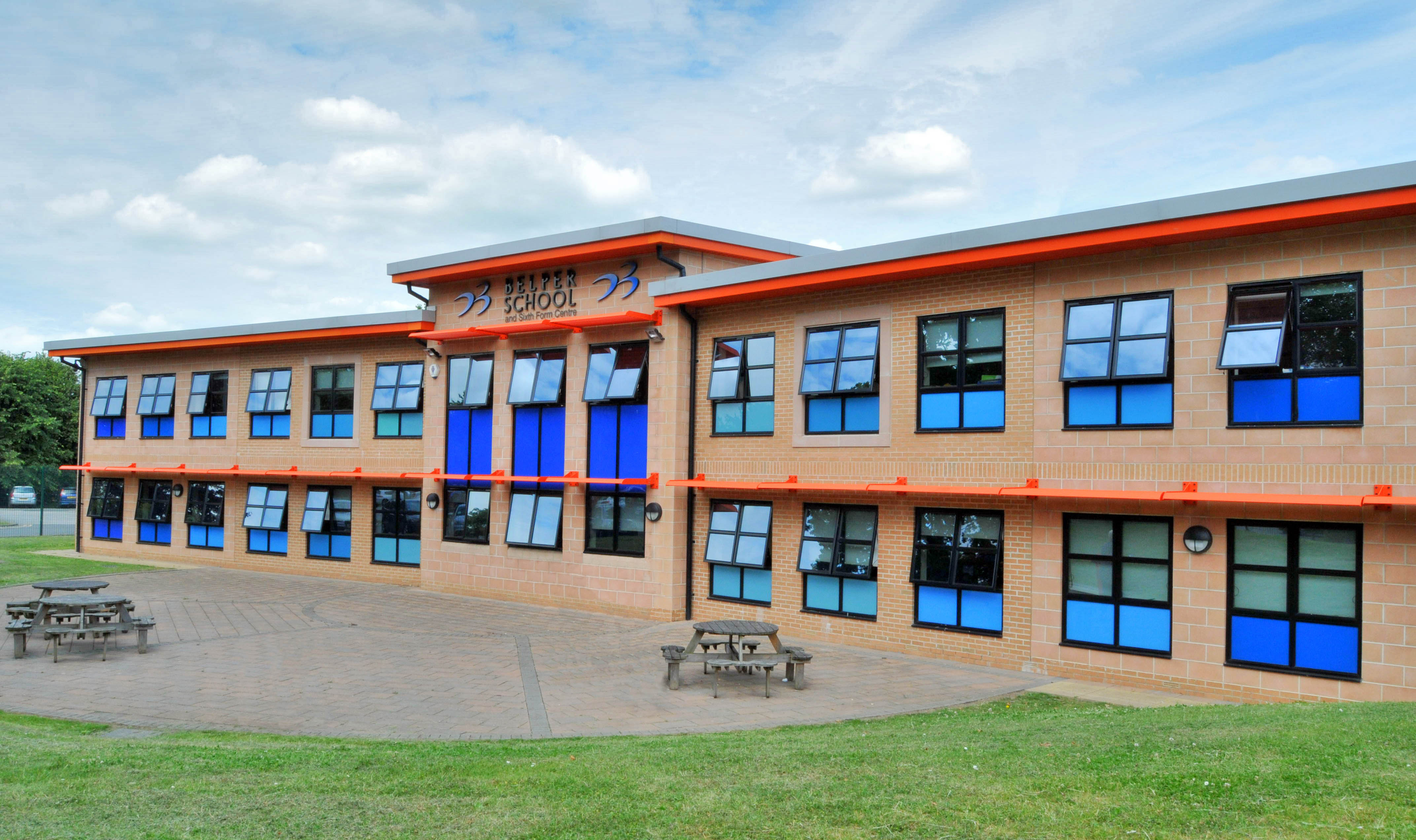
Belper School

Belper School and Sixth Form Centre is a foundation secondary school located in the north-east of Belper, Derbyshire, England. In October 2019, Ofsted...

Heage Windmill

Heage Windmill, in Heage, Derbyshire, is a restored windmill, built in the 1790s. After standing unused since 1919, it was restored to working order in...

Street Lane

Street Lane is a hamlet in the Amber Valley district of Derbyshire, England. It is in close proximity to the nearby town of Ripley. Street Lane is a linear...

Belper Urban District

Belper was an Urban District in Derbyshire, England from 1894 to 1974. It was created under the Local Government Act 1894. It was enlarged in 1934 when...
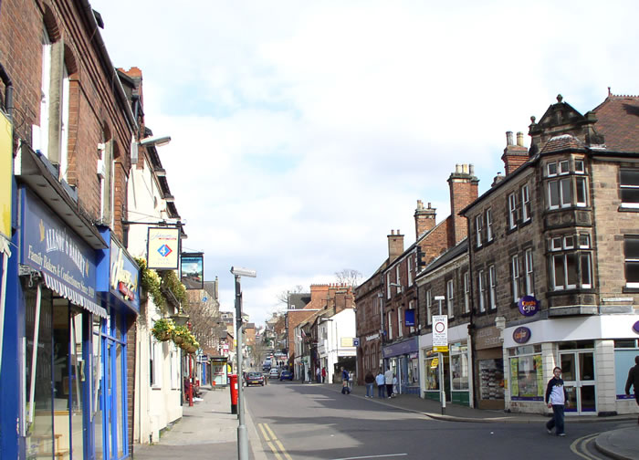
Belper

Belper () is a town and civil parish in the local government district of Amber Valley in Derbyshire, England, located about 7 miles (11 km) north of Derby...

Nearby Amenities

Located within 500m of 53.039307,-1.4482754
Boothgate
Is In: Derbyshire, England, UK
Place: village
Wikidata: Q4943938
Lat/Long: 53.0387011/-1.4480494
Turning Circle
Lat/Long: 53.04171/-1.4470723
Post Box
Brand: Royal Mail
Brand Wikidata: Q638098
Brand Wikipedia: en:Royal Mail
Operator: Royal Mail
Operator Wikidata: Q638098
Ref: DE56 430
Lat/Long: 53.0424154/-1.4462609
Fast Food
The Chippy
Addr City: Belper
Addr Housenumber: 213
Addr Postcode: DE56 2AB
Addr Street: Park Road
Addr Village: Heage
Cuisine: fish_and_chips
Ele: 124
Old Fhrs Id: 25054
Lat/Long: 53.04214/-1.4460736
Pub
The Windmill Inn
Addr City: Belper
Addr Housenumber: 215
Addr Postcode: DE56 2AB
Addr Street: Park Road
Addr Village: Heage
Car Park: yes
Ele: 123.1737061
Fhrs Id: 1269
Real Ale: Taylor Landlord
Lat/Long: 53.0420543/-1.446208
Ele: 94
Lat/Long: 53.0365929/-1.4495146
Barrier: stile
Steps: 2
Stile: stepover
Lat/Long: 53.0369998/-1.4466556
Ele: 95.7763672
Lat/Long: 53.0369199/-1.4476181
Barrier: stile
Ele: 94.8150635
Steps: 1
Stile: stepover
Lat/Long: 53.0362573/-1.4505482
Barrier: stile
Ele: 95.0554199
Steps: 2
Stile: stepover
Lat/Long: 53.0354234/-1.4508444
Ele: 118.6074219
Lat/Long: 53.0409884/-1.4476627
Ele: 119.3284912
Lat/Long: 53.0419921/-1.4464217
Ele: 120
Lat/Long: 53.0424445/-1.4464631
Ele: 121
Lat/Long: 53.0427363/-1.4466216
Ele: 123
Lat/Long: 53.0428271/-1.4462525
Ele: 122
Lat/Long: 53.0429244/-1.4459297
Barrier: stile
Lat/Long: 53.0383283/-1.4472553
Ele: 117.6461182
Lat/Long: 53.0407957/-1.4477632
Barrier: stile
Ele: 106.0000000
Steps: 1
Stile: stepover
Lat/Long: 53.0363709/-1.4448855
Ele: 106.0000000
Lat/Long: 53.036364/-1.444832
Ele: 108
Lat/Long: 53.036398/-1.4461138
Ele: 107
Lat/Long: 53.0365173/-1.4457126
Barrier: stile
Ele: 109.0000000
Steps: 1
Stile: stepover
Lat/Long: 53.0364406/-1.4460875
Barrier: stile
Steps: 1
Stile: stepover
Lat/Long: 53.0366364/-1.4495203
Barrier: stile
Stile: squeezer
Lat/Long: 53.0383376/-1.4465426
Barrier: stile
Stile: squeezer
Lat/Long: 53.0377315/-1.4424891
Barrier: stile
Stile: wall
Lat/Long: 53.0377988/-1.449724
Power: pole
Lat/Long: 53.0404811/-1.442242
Power: pole
Lat/Long: 53.0413148/-1.4432585
Power: pole
Lat/Long: 53.041826/-1.4435348
Power: pole
Lat/Long: 53.0423179/-1.4437843
Power: pole
Lat/Long: 53.0428516/-1.4440659
Power: pole
Lat/Long: 53.040065/-1.4417303
Power: pole
Lat/Long: 53.039586/-1.441167
Bus Stop
Park Road
Bus: yes
Public Transport: platform
Lat/Long: 53.0429615/-1.445017
Bus Stop
Park Road
Bus: yes
Public Transport: platform
Lat/Long: 53.0429734/-1.4451414
Bus Stop
Windmill Inn
Bus: yes
Naptan AtcoCode: 100054230
Naptan NaptanCode: dbsjdpaw
Public Transport: platform
Lat/Long: 53.0422931/-1.4465522
Bus Stop
Windmill Inn
Bus: yes
Naptan AtcoCode: 100000008547
Naptan NaptanCode: dbsdpjdm
Public Transport: platform
Lat/Long: 53.0422645/-1.4463906
Bus Stop
Old Road
Bus: yes
Naptan AtcoCode: 1000DHPR4064
Naptan NaptanCode: dbsapjgm
Public Transport: platform
Lat/Long: 53.0416198/-1.4485263
Bus Stop
Old Road
Bus: yes
Naptan AtcoCode: 1000DHPR4063
Naptan NaptanCode: dbsapjgj
Public Transport: platform
Lat/Long: 53.0416868/-1.4485793
Bus Stop
High Edge Drive
Bus: yes
Public Transport: platform
Lat/Long: 53.0433034/-1.4497645
Bus Stop
Jacksons Lane
Bus: yes
Public Transport: platform
Lat/Long: 53.0410506/-1.4491721
Bus Stop
Boothgate
Bus: yes
Public Transport: platform
Lat/Long: 53.0393625/-1.4482789
Bus Stop
Boothgate
Bus: yes
Naptan AtcoCode: 1000DHBG4061
Naptan NaptanCode: dbsgtjwj
Public Transport: platform
Lat/Long: 53.0392548/-1.4483044
Bus Stop
Pumping Station
Bus: yes
Naptan AtcoCode: 100000008549
Naptan NaptanCode: dbsdpjdt
Public Transport: platform
Lat/Long: 53.0371139/-1.4466843
Bus Stop
Pumping Station
Bus: yes
Naptan AtcoCode: 100000008548
Naptan NaptanCode: dbsdpjdp
Public Transport: platform
Lat/Long: 53.0371276/-1.4465998
Generator Method: photovoltaic
Generator Output Electricity: yes
Generator Source: solar
Generator Type: solar_photovoltaic_panel
Location: roof
Power: generator
Lat/Long: 53.0425225/-1.444626
Generator Method: photovoltaic
Generator Output Electricity: yes
Generator Source: solar
Generator Type: solar_photovoltaic_panel
Location: roof
Power: generator
Lat/Long: 53.0424741/-1.4449774
Generator Method: photovoltaic
Generator Output Electricity: yes
Generator Source: solar
Generator Type: solar_photovoltaic_panel
Location: roof
Power: generator
Lat/Long: 53.0418484/-1.4472278
Generator Method: photovoltaic
Generator Output Electricity: yes
Generator Source: solar
Generator Type: solar_photovoltaic_panel
Location: roof
Power: generator
Lat/Long: 53.0418194/-1.4473941
Generator Method: photovoltaic
Generator Output Electricity: yes
Generator Source: solar
Generator Type: solar_photovoltaic_panel
Location: roof
Power: generator
Lat/Long: 53.0421838/-1.4474584
Generator Method: photovoltaic
Generator Output Electricity: yes
Generator Source: solar
Generator Type: solar_photovoltaic_panel
Location: roof
Power: generator
Lat/Long: 53.0423838/-1.4467047
Generator Method: photovoltaic
Generator Output Electricity: yes
Generator Source: solar
Generator Type: solar_photovoltaic_panel
Location: roof
Power: generator
Lat/Long: 53.0424193/-1.4466538
Generator Method: photovoltaic
Generator Output Electricity: yes
Generator Source: solar
Generator Type: solar_photovoltaic_panel
Location: roof
Power: generator
Lat/Long: 53.0425354/-1.4493333
Generator Method: photovoltaic
Generator Output Electricity: yes
Generator Source: solar
Generator Type: solar_photovoltaic_panel
Location: roof
Power: generator
Lat/Long: 53.0425209/-1.4493896
Generator Method: photovoltaic
Generator Output Electricity: yes
Generator Source: solar
Generator Type: solar_photovoltaic_panel
Location: roof
Power: generator
Lat/Long: 53.0425451/-1.4494111
Generator Method: photovoltaic
Generator Output Electricity: yes
Generator Source: solar
Generator Type: solar_photovoltaic_panel
Location: roof
Power: generator
Lat/Long: 53.0428885/-1.4482282
Generator Method: photovoltaic
Generator Output Electricity: yes
Generator Source: solar
Generator Type: solar_photovoltaic_panel
Location: roof
Power: generator
Lat/Long: 53.0429547/-1.4478688
Generator Method: photovoltaic
Generator Output Electricity: yes
Generator Source: solar
Generator Type: solar_photovoltaic_panel
Location: roof
Power: generator
Lat/Long: 53.0432046/-1.4480163
Generator Method: photovoltaic
Generator Output Electricity: yes
Generator Source: solar
Generator Type: solar_photovoltaic_panel
Location: roof
Power: generator
Lat/Long: 53.0435997/-1.4479064
Generator Method: photovoltaic
Generator Output Electricity: yes
Generator Source: solar
Generator Type: solar_photovoltaic_panel
Location: roof
Power: generator
Lat/Long: 53.0436706/-1.44877
Generator Method: photovoltaic
Generator Output Electricity: yes
Generator Source: solar
Generator Type: solar_photovoltaic_panel
Location: roof
Power: generator
Lat/Long: 53.0436803/-1.4495666
Generator Method: photovoltaic
Generator Output Electricity: yes
Generator Source: solar
Generator Type: solar_photovoltaic_panel
Location: roof
Power: generator
Lat/Long: 53.0425709/-1.4502908
Power: pole
Lat/Long: 53.0418621/-1.4504421
Power: pole
Lat/Long: 53.0418089/-1.4513513
Power: pole
Lat/Long: 53.043153/-1.4519307
Power: pole
Lat/Long: 53.0424838/-1.4521131
Power: pole
Lat/Long: 53.041763/-1.4522821
Power: pole
Lat/Long: 53.0410534/-1.4523008
Power: pole
Lat/Long: 53.0403261/-1.4523169
Power: pole
Lat/Long: 53.0396439/-1.452325
Power: pole
Lat/Long: 53.039044/-1.451759
Power: pole
Lat/Long: 53.0385053/-1.4512494
Power: pole
Lat/Long: 53.0379102/-1.4507049
Power: pole
Lat/Long: 53.0373731/-1.4502007
Power: pole
Lat/Long: 53.0392681/-1.4427173
Power: pole
Lat/Long: 53.0390069/-1.4437446
Power: pole
Lat/Long: 53.0387279/-1.444788
Power: pole
Lat/Long: 53.0384505/-1.445885
Power: pole
Lat/Long: 53.0381682/-1.4469579
Power: pole
Lat/Long: 53.0376522/-1.4489347
Power: pole
Lat/Long: 53.0373231/-1.450147
Power: pole
Lat/Long: 53.0370022/-1.4513755
Power: pole
Lat/Long: 53.0366651/-1.4526576
Style
Barrier: stile
Lat/Long: 53.0389554/-1.4434798
Style
Barrier: stile
Lat/Long: 53.0405272/-1.4438136
Power: transformer
Lat/Long: 53.0380173/-1.4475361
Bus Stop
Jacksons Lane
Bus: yes
Naptan AtcoCode: 100054234
Naptan NaptanCode: dbsjdpdg
Public Transport: platform
Lat/Long: 53.0412206/-1.4491383
Parking
Lat/Long: 53.043469/-1.4465539
The data included in this document is from www.openstreetmap.org. The data is made available under ODbL.

Have you been to Boothgate?

Leave your review of Boothgate below (or comments, questions and feedback).