Boorley Green

Settlement in Hampshire Eastleigh

England

Boorley Green

"The Railway" at Botley A pub in the Greene King Brewery estate on Station Hill opposite the entrance to Botley station.
"The Railway" at Botley Credit: Des Blenkinsopp

Boorley Green is a small village located in the county of Hampshire, England. Situated just six miles northeast of the city of Southampton, the village offers a peaceful and rural setting while still enjoying close proximity to urban amenities.

The village of Boorley Green is known for its picturesque countryside, with rolling hills, meandering streams, and lush green fields. The area is surrounded by beautiful woodland, making it an ideal destination for nature lovers and outdoor enthusiasts. It provides numerous walking and cycling paths, allowing visitors to explore the stunning surroundings.

Despite its size, Boorley Green boasts a close-knit community with a friendly and welcoming atmosphere. The village is home to a range of amenities, including a primary school, a community center, and a local pub, serving as a focal point for socializing and gathering.

For those seeking a wider range of services and entertainment, the nearby city of Southampton offers excellent shopping facilities, restaurants, theaters, and recreational activities. Boorley Green benefits from convenient transport links, with easy access to major road networks and public transport options, making it an attractive place for commuters who work in the city but prefer a quieter residential area.

In summary, Boorley Green offers a tranquil and idyllic setting, surrounded by natural beauty, while still providing easy access to the amenities and opportunities of nearby Southampton. Its thriving community and convenient location make it a desirable place to live for those seeking a balance between rural charm and urban convenience.

If you have any feedback on the listing, please let us know in the comments section below.

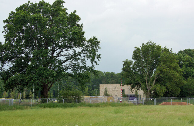
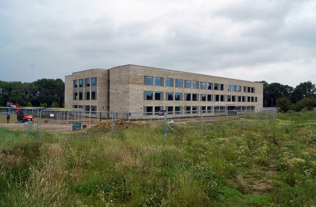
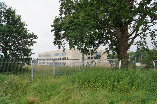
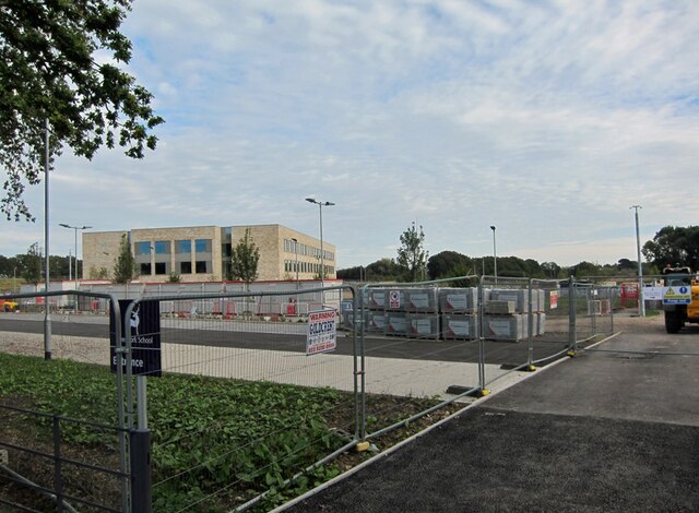
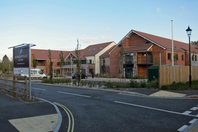
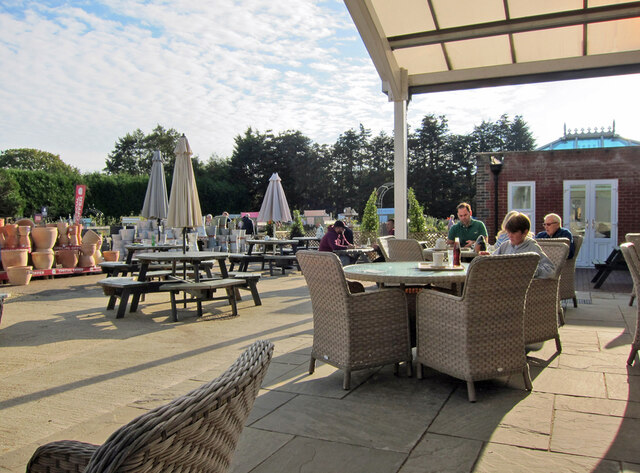
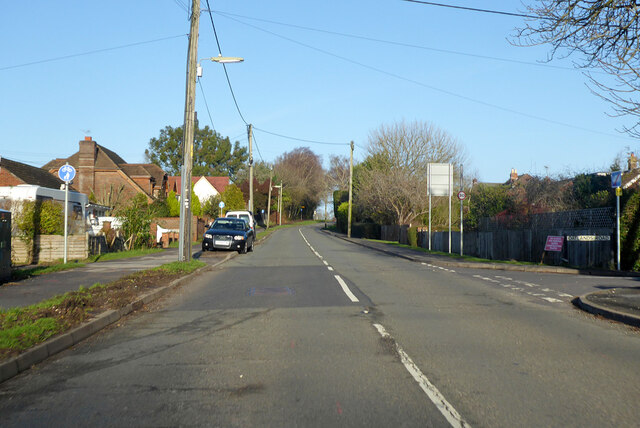
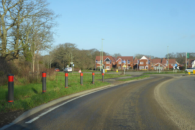
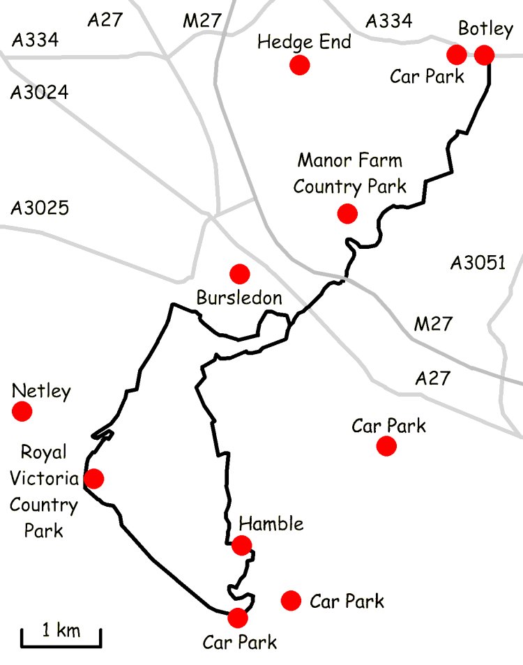
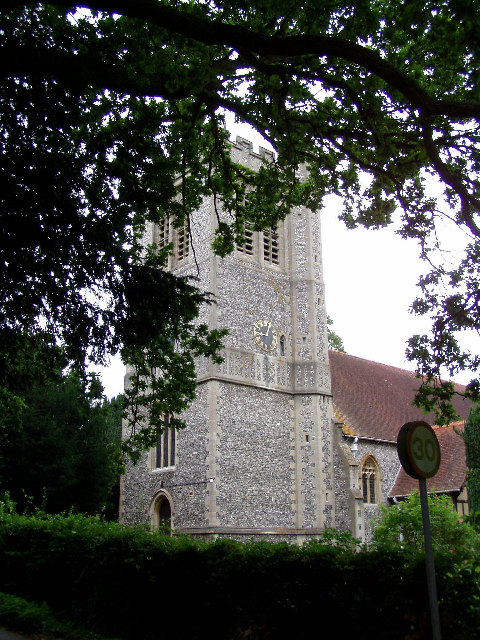
Boorley Green Images

Images are sourced within 2km of 50.924937/-1.274331 or Grid Reference SU5114. Thanks to Geograph Open Source API. All images are credited.

"The Railway" at Botley A pub in the Greene King Brewery estate on Station Hill opposite the entrance to Botley station.
"The Railway" at Botley
A pub in the Greene King Brewery estate on Station Hill opposite the entrance to Botley station.
Station Hill, Botley Part of a small business estate along Hillsons Road off to the left.
The station is beyond the trees in the background.
Station Hill, Botley
Part of a small business estate along Hillsons Road off to the left. The station is beyond the trees in the background.
Deer Park School, entrance The larger brick building is the Sports Hall. The main school building is out of sight to the left. The school is currently under the final stages of construction, and is due to open in September this year. Currently, the school is surrounded by open fields, though these are destined to shortly be turned into a new housing estate.
Deer Park School, entrance
The larger brick building is the Sports Hall. The main school building is out of sight to the left. The school is currently under the final stages of construction, and is due to open in September this year. Currently, the school is surrounded by open fields, though these are destined to shortly be turned into a new housing estate.
Deer Park School, nearing completion This new secondary school is due to open in September this year. It is currently surrounded by open fields, though very shortly, construction of a new housing estate will swallow them up.
Deer Park School, nearing completion
This new secondary school is due to open in September this year. It is currently surrounded by open fields, though very shortly, construction of a new housing estate will swallow them up.
Deer Park School, under construction The leafy rural setting of the new school will soon change. While most of the larger trees will survive, the fields which surround the school are soon to become a housing development.
Deer Park School, under construction
The leafy rural setting of the new school will soon change. While most of the larger trees will survive, the fields which surround the school are soon to become a housing development.
Deer Park School - now open This view is across the not-yet open car park of the school towards the main building. The school started accepting pupils in September of this year, though clearly parts of the campus are still unfinished.
Deer Park School - now open
This view is across the not-yet open car park of the school towards the main building. The school started accepting pupils in September of this year, though clearly parts of the campus are still unfinished.
Snowdrop Place Care Home Newly opened residential care home operated by Barchester Healthcare.
(See also <a href="https://www.geograph.org.uk/photo/6635397">SU5013 : Snowdrop Place Care Home - under construction</a>).
Snowdrop Place Care Home
Newly opened residential care home operated by Barchester Healthcare. (See also SU5013 : Snowdrop Place Care Home - under construction).
Garden centre café A pleasant place to enjoy a cup of tea and enjoy the autumn sunshine while thinking about all that gardening you could be doing.
Garden centre café
A pleasant place to enjoy a cup of tea and enjoy the autumn sunshine while thinking about all that gardening you could be doing.
A334 towards Wickham Leaving Botley, crossing the River Hamble.
A334 towards Wickham
Leaving Botley, crossing the River Hamble.
A334 High Street, Botley Eastwards towards Wickham.
A334 High Street, Botley
Eastwards towards Wickham.
A334 towards Botley
A334 towards Botley
B3354 Winchester Road, Boorley Green Towards Winchester.
B3354 Winchester Road, Boorley Green
Towards Winchester.
Roundabout on B3354 Winchester Road Inserted in the straight a few years ago to serve a housing development of a golf course site.
Roundabout on B3354 Winchester Road
Inserted in the straight a few years ago to serve a housing development of a golf course site.
Botley: on Platform 2 This is the line from Fareham to Eastleigh (ahead). The original station buildings - with the exception of the boarded-up signal box - have been demolished and Botley is now an unstaffed halt. The late Ben Brooksbank's <a href="https://www.geograph.org.uk/photo/1859055">SU5213 : Botley Station</a> shows it as it was in 1963.
Botley: on Platform 2
This is the line from Fareham to Eastleigh (ahead). The original station buildings - with the exception of the boarded-up signal box - have been demolished and Botley is now an unstaffed halt. The late Ben Brooksbank's SU5213 : Botley Station shows it as it was in 1963.
Approaching Botley Station The Railway Inn is on the right of the A334, opposite the station (which is masked by trees and part of an industrial estate).
Approaching Botley Station
The Railway Inn is on the right of the A334, opposite the station (which is masked by trees and part of an industrial estate).
Botley: at the corner of Church Lane and Mill Hill High Street is to the left and Winchester Street ahead. The house on the corner is one of many fine Grade II listed 18th-century houses in Botley. The bricks of the single-storey wing on the right are laid in Chinese bond - on their sides, rather than laid flat, they appear larger than bricks laid normally.
Botley: at the corner of Church Lane and Mill Hill
High Street is to the left and Winchester Street ahead. The house on the corner is one of many fine Grade II listed 18th-century houses in Botley. The bricks of the single-storey wing on the right are laid in Chinese bond - on their sides, rather than laid flat, they appear larger than bricks laid normally.
Botley: former maltings, Church Lane Now residential.
Botley: former maltings, Church Lane
Now residential.
Botley: north along Church Lane Looking past  Grade II listed Ivy Cottage towards the former maltings on an April evening.
Botley: north along Church Lane
Looking past Grade II listed Ivy Cottage towards the former maltings on an April evening.
Show me another place!

Boorley Green is located at Grid Ref: SU5114 (Lat: 50.924937, Lng: -1.274331)

Administrative County: Hampshire

District: Eastleigh

Police Authority: Hampshire

What 3 Words

///director.unlucky.quoted. Near Botley, Hampshire

Nearby Locations

Boorley Green

Related Wikis

Long Common

Long Common is a village in the civil parish of Botley in the Eastleigh district of Hampshire, England. It lies approximately 5.6 miles (9.0 km) north...

Edward Sparshott

Edward Sparshott (3 March 1788 – 9 November 1873) was an English officer of the Royal Navy, serving during the Napoleonic Wars. As midshipman on HMS Centaur...

Botley, Hampshire

Botley is a historic village in Hampshire, England. The village was once described as "the most delightful village in the world" by 18th century journalist...

Strawberry Trail

The Strawberry Trail is a 15-mile footpath through Hampshire, England The trail is part linear and part circular. The linear section connects Botley to...

Botley railway station

Botley railway station serves Botley and the surrounding areas in the English county of Hampshire. The station is on the railway line between Eastleigh...

Durley Mill

Durley Mill is a hamlet between Botley and Bishops Waltham in Hampshire, England. It once had a small intermediate halt on the Bishops Waltham branch...

Shamblehurst Farmhouse

Shamblehurst Farmhouse is a Grade II listed building in Hedge End, Hampshire. Situated on Shamblehurst Lane, it was first listed on 14 February 1983. The...

Curdridge

Curdridge is a village and civil parish within the City of Winchester district of Hampshire, England. The parish also contains the similarly named village...

Nearby Amenities

Located within 500m of 50.924937,-1.274331
Boorley Green
Place: suburb
Lat/Long: 50.9280981/-1.2749584
Post Box
Collection Times: Mo-Fr 16:00; Sa 08:15
Operator: Royal Mail
Operator Wikidata: Q638098
Ref: SO32 214
Source: Bing, Survey
Lat/Long: 50.9264971/-1.2778132
Power: tower
Ref: 59
Source: survey
Lat/Long: 50.9240342/-1.2792038
Barrier: stile
Lat/Long: 50.924775/-1.2672303
Power: tower
Ref: 58
Source: interpolation
Lat/Long: 50.9231484/-1.2770485
Power: tower
Ref: 57
Source: interpolation
Lat/Long: 50.9216189/-1.2736948
Bus Stop
Winchester Street
Bus: yes
Naptan AtcoCode: 1900HA030432
Naptan Bearing: S
Naptan CommonName: Winchester Street
Naptan Crossing: Winchester Street
Naptan NaptanCode: hamdjwpd
Naptan Street: Holmesland Lane
Naptan Verified: no
Public Transport: platform
Source: naptan_import
Lat/Long: 50.9210444/-1.2772058
Bus Stop
Oatlands Road
Bus: yes
Naptan AtcoCode: 1900HA030545
Naptan Bearing: N
Naptan CommonName: Boorley Green - Oatlands Road
Naptan Crossing: Oatlands Road
Naptan NaptanCode: hamdjwjm
Naptan Street: Winchester Road
Naptan Verified: no
Public Transport: platform
Source: naptan_import
Lat/Long: 50.9254785/-1.2789509
Bus Stop
Oatlands Road
Bus: yes
Naptan AtcoCode: 1900HA030546
Naptan Bearing: S
Naptan CommonName: Boorley Green - Oatlands Road
Naptan Crossing: Kestrel Close
Naptan NaptanCode: hamdjwjp
Naptan Street: Winchester Road
Naptan Verified: no
Public Transport: platform
Source: naptan_import
Lat/Long: 50.9255064/-1.2789294
Material: wood
Power: pole
Source: bing
Lat/Long: 50.9253239/-1.2729365
Material: wood
Power: pole
Source: bing
Lat/Long: 50.9263077/-1.2718598
Material: wood
Power: pole
Source: bing
Lat/Long: 50.9273625/-1.2707309
Material: wood
Power: pole
Source: bing
Lat/Long: 50.9208568/-1.2734746
Material: wood
Power: pole
Source: bing
Lat/Long: 50.9209033/-1.2736015
Material: wood
Power: pole
Source: bing
Lat/Long: 50.9225865/-1.273249
Material: wood
Power: pole
Source: bing
Lat/Long: 50.9226292/-1.273373
Material: wood
Power: pole
Source: bing
Lat/Long: 50.9243797/-1.2730835
Material: wood
Power: pole
Source: bing
Lat/Long: 50.9244382/-1.2736976
Boorley Park Primary School
Bus: yes
Public Transport: stop_position
Lat/Long: 50.9284986/-1.2734068
Boorley Park Primary School
Bus: yes
Network: Bluestar
Operator: Go South Coast Limited
Public Transport: stop_position
Lat/Long: 50.9286775/-1.2746135
Crossing
Lat/Long: 50.9271678/-1.2802714
Generator Method: photovoltaic
Generator Output Electricity: yes
Generator Source: solar
Generator Type: solar_photovoltaic_panel
Location: roof
Power: generator
Lat/Long: 50.9278979/-1.2793922
Generator Method: photovoltaic
Generator Output Electricity: yes
Generator Source: solar
Generator Type: solar_photovoltaic_panel
Location: roof
Power: generator
Lat/Long: 50.9277914/-1.279572
Generator Method: photovoltaic
Generator Output Electricity: yes
Generator Source: solar
Generator Type: solar_photovoltaic_panel
Location: roof
Power: generator
Lat/Long: 50.9273975/-1.2796283
Generator Method: photovoltaic
Generator Output Electricity: yes
Generator Source: solar
Generator Type: solar_photovoltaic_panel
Location: roof
Power: generator
Lat/Long: 50.927247/-1.2799609
Generator Method: photovoltaic
Generator Output Electricity: yes
Generator Source: solar
Generator Type: solar_photovoltaic_panel
Location: roof
Power: generator
Lat/Long: 50.9256443/-1.2788236
Generator Method: photovoltaic
Generator Output Electricity: yes
Generator Source: solar
Generator Type: solar_photovoltaic_panel
Location: roof
Power: generator
Lat/Long: 50.9257508/-1.2781343
Generator Method: photovoltaic
Generator Output Electricity: yes
Generator Source: solar
Generator Type: solar_photovoltaic_panel
Location: roof
Power: generator
Lat/Long: 50.9258658/-1.2785098
Generator Method: photovoltaic
Generator Output Electricity: yes
Generator Source: solar
Generator Type: solar_photovoltaic_panel
Location: roof
Power: generator
Lat/Long: 50.925974/-1.2780404
Generator Method: photovoltaic
Generator Output Electricity: yes
Generator Source: solar
Generator Type: solar_photovoltaic_panel
Location: roof
Power: generator
Lat/Long: 50.9261667/-1.276415
Generator Method: photovoltaic
Generator Output Electricity: yes
Generator Source: solar
Generator Type: solar_photovoltaic_panel
Power: generator
Lat/Long: 50.9289335/-1.2755767
Generator Method: photovoltaic
Generator Output Electricity: yes
Generator Source: solar
Generator Type: solar_photovoltaic_panel
Power: generator
Lat/Long: 50.9289227/-1.2755031
Generator Method: photovoltaic
Generator Output Electricity: yes
Generator Source: solar
Generator Type: solar_photovoltaic_panel
Power: generator
Lat/Long: 50.9289033/-1.2753525
Generator Method: photovoltaic
Generator Output Electricity: yes
Generator Source: solar
Generator Type: solar_photovoltaic_panel
Power: generator
Lat/Long: 50.9288903/-1.2752772
Generator Method: photovoltaic
Generator Output Electricity: yes
Generator Source: solar
Generator Type: solar_photovoltaic_panel
Power: generator
Lat/Long: 50.9288623/-1.2751197
Generator Method: photovoltaic
Generator Output Electricity: yes
Generator Source: solar
Generator Type: solar_photovoltaic_panel
Power: generator
Lat/Long: 50.9288515/-1.2750409
Generator Method: photovoltaic
Generator Output Electricity: yes
Generator Source: solar
Generator Type: solar_photovoltaic_panel
Power: generator
Lat/Long: 50.9288256/-1.2748664
Generator Method: photovoltaic
Generator Output Electricity: yes
Generator Source: solar
Generator Type: solar_photovoltaic_panel
Power: generator
Lat/Long: 50.9288148/-1.2747979
Generator Method: photovoltaic
Generator Output Electricity: yes
Generator Source: solar
Generator Type: solar_photovoltaic_panel
Power: generator
Lat/Long: 50.9287415/-1.2744127
Generator Method: photovoltaic
Generator Output Electricity: yes
Generator Source: solar
Generator Type: solar_photovoltaic_panel
Power: generator
Lat/Long: 50.9288658/-1.2743504
Generator Method: photovoltaic
Generator Output Electricity: yes
Generator Source: solar
Generator Type: solar_photovoltaic_panel
Power: generator
Lat/Long: 50.9289361/-1.2743115
Generator Method: photovoltaic
Generator Output Electricity: yes
Generator Source: solar
Generator Type: solar_photovoltaic_panel
Power: generator
Lat/Long: 50.9289835/-1.2742985
Generator Method: photovoltaic
Generator Output Electricity: yes
Generator Source: solar
Generator Type: solar_photovoltaic_panel
Power: generator
Lat/Long: 50.9290359/-1.2748926
Generator Method: photovoltaic
Generator Output Electricity: yes
Generator Source: solar
Generator Type: solar_photovoltaic_panel
Power: generator
Lat/Long: 50.9290882/-1.2748719
Generator Method: photovoltaic
Generator Output Electricity: yes
Generator Source: solar
Generator Type: solar_photovoltaic_panel
Power: generator
Lat/Long: 50.9288004/-1.2743634
Generator Method: photovoltaic
Generator Output Electricity: yes
Generator Source: solar
Generator Type: solar_photovoltaic_panel
Power: generator
Lat/Long: 50.9291062/-1.2753259
Generator Method: photovoltaic
Generator Output Electricity: yes
Generator Source: solar
Generator Type: solar_photovoltaic_panel
Power: generator
Lat/Long: 50.929152/-1.2753
Generator Method: photovoltaic
Generator Output Electricity: yes
Generator Source: solar
Generator Type: solar_photovoltaic_panel
Power: generator
Lat/Long: 50.9281246/-1.2727057
Generator Method: photovoltaic
Generator Output Electricity: yes
Generator Source: solar
Generator Type: solar_photovoltaic_panel
Power: generator
Lat/Long: 50.9280648/-1.2726854
Generator Method: photovoltaic
Generator Output Electricity: yes
Generator Source: solar
Generator Type: solar_photovoltaic_panel
Power: generator
Lat/Long: 50.9280178/-1.2726899
Generator Method: photovoltaic
Generator Output Electricity: yes
Generator Source: solar
Generator Type: solar_photovoltaic_panel
Power: generator
Lat/Long: 50.9279224/-1.2727848
Generator Method: photovoltaic
Generator Output Electricity: yes
Generator Source: solar
Generator Type: solar_photovoltaic_panel
Power: generator
Lat/Long: 50.927874/-1.2728141
Generator Method: photovoltaic
Generator Output Electricity: yes
Generator Source: solar
Generator Type: solar_photovoltaic_panel
Power: generator
Lat/Long: 50.9278043/-1.2728503
Generator Method: photovoltaic
Generator Output Electricity: yes
Generator Source: solar
Generator Type: solar_photovoltaic_panel
Power: generator
Lat/Long: 50.9277473/-1.272909
Generator Method: photovoltaic
Generator Output Electricity: yes
Generator Source: solar
Generator Type: solar_photovoltaic_panel
Power: generator
Lat/Long: 50.9277317/-1.2725363
Generator Method: photovoltaic
Generator Output Electricity: yes
Generator Source: solar
Generator Type: solar_photovoltaic_panel
Power: generator
Lat/Long: 50.9277117/-1.2724686
Generator Method: photovoltaic
Generator Output Electricity: yes
Generator Source: solar
Generator Type: solar_photovoltaic_panel
Power: generator
Lat/Long: 50.9276961/-1.2724031
Generator Method: photovoltaic
Generator Output Electricity: yes
Generator Source: solar
Generator Type: solar_photovoltaic_panel
Power: generator
Lat/Long: 50.9276662/-1.2723037
Generator Method: photovoltaic
Generator Output Electricity: yes
Generator Source: solar
Generator Type: solar_photovoltaic_panel
Power: generator
Lat/Long: 50.9276505/-1.2722269
Generator Method: photovoltaic
Generator Output Electricity: yes
Generator Source: solar
Generator Type: solar_photovoltaic_panel
Power: generator
Lat/Long: 50.9276349/-1.2729632
Generator Method: photovoltaic
Generator Output Electricity: yes
Generator Source: solar
Generator Type: solar_photovoltaic_panel
Power: generator
Lat/Long: 50.9275295/-1.2730106
Generator Method: photovoltaic
Generator Output Electricity: yes
Generator Source: solar
Generator Type: solar_photovoltaic_panel
Power: generator
Lat/Long: 50.9274498/-1.27304
Generator Method: photovoltaic
Generator Output Electricity: yes
Generator Source: solar
Generator Type: solar_photovoltaic_panel
Power: generator
Lat/Long: 50.9273786/-1.2725408
Generator Method: photovoltaic
Generator Output Electricity: yes
Generator Source: solar
Generator Type: solar_photovoltaic_panel
Power: generator
Lat/Long: 50.9274982/-1.2724392
Generator Method: photovoltaic
Generator Output Electricity: yes
Generator Source: solar
Generator Type: solar_photovoltaic_panel
Power: generator
Lat/Long: 50.9272405/-1.2726673
Power: pole
Lat/Long: 50.9251633/-1.2705407
Power: pole
Lat/Long: 50.9256456/-1.2683383
Power: pole
Lat/Long: 50.9249528/-1.2714924
Power: pole
Lat/Long: 50.9247506/-1.2723356
Power: pole
Lat/Long: 50.9253742/-1.2695777
Bus Stop
Primary School
Bus: yes
Naptan AtcoCode: 1900HAA92111
Naptan NaptanCode: hampagja
Public Transport: platform
Lat/Long: 50.9285313/-1.2733946
Bus Stop
Primary School
Bus: yes
Network: Bluestar
Network Wikidata: Q4930564
Operator: Go South Coast Limited
Public Transport: platform
Lat/Long: 50.9286312/-1.2746271
Crossing
Crossing: unmarked
Crossing Markings: no
Tactile Paving: yes
Lat/Long: 50.9230994/-1.2798782
Crossing
Crossing: unmarked
Crossing Markings: no
Tactile Paving: yes
Lat/Long: 50.9231452/-1.2799737
Crossing
Crossing: unmarked
Crossing Markings: no
Tactile Paving: yes
Lat/Long: 50.9231761/-1.2804786
Crossing
Crossing: unmarked
Crossing Markings: no
Tactile Paving: yes
Lat/Long: 50.9231419/-1.2805628
Crossing
Crossing: unmarked
Crossing Markings: no
Lat/Long: 50.921787/-1.2785553
The data included in this document is from www.openstreetmap.org. The data is made available under ODbL.

Have you been to Boorley Green?

Leave your review of Boorley Green below (or comments, questions and feedback).