Common, The

Settlement in Sussex Horsham

England

Common, The

Waitrose and John Lewis - off Albion Way The photo shows the upper level of the car park. There is a level below this as well.
Waitrose and John Lewis - off Albion Way Credit: Ian Cunliffe

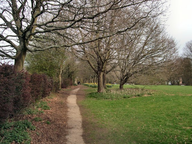
The Common is a large open space located in the town of Sussex in England. It is a popular recreational area for locals and visitors alike, offering a variety of activities such as picnicking, walking, jogging, and cycling. The Common is known for its picturesque views of the surrounding countryside and is home to a diverse range of wildlife, including birds, rabbits, and squirrels.

The Common is also a historical site, with evidence of human activity dating back to the Bronze Age. In more recent times, it has been used for military training during both World Wars. Today, the Common is maintained by the local council and is a designated conservation area, ensuring its protection for future generations to enjoy.

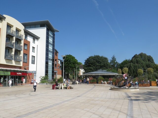
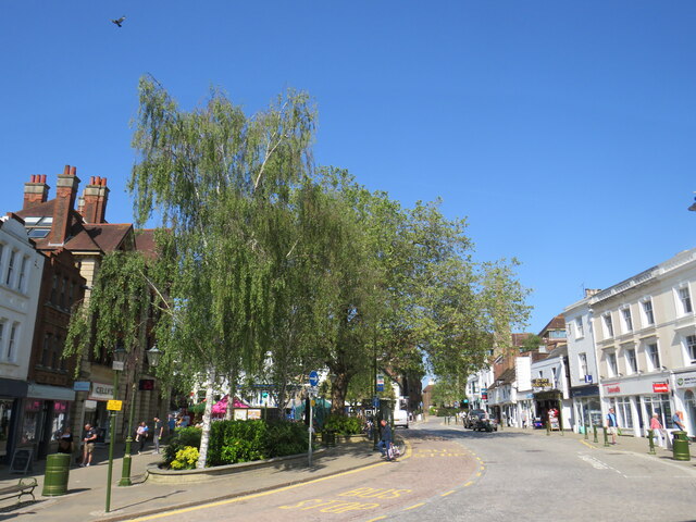
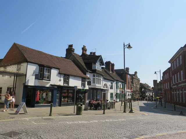
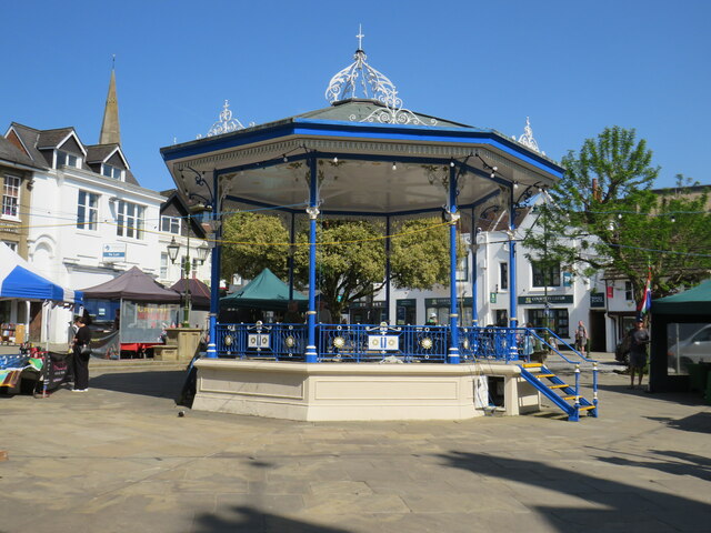
Visitors to The Common can also explore nearby attractions such as the town center of Sussex, which offers a range of shops, restaurants, and cultural sites. Overall, The Common is a peaceful and scenic destination that offers a welcome escape from the hustle and bustle of everyday life.

If you have any feedback on the listing, please let us know in the comments section below.

Common, The Images

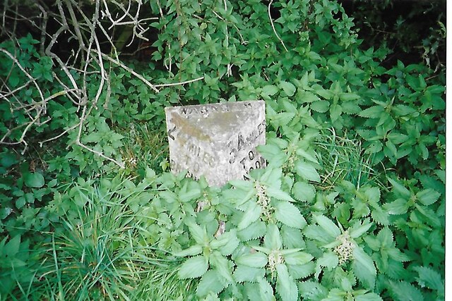
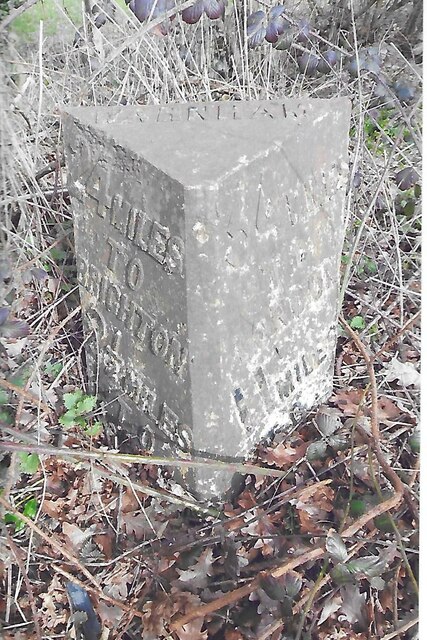
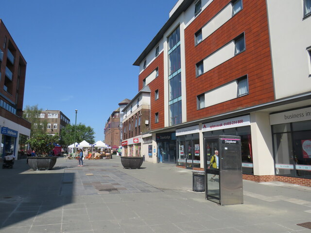
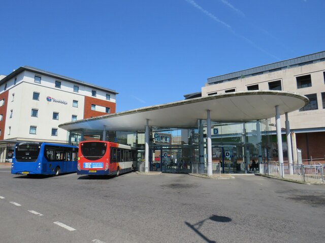
Images are sourced within 2km of 51.071607/-0.33397 or Grid Reference TQ1631. Thanks to Geograph Open Source API. All images are credited.

Waitrose and John Lewis - off Albion Way The photo shows the upper level of the car park. There is a level below this as well.
Waitrose and John Lewis - off Albion Way
The photo shows the upper level of the car park. There is a level below this as well.
River Arun Overflow stream that maybe the original River Arun route. A higher level canal was cut for the mill.

River info : <span class="nowrap"><a title="https://en.wikipedia.org/wiki/River_Arun" rel="nofollow ugc noopener" href="https://en.wikipedia.org/wiki/River_Arun">Link</a><img style="margin-left:2px;" alt="External link" title="External link - shift click to open in new window" src="https://s1.geograph.org.uk/img/external.png" width="10" height="10"/></span>
River Arun
Overflow stream that maybe the original River Arun route. A higher level canal was cut for the mill. River info : LinkExternal link
Streets of Horsham Junction of Curzon Avenue and Vale Drive.
Streets of Horsham
Junction of Curzon Avenue and Vale Drive.
Waitrose and John Lewis store
Old Milestone by A24, Andrews Farm The Milestone is located by the road.  Parish of Warnham (Horsham District). Cast iron post, Horsham post design, erected by the Horsham & Dorking turnpike trust in the 19th Century. An earlier photograph can be found here: <a title="https://www.geograph.org.uk/photo/1596429" href="https://www.geograph.org.uk/photo/1596429">Link</a> 

Inscription reads:-  
24 MILES / TO / BRIGHTON / 2½ / TO / HORSHAM : : 34 MILES / TO / LONDON / 11 / MILES TO / DORKING : : WARNHAM  

Milestone Society National ID: SX_LA34
Old Milestone by A24, Andrews Farm
The Milestone is located by the road.  Parish of Warnham (Horsham District). Cast iron post, Horsham post design, erected by the Horsham & Dorking turnpike trust in the 19th Century. An earlier photograph can be found here: Link  Inscription reads:- 24 MILES / TO / BRIGHTON / 2½ / TO / HORSHAM : : 34 MILES / TO / LONDON / 11 / MILES TO / DORKING : : WARNHAM Milestone Society National ID: SX_LA34
Old Milestone by A24, Andrews Farm The Milestone is located by the road.  Parish of Warnham (Horsham District). Cast iron post, Horsham post design, erected by the Horsham & Dorking turnpike trust in the 19th Century. An earlier photograph can be found here: <a title="https://www.geograph.org.uk/photo/7429171" href="https://www.geograph.org.uk/photo/7429171">Link</a> 

Inscription reads:-  
24 MILES / TO / BRIGHTON / 2½ / TO / HORSHAM : : 34 MILES / TO / LONDON / 11 / MILES TO / DORKING : : WARNHAM  

Milestone Society National ID: SX_LA34
Old Milestone by A24, Andrews Farm
The Milestone is located by the road.  Parish of Warnham (Horsham District). Cast iron post, Horsham post design, erected by the Horsham & Dorking turnpike trust in the 19th Century. An earlier photograph can be found here: Link  Inscription reads:- 24 MILES / TO / BRIGHTON / 2½ / TO / HORSHAM : : 34 MILES / TO / LONDON / 11 / MILES TO / DORKING : : WARNHAM Milestone Society National ID: SX_LA34
Worthing Road, Horsham A pedestrianised section of Worthing Road, in the centre of Horsham, a town in West Sussex.
Worthing Road, Horsham
A pedestrianised section of Worthing Road, in the centre of Horsham, a town in West Sussex.
Horsham Bus Station A purpose-built bus terminus in Horsham, a town in West Sussex.  The bus station is quite small, accommodating just five buses, but has seating for waiting passengers.
Horsham Bus Station
A purpose-built bus terminus in Horsham, a town in West Sussex. The bus station is quite small, accommodating just five buses, but has seating for waiting passengers.
The Forum, Horsham The Forum is a public open space in Horsham, a town in West Sussex.
The Forum, Horsham
The Forum is a public open space in Horsham, a town in West Sussex.
Blackhorse Way, Horsham Blackhorse Way is a street in Horsham, a town in West Sussex.
Blackhorse Way, Horsham
Blackhorse Way is a street in Horsham, a town in West Sussex.
South Street, Horsham A short parade of shops in South Street, in the centre of Horsham.  The shop nearest the camera is a café.
South Street, Horsham
A short parade of shops in South Street, in the centre of Horsham. The shop nearest the camera is a café.
Causeway, Horsham Causeway is a residential street close to the town centre in Horsham, West Sussex.
Causeway, Horsham
Causeway is a residential street close to the town centre in Horsham, West Sussex.
Carfax, Horsham Carfax is a street in the centre of Horsham, a town in West Sussex.
Carfax, Horsham
Carfax is a street in the centre of Horsham, a town in West Sussex.
Carfax, Horsham Carfax is a street in the centre of Horsham, a market town in West Sussex.
Carfax, Horsham
Carfax is a street in the centre of Horsham, a market town in West Sussex.
Bandstand in Horsham A bandstand in Carfax, a street in the centre of Horsham.
Bandstand in Horsham
A bandstand in Carfax, a street in the centre of Horsham.
Barrackfield Crossing Crossing the Arun Valley Line near Horsham
Barrackfield Crossing
Crossing the Arun Valley Line near Horsham
Rail Line viewed from Barrackfield Crossing On the Arun valley line between Horsham and Christ's Hospital
Rail Line viewed from Barrackfield Crossing
On the Arun valley line between Horsham and Christ's Hospital
Path by Horsham Cricket Field
Show me another place!

Common, The is located at Grid Ref: TQ1631 (Lat: 51.071607, Lng: -0.33397)

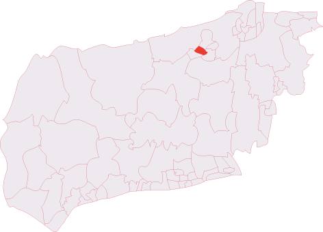
Administrative County: West Sussex

District: Horsham

Police Authority: Sussex

What 3 Words

///enable.remark.overnight. Near Horsham, West Sussex

Nearby Locations

Common, The The Common

Related Wikis

Horsham Hurst (electoral division)

Horsham Hurst is an electoral division of West Sussex in the United Kingdom and returns one member to sit on West Sussex County Council. == Extent == The...

Horsham Hospital

Horsham Hospital is a health facility at Hurst Road in Horsham, West Sussex, England. It is managed by Sussex Community NHS Foundation Trust. == History... ==

The College of Richard Collyer

The College of Richard Collyer (colloquially Collyer's ), formerly called Collyer's School, is a co-educational sixth form college in Horsham, West Sussex...

Rising Universe

Rising Universe, more commonly known locally as the Shelley Fountain, was a large kinetic water sculpture in Horsham, West Sussex, England. It was created...

Horsham Unitarian Church

Horsham Unitarian Church (formerly Horsham General Baptist Chapel) is a Unitarian chapel in Horsham in the English county of West Sussex. It was founded...

The Capitol Theatre, Horsham

The Capitol Theatre is a multi-purpose arts venue in Horsham, West Sussex, England.The original Capitol Theatre, built in Italian style by the Blue Flash...
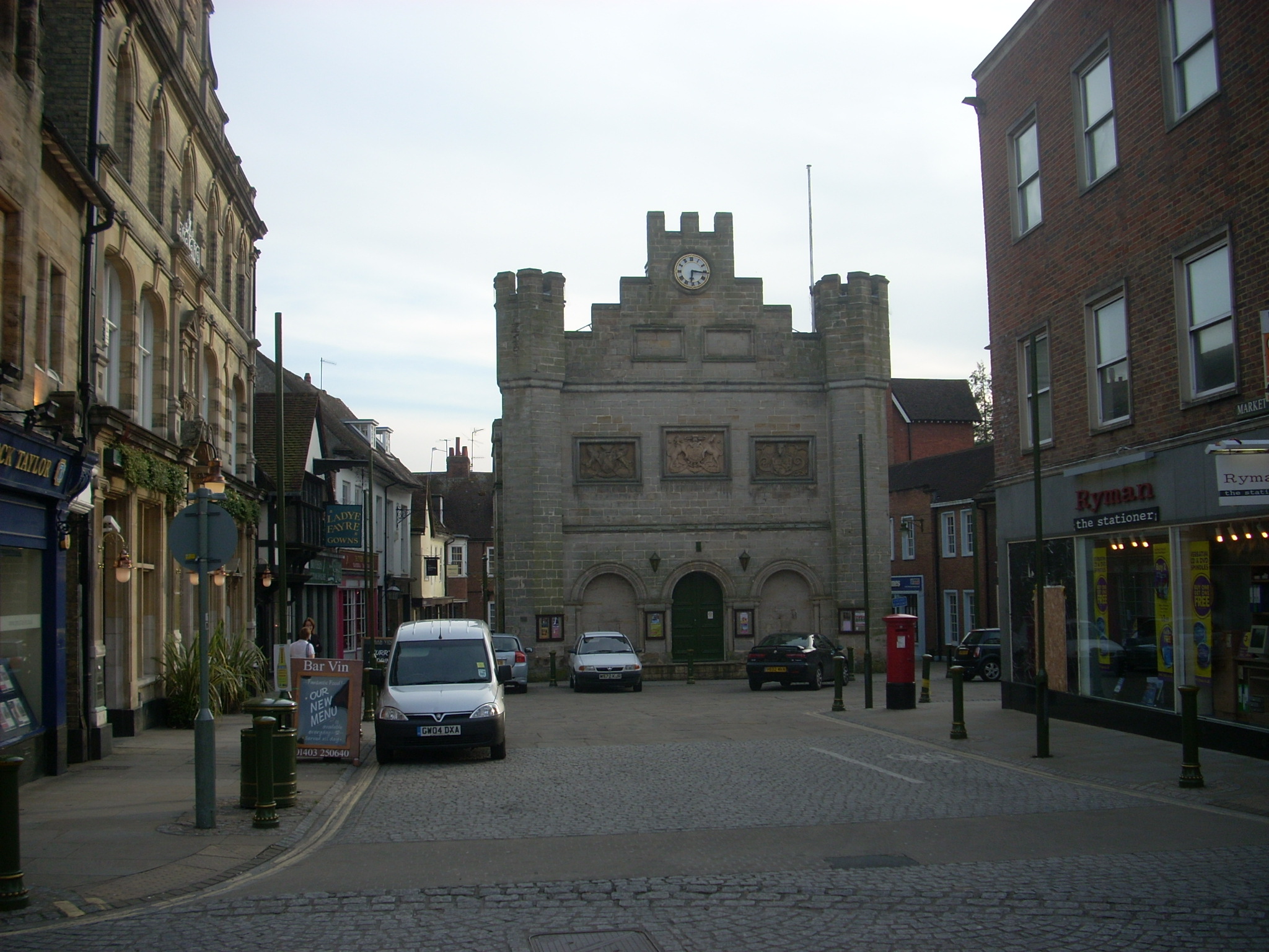
Horsham Town Hall

Horsham Town Hall is a municipal building in the Market Square in Horsham, West Sussex. It is a Grade II listed building. == History == The earliest mention...

Warnham LNR

Warnham LNR is a 38.4-hectare (95-acre) Local Nature Reserve in Horsham in West Sussex. It is owned and managed by Horsham District Council.The principal...

Nearby Amenities

Located within 500m of 51.071607,-0.33397
Turning Circle
Lat/Long: 51.0685971/-0.3342973
Post Box
Brand: Royal Mail
Brand Wikidata: Q638098
Collection Plate: CP1D
Collection Times: Mo-Fr 09:00; Sa 07:00
Operator: Royal Mail
Operator Wikidata: Q638098
Post Box Type: pillar
Ref: RH12 199D
Royal Cypher: GVIR
Royal Cypher Wikidata: Q33102169
Lat/Long: 51.0744924/-0.3368455
Booth: K6
Removed Amenity: telephone
Lat/Long: 51.0704926/-0.3392697
Post Box
North Parade
Brand: Royal Mail
Brand Wikidata: Q638098
Collection Plate: CP1
Collection Times: Mo-Fr 16:30; Sa 12:00
Operator: Royal Mail
Operator Wikidata: Q638098
Post Box Type: pillar
Ref: RH12 1
Royal Cypher: EIIR
Royal Cypher Wikidata: Q33102113
Source: survey
Lat/Long: 51.0704604/-0.327672
Post Box
Brand: Royal Mail
Brand Wikidata: Q638098
Collection Plate: CP1
Collection Times: Mo-Fr 17:00; Sa 11:30
Operator: Royal Mail
Operator Wikidata: Q638098
Post Box Type: pillar
Ref: RH12 72
Royal Cypher: EVIIR
Royal Cypher Wikidata: Q33102324
Lat/Long: 51.0723513/-0.3306575
Alexander Terrace
Building: yes
Lat/Long: 51.0697253/-0.3318667
Bus Stop
Cootes Avenue
Bus: yes
Naptan AtcoCode: 4400HO0064
Naptan Bearing: N
Naptan CommonName: Cootes Avenue
Naptan Indicator: o/s 87
Naptan Landmark: Cootes Avenue
Naptan NaptanCode: wsxaptgd
Naptan Street: Merryfield Drive
Naptan Verified: no
Public Transport: platform
Source: naptan_import
Lat/Long: 51.0706254/-0.3389199
Bus Stop
Cootes Avenue
Bus: yes
Naptan AtcoCode: 4400HO0065
Naptan Bearing: S
Naptan CommonName: Cootes Avenue
Naptan Indicator: o/s 84
Naptan Landmark: Cootes Avenue
Naptan NaptanCode: wsxaptgj
Naptan Street: Merryfield Drive
Naptan Verified: no
Public Transport: platform
Source: naptan_import
Lat/Long: 51.0718379/-0.3377091
Swindon Road
Bus: yes
Public Transport: stop_position
Lat/Long: 51.0730942/-0.3372315
Swindon Road
Bus: yes
Public Transport: stop_position
Lat/Long: 51.0736489/-0.3370538
Saxon Crescent
Bus: yes
Public Transport: stop_position
Lat/Long: 51.0743762/-0.3369258
Bus Stop
Saxon Crescent
Bus: yes
Naptan AtcoCode: 4400HO0069
Naptan Bearing: E
Naptan CommonName: Saxon Crescent
Naptan Indicator: opp. Saxon Crescent
Naptan Landmark: Saxon Crescent
Naptan NaptanCode: wsxaptgw
Naptan Street: Redford Avenue
Naptan Verified: no
Public Transport: platform
Source: naptan_import
Lat/Long: 51.0760847/-0.3337766
Bus Stop
Saxon Crescent
Bus: yes
Naptan AtcoCode: 4400HO0070
Naptan Bearing: W
Naptan CommonName: Saxon Crescent
Naptan Indicator: adj Saxon Crescent
Naptan Landmark: Saxon Crescent
Naptan NaptanCode: wsxaptja
Naptan Street: Redford Avenue
Naptan Verified: no
Public Transport: platform
Source: naptan_import
Lat/Long: 51.0760142/-0.3334853
Bus Stop
Percy Road
Bus: yes
Naptan AtcoCode: 4400HO0071
Naptan Bearing: NE
Naptan CommonName: Percy Road
Naptan Indicator: adj Percy Road
Naptan Landmark: Percy Road
Naptan NaptanCode: wsxaptjd
Naptan Street: Rushams Road
Naptan Verified: no
Public Transport: platform
Source: naptan_import
Lat/Long: 51.068487/-0.3332312
Bus Stop
Percy Road
Bus: yes
Naptan AtcoCode: 4400HO0072
Naptan Bearing: SW
Naptan CommonName: Percy Road
Naptan Indicator: opp. Percy Road
Naptan Landmark: Percy Road
Naptan NaptanCode: wsxaptjg
Naptan Street: Rushams Road
Naptan Verified: no
Public Transport: platform
Source: naptan_import
Lat/Long: 51.0687478/-0.332728
Bus Stop
Post Office
Bus: yes
Naptan AtcoCode: 4400HO0073
Naptan Bearing: W
Naptan CommonName: Post Office
Naptan Indicator: adj Blunts Way
Naptan Landmark: Blunts Way
Naptan NaptanCode: wsxaptjm
Naptan Street: Rushams Road
Naptan Verified: no
Public Transport: platform
Source: naptan_import
Lat/Long: 51.0695066/-0.3313253
Bus Stop
Post Office
Bus: yes
Naptan AtcoCode: 4400HO0074
Naptan Bearing: E
Naptan CommonName: Post Office
Naptan Indicator: opp. Blunts Way
Naptan Landmark: Blunts Way
Naptan NaptanCode: wsxaptjp
Naptan Street: Rushams Road
Naptan Verified: no
Public Transport: platform
Source: naptan_import
Lat/Long: 51.0696318/-0.3310804
Bus Stop
Greenway
Bus: yes
Naptan AtcoCode: 4400HO0078
Naptan Bearing: E
Naptan CommonName: Greenway
Naptan Indicator: opp Vale Drive
Naptan Landmark: Rushams Road
Naptan NaptanCode: wsxaptmd
Naptan Street: Greenway
Naptan Verified: no
Public Transport: platform
Source: naptan_import
Lat/Long: 51.0679746/-0.3339843
Bus Stop
Rushams Road
Bus: yes
Naptan AtcoCode: 4400HO0079
Naptan Bearing: W
Naptan CommonName: Rushams Road
Naptan Indicator: adj Vale Drive
Naptan Landmark: Rushams Road
Naptan NaptanCode: wsxaptmg
Naptan Street: Greenway
Naptan Verified: no
Public Transport: platform
Source: naptan_import
Lat/Long: 51.0679122/-0.3343533
Bus Stop
Greenway
Bus: yes
Naptan AtcoCode: 4400HO0080
Naptan Bearing: SE
Naptan CommonName: Greenway
Naptan Indicator: opp. Farm Avenue
Naptan Landmark: Farm Avenue
Naptan NaptanCode: wsxaptmj
Naptan Street: Greenway
Naptan Verified: no
Public Transport: platform
Source: naptan_import
Lat/Long: 51.0687178/-0.3365373
Bus Stop
Greenway School
Bus: yes
Naptan AtcoCode: 4400HO0081
Naptan Bearing: E
Naptan CommonName: Greenway School
Naptan Indicator: o/s School
Naptan Landmark: Merryfield Drive
Naptan NaptanCode: wsxaptmp
Naptan Street: Greenway
Naptan Verified: no
Public Transport: platform
Source: naptan_import
Lat/Long: 51.0694736/-0.3385464
Bus Stop
Greenway School
Bus: yes
Naptan AtcoCode: 4400HO0082
Naptan Bearing: W
Naptan CommonName: Greenway School
Naptan Indicator: opp school
Naptan Landmark: Merryfield Drive
Naptan NaptanCode: wsxaptmt
Naptan Street: Greenway
Naptan Verified: no
Public Transport: platform
Source: naptan_import
Lat/Long: 51.0695269/-0.3391307
Bus Stop
Spencers Place
Bus: yes
Naptan AtcoCode: 4400HO0083
Naptan Bearing: SE
Naptan CommonName: Spencers Place
Naptan Indicator: opp. Purton Road
Naptan Landmark: Purton Road
Naptan NaptanCode: wsxaptmw
Naptan Street: Spencers Place
Naptan Verified: no
Public Transport: platform
Source: naptan_import
Lat/Long: 51.0734298/-0.3343721
Bus Stop
Spencers Place
Bus: yes
Naptan AtcoCode: 4400HO0084
Naptan Bearing: NW
Naptan CommonName: Spencers Place
Naptan Indicator: adj Purton Road
Naptan Landmark: Purton Road
Naptan NaptanCode: wsxaptpa
Naptan Street: Spencers Palce
Naptan Verified: no
Public Transport: platform
Source: naptan_import
Lat/Long: 51.0733067/-0.3342816
Bus Stop
Kempshott Road
Bus: yes
Naptan AtcoCode: 4400HO0085
Naptan Bearing: NW
Naptan CommonName: Kempshott Road
Naptan Indicator: o/s 11
Naptan Landmark: Trafalgar Road
Naptan NaptanCode: wsxaptpd
Naptan Street: Kempshott Road
Naptan Verified: no
Public Transport: platform
Source: naptan_import
Lat/Long: 51.0727142/-0.3316386
Bus Stop
Kempshott Road
Bus: yes
Naptan AtcoCode: 4400HO0086
Naptan Bearing: SE
Naptan CommonName: Kempshott Road
Naptan Indicator: o/s 2
Naptan Landmark: Trafalgar Road
Naptan NaptanCode: wsxaptpg
Naptan Street: Kempshott Road
Naptan Verified: no
Public Transport: platform
Source: naptan_import
Lat/Long: 51.0726621/-0.3309881
Bus Stop
Swindon Road
Bus: yes
Naptan AtcoCode: 4400HO0087
Naptan Bearing: N
Naptan CommonName: Swindon Road
Naptan Indicator: adj Kempshott Road
Naptan Landmark: Swindon Road
Naptan NaptanCode: wsxaptpj
Naptan Street: Trafalgar Road
Naptan Verified: no
Public Transport: platform
Source: naptan_import
Lat/Long: 51.0720392/-0.3308726
Bus Stop
Swindon Road
Bus: yes
Naptan AtcoCode: 4400HO0088
Naptan Bearing: S
Naptan CommonName: Swindon Road
Naptan Indicator: opp. Swindon Road
Naptan Landmark: Swindon Road
Naptan NaptanCode: wsxaptpm
Naptan Street: Trafalgar Road
Naptan Verified: no
Public Transport: platform
Source: naptan_import
Lat/Long: 51.0717534/-0.3308333
Bus Stop
Nelson Road
Bus: yes
Naptan AtcoCode: 4400HO0089
Naptan Bearing: S
Naptan CommonName: Nelson Road
Naptan Indicator: opp. Nelson Road
Naptan Landmark: Nelson Road
Naptan NaptanCode: wsxaptpt
Naptan Street: Trafalgar Road
Naptan Verified: no
Public Transport: platform
Source: naptan_import
Lat/Long: 51.0701231/-0.3302038
Bus Stop
Nelson Road
Bus: yes
Naptan AtcoCode: 4400HO0090
Naptan Bearing: N
Naptan CommonName: Nelson Road
Naptan Indicator: adj Nelson Road
Naptan Landmark: Nelson Road
Naptan NaptanCode: wsxaptpw
Naptan Street: Trafalgar Road
Naptan Verified: no
Public Transport: platform
Source: naptan_import
Lat/Long: 51.0698649/-0.3302279
Bus Stop
Warnham Road
Bus: yes
Naptan AtcoCode: 4400HO0269
Naptan Bearing: NW
Naptan CommonName: Warnham Road
Naptan Indicator: Wimblehurst Rd
Naptan Landmark: Fishers Court
Naptan NaptanCode: wsxdptja
Naptan Street: North Parade
Naptan Verified: no
Public Transport: platform
Source: naptan_import
Lat/Long: 51.0737437/-0.3280085
Bus Stop
Warnham Road
Bus: yes
Naptan AtcoCode: 4400HO0270
Naptan Bearing: SE
Naptan CommonName: Warnham Road
Naptan Indicator: Wimblehurst Rd
Naptan Landmark: opp. Fishers Court
Naptan NaptanCode: wsxdptjd
Naptan Street: North Parade
Naptan Verified: no
Public Transport: platform
Source: naptan_import
Lat/Long: 51.0737127/-0.3278247
Post Box
Swindon Road
Brand: Royal Mail
Brand Wikidata: Q638098
Collection Plate: CP5D
Collection Times: Mo-Fr 09:00; Sa 07:00
Drive Through: no
Operator: Royal Mail
Operator Wikidata: Q638098
Post Box Type: wall
Ref: RH12 151D
Royal Cypher: GR
Royal Cypher Wikidata: Q33102273
Lat/Long: 51.0724352/-0.3340221
Traffic Signals
Lat/Long: 51.0724223/-0.3272791
Traffic Signals
Lat/Long: 51.071435/-0.3275079
The Common
Place: locality
Lat/Long: 51.0743632/-0.3307371
Information: board
Tourism: information
Lat/Long: 51.0691756/-0.3280598
Trafalgar Mosaic
Artwork Type: mosaic
Tourism: artwork
Lat/Long: 51.0711133/-0.334804
Childcare
Rocketeers
Addr City: Horsham
Addr Postcode: RH12 2JF
Addr Street: Victory Road
Fhrs Id: 954393
Source Addr: FHRS Open Data
Website: https://rocketeerschildcare.co.uk/
Lat/Long: 51.0713071/-0.3330942
Kindergarten
Little Learners Nursery School
Addr City: Horsham
Addr Housename: Scout Hut
Addr Postcode: RH12 2HF
Addr Street: Swindon Road
Fhrs Id: 1026415
Source Addr: FHRS Open Data
Lat/Long: 51.0726335/-0.3367259
Fast Food
Mandarin House
Addr City: Horsham
Addr Housenumber: 33
Addr Postcode: RH12 2JQ
Addr Street: Spencers Road
Cuisine: chinese
Fhrs Id: 185902
Source Addr: FHRS Open Data
Takeaway: yes
Lat/Long: 51.0693189/-0.3338253
Post Box
Brand: Royal Mail
Brand Wikidata: Q638098
Collection Plate: CP7D
Collection Times: Mo-Fr 09:00; Sa 07:00
Operator: Royal Mail
Operator Wikidata: Q638098
Post Box Type: wall
Ref: RH12 51D
Royal Cypher: GR
Royal Cypher Wikidata: Q33102273
Lat/Long: 51.0694587/-0.3316049
Childcare
Greenway nursery
Lat/Long: 51.0701745/-0.3369448
Bus Stop
Swindon Road
Bus: yes
Naptan AtcoCode: 4400HO0066
Naptan Bearing: N
Naptan CommonName: Swindon Road
Naptan Indicator: opp. Swindon Road
Naptan Landmark: Swindon Road
Naptan NaptanCode: wsxaptgm
Naptan Street: Redford Avenue
Naptan Verified: no
Public Transport: platform
Source: naptan_import
Lat/Long: 51.0731068/-0.3373188
Bus Stop
Swindon Road
Bus: yes
Naptan AtcoCode: 4400HO0067
Naptan Bearing: S
Naptan CommonName: Swindon Road
Naptan Indicator: adj Spencers Place
Naptan Landmark: Swindon Road
Naptan NaptanCode: wsxaptgp
Naptan Street: Redford Avenue
Naptan Verified: no
Public Transport: platform
Source: naptan_import
Lat/Long: 51.0736469/-0.3369699
Bus Stop
Saxon Crescent
Bus: yes
Naptan AtcoCode: 4400HO0068
Naptan Bearing: N
Naptan CommonName: Saxon Crescent
Naptan Indicator: opp 81
Naptan Landmark: Saxon Crescent
Naptan NaptanCode: wsxaptgt
Naptan Street: Redford Avenue
Naptan Verified: no
Public Transport: platform
Source: naptan_import
Lat/Long: 51.0743819/-0.33701
Ford: yes
Lat/Long: 51.0712105/-0.3393354
Fountain
Lat/Long: 51.0681865/-0.3297965
Scissors
Shop: hairdresser
Lat/Long: 51.0732155/-0.3340238
T Cuts
Shop: hairdresser
Lat/Long: 51.0717898/-0.3310858
Milestone
Direction: forward
Distance: 36
Lat/Long: 51.0692263/-0.3281481
Bus Stop
Parkfield
Bus: yes
Naptan AtcoCode: 4400HO1153
Naptan Bearing: S
Naptan CommonName: Parkfield
Naptan Indicator: adj
Naptan Landmark: Ravenscroft Court
Naptan NaptanCode: wsxgpwaj
Naptan Street: North Parade
Naptan Verified: no
Public Transport: platform
Source: naptan_import
Lat/Long: 51.070017/-0.3279014
The data included in this document is from www.openstreetmap.org. The data is made available under ODbL.

Have you been to Common, The?

Leave your review of Common, The below (or comments, questions and feedback).