Brushes, The

Settlement in Derbyshire Chesterfield

England

Brushes, The

Crossfield path. Dronfield 2000 rotary walk.
Crossfield path. Credit: steven ruffles

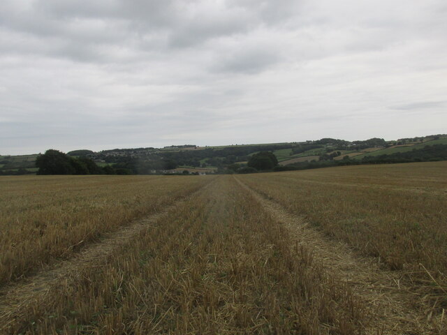
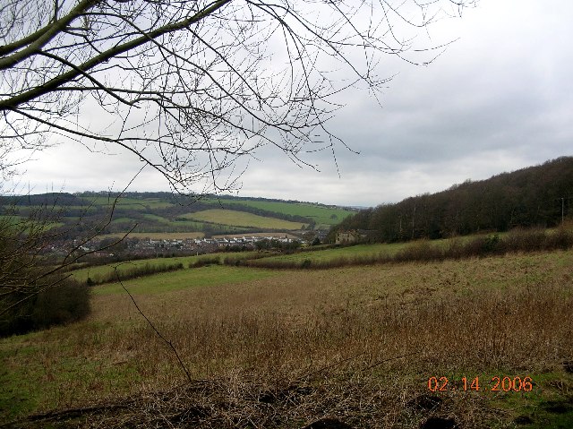
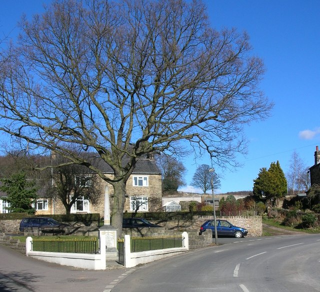
The Brushes, located in Derbyshire, England, is a small village known for its picturesque setting and historical significance. Situated in the southern part of the county, it is nestled within the rolling hills and lush greenery of the Peak District National Park.

The village is home to a tight-knit community, with a population of around 500 residents. It boasts a charming blend of traditional stone cottages and modern houses, creating a harmonious atmosphere that attracts visitors from far and wide. The Brushes offers a peaceful retreat from the bustling city life, making it a popular destination for nature lovers and hikers seeking tranquility.

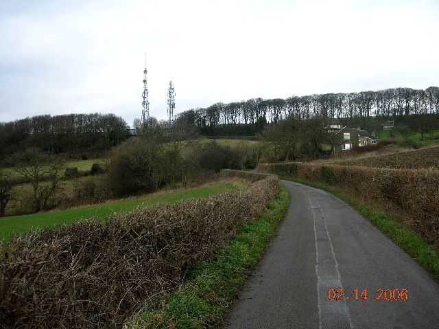
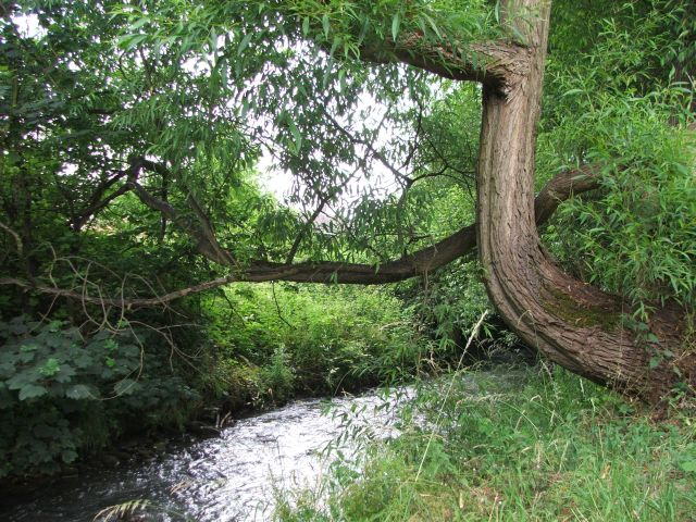
One of the notable features of The Brushes is its proximity to various natural attractions. The village is surrounded by breathtaking landscapes, including the famous Dovedale, a valley renowned for its stunning limestone ravines and crystal-clear river. The nearby Tissington Trail, a former railway line converted into a scenic walking and cycling path, also attracts outdoor enthusiasts.

History buffs will find The Brushes intriguing, as the village has a rich heritage dating back centuries. The local parish church, St. Peter's, stands as a testament to its historical significance, with parts of the building dating back to the 12th century. The Brushes also played a role in the Industrial Revolution, as it was once home to several mills and factories.

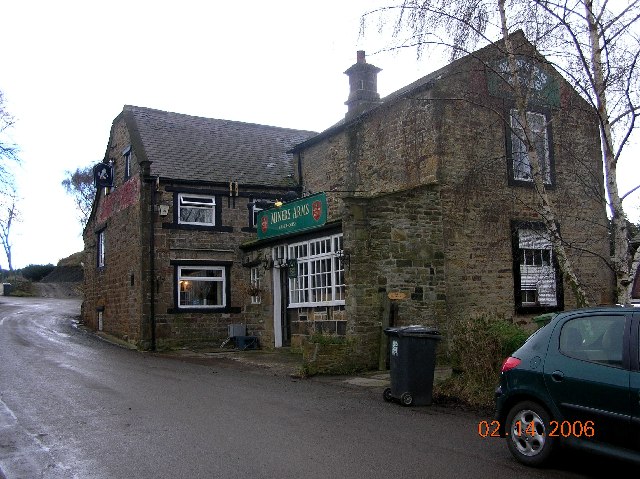
In terms of amenities, The Brushes offers a range of essential services, including a primary school, village hall, and a few local shops. While it may lack some of the conveniences found in larger towns, its idyllic setting and friendly community more than make up for it.

Overall, The Brushes in Derbyshire is a charming village that offers a tranquil escape from urban life. Its stunning natural surroundings, historical landmarks, and tight-knit community make it a sought-after destination for both residents and visitors alike.

If you have any feedback on the listing, please let us know in the comments section below.

Brushes, The Images

Images are sourced within 2km of 53.274959/-1.43686 or Grid Reference SK3775. Thanks to Geograph Open Source API. All images are credited.

Crossfield path. Dronfield 2000 rotary walk.
Crossfield path.
Dronfield 2000 rotary walk.
Thompson Street and Webster's Scrap Metals, Chesterfield
Old Whittington, St Bartholomew
Modern factory beside the A61 Just north of Chesterfield.
Modern factory beside the A61
Just north of Chesterfield.
Avenue Road  Whittington Moor This view shows the end of Avenue Road where it joins Whittington Moor.  It was a thriving area on the A61 between Chesterfield and Sheffield until a bypass destroyed most of it.

The building in the picture (where I was born) was two houses adjoining the corner shop where my family ran an electrical and TV shop with an adjoining cycle shop many years ago.
Avenue Road Whittington Moor
This view shows the end of Avenue Road where it joins Whittington Moor. It was a thriving area on the A61 between Chesterfield and Sheffield until a bypass destroyed most of it. The building in the picture (where I was born) was two houses adjoining the corner shop where my family ran an electrical and TV shop with an adjoining cycle shop many years ago.
Miner's Arms at Hundall in NE Derbyshire
View towards Unstone in NE Derbyshire
TV masts at Hundall in NE Derbyshire
St. Bartholomew's Church, New Whittington, Nr Chesterfield
Cock & Magpie Inn, Old Whittington, Chesterfield
Trading Estate Built into Cobnar Wood this is the western end of Chesterfield Trading Estate.  <a href="https://www.geograph.org.uk/gridref/SK3675">SK3675</a>
Trading Estate
Built into Cobnar Wood this is the western end of Chesterfield Trading Estate. SK3675
Trading Estate Chesterfield Trading Estate accounts for half of this grid square.  The hills in the distance lie just south of Dronfield with the A61 climbing up from Chesterfield.  <a href="https://www.geograph.org.uk/gridref/SK3575">SK3575</a>
Trading Estate
Chesterfield Trading Estate accounts for half of this grid square. The hills in the distance lie just south of Dronfield with the A61 climbing up from Chesterfield. SK3575
Skewed Bridge Carrying the Midland Mainline over Sheffield Road is this skewed railway bridge.
Skewed Bridge
Carrying the Midland Mainline over Sheffield Road is this skewed railway bridge.
Woodmere Drive, New Whittington, Chesterfield. Concrete monument at entrance to private estate on Woodmere Drive.
Woodmere Drive, New Whittington, Chesterfield.
Concrete monument at entrance to private estate on Woodmere Drive.
Wellington Street, New Whittington, Chesterfield.
Hundall Lane, Hundall in NE Derbyshire
War Memorial, Unstone.
Unstone School, near Chesterfield
Show me another place!

Brushes, The is located at Grid Ref: SK3775 (Lat: 53.274959, Lng: -1.43686)

Administrative County: Derbyshire

District: Chesterfield

Police Authority: Derbyshire

What 3 Words

///boots.pumps.eaten. Near Chesterfield, Derbyshire

Related Wikis

Broomhouse Tunnel

Broomhouse Tunnel was on the Midland Main Line between Chesterfield and Sheffield. It was built by the Midland Railway in 1870 on what is known to railwaymen...

River Drone

The River Drone is a river which flows south from its source on the Sheffield, South Yorkshire, border. It flows through Dronfield, Unstone and Unstone...

Unstone

Unstone ( UN-stən) is a village and civil parish in the English county of Derbyshire, in the North East Derbyshire administrative district approximately...

Peak FM (North Derbyshire)

Peak FM was an Independent Local Radio station serving north Derbyshire. The station was folded into Greatest Hits Radio Yorkshire, as part of a rebrand...

Whittington Green School

Whittington Green School (formerly The Meadows Community School) is a mixed secondary school located in Old Whittington, Chesterfield in the English county...

Sheepbridge railway station

Sheepbridge railway station was a station in Chesterfield, Derbyshire, England. It was built by the Midland Railway in 1870 on what is known to railwaymen...

Old Whittington

Old Whittington is a village in the Borough of Chesterfield in Derbyshire, England. Old Whittington is 2 miles (3.2 km) north of Chesterfield and 10 miles...

Unstone railway station

Unstone railway station was a station in Derbyshire, England. It was built by the Midland Railway in 1870 and was designed by the company architect John...

Nearby Amenities

Located within 500m of 53.274959,-1.43686
Crossing
Bicycle: yes
Button Operated: yes
Crossing: traffic_signals
Crossing Island: no
Crossing Ref: toucan
Tactile Paving: yes
Lat/Long: 53.2742487/-1.4419604
Post Box
Brand: Royal Mail
Brand Wikidata: Q638098
Collection Times: Mo-Fr 09:00; Sa 07:00
Operator: Royal Mail
Operator Wikidata: Q638098
Post Box Type: wall
Postal Code: S41 9EQ
Ref: S41 145D
Royal Cypher: EIIR
Royal Cypher Wikidata: Q33102113
Lat/Long: 53.2772451/-1.4393082
Post Box
Brand: Royal Mail
Brand Wikidata: Q638098
Collection Times: Mo-Fr 09:00; Sa 07:00
Drive Through: no
Operator: Royal Mail
Operator Wikidata: Q638098
Post Box Type: pillar
Postal Code: S41 9ED
Ref: S41 320D
Royal Cypher: EIIR
Royal Cypher Wikidata: Q33102113
Lat/Long: 53.2725941/-1.4414833
Cafe
Fixme: There's a cafe in here somewhere, but where is it and what is it called?
Lat/Long: 53.2731571/-1.4426445
Barrier: stile
Lat/Long: 53.2744064/-1.4349055
Barrier: stile
Lat/Long: 53.2748554/-1.4340927
Barrier: stile
Lat/Long: 53.2747142/-1.4379918
Turning Circle
Lat/Long: 53.2752768/-1.4402499
Turning Circle
Lat/Long: 53.2753008/-1.4395311
Generator Method: photovoltaic
Generator Output Electricity: yes
Generator Source: solar
Generator Type: solar_photovoltaic_panel
Location: roof
Power: generator
Lat/Long: 53.2744879/-1.429938
Generator Method: photovoltaic
Generator Output Electricity: yes
Generator Source: solar
Generator Type: solar_photovoltaic_panel
Location: roof
Power: generator
Lat/Long: 53.274405/-1.4296462
Generator Method: photovoltaic
Generator Output Electricity: yes
Generator Source: solar
Generator Type: solar_photovoltaic_panel
Location: roof
Power: generator
Lat/Long: 53.2752308/-1.4304624
Generator Method: photovoltaic
Generator Output Electricity: yes
Generator Source: solar
Generator Type: solar_photovoltaic_panel
Location: roof
Power: generator
Lat/Long: 53.2752083/-1.4304195
Generator Method: photovoltaic
Generator Output Electricity: yes
Generator Source: solar
Generator Type: solar_photovoltaic_panel
Location: roof
Power: generator
Lat/Long: 53.2752252/-1.4303833
Bus Stop
Bus: yes
Ele: 124.6157227
Naptan AtcoCode: 1000DSSC7340
Naptan NaptanCode: dbsgtwpt
Public Transport: platform
Lat/Long: 53.2724299/-1.4417195
Bus Stop
Bus: yes
Ele: 124.6157227
Naptan AtcoCode: 1000DSSC7341
Naptan NaptanCode: dbsgtwpw
Public Transport: platform
Lat/Long: 53.2728566/-1.441741
Barrier: stile
Lat/Long: 53.2739995/-1.4355687
Barrier: stile
Lat/Long: 53.2740758/-1.4378397
Defibrillator
Access: yes
Defibrillator Location: Outside number 31 Mallory Close.
Emergency: defibrillator
Indoor: no
Lat/Long: 53.2751394/-1.4394299
The data included in this document is from www.openstreetmap.org. The data is made available under ODbL.

Have you been to Brushes, The?

Leave your review of Brushes, The below (or comments, questions and feedback).