Broad, The

Settlement in Herefordshire

England

Broad, The

Leominster Wharf House
Leominster Wharf House Credit: Mr M Evison

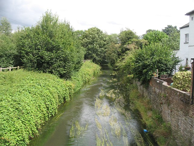
Broad is a small village located in the county of Herefordshire, England. Situated in the western part of the county, it is nestled in a picturesque rural setting surrounded by rolling hills and lush green fields. The village is part of the parish of Dilwyn and sits about 10 miles northwest of the city of Hereford.

Despite being a small village, Broad is home to a close-knit community that takes pride in its tranquil and idyllic surroundings. The village itself is characterized by a mix of traditional and modern architecture, with charming cottages and farmhouses dotted throughout the area. The local church, St. Peter's, is a notable landmark, boasting a beautiful 13th-century tower.

The village offers a range of amenities to its residents and visitors. These include a village hall, a primary school, and a post office. Additionally, there is a local pub where locals and tourists can enjoy a pint and sample traditional English pub fare.

Broad is ideally located for those seeking to explore the Herefordshire countryside. The surrounding area offers numerous opportunities for outdoor activities such as hiking, cycling, and horseback riding. The nearby River Arrow is also popular for fishing enthusiasts.

Overall, Broad, Herefordshire, is a charming village that offers a peaceful and picturesque escape from the hustle and bustle of city life. With its rich history, beautiful scenery, and strong sense of community, it is a place that truly captures the essence of rural England.

If you have any feedback on the listing, please let us know in the comments section below.

Broad, The Images

Images are sourced within 2km of 52.242695/-2.7467747 or Grid Reference SO4960. Thanks to Geograph Open Source API. All images are credited.

Leominster Wharf House
Newly cultivated ground, Luston
Barns, Nordan "Tin" barns beyond a winter wheat field just north of Leominster. View from the B4361 to Ludlow.
Barns, Nordan
"Tin" barns beyond a winter wheat field just north of Leominster. View from the B4361 to Ludlow.
The Broad Field and scattered houses just north of Leominster.
The Broad
Field and scattered houses just north of Leominster.
B4361, The Broad One of the two Leominster to Ludlow routes, this one traditionally carries the bus service. Apple and pear blossom time.
B4361, The Broad
One of the two Leominster to Ludlow routes, this one traditionally carries the bus service. Apple and pear blossom time.
Ruined shed This looks like a former orchard with the pear tree, but is not shown as such on old maps. A hawthorn hedge has grown out.
Ruined shed
This looks like a former orchard with the pear tree, but is not shown as such on old maps. A hawthorn hedge has grown out.
Orchard, Coxall Orchard near the River Lugg by Eyton.
Orchard, Coxall
Orchard near the River Lugg by Eyton.
Gap in the hedge A missing section of hedge at Coxall. Now replaced by a wire fence.
Gap in the hedge
A missing section of hedge at Coxall. Now replaced by a wire fence.
Orchard, Eyton Cattle (sadly not Herefords) in an orchard at blossom time.
Orchard, Eyton
Cattle (sadly not Herefords) in an orchard at blossom time.
Eyton Common As is the usual practice, the road across the common is unfenced.
Eyton Common
As is the usual practice, the road across the common is unfenced.
Potato field Field prepared for growing potatoes. The soil was very dry.
Potato field
Field prepared for growing potatoes. The soil was very dry.
Eyton Common A damp meadow in a dry spell.
Eyton Common
A damp meadow in a dry spell.
The River Lugg with The Priory Church, Leominster in the background The Lugg here flows in a shallow bed between high banks through flood meadows not far from the old town centre, which is on slightly higher ground. The Lugg here apparently supports a few Herons and some Kingfishers.
The River Lugg with The Priory Church, Leominster in the background
The Lugg here flows in a shallow bed between high banks through flood meadows not far from the old town centre, which is on slightly higher ground. The Lugg here apparently supports a few Herons and some Kingfishers.
Footpath beside a potato field near Eaton Hill, Leominster This access drive to the home ahead also carries a footpath. The potato crop seems to be doing well.
Footpath beside a potato field near Eaton Hill, Leominster
This access drive to the home ahead also carries a footpath. The potato crop seems to be doing well.
Gothic mansion near Eaton Hill A very nice, large and very Gothic looking mansion viewed from a distance.
Gothic mansion near Eaton Hill
A very nice, large and very Gothic looking mansion viewed from a distance.
Brick built home near Eaton Hill, Leominster I think that the homeowner here had this house designed and built with World War III in mind; it resembles a fortress more than a rural home, surrounded by a high wall topped with metal railings, small windows like eyes squinting out down the long approach drive like a soldier in a trench. Maybe he knows something I don't...
Brick built home near Eaton Hill, Leominster
I think that the homeowner here had this house designed and built with World War III in mind; it resembles a fortress more than a rural home, surrounded by a high wall topped with metal railings, small windows like eyes squinting out down the long approach drive like a soldier in a trench. Maybe he knows something I don't...
Converted farm buildings at Luston The old range of farm buildings have been gradually converted into residential use over the last decade or so, this being the most recent section to come to the market. Described as an oast house by developer and or the estate agents it looks like it would make a nice, quirky home for someone.
Converted farm buildings at Luston
The old range of farm buildings have been gradually converted into residential use over the last decade or so, this being the most recent section to come to the market. Described as an oast house by developer and or the estate agents it looks like it would make a nice, quirky home for someone.
Nordan Hall This substantial property is sealed up and up for sale now. A sad sight.
Nordan Hall
This substantial property is sealed up and up for sale now. A sad sight.
Show me another place!

Broad, The is located at Grid Ref: SO4960 (Lat: 52.242695, Lng: -2.7467747)

Unitary Authority: County of Herefordshire

Police Authority: West Mercia

What 3 Words

///worthy.directs.panics. Near Eyton, Herefordshire

Nearby Locations

The Broad Broad, The

Related Wikis

Leominster nunnery

Leominster nunnery was an Anglo-Saxon nunnery at Leominster, Herefordshire, England. Founded in the ninth century, the nunnery is known to have been active...

Priory Church, Leominster

The Priory Church is an Anglican parish church in Leominster, Herefordshire, England, dedicated to Saint Peter and Saint Paul. The building was constructed...

River Kenwater

The River Kenwater or simply Kenwater is a short anabranch of the River Lugg, i.e. it splits from and later re-joins that river. It separates from it about...

Leominster

Leominster ( LEM-stər) is a market town in Herefordshire, England; it is located at the confluence of the River Lugg and its tributary the River Kenwater...

Nearby Amenities

Located within 500m of 52.242695,-2.7467747
Post Box
Post Box Type: lamp
Lat/Long: 52.2428237/-2.7468727
Bus Stop
The Broad
Bus: yes
Naptan AtcoCode: 2090A114600
Naptan Bearing: N
Naptan BusStopType: CUS
Naptan CommonName: The Broad
Naptan Indicator: Northbound
Naptan Landmark: N/K
Naptan NaptanCode: heradpjw
Naptan Street: B4361
Naptan Verified: no
Public Transport: platform
Source: naptan_import
Lat/Long: 52.23953/-2.7460146
Bus Stop
The Broad
Bus: yes
Naptan AtcoCode: 2090A20325
Naptan Bearing: S
Naptan BusStopType: CUS
Naptan CommonName: The Broad
Naptan Indicator: Southbound
Naptan Landmark: N/K
Naptan NaptanCode: herapgad
Naptan Street: B4361
Naptan Verified: no
Public Transport: platform
Source: naptan_import
Lat/Long: 52.2395153/-2.7458208
Barrier: kissing_gate
Source: survey
Lat/Long: 52.2443765/-2.7493981
Barrier: kissing_gate
Source: survey
Lat/Long: 52.2428049/-2.7469468
Barrier: kissing_gate
Source: survey
Lat/Long: 52.2444006/-2.749259
Fire Hydrant
Emergency: fire_hydrant
Fire Hydrant Type: underground
Operator: H&WFR&S
Source: survey
Lat/Long: 52.242047/-2.7464734
The data included in this document is from www.openstreetmap.org. The data is made available under ODbL.

Have you been to Broad, The?

Leave your review of Broad, The below (or comments, questions and feedback).