Bratch, The

Settlement in Staffordshire South Staffordshire

England

Bratch, The

Railway Path The south staffordshire railway walk near Himley.
Railway Path Credit: Gordon Griffiths

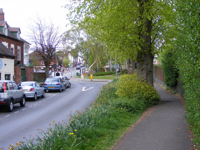
Bratch, The, Staffordshire is a picturesque village nestled in the heart of Staffordshire, England. With a population of approximately 2,000 residents, it offers a serene and idyllic retreat from the hustle and bustle of city life. Bratch is located just a short distance from Wolverhampton, making it easily accessible for both residents and visitors.

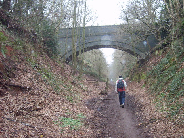
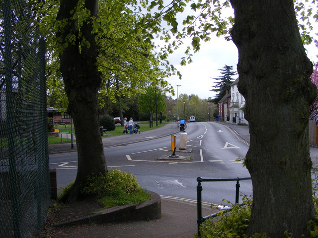
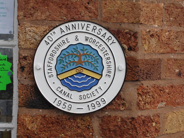
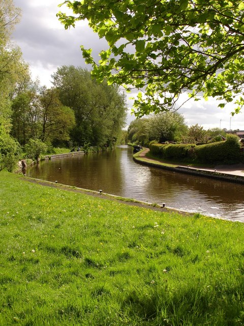
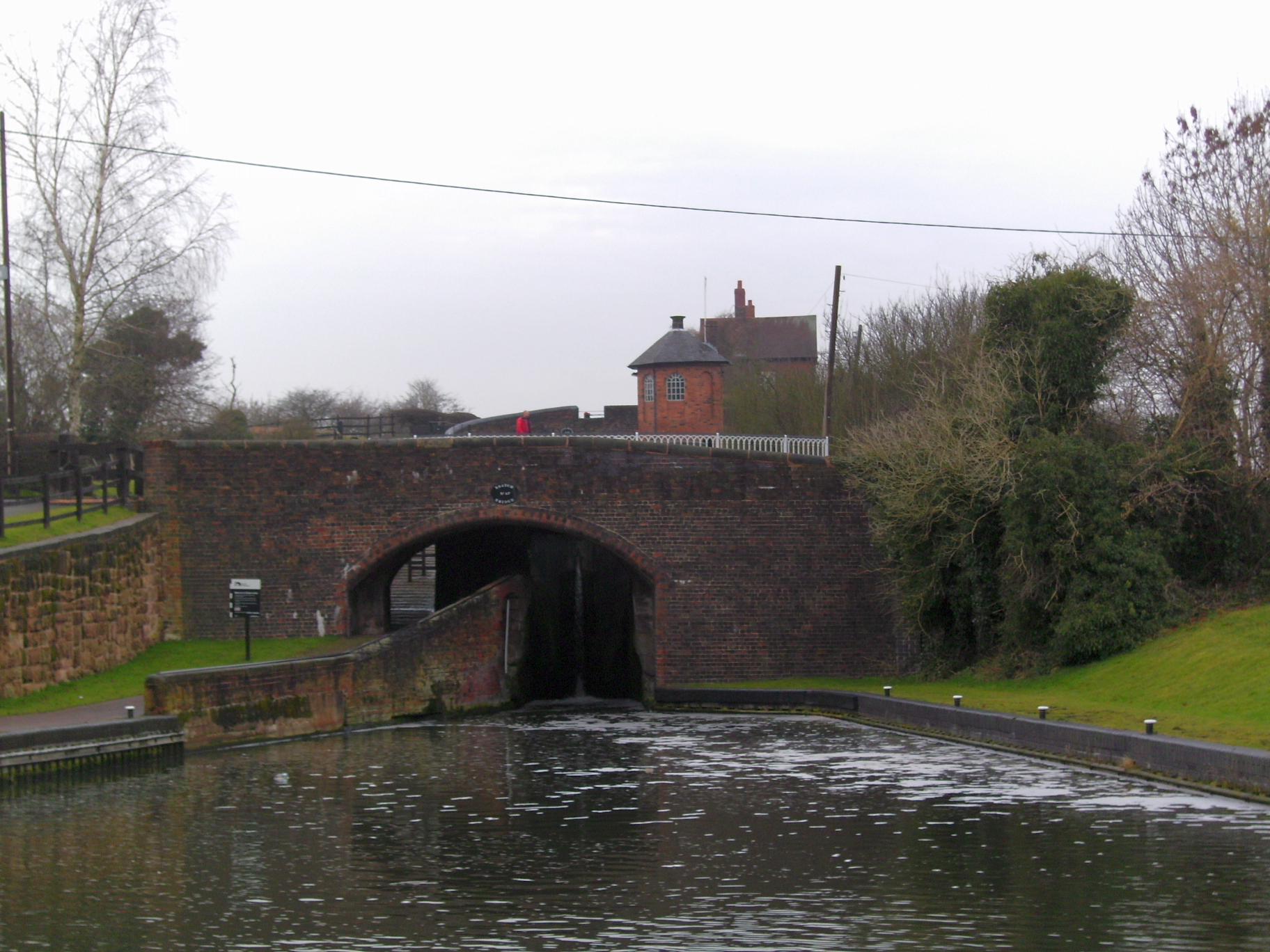
The village is renowned for its natural beauty, boasting stunning landscapes and charming countryside. The Bratch Locks, a series of canal locks on the Staffordshire and Worcestershire Canal, are a popular attraction among tourists and locals alike. Visitors can enjoy leisurely walks along the towpath, taking in the tranquil surroundings and observing the boats passing through the locks.

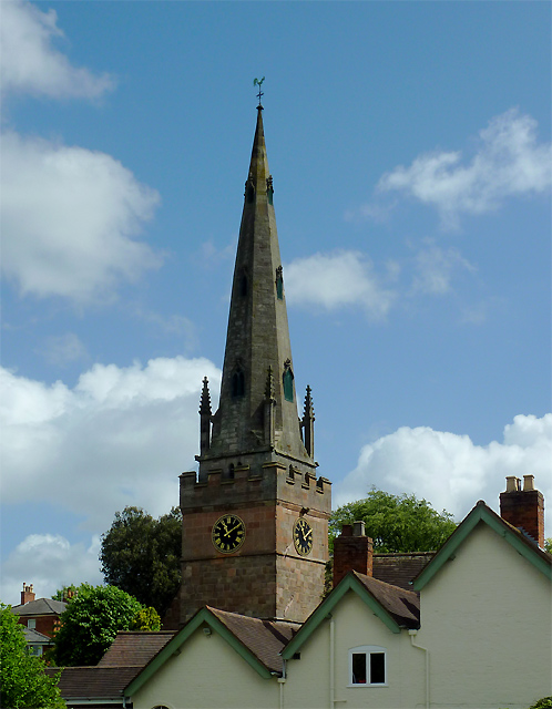
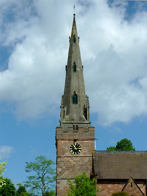
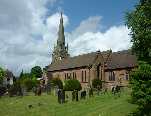
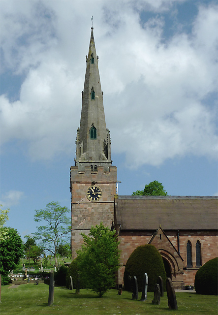
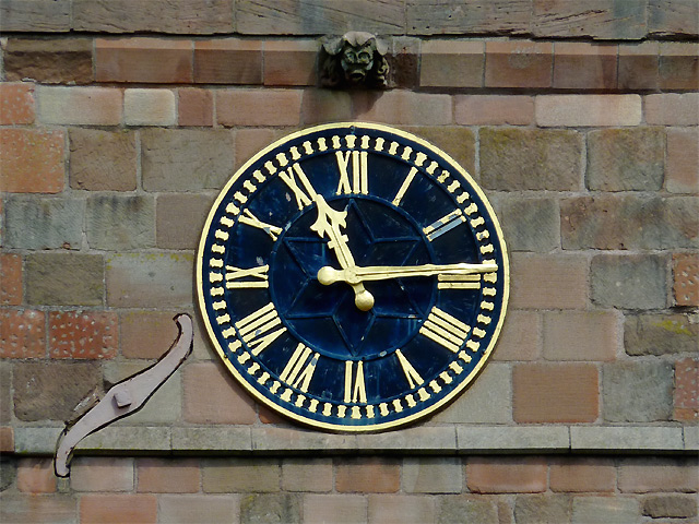
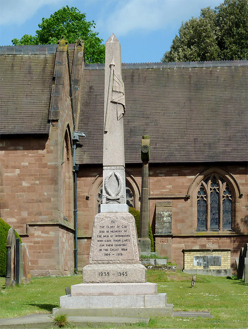
Bratch is also home to several historic landmarks, including the Bratch Pumping Station. This Grade II listed building showcases Victorian engineering at its finest and provides a fascinating glimpse into the area's industrial past. The village is proud of its heritage and hosts various events throughout the year to celebrate its history.

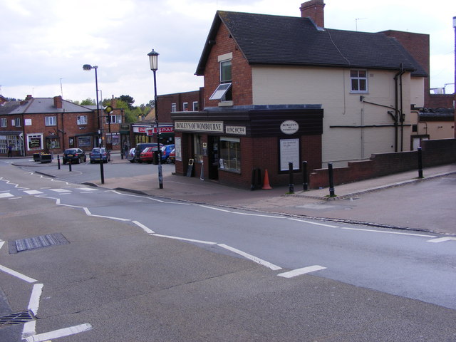
In terms of amenities, Bratch offers a range of facilities to cater to the needs of its residents. These include a primary school, a village hall, and a selection of local shops and eateries. The village has a strong sense of community, with various clubs and societies for residents to get involved in.

Overall, Bratch, The, Staffordshire is a charming and peaceful village that encapsulates the beauty of the English countryside. With its rich history, stunning landscapes, and welcoming community, it is a place that continues to captivate all who visit.

If you have any feedback on the listing, please let us know in the comments section below.

Bratch, The Images

Images are sourced within 2km of 52.541317/-2.201236 or Grid Reference SO8693. Thanks to Geograph Open Source API. All images are credited.

Railway Path The south staffordshire railway walk near Himley.
Railway Path
The south staffordshire railway walk near Himley.
Wombourne Institute The 1863 Institute in Church Road stands next to St Benedict Church overlooking the Staffordshire Village Green.
Wombourne Institute
The 1863 Institute in Church Road stands next to St Benedict Church overlooking the Staffordshire Village Green.
Wombourne Church The St Benedict Biscop Church stands in Church Road overlooking the Village Green.
Wombourne Church
The St Benedict Biscop Church stands in Church Road overlooking the Village Green.
Green on the Green Wombourne Bowls Club stands on the Staffordshire Village Green, with St Benedict's Church in the background.
Green on the Green
Wombourne Bowls Club stands on the Staffordshire Village Green, with St Benedict's Church in the background.
Wombourne Path The view up Maypole Street alongside the Staffordshire Village Green.
Wombourne Path
The view up Maypole Street alongside the Staffordshire Village Green.
Wombourne Butchers The view of Boxley's of Wombourne in Windmill Bank near the Staffordshire Village Green.
Wombourne Butchers
The view of Boxley's of Wombourne in Windmill Bank near the Staffordshire Village Green.
Maypole and Street The view in Maypole Street Wombourne near the Staffordshire Village Green.
Maypole and Street
The view in Maypole Street Wombourne near the Staffordshire Village Green.
Wombourne View The view of Gravel Hill from the corner of the Staffordshire Village Green.
Wombourne View
The view of Gravel Hill from the corner of the Staffordshire Village Green.
The spire of St Benedict Biscop Church at Wombourne, Staffordshire In 1840 nearly all the then existing medieval church was demolished. The 14th century tower with its recessed stone spire was retained. The 1840 rebuild was itself taken down, and the present fine structure replaced it in 1867 - again retaining the original 14th century tower and spire.
The spire of St Benedict Biscop Church at Wombourne, Staffordshire
In 1840 nearly all the then existing medieval church was demolished. The 14th century tower with its recessed stone spire was retained. The 1840 rebuild was itself taken down, and the present fine structure replaced it in 1867 - again retaining the original 14th century tower and spire.
St Benedict Biscop Church in Wombourne, Staffordshire In 1840 nearly all the then existing medieval church was demolished. The 14th century tower with its recessed stone spire was retained. The 1840 rebuild was itself taken down, and the present fine structure replaced it in 1867 - again retaining the original 14th century tower and spire.
St Benedict Biscop Church in Wombourne, Staffordshire
In 1840 nearly all the then existing medieval church was demolished. The 14th century tower with its recessed stone spire was retained. The 1840 rebuild was itself taken down, and the present fine structure replaced it in 1867 - again retaining the original 14th century tower and spire.
St Benedict Biscop Church in Wombourne, Staffordshire In 1840 nearly all the then existing medieval church was demolished. The 14th century tower with its recessed stone spire was retained. The 1840 rebuild was itself taken down, and the present fine structure replaced it in 1867 - again retaining the original 14th century tower and spire.

<span class="nowrap"><a title="http://www.stbenedictbiscop.org.uk/" rel="nofollow ugc noopener" href="http://www.stbenedictbiscop.org.uk/">Link</a><img style="margin-left:2px;" alt="External link" title="External link - shift click to open in new window" src="https://s1.geograph.org.uk/img/external.png" width="10" height="10"/></span>
St Benedict Biscop Church in Wombourne, Staffordshire
In 1840 nearly all the then existing medieval church was demolished. The 14th century tower with its recessed stone spire was retained. The 1840 rebuild was itself taken down, and the present fine structure replaced it in 1867 - again retaining the original 14th century tower and spire. LinkExternal link
St Benedict's Church clock in Wombourne, Staffordshire The tower was originally built in the 14th century and has structural strengthening ironware showing here, as well as a gargoyle.

In 1840 nearly all the then existing medieval church was demolished. The tower with its recessed stone spire was retained. The 1840 rebuild was itself taken down, and the present fine structure replaced it in 1867 - again retaining the 14th century tower and spire.
St Benedict's Church clock in Wombourne, Staffordshire
The tower was originally built in the 14th century and has structural strengthening ironware showing here, as well as a gargoyle. In 1840 nearly all the then existing medieval church was demolished. The tower with its recessed stone spire was retained. The 1840 rebuild was itself taken down, and the present fine structure replaced it in 1867 - again retaining the 14th century tower and spire.
War memorial in St Benedict's churchyard in Wombourne, Staffordshire The inscription reads:

TO
THE GLORY OF GOD
AND IN MEMORY OF
THE MEN OF WOMBOURN
WHO GAVE THEIR LIVES
FOR THEIR COUNTRY
IN THE GREAT WAR
1914-1919
1939-1945
War memorial in St Benedict's churchyard in Wombourne, Staffordshire
The inscription reads: TO THE GLORY OF GOD AND IN MEMORY OF THE MEN OF WOMBOURN WHO GAVE THEIR LIVES FOR THEIR COUNTRY IN THE GREAT WAR 1914-1919 1939-1945
Bratch Locks Plaque recording the refurbishment of the locks
Bratch Locks
Plaque recording the refurbishment of the locks
Below Bratch Locks
Below Bratch Locks
Griffiths Drive The view of the Close off Sytch Lane, Wombourne.
Griffiths Drive
The view of the Close off Sytch Lane, Wombourne.
Sytch Lane Cemetery Entrance The view of the entrance to the Wombourne Cemetery which opened in December 2009.
Sytch Lane Cemetery Entrance
The view of the entrance to the Wombourne Cemetery which opened in December 2009.
Show me another place!

Bratch, The is located at Grid Ref: SO8693 (Lat: 52.541317, Lng: -2.201236)

Administrative County: Staffordshire

District: South Staffordshire

Police Authority: Staffordshire

What 3 Words

///pipe.wallet.same. Near Wombourn, Staffordshire

Nearby Locations

The Bratch Bratch, The

Related Wikis

Bratch

The Bratch is an area of Wombourne in South Staffordshire, England, noted for its industrial heritage and more recently as a way station for walkers, riders...

Wombourn railway station

Wombourn railway station was the main intermediate station on the Wombourne Branch Line, situated at the Bratch. It was opened by the Great Western Railway...

Wombourne High School

Wombourne High School (formerly Ounsdale High School) is a coeducational secondary school and sixth form located in Wombourne, Staffordshire, England....

Trysull

Trysull is a rural village in the county of Staffordshire, England approximately five miles south-west of Wolverhampton. With the adjacent village of...

Wom Brook

The Wom Brook is a stream in South Staffordshire, England. It flows through the large village of Wombourne, and has played an important part in its industrial...

Orton, Staffordshire

Orton is a hamlet in the South Staffordshire district, in the English county of Staffordshire. Nearby settlements include the city of Wolverhampton and...

Wombourne

Wombourne is a village and civil parish located in the district of South Staffordshire, in the county of Staffordshire, England. It is 4 miles (6 km) south...

Trysull and Seisdon

Trysull and Seisdon is a conjoined civil parish in the South Staffordshire non-metropolitan district, in the county of Staffordshire, England. The population...

Nearby Amenities

Located within 500m of 52.541317,-2.201236
HE Ref: 1232420
Heritage: 2
Heritage Operator: Historic England
Listed Status: Grade II
Seamark Type: gate
Source: survey
Waterway: lock_gate
Lat/Long: 52.5377797/-2.2002687
Source: survey
Waterway: turning_point
Lat/Long: 52.5393151/-2.198123
Source: www.npemap.org.uk
Uk Postcode Centroid: WV5
Lat/Long: 52.538669/-2.203222
Power Historic: tower
Source: OS 1:25k
Lat/Long: 52.54069/-2.1965155
Turning Circle
Lat/Long: 52.5389188/-2.1956084
Mini Roundabout
Lat/Long: 52.5385294/-2.2005988
Turning Circle
Lat/Long: 52.5386027/-2.2015106
Turning Circle
Lat/Long: 52.5409283/-2.199133
Turning Circle
Lat/Long: 52.5396326/-2.1997284
Mini Roundabout
Source: bing
Lat/Long: 52.5373818/-2.2017043
Turning Circle
Lat/Long: 52.5374383/-2.202239
Seamark Type: gate
Waterway: lock_gate
Lat/Long: 52.5417203/-2.1968002
Seamark Type: gate
Waterway: lock_gate
Lat/Long: 52.5419627/-2.1968619
Seamark Type: gate
Waterway: lock_gate
Lat/Long: 52.542264/-2.1969271
Seamark Type: gate
Waterway: lock_gate
Lat/Long: 52.5420443/-2.196874
Barrier: kissing_gate
Foot: yes
Lat/Long: 52.5402157/-2.1972308
Barrier: kissing_gate
Foot: yes
Lat/Long: 52.5414845/-2.1965609
HE Ref: 1232420
Heritage: 2
Heritage Operator: Historic England
Listed Status: Grade II
Seamark Type: gate
Source: survey
Waterway: lock_gate
Lat/Long: 52.537631/-2.2005256
Barrier: kissing_gate
Source: survey
Lat/Long: 52.537474/-2.2010092
Source: survey
Tourism: picnic_site
Lat/Long: 52.5413231/-2.1965135
Barrier: cycle_barrier
Source: survey
Lat/Long: 52.5414062/-2.1969099
Turning Circle
Lat/Long: 52.5376633/-2.1986538
Turning Circle
Lat/Long: 52.5378035/-2.2027051
Turning Circle
Lat/Long: 52.5393439/-2.2002822
Waste Disposal
Lat/Long: 52.5415172/-2.1968179
Generator Method: photovoltaic
Generator Output Electricity: yes
Generator Source: solar
Generator Type: solar_photovoltaic_panel
Power: generator
Lat/Long: 52.538761/-2.2017476
Generator Method: photovoltaic
Generator Output Electricity: yes
Generator Source: solar
Generator Type: solar_photovoltaic_panel
Power: generator
Lat/Long: 52.538358/-2.2020695
Generator Method: photovoltaic
Generator Output Electricity: yes
Generator Source: solar
Generator Type: solar_photovoltaic_panel
Location: roof
Power: generator
Lat/Long: 52.5400343/-2.1988642
Generator Method: photovoltaic
Generator Output Electricity: yes
Generator Source: solar
Generator Type: solar_photovoltaic_panel
Location: roof
Power: generator
Lat/Long: 52.5391313/-2.2003368
The data included in this document is from www.openstreetmap.org. The data is made available under ODbL.

Have you been to Bratch, The?

Leave your review of Bratch, The below (or comments, questions and feedback).