Bents, The

Settlement in Staffordshire East Staffordshire

England

Bents, The

Misty Morning Path This footpath is not that well trodden, especially not on this misty morning in October.
Misty Morning Path Credit: Michael Patterson

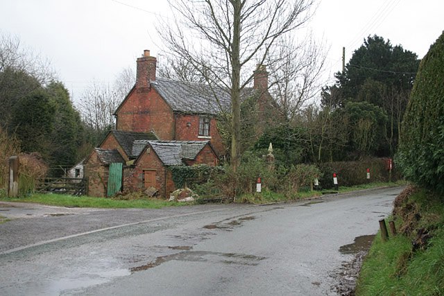
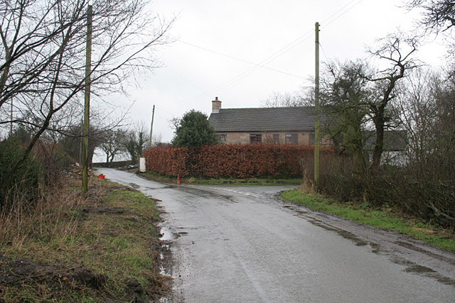
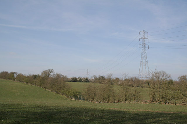
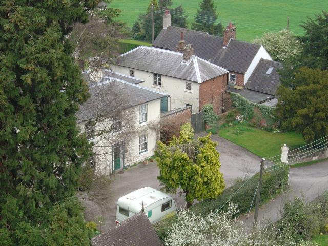
Bents, The, Staffordshire is a small village located in the county of Staffordshire, England. Situated near the town of Leek, Bents is known for its picturesque countryside and charming rural atmosphere. The village is surrounded by rolling hills and farmland, offering stunning views of the Staffordshire Moorlands.

Bents is a tight-knit community with a population of around 500 residents. The village has a tranquil and peaceful ambiance, making it an ideal place for those seeking a quiet and idyllic lifestyle. The local residents take pride in maintaining the village's natural beauty and preserving its rich heritage.

The village is home to a few amenities, including a village hall and a local pub that serves as a social hub for the community. While Bents does not have its own primary school, there are several schools in the nearby towns that cater to the educational needs of the village's children.

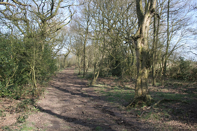
For outdoor enthusiasts, Bents offers plenty of opportunities for walking, hiking, and exploring the surrounding countryside. The village is located near several nature reserves and parks, providing residents with ample opportunities to enjoy the great outdoors.

Overall, Bents, The, Staffordshire is a quaint and peaceful village that offers a close-knit community and beautiful natural surroundings. Its rural charm and scenic landscapes make it an attractive place to live for those seeking a serene and picturesque lifestyle.

If you have any feedback on the listing, please let us know in the comments section below.

Bents, The Images

Images are sourced within 2km of 52.911681/-1.963238 or Grid Reference SK0234. Thanks to Geograph Open Source API. All images are credited.

Misty Morning Path This footpath is not that well trodden, especially not on this misty morning in October.
Misty Morning Path
This footpath is not that well trodden, especially not on this misty morning in October.
Bridleway and Fog This bridleway leads south east off Painleyhill.
Bridleway and Fog
This bridleway leads south east off Painleyhill.
Hens and River The River Blithe passes through this field just to the west of Field.
Hens and River
The River Blithe passes through this field just to the west of Field.
Barn Croft at Dods Leigh Rather overgrown but apparently still inhabited.
Barn Croft at Dods Leigh
Rather overgrown but apparently still inhabited.
Leigh Level Crossing The station has disappeared, but a signalbox <a title="https://www.geograph.org.uk/photo/3748106" href="https://www.geograph.org.uk/photo/3748106">Link</a> has been (?re-)built on adjacent premises.
Leigh Level Crossing
The station has disappeared, but a signalbox Link has been (?re-)built on adjacent premises.
The lane to Upper Leigh The building on the right appears to have been an alehouse. It carries a stone with the following inscription:
"Walk in my friend and Drink with me
Heres ALE as good as e'er you see
Refresh yourself it is no CRIME
Stay not too long to Spend your time
Francis Sherratt 1751"
Update (via an external correspondent) - until the 1960s this was the Railway Tavern serving Bass products. (Clearly not the original name as there was no railway in 1751!)
The lane to Upper Leigh
The building on the right appears to have been an alehouse. It carries a stone with the following inscription: "Walk in my friend and Drink with me Heres ALE as good as e'er you see Refresh yourself it is no CRIME Stay not too long to Spend your time Francis Sherratt 1751" Update (via an external correspondent) - until the 1960s this was the Railway Tavern serving Bass products. (Clearly not the original name as there was no railway in 1751!)
The Derby to Stoke railway at Bent's Farm Bridge
The Star Inn at Church Leigh Church Leigh, Lower Leigh, Upper Leigh and Dods Leigh share one church!
The Star Inn at Church Leigh
Church Leigh, Lower Leigh, Upper Leigh and Dods Leigh share one church!
Farm buildings at Park Hall. Clearly there has been a settlement here for a long time; the OS map indicates the presence of an ancient moat.
Farm buildings at Park Hall.
Clearly there has been a settlement here for a long time; the OS map indicates the presence of an ancient moat.
Hothill Lane near Withington
Farmers Arms at Withington The half-timbered construction is genuine!
Farmers Arms at Withington
The half-timbered construction is genuine!
Farmland near Withington The woodland on the horizon carries the name Hell Clough
Farmland near Withington
The woodland on the horizon carries the name Hell Clough
Upper Nobut Nobbut a little place - a hall, a farm an half-a-dozen cottages
Upper Nobut
Nobbut a little place - a hall, a farm an half-a-dozen cottages
Field of Dandelions All Saints church and Church Leigh village above a field of dandelions.
Field of Dandelions
All Saints church and Church Leigh village above a field of dandelions.
Footpath near Dod's Leigh This path had clearly been recently smoothed using something like a small bulldozer, making it far more walkable than would clearly have been the case a few weeks earlier.
Footpath near Dod's Leigh
This path had clearly been recently smoothed using something like a small bulldozer, making it far more walkable than would clearly have been the case a few weeks earlier.
Farmland near Dod's Leigh
New Houses The village of Church Leigh Is expanding.
New Houses
The village of Church Leigh Is expanding.
North-east from the Tower The view from Church Leigh church tower.
North-east from the Tower
The view from Church Leigh church tower.
Show me another place!

Bents, The is located at Grid Ref: SK0234 (Lat: 52.911681, Lng: -1.963238)

Administrative County: Staffordshire

District: East Staffordshire

Police Authority: Staffordshire

What 3 Words

///micro.stun.snapped. Near Uttoxeter, Staffordshire

Nearby Locations

Bents, The The Bents

Related Wikis

Leigh, Staffordshire

Leigh is a civil parish in the English county of Staffordshire. The parish includes the village of Church Leigh, together with the settlements of Withington...

Leigh railway station (Staffordshire)

Leigh railway station was a railway station in Staffordshire, England. The railway line between Stoke-on-Trent and Uttoxeter was opened by the North Staffordshire...

St Mary's and All Saints' Church, Checkley

St Mary's and All Saints' Church is an Anglican church in the village of Checkley, Staffordshire, England. It is a Grade I listed building. The oldest...

Gratwich

Gratwich is a village and former civil parish, now in the parish of Kingstone, in the East Staffordshire district, in the county of Staffordshire, England...

Checkley

Checkley is a village and civil parish in the district of Staffordshire Moorlands in the English county of Staffordshire. == Location == The village is...

Bromshall railway station

Bromshall railway station was a short lived railway station in Staffordshire, England. The railway line between Stoke-on-Trent and Uttoxeter was opened...

Uttoxeter Road

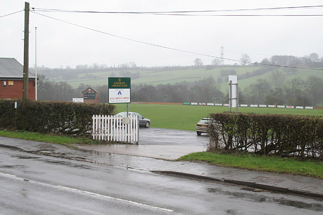
Uttoxeter Road (also known as Four Trees) is a cricket ground located along the Uttoxeter Road between the villages of Lower Tean and Checkley in Staffordshire...

Beamhurst

Beamhurst is a village in Staffordshire, England. For population details taken at the 2011 census see Croxden. == References ==

Nearby Amenities

Located within 500m of 52.911681,-1.963238
Bus Stop
Brooks Cottage
Bus: yes
Naptan AtcoCode: 3800C312300
Naptan Bearing: SW
Naptan CommonName: Brooks Cottage
Naptan Indicator: Opp
Naptan Landmark: Brooks Cottage
Naptan Street: Withington Rd
Naptan Verified: no
Public Transport: platform
Source: naptan_import
Lat/Long: 52.9127393/-1.9602651
Bus Stop
Brooks Cottage
Bus: yes
Naptan AtcoCode: 3800C312301
Naptan Bearing: NE
Naptan BusStopType: CUS
Naptan CommonName: Brooks Cottage
Naptan Indicator: Adj
Naptan Landmark: Brooks Cottage
Naptan Street: Withington Rd
Naptan Verified: no
Public Transport: platform
Source: naptan_import
Lat/Long: 52.912838/-1.9599081
The data included in this document is from www.openstreetmap.org. The data is made available under ODbL.

Have you been to Bents, The?

Leave your review of Bents, The below (or comments, questions and feedback).