Beeches, The

Settlement in Gloucestershire Cotswold

England

Beeches, The

Cirencester marketplace looking ESE
Cirencester marketplace Credit: mym

Beeches, The, Gloucestershire is a small village located in the South West region of England. Situated in the picturesque county of Gloucestershire, it is nestled amidst the scenic beauty of the Cotswolds. The village is known for its idyllic countryside setting, charming architecture, and rich history.

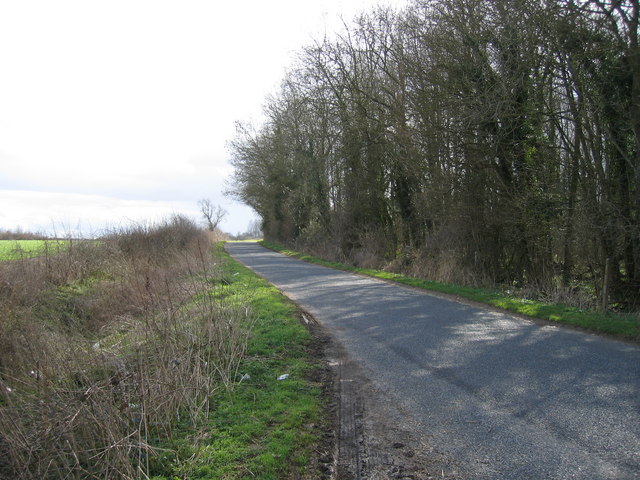
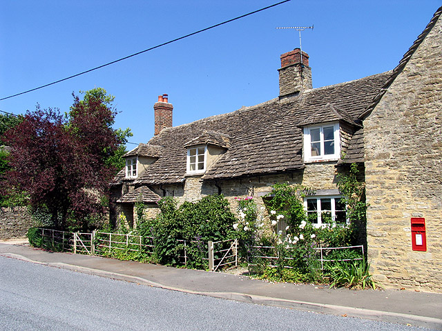
Beeches, The, Gloucestershire is home to a tight-knit community that prides itself on its traditional values and strong sense of community spirit. The village is characterized by its quaint cottages made of local Cotswold stone, giving it a distinct and timeless charm. The surrounding countryside offers breathtaking views, with rolling hills, lush green meadows, and picturesque walking trails that attract nature enthusiasts and hikers alike.

Despite its small size, Beeches, The, Gloucestershire boasts a number of amenities and facilities for its residents. These include a village hall, a local pub, a small grocery store, and a primary school. The village also hosts various community events and activities throughout the year, fostering a sense of togetherness among its residents.

The village is conveniently located near several larger towns and cities, such as Cheltenham and Gloucester, providing residents with easy access to a wider range of services and entertainment options. Additionally, Beeches, The, Gloucestershire is well-connected by road and public transportation, making it an ideal location for those who value the tranquility of rural living while still needing access to urban amenities.

In summary, Beeches, The, Gloucestershire is a charming village in the heart of the Cotswolds, offering a peaceful and picturesque setting for its residents. With its strong community spirit, beautiful countryside, and convenient location, it is a desirable place to live for those seeking a laid-back lifestyle with easy access to nearby towns and cities.

If you have any feedback on the listing, please let us know in the comments section below.
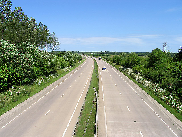
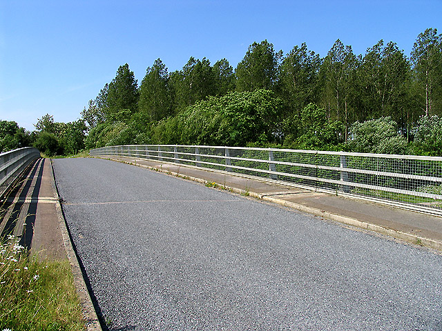
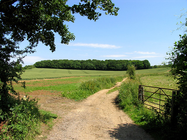
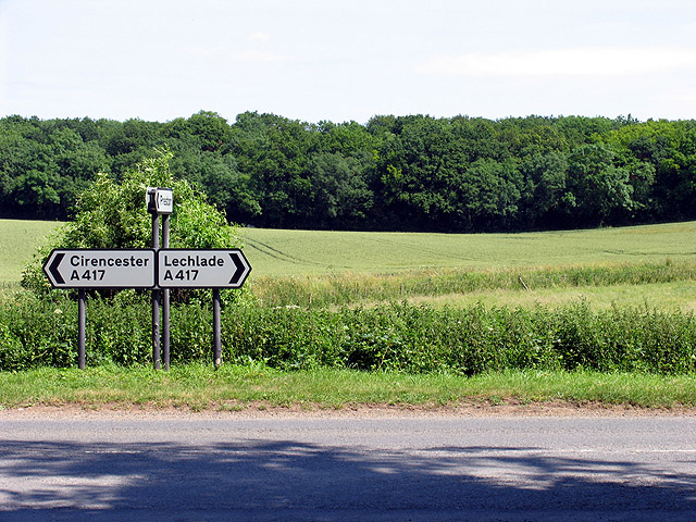
Beeches, The Images

Images are sourced within 2km of 51.716132/-1.947134 or Grid Reference SP0301. Thanks to Geograph Open Source API. All images are credited.

Cirencester marketplace looking ESE
Cirencester marketplace
looking ESE
Norcote Farm near Cirencester This farm on the north side of London Road (A417) is in the south eastern section of the square. This square is almost all farmland.
Norcote Farm near Cirencester
This farm on the north side of London Road (A417) is in the south eastern section of the square. This square is almost all farmland.
A417 (T) near Cirencester A view of the A417 (T) in the south eastern section of the square. The square consists of this road, Witpit lane, a byway, farmland and a copse.
A417 (T) near Cirencester
A view of the A417 (T) in the south eastern section of the square. The square consists of this road, Witpit lane, a byway, farmland and a copse.
Bridge over the A417(T) near Cirencester The bridge carries Witpit Lane over the A417. This view is taken from the north east looking towards the plantation in the south east section of the square.
Bridge over the A417(T) near Cirencester
The bridge carries Witpit Lane over the A417. This view is taken from the north east looking towards the plantation in the south east section of the square.
Plantation at intersection of A417 and Witpit Lane The plantation is in the south eastern section of the square.
Plantation at intersection of A417 and Witpit Lane
The plantation is in the south eastern section of the square.
Church: Preston This church is in the northern section of the square. The square contains the village of Preston in the northern half and a Roman road, the A419, farmland and some copses.
Church: Preston
This church is in the northern section of the square. The square contains the village of Preston in the northern half and a Roman road, the A419, farmland and some copses.
Preston Street: Cotswolds This is a typical street scene in the village of Preston and surrounding villages.
Preston Street: Cotswolds
This is a typical street scene in the village of Preston and surrounding villages.
Merrilhill Copse Looking northish from the dirt track opposite Witpit Lane where it intersects with the A417.
Merrilhill Copse
Looking northish from the dirt track opposite Witpit Lane where it intersects with the A417.
Intersection of the A417 and Witpit Lane This intersection with a view of the farmland typical of this square, is in the south western section of the square. The square is mostly farmland.
Intersection of the A417 and Witpit Lane
This intersection with a view of the farmland typical of this square, is in the south western section of the square. The square is mostly farmland.
Cirencester Parish Church View from south. Dedicated to St John the Baptist
Cirencester Parish Church
View from south. Dedicated to St John the Baptist
Watermoor Church Watermoor Church, designed by George Gilbert Scott and completed in 1851/2. This area formerly contained both of Cirencester's railway stations as well as most of its commercial activity
Watermoor Church
Watermoor Church, designed by George Gilbert Scott and completed in 1851/2. This area formerly contained both of Cirencester's railway stations as well as most of its commercial activity
Siddington Road, Watermoor Looking north along Siddington Road, Watermoor, Cirencester, a ribbon development which grew up following the arrival of the Midland & South Western Junction Railway in 1891.
Siddington Road, Watermoor
Looking north along Siddington Road, Watermoor, Cirencester, a ribbon development which grew up following the arrival of the Midland & South Western Junction Railway in 1891.
Love Lane Trading Estate An area of Cirencester composed mainly of commercial and light industrial development, some of it on the site of the former railway workshops.
Love Lane Trading Estate
An area of Cirencester composed mainly of commercial and light industrial development, some of it on the site of the former railway workshops.
Golden Farm Road Golden Farm Road on the Beeches Estate. The main features of this square are a number of 1950's housing estates, a bypass and a section of old Roman city wall
Golden Farm Road
Golden Farm Road on the Beeches Estate. The main features of this square are a number of 1950's housing estates, a bypass and a section of old Roman city wall
Ashcroft Methodist Church Cirencester In Ashcroft Road Cirencester
Ashcroft Methodist Church Cirencester
In Ashcroft Road Cirencester
Salvation Army Thomas Street Cirencester Opposite to the Friends Meeting House
Salvation Army Thomas Street Cirencester
Opposite to the Friends Meeting House
London Road Cirencester The edge of town as at early 2006. London Road is the A417 which meanders off towards Reading
London Road Cirencester
The edge of town as at early 2006. London Road is the A417 which meanders off towards Reading
Witpit Copse on Witpit Lane Preston
Show me another place!

Beeches, The is located at Grid Ref: SP0301 (Lat: 51.716132, Lng: -1.947134)

Administrative County: Gloucestershire

District: Cotswold

Police Authority: Gloucestershire

What 3 Words

///groups.pillows.calendars. Near Cirencester, Gloucestershire

Related Wikis

Nearby Amenities

Located within 500m of 51.716132,-1.947134
Crossing
Crossing: traffic_signals
Lat/Long: 51.7195538/-1.9469987
Bus Stop
Kingshill School
Bus: yes
Naptan AtcoCode: 1600GL1289
Naptan Bearing: N
Naptan CommonName: Kingshill School
Naptan NaptanCode: glogampd
Naptan Street: Kingshill Lane
Naptan Verified: no
Public Transport: platform
Source: naptan_import
Lat/Long: 51.7177104/-1.9431108
Bus Stop
Kingshill School Grounds
Bus: yes
Naptan AtcoCode: 1600GL2772
Naptan Bearing: SE
Naptan CommonName: Kingshill School Grounds
Naptan NaptanCode: glogampa
Naptan Street: Off Kingshill Ln
Naptan Verified: no
Public Transport: platform
Source: naptan_import
Lat/Long: 51.7168931/-1.9451239
Bus Stop
Akeman Rd
Bus: yes
Lit: yes
Naptan AtcoCode: 1600GL351
Naptan Bearing: E
Naptan CommonName: Akeman Rd
Naptan Indicator: Opp
Naptan NaptanCode: glogajmt
Naptan Street: Archery Rd
Naptan Verified: no
Public Transport: platform
Source: naptan_import
Lat/Long: 51.7159708/-1.9539693
Bus Stop
Akeman Rd
Bus: yes
Lit: yes
Naptan AtcoCode: 1600GL352
Naptan Bearing: W
Naptan CommonName: Akeman Rd
Naptan NaptanCode: glogajmj
Naptan Street: Archery Rd
Naptan Verified: no
Public Transport: platform
Source: naptan_import
Lat/Long: 51.7158899/-1.9540707
Bus Stop
Pheasant Way
Bus: yes
Lit: yes
Naptan AtcoCode: 1600GLC007
Naptan Bearing: E
Naptan CommonName: Pheasant Way
Naptan Indicator: Opp
Naptan NaptanCode: glogajwg
Naptan Street: London Rd
Naptan Verified: no
Public Transport: platform
Source: naptan_import
Lat/Long: 51.7190808/-1.951288
Bus Stop
Pheasant Way
Bus: yes
Lit: yes
Naptan AtcoCode: 1600GLC008
Naptan Bearing: W
Naptan CommonName: Pheasant Way
Naptan NaptanCode: glogajwm
Naptan Street: London Rd
Naptan Verified: no
Public Transport: platform
Source: naptan_import
Lat/Long: 51.7189908/-1.951042
Bus Stop
Kingshill Ln
Bus: yes
Lit: no
Naptan AtcoCode: 1600GLC029
Naptan Bearing: E
Naptan CommonName: Kingshill Ln
Naptan Indicator: Opp
Naptan NaptanCode: glogamjw
Naptan Street: London Rd A417
Naptan Verified: no
Public Transport: platform
Source: naptan_import
Lat/Long: 51.7192573/-1.9438471
Bus Stop
Kingshill Ln
Bus: yes
Lit: no
Naptan AtcoCode: 1600GLC030
Naptan Bearing: W
Naptan CommonName: Kingshill Ln
Naptan NaptanCode: glogamjt
Naptan Street: London Rd A417
Naptan Verified: no
Public Transport: platform
Source: naptan_import
Lat/Long: 51.7191494/-1.9438762
Bus Stop
Queen Elizabeth Rd
Bus: yes
Lit: yes
Naptan AtcoCode: 1600GLC287
Naptan Bearing: NE
Naptan CommonName: Queen Elizabeth Rd
Naptan NaptanCode: glogajtp
Naptan Street: Queen Elizabeth Rd
Naptan Verified: no
Public Transport: platform
Source: naptan_import
Lat/Long: 51.7134705/-1.9521191
Bus Stop
Queen Elizabeth Rd
Bus: yes
Lit: yes
Naptan AtcoCode: 1600GLC288
Naptan Bearing: SW
Naptan CommonName: Queen Elizabeth Rd
Naptan NaptanCode: glogajwa
Naptan Street: Queen Elizabeth Rd
Naptan Verified: no
Public Transport: platform
Source: naptan_import
Lat/Long: 51.7133356/-1.9521047
Bus Stop
Old Railway Footpath Bridge
Bus: yes
Lit: yes
Naptan AtcoCode: 1600GLC331
Naptan Bearing: SE
Naptan CommonName: Old Railway Footpath Bridge
Naptan NaptanCode: glogamaj
Naptan Street: Golden Farm Rd
Naptan Verified: no
Public Transport: platform
Source: naptan_import
Lat/Long: 51.7146568/-1.9506848
Power: tower
Source: bing
Lat/Long: 51.714761/-1.9470701
Power: tower
Source: bing
Lat/Long: 51.7175838/-1.9469707
Power: tower
Source: bing
Lat/Long: 51.7118449/-1.9471652
Bus Stop
Kingshill School
Bus: yes
Naptan AtcoCode: 1600GL1290
Naptan Bearing: S
Naptan CommonName: Kingshill School
Naptan Indicator: Opp
Naptan NaptanCode: glogampg
Naptan Street: Kingshill Lane
Naptan Verified: no
Public Transport: platform
Source: naptan_import
Lat/Long: 51.7173223/-1.9429949
Material: wood
Power: pole
Lat/Long: 51.7175622/-1.9411131
Generator Method: photovoltaic
Generator Output Electricity: yes
Generator Source: solar
Generator Type: solar_photovoltaic_panel
Location: roof
Power: generator
Lat/Long: 51.7132898/-1.9489038
Generator Method: photovoltaic
Generator Output Electricity: yes
Generator Source: solar
Generator Type: solar_photovoltaic_panel
Location: roof
Power: generator
Lat/Long: 51.7132565/-1.9488528
Generator Method: photovoltaic
Generator Output Electricity: yes
Generator Source: solar
Generator Type: solar_photovoltaic_panel
Location: roof
Power: generator
Lat/Long: 51.7124206/-1.9480535
Generator Method: photovoltaic
Generator Output Electricity: yes
Generator Source: solar
Generator Type: solar_photovoltaic_panel
Location: roof
Power: generator
Lat/Long: 51.7122527/-1.9493088
Generator Method: photovoltaic
Generator Output Electricity: yes
Generator Source: solar
Generator Type: solar_photovoltaic_panel
Location: roof
Power: generator
Lat/Long: 51.7184895/-1.9526884
Generator Method: photovoltaic
Generator Output Electricity: yes
Generator Source: solar
Generator Type: solar_photovoltaic_panel
Location: roof
Power: generator
Lat/Long: 51.7180026/-1.9514439
Generator Method: photovoltaic
Generator Output Electricity: yes
Generator Source: solar
Generator Type: solar_photovoltaic_panel
Location: roof
Power: generator
Lat/Long: 51.7178448/-1.9519025
Generator Method: photovoltaic
Generator Output Electricity: yes
Generator Source: solar
Generator Type: solar_photovoltaic_panel
Location: roof
Power: generator
Lat/Long: 51.7164431/-1.9522485
Generator Method: photovoltaic
Generator Output Electricity: yes
Generator Source: solar
Generator Type: solar_photovoltaic_panel
Location: roof
Power: generator
Lat/Long: 51.7174775/-1.9484425
Generator Method: photovoltaic
Generator Output Electricity: yes
Generator Source: solar
Generator Type: solar_photovoltaic_panel
Location: roof
Power: generator
Lat/Long: 51.7171784/-1.9496843
Generator Method: photovoltaic
Generator Output Electricity: yes
Generator Source: solar
Generator Type: solar_photovoltaic_panel
Location: roof
Power: generator
Lat/Long: 51.7172698/-1.9492364
Generator Method: photovoltaic
Generator Output Electricity: yes
Generator Source: solar
Generator Type: solar_photovoltaic_panel
Location: roof
Power: generator
Lat/Long: 51.7172515/-1.9491667
Generator Method: photovoltaic
Generator Output Electricity: yes
Generator Source: solar
Generator Type: solar_photovoltaic_panel
Location: roof
Power: generator
Lat/Long: 51.7169408/-1.9495904
Generator Method: photovoltaic
Generator Output Electricity: yes
Generator Source: solar
Generator Type: solar_photovoltaic_panel
Location: roof
Power: generator
Lat/Long: 51.7182402/-1.9493195
Generator Method: photovoltaic
Generator Output Electricity: yes
Generator Source: solar
Generator Type: solar_photovoltaic_panel
Location: roof
Power: generator
Lat/Long: 51.7197756/-1.9480321
Generator Method: photovoltaic
Generator Output Electricity: yes
Generator Source: solar
Generator Type: solar_photovoltaic_panel
Location: roof
Power: generator
Lat/Long: 51.7149732/-1.9514975
Generator Method: photovoltaic
Generator Output Electricity: yes
Generator Source: solar
Generator Type: solar_photovoltaic_panel
Location: roof
Power: generator
Lat/Long: 51.7149566/-1.9514304
Generator Method: photovoltaic
Generator Output Electricity: yes
Generator Source: solar
Generator Type: solar_photovoltaic_panel
Location: roof
Power: generator
Lat/Long: 51.7148386/-1.9520769
Generator Method: photovoltaic
Generator Output Electricity: yes
Generator Source: solar
Generator Type: solar_photovoltaic_panel
Location: roof
Power: generator
Lat/Long: 51.7174393/-1.9538471
Power: pole
Lat/Long: 51.7176088/-1.9426057
Post Box
Brand: Royal Mail
Brand Wikidata: Q638098
Operator: Royal Mail
Operator Wikidata: Q638098
Ref: GL7 133D
Lat/Long: 51.7143673/-1.9506795
Post Box
Brand: Royal Mail
Brand Wikidata: Q638098
Operator: Royal Mail
Operator Wikidata: Q638098
Ref: GL7 116
Lat/Long: 51.7160299/-1.9532433
Post Box
Brand: Royal Mail
Brand Wikidata: Q638098
Operator: Royal Mail
Operator Wikidata: Q638098
Ref: GL7 126
Lat/Long: 51.718268/-1.9508876
The Beeches
Place: neighbourhood
Lat/Long: 51.7140843/-1.9515104
Access: no
Barrier: yes
Lat/Long: 51.7195347/-1.9449282
Crossing
Lat/Long: 51.7195861/-1.9456247
The data included in this document is from www.openstreetmap.org. The data is made available under ODbL.

Have you been to Beeches, The?

Leave your review of Beeches, The below (or comments, questions and feedback).