Templand

Settlement in Dumfriesshire

Scotland

Templand

Kinnel Water from the Shaw Bridge Looking in a roughly southward direction from the Shaw Bridge over The Kinnel Water.
Kinnel Water from the Shaw Bridge Credit: Colin Kinnear

Templand is a small village located in the historic county of Dumfriesshire, Scotland. Situated approximately 7 miles northwest of Dumfries, the village is nestled in a picturesque rural setting surrounded by beautiful countryside. With a population of around 400 residents, Templand maintains a close-knit community atmosphere.

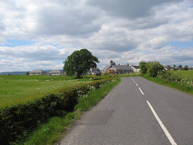
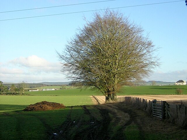
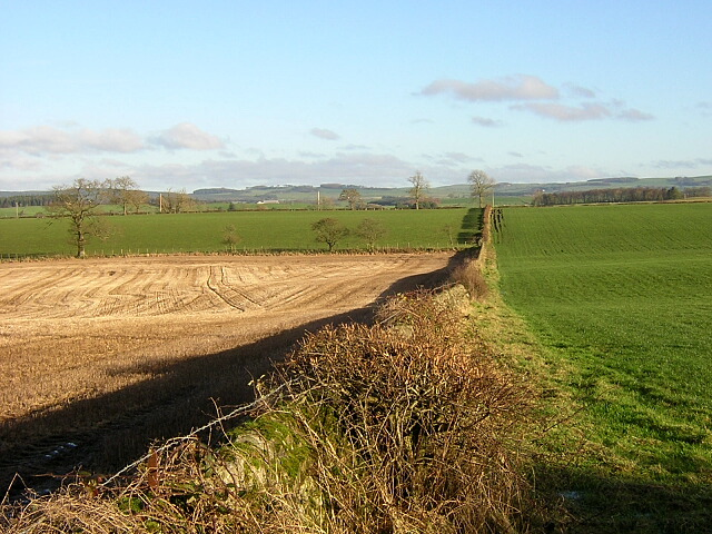
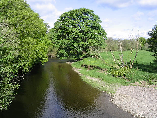
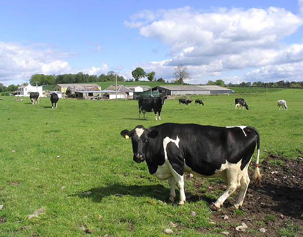
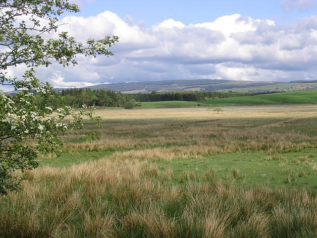
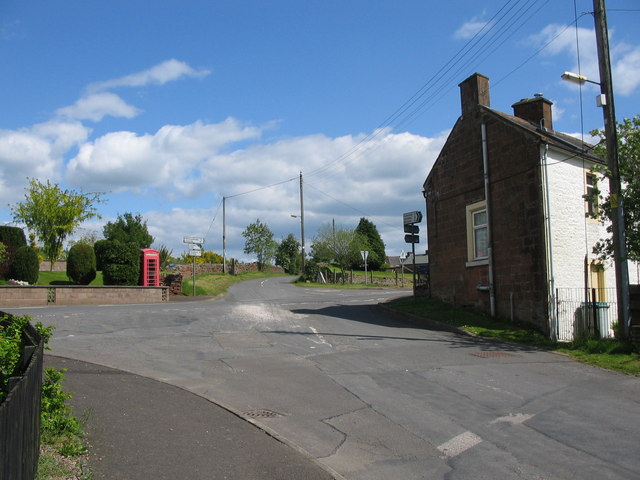
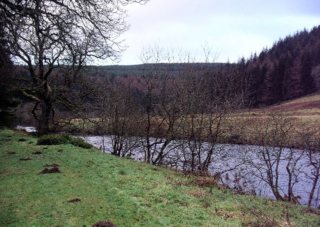
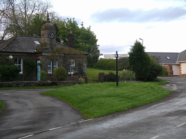
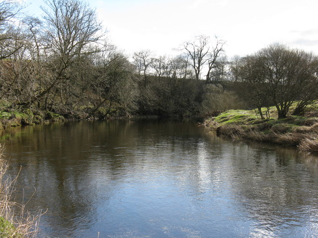
The village is known for its charming, traditional architecture, featuring a mix of stone-built cottages and more modern houses. The local scenery is dominated by rolling hills and farmland, offering an idyllic backdrop for outdoor activities and leisurely walks.

Templand benefits from a range of amenities to serve its residents. These include a primary school, a community hall, and a local shop for basic necessities. Additionally, a nearby town provides access to a wider range of services such as supermarkets, healthcare facilities, and secondary schools.

For those interested in history and culture, Templand is within easy reach of various landmarks and attractions. Nearby, visitors can explore the ruins of the medieval Sweetheart Abbey or take a trip to Drumlanrig Castle, a grand country house boasting beautiful gardens and extensive woodland trails.

Transportation in Templand is primarily reliant on private vehicles, as public transport options are limited. However, the village benefits from good road links, with the A76 running nearby, providing easy access to surrounding areas.

In summary, Templand offers a tranquil and close-knit community within a picturesque rural setting. With its charming architecture, natural beauty, and access to local amenities, the village provides a pleasant and welcoming environment for residents and visitors alike.

If you have any feedback on the listing, please let us know in the comments section below.

Templand Images

Images are sourced within 2km of 55.162686/-3.4403163 or Grid Reference NY0886. Thanks to Geograph Open Source API. All images are credited.

Kinnel Water from the Shaw Bridge Looking in a roughly southward direction from the Shaw Bridge over The Kinnel Water.
Kinnel Water from the Shaw Bridge
Looking in a roughly southward direction from the Shaw Bridge over The Kinnel Water.
Meadow above Millhousebridge Annanhill Farm can be seen on the far side of the river.
Meadow above Millhousebridge
Annanhill Farm can be seen on the far side of the river.
Approaching Templand A view looking to the northwest along the B7020 on the approach to Templand.
Approaching Templand
A view looking to the northwest along the B7020 on the approach to Templand.
Crossroads at Templand A view looking east to the crossroads on the B7020 at Templand, from the lane to Parkgate.
Crossroads at Templand
A view looking east to the crossroads on the B7020 at Templand, from the lane to Parkgate.
Shaw Bridge A view looking southeast towards Shaw Bridge over Kinnel Water. The buildings at Templand can be seen at left.
Shaw Bridge
A view looking southeast towards Shaw Bridge over Kinnel Water. The buildings at Templand can be seen at left.
Cumrue Cottages
Cumrue Cottages
Trees Near Elshieshields
Small Wood Near Cumrue
Elshieshields Bridge Elshieshields Bridge over Water of Ae
Elshieshields Bridge
Elshieshields Bridge over Water of Ae
Water of Ae from Elshieshields Bridge
Fields Near Elshieshields
The River Annan Viewed from a bridge near Spedlins Tower.
The River Annan
Viewed from a bridge near Spedlins Tower.
Hellshole Moss Bog cotton grass in flower on this moss to the east of the B7020.
Hellshole Moss
Bog cotton grass in flower on this moss to the east of the B7020.
Livestock field Corsua Farm is in the background.
Livestock field
Corsua Farm is in the background.
Mossland Looking towards Hellshole Moss from a minor road by Corncockle Plantation.
Mossland
Looking towards Hellshole Moss from a minor road by Corncockle Plantation.
Kinnel Water Fast flowing tributary of the river Annan, seen here just south of Templand.
Kinnel Water
Fast flowing tributary of the river Annan, seen here just south of Templand.
Farmland near Templand Mixed farming, Annandale.
Farmland near Templand
Mixed farming, Annandale.
Field Farmland beside Corncockle plantation, near Templand.
Field
Farmland beside Corncockle plantation, near Templand.
Show me another place!

Templand is located at Grid Ref: NY0886 (Lat: 55.162686, Lng: -3.4403163)

Unitary Authority: Dumfries and Galloway

Police Authority: Dumfries and Galloway

What 3 Words

///boast.assorted.hounded. Near Lochmaben, Dumfries & Galloway

Nearby Locations

Templand

Related Wikis

Templand

Templand is a village in Dumfriesshire, Scotland, located around 4.5 miles (7.2 km) northwest of Lockerbie. Templand was built during the Industrial Revolution...

Corncockle Quarry

Corncockle Quarry was a large and historically important sandstone quarry near Templand in Dumfries and Galloway, Scotland. Stone from here was used in...

Water of Ae

The Water of Ae is a tributary of the River Annan into which it flows west of Lockerbie in Dumfries and Galloway administrative county of South West Scotland...

Annandale Way

The Annandale Way is a 90-kilometre (56 mi) hiking trail in Scotland, which is officially designated by NatureScot as one of Scotland's Great Trails. It...

Millhousebridge

Millhousebridge (Scottish Gaelic: Drochaid a' Mhuilinn) is a village in Dumfries and Galloway, Scotland. == References ==

Kinnel Water

The Kinnel Water is a river in the Scottish council area of Dumfries and Galloway, in the shire of Dumfriesshire. == History == The Kinnel Water rises...

Lochmaben railway station

Lochmaben railway station was a station which served Lochmaben, in the Scottish county of Dumfries and Galloway. It was served by trains on a local line...

Applegarthtown

Applegarthtown, also known as Applegarth or Applegirth, is a village near Lockerbie in Annandale, Dumfries and Galloway, Scotland. Applegarth's Town is...

Nearby Amenities

Located within 500m of 55.162686,-3.4403163
Templand
Place: hamlet
Lat/Long: 55.1621267/-3.4391733
Main Road
Naptan AtcoCode: 680000231111
Naptan Bearing: NW
Naptan BusStopType: CUS
Naptan CommonName: Main Road
Naptan Indicator: opp Shelter
Naptan Landmark: Redhall Road
Naptan NaptanCode: 34237289
Naptan Notes: none
Naptan Street: Main Road
Naptan Verified: no
Source: naptan_import
Lat/Long: 55.1596694/-3.4381746
Bus Stop
Main Road
Naptan AtcoCode: 680000231222
Naptan Bearing: SE
Naptan CommonName: Main Road
Naptan Indicator: Shelter
Naptan Landmark: Redhall Road
Naptan NaptanCode: 34237287
Naptan Notes: none
Naptan Street: Main Road
Naptan Verified: no
Source: naptan_import
Lat/Long: 55.159667/-3.4380646
Village
Naptan AtcoCode: 680000231501
Naptan Bearing: NW
Naptan BusStopType: CUS
Naptan CommonName: Village
Naptan Indicator: opp Hall
Naptan Landmark: Hall
Naptan NaptanCode: 34237292
Naptan Notes: none
Naptan Street: Main Road
Naptan Verified: no
Source: naptan_import
Lat/Long: 55.1610708/-3.4394337
Bus Stop
Village
Naptan AtcoCode: 680000231502
Naptan Bearing: SE
Naptan CommonName: Village
Naptan Indicator: Hall
Naptan Landmark: Hall
Naptan NaptanCode: 34237293
Naptan Notes: none
Naptan Street: Main Road
Naptan Verified: no
Source: naptan_import
Lat/Long: 55.1611708/-3.4393431
Crossroads
Naptan AtcoCode: 680000231503
Naptan Bearing: N
Naptan BusStopType: CUS
Naptan CommonName: Crossroads
Naptan Indicator: opp Telephone
Naptan Landmark: Crossroad
Naptan NaptanCode: 34237295
Naptan Notes: none
Naptan Street: B7020
Naptan Verified: no
Source: naptan_import
Lat/Long: 55.162445/-3.440268
Crossroads
Naptan AtcoCode: 680000231504
Naptan Bearing: S
Naptan BusStopType: CUS
Naptan CommonName: Crossroads
Naptan Indicator: Telephone Box
Naptan Landmark: Crossroad
Naptan NaptanCode: 34237348
Naptan Notes: none
Naptan Street: B7020
Naptan Verified: no
Source: naptan_import
Lat/Long: 55.1627154/-3.4401993
Bus Stop
Redhall Road
Naptan AtcoCode: 680000231505
Naptan Bearing: NW
Naptan CommonName: Redhall Road
Naptan Indicator: Shelter
Naptan Landmark: Redhall Road
Naptan NaptanCode: 34238643
Naptan Notes: none
Naptan Street: Shaw Road
Naptan Verified: no
Source: naptan_import
Lat/Long: 55.1617229/-3.4374919
Redhall Road
Naptan AtcoCode: 680000231506
Naptan Bearing: SE
Naptan BusStopType: CUS
Naptan CommonName: Redhall Road
Naptan Indicator: opp shelter
Naptan Landmark: Redhall Road
Naptan NaptanCode: 34237349
Naptan Notes: none
Naptan Street: Shaw Road
Naptan Verified: no
Source: naptan_import
Lat/Long: 55.1617248/-3.4373223
Post Box
Ref: DG11 13
Source: survey
Lat/Long: 55.1603906/-3.4379014
Power: pole
Lat/Long: 55.1601139/-3.4354049
Power: pole
Lat/Long: 55.1608629/-3.4358016
Power: pole
Lat/Long: 55.1614986/-3.436139
Power: pole
Lat/Long: 55.1621049/-3.4364481
Power: pole
Lat/Long: 55.1627568/-3.4371024
Power: pole
Lat/Long: 55.1633822/-3.4377928
Power: pole
Lat/Long: 55.1639149/-3.4383466
Power: pole
Lat/Long: 55.164449/-3.4389185
Power: pole
Lat/Long: 55.1652524/-3.4389932
Power: pole
Lat/Long: 55.1660322/-3.4390911
Power: pole
Lat/Long: 55.1667326/-3.4391735
Power: pole
Lat/Long: 55.1618371/-3.4370509
Power: pole
Lat/Long: 55.1632762/-3.4386377
Power: pole
Lat/Long: 55.1631188/-3.4398793
The data included in this document is from www.openstreetmap.org. The data is made available under ODbL.

Have you been to Templand?

Leave your review of Templand below (or comments, questions and feedback).